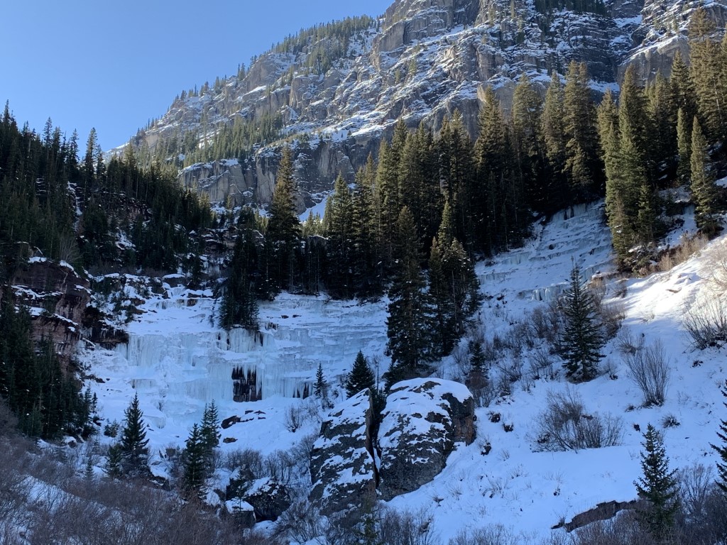
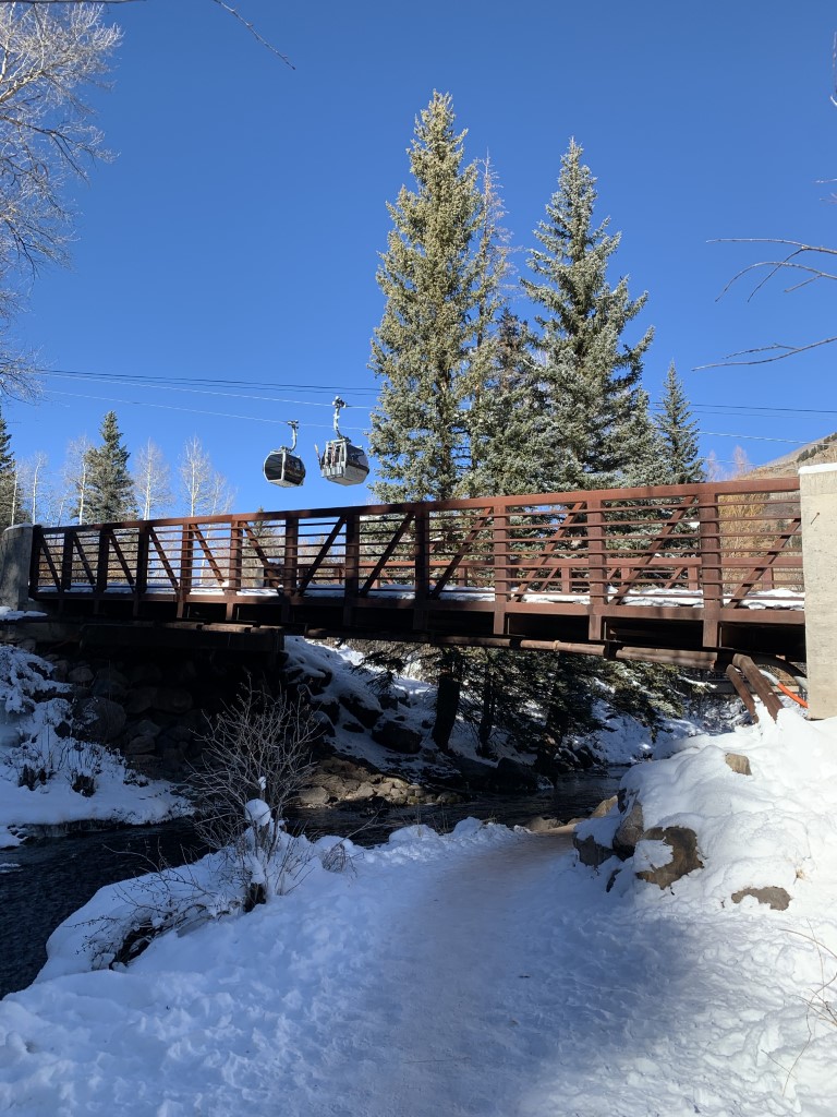
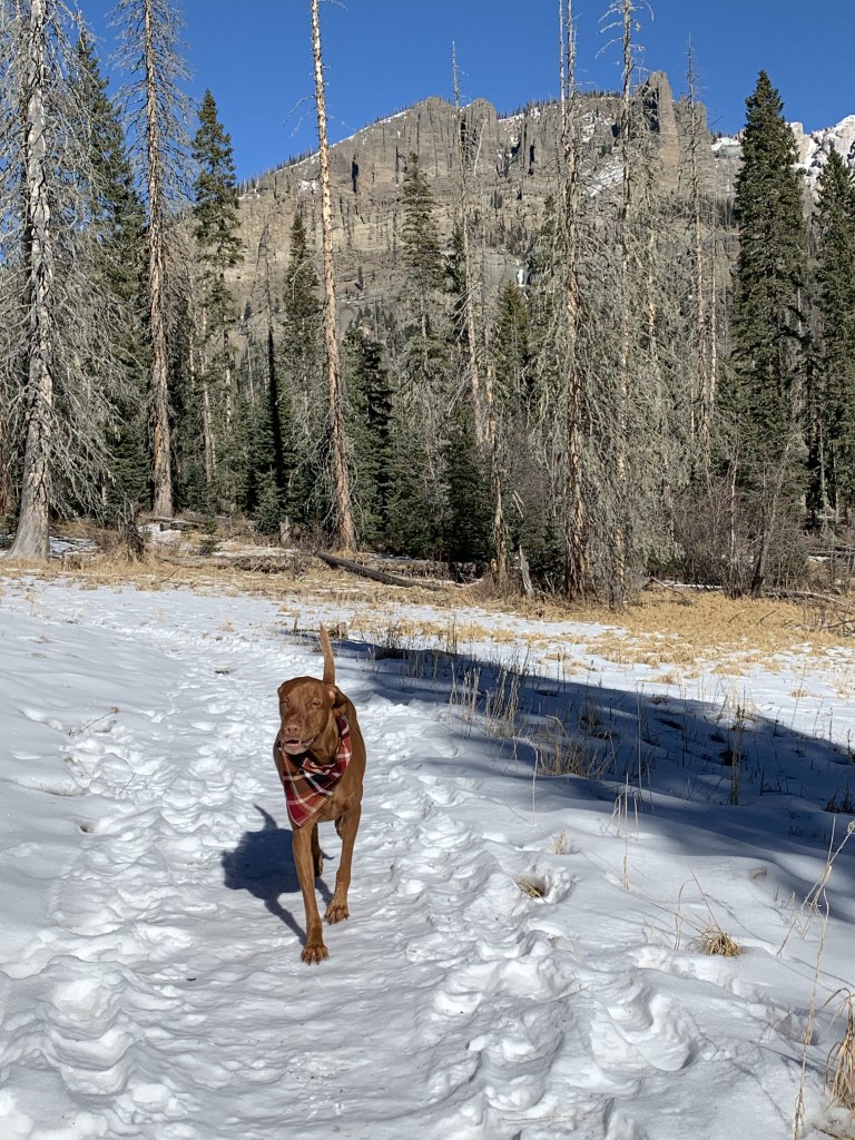
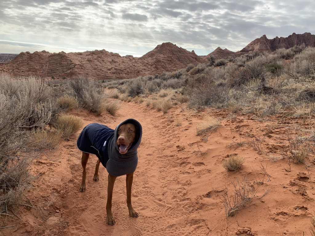
Bear Creek Trail – Winter

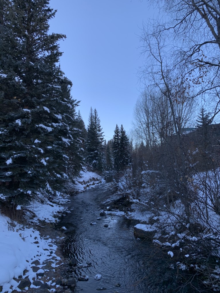
Cappie’s Scoop: This trail brings you to a waterfall and it was frozen in the winter! Mom and I tried to get closer but then mom sank in the snow up to her knees. Mom didn’t have snowshoes and I don’t know if I could’ve made it because I’m shorter than mom. So we looked at the falls from far away and headed back. On the way back, some hoomans on skiis went zooming by me! Wow, they are so fast! Don’t hesitate to add YOUR scoop in the comments below!
Tips: Bear Creek trail winds its way through the 325 acre Bear Creek Preserve. The trail ends at Bear Creek Falls and passes the Wasatch trail on your right which provides some loop routes. We did an out and back this time. This trail is filled with aspen trees which is probably gorgeous in the fall. We hiked in the winter and found a frozen waterfall and brave mountain skiers coming from over the mountain!
Directions: Trail starts at the south end of Pine Street in downtown Telluride and the coordinates are for the trailhead. Parking is available nearby on the street but not at the trailhead.
| Mileage (round trip) | 4.6 |
| Difficulty | Moderate |
| Gain (in feet) | 1092 |
| Trailhead | 37.934254, -107.811862 |
| Hike Time (in hours) | 3-4 |
| Exposure | Sunny and Shady |
| Scenery | Mountain Views, Forest, Waterfalls |
| Facilities | None |
| Fees/Permits | None |
| More Info | https://rootsrated.com/telluride-co/hiking/bear-creek-trail2 |
| Last Hiked | 12/6/2020 |


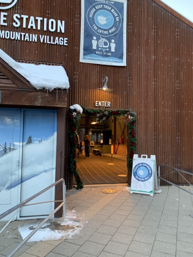
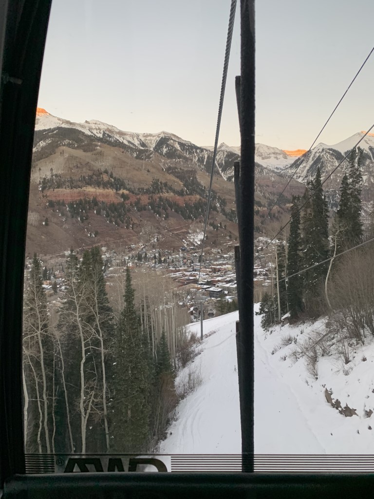
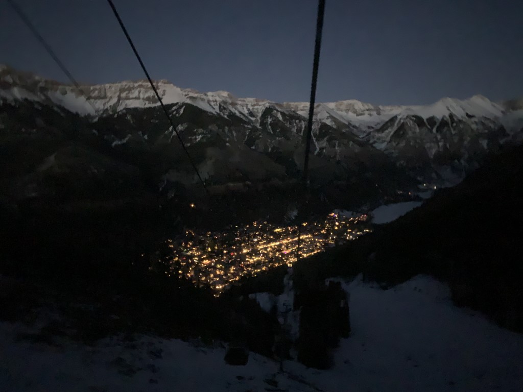
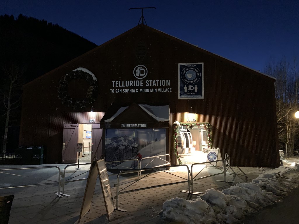
Mountain Gondola Ride
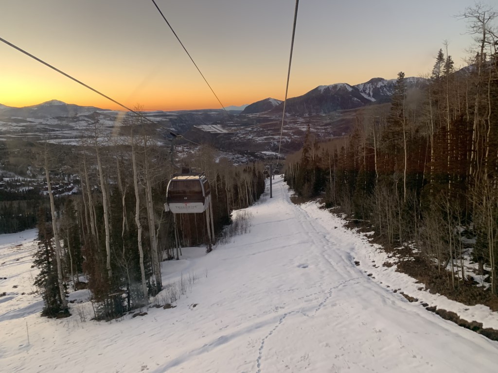
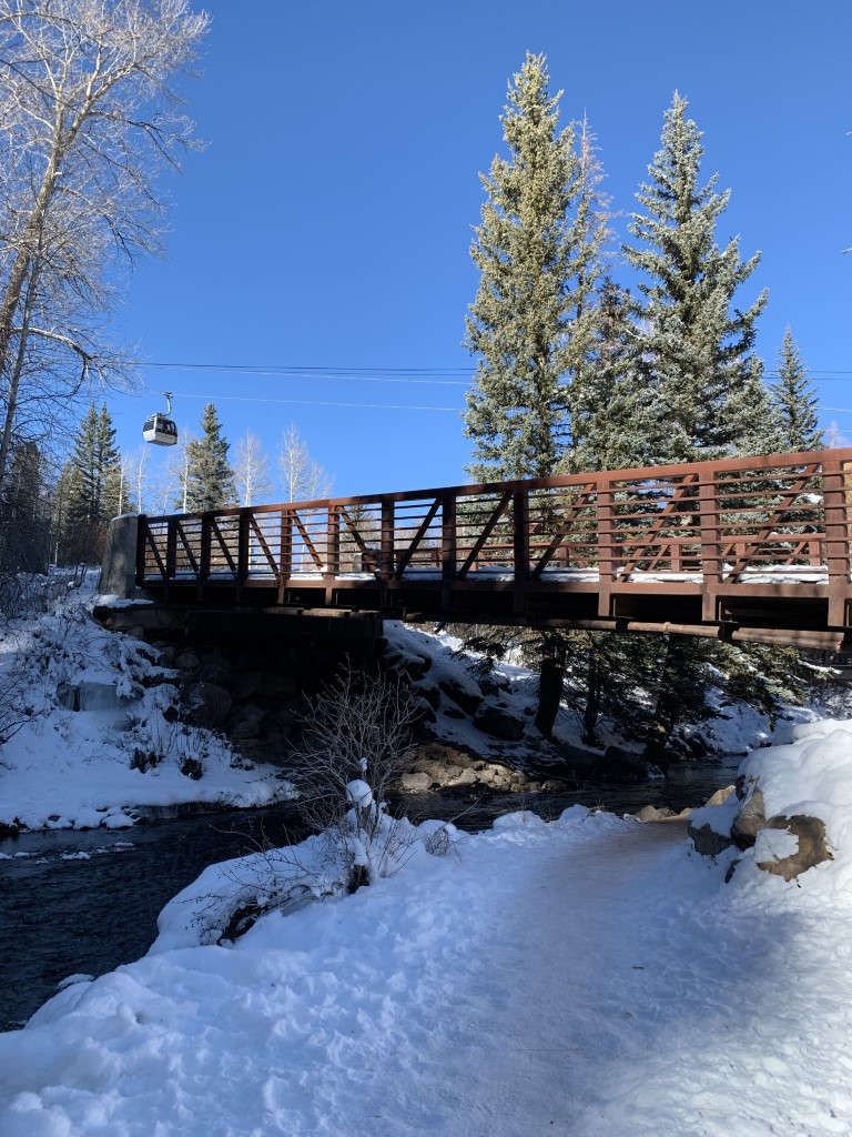
Cappie’s Scoop: Yes, dogs can ride the gondola! I was very scared at first when it started moving but then it wasn’t so bad at all. It was like a bumpy car ride plus mom gave me lots of treats for being a good boy. It was worth it! I got to ride on it two times since we visited Mountain Village and then we returned to Telluride. Don’t hesitate to add YOUR scoop in the comments below!
Tips: Want a different adventure! The gondola offers free, seasonal transportation and even has pet-friendly cars! The gondola connects the town of Telluride and Mountain Village which has shops and restaurants with outdoor seating. We took the ride from Telluride to Mountain Village at sunset and it was amazing! Then on the way back, we rode back into Telluride with a view of the town’s night lights and snow on the mountains. Check the website for the operating hours before you go.
Directions: Coordinates take you to the entrance of the gondola in downtown Telluride on W San Juan Ave. Link below that has details on the gondola parking garage.
| Location | 37.936108, -107.813681 |
| Time | 13 minute ride |
| Exposure | N/A |
| Scenery | Mountain Views |
| Facilities | Restrooms available in Mountain Village. |
| Fees/Permits | None |
| More Info | https://www.telluride.com/plan/our-destination/telluride-mountain-village-gondola; https://www.telluride-co.gov/256/Gondola; https://townofmountainvillage.com/explore/getting-around/parking |
| Last Rode | 12/6/2020 |


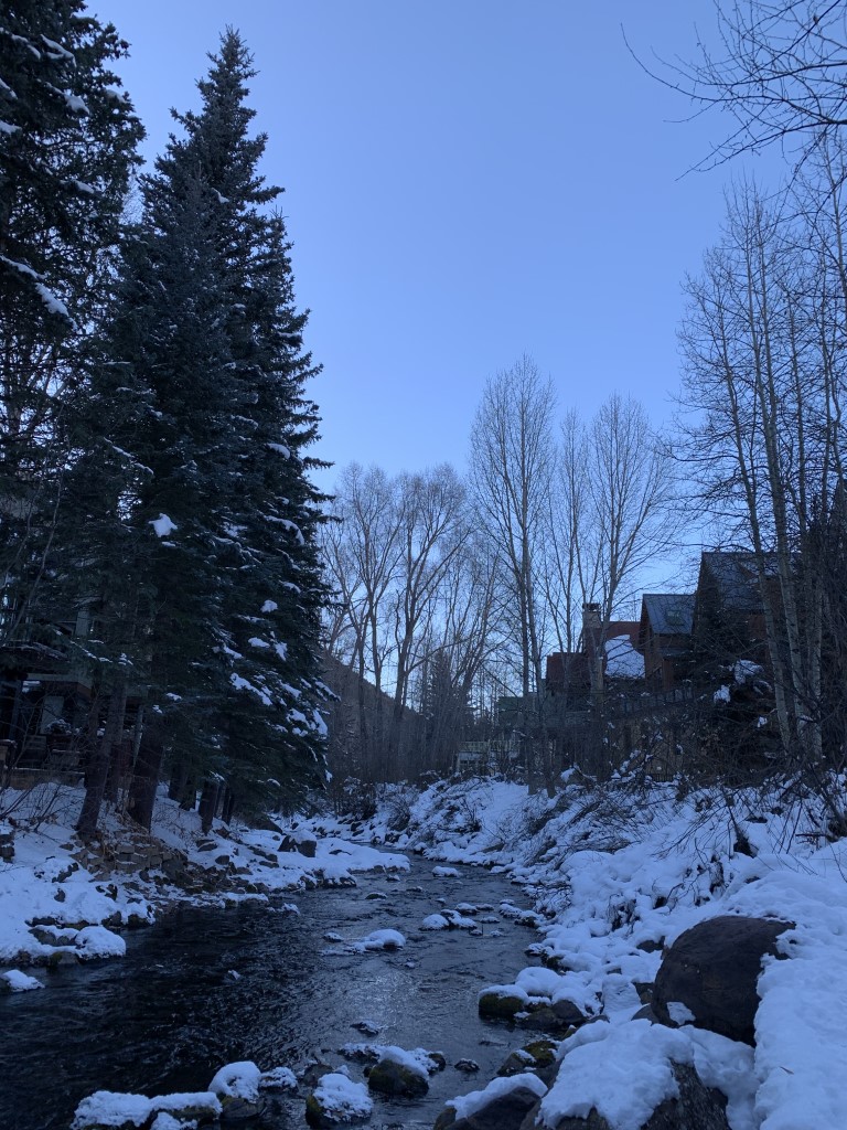
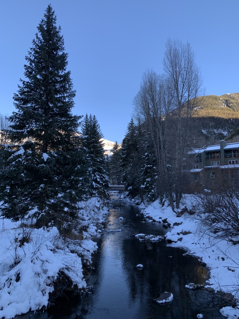
Telluride River Trail
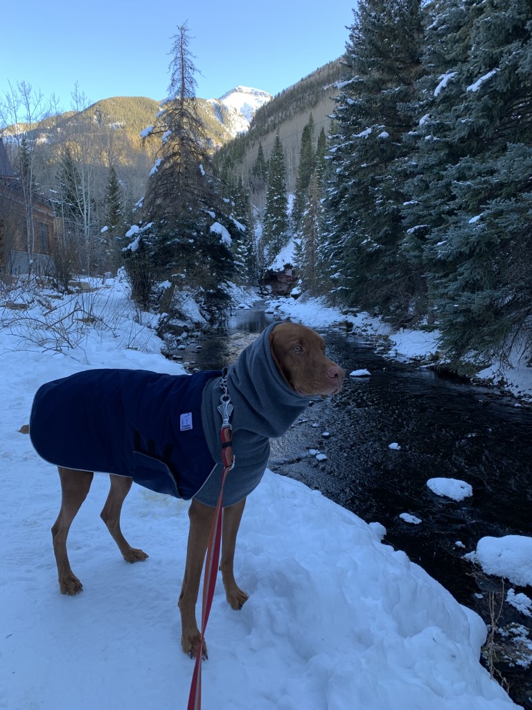
Cappie’s Scoop: Need a walk through town, this is a fun one because you get to stop and dip your paws in the river! It was a bit cold at night but during the day, I put my paws in. Don’t hesitate to add YOUR scoop in the comments below!
Tips: This is a great trail to hike (or stroll) to get acclimated to the area before you start climbing some mountains! It’s also a great path to get from one end of town to the other. There’s even some spots to let your dog soak his paws in the river.
Directions: You can access this trail from multiple spots in downtown Telluride since it follows the San Miguel River for the length of town.
| Mileage (round trip) | 4.1 |
| Difficulty | Easy |
| Gain (in feet) | 242 |
| Trailhead | Various |
| Hike Time (in hours) | 2-3 |
| Exposure | Mostly Shady |
| Scenery | Mountain Views, River |
| Facilities | None |
| Fees/Permits | None |
| More Info | https://www.alltelluride.com/nature/river_trail.php |
| Last Hiked | 12/5/2020, 7/8/2023 |

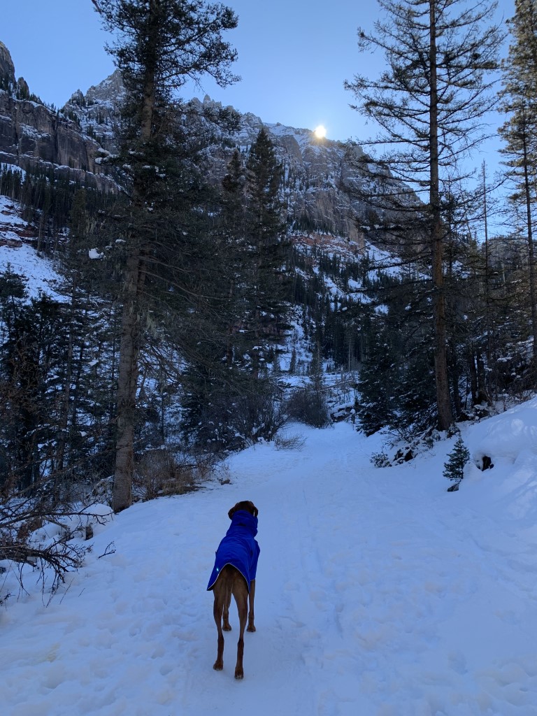
Fourmile Falls
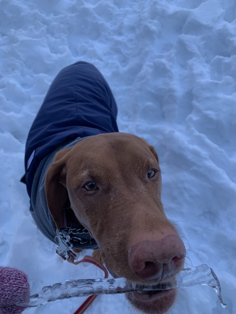
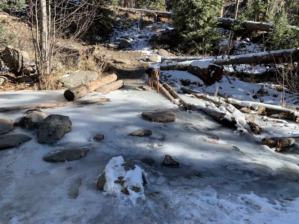
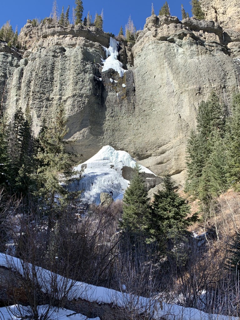
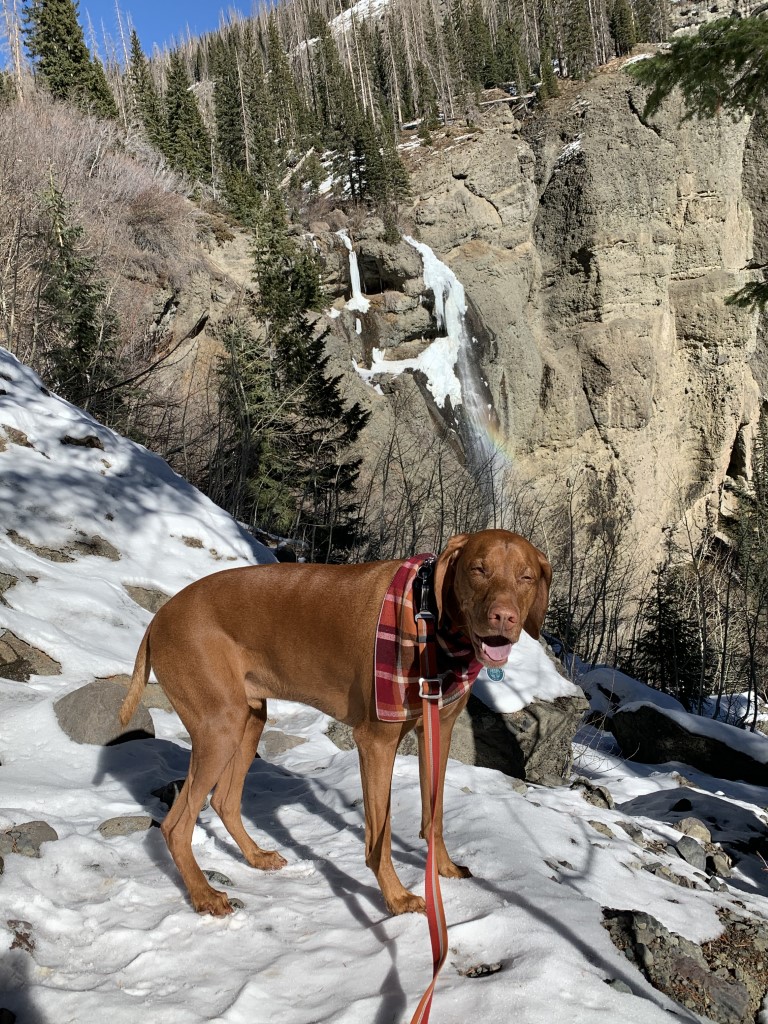
Cappie’s Scoop: Oh what fun it is to hike on snow and slide on ice! I must have crossed 3 or 4 spots covered with ice. Maybe they were small streams or creeks. Be very careful when you cross them and don’t run. Mom had spikes on her shoes. I think I need some of those. I saw the waterfall from far away because it was very muddy and slippery to get closer. But it’s okay because I saw a rainbow by the waterfall and mom took my picture with it! Don’t hesitate to add YOUR scoop in the comments below!
Tips: Take Fourmile Stock Drive trail 569 to reach the waterfall. At the time we hiked this trail, there was still snow and ice on the trail so we packed (and used) our microspikes which made the trek so much better. We passed over frozen creek crossings and enjoyed the gorgeous views of snow covered trees. We weren’t able to close very close to the falls due to mud and snow but we did have a view of them!
Directions: The road to the trailhead closes in the winter.
| Mileage (round trip) | 8.3 |
| Difficulty | Moderate |
| Gain (in feet) | 1148 |
| Trailhead | 37.409255, -107.052958 |
| Hike Time (in hours) | 5-6 |
| Exposure | Mostly Sunny |
| Scenery | Mountain Views, Forest, Creek, Waterfalls |
| Facilities | Vault toilet at trailhead. |
| Fees/Permits | None |
| More Info | http://pagosatrails.org/portfolio/fourmile-trail-no-569 |
| Last Hiked | 12/4/2020 |


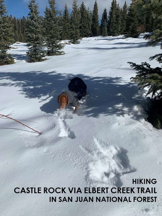
Castle Rock via Elbert Creek Trail
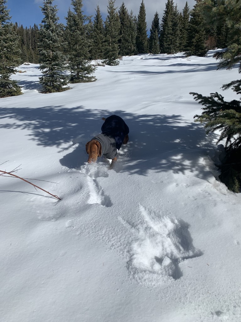
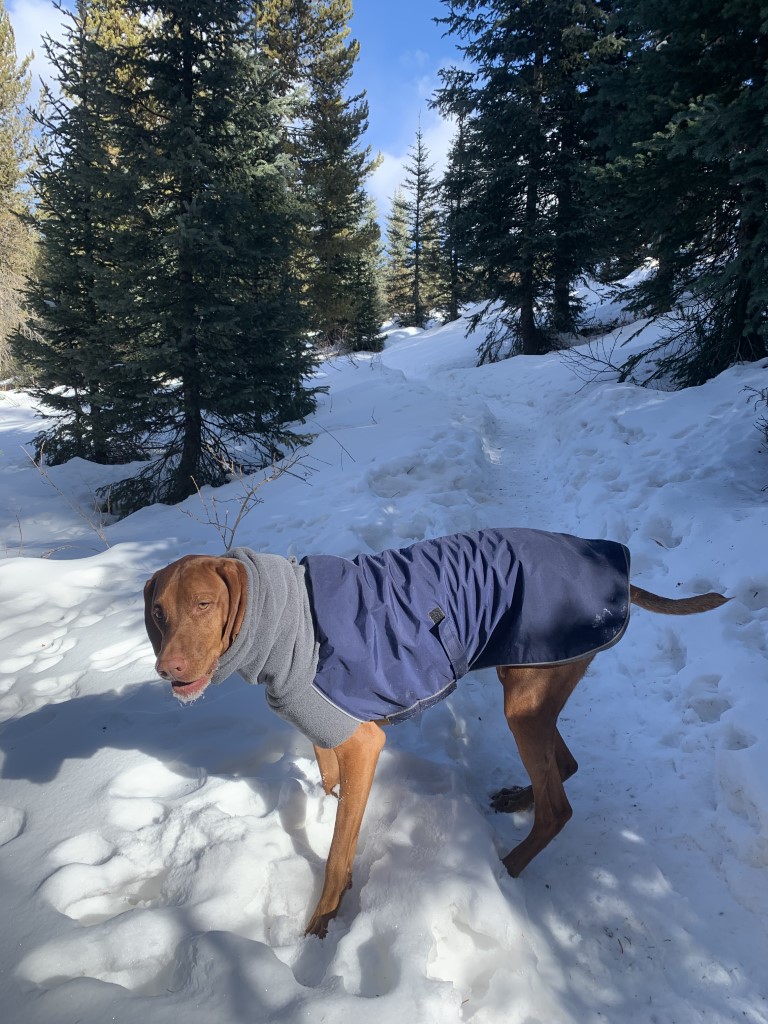
Cappie’s Scoop: I’ve only done this trail one time and it was in the snow, it was very cool! The snow was fresh so I was zomming around in it getting snow all over my face. Mom took lots of pictures of me with a snow beard. The view from the top is very nice but mom wouldn’t let me get too close because it’s a cliff and we need to be safe. Don’t hesitate to add YOUR scoop in the comments below!
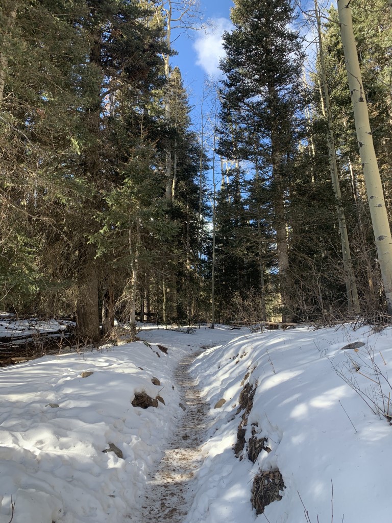
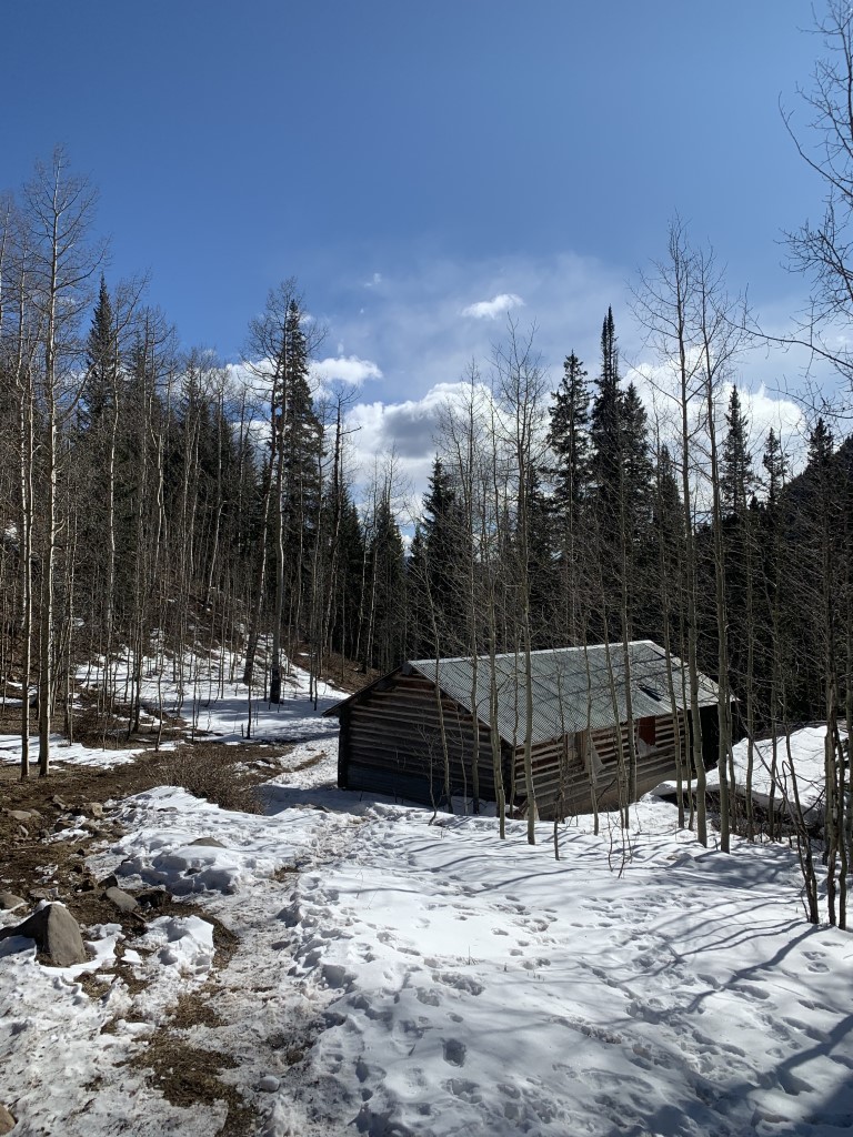
Tips: This trail is located in the beautiful Hermosa Cliffs and the trailhead we started from is in an odd location. Note, there are a few connecting trails to make this a longer hike but this post provides details for starting next to the Needles Country Store to Castle Rock and back. We hiked this trail in the snow, oh the beautiful snow! We used our microspikes and they worked well because the trail was packed down but this would’ve been a great spot for snowshoeing too! We also think the view from Castle Rock would be amazing in the fall as well. Once on the trail there’s only one junction to look for. Just a few minutes after passing the cabin, stay right at a trail fork and follow the wide switchback heading up the mountainside.
Directions: From the town of Durango head north on US-550 for 24 miles. Turn left at the Needles Country Store where you can get gas, water and snacks too. Trailhead parking is at the south end of the parking lot. Look for the wooden fence and the trailhead sign.
| Mileage (round trip) | 5.3 |
| Difficulty | Moderate |
| Gain (in feet) | 1666 |
| Trailhead | 37.592436, -107.824291 |
| Hike Time (in hours) | 3-4 |
| Exposure | Mostly Shady |
| Scenery | Mountain Views, Forest |
| Facilities | None |
| Fees/Permits | None |
| More Info | https://rootsrated.com/durango-co/hiking/elbert-creek-hiking; https://www.fs.usda.gov/recarea/sanjuan/recarea/?recid=42888&actid=50 |
| Last Hiked | 12/3/2020 |


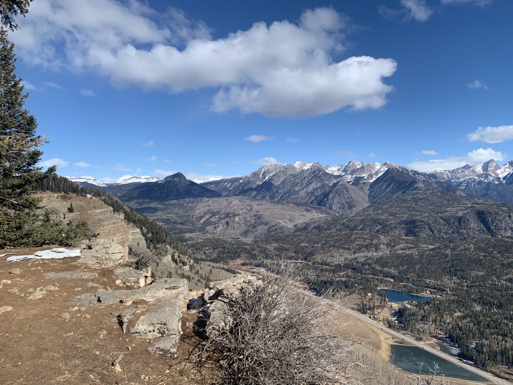
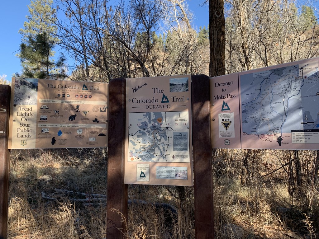
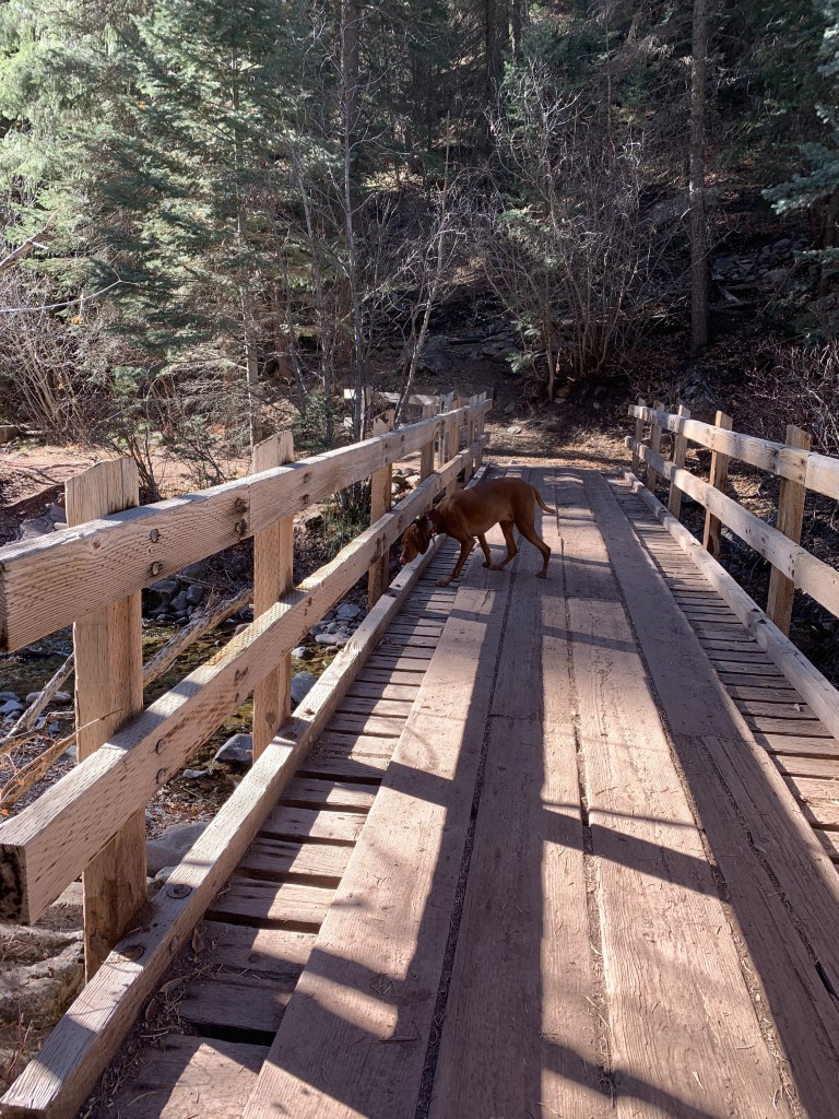
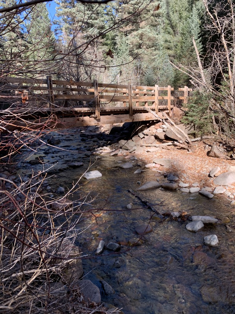
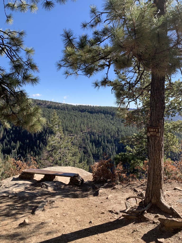
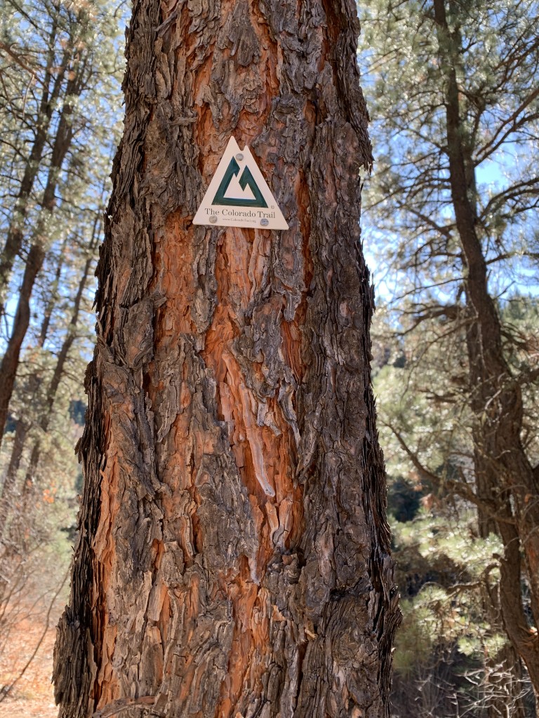
Colorado Trail to Gudy’s Rest
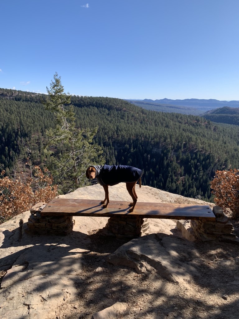
Cappie’s Scoop: When I visit Durango, sometimes I need to get out but mom doesn’t want to drive too far. So we found this spot on the popular Colorado Trail. We pass a lot of hoomans with dogs and even hoomans on big bikes. They are very nice when they pass us. We hike up to a cool bench where mom and I sit, have treats and look at the beautiful view! Don’t hesitate to add YOUR scoop in the comments below!
Tips: We started this trail at Junction Creek, the southern terminus for The Colorado Trail. You could hike to Denver from here! Instead we hiked up to a beautiful view point called Gudy’s Rest. The first couple miles follow the creek on your left and then you make a left crossing over a wooden bridge to start climbing the switchbacks to the view point. We’ve read that Gudy’s Rest is named for Gudy Gaskill, known as “the Mother of the Colorado Trail” and her favorite spot to sit was this high point.
Directions: From the town of Durango head north on US-550 and turn left onto W 25th St. This street becomes Junction St and then Junction Creek Rd/Co Rd 204. In about 3.5 miles, the trailhead parking lot will be on your left.
| Mileage (round trip) | 9.1 |
| Difficulty | Moderate |
| Gain (in feet) | 1309 |
| Trailhead | 37.331330, -107.902694 |
| Hike Time (in hours) | 6 |
| Exposure | Shady |
| Scenery | Mountain Views, Forest, Creek |
| Facilities | Vault toilets at trailhead. |
| Fees/Permits | None |
| More Info | https://rootsrated.com/durango-co/hiking/colorado-trail-junction-creek-to-gudy-s-rest |
| Last Hiked | 12/1/2020, 5/28/2022 |


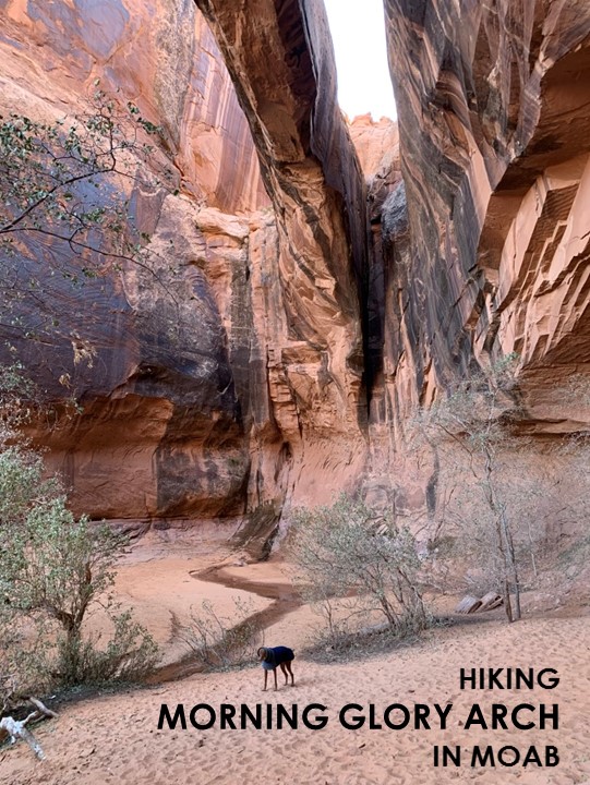
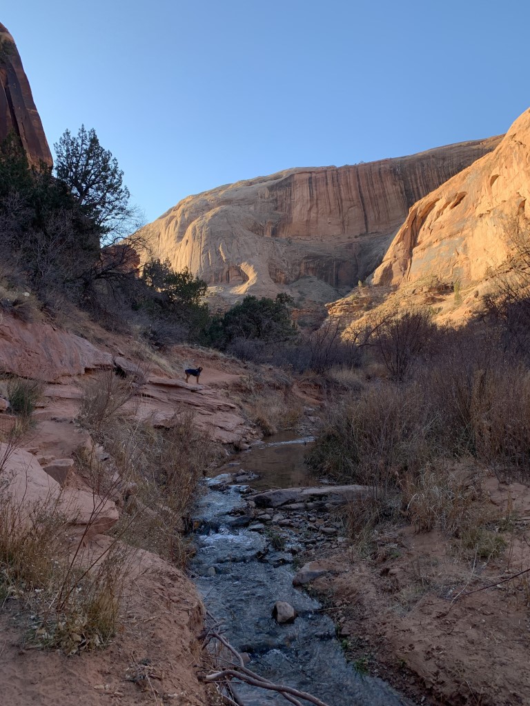
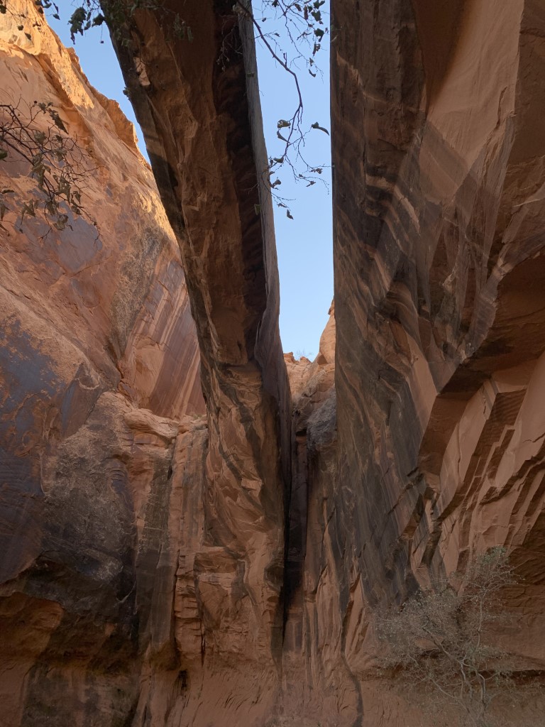
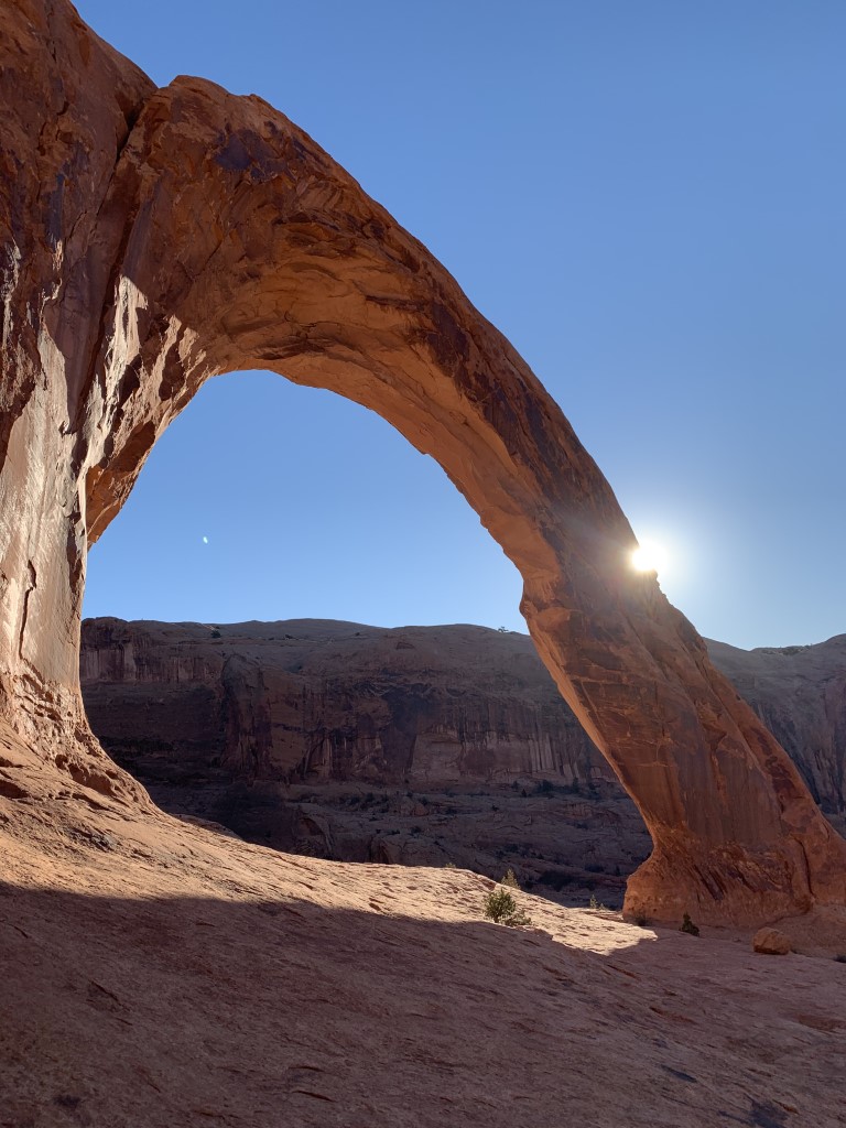
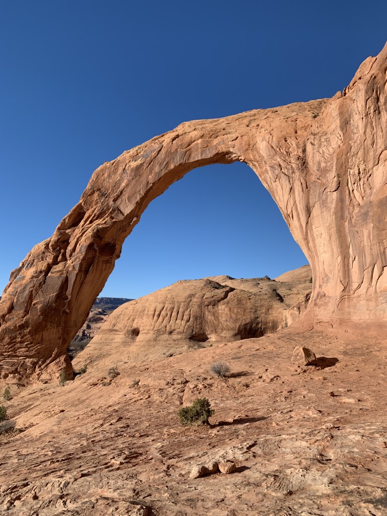
Morning Glory Arch

Cappie’s Scoop: Rocks, sand and water, am I at the beach?! This was a lot of fun because the trail had a little bit of everything that I love. Running in the sand, climbing on rocks and water to swim in. It was a bit cold when we went hiking here so I didn’t get in the water too much. Mom said there was a big rock at the end called an arch but I think it was so tall, I couldn’t even see it above me. That’s okay, I was playing in the sand while mom looked at the arch. Don’t hesitate to add YOUR scoop in the comments below!
Tips: The Morning Glory Arch or Morning Glory Natural Bridge is located in Grandstaff Canyon. This arch is the sixth longest natural rock span in the United States stretching 243 feet across. The canyon was named after William Grandstaff, an African American prospector who grazed livestock in the area during the 19th century and is home to Cottonwoods, singing frogs, sandstone amphitheaters, and natural arches. There are a couple stream crossings. When we hiked the trail in November, the water was so low that we didn’t have to take our shoes off and could easily cross without getting our feet wet.
Directions: There is a small parking lot that can fill up quickly. Overflow parking is on the main road along the Colorado River.
| Mileage (round trip) | 5 |
| Difficulty | Moderate |
| Gain (in feet) | 836 |
| Trailhead | 38.609808, -109.533667 |
| Hike Time (in hours) | 2-3 |
| Exposure | Sunny |
| Scenery | Boulders, Rock Formations, Creek |
| Facilities | Toilet in parking area. |
| Fees/Permits | None |
| More Info | https://www.visitutah.com/things-to-do/hiking/moab-hiking/grandstaff; https://utah.com/hiking/morning-glory-bridge-trail |
| Last Hiked | 11/30/2020 |


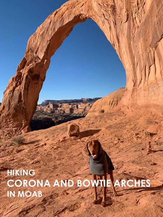
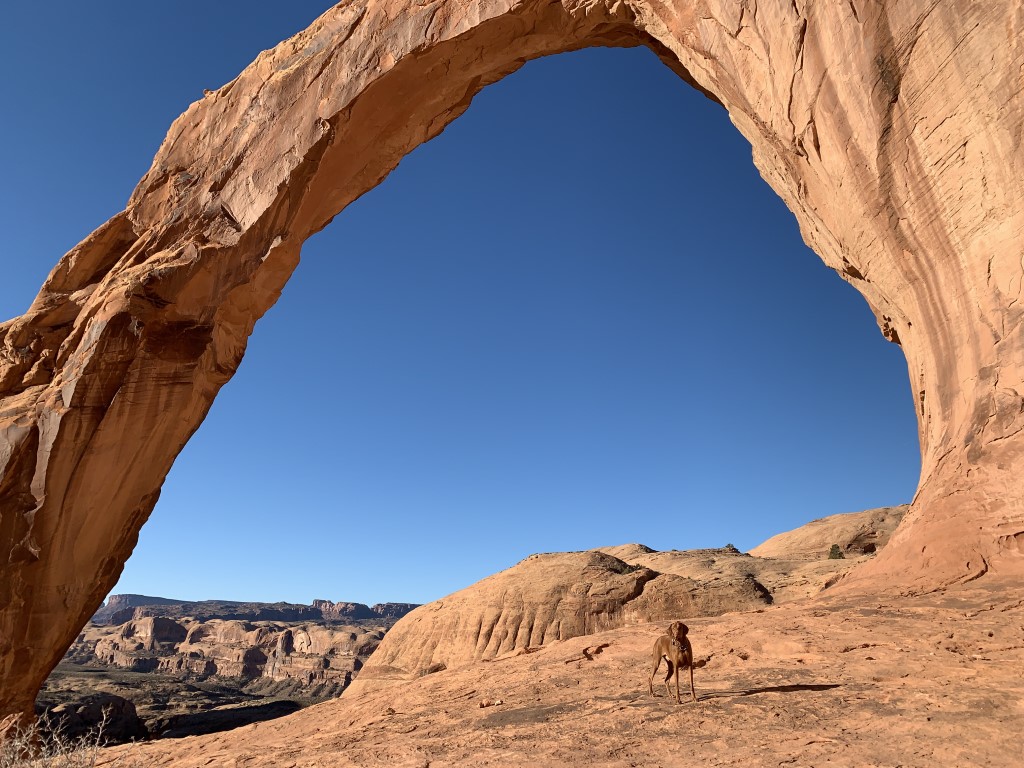
Corona and Bowtie Arches
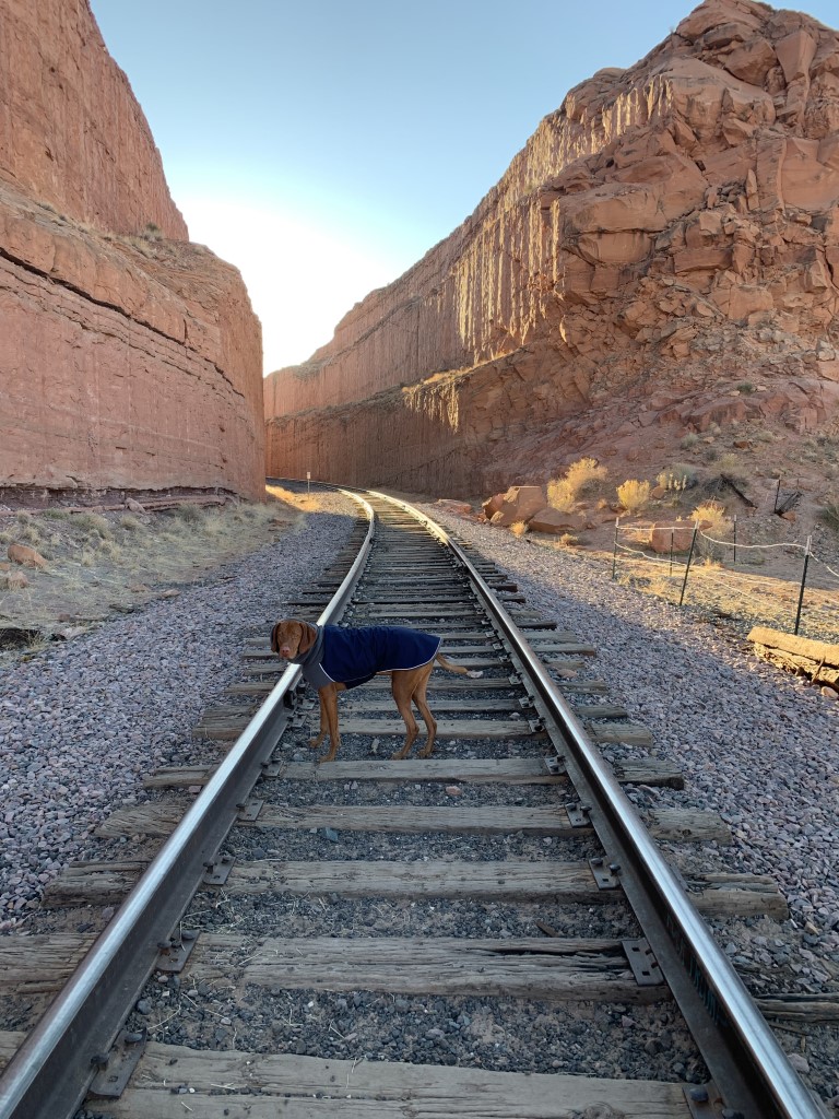
Cappie’s Scoop: I love climbing on rocks so this trail was a lot of fun. I got to hike on rocks, climb up a rock like ladder (mom helped me) and then eat breakfast under a huge rock called an arch. There is an even a railroad track that I had to hike over, my very first one! Get out there early so you can have the rocks all to yourselves. This trail gets very busy with hoomans and dogs. Don’t hesitate to add YOUR scoop in the comments below!
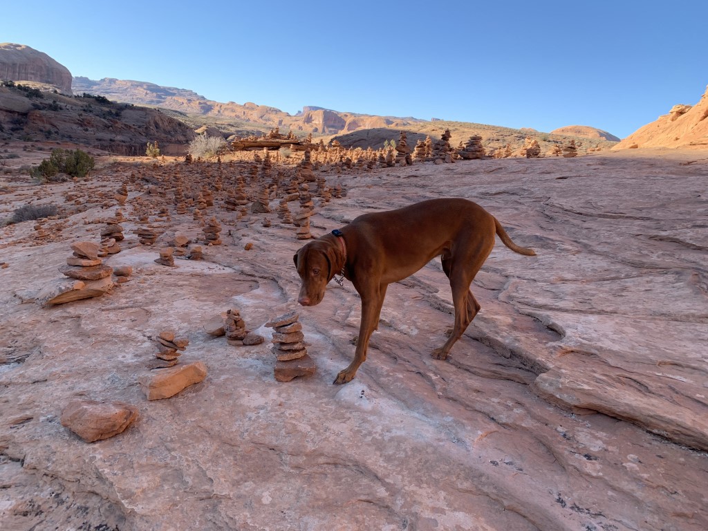
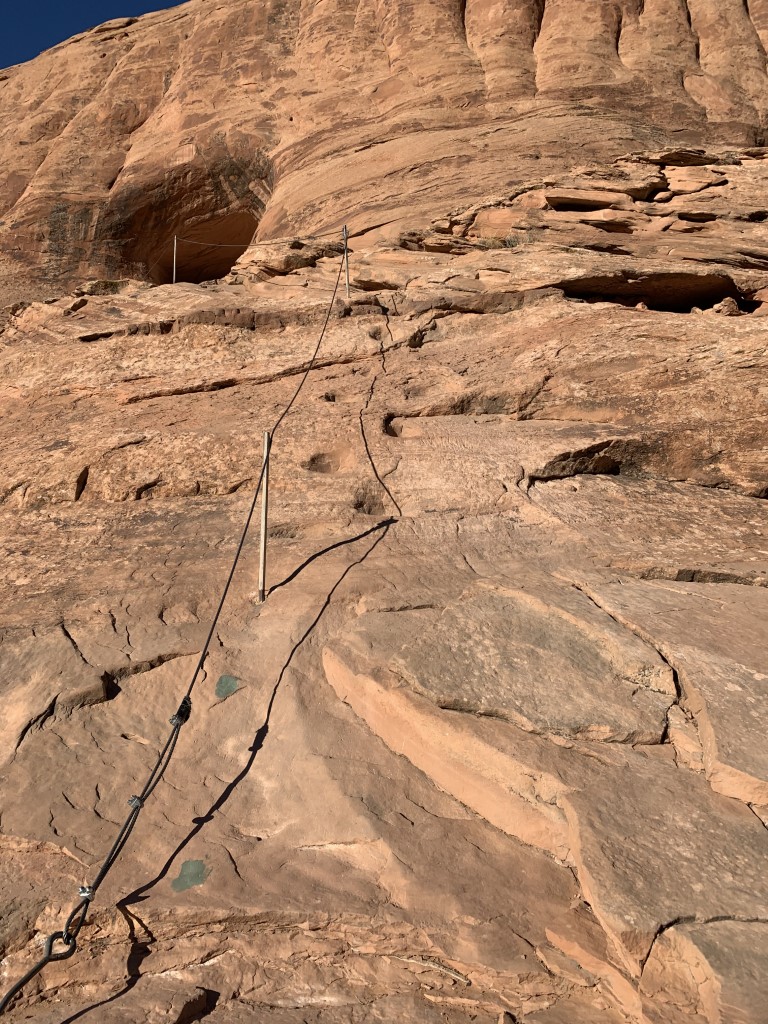
Tips: The trail starts hiking up a set of rock stairs before reaching the railroad tracks. Carefully cross the tracks and continue hiking on the rock trail. The trail is clearly marked. We chose to visit Corona Arch first and then on our way back went to Bowtie but you can also do it in the reveres order. At some point on the hike, you pass a really cool spectacle – a city of cairns (small piles of rocks) lined up together! You also need to scale a ladder bolted to the rock. With a boost, Cappie was able to climb up the rock next to the ladder. Both arches are fun to see but if you arrive early enough, it’s amazing seeing the Corona Arch during sunrise!
Directions: The trailhead starts along Potash Road. There is a sign along with a parking lot about 10 miles down the road. If the small parking lot is full, you may need to park alongside the road next to the Colorado River.
| Mileage (round trip) | 3 |
| Difficulty | Moderate |
| Gain (in feet) | 482 |
| Trailhead | 38.574766, -109.632472 |
| Hike Time (in hours) | 2-3 |
| Exposure | Sunny |
| Scenery | Boulders, Rock Formations |
| Facilities | None |
| Fees/Permits | None |
| More Info | https://www.discovermoab.com/hiking; https://utah.com/hiking/arches-national-park/bowtie-corona-arches |
| Last Hiked | 11/28/2020 |


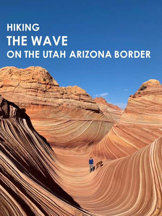
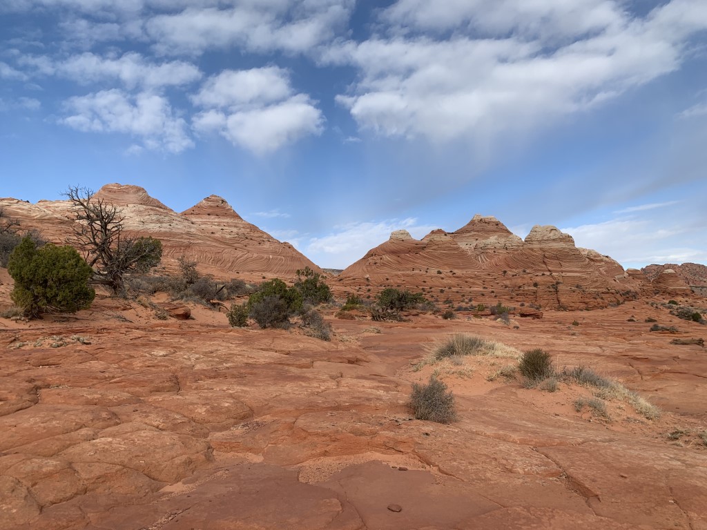
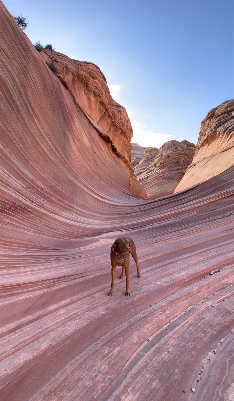
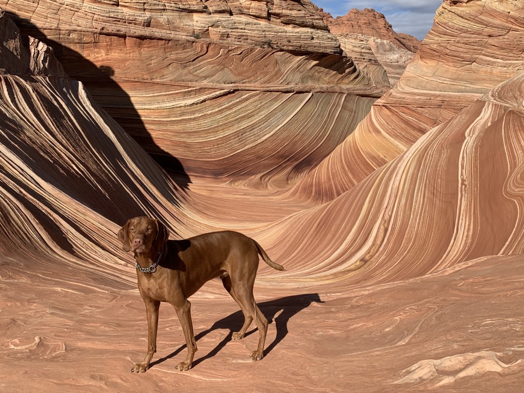
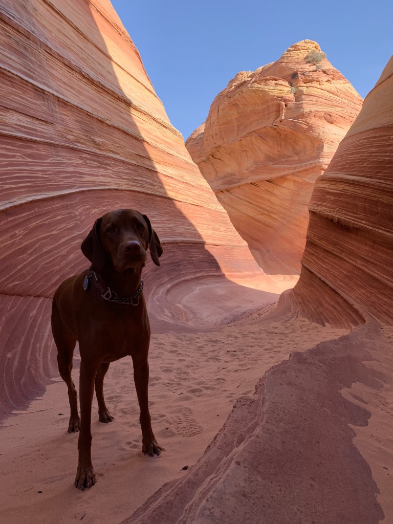
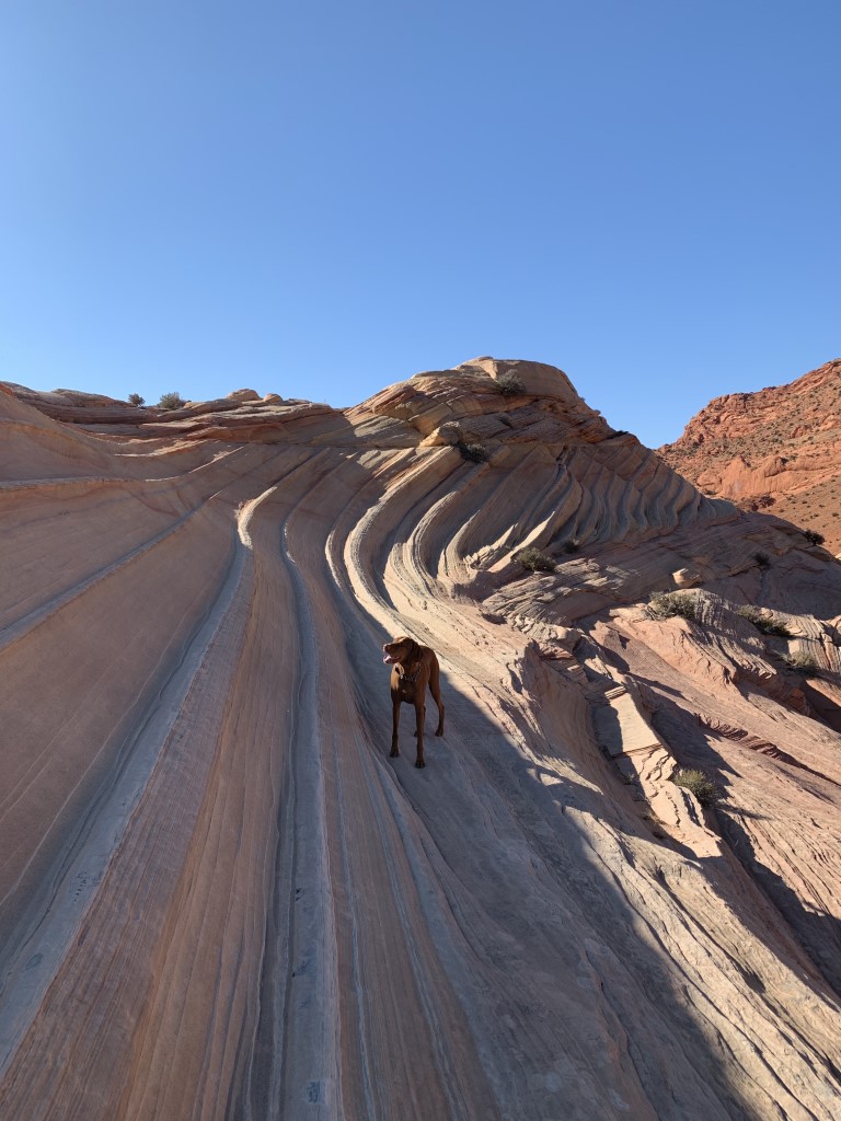
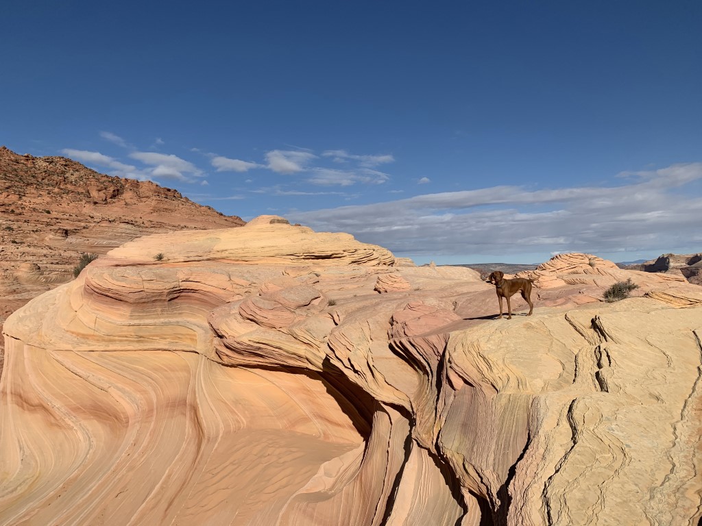
The Wave
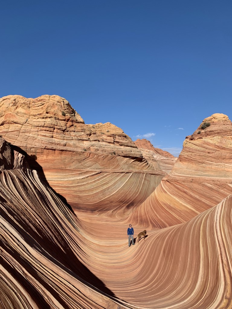
Cappie’s Scoop: Mom said this was a very special trip and now I know why. These rocks are amazing! I got to hike on lots of big rocks for a long time, it was mostly rocks and some sand but we weren’t at the beach. I even got really high and could see rocks for miles. The weather was very nice so my paws didn’t get hot at all. We had some snacks sitting on rocks and then made our way back. I hope we can come back one day! Don’t hesitate to add YOUR scoop in the comments below!
Tips: This epic hike is located in the Coyote Buttes North area on the Utah Arizona border. The best time to visit for photos is mid-morning to early afternoon to minimize shadows. Besides your main attraction (The Wave), there are several other rock formations and also some dinosaur tracks to check out while you’re there. Some of them are easy to find and others require a bit more navigation with a map or GPS.
We’ve been lucky enough to win the online lottery twice. We received our permit in the mail along with a parking permit and a map (mostly with pictures which is a lot of fun). Display your parking permit in the window of your car and place your hiking permit on your backpack. The Bureau of Land Management (BLM) does check and also has been known to hike the trail, checking hiker’s permits along the way. On our recent visit in November 2020, we were surprised to find new trail signs/markers and more cairns guiding your way into The Wave making it much easier to find.
Permits: Effective February 1, 2021, the daily limit on visits to The Wave increased! Now up to 64 people or 16 groups are allowed to visit each day, whichever comes first. The online lottery will grant permits for up to 48 people or 12 groups and the walk-in lottery for up to 16 people or 4 groups.
Most popular months are April, May, September, and October. We visited on Thanksgiving Day in November and the weather was perfect. It gets very hot in the summer months so if you’re bringing your dog, you should consider another time. The hike may only be 6 miles but it’s on sand and rocks which can heat up quickly and be too hot for your dog’s pads.
Online Permits: Permits are distributed by lottery, either through this Daily Lottery, two days ahead of the permit date, or through the Advanced Lottery four months ahead of the permit date. For the Advanced Lottery: Apply for a permit for the Coyote Buttes North (The Wave) at this link – https://www.recreation.gov/permits/274309. The lottery opens up four months in advance of your trip date and you have the whole month to apply. For example, if you want a permit on November 26, you would apply for a permit between July 1-31. See full schedule below. For the Daily Lottery: Apply for a permit at this link – https://www.recreation.gov/permits/4251909.
Coyote Buttes North Lottery Schedule
Apply between for a permit during
January 1 – 31 — May
February 1 – 28 — June
March 1 – 31 — July
April 1- 30 — August
May 1 – 31 — September
June 1 – 30 — October
July 1 – 31 — November
August 1 – 31 — December
September 1 – 30 — January
October 1 – 31 — February
November 1 – 30 — March
December 1 – 31 — April
Walk-in Permits: It’s our understanding that there are no longer walk-in permits with the addition of the online daily lottery now.
Directions:
From the town of Page, AZ, take US-89 headed west for about 34 miles entering Utah. Turn left onto House Rock Valley Road and travel 8.4 miles to the Wire Pass trailhead. Parking lot will be on your right.
From the town of Kanab, UT, take US-89 headed south/east for about 38 miles. Turn right onto House Rock Valley Road and travel 8.4 miles to the Wire Pass trailhead. Parking lot will be on your right.
| Mileage (round trip) | 6 |
| Difficulty | Moderate |
| Gain (in feet) | 400 |
| Trailhead | 37.019163, -112.025054 |
| Hike Time (in hours) | 2-4 |
| Exposure | Sunny |
| Scenery | Boulders, Rock Formations, Wildflowers |
| Facilities | Toilets in parking area. |
| Fees/Permits | Yes, a BLM permit is required. You can obtain a permit via online lottery ($9.00 fee to enter lottery). If you win an online permit, you’re notified via email and you log into your recreation.gov account and pay $7.00 per person and $7.00 per dog. Read our tips section above and/or visit https://www.thewave.info for more information on permits. |
| More Info | https://www.thewave.info; https://bearfoottheory.com/hiking-the-wave-in-arizona |
| Last Hiked | 11/26/2020 |
Heart Rock Trail
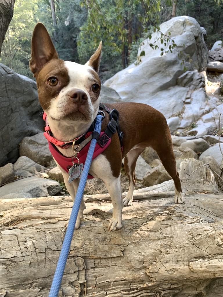
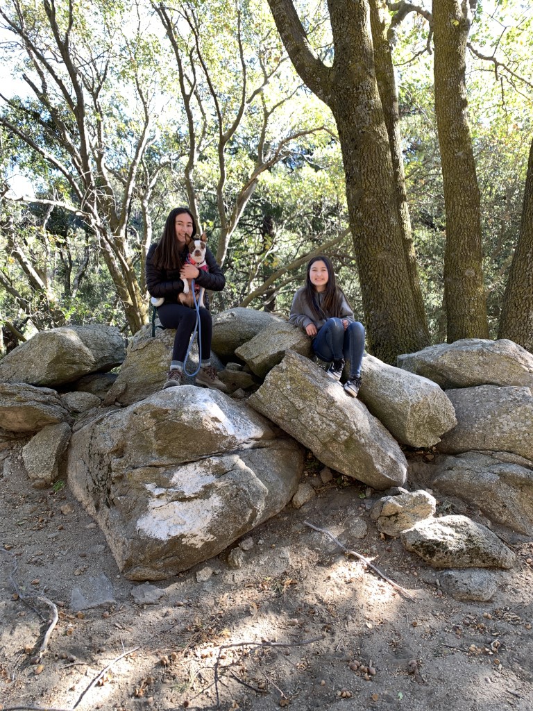
Jessica, Hunny, & Bauer’s Scoop: Our two Boston Terrier pups, Hunny (brown and white) and Bauer (black and white) are the best adventure buddies and love being outside exploring. We were on the Heart Rock Trail in Crestline. Super dog friendly and our dogs were pooped by the end!
| Mileage (round trip) | 1.3 |
| Difficulty | Easy |
| Gain (in feet) | 300 |
| Trailhead | 34.254604, -117.304806 |
| Hike Time (in hours) | 1-2 |
| More Info | https://modernhiker.com/hike/heart-rock; https://www.fs.usda.gov/recarea/sbnf/recreation/hiking/recarea/?recid=26321&actid=50 |
| Follow Us! | @sweet.life.of.jess |