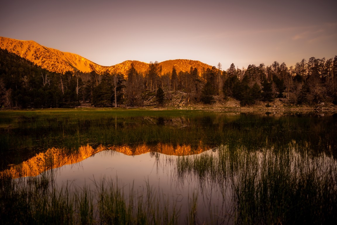
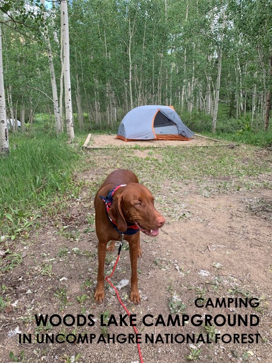
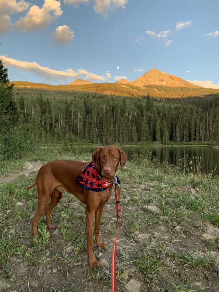
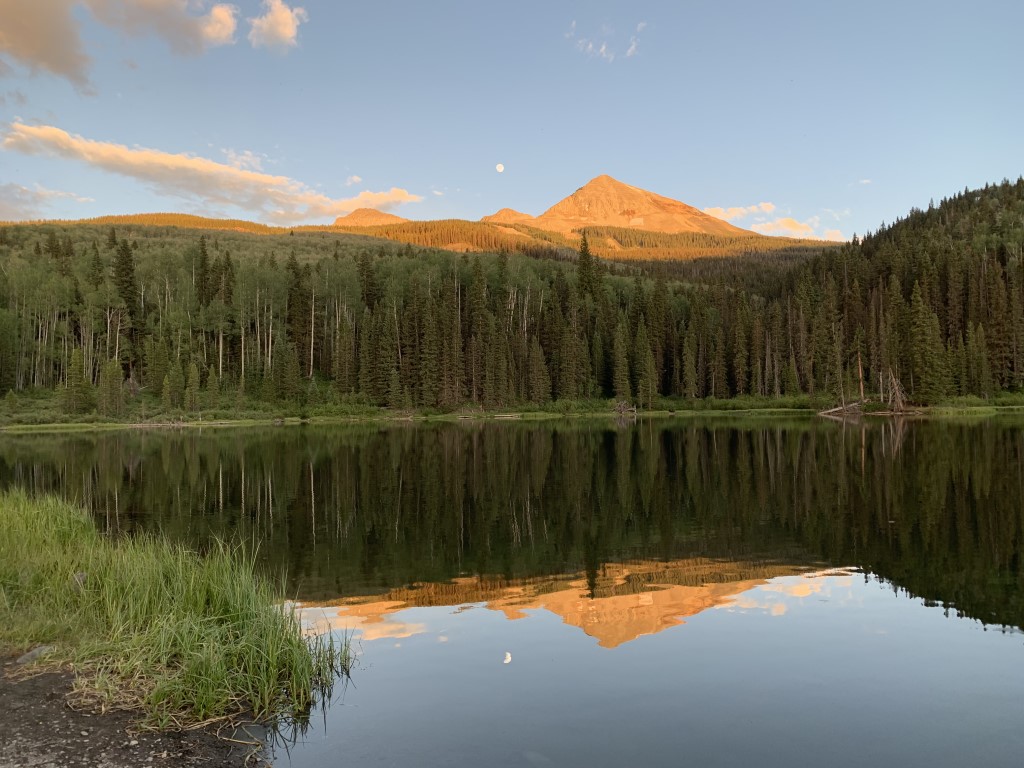
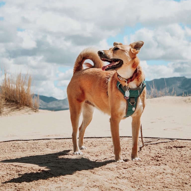
Woods Lake Campground
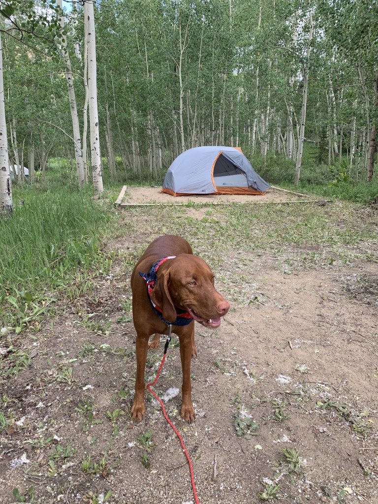
Cappie’s Scoop: I love to camp and this was a really fun spot! I was able to walk to the trails and a lake. I hiked the trails which were very green and lots of aspen trees. I bet this spot looks great in the fall. I also went to paddle boarding with mom on the lake. The view was great and all I had to do was sit pretty on the board while mom did all the work. Haha! One day it rained and then I saw there was ice on the ground. Mom said it was something called hail. I was in the tent when it happened, all cozy and snuggled inside my bed. At night, we had a fire to stay warm and extra treats before bedtime. I hope we go back here one day. Don’t hesitate to add YOUR scoop in the comments below!
Tips: The campground has 3 loops with 41 campsites. Camp sites have a picnic table and a fire ring. Firewood is available for sale, $10 per bundle. Camping here is great because there are hiking trails within walking distance that give you access into the Lizard Head Wilderness and also a lake for standup paddleboarding! The town of Telluride is located 40 minutes from here.
Directions: From the town of Telluride, head west on highway 145 for about 13 miles to County Road 57P, Fall Creek Road. Turn left (heading south) onto CR 57P and continue for about 5.2 miles to the National Forest Boundary where CR 57P becomes Forest Service Road 618. Follow 618 for another 3.3 miles to the Woods Lake Campground and Lake.
| Location | 37.886709, -108.056382 |
| Time | 3 nights |
| Exposure | Sunny and Shady |
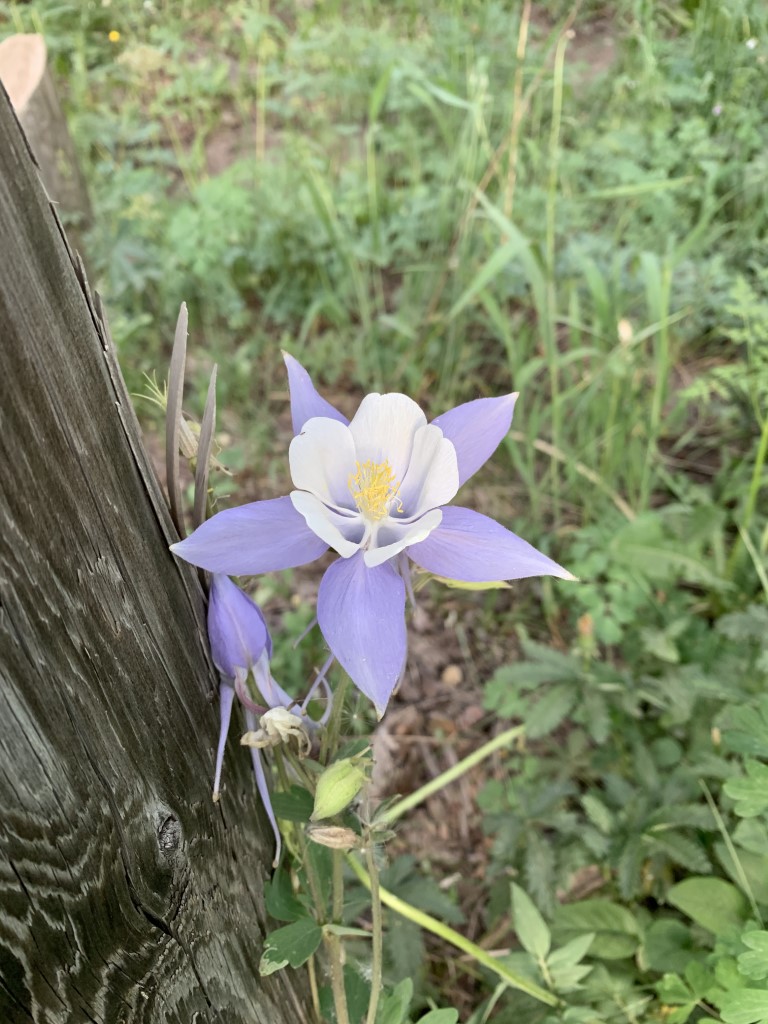
| Scenery | Forest, Wildlife, Wildflowers, Lake Views |
| Facilities | Toilets at the campground. |
| Fees/Permits | First-come, first-served sites for $18/night at the time of writing this post OR $4 per day for day use/picnic in a campsite if you don’t want to stay overnight. |
| More Info | https://www.fs.usda.gov/recarea/gmug/recarea/?recid=32380 |
| Last Camped | 7/3/2020-7/6/2020, 7/7/2023-7/9/2023 |


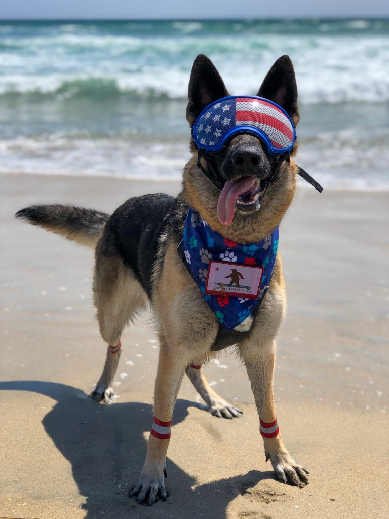
Mission Bay – SUP/Kayak
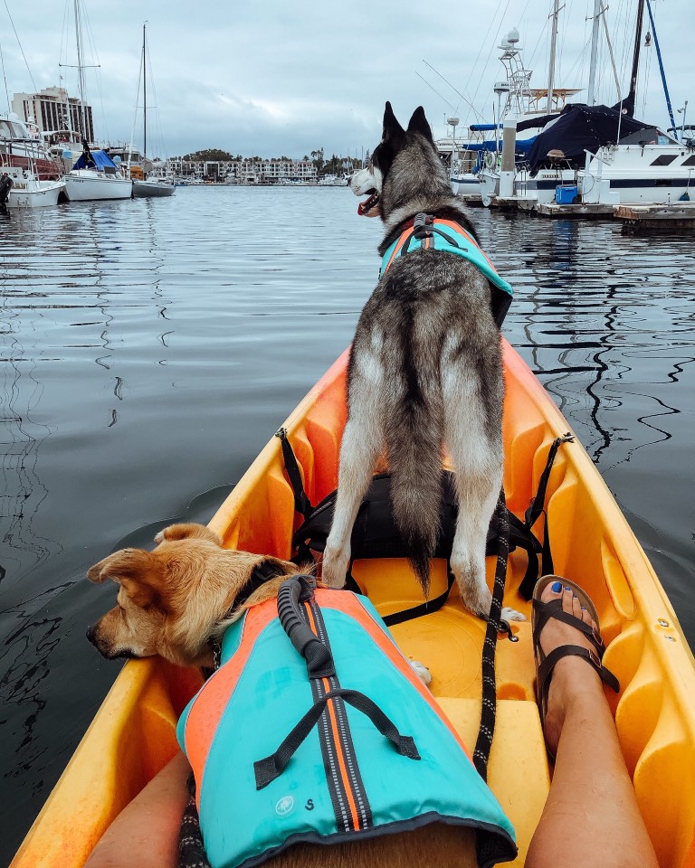
The Parkhouse Pack’s Scoop: Aqua Adventures in Mission Bay, San Diego is dog friendly and the staff were so helpful getting us situated for the first time with the dogs. The tandem kayak gave plenty of room for both dogs to be comfortable, and the kayak to be sturdy for all 3 of us. They rent SUP and hydro bikes as well, which I had read reviews of people taking their dogs on too. Rental price is for 1.5hrs, paddle around Mission Bay, enjoy seeing the seals (from a distance for us), and the salty breeze on your skin. Afterwards we took the dogs to play at the beach on Fiesta Island. Wanting to SUP/kayak with your dog but not in San Diego? There are plenty of rental companies throughout SoCal that allow dogs! Newport, Huntington Beach, Sunset Beach, South Bay, check it out and be sure to bring a life jacket for the dog(s).
| Location | 1548 Quivira Way, San Diego, CA 92109 |
| More Info | https://www.aqua-adventures.com |
| Follow Us! | @sandi_n_aspen |

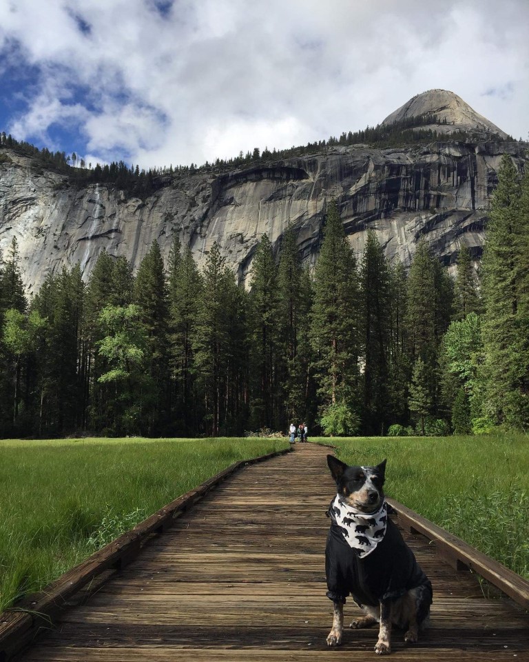
Yosemite National Park – Bridalveil Fall
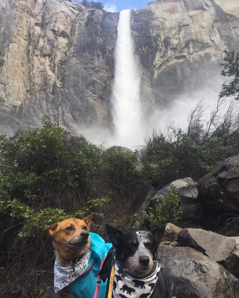
Ana, Hannibal & Clarice’s Scoop: Yosemite has a few trails/short walks that are dog friendly. I was able to see the beauty of Yosemite with my best friends by my side. Even though most trails were really just short walks, we did them all in a day and the dogs were exhausted at the end of the day.
| Mileage (round trip) | 0.5 |
| Difficulty | Easy |
| Gain (in feet) | 80 |
| Trailhead | 37.716504, -119.650989 |
| More Info | https://www.nps.gov/yose/planyourvisit/bridalveilfalltrail.htm |
| Follow Us! | @ana_adventurer |

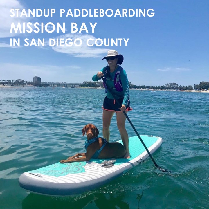
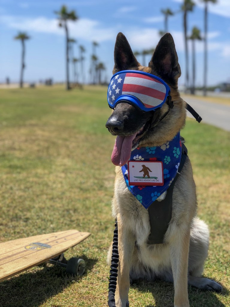
Mission Bay – SUP
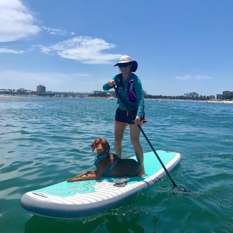
Cappie’s Scoop: I’m still figuring out how to stay on the board when mom takes me to paddle! I love the water so much I want to jump in and start swimming. But the game is to stay on the board. I’m working on that part! When I do hang out and relax, mom really does all the work and I get a bay tour of boats, people swimming, kayakers and sometimes I even see a sea lion. They are huge and noisy! Sometimes I like to look for fish and get very close to the edge of the board so I can look in the water. Mom knows we’re both going for a swim one day! Don’t hesitate to add YOUR scoop in the comments below!
Tips: This spot is best for folks who have their own board as there are no places nearby to rent one.
Directions: Coordinates below take you to our favorite launch spot at Bessemer Beach in Point Loma. We park on the street and it’s free!
| Mileage (round trip) | Up to you! |
| Difficulty | Easy |
| Gain (in feet) | N/A |
| Location | 32.718314, -117.233712 |
| Time (in hours) | 2-3 |
| Exposure | Sunny |
| Scenery | Bay Views, Birds |
| Facilities | None |
| Fees/Permits | None |
| More Info | None |
| Last SUP’d | 6/28/2020 |

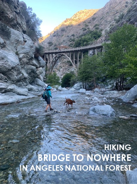
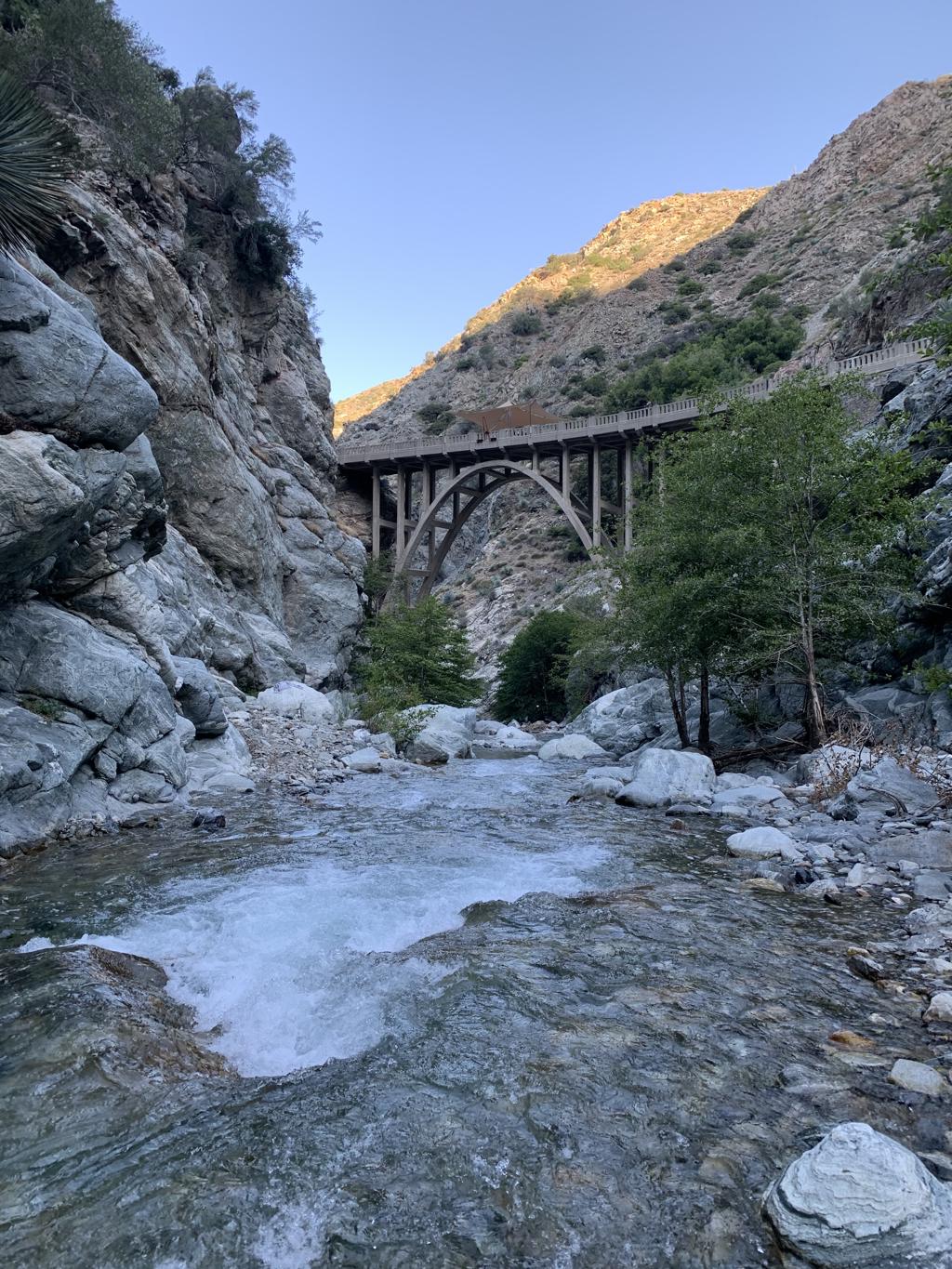
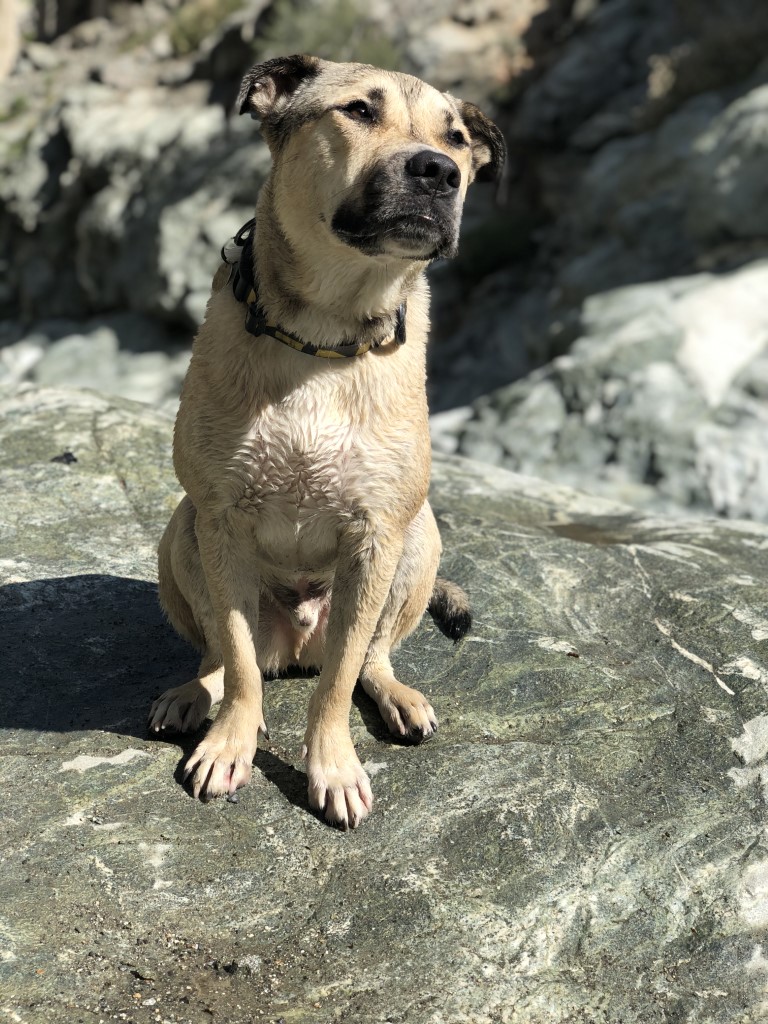
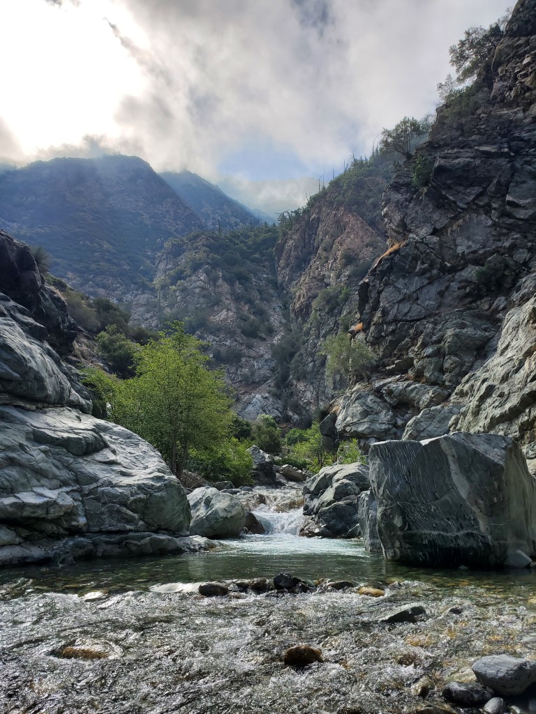
Bridge to Nowhere Trail
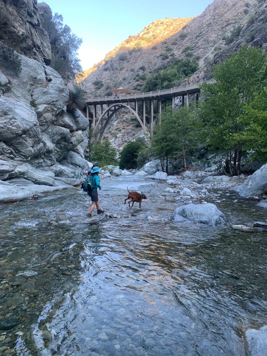
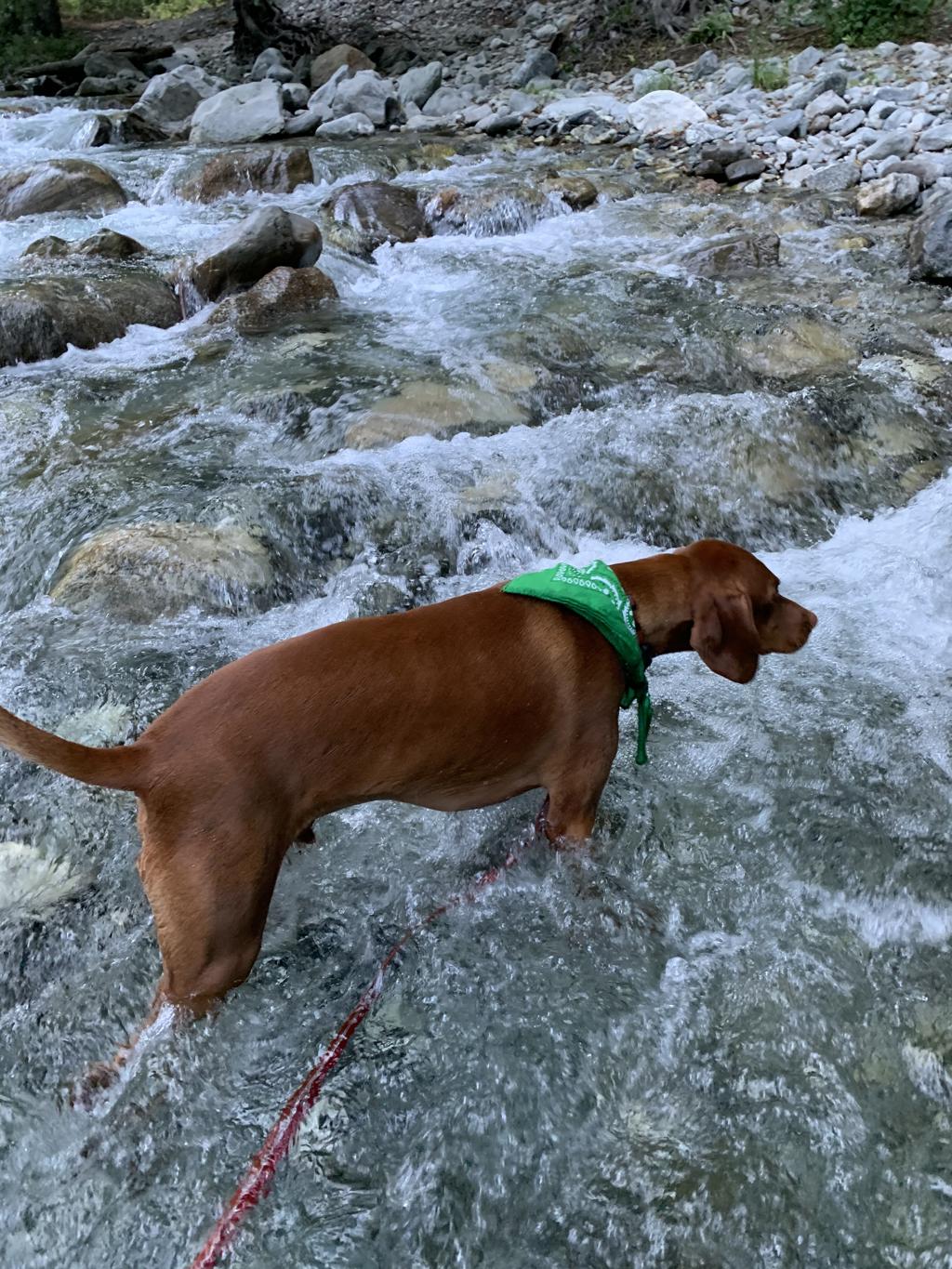
Cappie’s Scoop: I love the water and this hike had so much water, it was amazing! There are a bunch of creek crossings that we have to hike through to stay on the trail. Then we got to a bridge and we crossed it and hiked down to the water again. I saw lots of sticks floating in the water so I jumped in to save them! It was a lot of fun! Don’t hesitate to add YOUR scoop in the comments below!
Tips: There are lots of creek crossings, at least 7 of them. We wore our non-waterproof hiking boots and walked through every creek crossing with them on. Non-waterproof hiking boots will allow the water to drain out and dry faster than waterproof boots. You’re walking through the creek bed with rocks and so we don’t recommend going barefoot. For your dogs, if they have sensitive paws, you may want to put on some booties for the creek crossings but we wouldn’t recommend leaving them on for the entire hike because your dogs paws will get wet, soggy and rubbing/blisters could happen inside the booties. If your dog can go without them, that’s a better plan. Cappie didn’t wear booties and he did great.
Directions: From the 210, head towards State Rte 39 N/N Azusa Ave and continue driving north for about 11.6 miles. This road becomes San Gabriel Canyon Road. Then turn right onto E Fork Road and drive for 5.2 miles. E Fork Road turns into Camp Bonita Road and ends at the trailhead in about 0.9 miles.
| Mileage (round trip) | 10-11 |
| Difficulty | Moderate (Technical) |
| Gain (in feet) | 913 |
| Trailhead | 34.237108, -117.764981 |
| Hike Time (in hours) | 5 |
| Exposure | Mostly Sunny |
| Scenery | Mountain Views, Forest, Creek |
| Facilities | Toilets in the parking lot. |
| Fees/Permits | California Adventure Pass or Interagency Annual Pass/America the Beautiful Pass (National Parks Pass). |
| More Info | https://www.visitcalifornia.com/experience/bridge-nowhere; https://californiathroughmylens.com/2011/08/bridge-to-nowhere-azua-ca-photo; https://www.bungeeamerica.com |
| Last Hiked | 6/27/2020 |


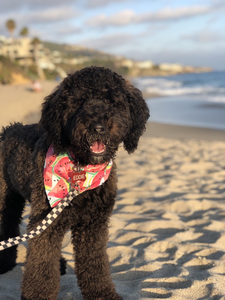
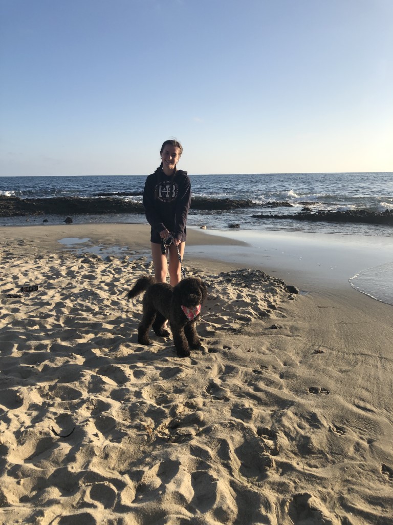
Treasure Island Beach
Eddie’s Scoop: We visited the Treasure Island beach during dog-friendly hours and it was just wonderful! We went later in the day, where the beach was not busy or too cold to enjoy. We set up a blanket where we relaxed and listened to the ocean waves and walked to the very cool tidal pools with the sunset surrounding us.
| Location | 33.514589, -117.759427 |
| More Info | https://www.visitlagunabeach.com/plan/dog-friendly |
| Follow Us! | @itseddiethedoodle |

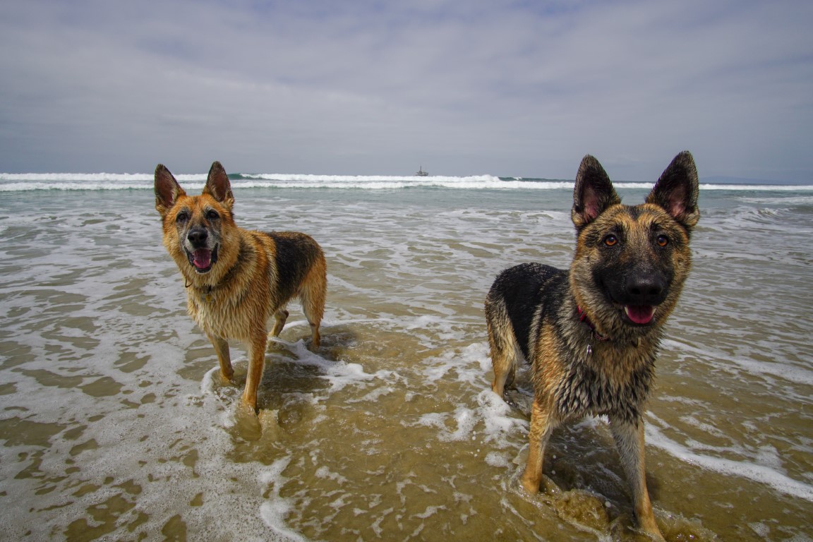
Huntington Dog Beach
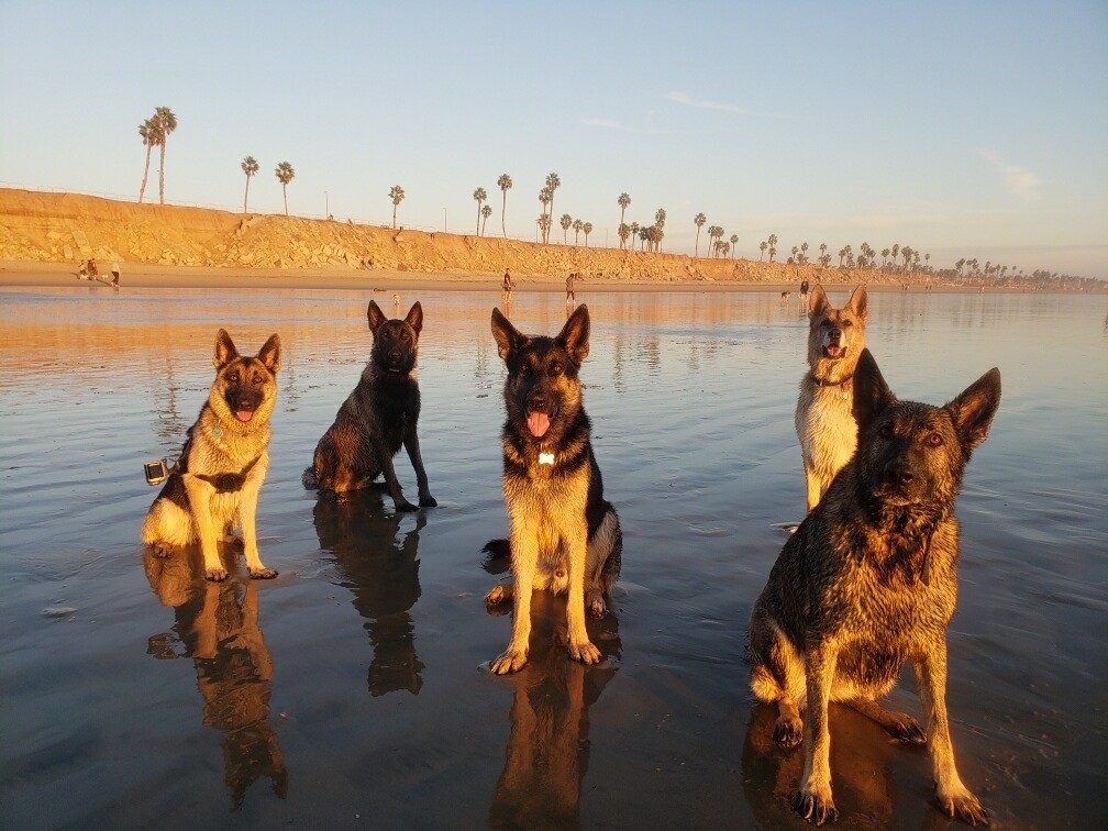
King & Sam’s Scoop: This is by far our favorite place to go! Who doesn’t love the beach right? Dad always takes us when he gets a day off. It’s always so much fun. There are tons of things to do there. Dad sometimes brings his bike and we ride on the nearby paved trails for a bit, or we pull him on his longboard, then we go cool off in the water and play fetch! Don’t forget to bring some fresh drinking water and snacks!
| Location | 33.674331, -118.026116 (Along the Pacific Coast Highway (PCH) between Seapoint Avenue and 21st Street) |
| More Info | https://www.dogbeach.org; https://www.surfcityusa.com/things-to-do/beaches/dog-beach |
| Follow Us! | @kingandsamexplore |
Bridge to Nowhere
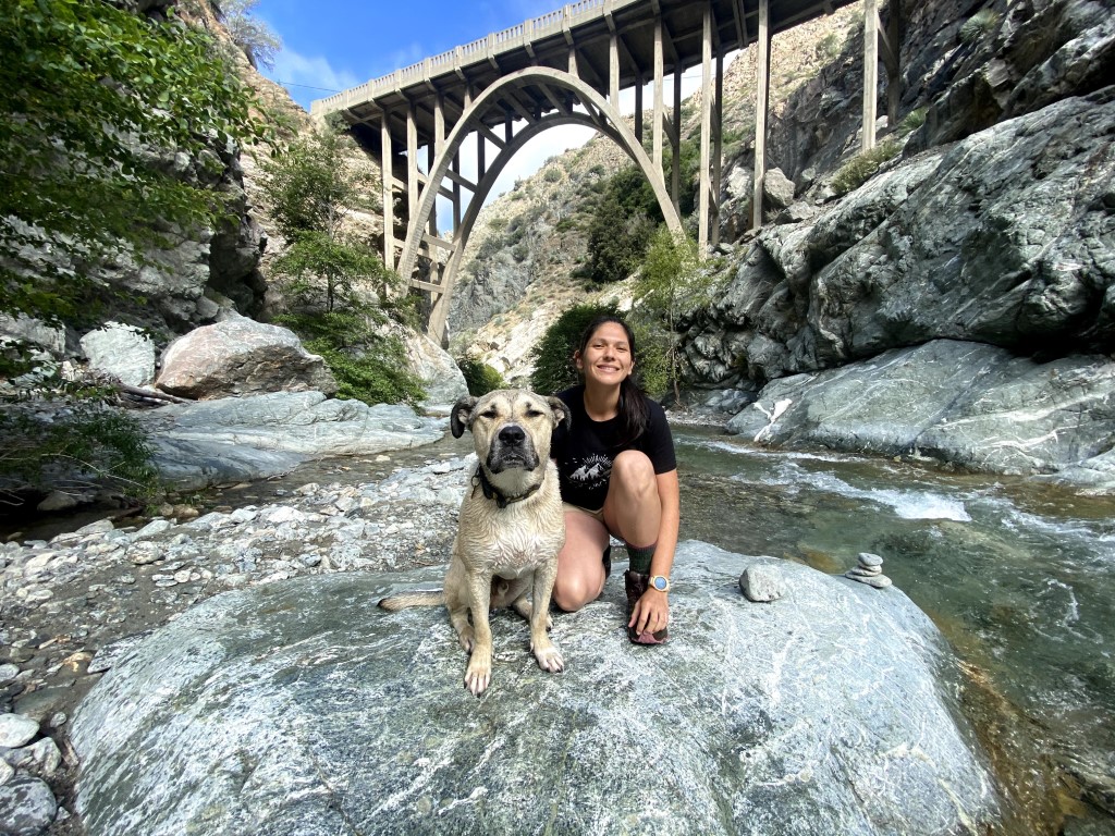
Elaine & Shadow’s Scoop: Two words: Water Crossings! We drove to the trailhead and waited for more dog friends and humans. We made a pack of 3 humans and 4 dogos. The we hiked with mild incline and walked through the rushing water. For Shadow it was at times up to his neck but he crossed the river confidently after seeing his other 3 seasoned friends do it. After about 5 miles we made it to the Bridge-it’s alright. The fun part was the pools below it where the dogs fetched in the water and laid out in the sun till our way back where we stopped for another swim. We cannot recommend this hike enough. We saw little dogs on the trail too but you may just have to carry them or have them swim through the crossing. Note: Go in the am or mid week or else you may hit crowds!
| Mileage (round trip) | 10-11 |
| Difficulty | Moderate (Technical) |
| Gain (in feet) | 913 |
| Trailhead | 34.237108, -117.764981 |
| Hike Time (in hours) | 5 |
| More Info | https://www.visitcalifornia.com/experience/bridge-nowhere |
| Follow Us! | @shadowtheshepkita |

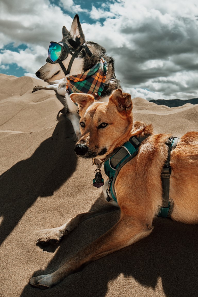
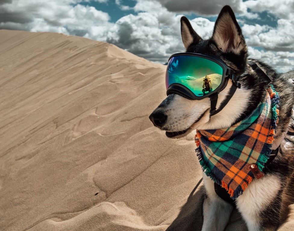
Kelso Dunes
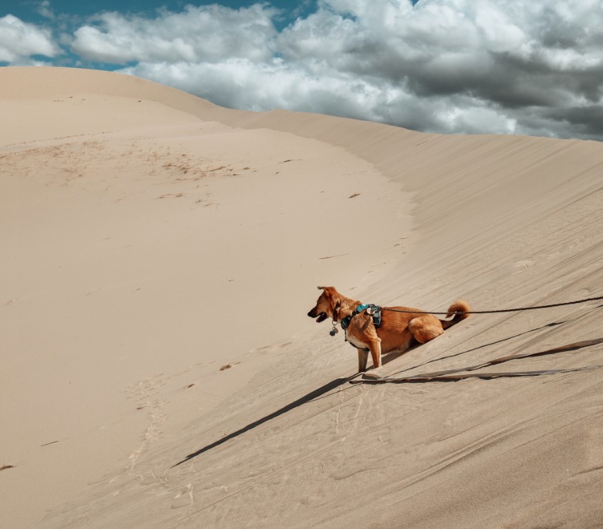
The Parkhouse Pack’s Scoop: For those in SoCal who have drooled over others’ photos from White Sands NP or Great Sand Dunes NP, you can have your own dune adventure right here at Kelso Dunes in the Mojave National Preserve! Definitely best for the cooler months (fall-early spring) since temps can get way too hot out there for both dogs and humans. It’s a short trail to get to the dunes, from there you can wander as you please! Feeling like a booty burn? Climb to the peak of a sand dune, sit down, and enjoy the sprawling views of the Mojave Desert. Make sure to bring lots of water, pack out any trash (trash cans at trailhead), and keep dogs on a leash since there are leash laws. No fees required, and there is a restroom at the trail head parking area. Nearby is the town of Baker, which many of you know from the drive to Vegas- grab some Alien Jerky and a gyro from the Mad Greek for the drive home!
| Trailhead | 34.892369, -115.699113 |
| More Info | https://www.nps.gov/moja/planyourvisit/hiking.htm |
| Follow Us! | @sandi_n_aspen |
“Dry” Lake

Kaela & Bo’s Scoop: Dry Lake was incredible. It’s a lake that isn’t man-made, so it is usually dry. But in the winter of 2018, we had so much rainfall that Dry Lake was still full of water in July of 2019. The trek in was beautiful, the lake is surrounded by some of the larger mountains that we had hiked before – Mount San Gorgonio, Mount Baldy, Mount San Bernardino. The campsites were well spread out and we were able to swim and kayak on the lake for sunset and sunrise. It was magical. You do need a permit if you plan on camping and there are 1-2 rangers that walk the trail and are at the campsites. There are no facilities at the top, but there is a stream you can filter your own water at. July had perfect weather, it wasn’t too hot or too cold, but make sure the lake is full if you are planning on going! We got lucky, the lake was full of water for the first time in 14 years!
| Mileage (round trip) | 12.4 |
| Difficulty | Moderately Strenuous |
| Gain (in feet) | 2250 |
| Trailhead | 34.161220, -116.871692 (South Fork Trailhead) 34.130784, -116.843544 (Dry Lake Trail/Junction) |
| Hike Time (in hours) | 2 days |
| More Info | http://sgwa.org/trails/south-fork-trail; https://www.fs.usda.gov/recarea/sbnf/recarea/?recid=26579 |
| Follow Us! | @misterbo619 |