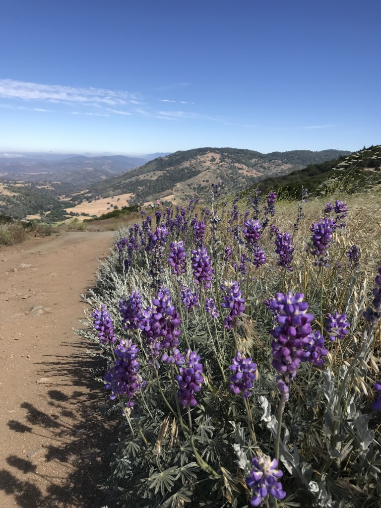
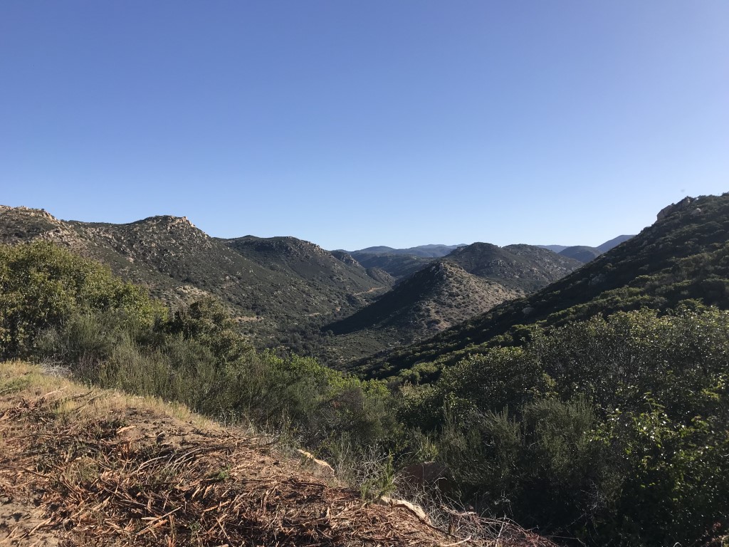
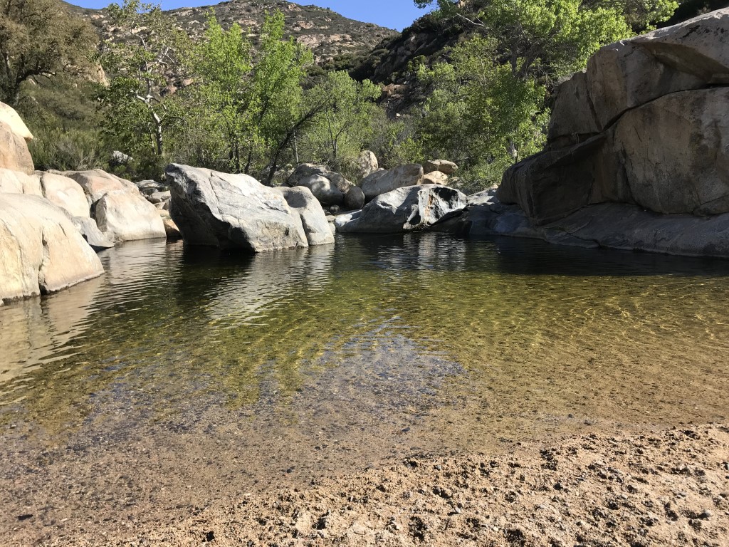
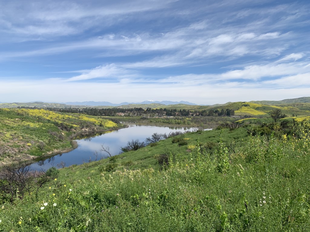
Horsethief Canyon
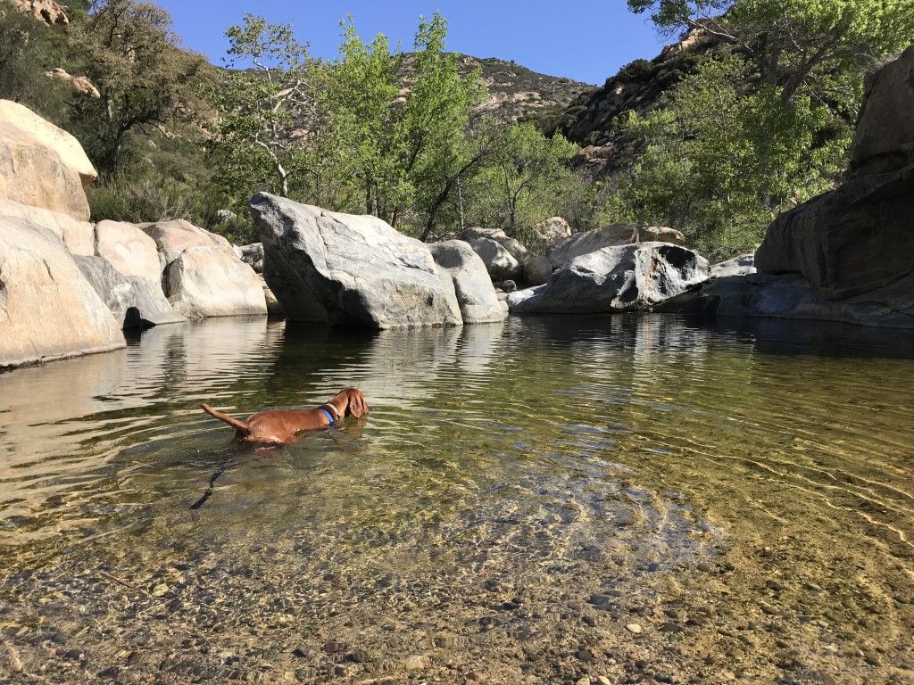
Cappie’s Scoop: Who loves a swimming hole! I do I do! I was really surprised when I found a big pool of water on this hike. I’m just hiking along, smelling the flowers, eating some green grass, dodging some garter snakes (yeah that one scared mom) … when all of a sudden, there it was. I immediately jumped in with my leash still on and started swimming. The water felt amazing. Mom started to toss sticks in the water and I would swim out to get them. I could get used to this. Maybe we can get a pool on our balcony at home. On the way back (which is uphill by the way), we saw a bunch of hoomans headed down to the water and they had these huge colorful sticks with them. Mom called them noodles and said they sit on those in the water. They should just doggie paddle like me! Don’t hesitate to add YOUR scoop in the comments below!
Tips: Depending on the time of year you go, you may encounter ticks on the trail so be prepared. Recommend you carry pet friendly tick spray.
Directions: Take I-8 E to the Tavern Road exit 30. Turn right (south) onto Tavern Road. Continue on Tavern Road for approximately 2.8 miles where it will turn into Japatul Road. Continue on Japatul Road for approximately 7 miles. Turn right onto Lyons Valley Road and continue for 1.5 miles until you see the sign for the Japatul Fire Station on the left. Turn left onto the Forest Service Road 16S04 and the large parking area will be on your left.
| Mileage (round trip) | 3.6 |
| Difficulty | Moderate |
| Gain (in feet) | 613 |
| Trailhead | 32.747131,-116.669386 |
| Hike Time (in hours) | 2-3 |
| Exposure | Sunny and Shady |
| Scenery | Mountain Views, Creek, Forest, Wildflowers |
| Facilities | None |
| Fees/Permits | None |
| More Info | http://hikingsdcounty.com/horsethief-canyon |
| Last Hiked | 4/21/2018, 4/12/2019, 3/27/2021, 4/15/2022 |


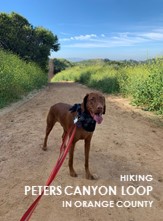
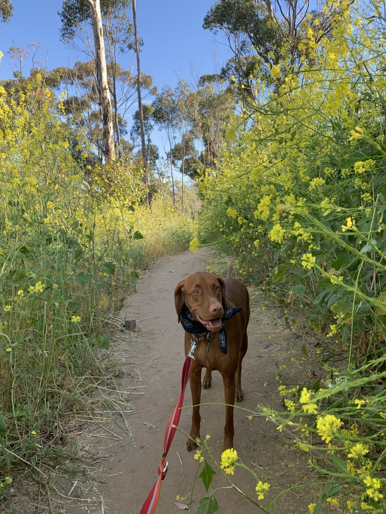
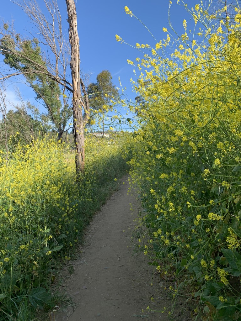
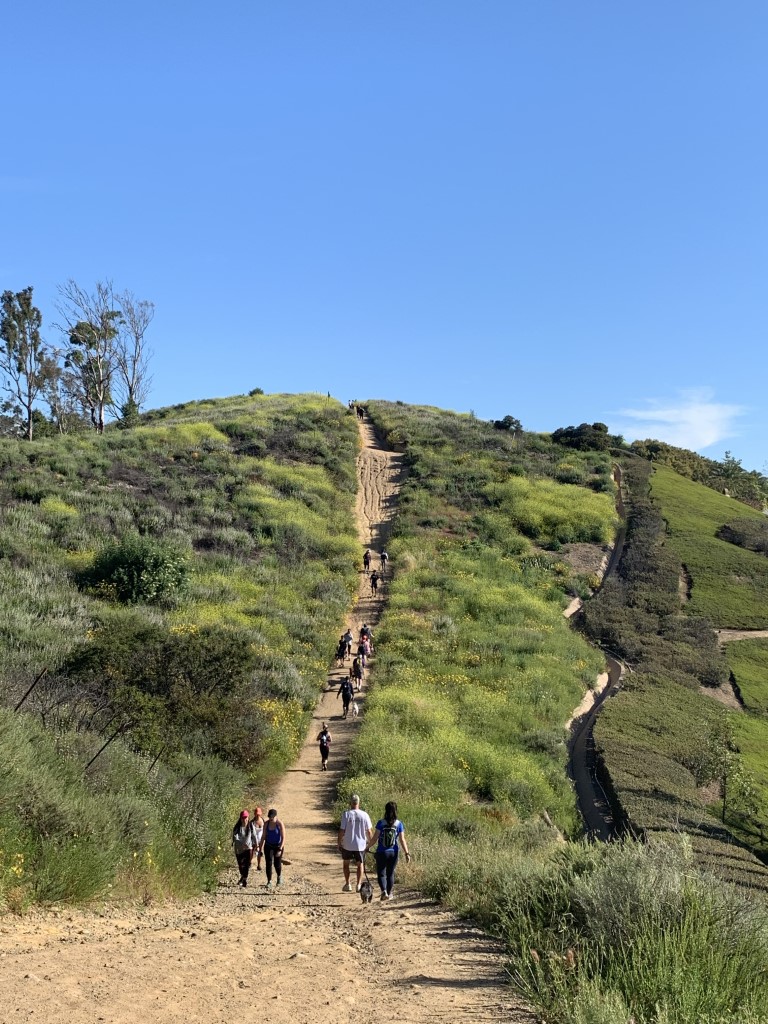
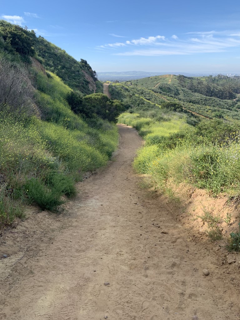
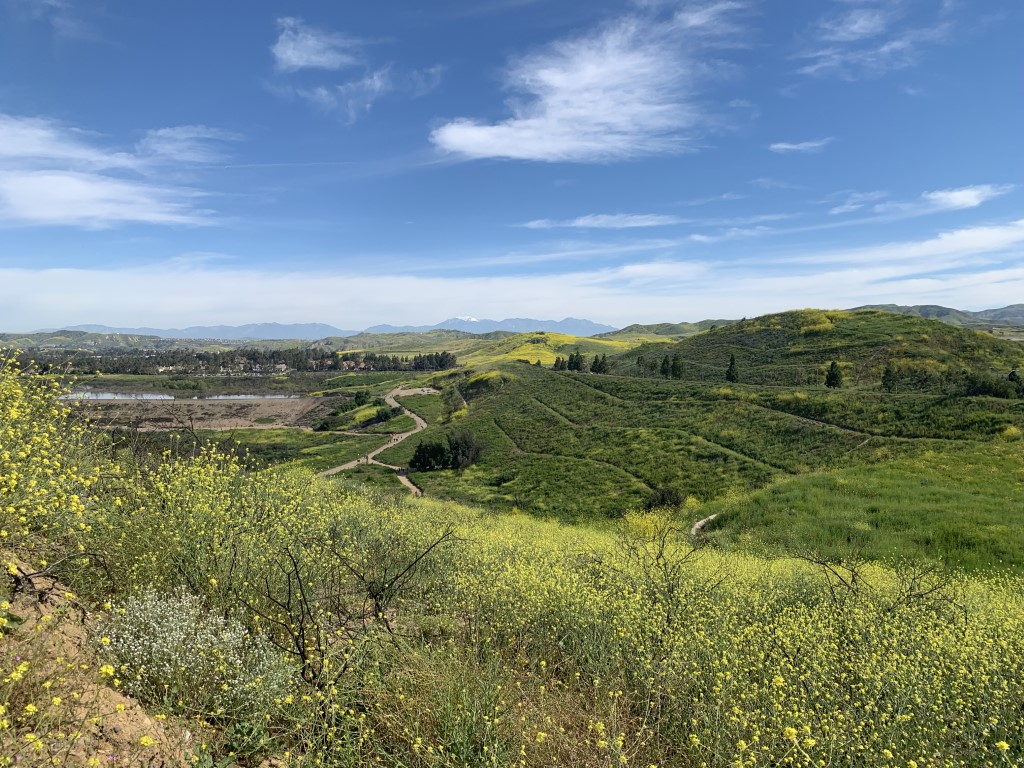
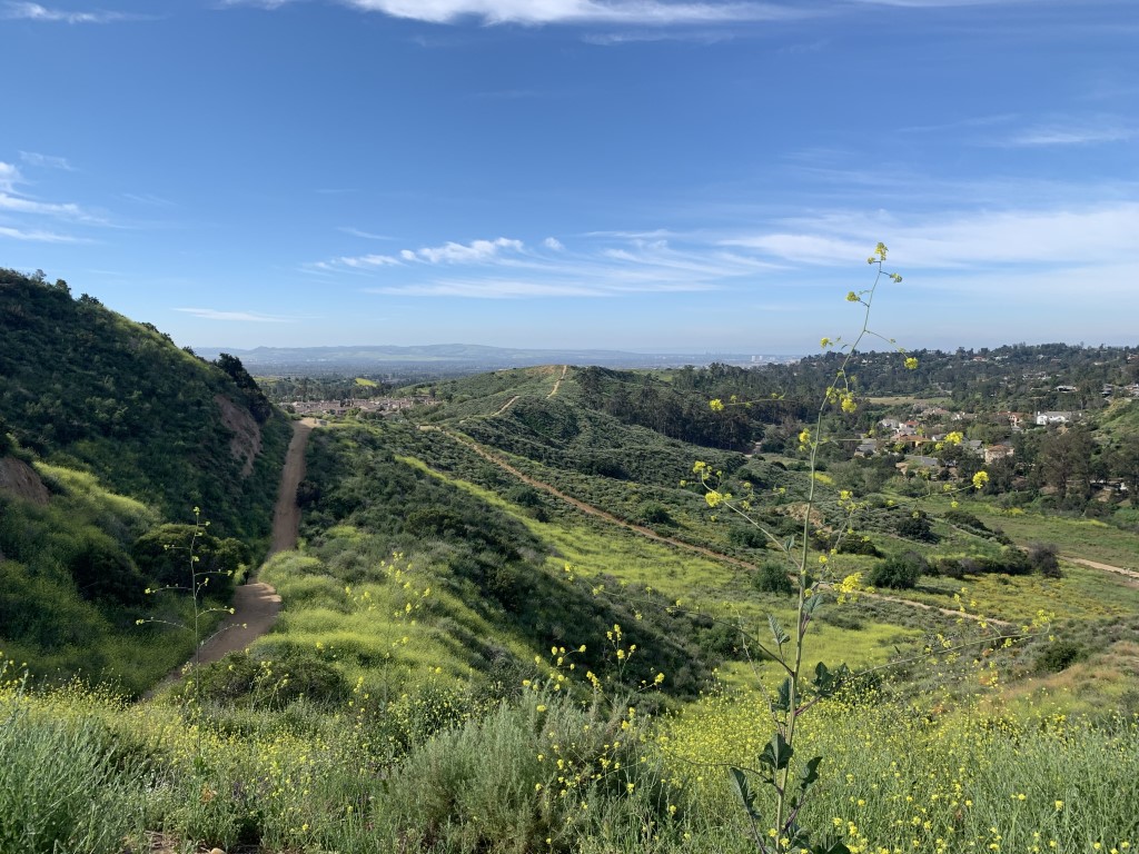
Peters Canyon Loop
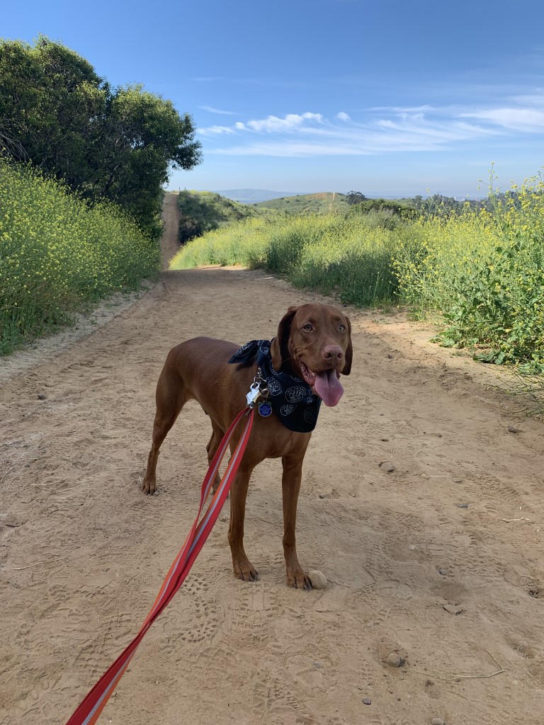
Cappie’s Scoop: This is another roller coaster hike! Just check out the pictures. Last time I hiked here, it was very green and mom was getting upset that I kept pulling over to eat the grass. I couldn’t help it. Again, look at the pictures. I wanted to roll around in the grass, eat it till I had a full belly and then take a nap in it. Maybe that’s why we haven’t gone back here yet … it took us a loooooong time to hike 6.5 miles. I promise I won’t stop to eat the grass too much if we go back mom! Don’t hesitate to add YOUR scoop in the comments below!
Tips: None
Directions: From I-5, exit Tustin Ranch Road and head towards the foothills. Drive approximately three miles. Get in the left hand lane and turn left on Pioneer Way. Get into the right lane and take the next right on Pioneer Road. This road will wind around Cedar Grove Park. Continue to the first stop sign and turn left on Peters Canyon Road. Take this road down around a little curve and park on the right side of the curb at the end of the road. There is a sign for Peter’s Canyon Trail at the end of the road. Pay attention to the “No Parking” signs, as tickets are issued frequently to those who park in that zone.
| Mileage (round trip) | 6.5 |
| Difficulty | Moderate |
| Gain (in feet) | 681 |
| Trailhead | 33.758550, -117.771703 |
| Hike Time (in hours) | 3 |
| Exposure | Sunny |
| Scenery | Rolling Hills, Wildflowers, Pond |
| Facilities | Restrooms at north/south entrances and water at north entrance. |
| Fees/Permits | None |
| More Info | https://socalhiker.net/hiking-peters-canyon-loop-trail; http://www.ocparks.com/civicax/filebank/blobdload.aspx?BlobID=15696 |
| Last Hiked | 4/7/2019 |

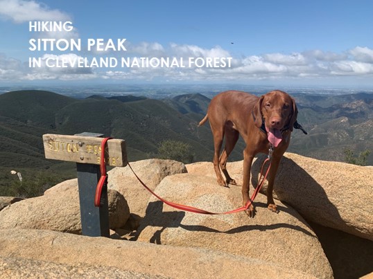
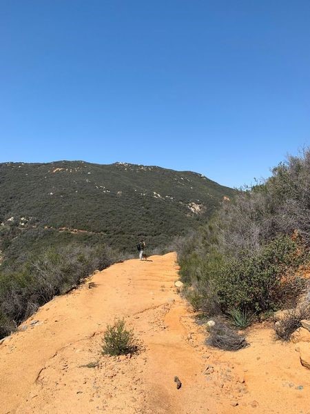
Sitton Peak
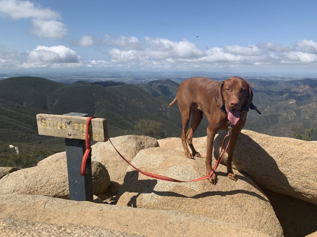
Cappie’s Scoop: One of my favorite hikes! The trail starts next to the candy store … ahhh the candy store where they have ice cream! The 3,273 ft peak has 360 views of the Santa Ana Mountains, San Diego County, Orange County, and Catalina on a clear day. Don’t hesitate to add YOUR scoop in the comments below!
Tips: There is a register at the start of the trail to sign in. Suggest you have a map handy as there are some trail junctions (mostly right turns). Stay on Bear Canyon Trail. Eventually you’ll reach 4 Corners, a great place to camp. The last 1/2 mile of the hike is steep and this is where a hiking pole is helpful.
Directions: Can also use address for Ortega Oaks Candy Store, 34950 Ortega Hwy, Lake Elsinore, CA 92530. Park in the lot ACROSS from the candy store. The trail begins right behind the candy store to the right side (if facing the store).
| Mileage (round trip) | 11 |
| Difficulty | Moderate |
| Gain (in feet) | 2200 |
| Trailhead | 33.613000, -117.426895 |
| Hike Time (in hours) | 5-6 |
| Exposure | Sunny and Shady |
| Scenery | Mountain Views, Forest |
| Facilities | Toilets in the parking lot. |
| Fees/Permits | California Adventure Pass or Interagency Annual Pass/America the Beautiful Pass (National Parks Pass). |
| More Info | https://socalhiker.net/hiking-sitton-peak-trail; https://hikingguy.com/hiking-trails/hiking-orange-county/sitton-peak-hike |
| Last Hiked | 3/24/2018, 3/24/2019 |
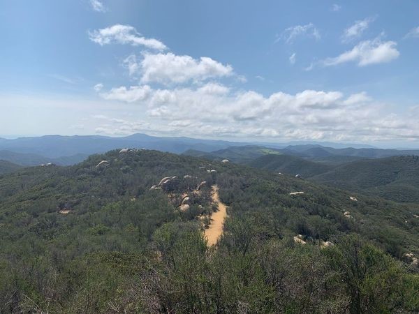
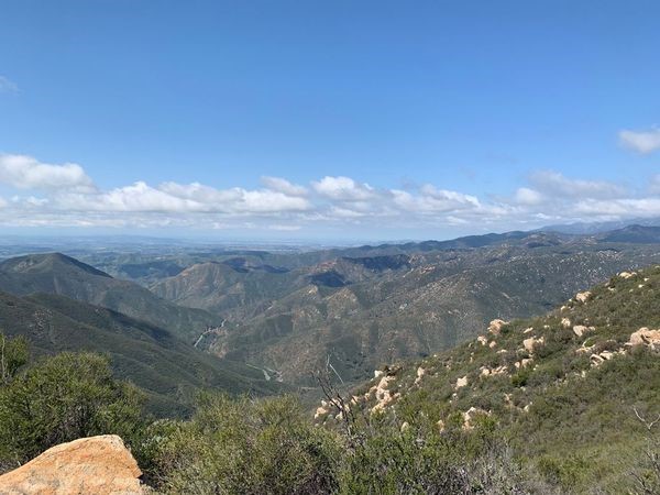
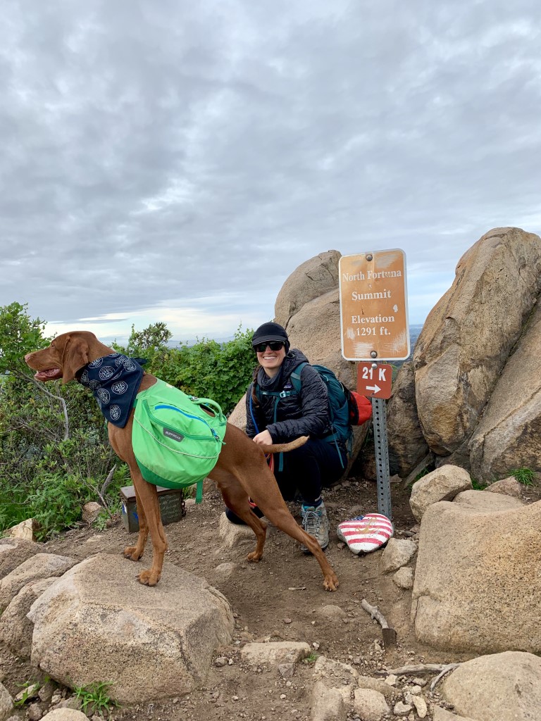
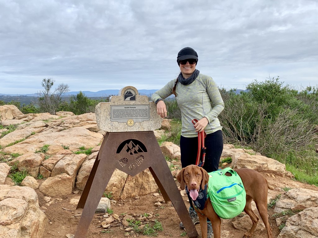
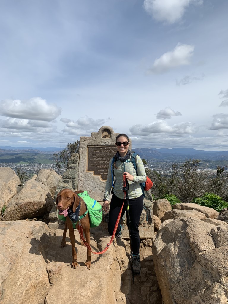
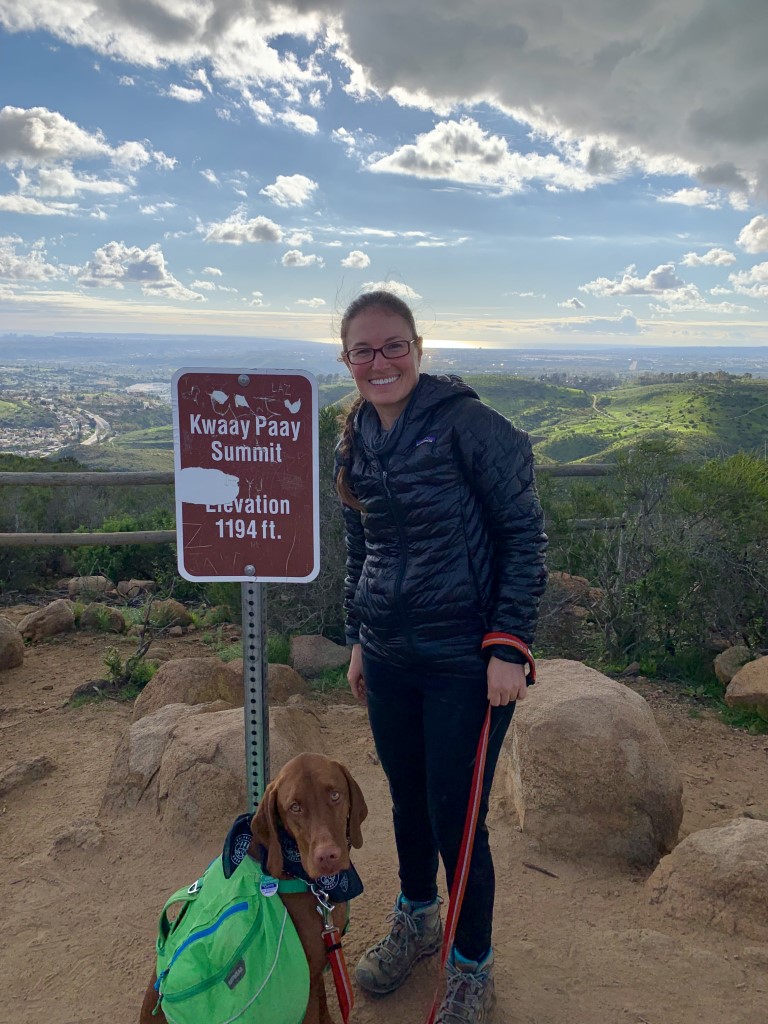
MTRP – 5 Peak Challenge
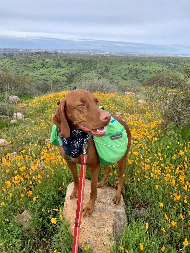
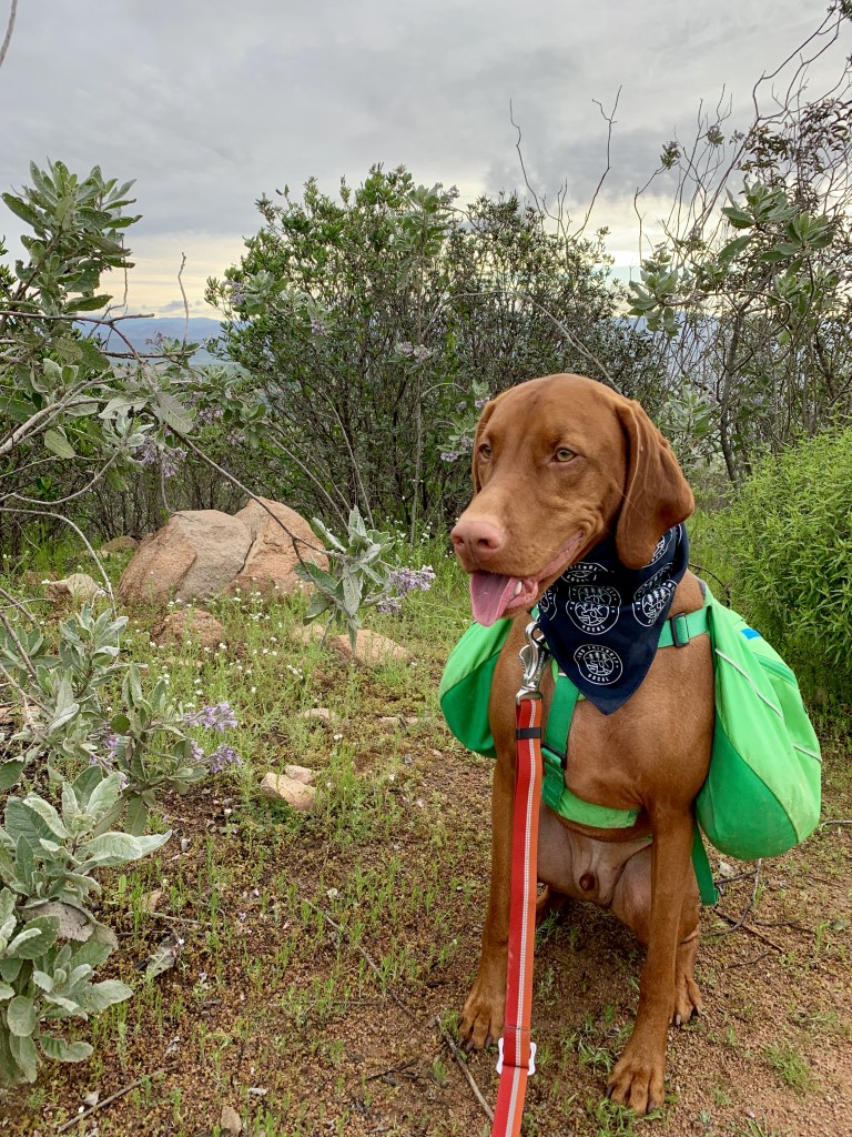
Cappie’s Scoop: Mom and I were training for my first long backpacking trip and she thought it was a good idea for us to do this hike. Five peaks in one day! As you can see from the pictures, I start out smiling, but by the last peak, I’m ready to hit the bed. We stopped a lot to take pictures because the park was blooming with wildflowers and green grass (which I loved). But it was a long day. We went with a few friends so that made it even more fun too! Don’t hesitate to add YOUR scoop in the comments below!
Tips: Officially, the challenge has ended lasting a good 5 years (2015-2020). However, you can still do it on your own even if you don’t get a pin and certificate from the park. Start early, it’s going to be a long day. Picking out your route is the fun part! If you decide to do the whole hike on foot (like we did) vs staging two cars, no matter what route you choose, you will have to cross Mission Gorge Rd at some point. This is the road that separates the two parts of the park.
Directions: Depends on where you want to start and finish. We parked across the street from the Kumeyaay Lake Campground at the dirt lot on the corner of Bushy Hill Drive and Father Junipero Sierra Trail. Sample loop route: from the parking lot, walk to the Big Rock Trail and go up the backside of Cowles Mountain (peak 1), then over to Pyles Peak (peak 2) and back and then down the front of Cowles to arrive at Golfcrest Drive. Turn right and head towards Mission Gorge Road. Cross the road and pick up the trail behind the visitor center to head towards South Fortuna (peak 3) and then North Fortuna (peak 4) peaks. You have a couple options on which trail you want to take but you want to make it down to Kwaay Paay (peak 5), you final one.
| Mileage (round trip) | 17 |
| Difficulty | Strenuous |
| Gain (in feet) | 4500 |
| Trailhead | 32.819451, -117.055746 |
| Hike Time (in hours) | 10-12 hrs |
| Exposure | Mostly Sunny |
| Scenery | Mountain Views, Wildlife, Wildflowers, River, Birds |
| Facilities | Bathrooms at the visitor center and toilets in the parking lot at Cowles Mountain |
| Fees/Permits | None |
| More Info | https://mtrp.org/wp-content/uploads/2020/05/MTRP_Trail_Map_Apr_2020.pdf; https://mtrp.org/5-peak-challenge |
| Last Hiked | 3/10/2019 |


Sweetwater Preserve
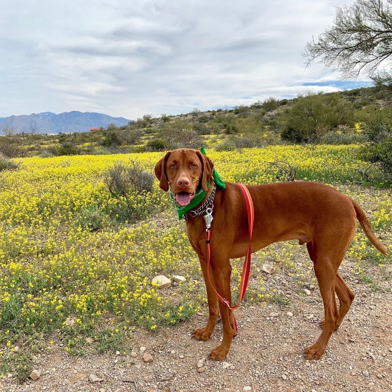
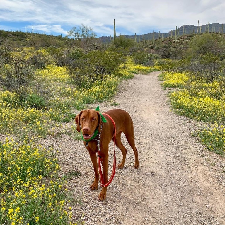
Cappie’s Scoop: I saw lots and lots of yellow flowers and very tall things with sharp needles staring at me. They didn’t smell like trees and I didn’t even get close to potty on them. I stayed on the trail like mom said and just sniffed a little as I walked by them. The flowers were my favorite because they did not poke me like those other plants. Don’t hesitate to add YOUR scoop in the comments below!
Tips: The Sweetwater Preserve is a 700+ acre preserve located in the eastern foothills of the Tucson Mountains of Southern Arizona, west of Tucson. The preserve is open dawn to dusk. There are a bunch of short trails in the preserve so you can definitely choose your adventure as you start hiking through making decisions as you go! This trail is also shared with mountain bikers so keep your eyes open for them and share the trail.
Directions: Address is 4001 N. Tortolita Road, Tucson, AZ 85745.
| Mileage (round trip) | 0.5+ |
| Difficulty | Easy to Moderate |
| Gain (in feet) | 100-500 |
| Trailhead | 32.279366, -111.081543 |
| Hike Time (in hours) | 1+ |
| Exposure | Sunny |
| Scenery | Cactus, Wildflowers |
| Facilities | None |
| Fees/Permits | None |
| More Info | https://webcms.pima.gov/cms/one.aspx?portalId=169&pageId=6688 |
| Last Hiked | 3/2/2019 |

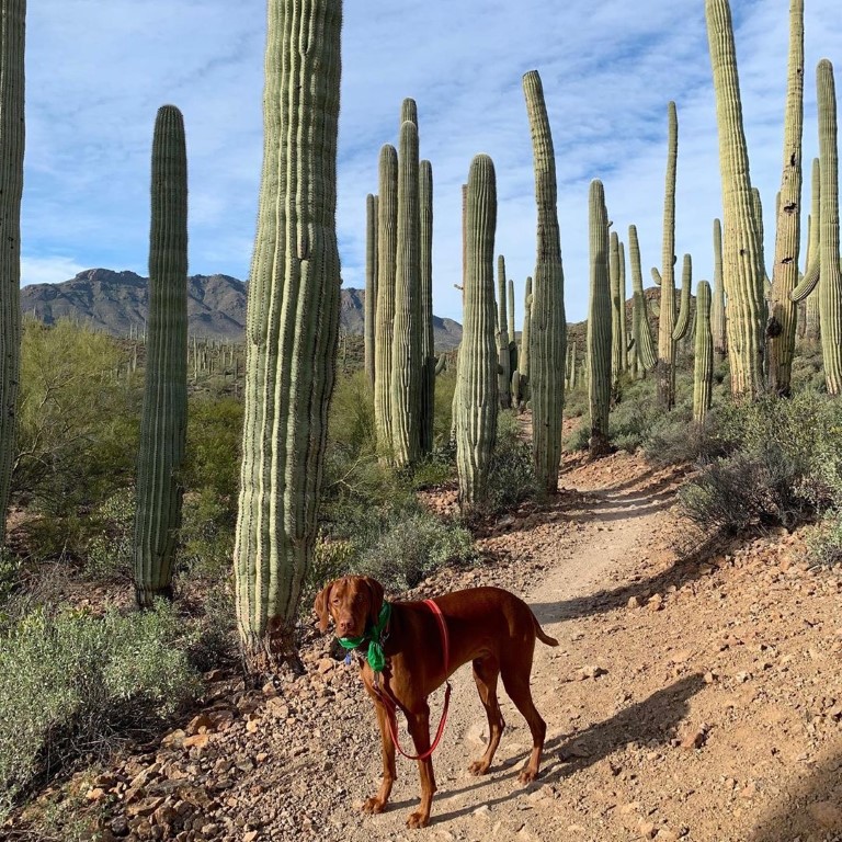
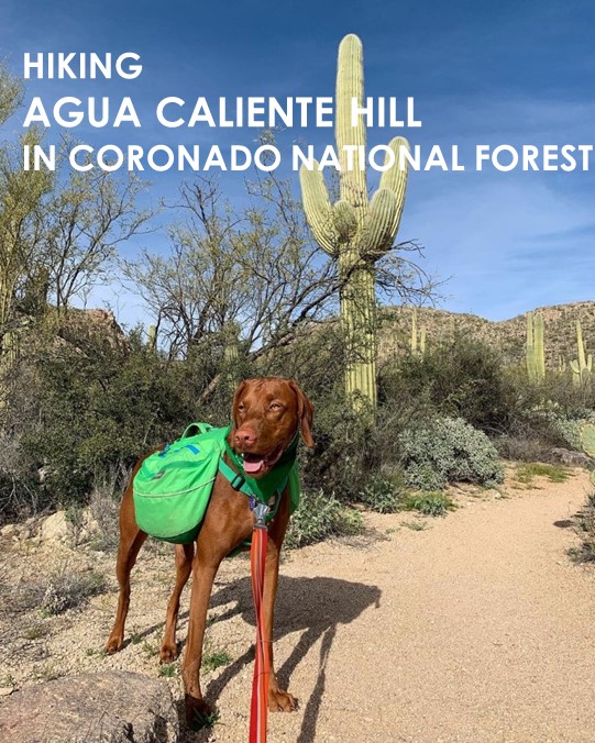
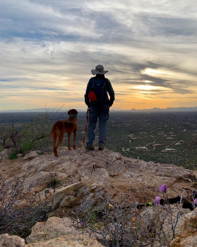
Agua Caliente Hill
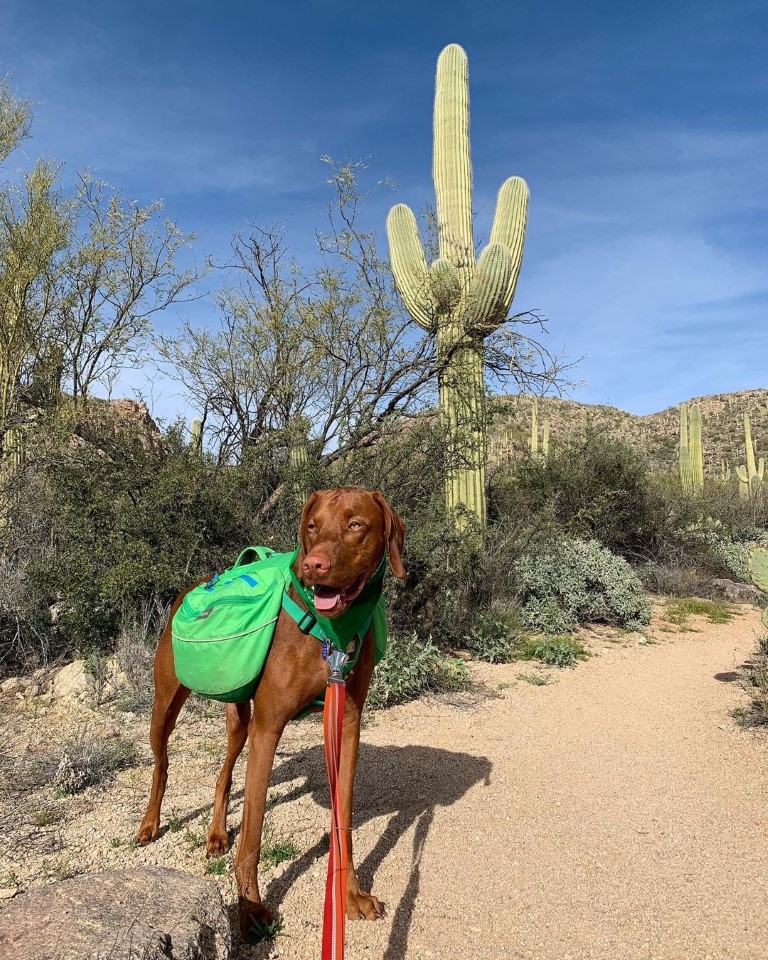
Cappie’s Scoop: Stay on the trail! There are very sharp things on the sides that can poke you in the nose if you smell them too close. Mom told me to be careful and stay on the trail, she was right! We watched the sunset and then carefully made our way back to the car. Don’t forget to bring your night lights furiends! Don’t hesitate to add YOUR scoop in the comments below!
Tips: This is a beautiful trail to hike at sunrise or sunset. You have a great view from above! If you do go at sunset, remember to watch your pup around the cactus that line the trail when it starts to get dark. Be sure to carry a cactus comb just in case you need to remove a sneaky one from yourself or your pup.
Directions: From Tanque Verde Road go east until Houghton Road. Turn left onto Houghton Road and after a short distance turn right onto Fort Lowell Road. Follow this until nearly the end, into a development where Camino Remuda breaks off to the left. Take this and stay left as smaller roads go right. Eventually it ends at a paved parking area on the right.
| Mileage (round trip) | 8.5 |
| Difficulty | Moderately Strenuous |
| Gain (in feet) | 2880 |
| Trailhead | 32.274547, -110.712137 |
| Hike Time (in hours) | 5-6 |
| Exposure | Sunny |
| Scenery | Cactus, Wildflowers |
| Facilities | None |
| Fees/Permits | None |
| More Info | https://webcms.pima.gov/cms/one.aspx?portalId=169&pageId=6109 |
| Last Hiked | 3/1/2019 |

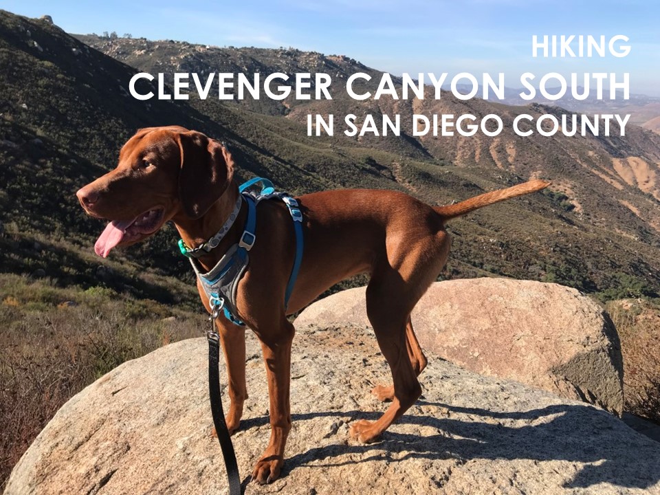
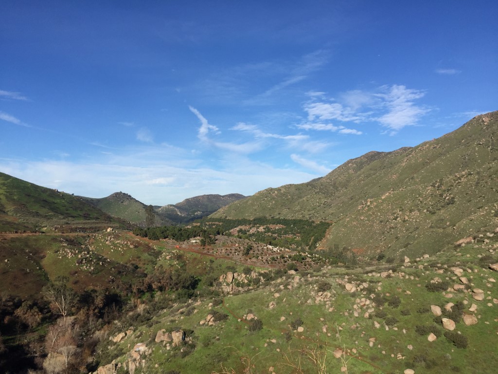
Clevenger Canyon South
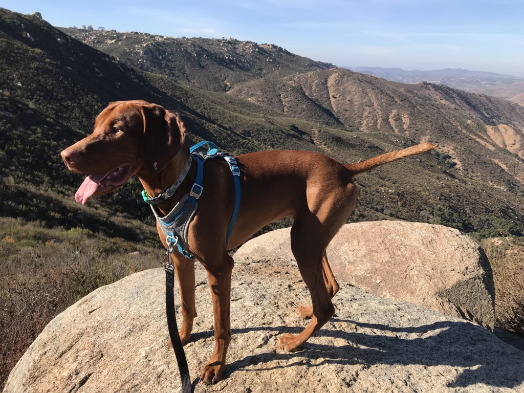
Cappie’s Scoop: I’ve hiked this trail a few times but not too long ago there was a fire and it hurt the area very badly. But when I last hiked here, I saw a lot of green grass, flowers and trees growing again. It’s kind of sad hiking in the burn area and I always seem to get black soot on me from the broken trees. If you make it past this part, you will find really nice views at the top plus two metal chairs to sit in on top of a huge boulder. Don’t hesitate to add YOUR scoop in the comments below!
Tips: At the top you’ll find a couple of metal chairs cemented to a big rock. Great resting spot with a view!
Directions: From I-15, take the Via Rancho Parkway exit. Head east on Via Rancho Parkway towards the San Diego Zoo Safari Park. Continue as Via Rancho Parkway turns into Bear Valley Parkway. Turn right onto San Pasqual Road, then turn right onto Highway 78, still following signs for San Diego Zoo Safari Park. Continue on Highway 78 for 6.7 miles, the trailhead will be on the right.
| Mileage (round trip) | 6.4 |
| Difficulty | Moderate |
| Gain (in feet) | 1832 |
| Trailhead | 33.085309, -116.922347 |
| Hike Time (in hours) | 4-5 |
| Exposure | Sunny |
| Scenery | Rolling Hills, Wildflowers |
| Facilities | None |
| Fees/Permits | None |
| More Info | http://hikingsdcounty.com/south-clevenger-canyon; https://modernhiker.com/hike/clevenger-canyon-south |
| Last Hiked | 12/2/2017, 2/24/2019 |


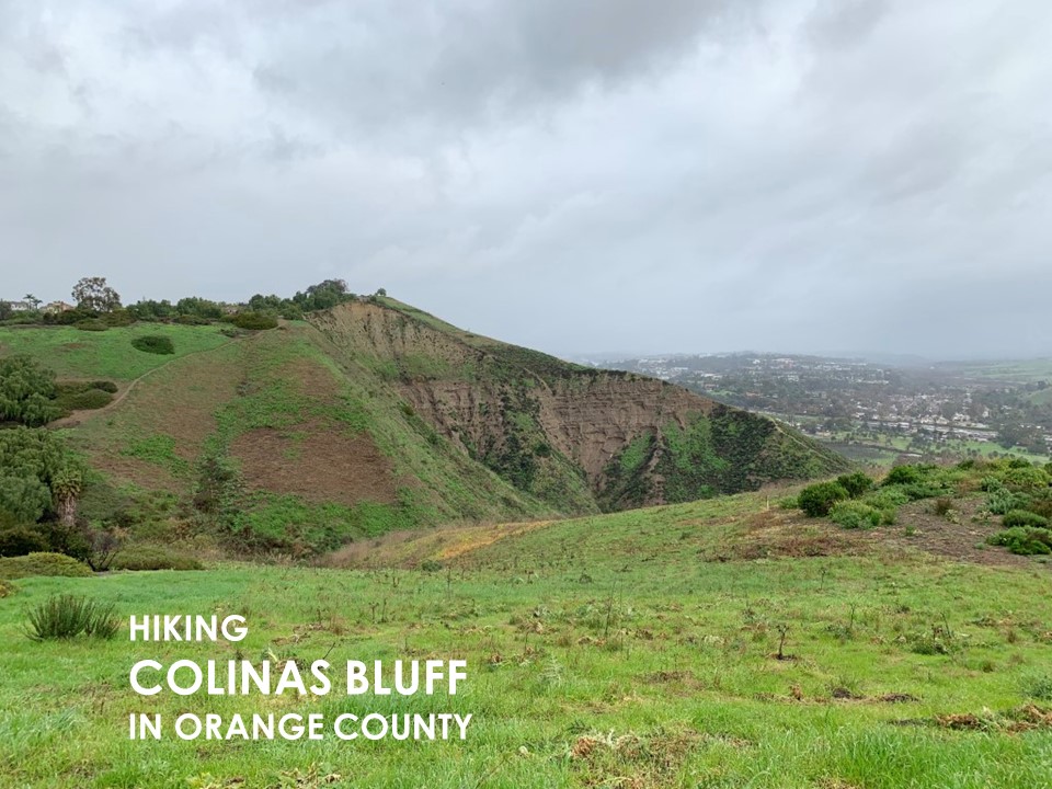
Colinas Bluff Trail
Cappie’s Scoop: When we pulled into a shopping area, I thought mom was stopping for tea and a puppuccino but she grabbed our gear to hike. We walked across the street and there was the Colinas Bluff trail also known as the Colinas Ridge trail! Cool! Mom called it a suburban trail with views of Santiago Peak, the ocean and Catalina Island on a clear day. But in the back of my head, I was thinking that this was a perfect spot to put a trail with victory puppuccino’s afterwards. I started hiking along and it turned out to be another roller coaster trail with lots of hills. Then it started raining and I got very muddy, it was great! I’m not sure mom felt the same but this is part of the adventure! Dirt trails, hills, rain, mud, and puppuccino’s! Don’t hesitate to add YOUR scoop in the comments below!
Tips: Trailhead coordinates bring you to the start of the trail.
Directions: You can choose to meet anywhere in the area. Recommend a meeting spot like Starbucks in the Marina Hills shopping center (corner of Marina Hills Drive and Golden Lantern in Laguna Niguel) and then you can walk across Golden Lantern street to pick up the trail. Starbucks address is 30211 Golden Lantern, Laguna Niguel, CA 92677.
| Mileage (round trip) | 6.7 |
| Difficulty | Moderate |
| Gain (in feet) | 1570 |
| Trailhead | 33.523805, -117.685488 |
| Hike Time (in hours) | 3-4 |
| Exposure | Sunny |
| Scenery | Ocean Views, Rolling Hills |
| Facilities | Available in Marina Hills shopping center. |
| Fees/Permits | None |
| More Info | https://socalhiker.net/hiking-colinas-bluff-trail |
| Last Hiked | 2/3/2019 |


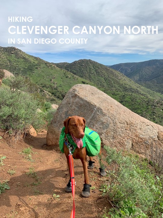
Clevenger Canyon North
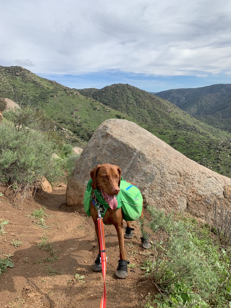
Cappie’s Scoop: Clevenger Canyon has a north and south side and I’ve hiked both! If I had to pick which one was my favorite, it would be the north side. Maybe it was because when I hiked there, the grass was green and lots of wildflowers were starting to bloom. Plus we had the trail all to ourselves so we had lots of time to stop, eat grass, relax, and eat more grass. Don’t hesitate to add YOUR scoop in the comments below!
Tips: After a heavy rain, the Santa Ysabel Creek may be too full to cross to continue on the trail. If that happens (especially after you drove all the way there), your plan B could be to drive down the road a short distance and hike Clevenger Canyon South (location 33.085309, -116.922347).
Directions: From I-15 N, take exit 27 for Via Rancho Pkwy toward Felicita Park/San Diego Wild Animal Park. Then take San Pasqual Rd to CA-78 E/San Pasqual Valley Rd in San Diego. Turn right onto E Via Rancho Pkwy and continue onto Bear Valley Pkwy. Turn right onto San Pasqual Rd and then turn right onto Old Milky Way. Old Milky Way turns slightly right and becomes CA-78 E/San Pasqual Valley Rd. In about 5.1 miles, the parking lot for the trail will be on your left.
| Mileage (round trip) | 4.7 |
| Difficulty | Moderately Strenuous |
| Gain (in feet) | 1438 |
| Trailhead | 33.084738, -116.916092 |
| Hike Time (in hours) | 3-4 |
| Exposure | Sunny |
| Scenery | Rolling Hills, Wildflowers, River |
| Facilities | None |
| Fees/Permits | None |
| More Info | http://hikingsdcounty.com/north-clevenger-canyon; https://modernhiker.com/hike/hike-clevenger-canyon |
| Last Hiked | 2/1/2019 |


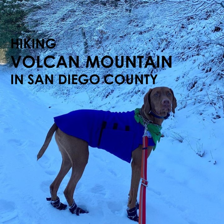
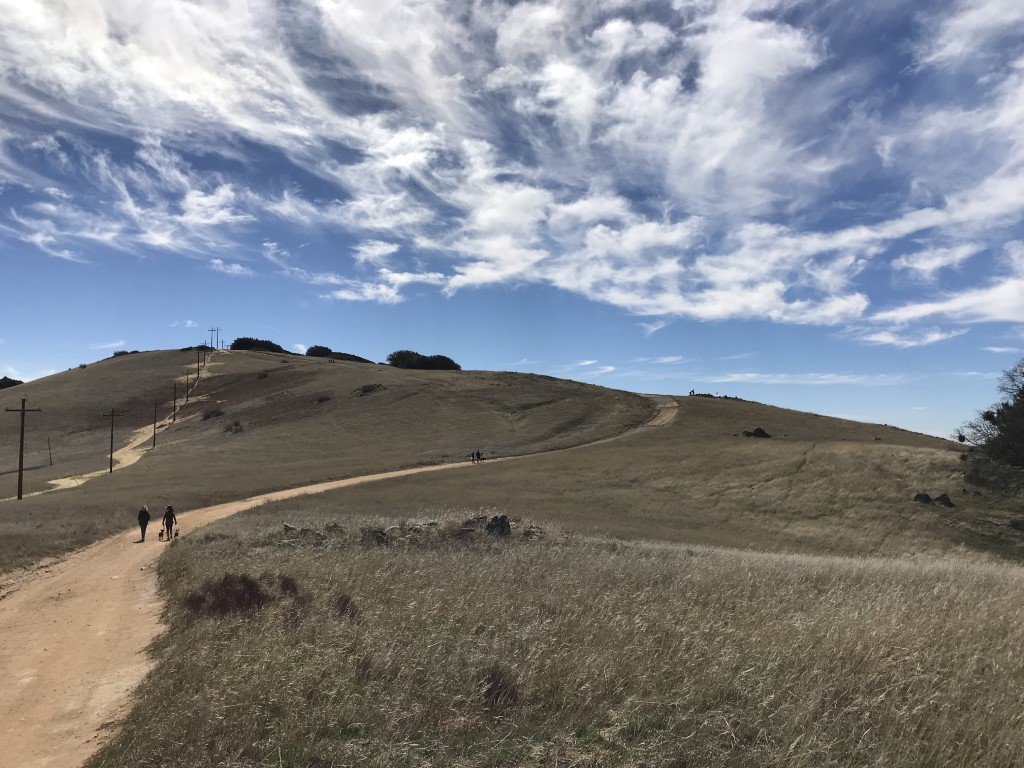
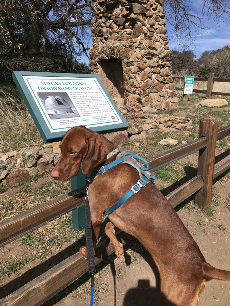
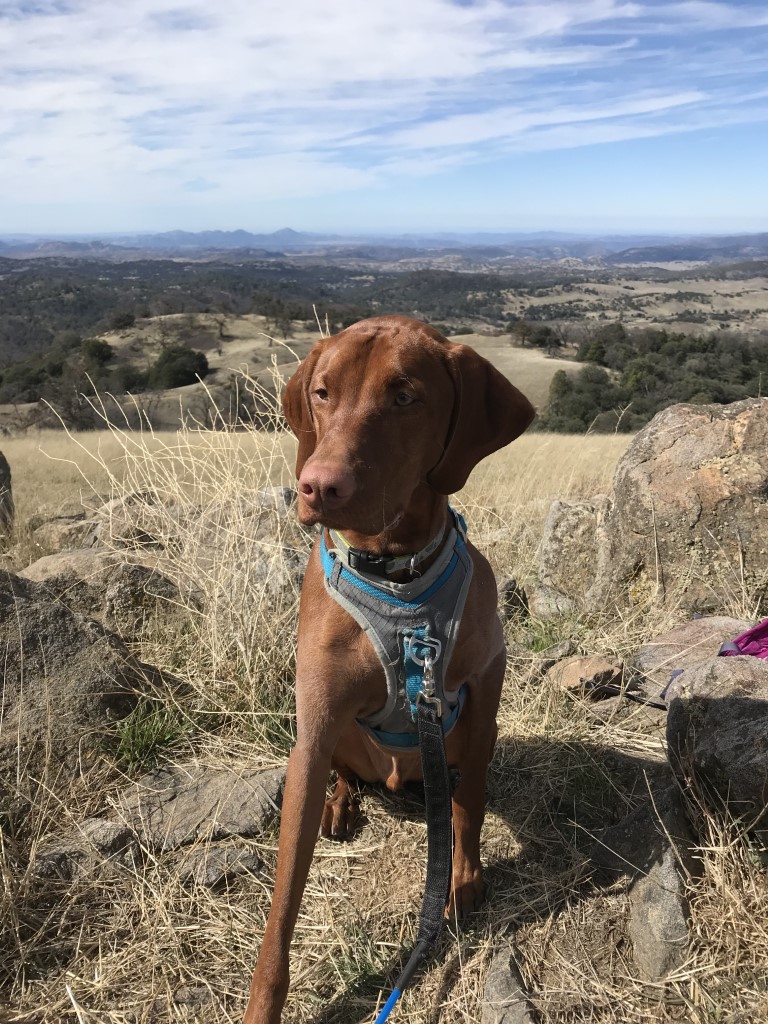
Volcan Mountain
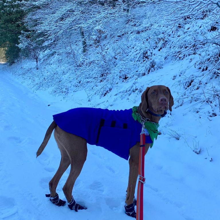
Cappie’s Scoop: I like this hike in the spring and in the winter time! I don’t always get to the hike in the snow but when I do, I love it! I turn into a happy snow dog and looking for sticks is even more fun because I have to dig for them under the snow. This hike was a lot of fun because we had snow all the way to the top of the mountain and it wasn’t too deep which made it easy to hike in it. At the top it was very windy and mom and I both had to put more warm clothes on. We took in the cool view of Julian around us and then started back down to escape the wind. Don’t hesitate to add YOUR scoop in the comments below!
Tips: If time allows, recommend you stop in town and have some apple pie.
Directions: Take 78 E/Julian Rd into Wynola Rd and turn left on Wynola Rd. In about 3.4 miles, turn left on Farmer Rd and the park on the side of the road. The trailhead will be on your right.
| Mileage (round trip) | 5.2 |
| Difficulty | Moderate |
| Gain (in feet) | 1200 |
| Trailhead | 33.105131, -116.602551 |
| Hike Time (in hours) | 4-5 |
| Exposure | Sunny and Shady |
| Scenery | Mountain Views, Wildlife, Birds, Wildflowers, Trees |
| Facilities | None |
| Fees/Permits | None |
| More Info | http://hikingsdcounty.com/volcan-mountain-summitfive-oaks-trail; https://modernhiker.com/hike/hiking-volcan-mountain; https://socalhiker.net/hiking-volcan-mountain |
| Last Hiked | 2/17/2018, 12/8/2018, 1/1/2019, 5/9/2020 |