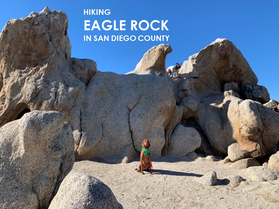
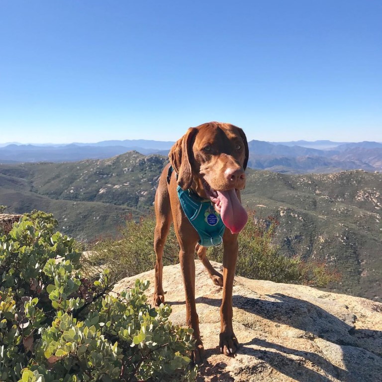
Eagle Rock

Cappie’s Scoop: I once hiked another trail called Eagle Peak and the whole time, I’m looking around for an eagle. No eagle. This time I was surprised to see some huge rocks on the trail that looked like an eagle! Finally, a bird dog on a hike to see a big bird! It’s really a surprise because you hike through some wooded areas, the trail then opens up to a big meadow with cows roaming around (they have big poops by the way), and then we get to a pile of rocks. But you have to walk around the rocks and stand in front of them to see the bird. We had our lunch on one of the rocks and then I told mom to get a good picture of me with the eagle. She did. Don’t hesitate to add YOUR scoop in the comments below!
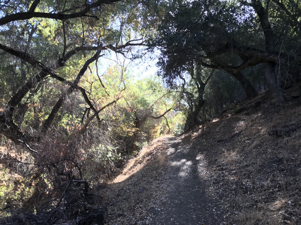
Tips: This hike travels along the PCT through oaks and rolling hills.
Directions: Can use address CAL FIRE Warner Springs Fire Station, 31049 CA-79, Warner Springs, CA 92086. OR take 67 N to downtown Ramona where it turns into Main Street and then 78 E. Continue on 78 E for approximately 14 miles, then turn left onto 79 N. Follow 79 N for approximately 13 miles to the Cal Fire Warner Springs Fire Station on the right. Park on the side of the road “opposite” the fire station, where there is a wide gravel shoulder.
| Mileage (round trip) | 6.5 |
| Difficulty | Moderate |
| Gain (in feet) | 988 |
| Trailhead | 33.273584, -116.644926 |
| Hike Time (in hours) | 3-4 |
| Exposure | Sunny |
| Scenery | Rock Formations, Wildlife |
| Facilities | None |
| Fees/Permits | None |
| More Info | http://hikingsdcounty.com/eagle-rock |
| Last Hiked | 12/30/2018 |

McGinty Mountain
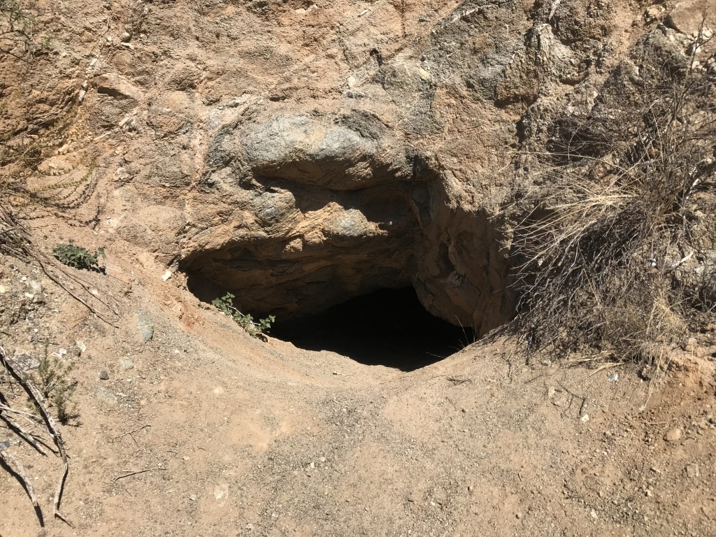
Cappie’s Scoop: I like this hike because we usually have the trail all to ourselves. Except when the people in the big jackets, big hats and carrying lots of stuff are there. Mom says they are firefighters and this is the spot where they train. They looked scary at first with all that stuff on even in the summer when it’s hot but they are very nice people and like to pet me so they are cool! Just under a mile, we reached a spot where we needed to go left but to the right was a nice view of Jamul and a big hole in the side of the mountain. Mom said it might be a mine but we were careful and only looked! The peak has nice views of San Diego Bay and downtown where I live! This is a great spot for a picnic with lots of treats for me. Don’t hesitate to add YOUR scoop in the comments below!
Tips: None
Directions: Take 94 E until it turns into Campo Road. Turn right onto CA-94 E/Campo Road (you’ll see TGI Friday’s across the street). Continue along Campo Road for approximately 4.5 miles, then turn left onto Lyons Valley Road. Take the 3rd left onto Jamul Drive. The dirt parking area will be on the right after approximately 0.4 miles, shortly after passing Jamul Community Church.
| Mileage (round trip) | 5 |
| Difficulty | Moderately Strenuous |
| Gain (in feet) | 1400 |
| Trailhead | 32.729445, -116.872597 |
| Hike Time (in hours) | 3-4 |
| Exposure | Sunny |
| Scenery | Mountain Views |
| Facilities | None |
| Fees/Permits | None |
| More Info | http://hikingsdcounty.com/mcginty-mountain |
| Last Hiked | 11/3/2017, 11/18/2017, 2/25/2018, 12/29/2018 |


Agua Dulce Loop
Cappie’s Scoop: I love a loop hike! You get to see something different around every turn. I remember this hike a lot because in the middle of hiking, I was jumping around with a pine cone and I managed to trip over something and hit my chin. I started bleeding but mom had my bandana with her and quickly cleaned me up. I didn’t really feel anything and was ready to keep hiking! Mom worries too much sometimes. It was only a scratch! This is a very nice trail but keep your eyes open for mountain bikers who also love this trail too. Don’t hesitate to add YOUR scoop in the comments below!
Tips: Keep your eyes open for mountain bikers on the trail.
Directions: From I-8 E take the Sunrise Highway exit and turn left onto Sunrise Highway (S1). Follow Sunrise Highway for approximately 5.5 miles to the Meadows Information Center trailhead where you can park on either side of the road, just past mile marker 19. The trail head is on the west side of the highway.
| Mileage (round trip) | 6.2 |
| Difficulty | Moderate |
| Gain (in feet) | 528 |
| Trailhead | 32.860856, -116.462210 |
| Hike Time (in hours) | 3-4 |
| Exposure | Mostly Shady |
| Scenery | Forest, Wildlife |
| Facilities | None |
| Fees/Permits | California Adventure Pass or Interagency Annual Pass/America the Beautiful Pass (National Parks Pass). |
| More Info | http://hikingsdcounty.com/agua-dulce-loop |
| Last Hiked | 12/22/2018 |
Knott Grove

Cappie’s Scoop: Who doesn’t love Los Peñasquitos Canyon Preserve! The hoomans are hiking, riding bikes, and sitting on big dogs which mom says are horses. So be careful furiends and share the trail. This time we headed through Knott Grove all the way to a road that had a small park. I got to do some rock hopping over water along the way which was fun. Don’t hesitate to add YOUR scoop in the comments below!
Tips: Keep your eyes open for horses and mountain bikers on the trail. This trail may close during/after rain so be sure to checkout San Diego Parks for any closures.
Directions: From I-15 N take the Mercy Rd/Scripps Poway Pkwy exit, and turn left onto Mercy Road. Follow Mercy Road for approximately 1.4 miles, then turn right onto Black Mountain Road. After 0.2 miles, turn left onto Canyonside Park Driveway and drive 0.4 miles down to find parking and the trailhead. The trailhead is located in the southwest corner of the park.
| Mileage (round trip) | 4.75 |
| Difficulty | Easy |
| Gain (in feet) | 285 |
| Trailhead | 32.940222, -117.135647 |
| Hike Time (in hours) | 2-3 |
| Exposure | Mostly Shady |
| Scenery | Trees, Creek, Wildlife |
| Facilities | Restrooms and drinking fountains at park. |
| Fees/Permits | None |
| More Info | http://hikingsdcounty.com/knott-grove |
| Last Hiked | 12/16/2018 |
Santa Ysabel Preserve East
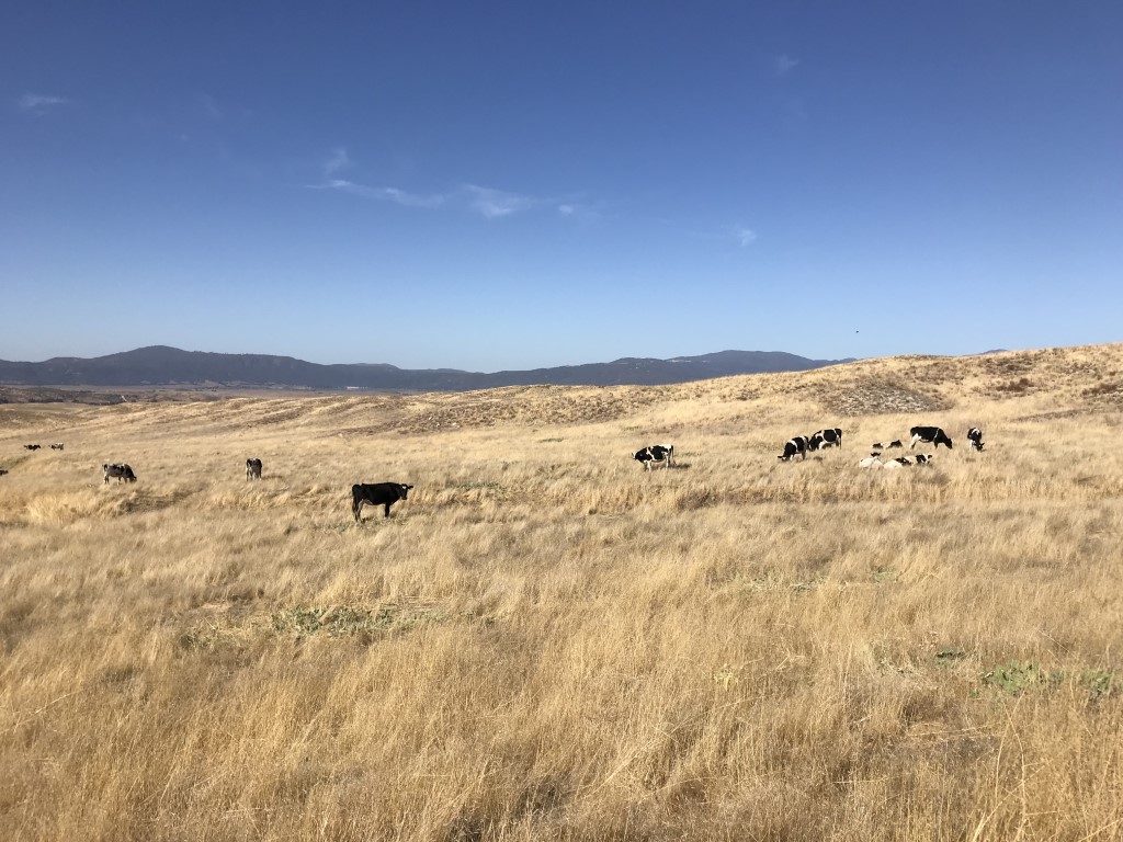
Cappie’s Scoop: We celebrated our 50th Meetup hike of 2018 at this preserve! All I can say, there were a lot of cows near the trail. Mom thought my poop was big and I told her, look at that cow poop! We did a loop and afterwards celebrated with lunch and drinks. Mom had some cider from Julian Hard Cider, 4470 Julian Rd, Julian, CA 92036 and I had water. We ordered food from the Mexican food spot next door. They gave us a stick with a number and we sat in the hard cider place which is dog friendly! They brought us our food because the area outside of the Mexican food place is not dog friendly. To celebrate all of hikes in 2018, we had giveaways and raffles! Don’t hesitate to add YOUR scoop in the comments below!
Tips: Keep your eyes open for roaming cows on the trail and cow pies.
Directions: Can use address 500 Farmer Road, Julian, CA, 92036.
| Mileage (round trip) | 7.4 |
| Difficulty | Moderate |
| Gain (in feet) | 950 |
| Trailhead | 33.120068, -116.602726 |
| Hike Time (in hours) | 3-4 |
| Exposure | Sunny |
| Scenery | Wildlife |
| Facilities | None |
| Fees/Permits | None |
| More Info | http://hikingsdcounty.com/kanaka-loop-trail-santa-ysabel-east-preserve; http://www.julianhardcider.biz; http://julianstation.com; http://www.sdparks.org |
| Last Hiked | 12/8/2018 |


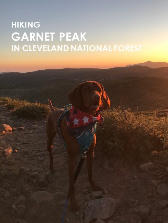
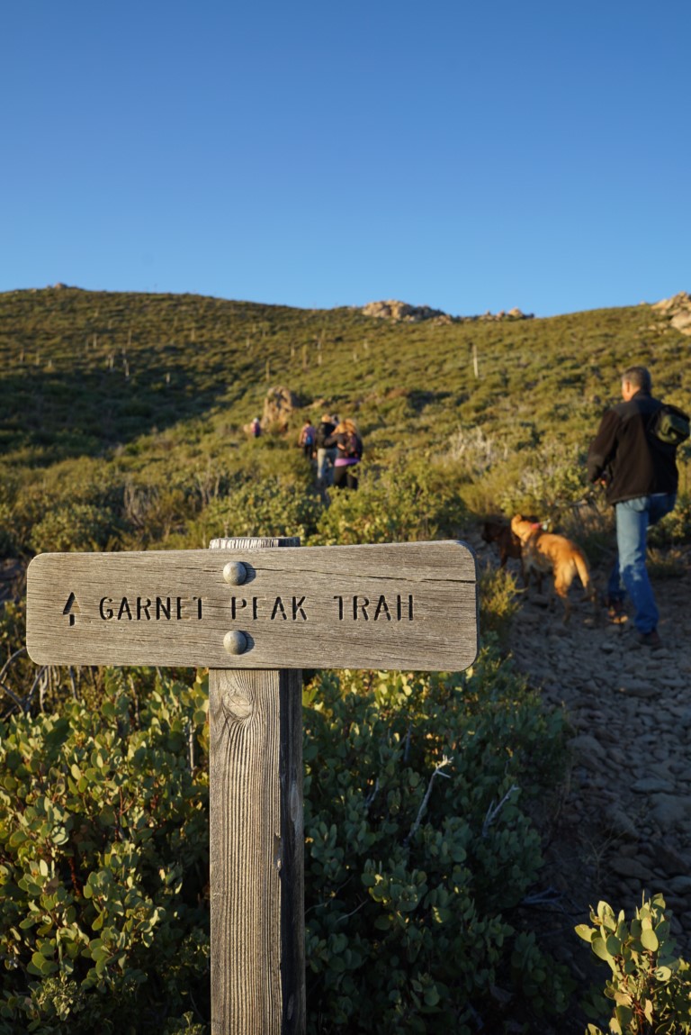
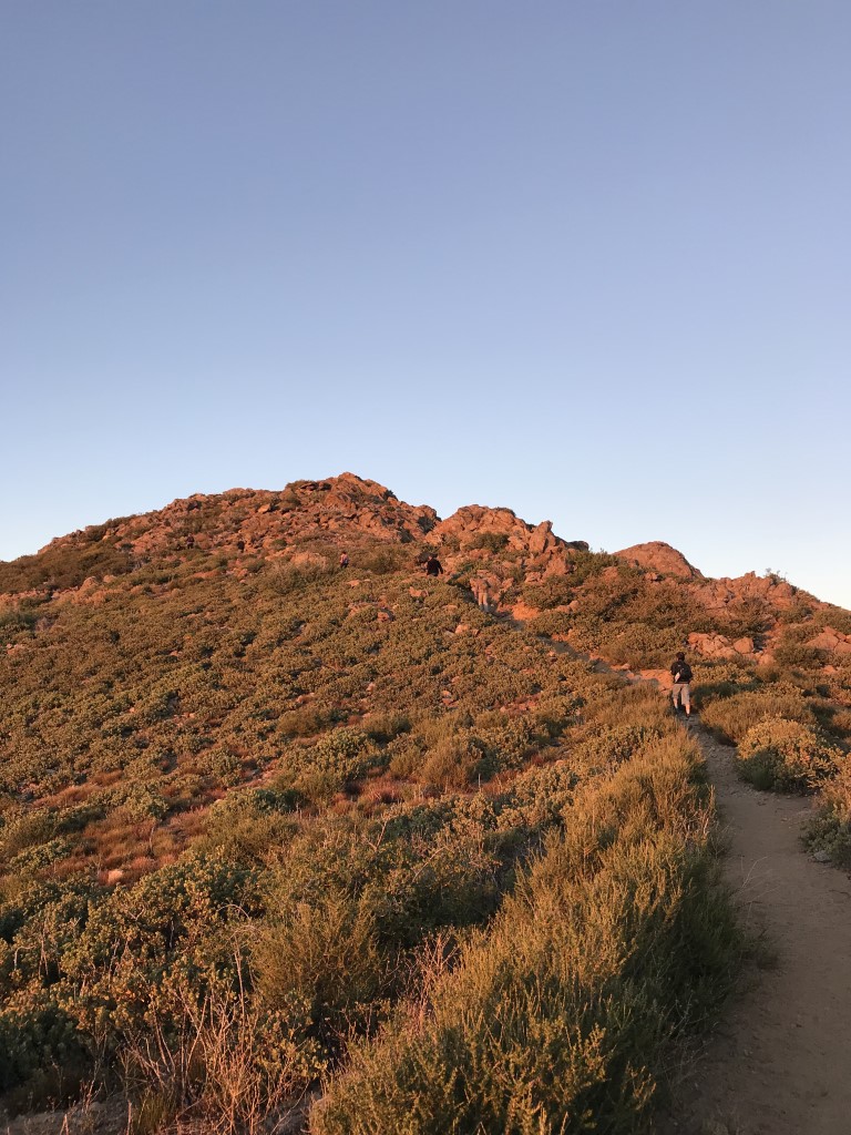
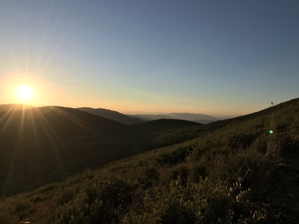
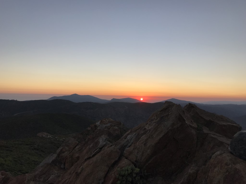
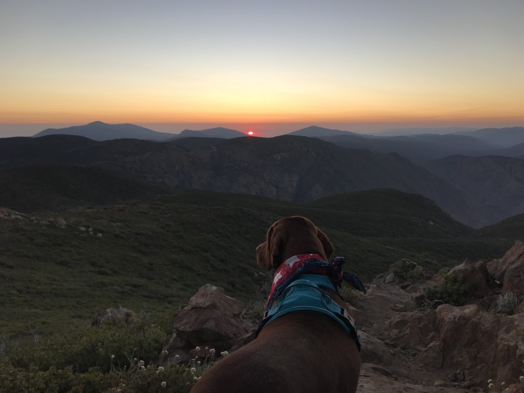
Garnet Peak
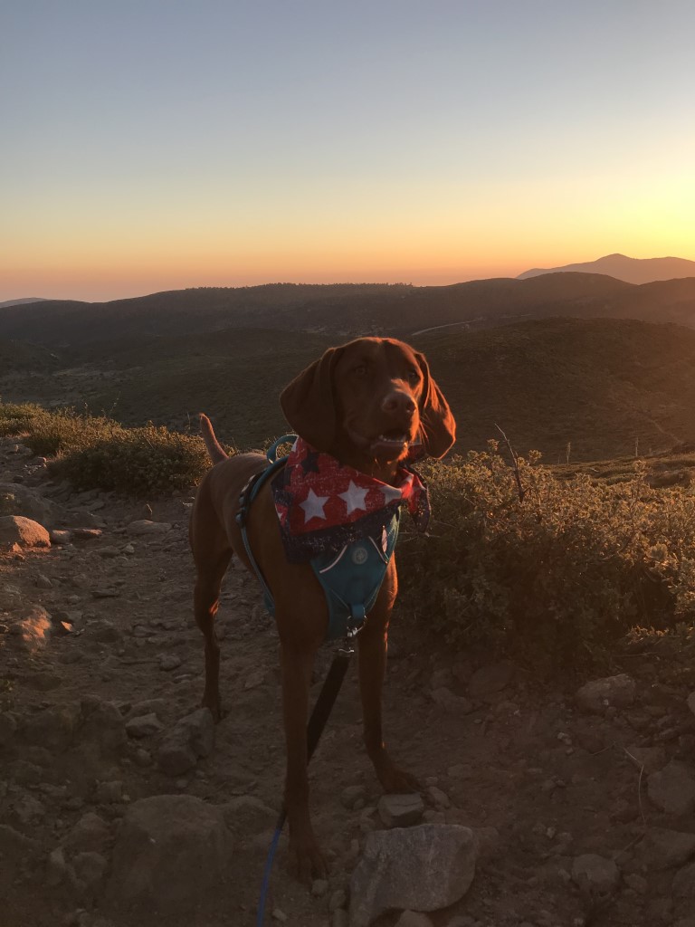
Cappie’s Scoop: When I go camping in Mount Laguna, there are two hikes I like to do, Garnet Peak and Monument Peak! It’s a tradition now to hike Garnet Peak to see the sunset. We like to start at a small trailhead that you could miss if you’re driving too fast. We hike up to the top as fast as we can so we can watch the sunset. Sometimes, it’s very windy at the top so bring your jacket or ear muffs. The trail is a bit rocky so take your time on the way back. Don’t hesitate to add YOUR scoop in the comments below!
Tips: This is a great hike to do at sunset. Don’t forget to bring a headlamp.
Directions: From I-8 E take the Sunrise Highway exit and turn left onto Sunrise Highway (S1). Head north on Sunrise Highway for approximately 14 miles. The trailhead can be found at a small, dirt turnout on the right just past mile marker 27.5.
| Mileage (round trip) | 1.7 |
| Difficulty | Moderate |
| Gain (in feet) | 530 |
| Trailhead | 32.911547, -116.461256 |
| Hike Time (in hours) | 1-2 |
| Exposure | Sunny |
| Scenery | Mountain Views, Desert Views |
| Facilities | None |
| Fees/Permits | California Adventure Pass or Interagency Annual Pass/America the Beautiful Pass (National Parks Pass). |
| More Info | http://hikingsdcounty.com/garnet-peak |
| Last Hiked | 7/3/2018, 12/5/2018 |
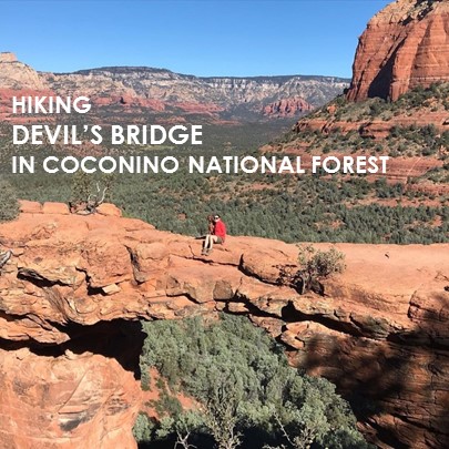
Devil’s Bridge
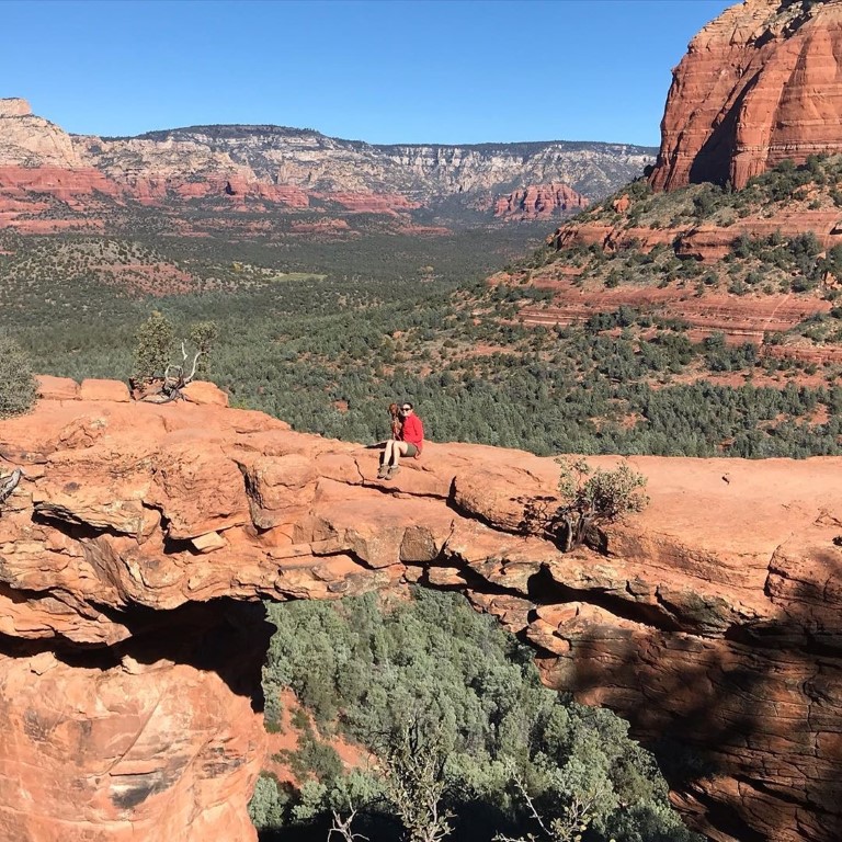
Cappie’s Scoop: I didn’t know what I was in for when we started to hike this trail. I should’ve known when mom said the “devil’s bridge” that it would be scary. We walked out onto the bridge and I looked at mom thinking we should turn back because there are no walls on either side! But mom said we will walk very slow and then sit down. That worked for me. We got a picture to remember this moment and then I said “lets gooooo!” Be careful furiends and stay close to your pawrents if you go! Don’t hesitate to add YOUR scoop in the comments below!
Tips: There are a few starting points. We began at the Mescal trailhead on Long Canyon Rd and hiked from Mescal to Chuckwagon trail to Devil’s Bridge.
Directions: Continue on Dry Creek Road to the stop sign at the intersection of Long Canyon Road, turn right and travel 0.2 miles to the Mescal Trailhead on the right. Use the signed Mescal-Chuckwagon trail connection to reach Devils Bridge Trailhead. The round trip to Devils Bridge from this trailhead is 4 miles.
| Mileage (round trip) | 4 |
| Difficulty | Moderate |
| Gain (in feet) | 564 |
| Trailhead | 34.901786, -111.826806 |
| Hike Time (in hours) | 2-3 |
| Exposure | Mostly Sunny |
| Scenery | Canyon Views, Trees |
| Facilities | None |
| Fees/Permits | None. Red Rock Passes are only required at trailheads where there are toilets or picnic facilities. |
| More Info | https://www.fs.usda.gov/recarea/coconino/recarea/?recid=55292 |
| Last Hiked | 11/19/2018 |
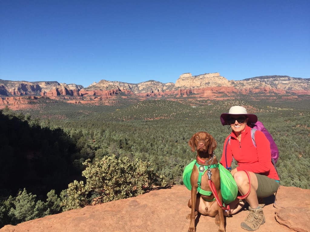
Boynton Canyon
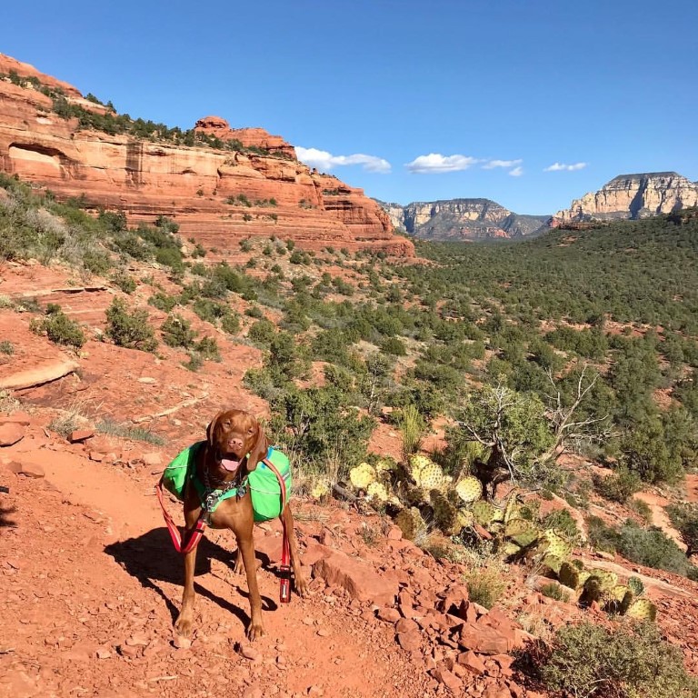
Cappie’s Scoop: All I wanted to do was zooooooom on this trail! Maybe there really is an energy vortex out there like mom says. The trail through the canyon had some shade and lots of leaves to crunch. Then when we went to the big rock (mom calls it a spire), the rock was fun to climb and I totally blended in with all the red colors. This place has the best colors ever!Don’t hesitate to add YOUR scoop in the comments below!
Tips: The round trip mileage includes the side detour to the vista lookout where you’ll find the Boynton Spire. This area has a reputation as a site of a spiritual energy vortex. There was one spot on the trail where all of a sudden the dogs went wild and had an urge to zoom! The vista trail ends at the vortex site.
Directions: From Sedona, head south on 89A. Turn right onto Dry Creek Road and continue onto Boynton Pass Rd. Turn right onto Boynton Canyon Rd and then another right into the parking lot and trailhead just outside the entrance to the Enchantment Resort.
| Mileage (round trip) | 7.5 |
| Difficulty | Moderate |
| Gain (in feet) | 944 |
| Trailhead | 34.907419, -111.848479 |
| Hike Time (in hours) | 3-4 |
| Exposure | Sunny |
| Scenery | Canyon Views, Boulders |
| Facilities | Vault toilets at trailhead. |
| Fees/Permits | Red Rock Pass or Interagency Annual Pass/America the Beautiful Pass (National Parks Pass). You can purchase daily ($5) and weekly ($15) Red Rock Passes from self-serve vending machines at this trailhead. These machines only accept credit cards for payment. For more locations plus options to buy an annual pass ($20) at the following link: https://www.fs.usda.gov/detail/coconino/recreation/?cid=stelprdb5416212#vendingmachines. |
| More Info | https://www.fs.usda.gov/recarea/coconino/recarea/?recid=55242 |
| Last Hiked | 11/18/2018 |
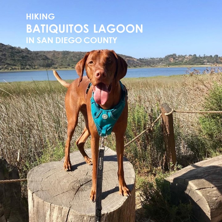
Batiquitos Lagoon
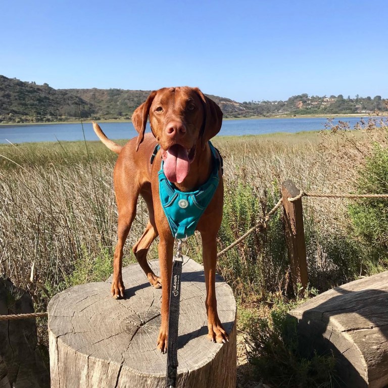
Cappie’s Scoop: This might be a short hike but it’s tough for any dog like me who loves the water. The whole time we’re hiking, I can see the lagoon and birds, lots of birds in the water but I can’t get there. There’s a fence! Mom says it’s a tidal wetland and it’s protected so we can’t jump in the water. As a compromise, after we finished hiking, mom took me to Del Mar Dog Beach which is about 20 minutes down the coast on our way home where I got to swim! Don’t hesitate to add YOUR scoop in the comments below!
Tips: None
Directions: Can use address for Batiquitos Lagoon Foundation, 7380 Gabbiano Lane, Carlsbad, CA 92011. Trail starts in multiple places but this route begins at the Nature Center at the end of Gabbiano Lane in Carlsbad. There are only a few dedicated parking spots for the trail so if you can’t find one, park on the street. From I-5 take exit 45 for Poinsettia Lane toward Aviara Parkway. Head east on Poinsettia Lane. Turn right onto Batiquitos Dr, then right onto Gabbiano Lane. Follow Gabbiano to the end of the cul-de-sac where the trail begins.
| Mileage (round trip) | 3.2 |
| Difficulty | Easy |
| Gain (in feet) | Negligible |
| Trailhead | 33.093681, -117.301309 |
| Hike Time (in hours) | 2 |
| Exposure | Sunny and Shady |
| Scenery | Lagoon Waters, Wildlife, Birds, Trees |
| Facilities | Restrooms inside Nature Center, open Monday to Friday 9am-12:30pm and weekends 9am-3pm. Water available outside Nature Center. |
| Fees/Permits | None |
| More Info | http://hikingsdcounty.com/batiquitos-lagoon; http://www.batiquitosfoundation.org/visit |
| Last Hiked | 7/8/2018, 11/12/2018 |

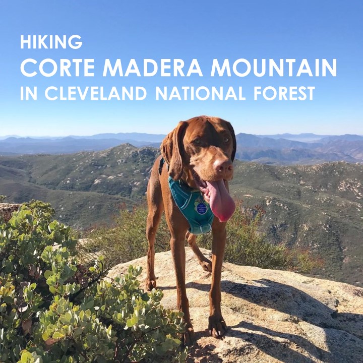
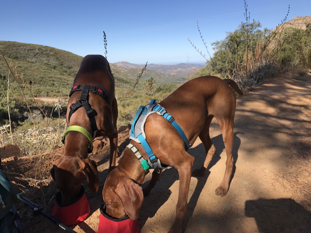
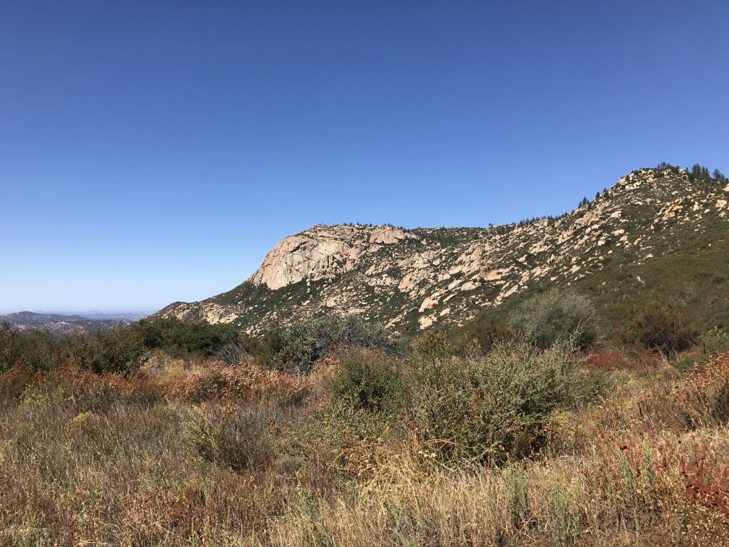
Corte Madera Mountain
Cappie’s Scoop: This is one of my favorite hikes! I’ve hiked it in the warm sun, the cold winter and even when it was raining. There is always something fun on this hike whether it’s finding tasty sticks, mud puddles, or patches of snow to zoom through. I like it here so much I even brought my brother Mickey to check it out. I showed him the best rocks to climb and where you can get the best view of the mountains! We also found some great sticks but later I found out mom didn’t put them in the car! I told mom we need to go back to hike it again AND so I can find my sticks! Don’t hesitate to add YOUR scoop in the comments below!
Tips: None
Directions: From I-8 E take the Buckman Springs Road exit. Turn right on Buckman Springs Road and continue for approximately 3 miles to Corral Canyon Road (note: this road shows up as Morena Stokes Valley Road in Google Maps – the street sign says Corral Canyon). Turn right onto Corral Canyon Road and continue for 4.8 miles until you reach a hairpin turn in the road. At the turn, you will see a gate that indicates the trailhead. Park wherever parking is available off of the pavement. Corral Canyon Road is partially a rough dirt road, and many of the sections that are paved have some large potholes.
| Mileage (round trip) | 7.2 |
| Difficulty | Moderately Strenuous |
| Gain (in feet) | 1469 |
| Trailhead | 32.735450, -116.557341 |
| Hike Time (in hours) | 4-5 |
| Exposure | Sunny and Shady |
| Scenery | Mountain Views, Forest |
| Facilities | None |
| Fees/Permits | None |
| More Info | http://hikingsdcounty.com/corte-madera-mountain |
| Last Hiked | 3/3/2018, 10/27/2018, 3/26/2021 |