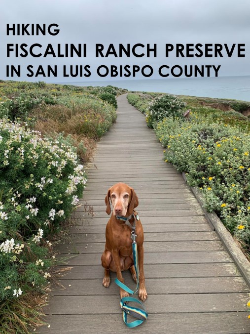
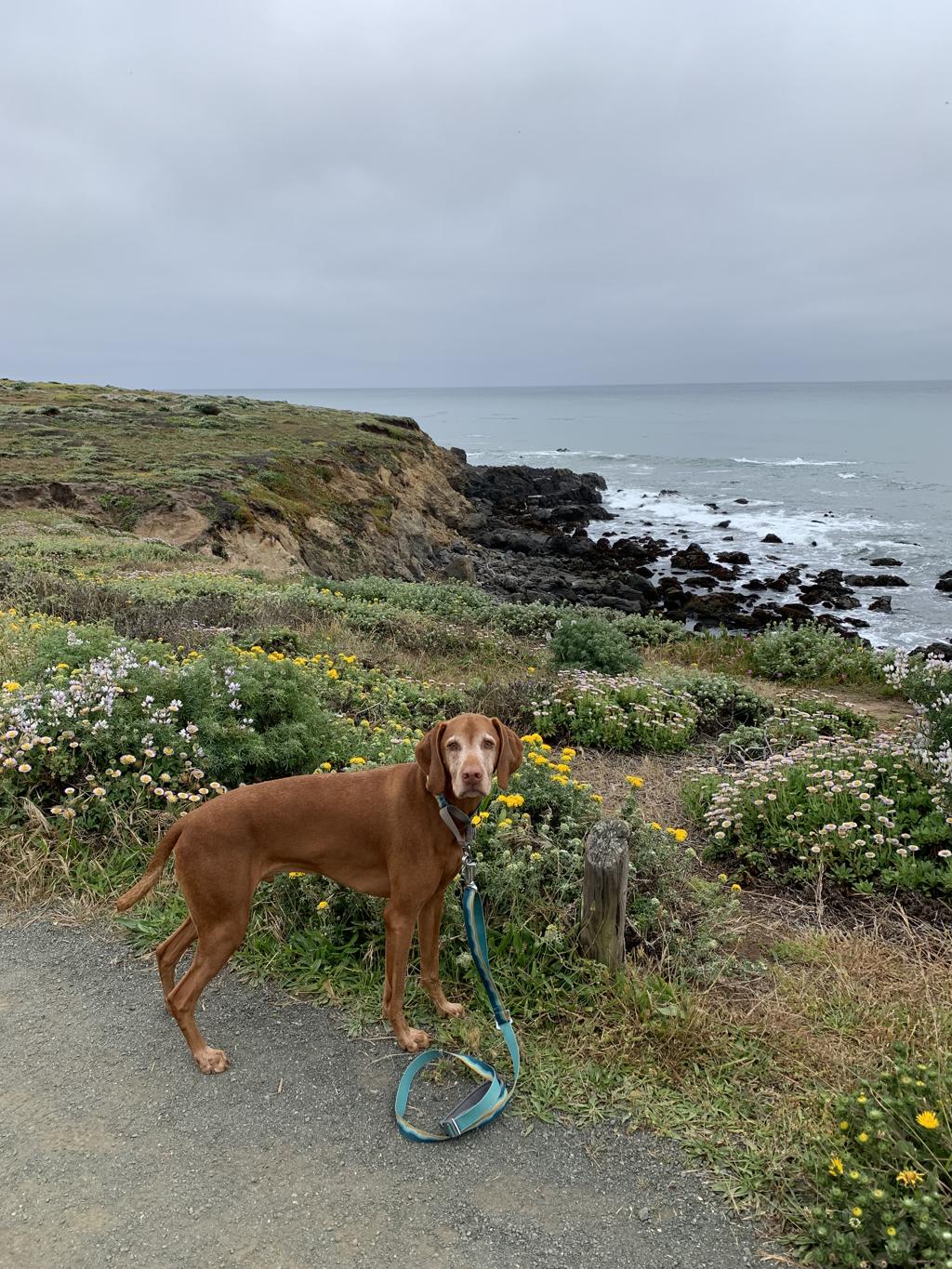
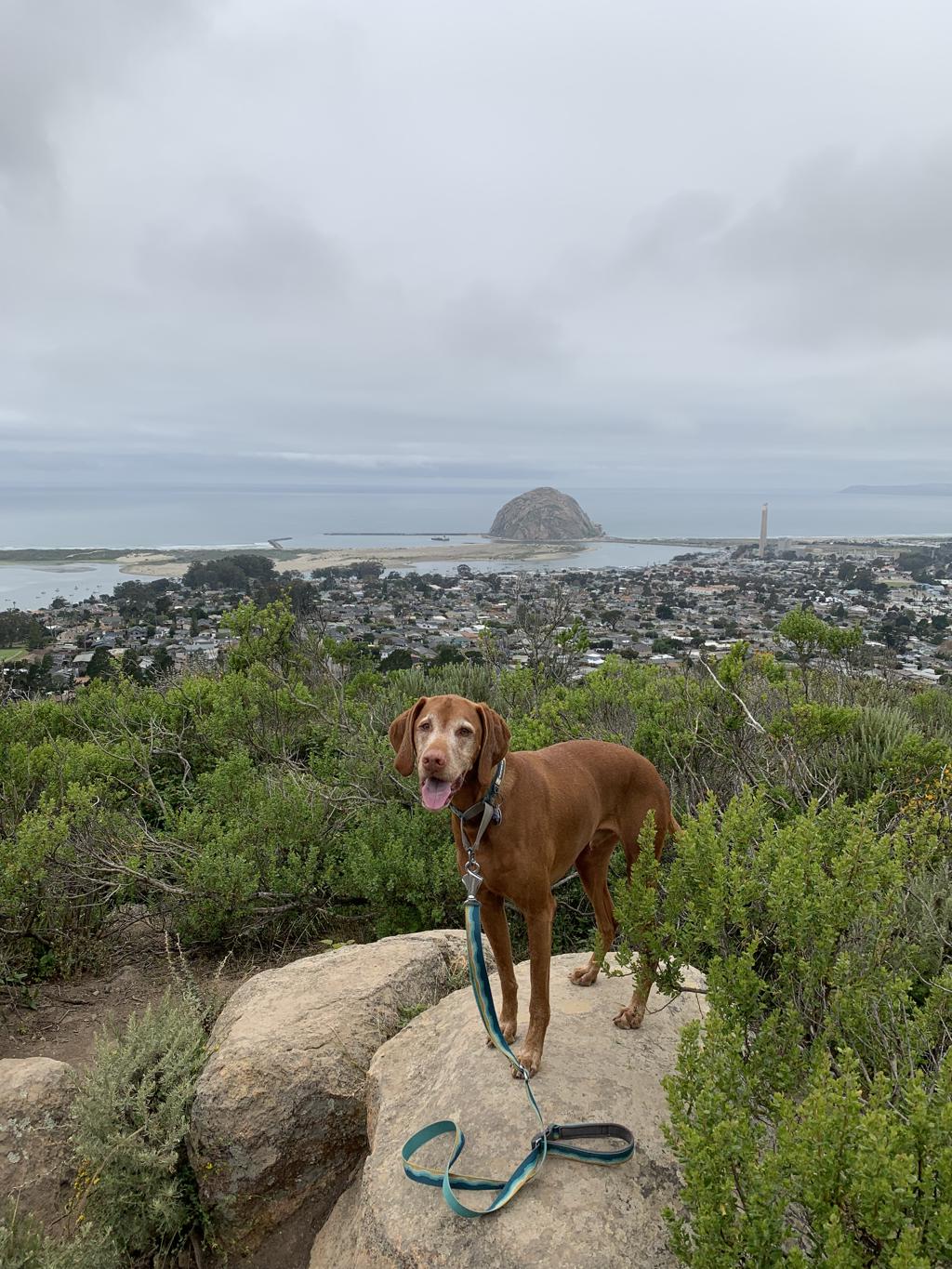
Fiscalini Ranch Preserve
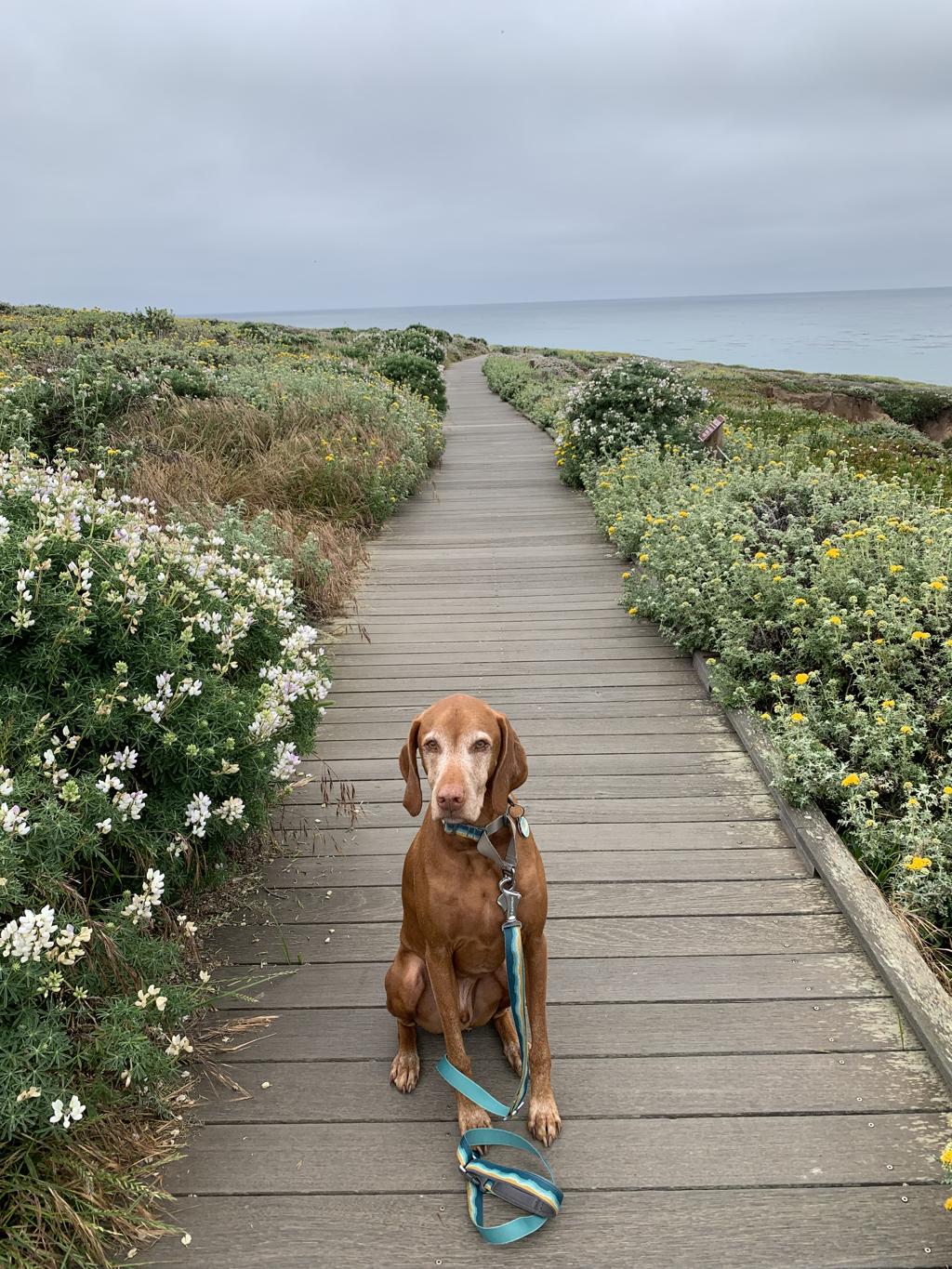
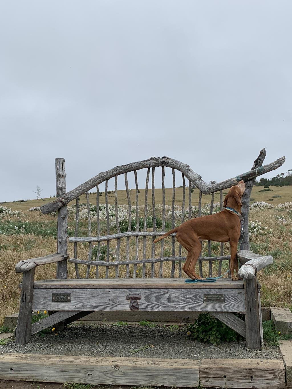
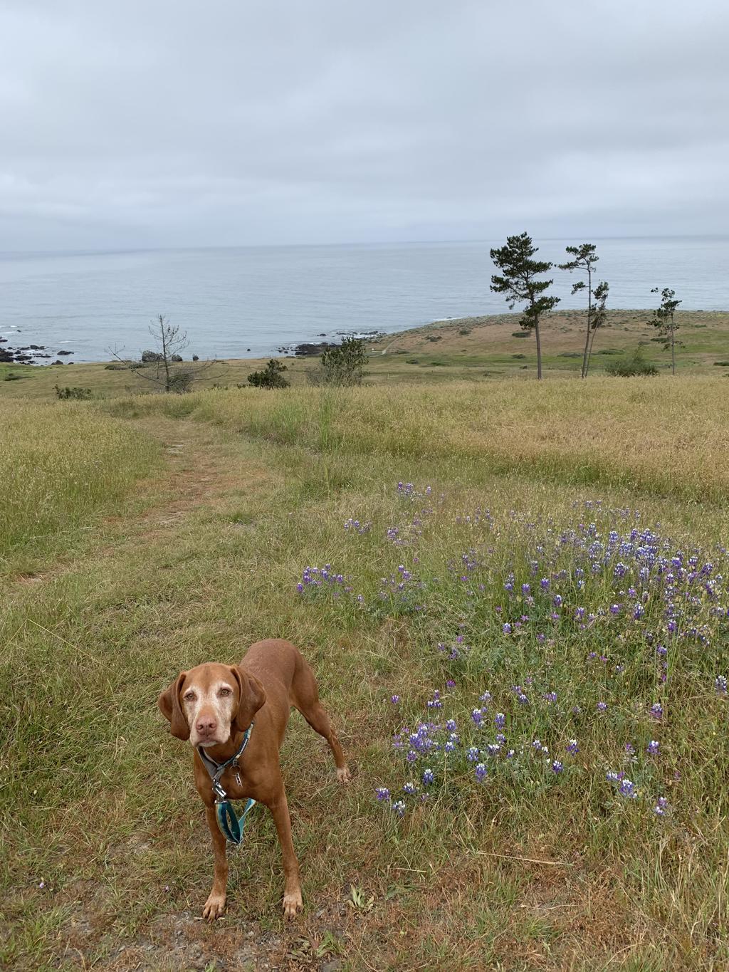
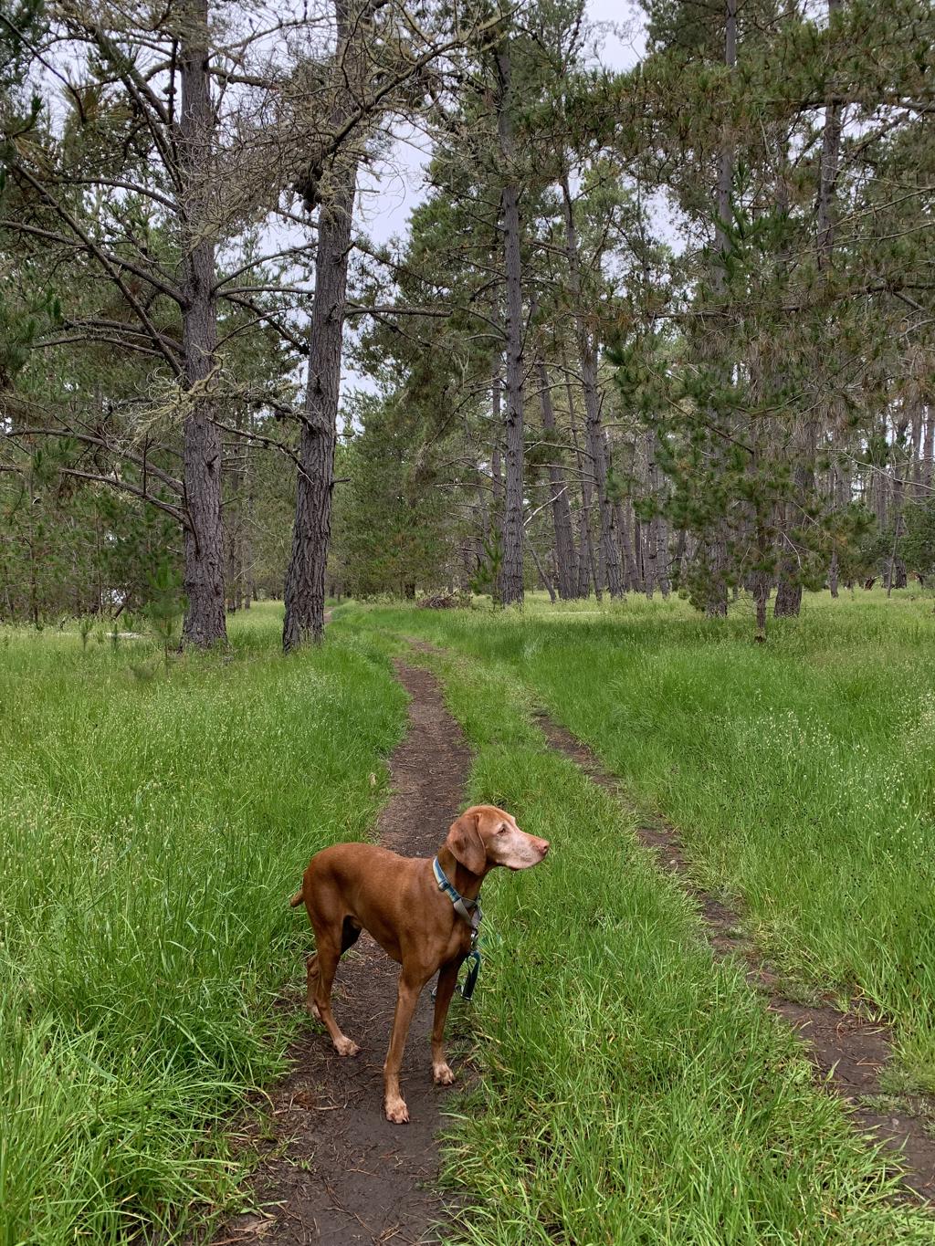
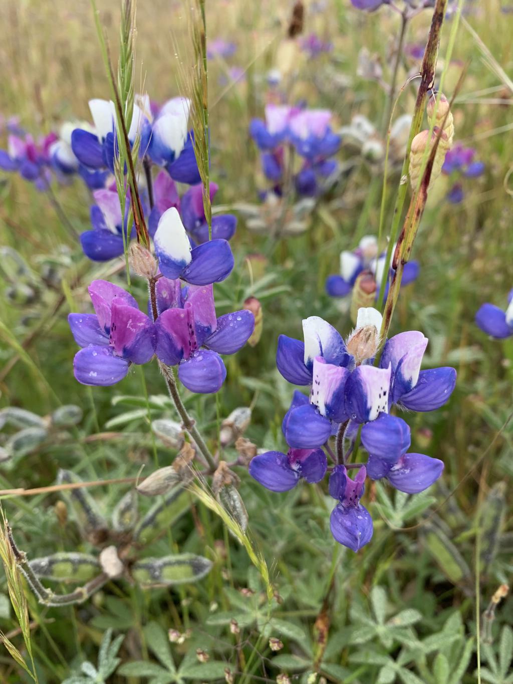
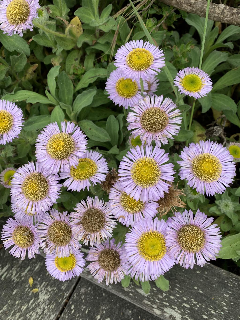
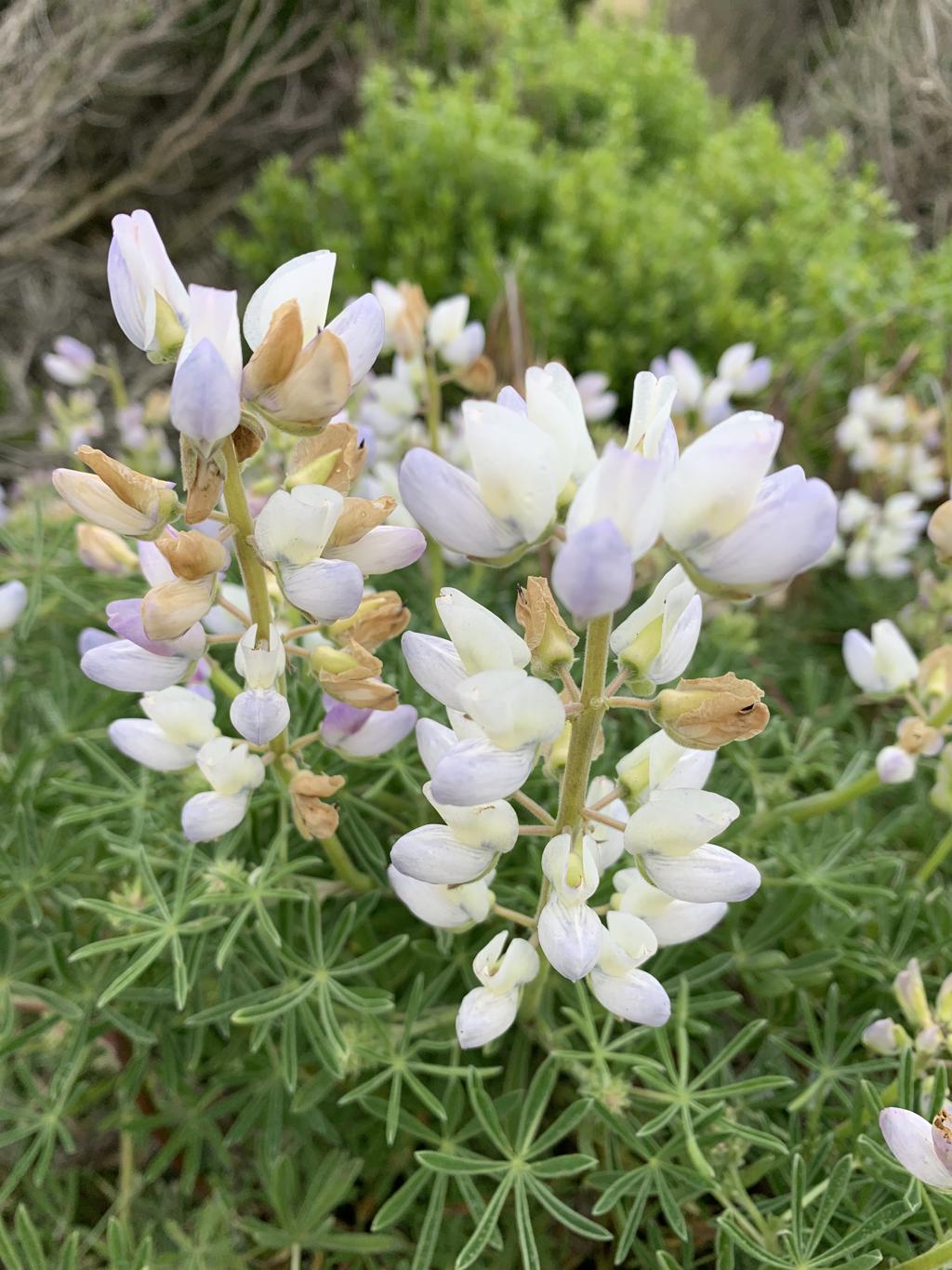
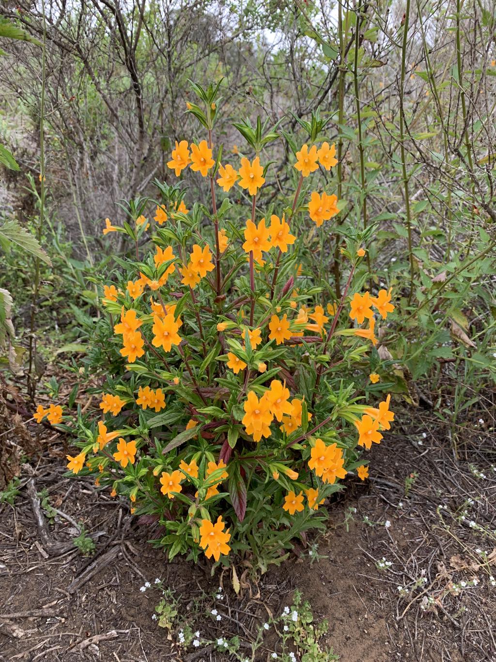
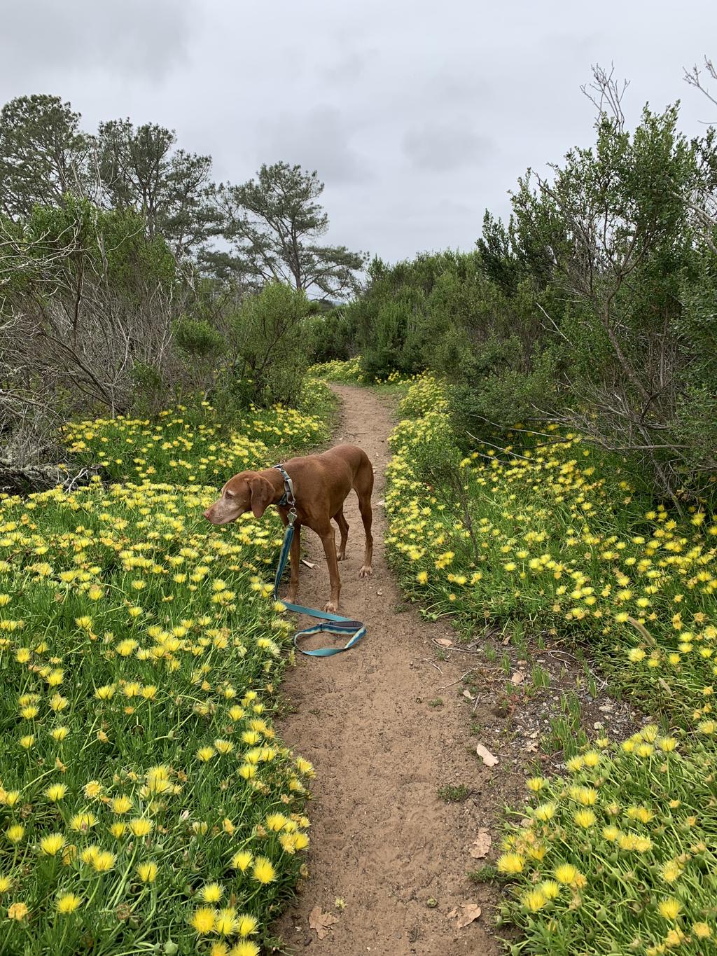
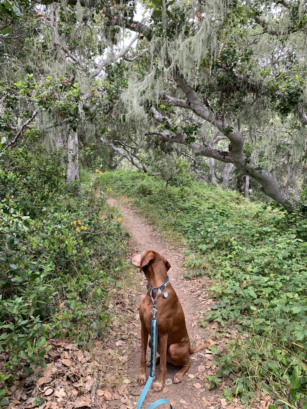
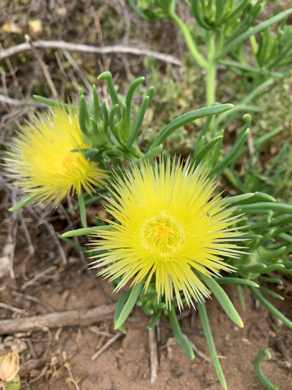
Cappie’s Scoop: This place is huge! I started hiking a trail along the water called the Bluff Trail. It was really nice. Lots of flowers and some cool wooden benches made out of big sticks. Then I hiked up a big hill and I went into the forest. It was really green and quiet except for really loud birds chirping. Mom said we went at a good time because when the preserve starts to get dry, the foxtails will be bad so I’m glad I got to see it before that happened. Don’t hesitate to add YOUR scoop in the comments below!
Tips: You will notice there are multiple trailheads to start your hike and even more trails to explore. We parked at the end of Windsor Road where there are four spots, but it’s also a residential area so you can park in front of the houses. Once you get up on the boardwalk, there are paper maps for the preserve and a nice sign to describe the ranch. We zig-zagged our way through the preserve seeing a little bit of everything to include the Bluff Trail, the Forest Loop Trail and the Ridge Trail to name a few. There are lots of coastal wildflowers and you pass a few pretty memorial benches made of wood.
Directions: From the town of Morro Bay, head north on CA-1 for about 21 miles. Then turn left onto Windsor Blvd and go to the end of the road, about 1.1 miles where you will see parking and the start of the boardwalk trail.
| Mileage (round trip) | 3.5+ |
| Difficulty | Easy |
| Gain (in feet) | 314 |
| Trailhead | 35.556173, -121.102481 |
| Hike Time (in hours) | 2-3 |
| Exposure | Sunny and Shady |
| Scenery | Ocean Views, Wildflowers, Forest |
| Facilities | None |
| Fees/Permits | None |
| More Info | https://www.fiscaliniranchpreserve.org |
| Last Hiked | 5/28/2023 |

Moonstone Beach Boardwalk
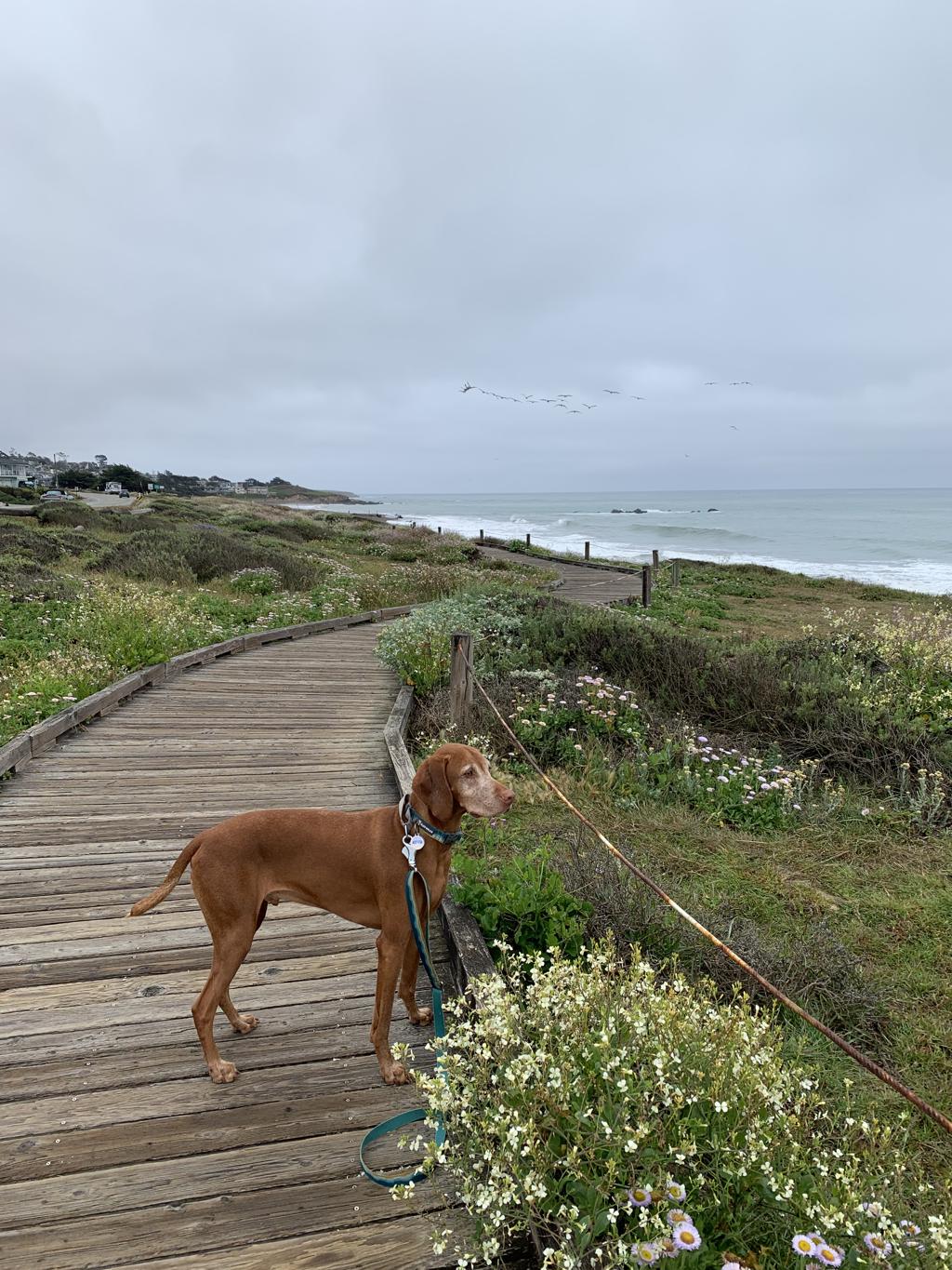
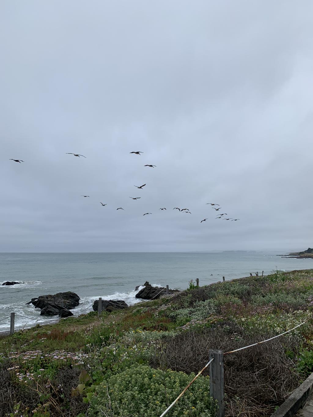
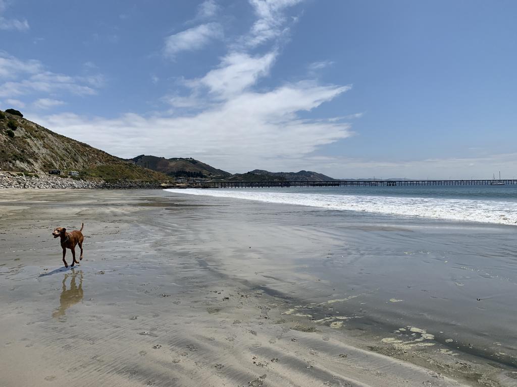
Cappie’s Scoop: Hikes along the beach are really nice but I wish I could go down to the beach and run into the water! This time I could only look at the beach from the boardwalk since no dogs are allowed on the beach. The boardwalk is really nice and there were still a lot of great smells! Don’t hesitate to add YOUR scoop in the comments below!
Tips: We started our hike on Moonstone Beach Dr. where the trail begins at the south end. It’s mostly a wooden boardwalk trail which is fun! Once the trail reaches the bluff, you have a view of the ocean. Unfortunately dogs are not allowed on the beach. At the time of this post, about one mile in, the trail is closed for repairs to the boardwalk. We were only able to hike 2 miles RT.
Directions: From the town of Morro Bay, head north on CA-1 for about 21 miles. Then turn left onto Windsor Blvd and then a quick right onto Moonstone Beach Dr. There is a small dirt turnout/parking area immediately on your left just after you pass the El Colibri Hotel and Spa. The trail starts at the far end of the dirt lot away from the hotel.
| Mileage (round trip) | 2.6 |
| Difficulty | Easy |
| Gain (in feet) | Negligible |
| Trailhead | 35.56898, -121.10570 |
| Hike Time (in hours) | 1-2 |
| Exposure | Sunny |
| Scenery | Ocean Views, Wildflowers |
| Facilities | None |
| Fees/Permits | None |
| More Info | https://highway1roadtrip.com/things-to-do/moonstone-beach-cambria |
| Last Hiked | 5/28/2023 |


Black Hill
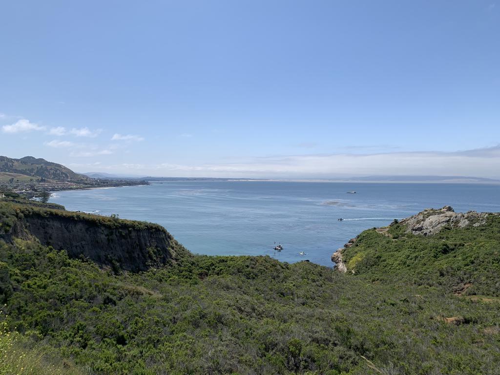
Cappie’s Scoop: This trail started out very sandy and it felt like I was at the beach! There were lots of flowers to smell too. But then I walked under the trees and there was lots of poison oak around so mom held me close and made me walk in the middle of the trail even though I wanted to smell the poison oak! Once you make it to the top, you need to climb on the big rocks to get the best view. You can see the water and of course the biggest rock of them all, Morro Rock in the water! Don’t hesitate to add YOUR scoop in the comments below!
Tips: Have a map handy because there are a few connecting trails. We started our hike on the Exercise Trail to Black Hill Trail to the peak! Then on the way back, we took Grove Trail back to the Exercise Trail to complete a small loop. There were lots of flowers blooming on this trail and also poison oak so watch your step. There is also an option to drive up the road and park closer to the peak but parking is limited.
Directions: From the town of Morro Bay, head south on Main Street and into Morro Bay State Park for about 2 miles. You will see a small dirt parking lot on your left and the trail starts here.
| Mileage (round trip) | 2.7 |
| Difficulty | Moderate |
| Gain (in feet) | 682 |
| Trailhead | 35.34756, -120.83526 |
| Hike Time (in hours) | 1-2 |
| Exposure | Sunny and Shady |
| Scenery | Mountain Views, Ocean Views |
| Facilities | None |
| Fees/Permits | None |
| More Info | https://www.morrobay.org/listing/black-hill/15521 |
| Last Hiked | 5/28/2023 |


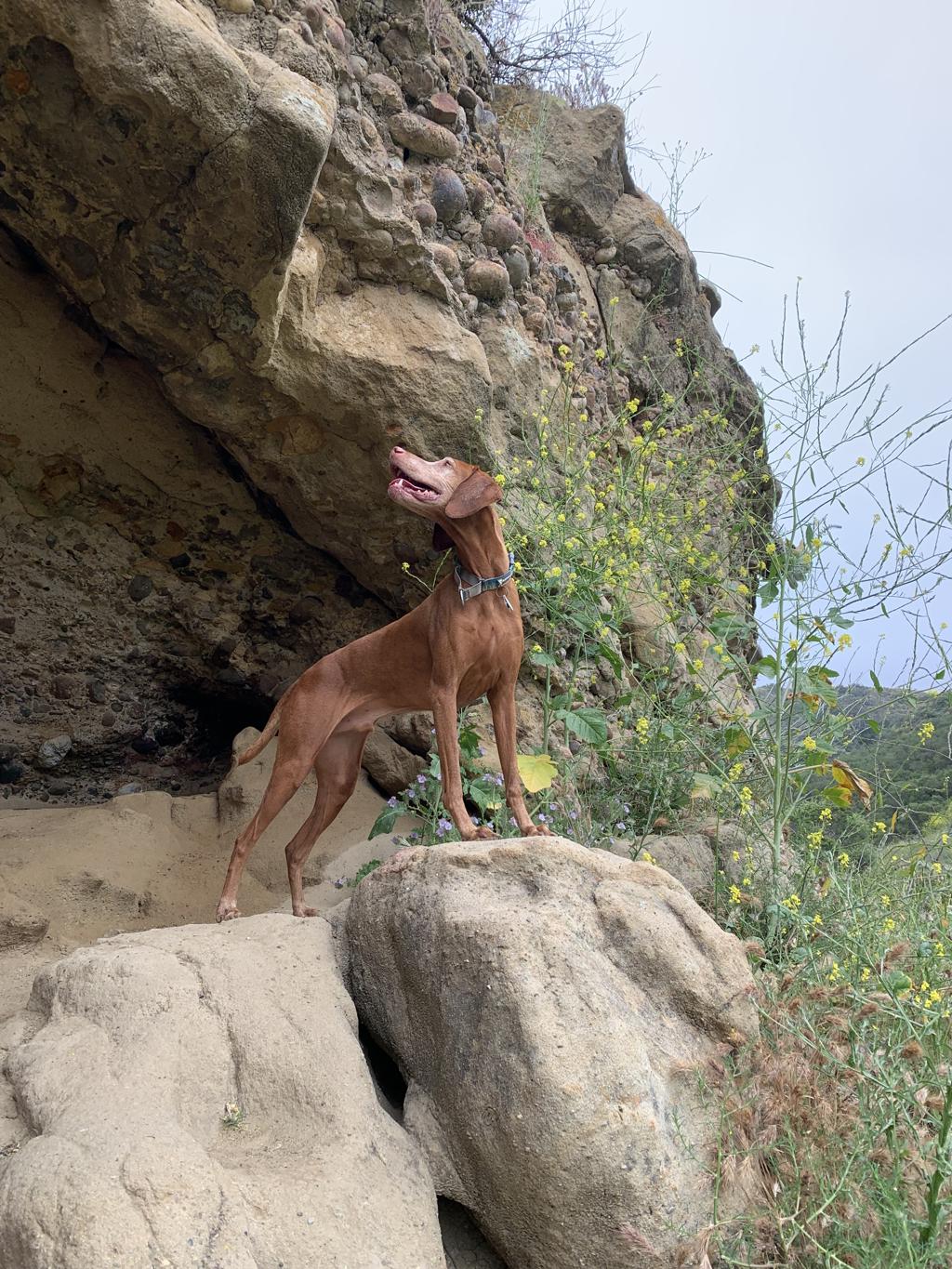
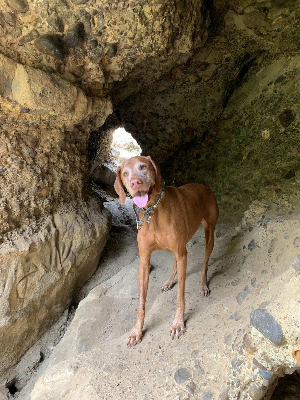
Pirate’s Cove and Cave Landing
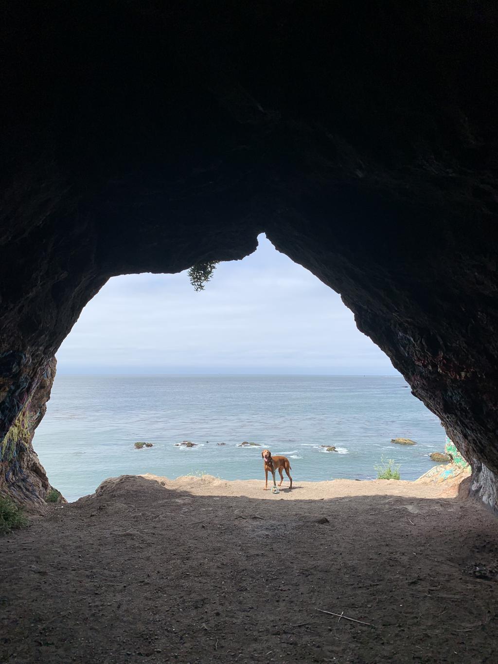
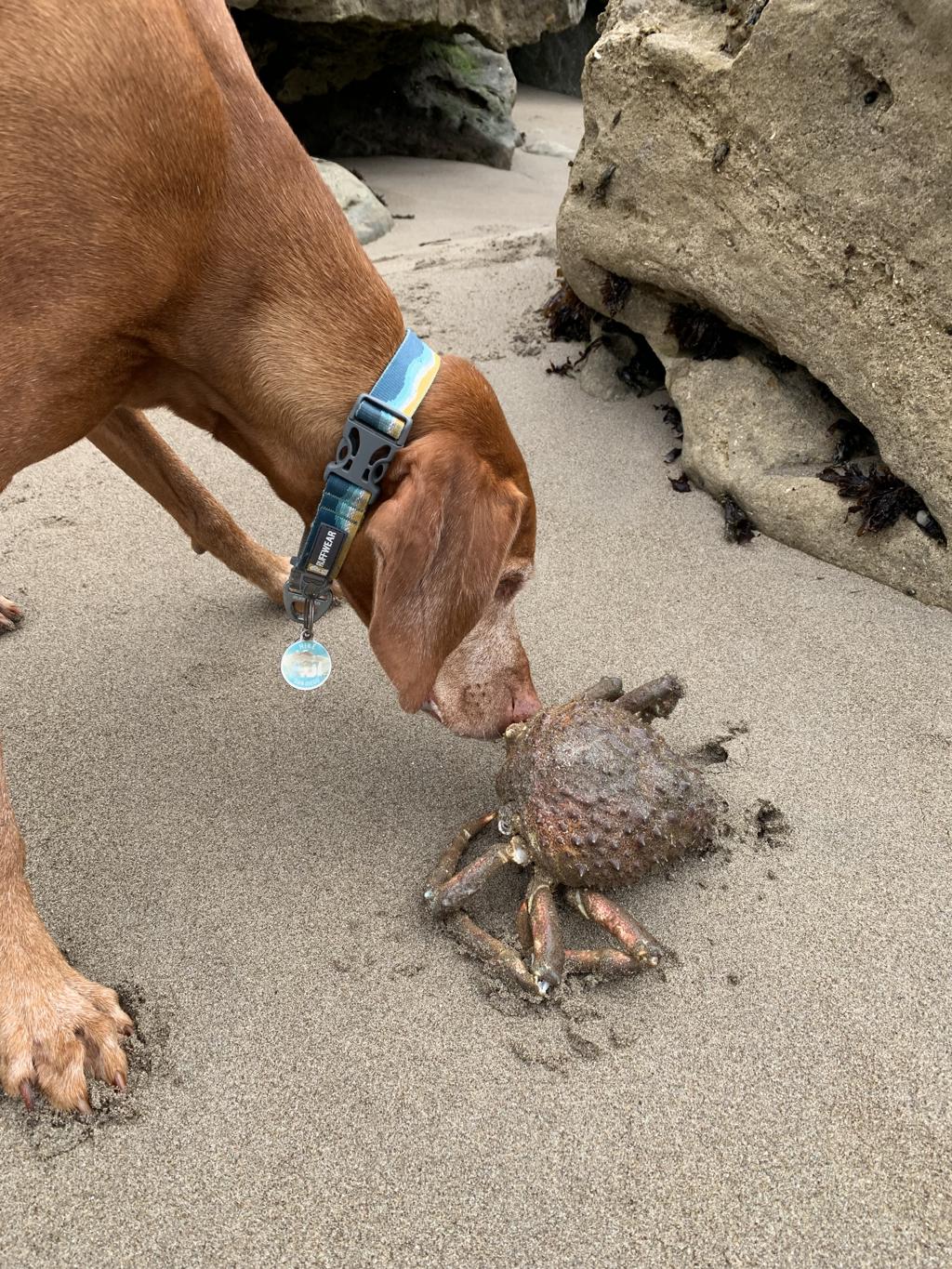
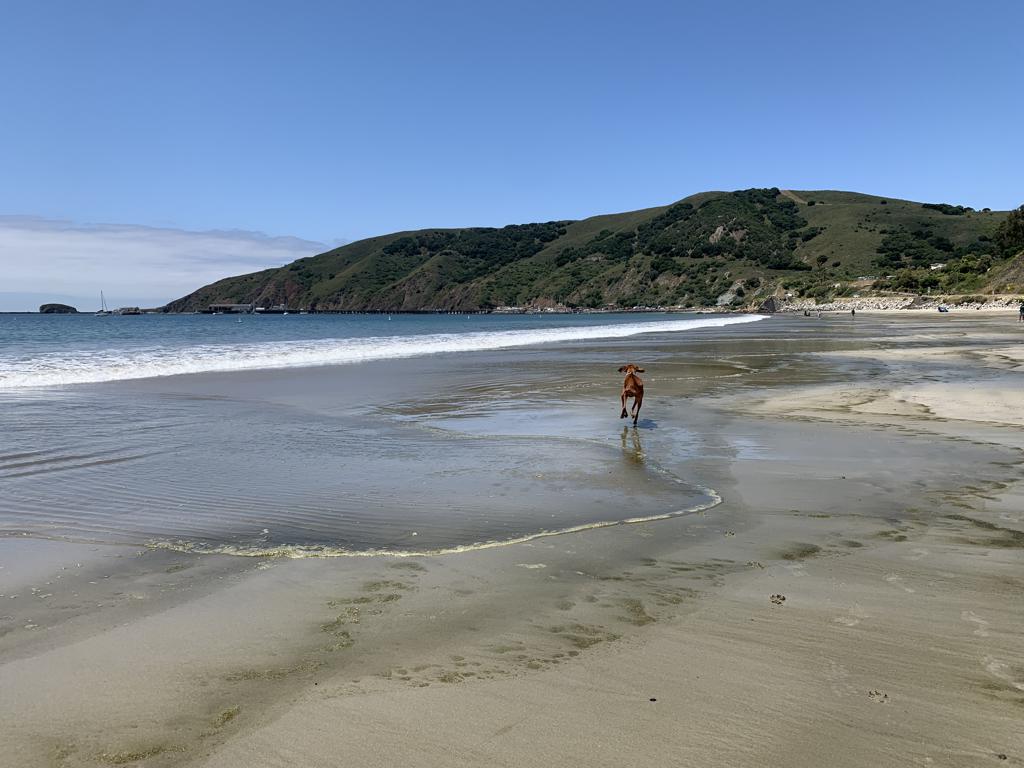
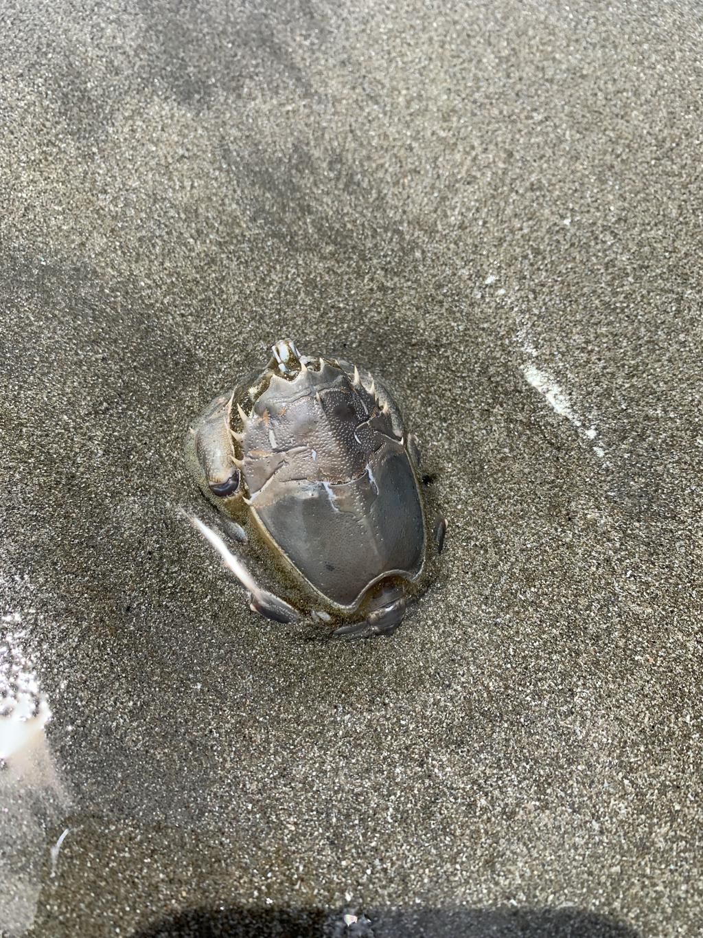
Cappie’s Scoop: The first part of this trail is strange because I can’t see anything! There are very big bushes on both sides of the trail but mom said she had a nice view of the ocean. When I got to the dirt trail, then I was able to see the ocean and the beach we were going to visit! I decided to visit the cave first and it was pretty cool. Be careful not to get too close to the edge. After the cave, I went down to the beach and mom let me run around. I found a big crab on the beach and some other stinky stuff that mom kept telling me not to sniff. It was a lot of fun! Don’t hesitate to add YOUR scoop in the comments below!
Tips: The Shell Beach Bluff Trail takes you to Pirate’s Cove and Cave Landing. There are two trailheads for this hike. We started from Indio Dr. and the parking lot is very small with only five parking spaces. But there is parking in the residential area and that’s where we ended up parking. We enjoyed a great hike along the paved trail and when it ends, continue on the unused road which is mostly dirt. You eventually reach a dirt parking lot which you could also park in for this hike but we preferred the extended route. There are great ocean views along the way! Once you hike down to the cove and cave area, you can decide which one to see first. When you reach the beach, some say clothing is optional but everyone we saw kept their clothes on.
Directions: From the town of Morro Bay, head south on CA-1 and then continue south on US-101. Take exit 195 for Avila Beach Dr. which turns into Shell Beach Rd. Stay on Shell Beach Rd. for 0.3 miles and then turn right onto El Portal Dr. which turns into Indio Dr. The road ends at a gated community but on the left is a small driveway down to the small parking lot. If you don’t find any spots available, turn around and park on Indio Dr. along the street.
| Mileage (round trip) | 2.2 |
| Difficulty | Moderate |
| Gain (in feet) | 416 |
| Trailhead | 35.17452, -120.70786 |
| Hike Time (in hours) | 1-2 |
| Exposure | Sunny |
| Scenery | Ocean Views, Cave |
| Facilities | None |
| Fees/Permits | None |
| More Info | https://www.hikespeak.com/trails/shell-beach-bluff-trail-ontario-ridge-avila |
| Last Hiked | 5/27/2023 |


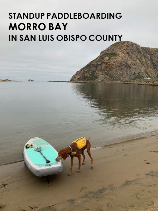
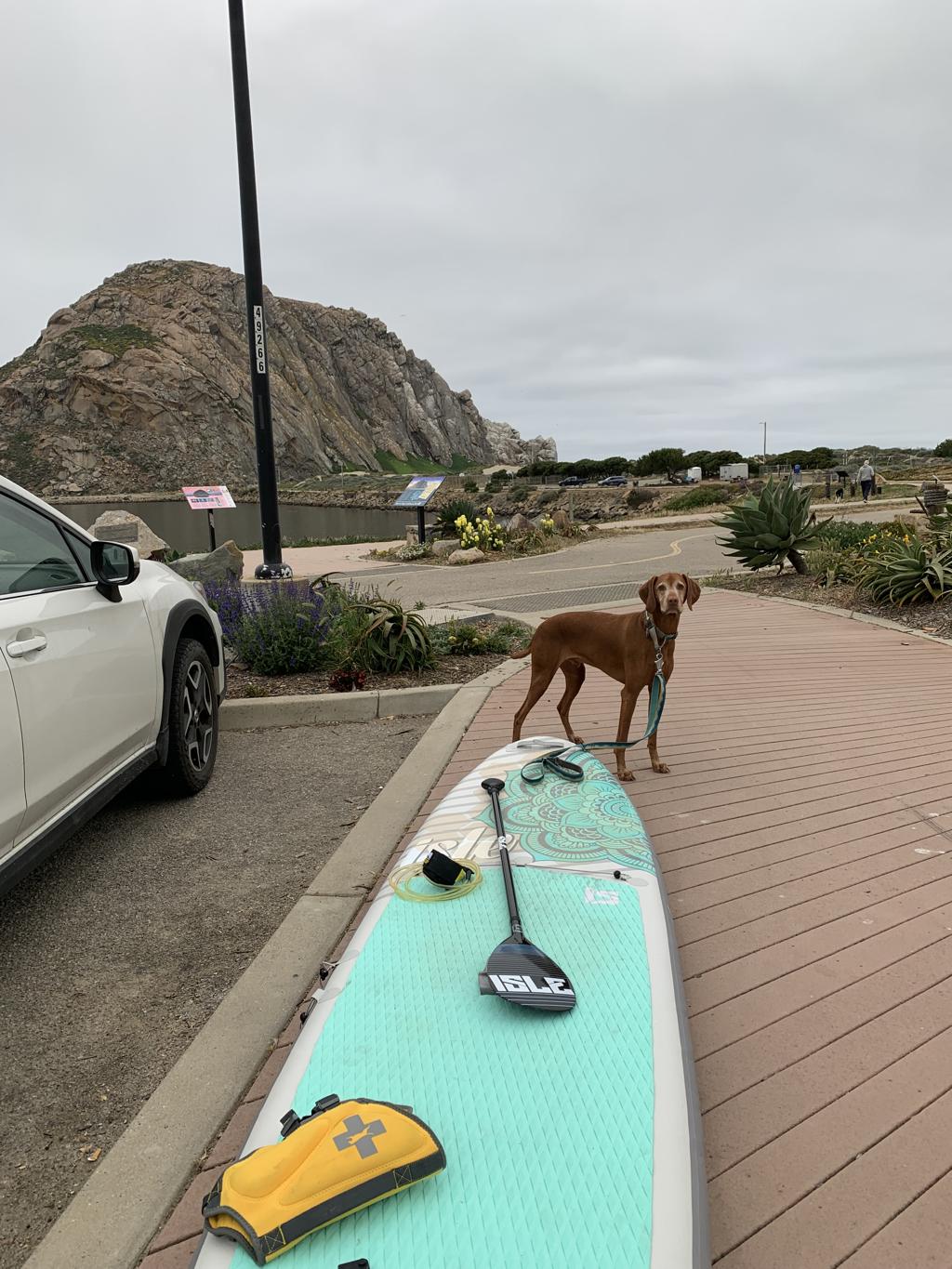
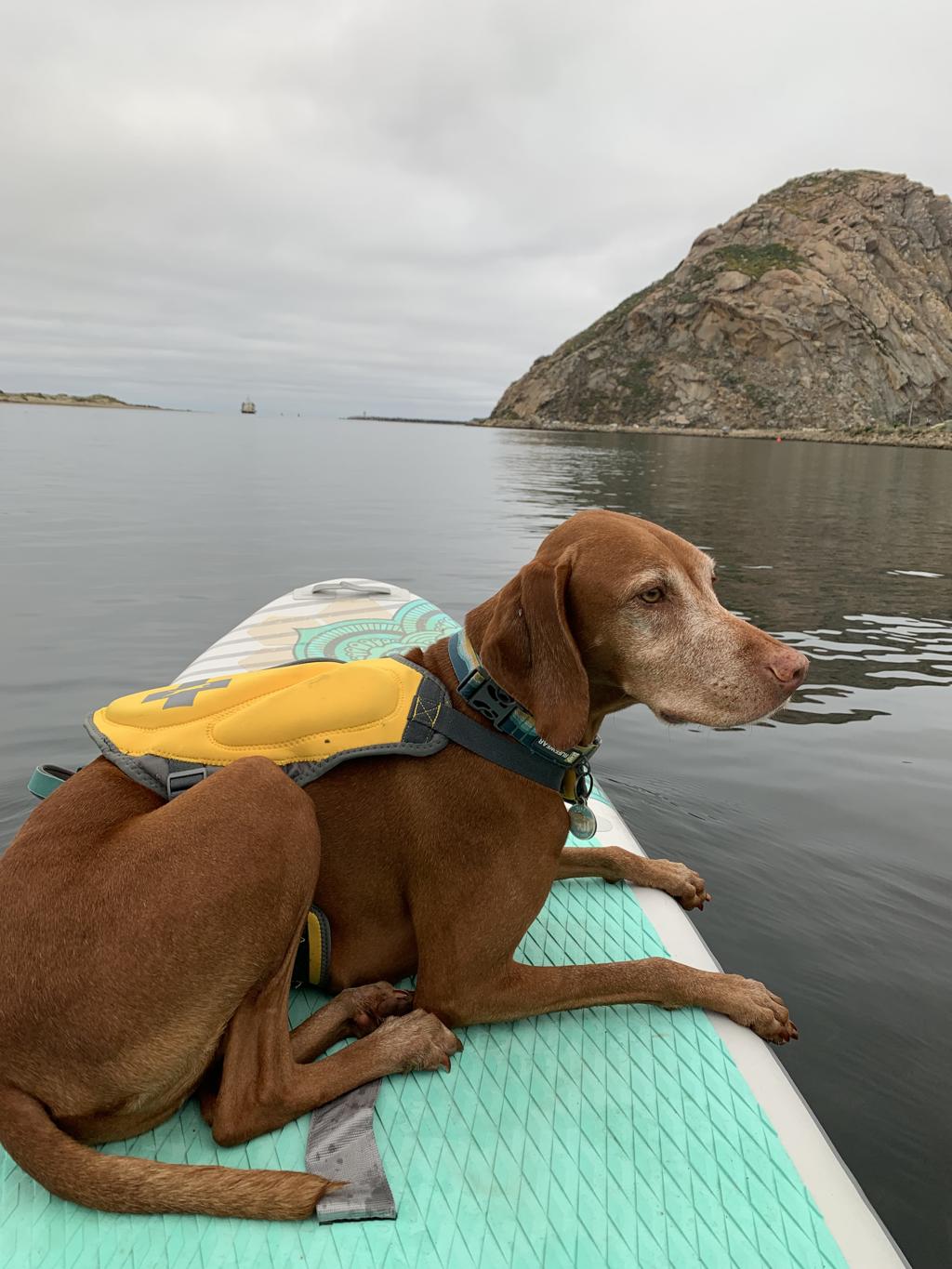
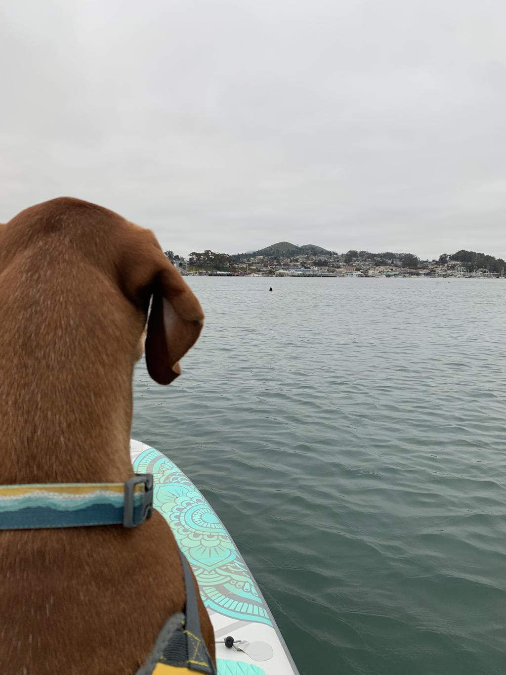
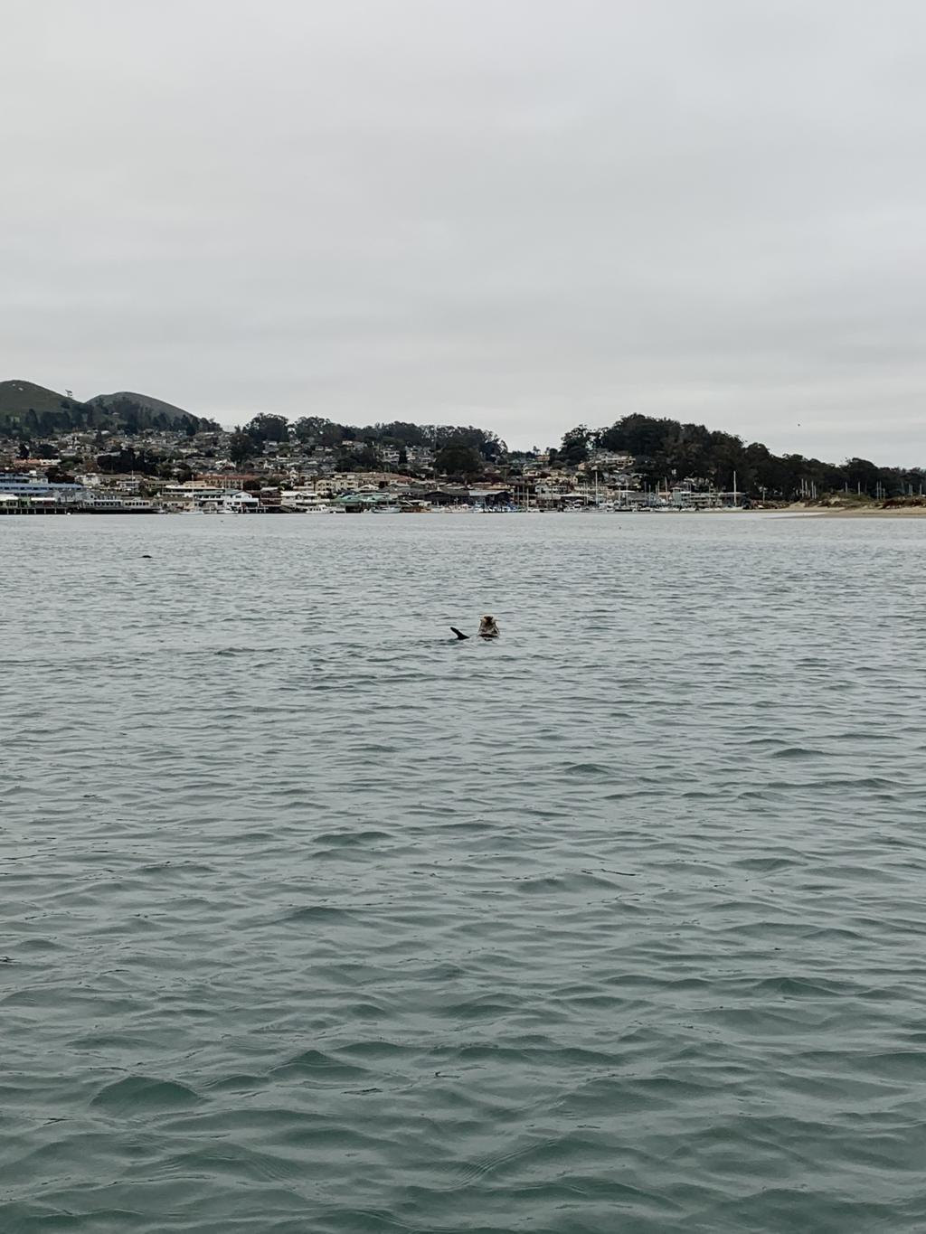
Morro Bay – SUP
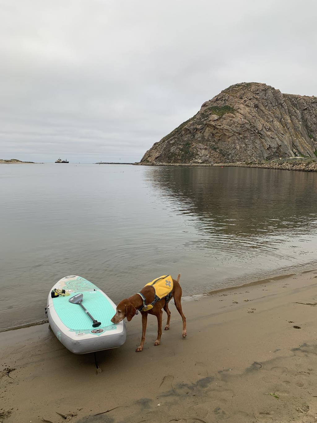
Cappie’s Scoop: The best part about this adventure was making some new furiends with the sea otters! I never even met an otter before but they were very nice. They like to place hide and seek too. They were swimming around in front of me and then all of a sudden, they disappeared into the water and I didn’t know where they were. They are very funny. I can’t wait to go back and hang out with the otters again! Don’t hesitate to add YOUR scoop in the comments below!
Tips: Depending on when you decide to paddle, the bay may be very busy with boat traffic to include tours and fishing boats. Keep your eyes open and stay out of the main channel.
Directions: We parked at Coleman Park and launched from the small beach in front of it.
| Mileage (round trip) | Up to you! |
| Difficulty | Easy |
| Gain (in feet) | N/A |
| Location | 35.372428, -120.859985 |
| Hike Time (in hours) | 1-2 |
| Exposure | Sunny |
| Scenery | Mountain Views, Ocean Views, Wildlife |
| Facilities | None |
| Fees/Permits | None |
| More Info | https://www.morrobay.org |
| Last Hiked | 5/27/2023 |


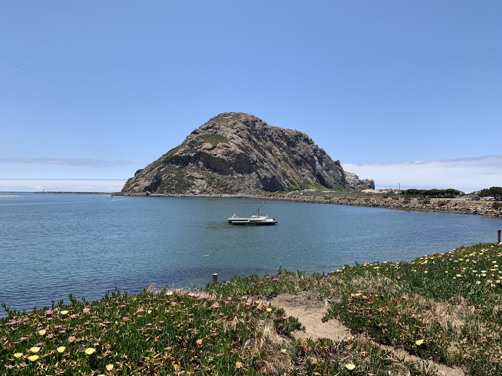
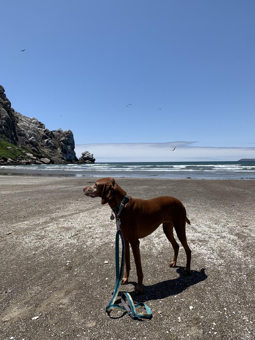
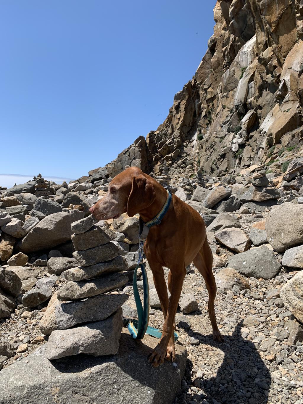
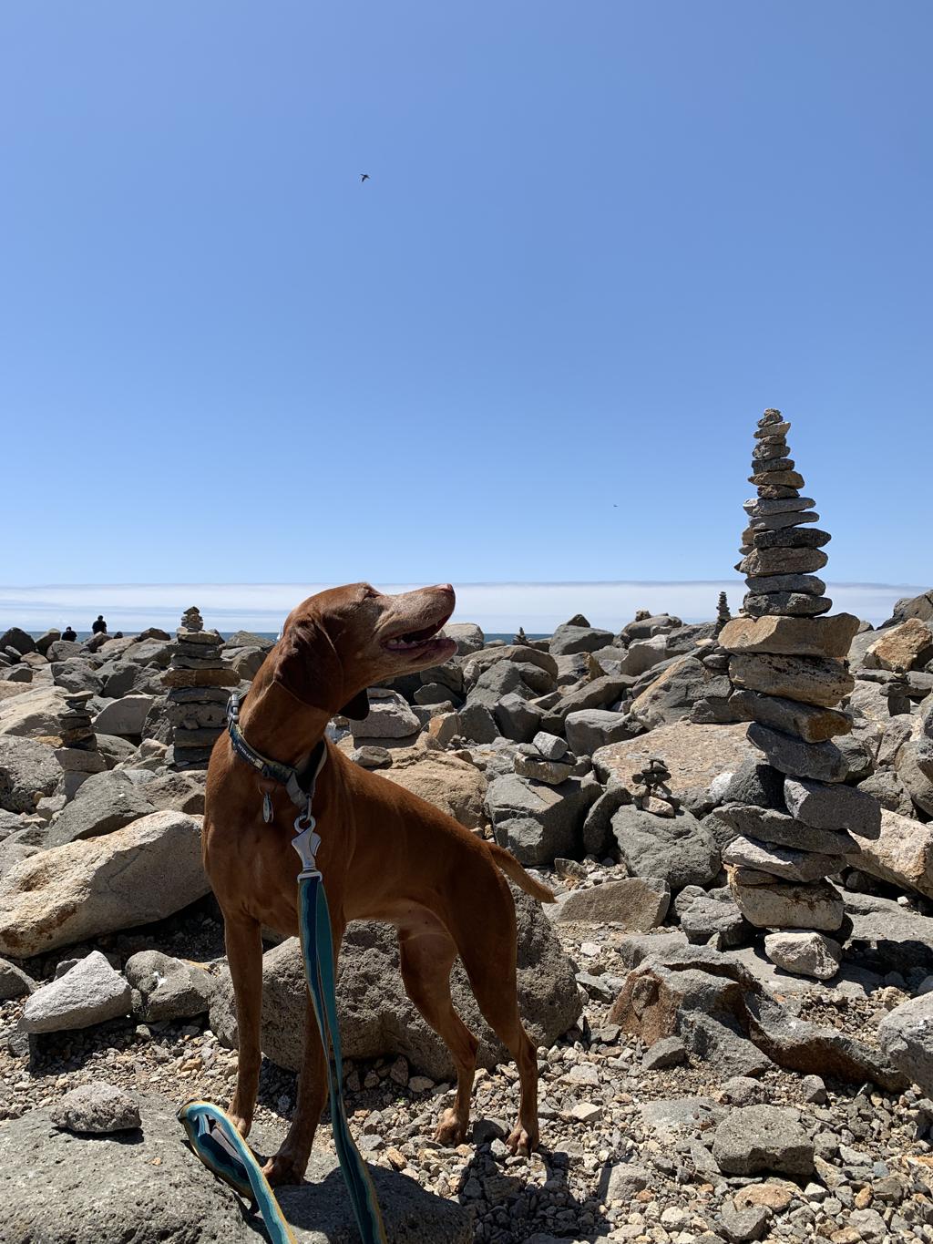
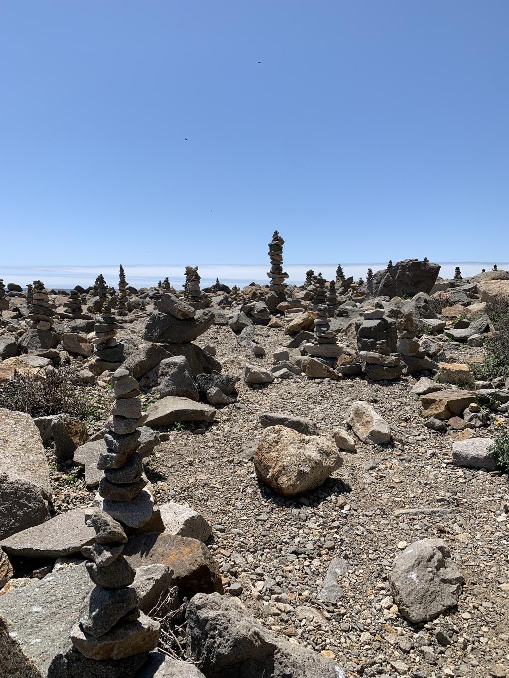
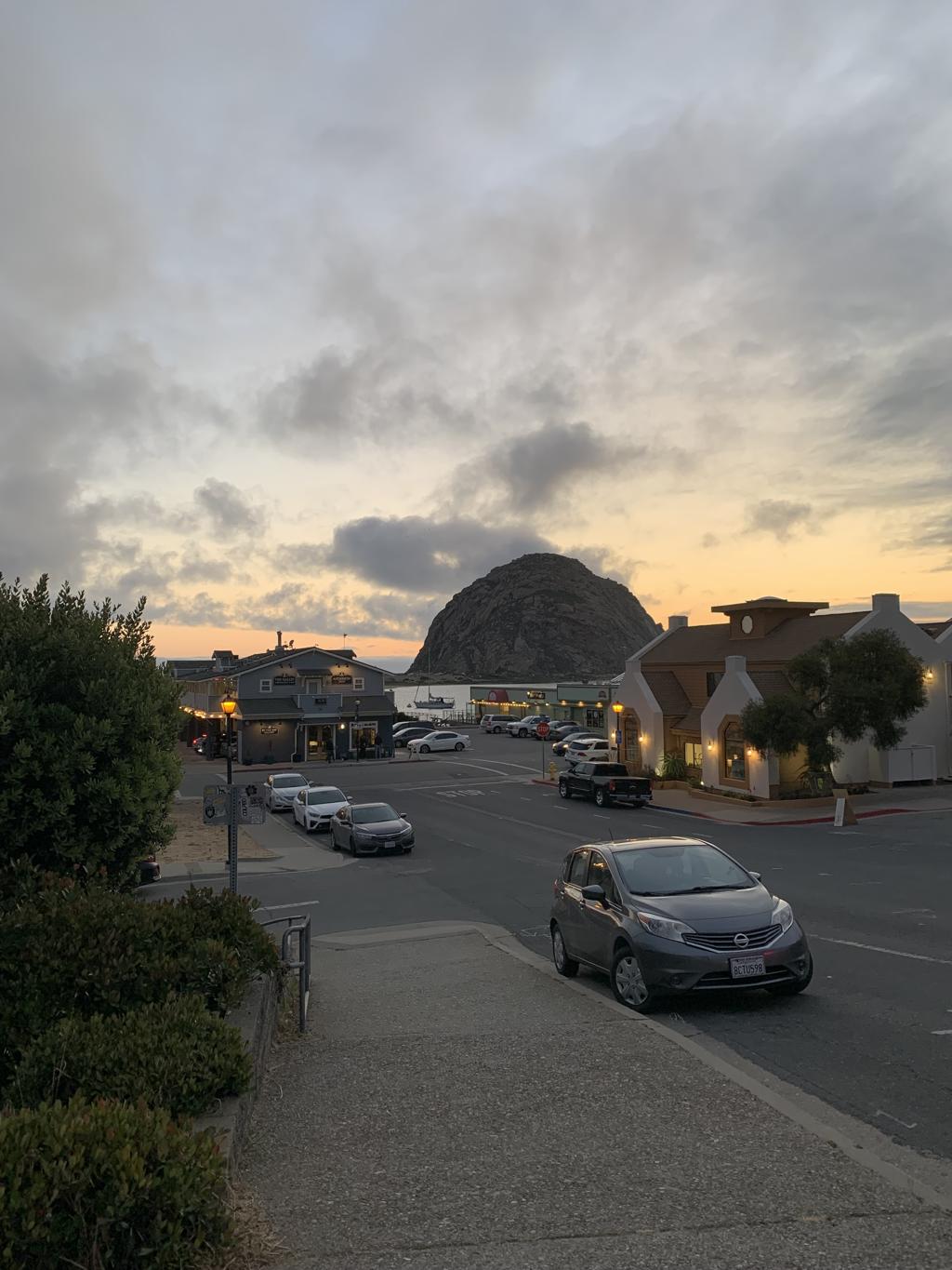
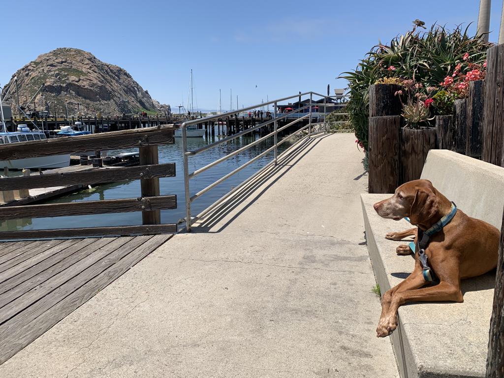
Morro Rock
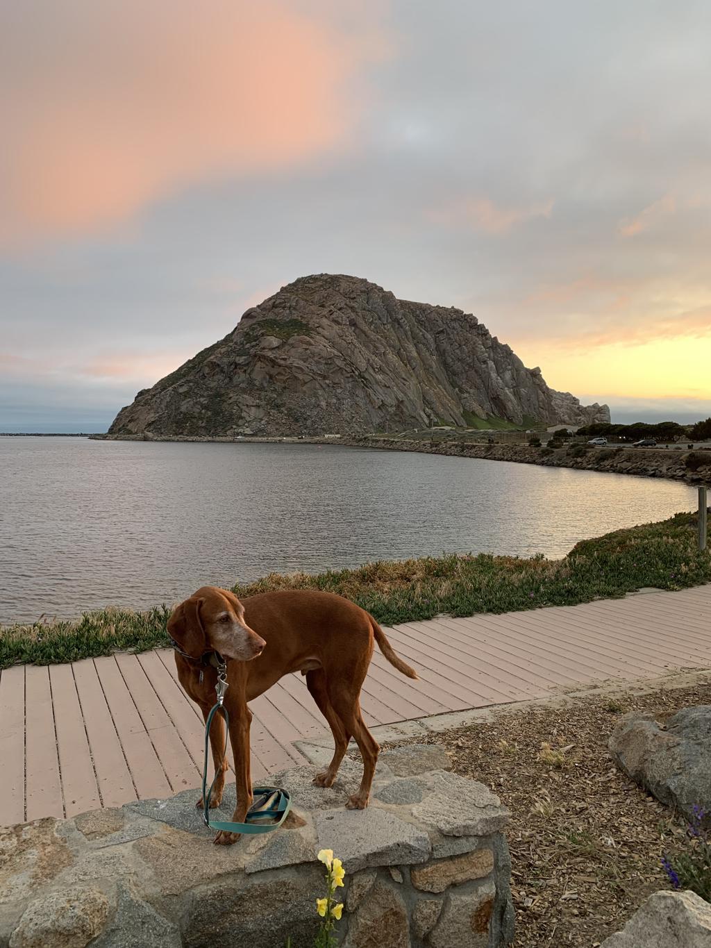
Cappie’s Scoop: Rocks are cool and they are even better when I can climb on them. This rock was way too big for me to climb on but next to it was a bunch of smaller rocks that I was able to check out. A lot of the rocks were stacked in a pile and that was very strange but mom said they are called cairns. Each night, mom and I watched the sunset next to big rock and that was a lot of fun but next time mom needs to remember to bring my sweater because it gets chilly when the sun goes down! Don’t hesitate to add YOUR scoop in the comments below!
Tips: You can also park next to Morro Rock in a dirt parking lot or a bit further down the road and walk along the harbor. Next to Morro Rock is a beach where dogs are allowed but only on-leash.
Directions: We parked at Coleman Park and walked along the Harbor Walk to Morro Rock.
| Mileage (round trip) | 1 |
| Difficulty | Easy |
| Gain (in feet) | N/A |
| Trailhead | 35.372428, -120.859985 |
| Hike Time (in hours) | 1-2 |
| Exposure | Sunny |
| Scenery | Mountain Views, Ocean Views, Wildlife |
| Facilities | None |
| Fees/Permits | None |
| More Info | https://www.morrobay.org |
| Last Hiked | 5/26/2023 |


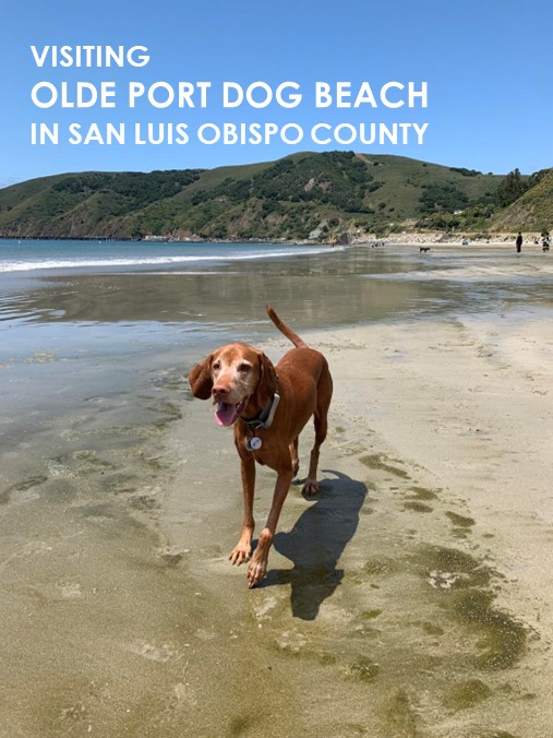
Olde Port Dog Beach
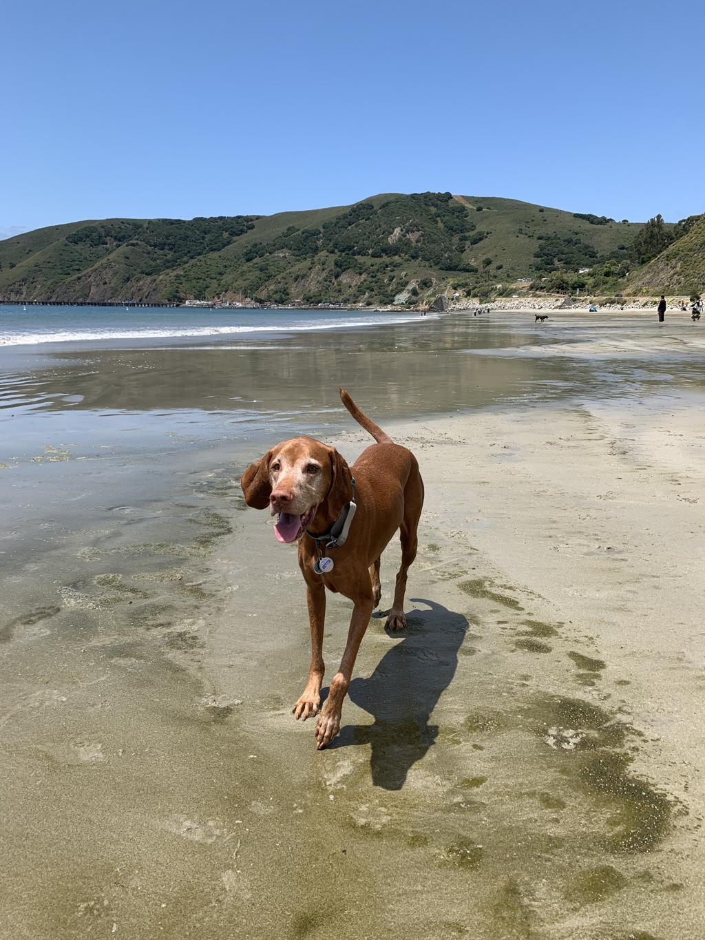
Cappie’s Scoop: I love dog beaches and I have bucket list to see how many different ones I can visit in California! This one adds another to the list! Don’t hesitate to add YOUR scoop in the comments below!
Tips: None
Directions: From the town of Morro Bay, head south on CA-1 and then continue south on US-101. Take exit 196 for San Luis Bay Dr. and then turn right onto Avila Beach Dr. Stay on Avila Beach Dr. for about 2.4 miles and the dog beach will be on your left. Park anywhere along the road.
| Location | 35.178125, -120.748077 |
| Hike Time (in hours) | 1 |
| Exposure | Sunny |
| Scenery | Ocean Views |
| Facilities | None |
| Fees/Permits | None |
| More Info | https://highway1roadtrip.com/things-to-do/olde-port-beach |
| Last Hiked | 5/26/2023 |

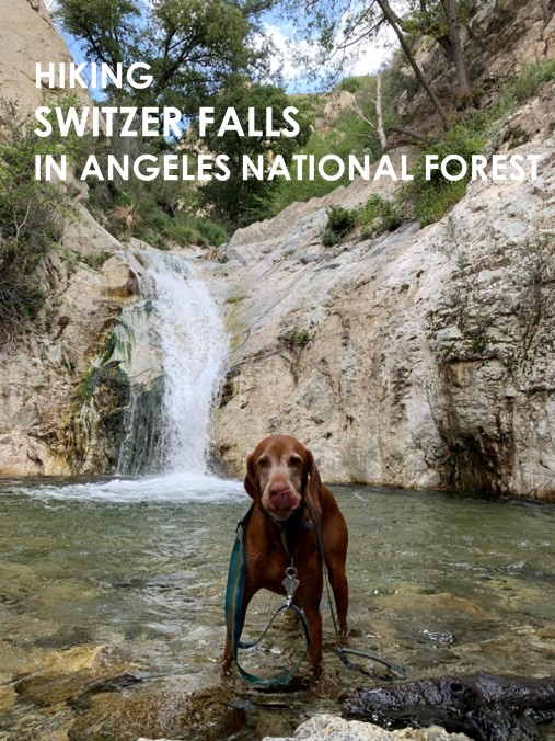
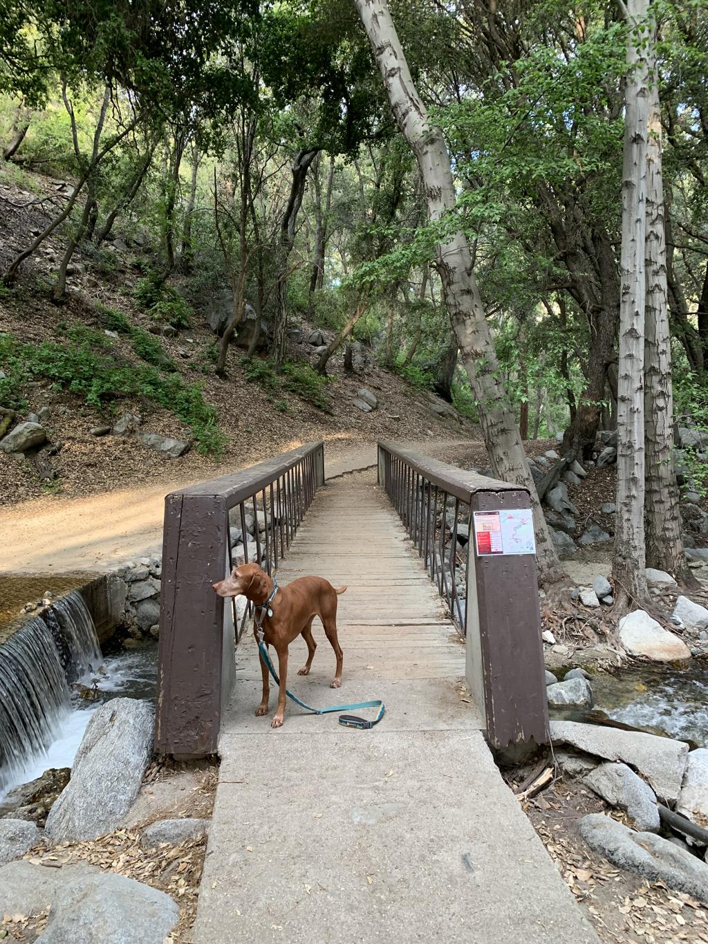
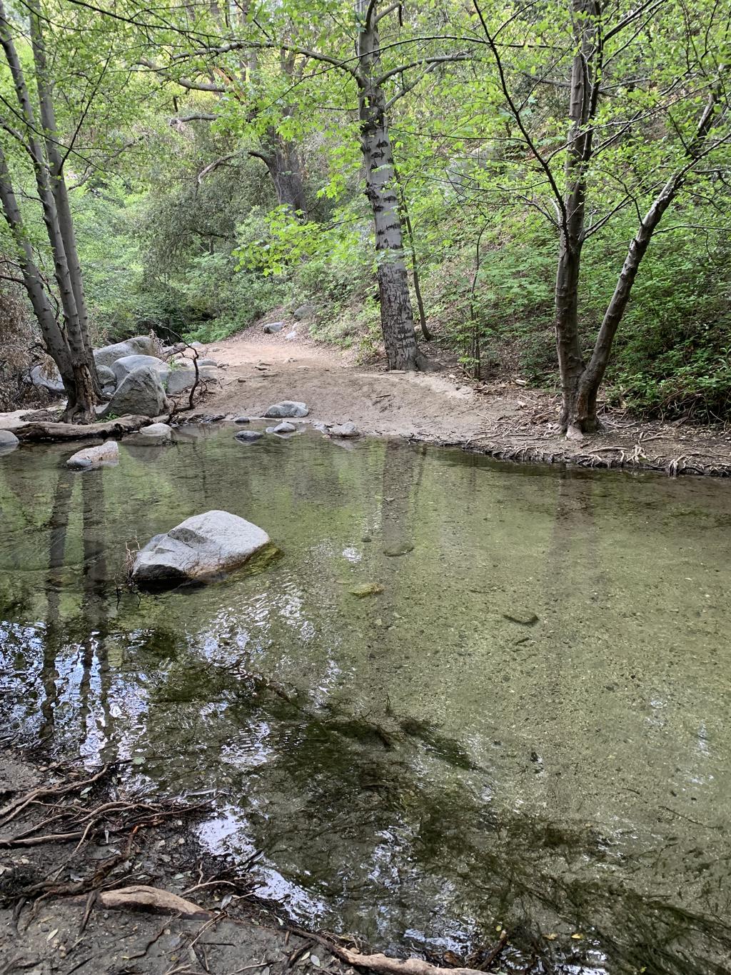
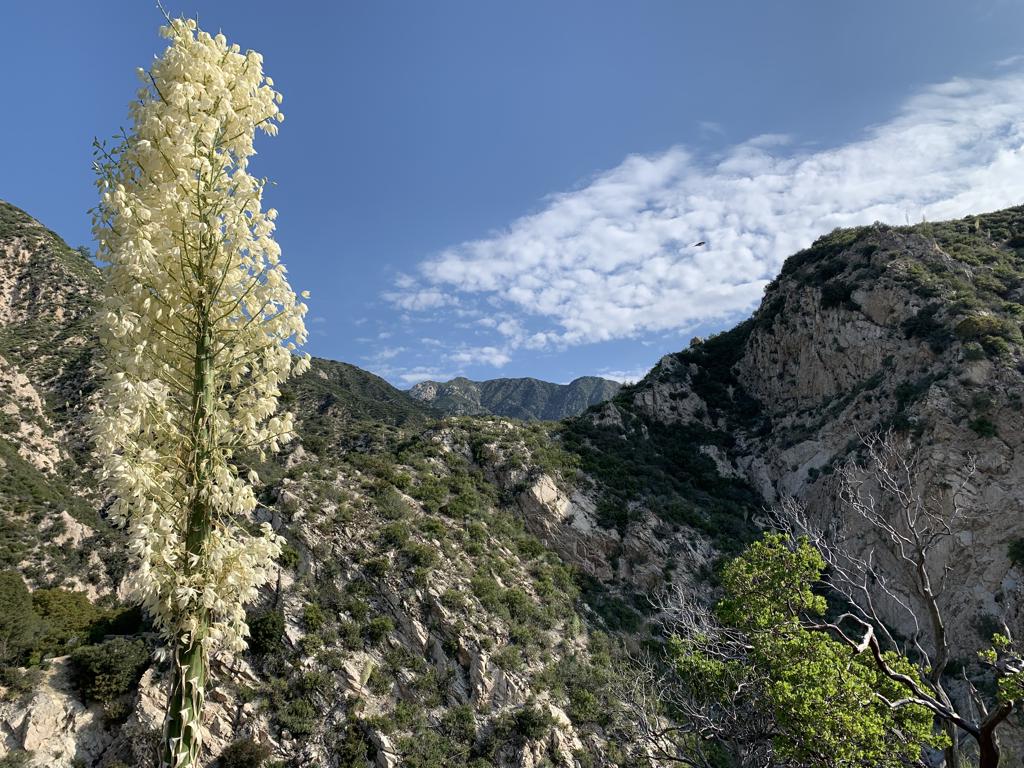
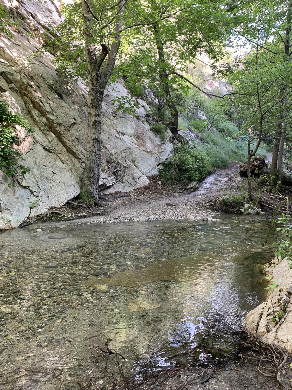
Switzer Falls
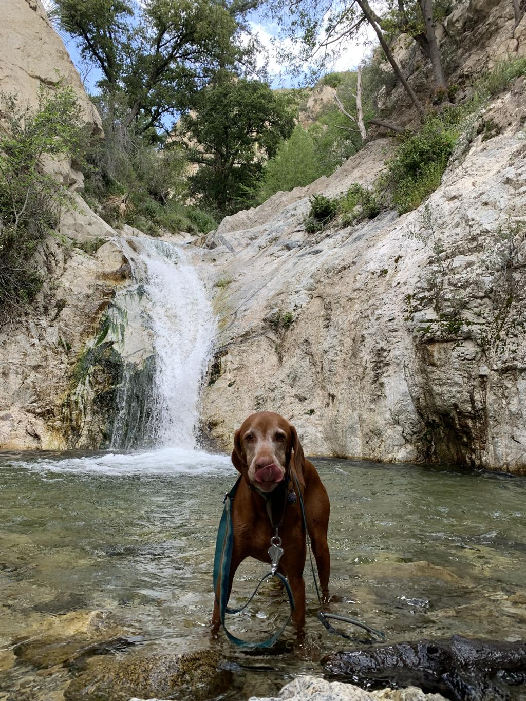
Cappie’s Scoop: The early bird gets to swim in the falls with very few people there! Mom made me wake up very early so we could start hiking to the waterfall. I’m glad she drove so I could sleep in the car. But she was right, it was a lot of fun to hike through all the water crossings and then swim in the falls! I can’t wait to go back and do this hike again. It was so much fun! Don’t hesitate to add YOUR scoop in the comments below!
Tips: There were 13 water crossings at the time of writing this post. So much fun! The falls are great for swimming too. Go early because this place gets crowded so we started our hike at 7am and only saw a few people at the falls. There is a lot of poison oak on this trail so hike in the middle when possible. You may also want to bring some bug repellent depending on the time of the year you do this hike. There are two trails that take you to the falls, Gabrielino and Bear Canyon. Both trails continue away from the falls so have a map handy so you make the correct turns at the junctions.
Directions: From 5 north, drive through LA and take exit 139A to merge onto CA-2 N/Glendale Fwy toward Glendale. Continue on CA-2 N and follow signs to merge onto CA-2 E/I-210 E. Then take exit 20 for CA-2/Angeles Crest Hwy toward La Cañada Flintridge. It’s a windy road into the mountains so take your time while driving the 9.8 miles. Then turn right onto Switzer Truck Trail. You will also see a sign for Switzer Picnic area. You can park in the lower or upper parking lots but you will need an adventure pass. If no spots are available, you can park along CA-2 in the dirt turnouts.
| Mileage (round trip) | 4.2 |
| Difficulty | Moderate |
| Gain (in feet) | 736 |
| Trailhead | 34.26633, -118.14572 |
| Hike Time (in hours) | 2-3 |
| Exposure | Mostly Shady |
| Scenery | Mountain Views, Creek, Waterfalls |
| Facilities | Vault toilet at trailhead. |
| Fees/Permits | California Adventure Pass or Interagency Annual Pass/America the Beautiful Pass (National Parks Pass). |
| More Info | https://hikingguy.com/hiking-trails/los-angeles-hikes/switzer-falls-hike |
| Last Hiked | 5/21/2023 |


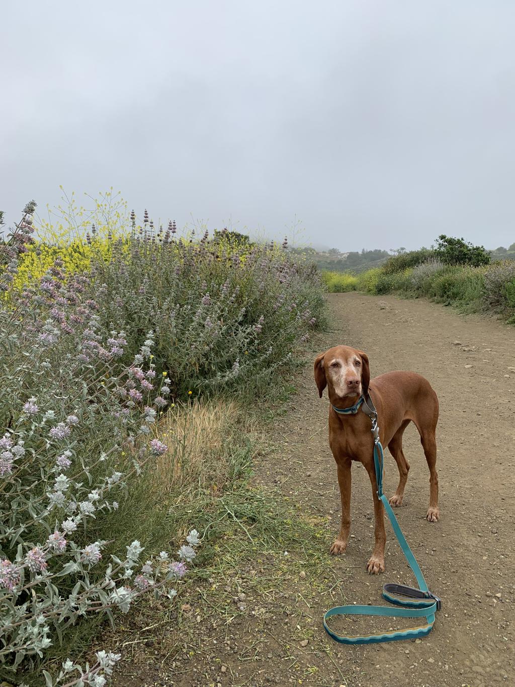
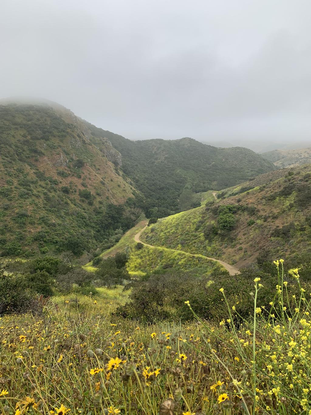
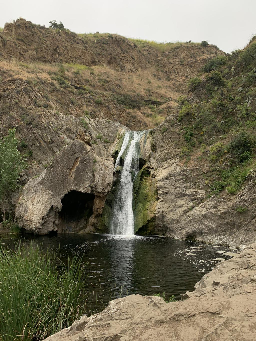
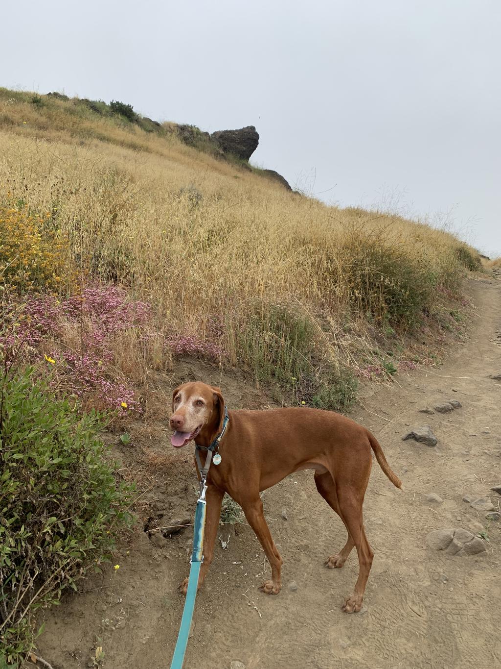
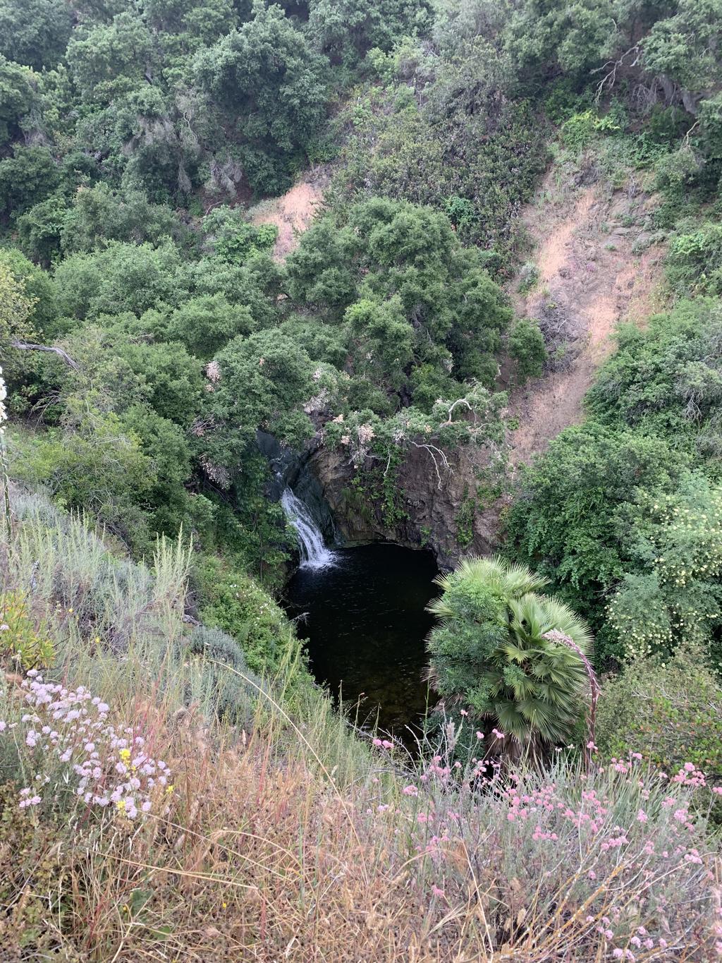
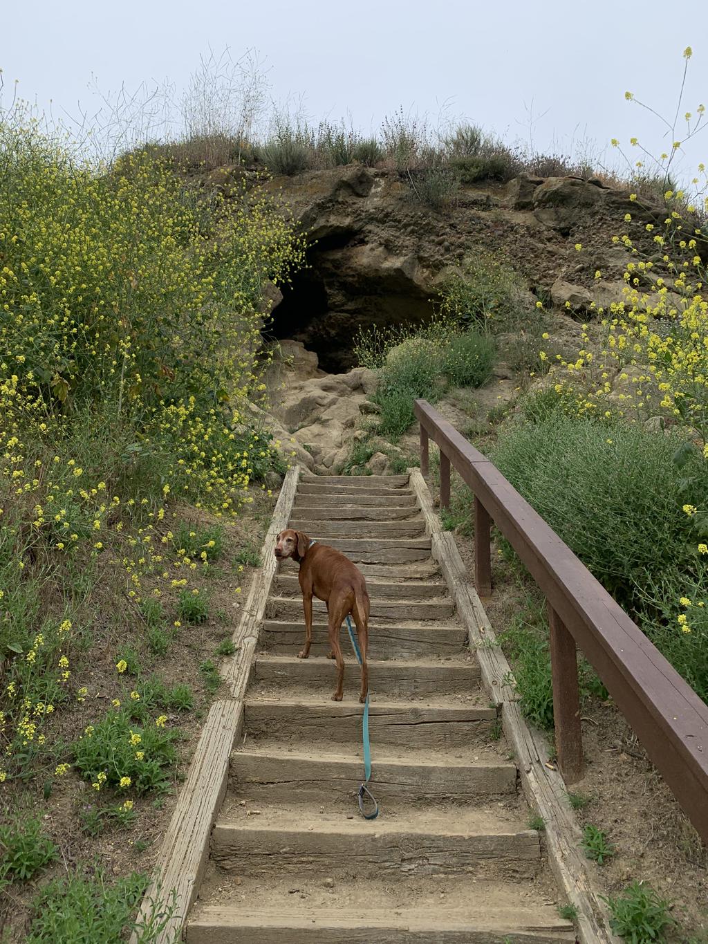
Paradise Falls
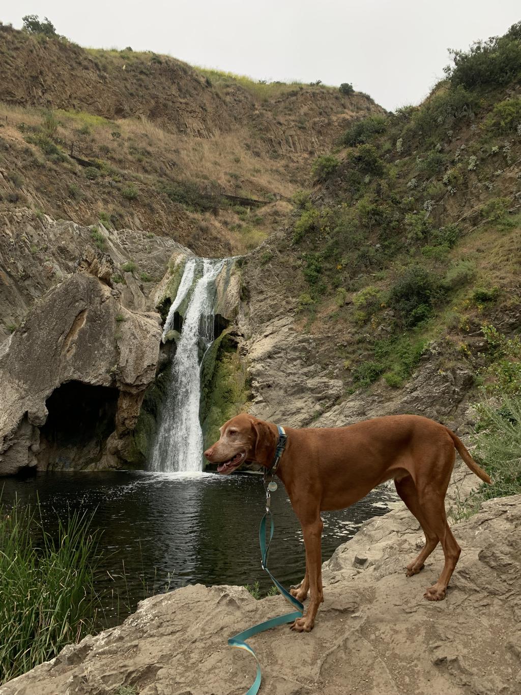
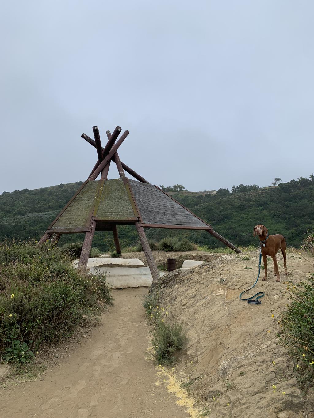
Cappie’s Scoop: This is a cool waterfall to see but it would’ve been better if mom let me swim in the water. I didn’t get a chance to jump in the water this time but we had a nice long hike and I got to play inside a cave and teepee instead. I had a lot of fun on this hike and I really want to go back and play in the cave again! Don’t hesitate to add YOUR scoop in the comments below!
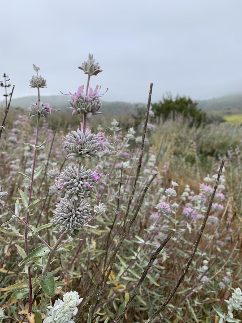
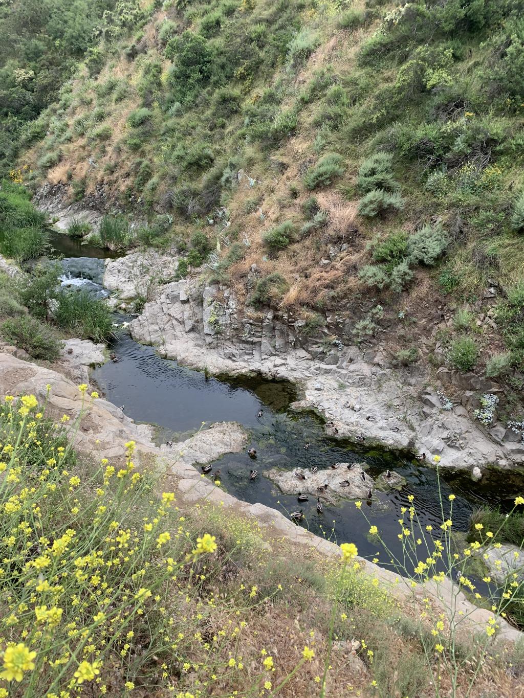
Tips: There is a lot to see on this hike and many trails to explore. You can see it all in one trip and we did by doing a big loop hike. We saw two waterfalls, a teepee, Lizard Rock and a hidden cave! Have a map handy so you can create your own route. There were lots of wildflowers blooming on the trail including mustard and cacti. We also smelled a lot of purple sage, the most aromatic sage plants we’ve smelled. There are a few water crossings but all of them had wooden planks in the water to help you cross.
Directions: From 5 north, drive through LA and take exit 144B to merge onto CA-134 W/Ventura Fwy toward Ventura. After 5.6 miles, CA-134 W/Ventura Fwy turns slightly right and becomes US-101 N/Ventura Fwy. After 31.2 miles, take exit 45 for Lynn Rd and turn right. In 2.5 miles, turn left onto W Avenida De Los Arboles. Drive to the end of the road and before the road becomes Big Sky Dr., you will see the trailhead parking on your left. If the parking lot is full, there is an overflow lot during the weekends at the Elementary School down the street.
| Mileage (round trip) | 6.5 |
| Difficulty | Moderate |
| Gain (in feet) | 1122 |
| Trailhead | 34.21981, -118.90245 |
| Hike Time (in hours) | 2-3 |
| Exposure | Mostly Sunny |
| Scenery | Mountain Views, Creek, Waterfalls, Wildflowers, Cave |
| Facilities | None |
| Fees/Permits | None |
| More Info | https://modernhiker.com/hike/hike-wildwood-regional-park-paradise-falls-lizard-rock |
| Last Hiked | 5/20/2023 |


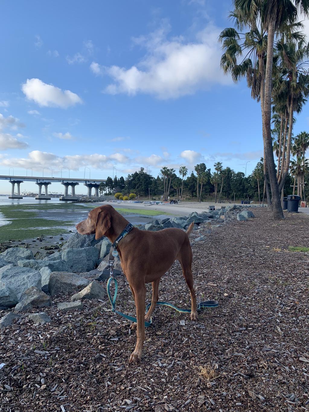
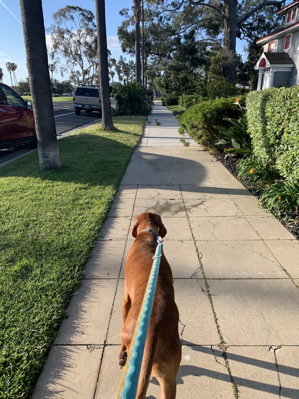
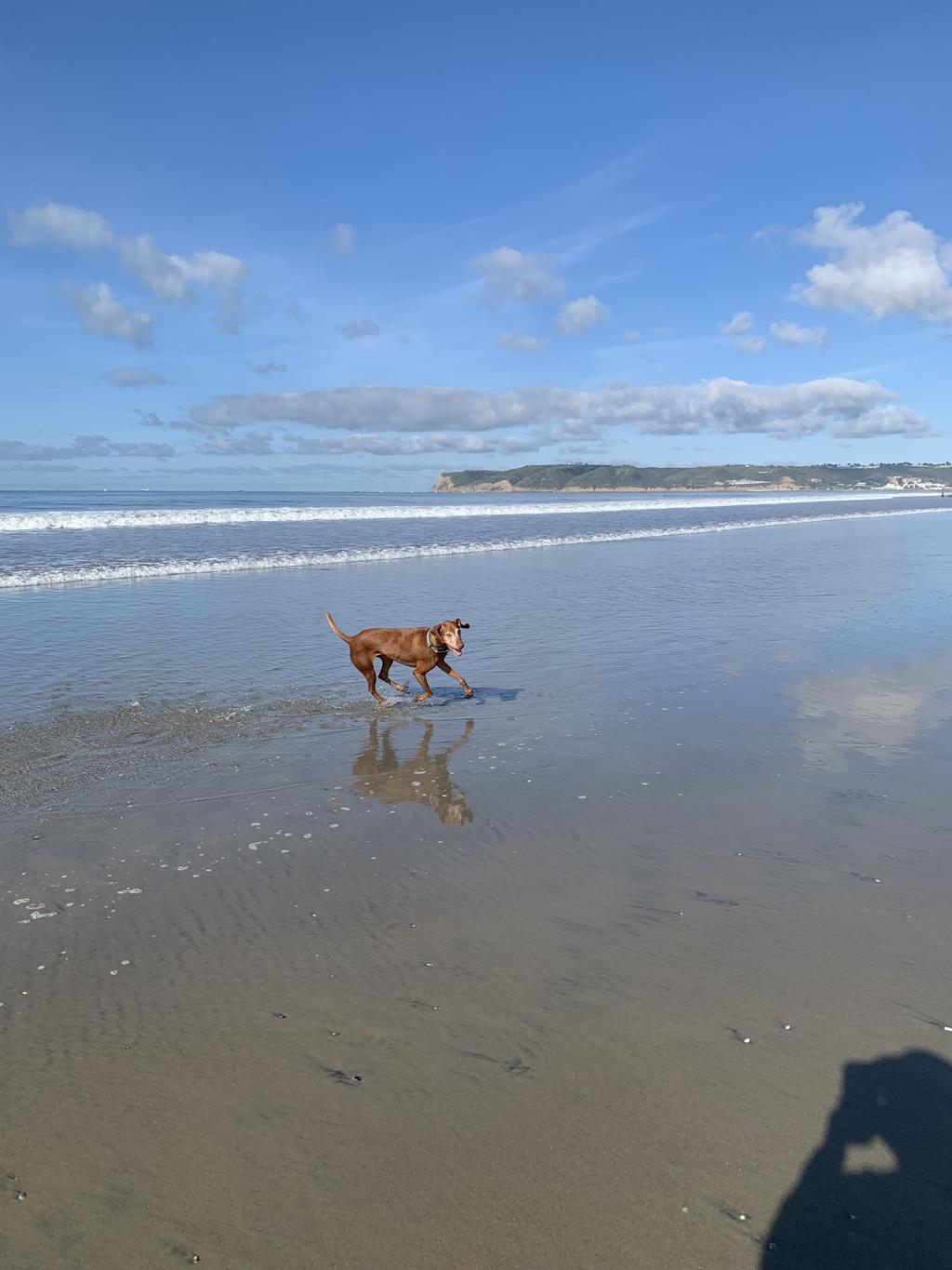
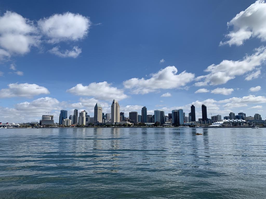
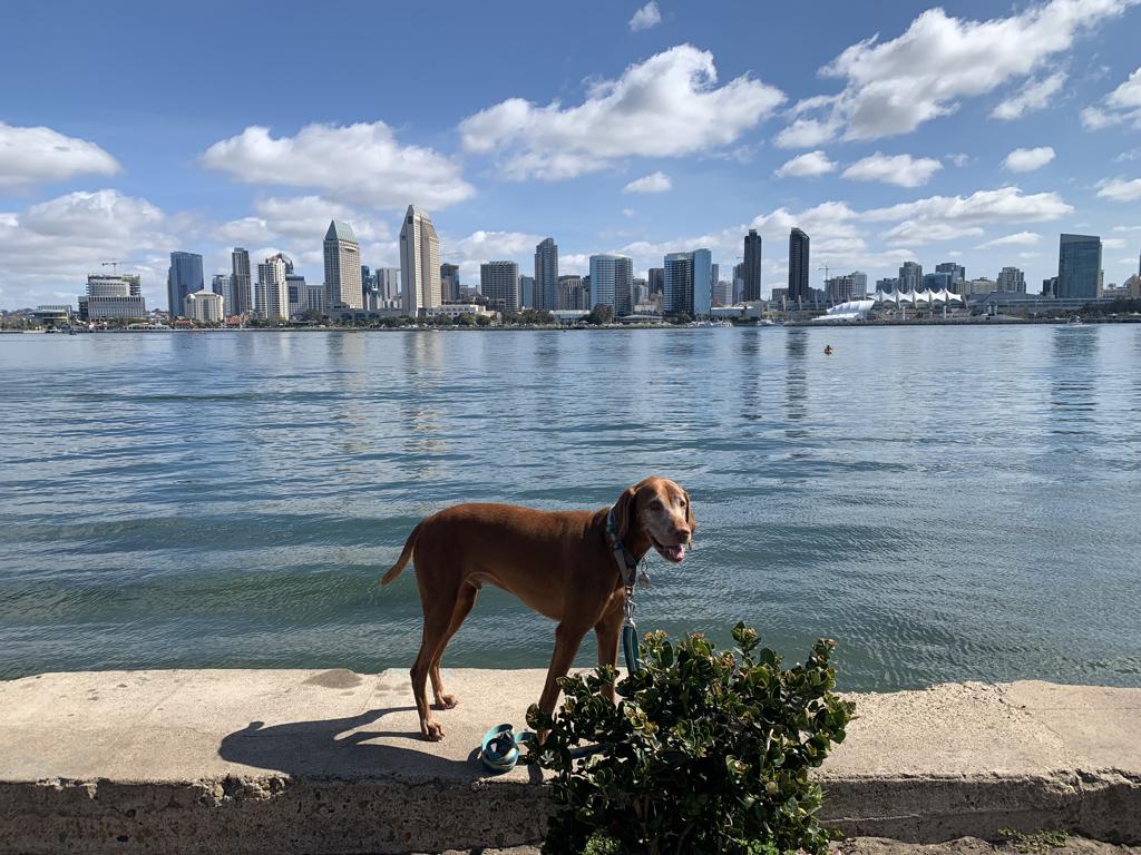
Coronado Island Loop
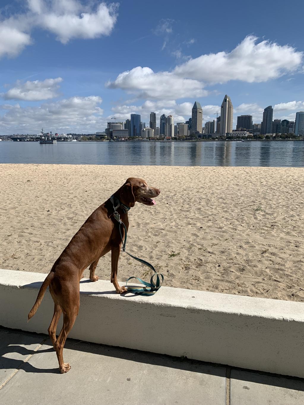
Cappie’s Scoop: I love to hike but sometimes I don’t want to sit in the car for a long drive to a trail. So mom picks out an urban trail close to our house for us to hike. This time I hiked around the entire island of Coronado. There was a lot to see too like a big bridge, flowers, ducks, the ocean and downtown San Diego. Mom even let me negotiate a detour to the dog beach so I could run around in the sand, play in the water, roll in the kelp and dig a hole. I love the beach! Don’t hesitate to add YOUR scoop in the comments below!
Tips: The loop can be hiked in either direction and we’ve done both ways. On this day, we started at Coronado Tidelands Park. We drove over the Coronado Bridge, thru the non-working toll booths and took the first exit on the right for Glorietta Blvd. The park has a great view of Coronado Bridge. We hiked towards the bridge on the paved sidewalk and went under the bridge following the path next to the golf course. At the end of the sidewalk, we crossed the road and turned left. This is Glorietta Blvd. and we hiked towards the Hotel Del Coronado. The road eventually splits and we stayed left on Pomona Ave. At the end, we crossed the road in front of The Del and hiked to the right along Orange Ave. We stayed straight until we saw R.H. Dana Place and turned left towards the ocean. We kept going to take a detour to Coronado Dog Beach but if you want to keep continue hiking, you can skip the beach and turn right on Alameda Blvd. Take Alameda all the way down to First Street and make a right. The next chance you get to hang a left and heads towards the water, take it. You will follow the sidewalk along the bay and return back to the park.
Directions: We started our loop hike from Coronado Tidelands Park. After you drive over the Coronado Bridge, go through the non-working toll booths and take the first exit on the right for Glorietta Blvd. Make your next right and follow the road to the parking lot in the park.
| Mileage (round trip) | 6.5 |
| Difficulty | Easy |
| Gain (in feet) | Negligible |
| Location | 32.690785, -117.164854 |
| Hike Time (in hours) | 2-3 |
| Exposure | Sunny |
| Scenery | Ocean Views |
| Facilities | Restrooms at park. |
| Fees/Permits | None |
| More Info | https://coronadovisitorcenter.com |
| Last Hiked | 5/7/2023 |