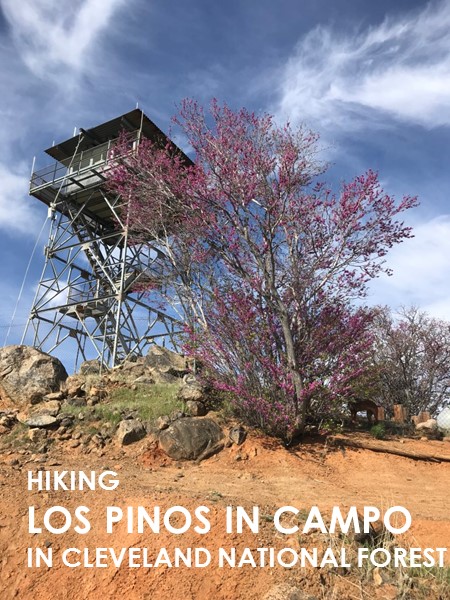
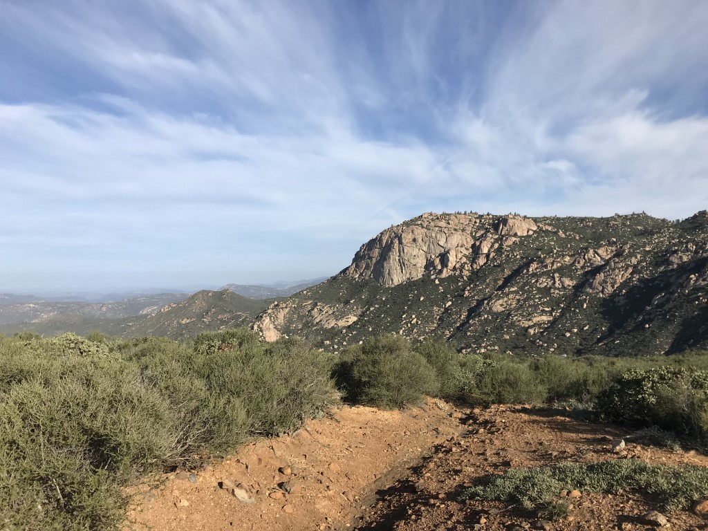
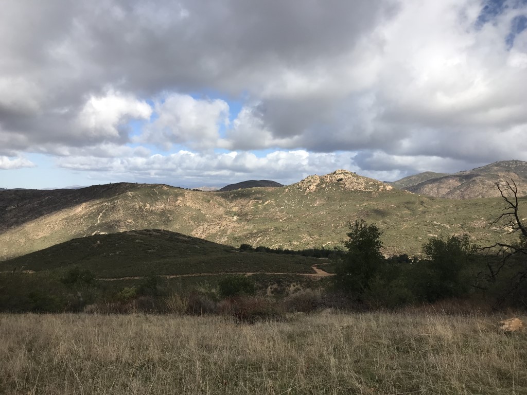
Los Pinos in Campo
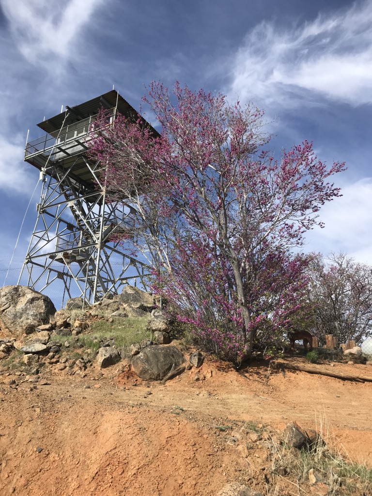
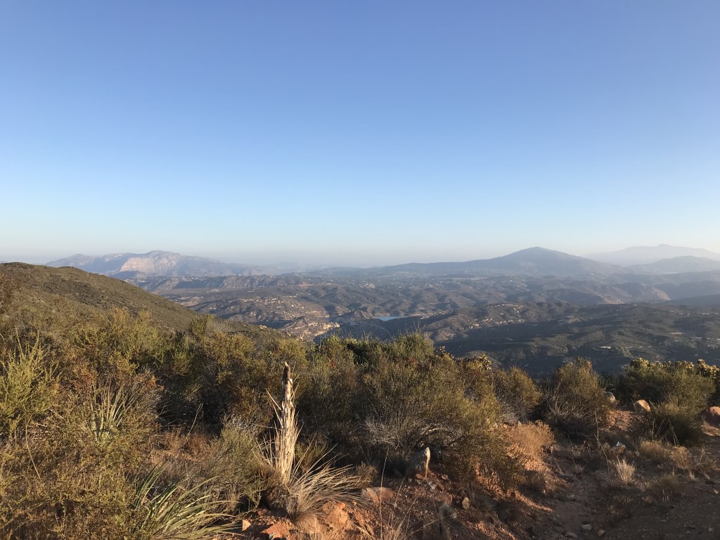
Cappie’s Scoop: Mom loves to visit lookout towers but I don’t. I can’t go inside! If only I could climb the stairs and get a view like that. So many trees, sticks and pine cones to admire all at once. But nope, dogs must stay on the ground. If anyone out there finds one that I can visit, please let my mom know in the comments below! Well I was tricked at first because I thought we were going to Corte Madera Mountain but at the 4-way junction, we made a left instead of a right! So that was exciting! The trail is mostly a fire road and sometimes people zoom by on bikes and not the kind you pedal, the kind that are loud! I’d need my own special seat to ride on one of those without falling off. The road winds up to the top where it’s, well, you guessed it, the no-dogs allowed tower. But it’s a very nice view! We sat to eat treats and drink some water before we headed back down. Don’t hesitate to add YOUR scoop in the comments below!
Tips: None
Directions: From I-8 E take the Buckman Springs Road exit. Turn right on Buckman Springs Road and continue for approximately 3 miles to Corral Canyon Road (note: this road shows up as Morena Stokes Valley Road in Google Maps – the street sign says Corral Canyon). Turn right onto Corral Canyon Road and continue for 4.8 miles until you reach a hairpin turn in the road. At the turn, you will see a gate that indicates the trailhead. Park wherever parking is available off of the pavement. Corral Canyon Road is partially a rough dirt road, and many of the sections that are paved have some large potholes.
| Mileage (round trip) | 7.3 |
| Difficulty | Moderate |
| Gain (in feet) | 1540 |
| Trailhead | 32.735450, -116.557341 |
| Hike Time (in hours) | 4-5 |
| Exposure | Mostly Sunny |
| Scenery | Mountain Views, Forest |
| Facilities | None |
| Fees/Permits | None |
| More Info | http://hikingsdcounty.com/los-pinos-peak |
| Last Hiked | 4/15/2018 |

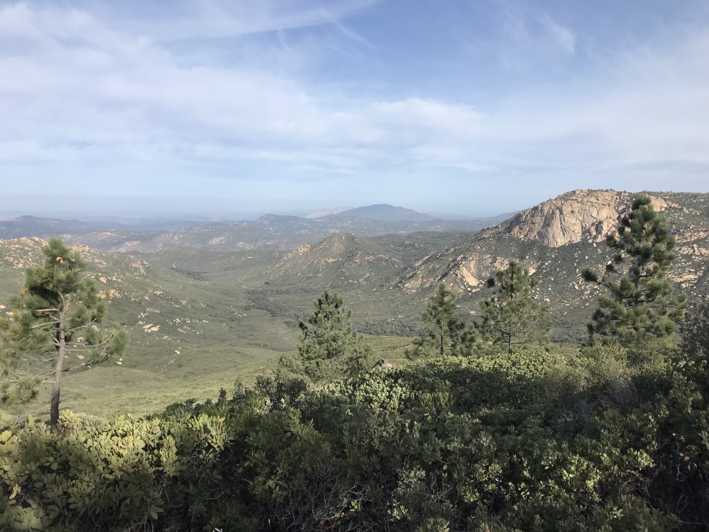
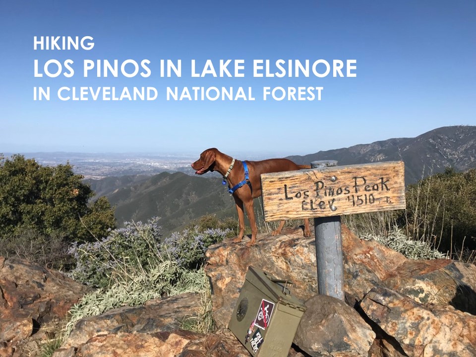
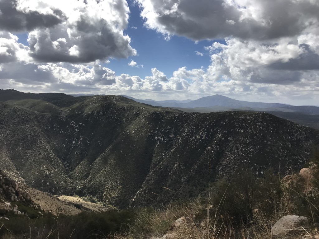
Los Pinos in Lake Elsinore
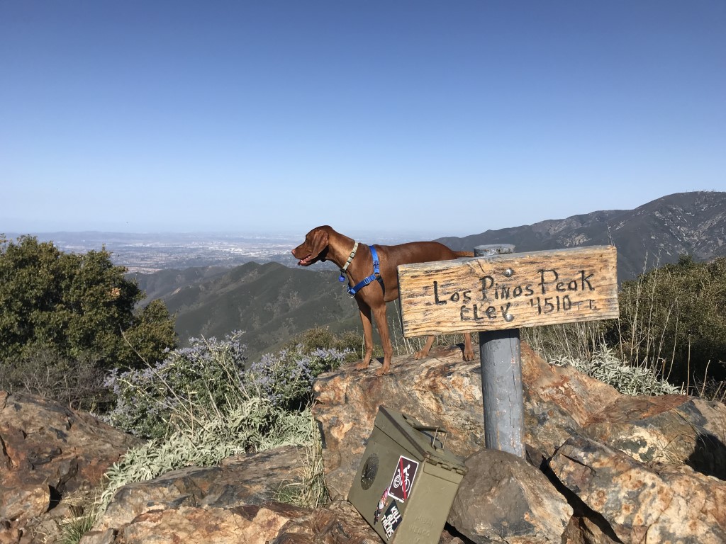
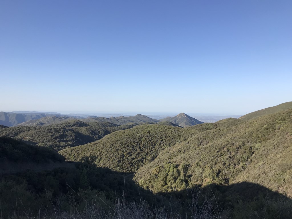
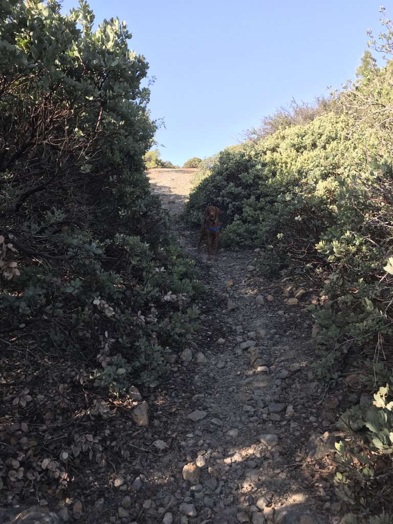
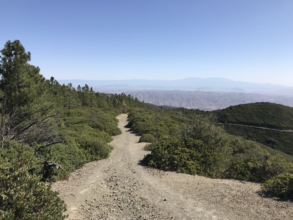
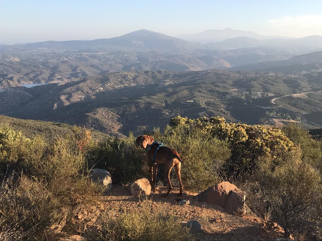
Cappie’s Scoop: You’re not having a deja vu moment if you also read another post about Los Pinos from me. There are two hikes to a Los Pinos Peak! I’m serious because this one did not have a lookout tower so I went all the way to the top and got my picture at the peak! The first part of the trail is a fire road so lookout for trucks and dust when they drive by. Eventually you leave the fire road and turn onto a side trail. The peak is almost hidden and when you find it, it’s like a surprise! Don’t hesitate to add YOUR scoop in the comments below!
Tips: Part of this trail is a fire road so you may encounter vehicles on your hike.
Directions: Park at the junction of the Main Divide Truck Trail and Long Canyon Road – this is near the Blue Jay and Falcon Campground. Depending on where you’re coming from, you can take either I-5 N or I-15 N to get to CA-74/Ortega Highway. From I-5 N, take exit 82 CA-74/Ortega Highway toward San Juan Capistrano. Continue on highway for about 21 miles and turn left onto Forest Rte 6S05/Main Divide Truck Trail. This becomes Long Canyon Road. Continue on this road for 3.5 miles and the trailhead parking will be on the right. From I-15 N, take exit 69 for Baxter Road and turn left onto Baxter Road. Take a slight left onto Central Street, then turn right onto Grand Ave. In 7 miles, turn left onto CA-74/Ortega Highway West. In 5 miles, turn right onto El Cariso Road and then a slight left onto El Cariso Road/N Main Divide. Continue to follow this road as it becomes Forest Rte 3S04. In 2.6 miles, turn left onto Long Canyon Road and the trailhead parking will be on your left.
| Mileage (round trip) | 5.3 |
| Difficulty | Moderate |
| Gain (in feet) | 1350 |
| Trailhead | 33.66222, -117.4478 |
| Hike Time (in hours) | 3-4 |
| Exposure | Mostly Sunny |
| Scenery | Mountain Views, Forest |
| Facilities | None |
| Fees/Permits | California Adventure Pass or Interagency Annual Pass/America the Beautiful Pass (National Parks Pass). |
| More Info | https://socalhiker.net/blue-jay-to-los-pinos; https://modernhiker.com/hike/hiking-los-pinos-peak |
| Last Hiked | 4/14/2018 |

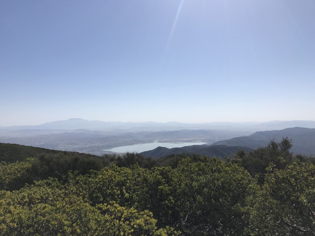
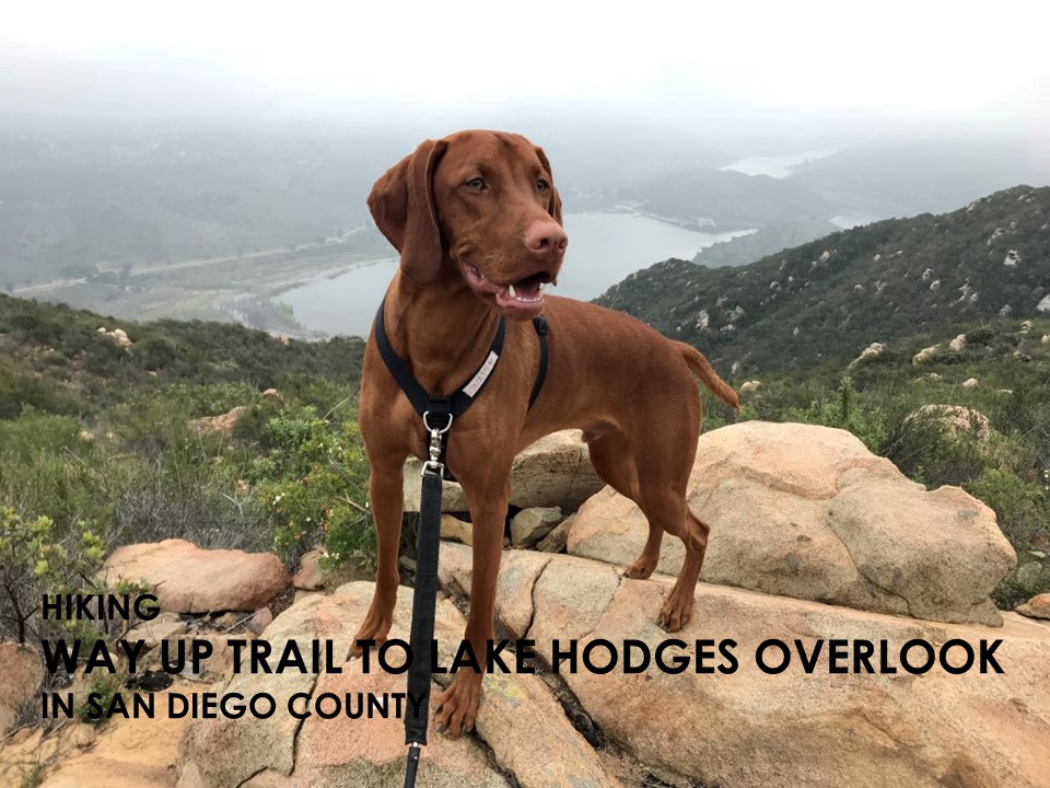
Way Up Trail to Lake Hodges Overlook
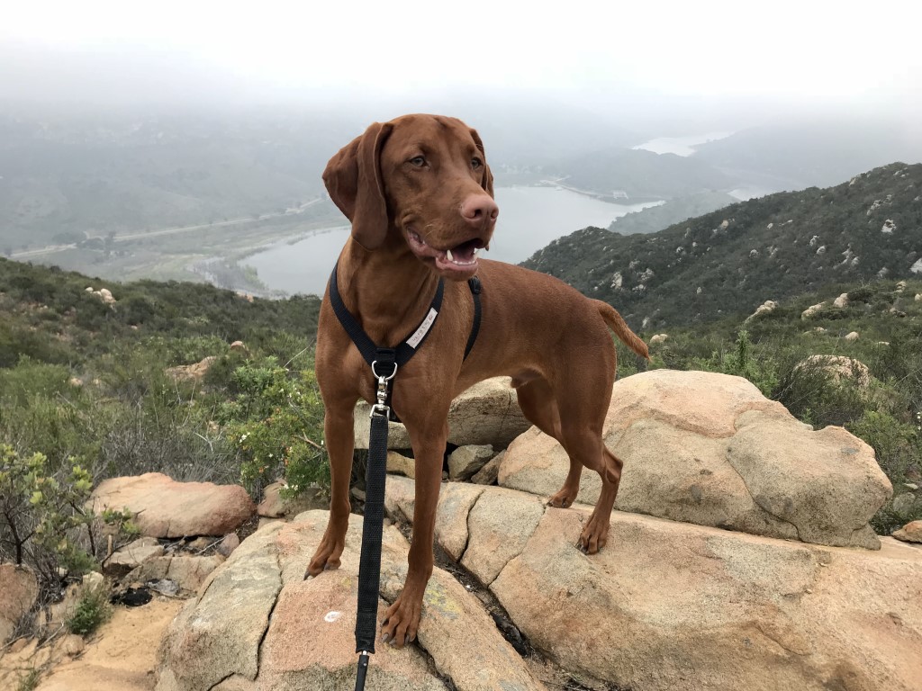
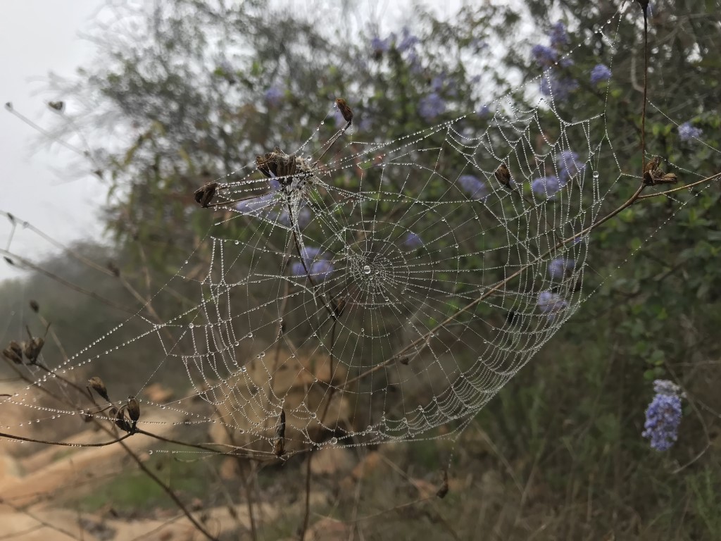
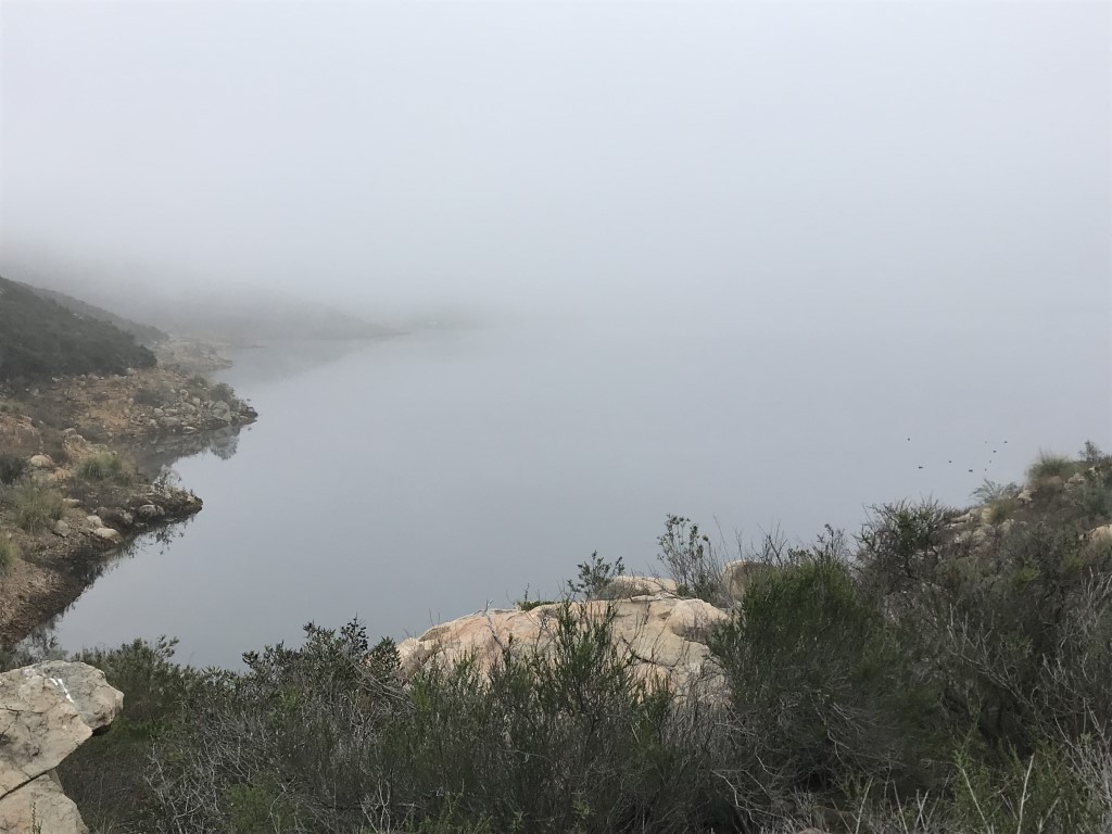
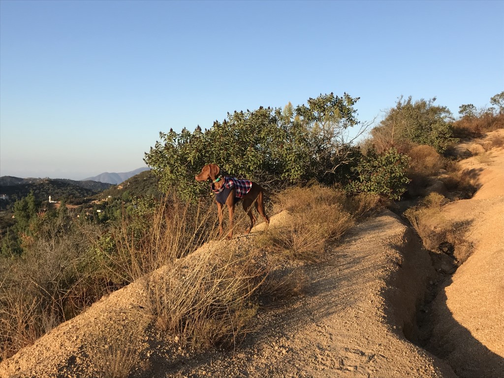
Cappie’s Scoop: We picked a foggy day to do this hike but it made the adventure more interesting because legend has it, the Elfin Forest is haunted (read more at Hidden San Diego). So I kept my eyes open for anything suspicious as we climbed to the top. I found a lot of flowers (very pretty) and a lot of spider webs. The mist brought out the webs that were all around us. I even walked through one and it was stuck on my face. I tried to wipe it off with my paw quickly so I could see what was happening around me. There weren’t many people on the trail. Maybe they knew something I didn’t know. I looked at mom and thought should we go back to the car. But we kept going and eventually reached the top. I saw Lake Hodges and smiled because we made it and everything was OK! Don’t hesitate to add YOUR scoop in the comments below!
Tips: Please respect park hours and do not enter before it opens. Special note dogs under effective voice command are permitted off leash Monday through Friday, but only at the top of the “Way Up” Trail (point marked with sign).
Directions: Park opens at 8am and the parking lot is small. If it’s full, you may need to park on the side of the road or in the overflow parking area. From I-15 take the Valley Parkway exit and go west on West Valley Parkway. Turn right onto Avenida Del Diablo and continue for approximately 0.6 mile. Turn right onto Citracado Parkway, which turns left and becomes Harmony Grove Village Parkway. Turn left onto Harmony Grove Road and continue for 2.2 miles to the Elfin Forest Recreational Reserve on your left.
| Mileage (round trip) | 7.1 |
| Difficulty | Moderate |
| Gain (in feet) | 1542 |
| Trailhead | 33.086705, -117.145345 |
| Hike Time (in hours) | 4-5 |
| Exposure | Mostly Sunny |
| Scenery | Lake Views, Wildlife, Birds, Wildflowers |
| Facilities | Port-a-potties and drinking fountains in parking lot. |
| Fees/Permits | None |
| More Info | http://hikingsdcounty.com/way-traillake-hodges-overlook-elfin-forest-recreational-reserve; https://elfinforest.olivenhain.com/rules |
| Last Hiked | 4/1/2018 |


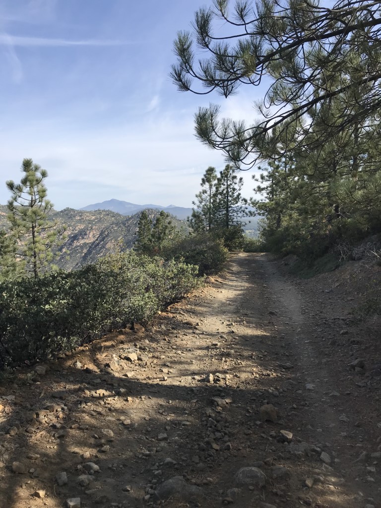
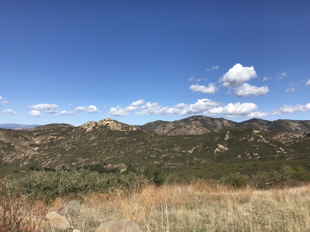
Eagle Peak
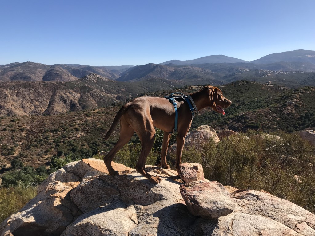
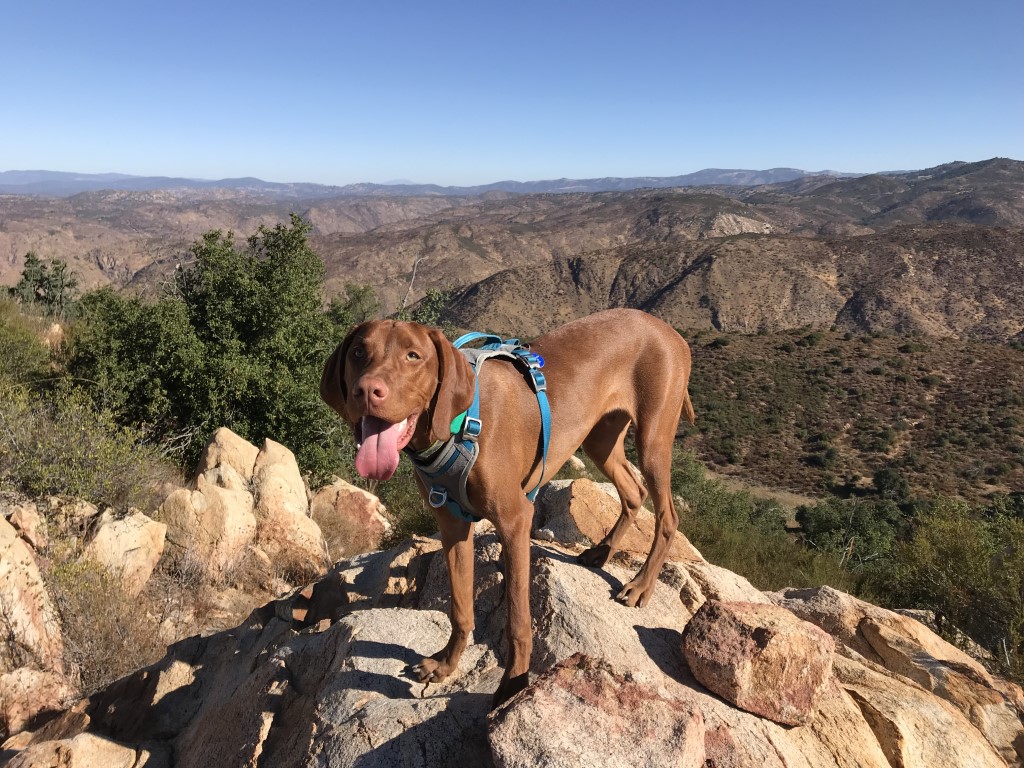
Cappie’s Scoop: The time we hiked this trail, it was freezing early in the morning. I’m glad Mom gets cold like me because then she brings extra clothes and my warm jacket. We drove down a dirt road until we found the parking lot. Wow, so many cars are here, there are going to be a lot of people hiking with us. Cool, more head scratches for me! We got on the trail and then it split. To the left was something called Three Sisters and to the right was Eagle Peak. I told Mom, definitely choose the bird. Always the bird. But to our surprise, no one was hiking the bird trail. Everyone wanted to meet the three sisters. We hiked along and I found some pretty good sticks right in the middle of the trail. This is like a secret stick spot! I told Mom we need to come back to do more stick hunting. We saw the people down on the other trail in the canyon but we had the view of the mountains around us. Don’t hesitate to add YOUR scoop in the comments below!
Tips: Go early because the trailhead parking lot gets really packed due to the Three Sisters Falls trail that also starts from this trailhead.
Directions: From I-8 E, take the CA-79 exit. Follow 79 N for approximately 1.3 miles, then turn left onto Riverside Drive. At 0.9 miles Riverside Drive turns into Viejas Blvd and you will see a market/gas station on the left. Turn left here onto Viejas Grade Rd, then make an immediate right onto Oak Grove Dr. Follow Oak Grove Dr for 1.6 miles and turn right onto Boulder Creek Rd. Continue on Boulder Creek Road for 13 miles until you reach a hairpin turn where you will find the small dirt parking area and trailhead on the left. Boulder Creek Road is a beautiful and exciting mountain road. It is only paved for the first five miles or so, but the dirt portion was in very good condition the last time we hiked there. Expect the drive to be a bit bumpy.
| Mileage (round trip) | 4.4 |
| Difficulty | Moderately Strenuous |
| Gain (in feet) | 1142 |
| Trailhead | 32.984608, -116.677994 |
| Hike Time (in hours) | 3-4 |
| Exposure | Sunny |
| Scenery | Mountain Views, Forest |
| Facilities | None |
| Fees/Permits | None |
| More Info | http://hikingsdcounty.com/eagle-peak |
| Last Hiked | 10/6/2017, 2/19/2018 |

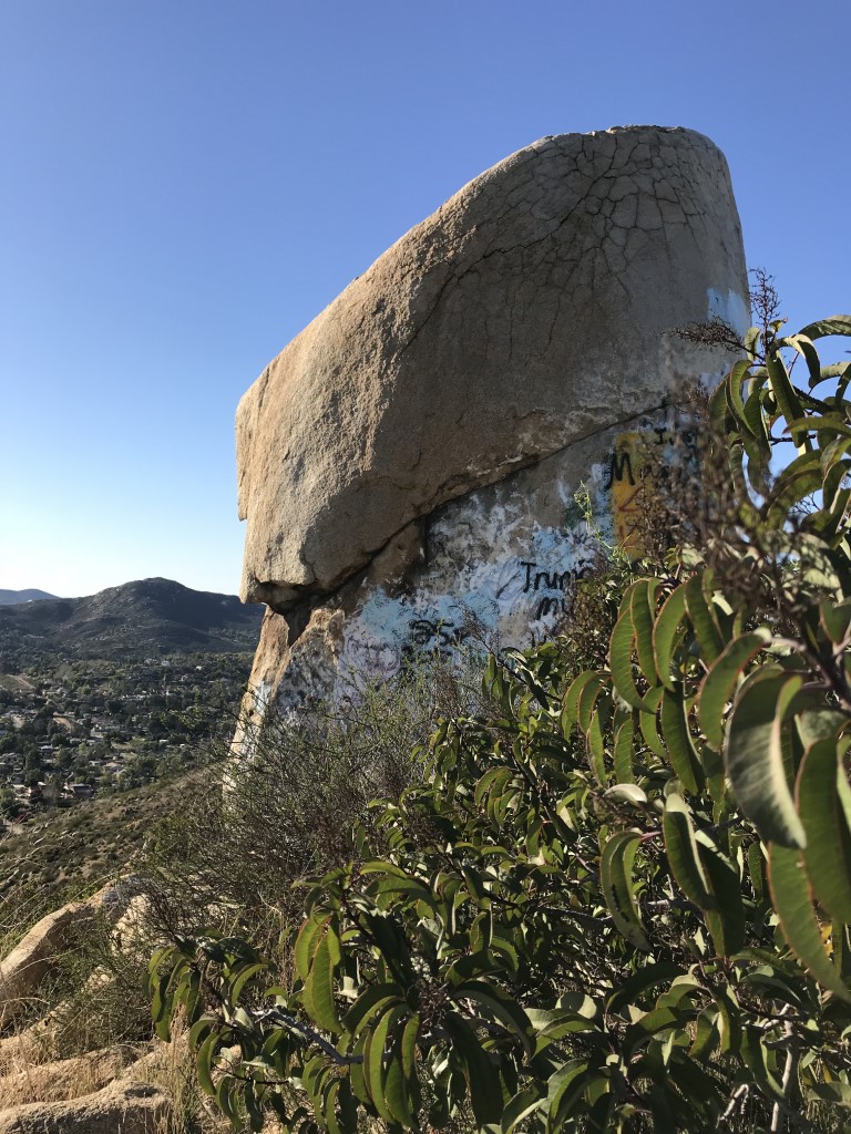
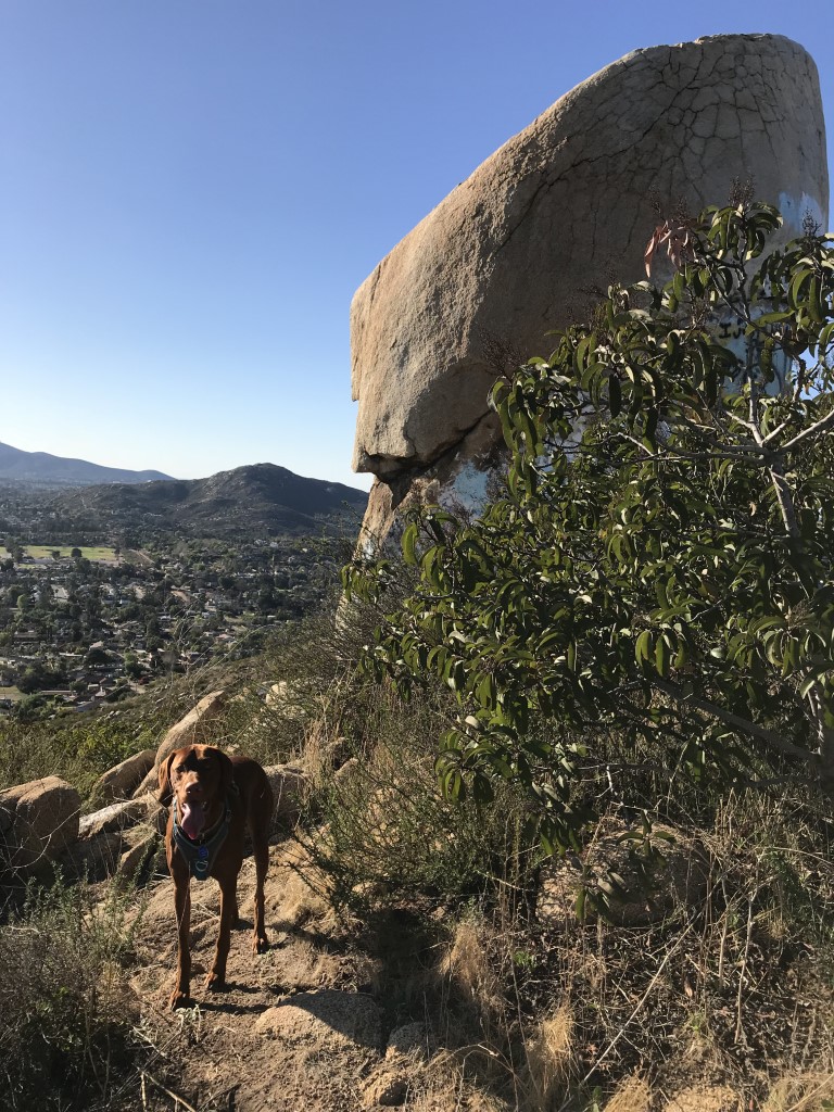
Tooth Rock via Rattlesnake Canyon
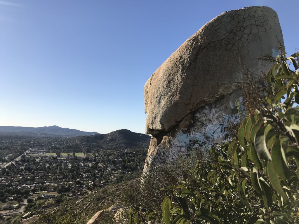
Cappie’s Scoop: When mom said we were going into Rattlesnake Canyon to hike to Tooth Rock, I thought she had too much sugar in her tea and was not making sense. Luckily if we really did see any rattlesnakes, I’ve had my rattlesnake training and I know to stay away from those sneaky noisy animals. We did not see any but we saw a very dirty tooth in the shape of a rock. Or maybe it’s a rock in the shape of a tooth. Either way, you may want to skip this one unless the tooth has had a recent cleaning. Mom almost had to cover my eyes because of some of the writing on the tooth. From the top, you can see Twin Peaks in the distance, one of the first hikes Mom and I did with the dog friendly meetup group. Don’t hesitate to add YOUR scoop in the comments below!
Tips: The trail is in a residential area so be sure to drive slow and keep your eyes open for the small trailhead.
Directions: Take I-15 to the Poway Road exit and head east on Poway Road. Follow Poway Road for 6.1 miles and turn left onto Espola Road. Follow Espola Road for 0.4 miles and turn right onto Range Park Road. Follow Range Park Road for approximately 0.3 miles and find the trailhead on your right. Park on the street.
| Mileage (round trip) | 3.2 |
| Difficulty | Moderate |
| Gain (in feet) | 612 |
| Trailhead | 32.975421, -117.015407 |
| Hike Time (in hours) | 3-4 |
| Exposure | Sunny |
| Scenery | Canyon Views |
| Facilities | None |
| Fees/Permits | None |
| More Info | http://hikingsdcounty.com/tooth-rock-via-rattlesnake-canyon; https://hiddensandiego.net/tooth-rock.php |
| Last Hiked | 2/16/2018 |

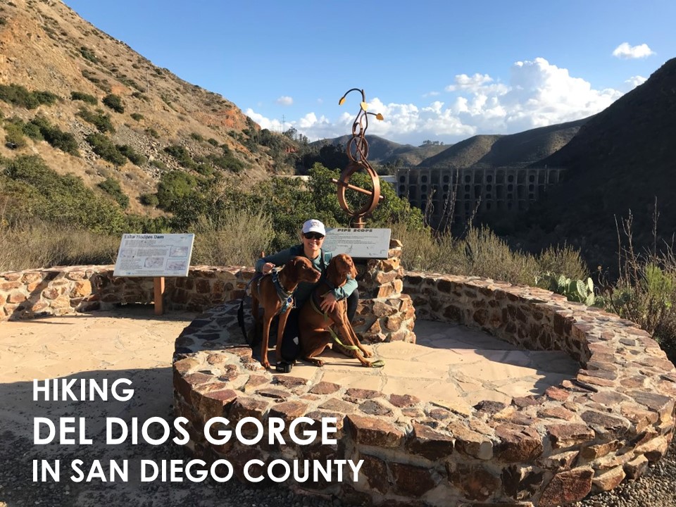
Del Dios Gorge

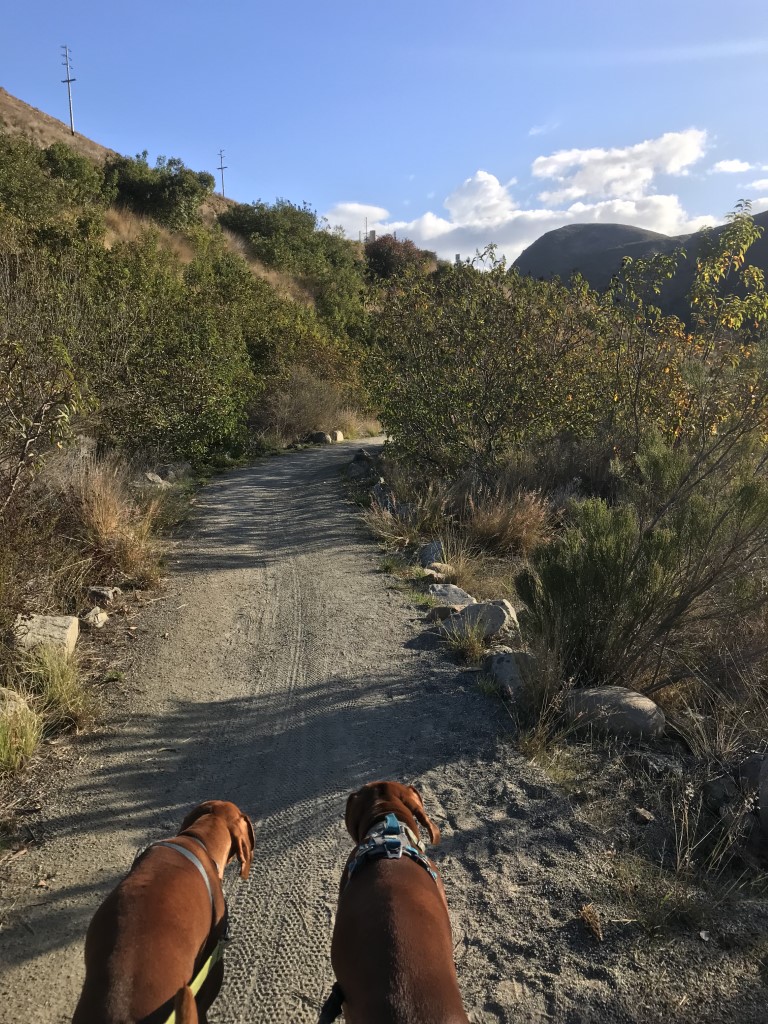
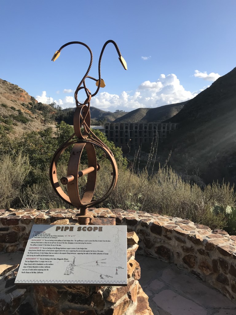
Cappie’s Scoop: When Mom and I first set out to hike this spot, it was part of the Coast to Crest trail challenge. We knew it was a shorter hike with a cool statue at the end of it. I asked my buddy Mickey to come along for the adventure. Who knew we’d both have a cactus run-in as soon as we started out on the trail. Luckily Mom packed my 10 essentials which included a cactus comb. So in no time, she pulled out the bad cactus that jumped on my leg and we were on our way again. Half way through we crossed a fun wooden bridge. I was a little nervous looking over the edge and I told Mickey not to even bother looking, there was no water or ducks. We kept going and then Mom dropped the biggest news on us, she said the statue was a rattlesnake. What?! Don’t we avoid those hissy things and now we’re walking towards one. Mickey and I thought about heading back to the car but I knew Mom had brought along the good treats for us so we stayed for those. They were the better treats because we had a guest with us. I started to see something in the distance but it wasn’t moving. I let Mom go first because she’s in charge (…well sometimes) and everything seemed OK. Turns out a statue is something that doesn’t move and so the rattlesnake is frozen! We took a picture in front of it and I stuck my tongue out at the rattlesnake – you can’t get us! Don’t hesitate to add YOUR scoop in the comments below!
Tips: Rattlesnake viewpoint is named for the stone rattlesnake built here. The area is also home to the C.W. Harris Site Archaeological District, where artifacts from over 9,000 years of human habitation have been found.
Directions: From I-5, take the Via De La Valle exit. Head east on Via De La Valle for approximately 5.2 miles. Turn right onto Paseo Delicias/Highway S6 (Del Dios Highway). Continue on Paseo Delicias/Del Dios Highway for 2.9 miles. Just past Calle Ambeinte, there is a small produce market on the right at 8175 Del Dios Highway. Turn into the market’s parking lot, and find the entrance to the San Dieguito River Park staging area at the southwestern edge of the lot. Drive down the long driveway to find a parking lot at the bottom where we’ll meet. After we meet in the parking lot, we’ll walk south (up the slope) to access the trail. The Coast to Crest Trailhead through the Del Dios Gorge will be on our left.
| Mileage (round trip) | 4.5 |
| Difficulty | Moderate |
| Gain (in feet) | 550 |
| Trailhead | 33.039966, -117.156865 |
| Hike Time (in hours) | 3-4 |
| Exposure | Sunny |
| Scenery | Trees |
| Facilities | None |
| Fees/Permits | None |
| More Info | http://hikingsdcounty.com/del-dios-gorge |
| Last Hiked | 1/20/2018 |

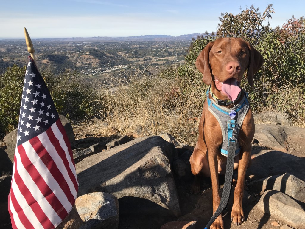
Monserate Mountain
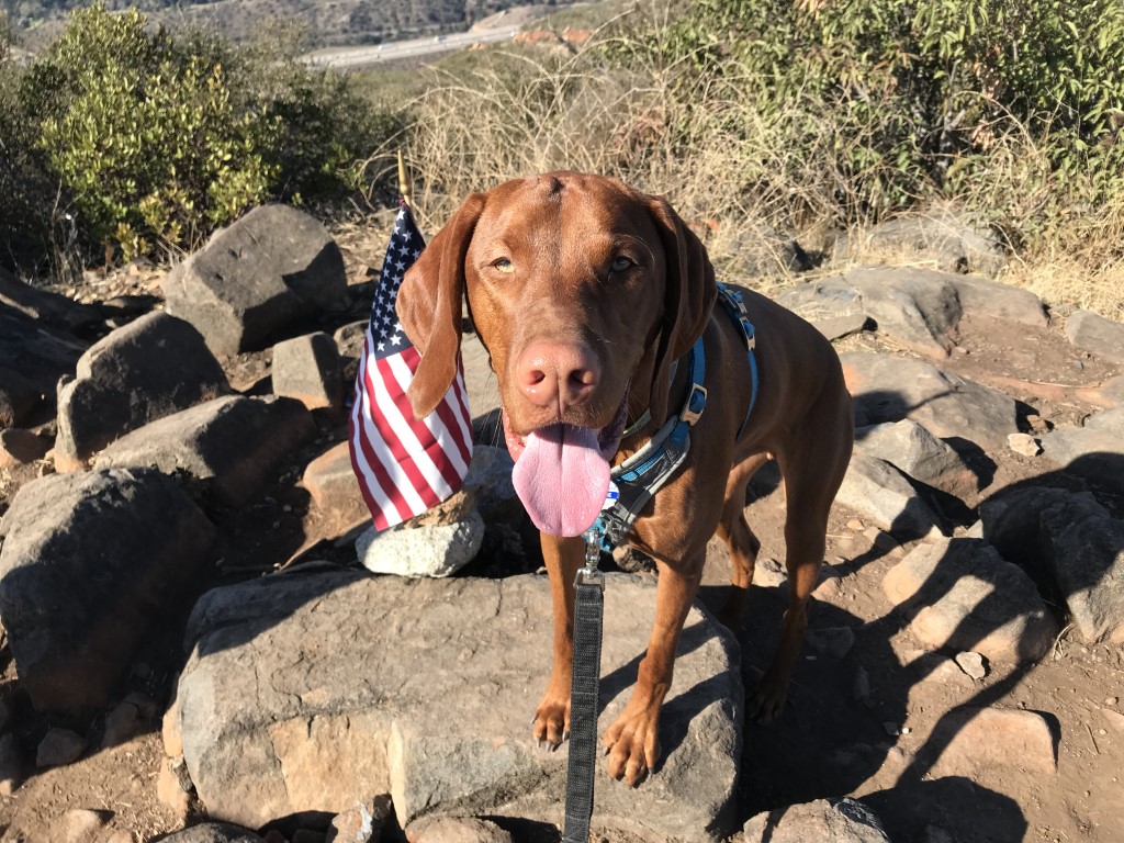
Cappie’s Scoop: Has your pawrent ever drove to the wrong trailhead. Well Mom and I set out to hike a new spot and she put in the wrong directions. I was so excited to hike but when we got there, there was just a patch of dirt and no mountain. So we started driving to the other end of the road and I started seeing a lot of cars so I knew we found it! This is a short hike and you really work on your legs because it’s straight up most of the way. The top is nice and flat and someone had left an American Flag so I asked Mom to take my picture with it. A patriotic moment if I do say so myself! The views aren’t bad but when Mom brings treats, I’ll eat them looking at anything, a rock, some trees, a highway, a construction site. She made the mistake of packing oranges and forgot I’m not big on the citrus fruit. She learned after I spit it out. Next time Mom, remember the watermelon. Don’t hesitate to add YOUR scoop in the comments below!
Tips: None
Directions: From I-15 N, take exit 46 for CA-76 exit toward Pala/Oceanside/Bonsall/Palomar Mount. Turn right onto CA-76 E, and after approximately 0.7 mile turn left onto Horse Ranch Creek Rd. The dirt parking lot is about 2.2 miles on your left.
| Mileage (round trip) | 3.2 |
| Difficulty | Moderately Strenuous |
| Gain (in feet) | 1150 |
| Trailhead | 33.365954, -117.159099 |
| Hike Time (in hours) | 3-4 |
| Exposure | Sunny |
| Scenery | Mountain Views |
| Facilities | None |
| Fees/Permits | None |
| More Info | http://hikingsdcounty.com/monserate-mountain |
| Last Hiked | 1/15/2018 |


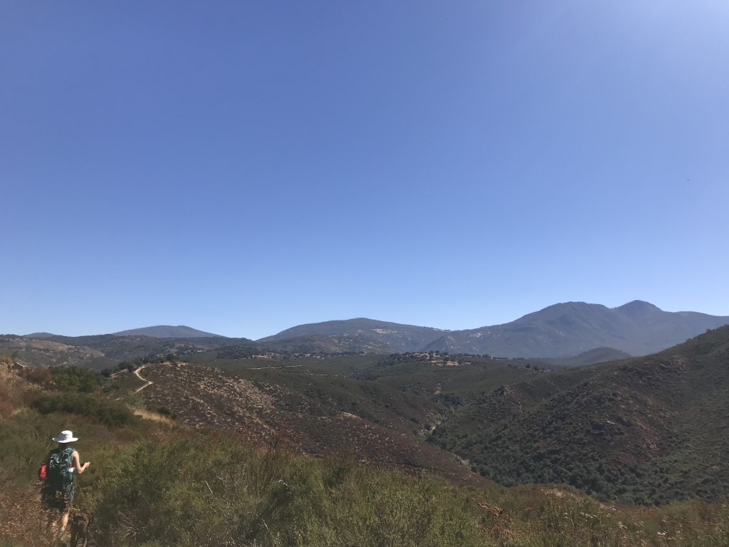
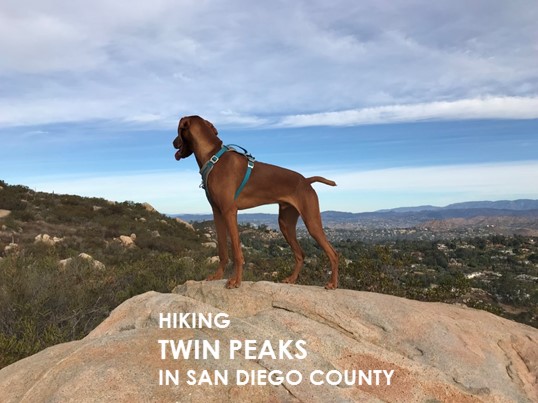
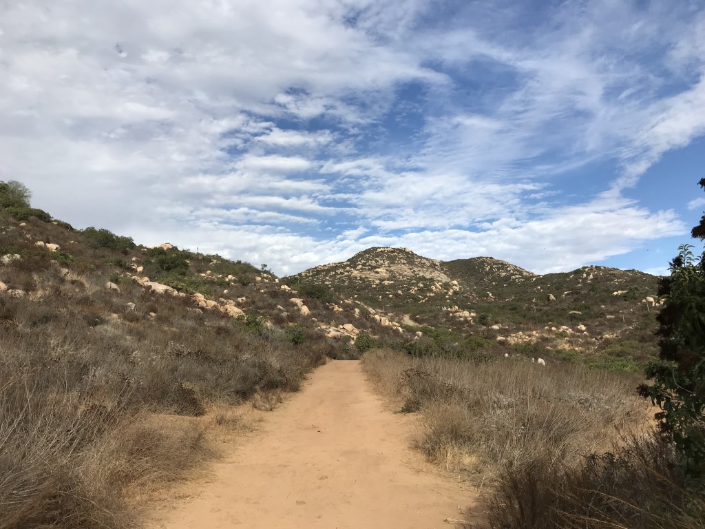
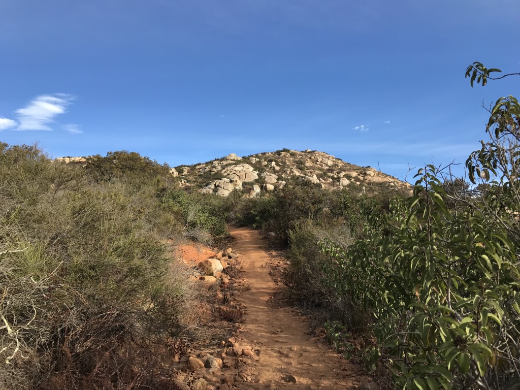
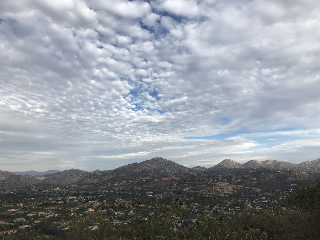
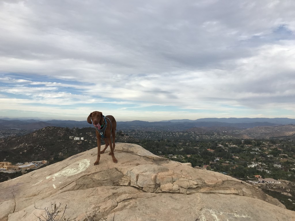
Twin Peaks
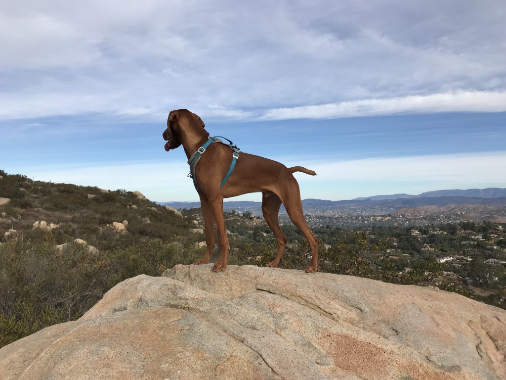
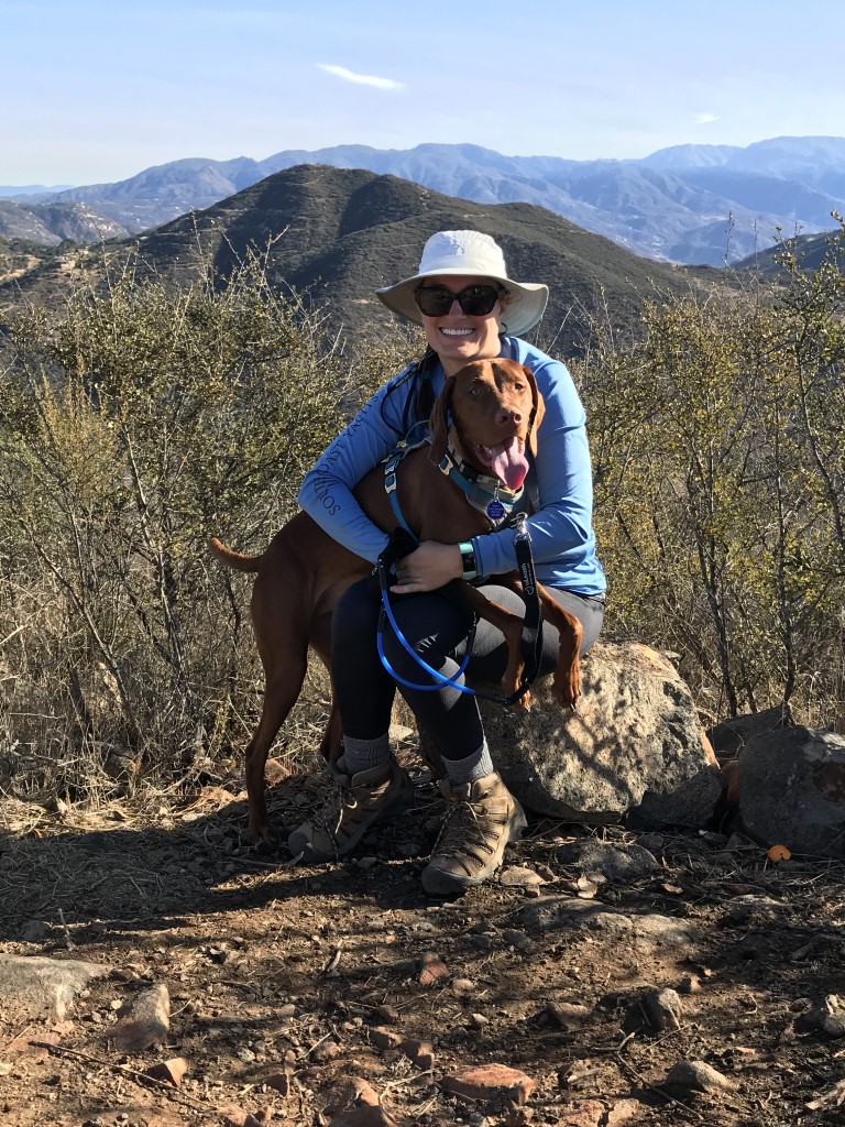
Cappie’s Scoop: Who doesn’t love two things for the price of one! Like two treats, two bones, or even better two sticks! Mom and I drove to Poway to tackle two peaks. As we turned into the parking lot for Silverset Park, I saw the trailhead on my left outside the car window and got excited! I jumped out of the car (once we parked and Mom opened the door) and we headed to the trailhead. Everything smelled good so we started up the trail and found ourselves alone. YES, the whole trail to ourselves. Once we reached the first peak, I jumped on a rock and checked out the town in the distance. Mom told me to keep my eyes open for the hooman “tooth rock” in the east but I forgot my compass so I made Mom look for it instead. It looked like another rock to me! The path to the next peak was slightly overgrown but I still made Mom run through it. Glad she had hiking pants on that day. I checked out the view on the second peak and all looked good. So we made our way back down the trail and said hello to other hoomans coming up. Don’t hesitate to add YOUR scoop in the comments below!
Tips: None
Directions: Can also use address 14795 Silverset St, Poway, CA 92064. Trailhead begins on your left hand side as soon as you turn into the park.
| Mileage (round trip) | 2.15 |
| Difficulty | Moderate |
| Gain (in feet) | 745 |
| Trailhead | 32.981005, -117.051387 |
| Hike Time (in hours) | 2-3 |
| Exposure | Sunny |
| Scenery | Mountain Views |
| Facilities | Restrooms and water at Silverset Park. |
| Fees/Permits | None |
| More Info | http://hikingsdcounty.com/twin-peaks |
| Last Hiked | 11/17/2017, 1/7/2018 |
Sycuan Peak
Cappie’s Scoop: This is a fun short hike with nice views! I’ve never seen anyone else on this trail so it’s nice and quiet. Don’t hesitate to add YOUR scoop in the comments below!
Tips: None
Directions: Take 94 East until it turns into Campo Road. Turn right onto CA-94 E/Campo Road and continue on Campo Road for 4.5 miles. Turn left onto Lyons Valley Road and after 1.6 miles, Lyons Valley Road turns into Skyline Truck Trail. Continue on Skyline Truck Trail for 2.2 miles and turn left onto Lawson Valley Road. Continue on Lawson Valley Road for another 2.2 miles. The trail head is at a narrow dirt turn out on the left side of the road, just past mile marker 2.5. Make sure you park completely off the road.
| Mileage (round trip) | 2.15 |
| Difficulty | Moderate |
| Gain (in feet) | 743 |
| Trailhead | 32.74673, -116.79896 |
| Hike Time (in hours) | 1-2 |
| Exposure | Sunny |
| Scenery | Mountain Views |
| Facilities | None |
| Fees/Permits | None |
| More Info | https://hikingsdcounty.com/sycuan-peak |
| Last Hiked | 12/1/2017 |

Black Mountain via Nighthawk Trail
Cappie’s Scoop: I heard that this hike gets packed with lots of hoomans but mom and I had the trail all to ourselves the day we went. It was kind of spooky. The clouds were out which helped a lot because there is no shade on this trail. After the hike, we returned the same way and sat in the park for a while drinking water and eating treats. Don’t hesitate to add YOUR scoop in the comments below!
Tips: We started our hike from Hilltop Community Park.
Directions: Can use address for Hilltop Community Park, 9748 Oviedo Way, San Diego, CA 92129. Or from I-15, take 56 West to the Black Mountain Road exit. Go north on Black Mountain Road for approximately 1 mile and turn right on Oviedo Street. Continue on Oviedo Street for approximately 0.2 miles, then turn right onto Oviedo Way. Follow Oviedo Way to the end (0.6 miles) to Hilltop Community Park.
| Mileage (round trip) | 4.1 |
| Difficulty | Moderate |
| Gain (in feet) | 700 |
| Trailhead | 32.971404, -117.117610 |
| Hike Time (in hours) | 3-4 |
| Exposure | Sunny |
| Scenery | Mountain Views |
| Facilities | Restrooms and water in the park. |
| Fees/Permits | None |
| More Info | http://hikingsdcounty.com/black-mountain-via-nighthawk-trail; https://modernhiker.com/hike/hiking-black-mountain |
| Last Hiked | 11/17/2017 |