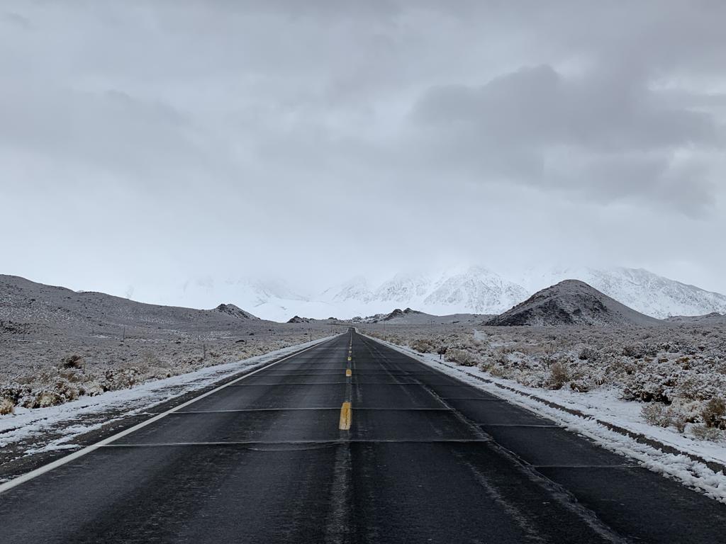
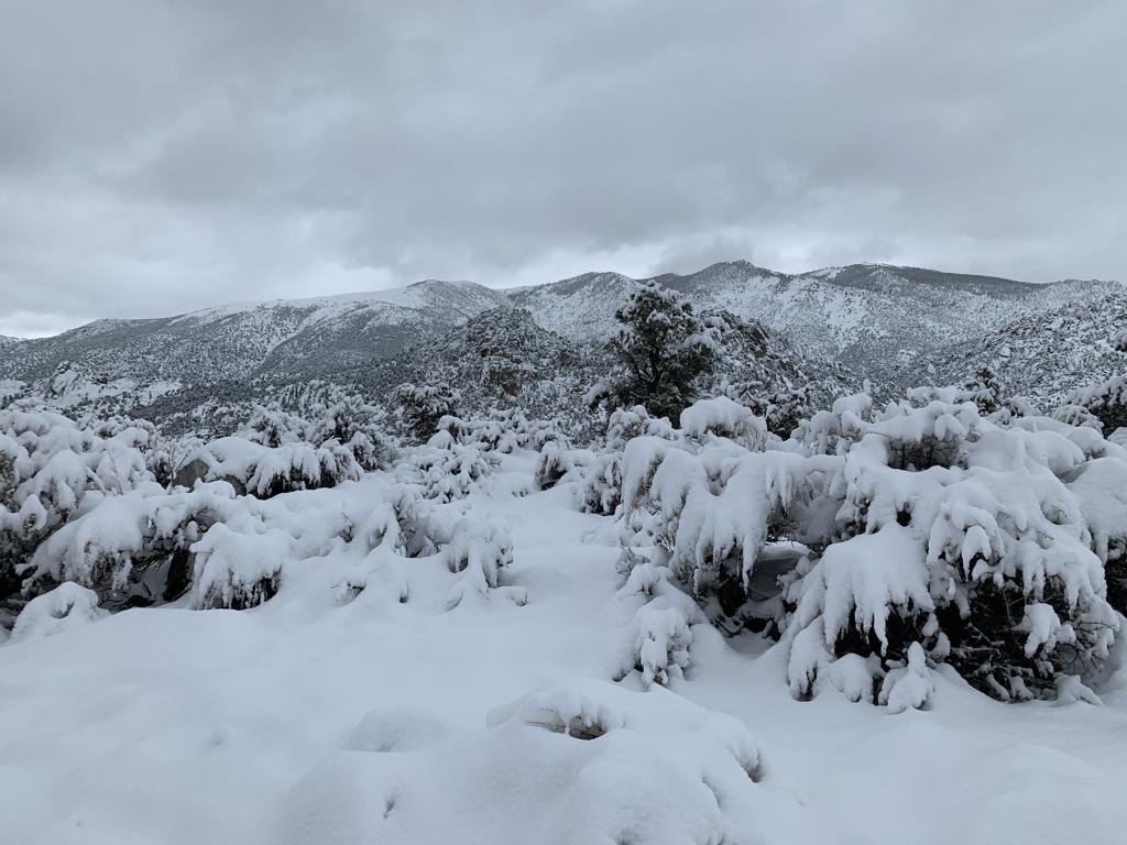
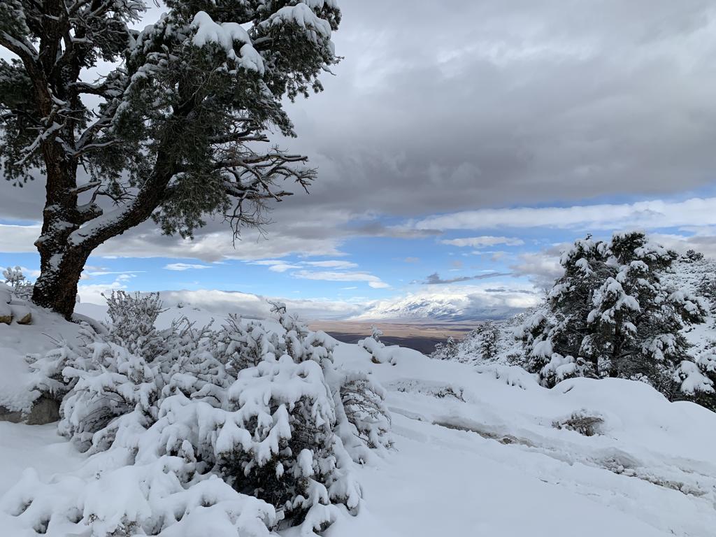
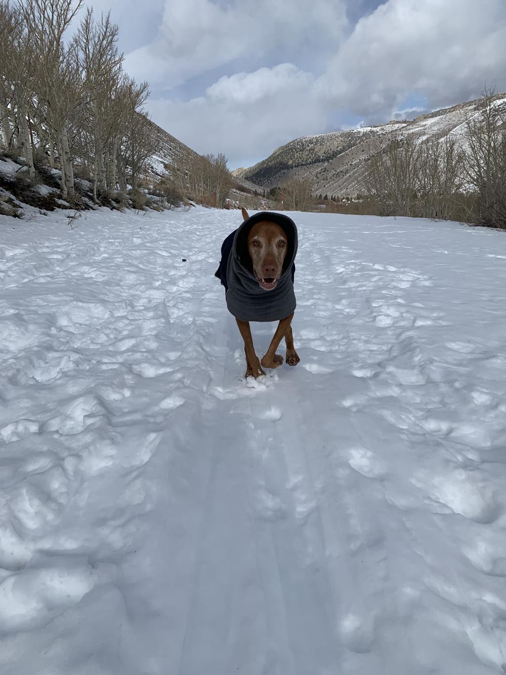
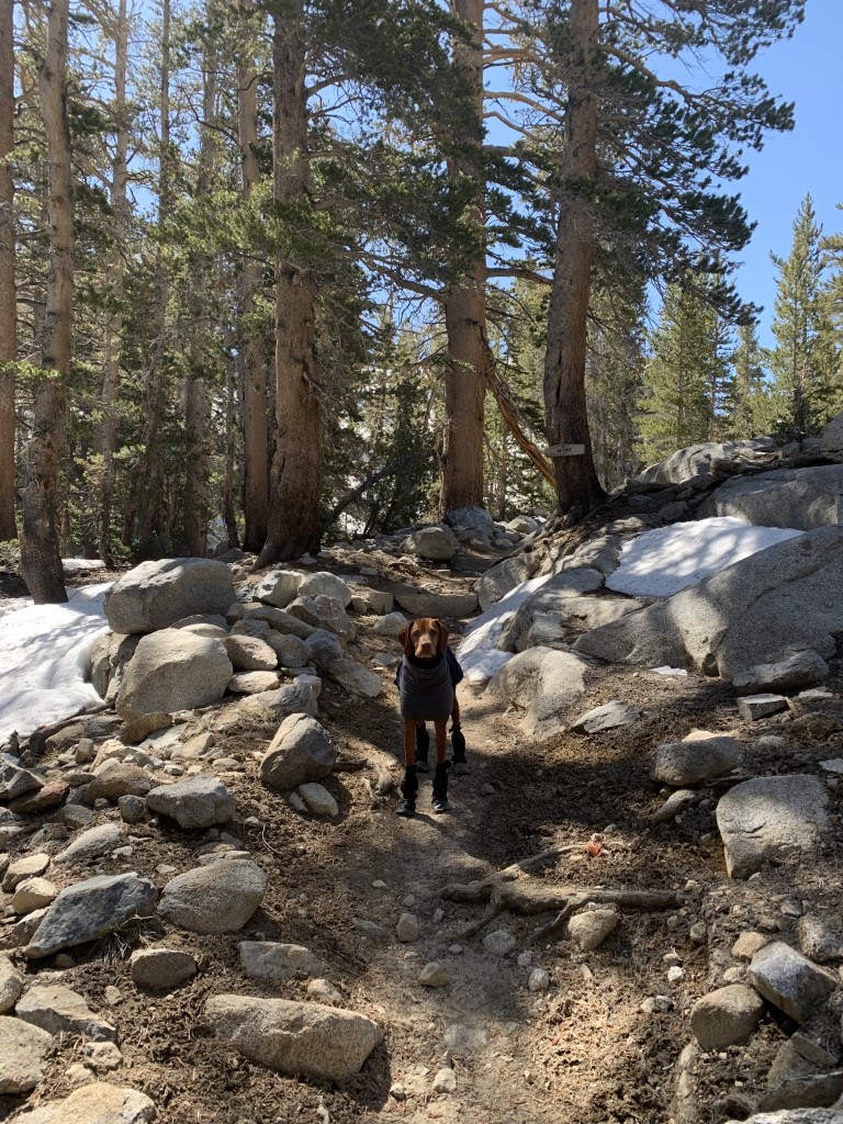
Buttermilks Fire Road
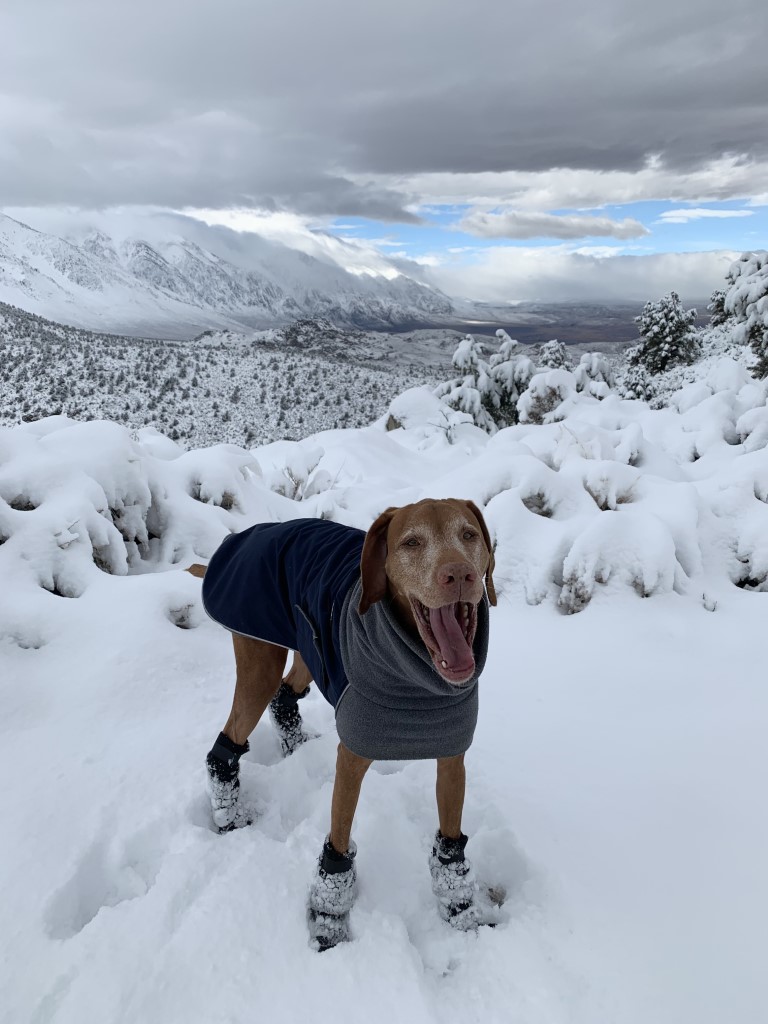
Cappie’s Scoop: This is a fun snow hike! Mom can snowshoe and I can zoom around in the snow. But even though the road was covered in snow, it wasn’t closed. There were two trucks that came by doing some off-road driving for fun. They waved to me as they passed which was very nice! Don’t hesitate to add YOUR scoop in the comments below!
Tips: This is a snowshoe we did in the winter and hiked up Forest Road 7S15.
Directions: From the town of Bishop, head west on CA-168 for about 9.8 miles and then turn right into what looks like a pullout. There is ample room for you to park off the road. The Forest Road 7S15 will be on your left going straight up towards the mountains and running parallel with CA-168.
| Mileage (round trip) | 4+ |
| Difficulty | Moderate |
| Gain (in feet) | 1700+ |
| Trailhead | 37.310467, -118.524304 |
| Hike Time (in hours) | 4-5 |
| Exposure | Sunny |
| Scenery | Mountain Views |
| Facilities | None at the trailhead. Vault toilets at the campground. Bring your own toilet paper. |
| Fees/Permits | None to park and none to camp. If you intend to build a fire in the provided fire rings at the campground, you will need a free CA campfire permit. You can obtain one by watching this short video online, https://www.readyforwildfire.org/permits/campfire-permit. |
| More Info | https://roads.dot.ca.gov (to check road conditions) |
| Last Hiked | 1/1/2023 |


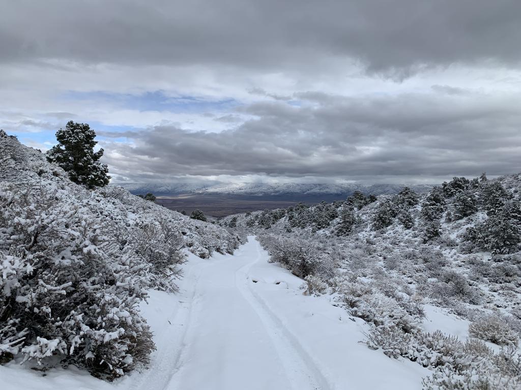
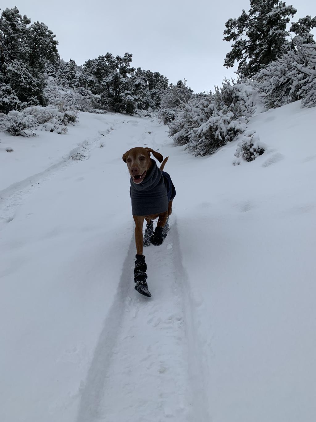


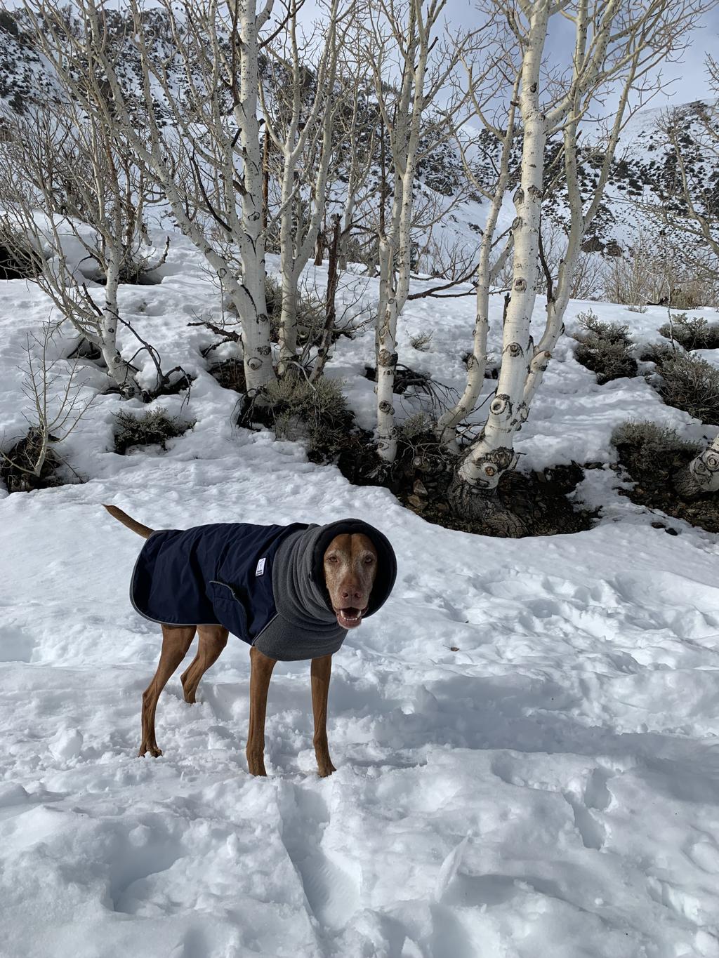
South Lake Road
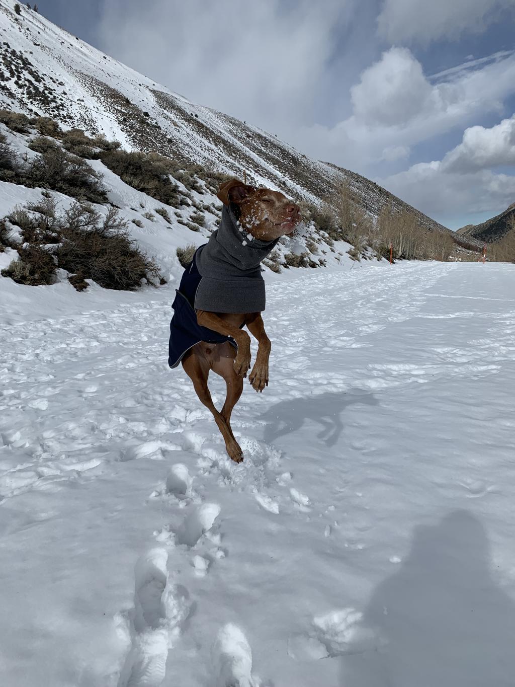
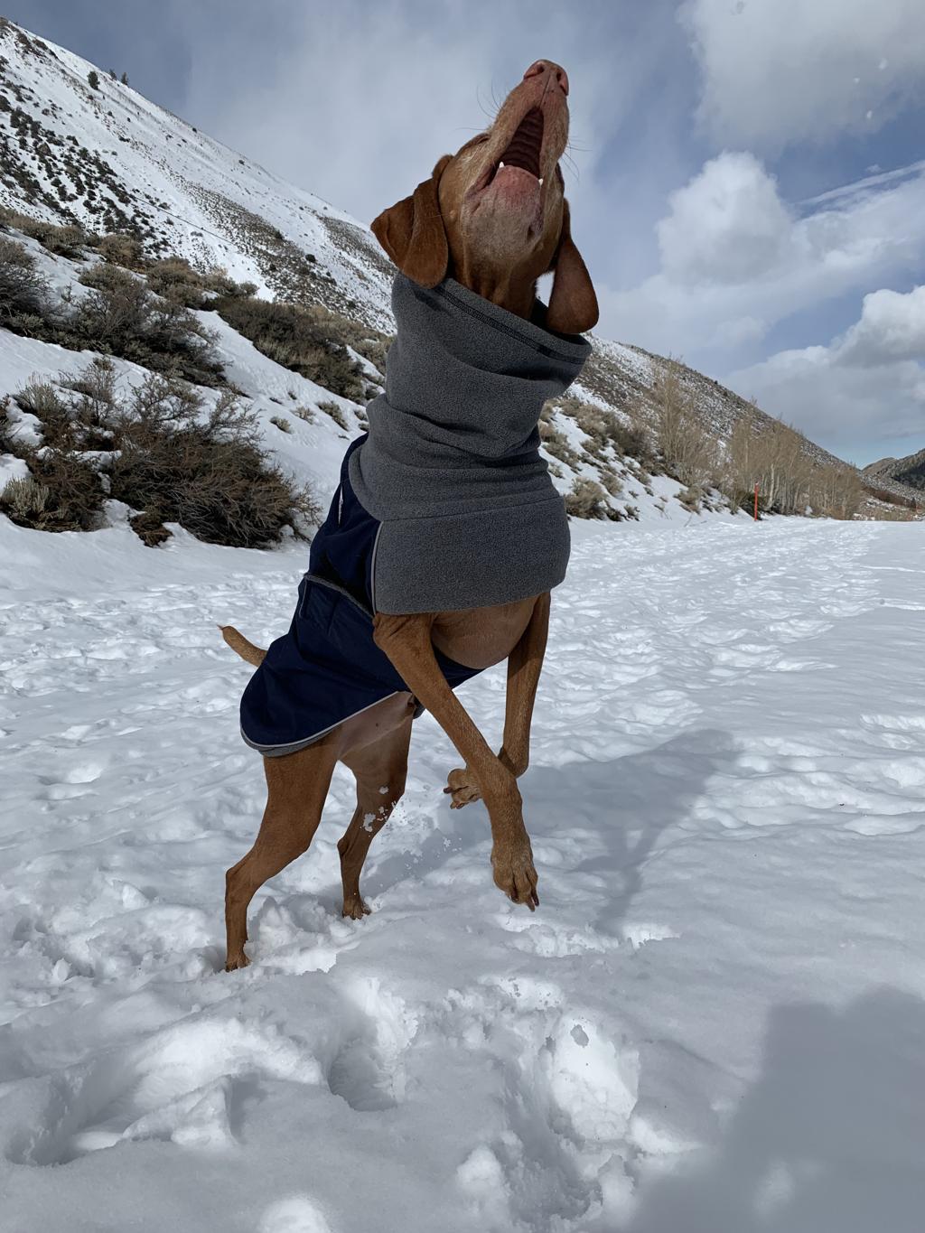
Cappie’s Scoop: This is a fun snow hike! Since this is a closed road covered in snow, it’s like a huge hiking trail! Mom can snowshoe and I can zoom around in the snow. We also saw lots of hoomans cross-country skiing. It was cool! Mom thinks we should bring a sled next time. Don’t hesitate to add YOUR scoop in the comments below!
Tips: This is a snowshoe we did in the winter when South Lake Road was closed. We snowshoed up the road a bit and had amazing views!
Directions: From the town of Bishop, head west on CA-168 for about 15 miles and then turn left onto South Lake Drive and continue driving until you reach the road closed sign during the winter and park on the side of the road.
| Mileage (round trip) | 3+ |
| Difficulty | Moderate |
| Gain (in feet) | 500+ |
| Trailhead | 37.233845, -118.566218 |
| Hike Time (in hours) | 2-3 |
| Exposure | Sunny |
| Scenery | Mountain Views |
| Facilities | None at the trailhead. Vault toilets at the campground. Bring your own toilet paper. |
| Fees/Permits | None to park and none to camp. If you intend to build a fire in the provided fire rings at the campground, you will need a free CA campfire permit. You can obtain one by watching this short video online, https://www.readyforwildfire.org/permits/campfire-permit. |
| More Info | https://roads.dot.ca.gov (to check road conditions) |
| Last Hiked | 12/30/2022, 2/17/2023 |

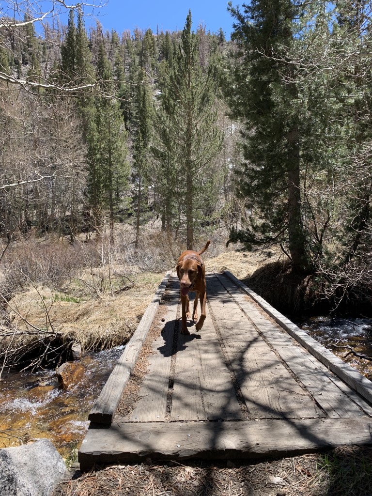
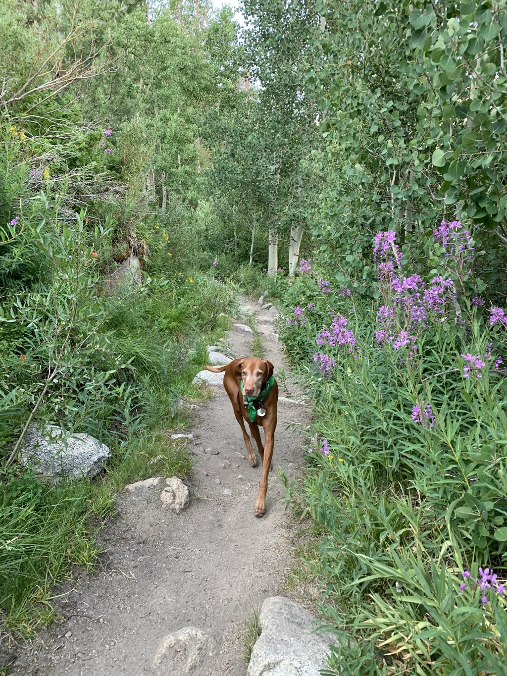
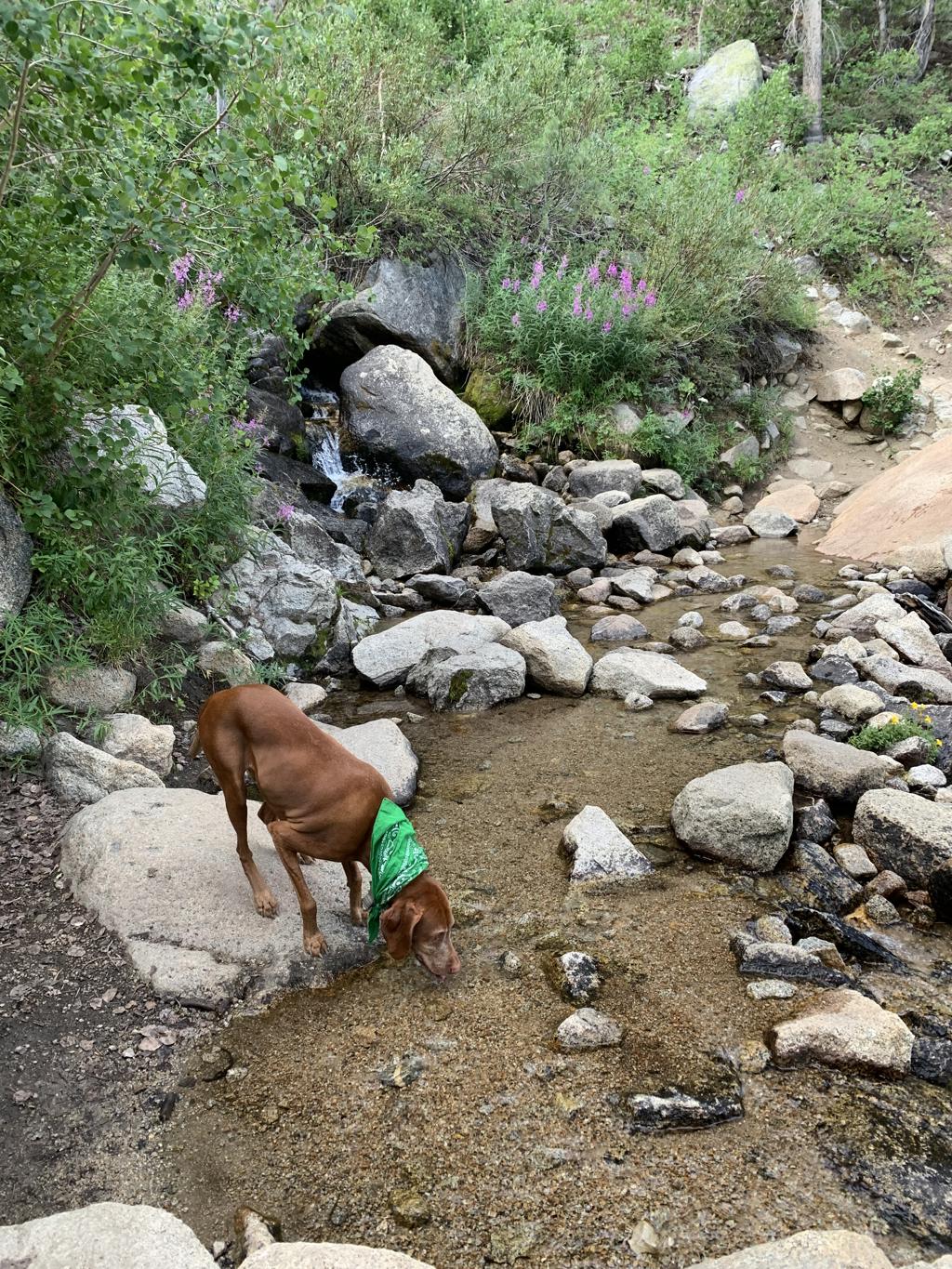
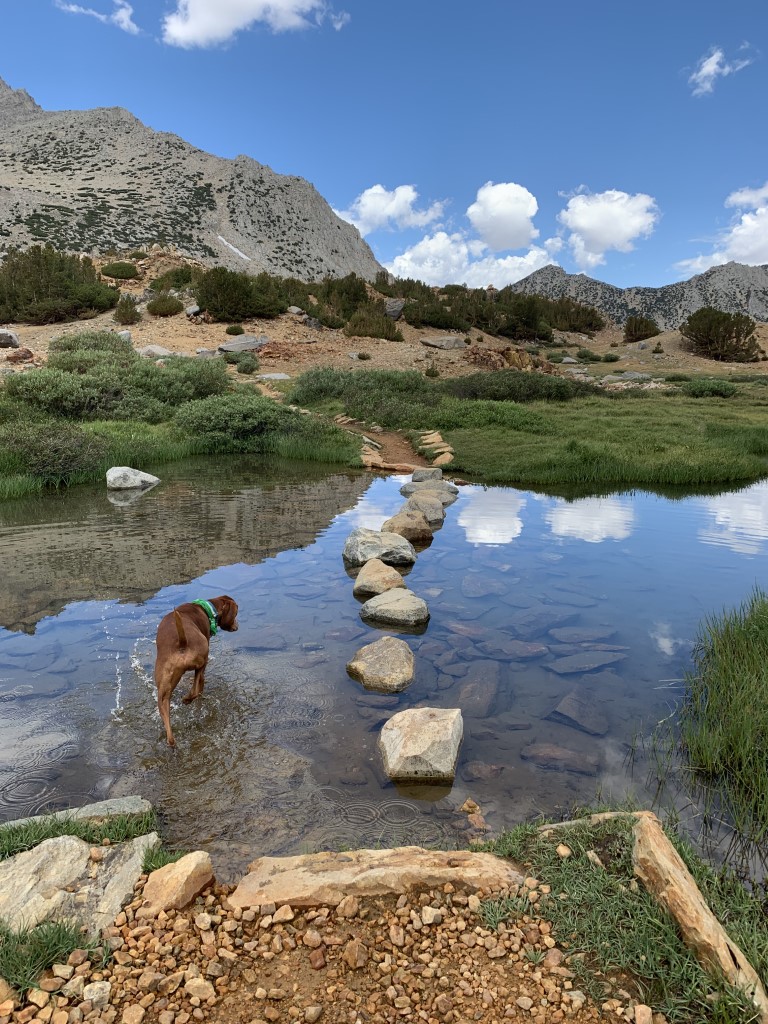
Lake Sabrina to Emerald Lakes
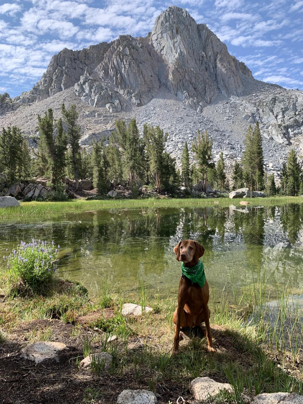
Cappie’s Scoop: This trail has a lot of big rocks that I can climb on to see a view of Lake Sabrina! I wanted to swim in the lake but mom said we’re hiking to another lake and I would be able to swim there. Along the trail, we passed a waterfall that covered the trail. I walked in the water to cross but mom went rock hopping. When we got to Blue Lake, I told mom it was swimming time! It was great! The water was cool and there were even spots to camp. Then we kept going to see more lakes. I can’t wait to come back and stay the night in a tent so I can swim a few times. Don’t hesitate to add YOUR scoop in the comments below!
Tips: We thought Lake Sabrina was beautiful and then you continue hiking and you reach Blue Lake, also equally as gorgeous! About halfway along Blue Lake’s western shore, you will head west on the Dingleberry Lake trail. You will see a junction sign for this turnoff. The other option is to head south to reach Donkey Lake and the Baboon Lakes. There are so many lakes in this area, we can’t wait to see them all but it will have to be a backpacking trip!
Directions: From the town of Bishop, head west on CA-168 for 18 miles. Continue straight for another 0.4 miles on Lake Sabrina Road. The trailhead will be on your left and you can park on the side of the road. This road is closed during the winter.
| Mileage (round trip) | 7.2 |
| Difficulty | Strenuous |
| Gain (in feet) | 1721 |
| Trailhead | 37.213582, -118.610107 |
| Hike Time (in hours) | 4-5 |
| Exposure | Sunny and Shady |
| Scenery | Mountain Views, Forest, Alpine Lake Views, Waterfalls |
| Facilities | None |
| Fees/Permits | None |
| More Info | https://modernhiker.com/hike/hike-sabrina-basin-to-emerald-lakes |
| Last Hiked | 7/30/2022 |

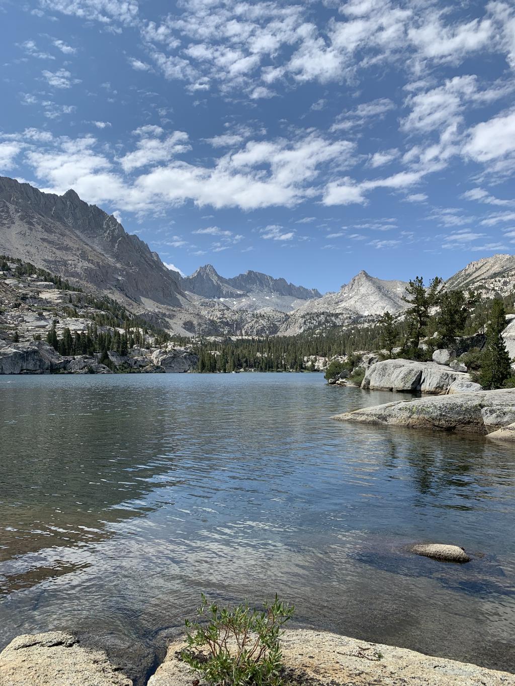


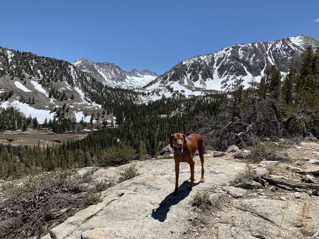
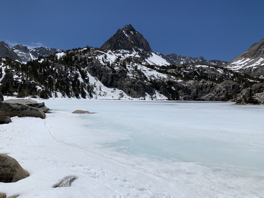
Bishop Pass

Cappie’s Scoop: I started very early because I knew we were going very far this time on the trail. I was going all the way to the pass! Last time I was here, I hiked in the snow to only Long Lake but this time, I was going all the way up! It was a great day too because the sun was shining and I could dip my paws in the water. I hiked up very high going over lots of rocks until I reached a strange sign that said, no dogs past this sign! What?! That’s okay because I had a lot of fun and we passed so many other trails along the way for Treasure Lakes and Chocolate Lakes so we’ll be back! Don’t hesitate to add YOUR scoop in the comments below!
Tips: This trailhead is really awesome because you have a menu of trails to hike once you get on Bishop Pass Trail. You can hike to the pass (posted here), Long Lake, Chocolate Lakes loop, Marie Louise Lakes or Treasure Lakes. The trails are marked at the junctions. We cannot wait to go back and hike all of these trails and even backpack a few too!
Directions: From the town of Bishop, head west on CA-168 for 14.7 miles and then turn left onto South Lake Rd. Continue on South Lake Rd for 7.1 miles until it ends at the parking lot/trailhead for Bishop Pass Trail. This road is closed during the winter.
| Mileage (round trip) | 10 |
| Difficulty | Strenuous |
| Gain (in feet) | 2345 |
| Trailhead | 37.169428, -118.566068 |
| Hike Time (in hours) | 6-7 |
| Exposure | Sunny and Shady |
| Scenery | Mountain Views, Forest, Alpine Lake Views, Creek |
| Facilities | Toilets at the trailhead. |
| Fees/Permits | None |
| More Info | https://www.fs.usda.gov/recarea/inyo/recarea/?recid=20358&actid=50 |
| Last Hiked | 7/29/2022 |


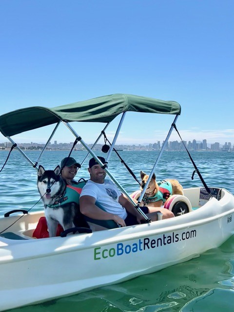
Pedal Boating
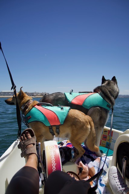
The Parkhouse Pack’s Scoop: We decided to beat the summer heat with the dogs and check out pedal boating with Eco Boat Rentals in San Diego, what a fun outing! The boat was good sized – smaller than a Duffy but much bigger than a kayak, which helped give the dogs room to settle but not easily jump out to swim – looking at you Aspen. We did the hour rental and pedaled around San Diego bay with a great view of the downtown skyline. The staff is super helpful and even put a Bluetooth speaker in the boat for us to connect to while pedaling, and if you don’t have a life jacket for your dog(s) they have some to borrow. Afterwards we had lunch on the dock at Point Loma Seafoods. There is also Eppig Brewing right on the docks as well, or Balboa Park is nearby for a dog-friendly walk (though crowded on weekends).
| Location | 2803 Emerson St Dock #1, San Diego, CA 92106 |
| More Info | https://www.ecoboatrentals.com |
| Follow Us! | @sandi_n_aspen |


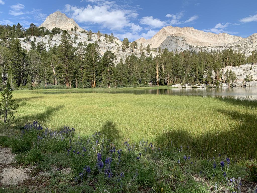
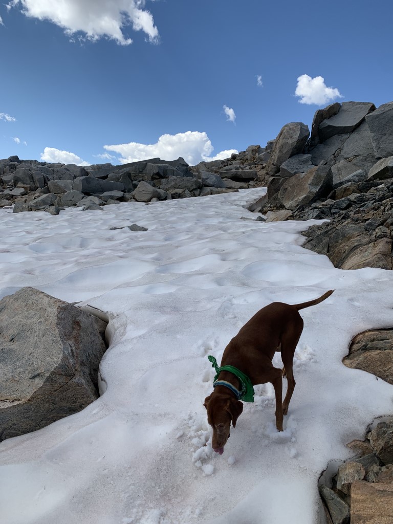
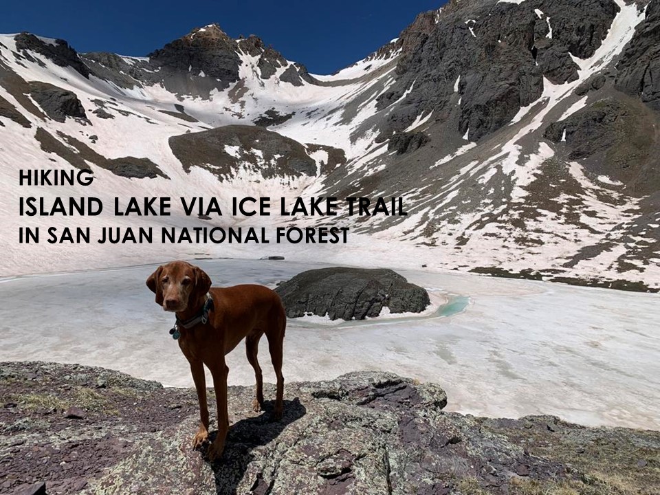
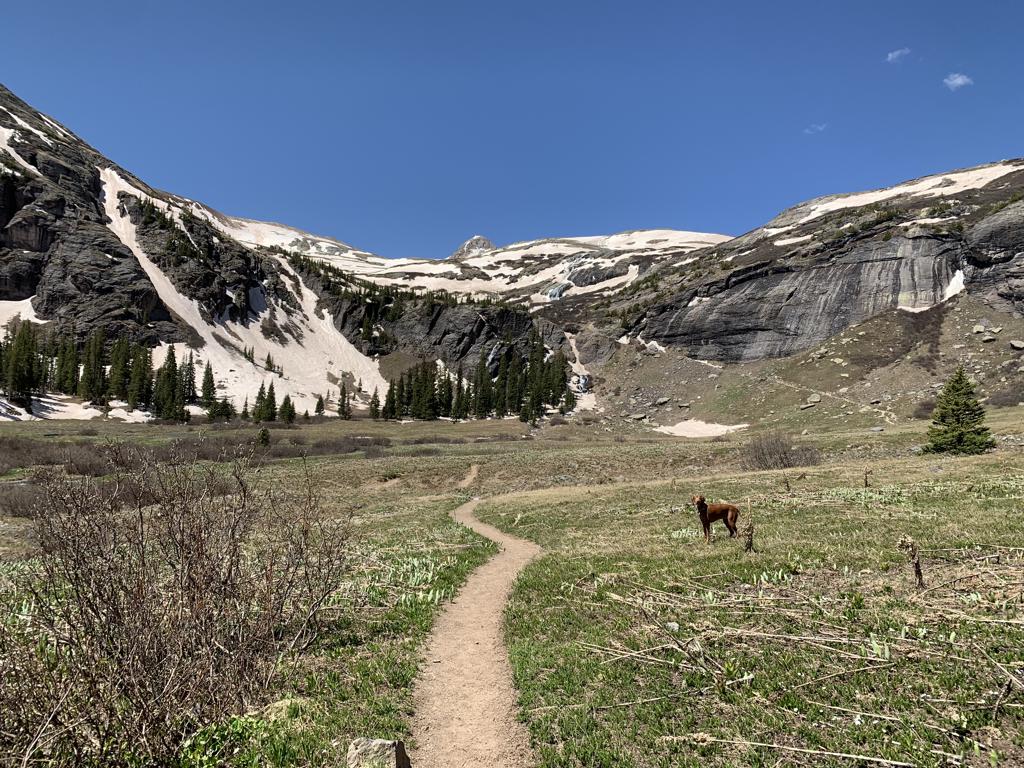
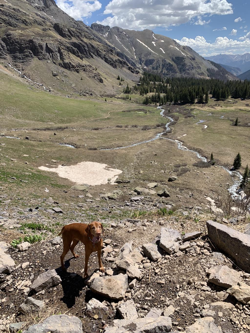
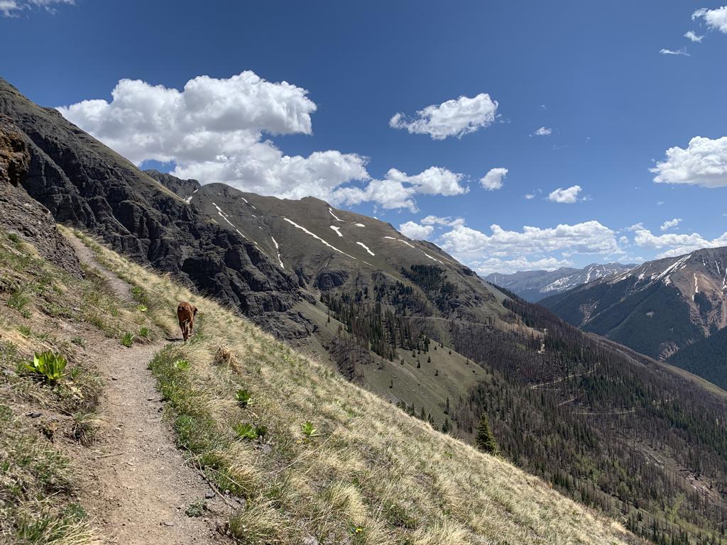
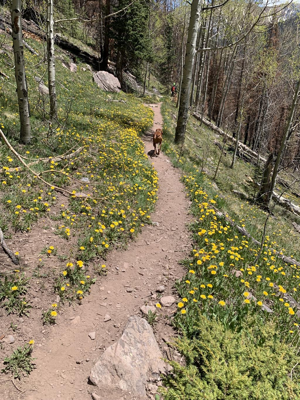
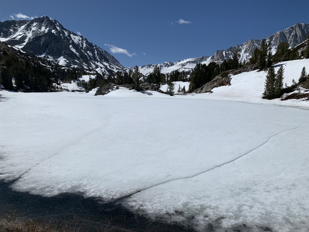
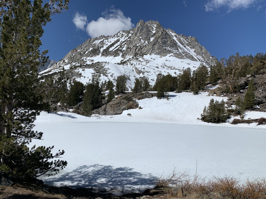
Island Lake via Ice Lake Trail
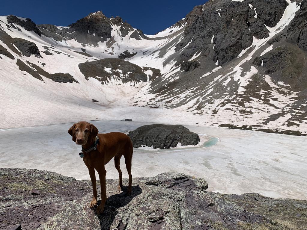
Cappie’s Scoop: I made mom slide down the mountain on her butt in the snow – it was so much fun to watch! Most of the trail was dry but then we kept hiking and eventually found snow, my favorite! The lake was also covered in snow and ice so I couldn’t swim in it or get very close. Mom said we’ll come back in the summer when I can swim and I told her “it’s a deal!” Don’t hesitate to add YOUR scoop in the comments below!
Tips: There are a number of amazing lakes in the Ice Lake Basin that you can hike to from this trailhead! There is even an option to do a bit of a loop to some of the lakes to include Island Lake, Ice Lake, and Fuller Lake. That route is about 8.6 miles with 3,070 ft elevation gain. You can also shorten this loop to hike just to Island Lake and Ice Lake which is about 7 miles with 2,650 ft elevation gain going clockwise. On this hike, we only hiked to Island Lake at 12,400 ft and back which is reflected in this post. Plus, dogs can be on leash or off-leash under voice control.
Directions: From the town of Silverton, head towards and turn slight right onto US-550 North. In about 2 miles, turn left onto Co Rd 7/Forest Rd 585. Continue down this dirt road passing dispersed camping sites and an established campground. The trailhead parking lot will be on your right in about 4.4 miles.
| Mileage (round trip) | 7.7 |
| Difficulty | Strenuous |
| Gain (in feet) | 2680 |
| Trailhead | 37.806673, -107.773987 |
| Hike Time (in hours) | 5-6 |
| Exposure | Sunny and Shady |
| Scenery | Mountain Views, Alpine Lake Views, Forest |
| Facilities | None |
| Fees/Permits | None |
| More Info | https://www.colorado.com/articles/hidden-colorado-gem-island-lake |
| Last Hiked | 5/27/2022 |


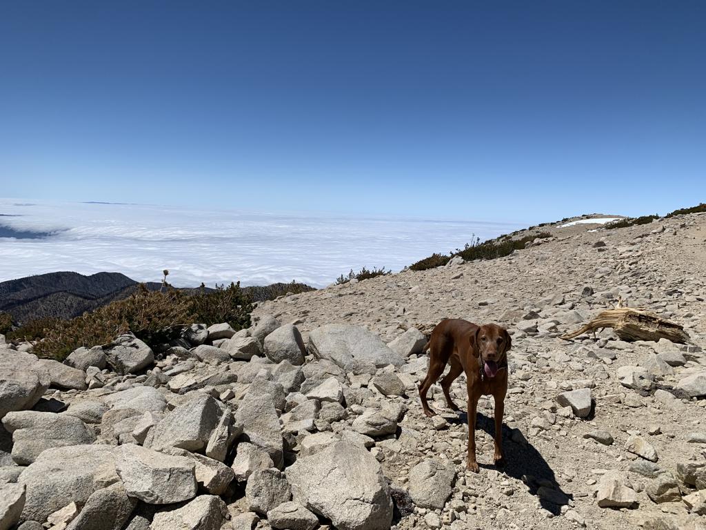
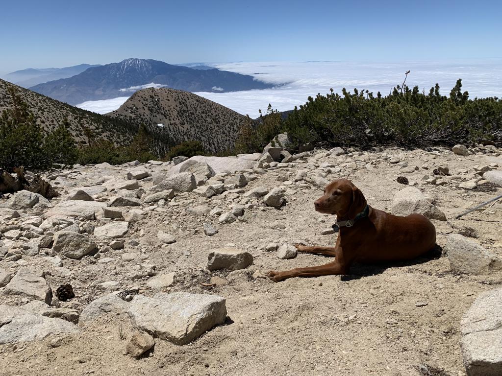
San Gorgonio Peak via South Fork Trail

Cappie’s Scoop: This is one of the highest mountain’s I’ve climbed! I was so proud of myself that I made it to the top! It’s a long hike if you want to do it in one day. Mom and I started very early. On the way up, there are a couple spots to camp so if you wanted to do this in 2 days, you can backpack it! When we go back, we’ll backpack it and camp at Dry Lake (9,065 ft). Hopefully the lake will not be dry either and we can get some water and swimming in! Don’t hesitate to add YOUR scoop in the comments below!
Tips: Start early, this is a very long and the parking lot can fill up fast. We hiked from the trailhead towards Dollar Lake crossing over Dollar Lake Saddle to get to the peak. You could also reach the peak by hiking towards Dry Lake as well or make it a backpack (overnight permit required). We’ve also done this hike via Vivian Creek trailhead passing through High Creek Camp where you can camp and access water.
Directions: Coordinates 34.161193, -116.871806 bring you to the parking lot. You will need to cross the road to pick up the South Fork Trail.
| Mileage (round trip) | 19.5 |
| Difficulty | Strenuous |
| Gain (in feet) | 4700 |
| Trailhead | 34.161193, -116.871806 |
| Hike Time (in hours) | 10-12 |
| Exposure | Sunny and Shady |
| Scenery | Mountain Views, Forest, Creek |
| Facilities | Vault toilets at trailhead. Typically no water on this trail unless the seasonal creek is running which is fairly early in the hike at the junction to Dry Lake or Dollar Lake. |
| Fees/Permits | California Adventure Pass or Interagency Annual Pass/America the Beautiful Pass (National Parks Pass). Beginning 9/1/2020, a free day-use permit for entering San Gorgonio Wilderness areas within the San Bernardino National Forest is required and there are quotas, information at http://sgwa.org/wilderness-permits. |
| More Info | https://hikingguy.com/hiking-trails/best-la-hikes/south-fork-trail-to-san-gorgonio-mountain |
| Last Hiked | 5/21/2022 |


Long Lake via Bishop Pass Trail

Cappie’s Scoop: This trail is great and we need to hike it many more times to see all the different things! There are lots of lakes, big rocks to climb and a very high point called a pass. On this hike, there was lots of snow but the road was open so we got to park at the South Lake trailhead. We only made it to Long Lake because the snow was melting and mom didn’t have her snow shoes on and I was sinking in! I had so much zooming in the snow. This was a good time of year to go! Check out our separate post where we hiked all the way to Bishop Pass! I still need to check out more lakes from this trailhead, stay tuned. Don’t hesitate to add YOUR scoop in the comments below!
Tips: This trailhead is really awesome because you have a menu of trails to hike once you get on Bishop Pass Trail. You can hike to the pass, Long Lake (posted here), Chocolate Lakes loop, Marie Louise Lakes or Treasure Lakes. The trails are marked at the junctions. We cannot wait to go back and hike all of these trails and even backpack a few too!
Directions: From the town of Bishop, head west on CA-168 for 14.7 miles and then turn left onto South Lake Rd. Continue on South Lake Rd for 7.1 miles until it ends at the parking lot/trailhead for Bishop Pass Trail. This road is closed during the winter.
| Mileage (round trip) | 4.7 |
| Difficulty | Moderate |
| Gain (in feet) | 1013 |
| Trailhead | 37.169428, -118.566068 |
| Hike Time (in hours) | 2-3 |
| Exposure | Sunny and Shady |
| Scenery | Mountain Views, Forest, Alpine Lake Views, Creek |
| Facilities | Toilets at the trailhead. |
| Fees/Permits | None |
| More Info | https://www.fs.usda.gov/recarea/inyo/recarea/?recid=20358&actid=50; https://modernhiker.com/hike/hike-south-lake-to-long-lake |
| Last Hiked | 5/8/2022 |


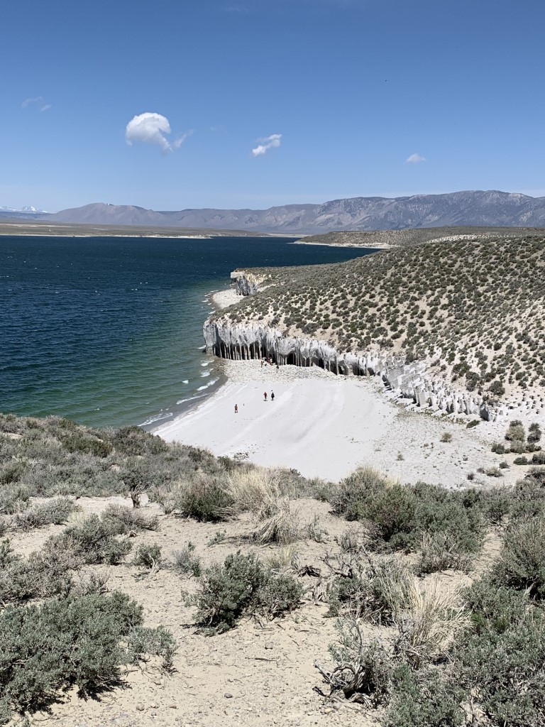
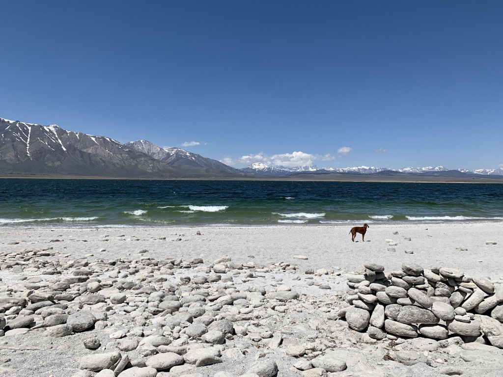
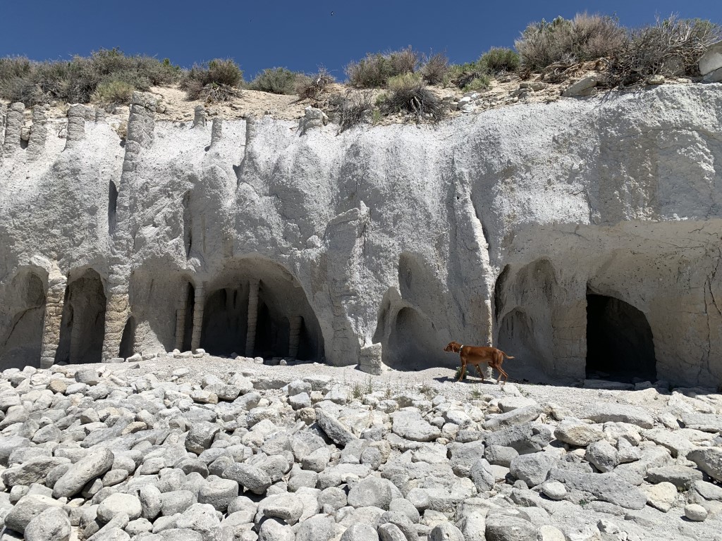
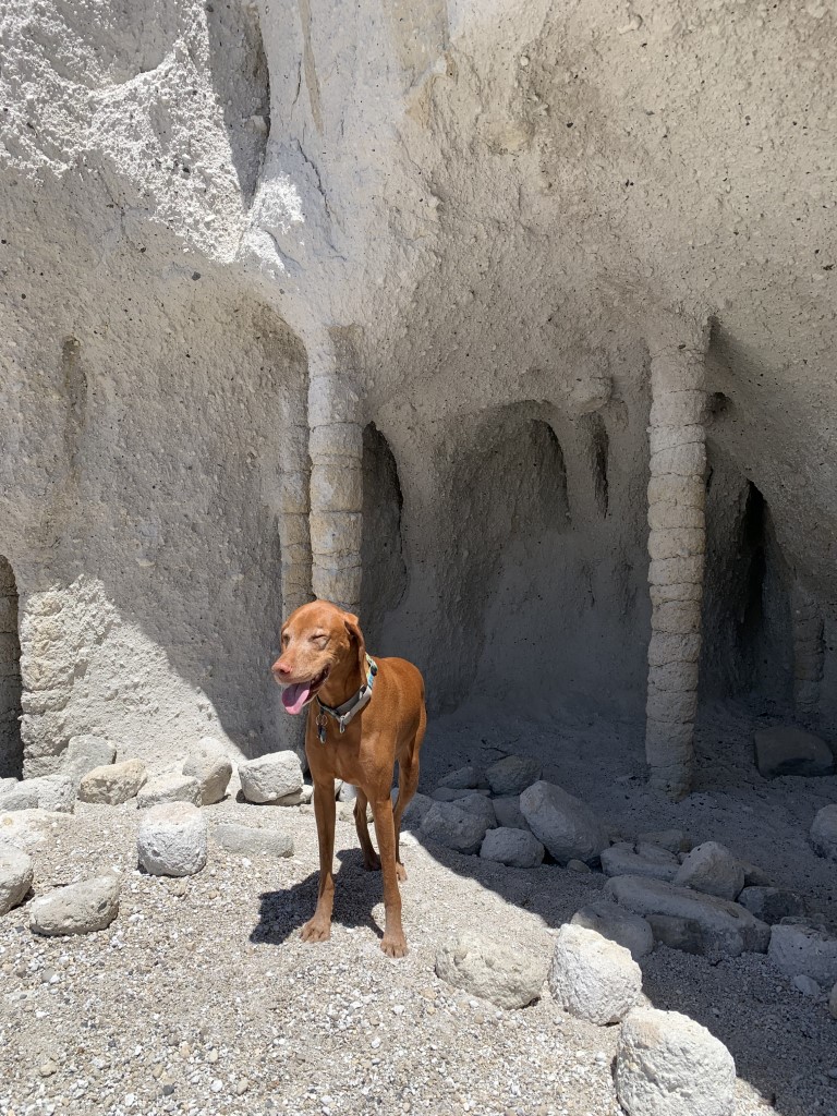
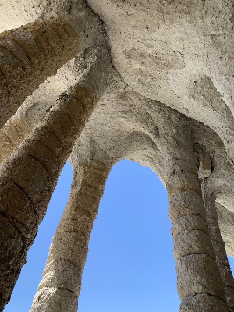
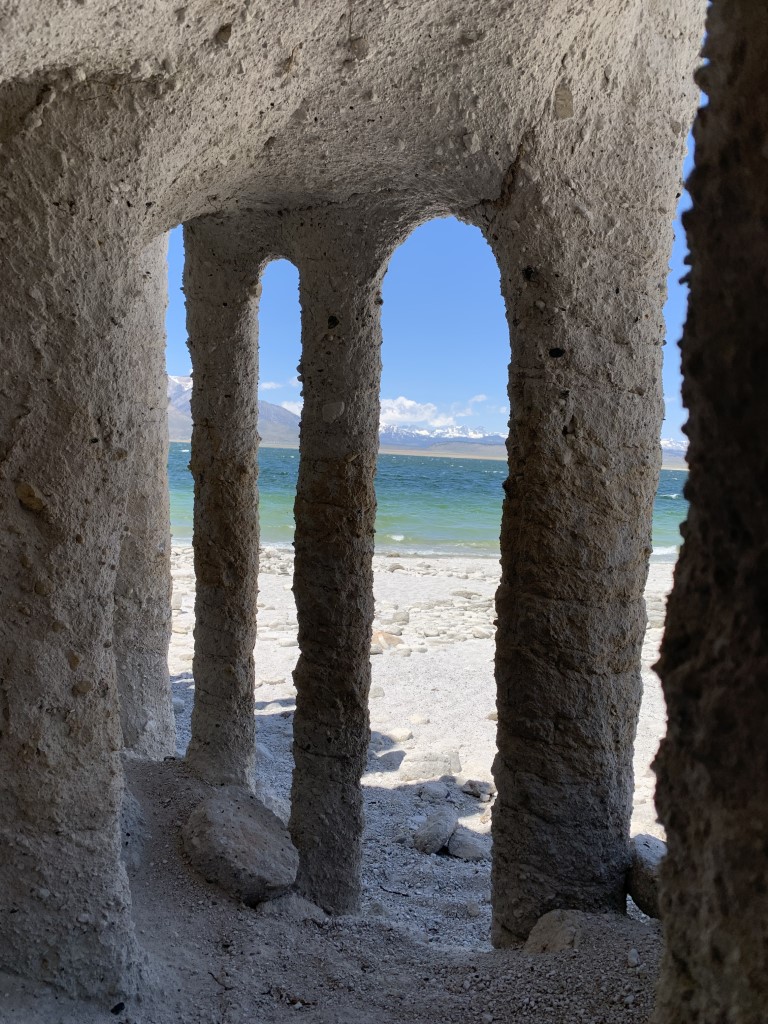
Crowley Lake Columns
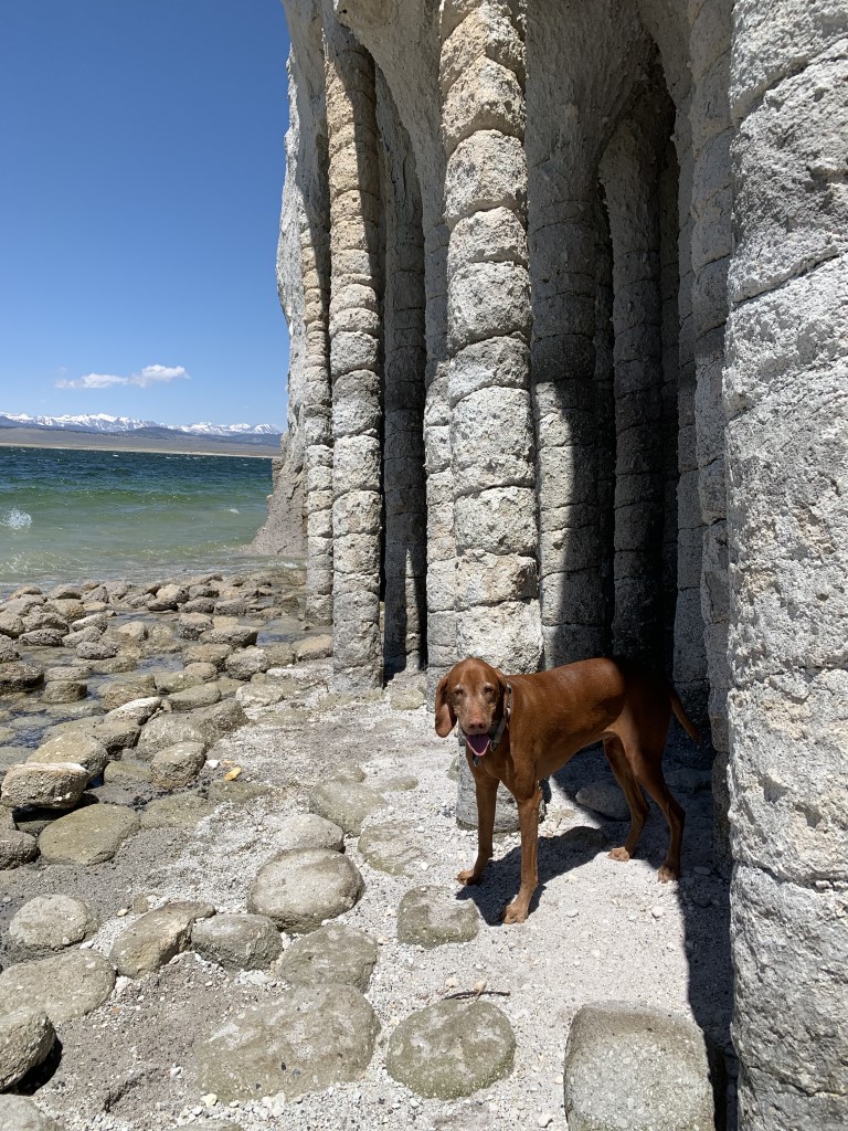
Cappie’s Scoop: When mom and I visited the Sierras, we were hiking a lot of trails in the mountains and some had snow which was a lot of fun. Then mom surprised me by taking me on this hike and we ended up on the beach! I was so happy to zoom in the sand and check out these weird rocks that look like trees! Don’t hesitate to add YOUR scoop in the comments below! Don’t hesitate to add YOUR scoop in the comments below!
Tips: These rock columns are really interesting to see up close and access to them is not always possible because of water levels but worth the trip to see if they’re visible! Also, be sure to have a map handy like AllTrails because there are a few junctions along the way and you want to be sure you’re hiking down the correct dirt road! To access the beach, you have to hike down a steep hill but the sand is soft which made it easy to get down. Besides the columns which are the main feature, you have a gorgeous view of the mountains behind the lake so stay a while, sit on the beach and soak up the warm sun!
Directions: From the town of Bishop, head north on 395 for about 24 miles. Turn right onto Owens Gorge Rd and stay on Owens Gorge Rd until it turns into a dirt road. (Note: There is a portion of the paved road that becomes a single narrow lane and crosses over the damn. Keep your eyes open for oncoming cars.) When it turns into a dirt road, make the first sharp left turn and go another 0.2 miles or so and look for parking anywhere on the side of the road. If you have 4WD, you may consider driving all the way to the dirt parking area overlooking the beach which will shorten your hike greatly. The biggest hurdle is the initial steep hill which most vehicles may find it difficult to drive up (photo below). After that, the road is narrow with brush on the sides but mostly flat.
| Mileage (round trip) | 4.2 |
| Difficulty | Moderate |
| Gain (in feet) | 515 |
| Trailhead | 37.589835, -118.706280 |
| Hike Time (in hours) | 1-2 |
| Exposure | Sunny |
| Scenery | Mountain Views, Lake Views |
| Facilities | None |
| Fees/Permits | None |
| More Info | https://californiathroughmylens.com/crowley-lake-columns |
| Last Hiked | 5/7/2022, 6/16/2023 |


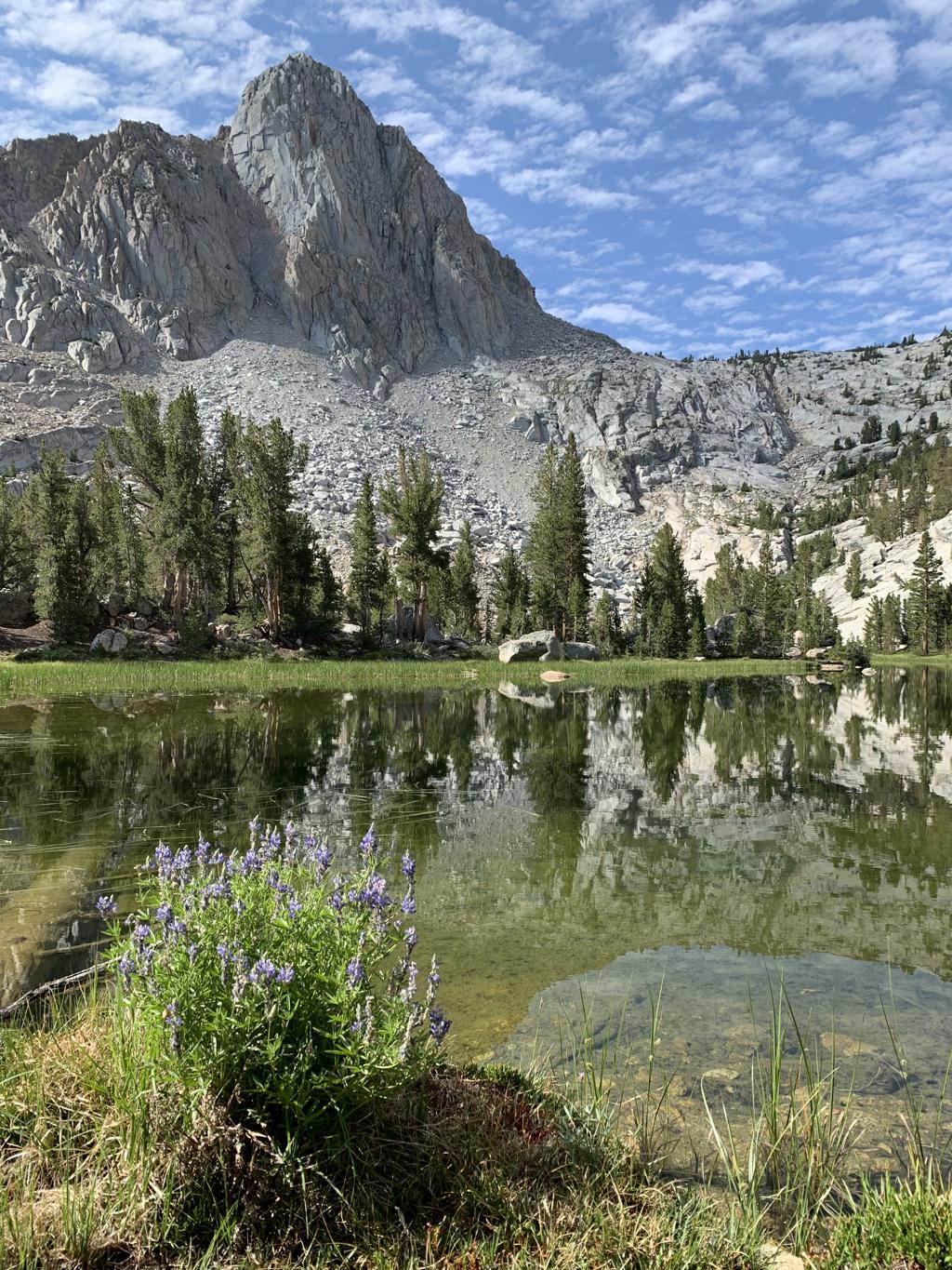
Lower Lamarck Lake

Cappie’s Scoop: More lakes in the Bishop area! I told mom we should move here because I could play in the snow and the lakes all the time. This time we only made it to the lower lake and it was nice and frozen! Next time, we’ll keep going and see what the upper lake looks like. Then I have twice the chances to jump in to swim when it’s not frozen of course. Don’t hesitate to add YOUR scoop in the comments below!
Tips: Round trip mileage includes 1 mile RT for the hike to/from the parking lot. It also includes both Lower and Upper Lamarck Lakes. Lower Lamarck lake is 10,662 ft and Upper Lamarck lake is 10,918 ft. On this trip, we only hiked to Lower Lamarck Lake and can’t wait to go back to hike to Upper Lamarck Lake!
Directions: From the town of Bishop, head west on CA-168 for 17.8 miles and then turn right onto North Lake Rd. Continue on North Lake Rd for 1.6 miles and turn right to stay on North Lake Rd for 0.2 miles until you reach the hiker parking lot. If you stay straight, you’ll end up in the North Lake Campground (if the gate is open) and there is no day use parking there. You could also park in the North Lake day use parking lot which you pass before you reach the campground entrance. Either way, you’ll be walking down the road through the campground (0.5 miles one-way) to find the trailhead for Lamarck Lakes (and Piute Pass Trail) at the end of the road. This road is closed during the winter.
| Mileage (round trip) | 5 |
| Difficulty | Moderate |
| Gain (in feet) | 1627 |
| Trailhead | 37.230712, -118.619012 |
| Hike Time (in hours) | 3-4 |
| Exposure | Sunny and Shady |
| Scenery | Mountain Views, Forest, Alpine Lake Views, Creek |
| Facilities | Toilets in the parking lot and at the trailhead. |
| Fees/Permits | None |
| More Info | https://www.fs.usda.gov/recarea/inyo/recreation/recarea/?recid=20368; https://modernhiker.com/hike/lamarck-lakes; http://www.hikingwalking.com/index.php/destinations/ca/ca_ses/bishop/lamarck_lakes |
| Last Hiked | 5/6/2022 |