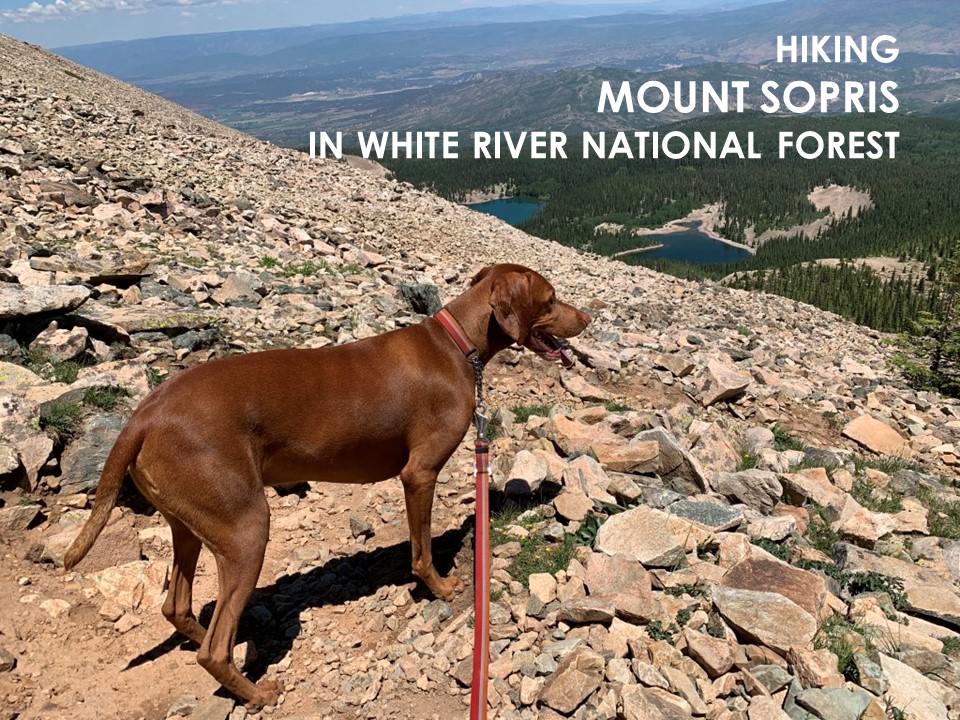
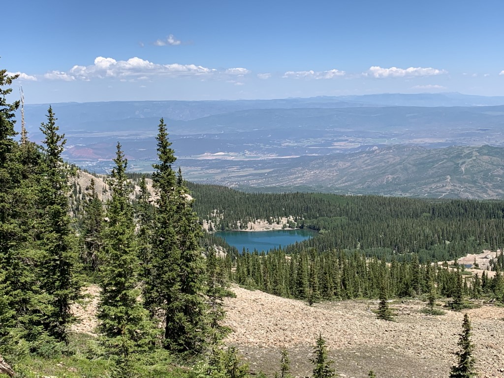
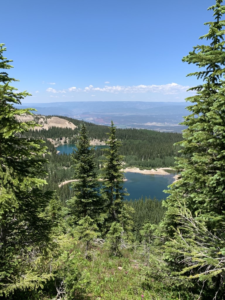
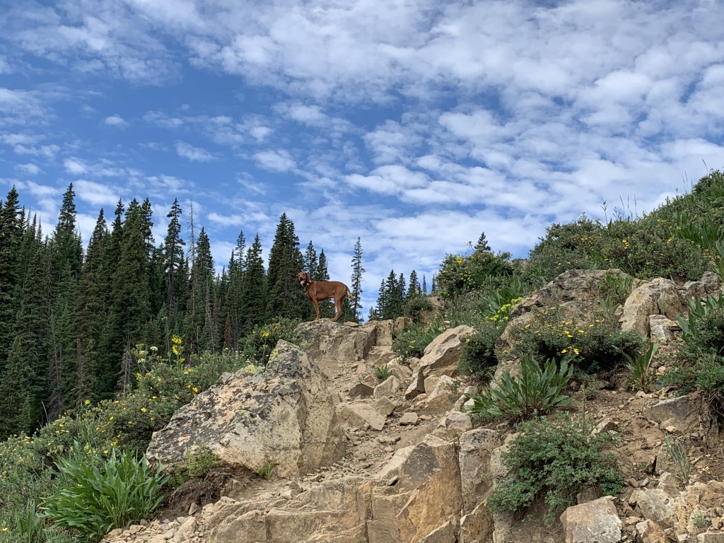
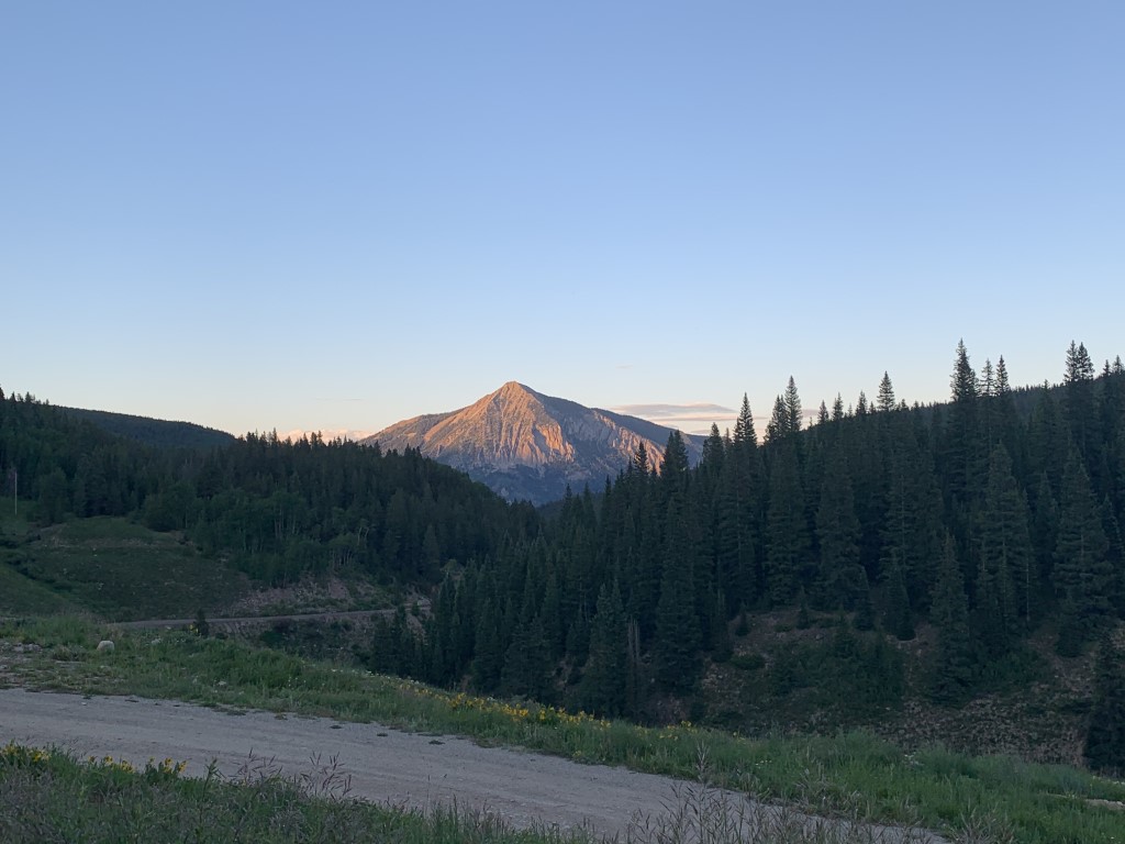
Mount Sopris
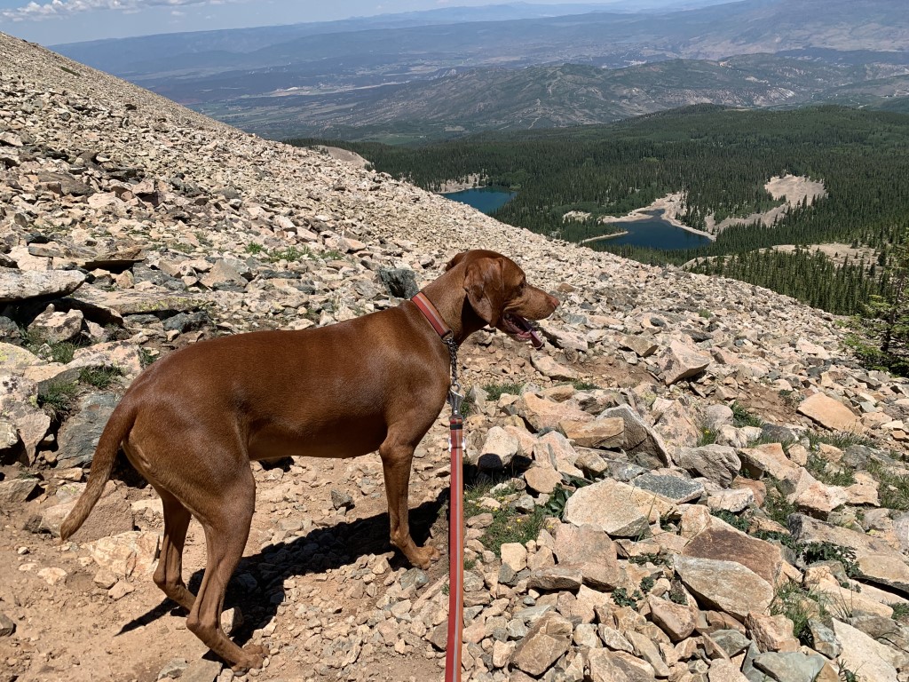
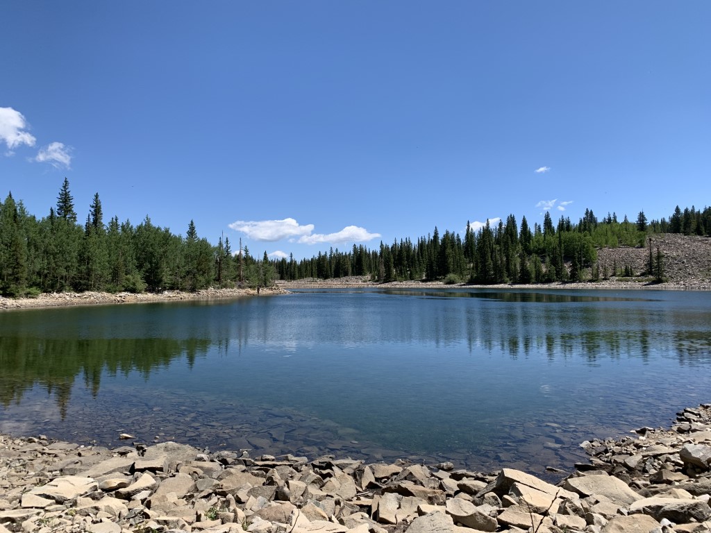
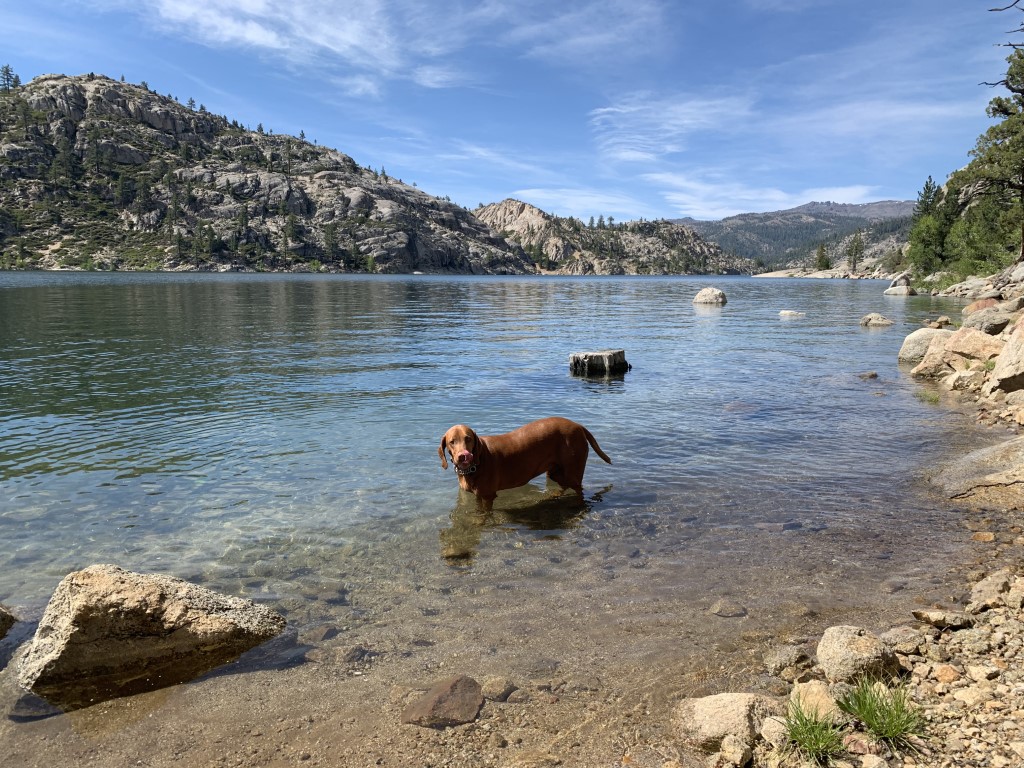
Cappie’s Scoop: I didn’t make it to the top – it was rock central! But that’s okay because the rest of the trail was a lot of fun and there were lots of alpine lakes along the way! That was the best part for me, swimming in the lake! While I was swimming in the lake, there were some hoomans trying to catch some fish. I told them I was sorry if I scared them away but I had to jump in for a swim! I also passed some nice hoomans fixing the trail to make it better to hike on it so I thanked them for helping keep the trail nice. Don’t hesitate to add YOUR scoop in the comments below!
Tips: Check the weather before you go, start early and plan for steep rocky parts once you pass Thomas Lakes. We didn’t make it to the peak standing at 12,965 ft due to the weather and thought best to turn around before an afternoon storm. We also recommend hiking poles for stability in the rocky areas. The good news is that this peak shares the same trailhead as Thomas Lakes so if you need to shorten your hike, you can plan to just swim in the lakes with your dog! Also, you can obtain a free self-serve overnight permit at the trailhead for camping. We passed 13 camp sites near the lakes that would make an awesome backpacking trip.
Directions: From the town of Carbondale, head south on highway 133 and turn left (east) onto Prince Creek Road (Co Rd 111). Follow this road for about 5 miles or so which turns into a dirt road (closed in the winter) until you come to an intersection which may be confusing. Keep right to follow Dinkle Lake Rd to Dinkle Lake. In about 2 miles, the parking area will be on your left before you reach Dinkle Lake.
| Mileage (round trip) | 12 |
| Difficulty | Strenuous |
| Gain (in feet) | 4412 |
| Trailhead | 39.304162, -107.124381 |
| Hike Time (in hours) | 8-9 |
| Exposure | Sunny and Shady |
| Scenery | Mountain Views, Alpine Lake Views, Forest, Wildflowers |
| Facilities | Vault toilet at trailhead. |
| Fees/Permits | None |
| More Info | https://www.fs.usda.gov/Internet/FSE_DOCUMENTS/stelprdb5187123.pdf; https://rootsrated.com/aspen-co/hiking/mount-sopris-hiking |
| Last Hiked | 7/7/2021 |


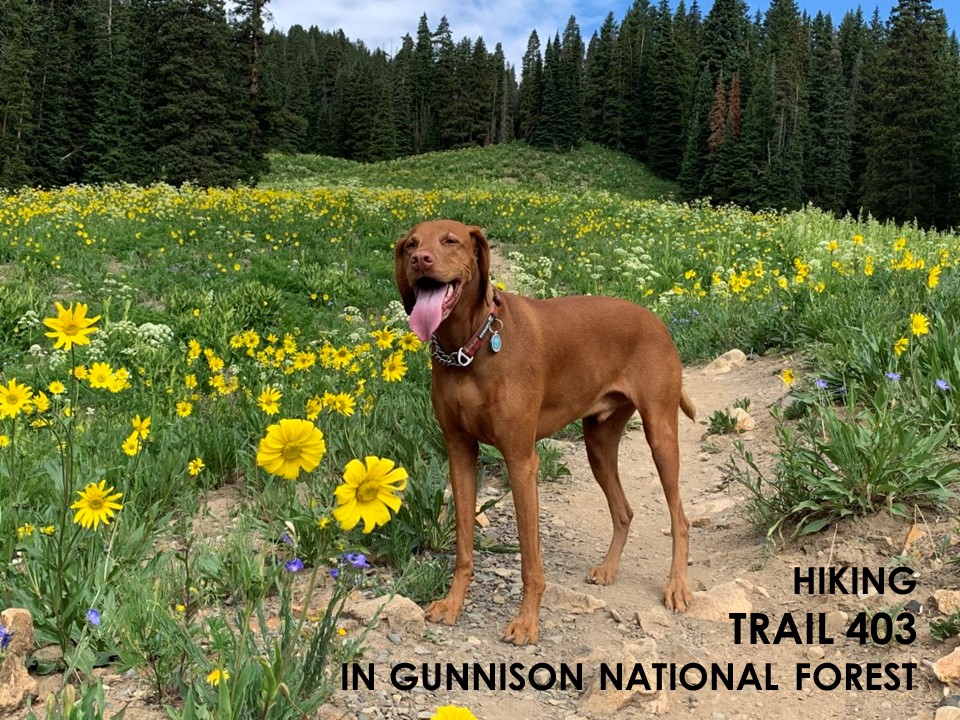
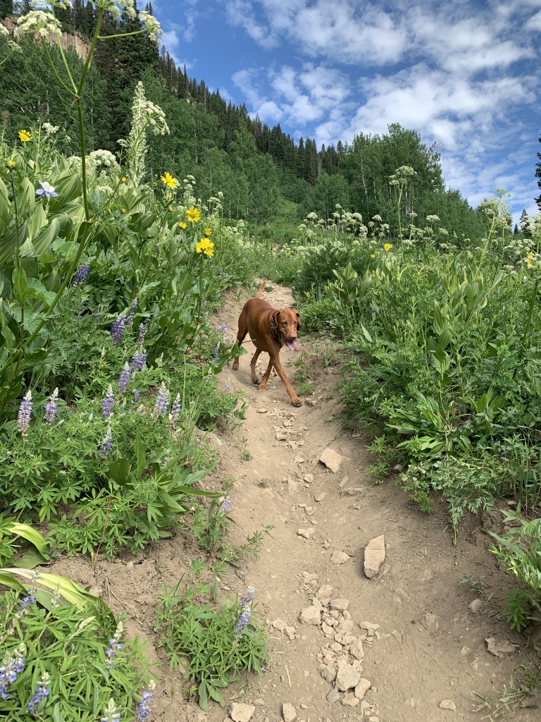
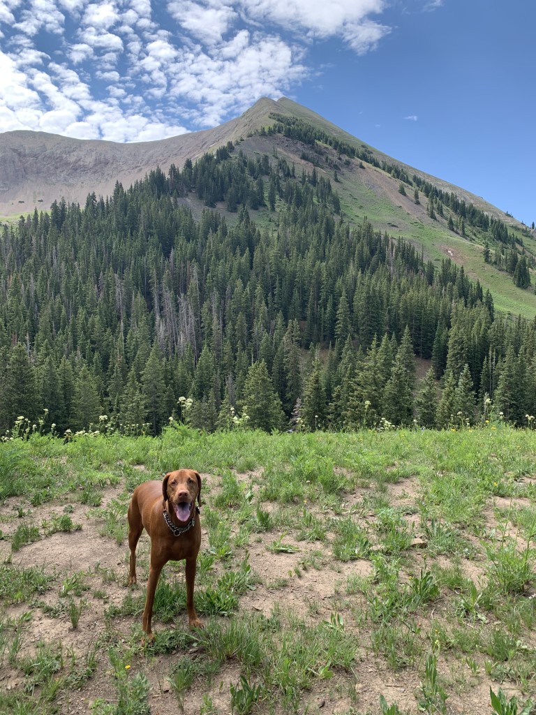
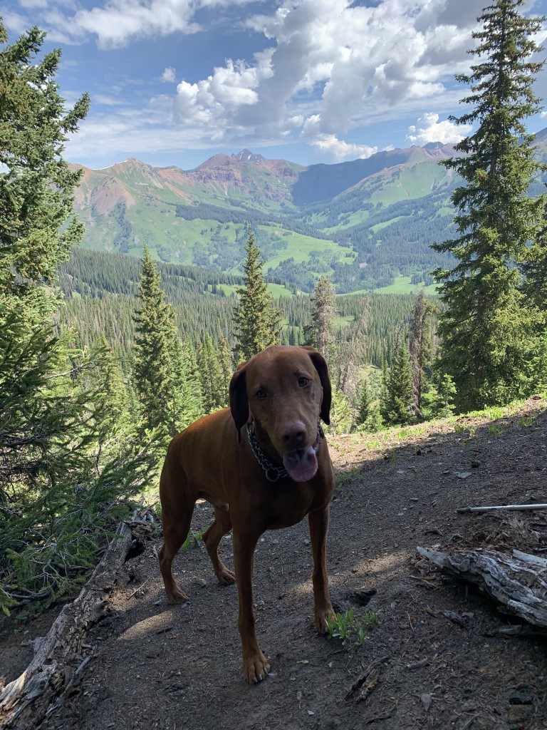
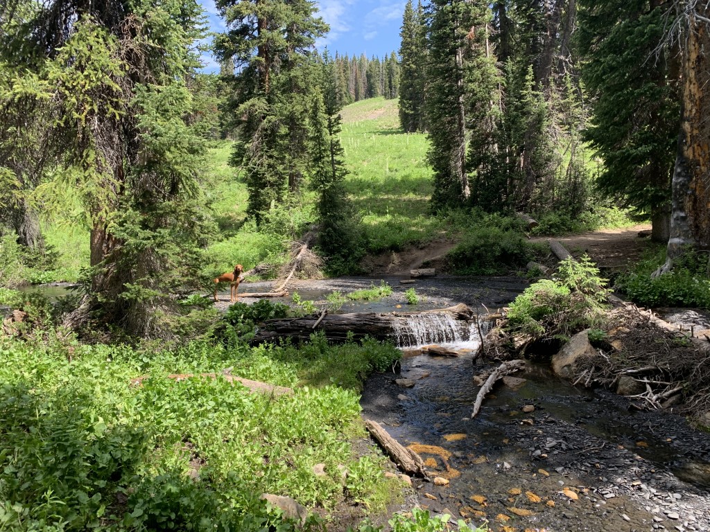
Trail 403

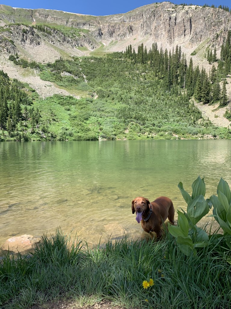
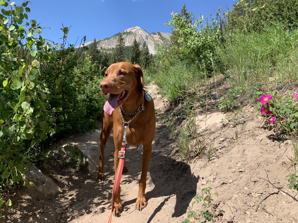
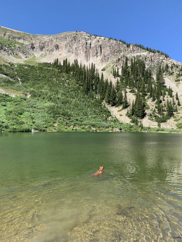
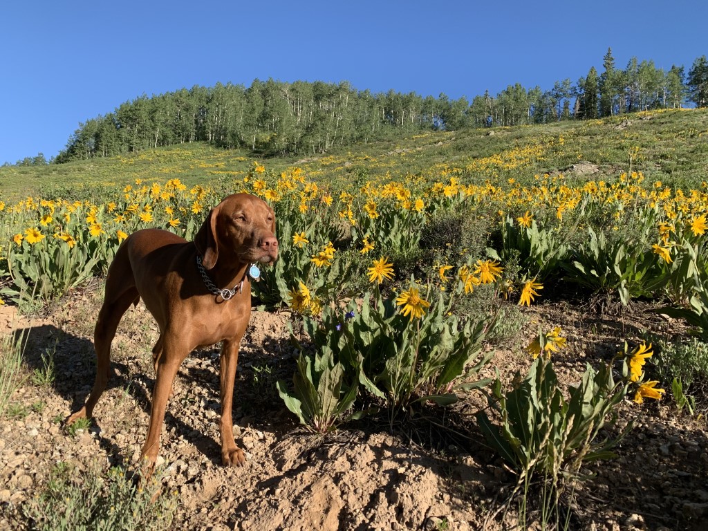
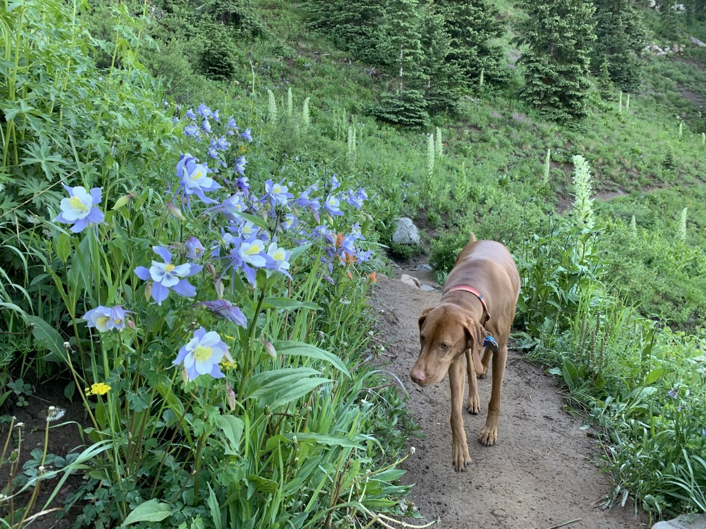
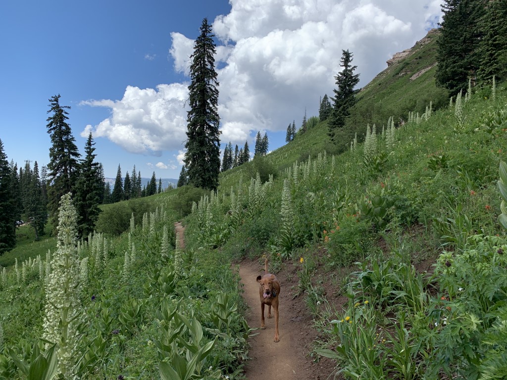
Cappie’s Scoop: This trail was covered in wildflowers and there was water to dip my paws in too. It started to rain on our way back so mom and I hurried to the car to avoid getting really muddy. I hope we go back to this town one day and hike more in the flowers! Don’t hesitate to add YOUR scoop in the comments below!
Tips: Crested Butte is the wildflower capital of Colorado and this trail was one of many amazing spots for hiking among wildflowers! The first mile is steep gaining quite a bit of elevation but when you’re wading through wildflowers and stopping to take pictures, you hardly notice it. The trail climbs up into the trees for shade and there is one stream crossing which was easy enough without rock hopping. At the first unmarked junction, we took a left and headed towards Gothic Mountain with a peak of 12,631 ft but we only made it halfway up because it was extremely steep, actually so steep that it felt vertical. So we turned around feeling good that we at least tried. Please remember not to pick or step on any of the wildflowers. Leave them unharmed for others to enjoy and remember to follow the Leave No Trace principles.
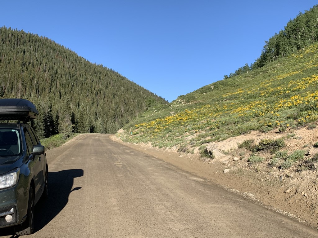
Directions: The Washington Gulch trailhead listed here is about a 10 minute drive down a beautiful road (filled with wildflowers in July) from downtown Crested Butte. If you stage two cars, you can do a point-to-point hike since this trail connects with others! From the town of Crested Butte, go about one mile north on County Road 317 to the intersection with Washington Gulch Road, CR 811. Continue on CR 811 for approximately 6 miles to reach the trailhead and a small parking lot on the left-hand side of the road just after passing the campground.
| Mileage (round trip) | 7.5 |
| Difficulty | Moderate |
| Gain (in feet) | 2142 |
| Trailhead | 38.982119, -107.006482 |
| Hike Time (in hours) | 4-5 |
| Exposure | Sunny and Shady |
| Scenery | Mountain Views, Creek, Forest, Wildflowers |
| Facilities | Vault toilet at campground nearby and close enough to walk to after parking at the trailhead. |
| Fees/Permits | None |
| More Info | https://www.outtherecolorado.com/adventures/hit-this-colorado-trail-for-alpine-views-and-wildflower-galore/article_a0bf7d1d-c700-56d1-ba04-98053a714b18.html; http://coloradowatertrust.org/washington-gulch-story |
| Last Hiked | 7/6/2021 |


Green Lake
Cappie’s Scoop: It’s really green! I didn’t believe it until I got there and started swimming around in it. Green is mine and my mom’s favorite color so we had fun in this spot. Don’t hesitate to add YOUR scoop in the comments below!
Tips: This trail is on private property even though it’s in the National Forest too. There is one small section in the middle where you hike on a fire road for 0.4 miles. After that, you pick up the trail in the forest again.
Directions: Mileage and directions are based on starting from the Nordic Center. Head northwest on CO-135 N towards the town of Crested Butte. Turn left onto Whiterock Ave. and in 0.4 miles turn left onto 2nd St. The road ends at the trailhead parking lot. If the lot is closed, there is parking nearby on the street.
| Mileage (round trip) | 8.5 |
| Difficulty | Moderate |
| Gain (in feet) | 1814 |
| Trailhead | 38.86703, -106.98741 |
| Hike Time (in hours) | 5-6 |
| Exposure | Sunny and Shady |
| Scenery | Mountain Views, Alpine Lake Views, Wildflowers, Forest |
| Facilities | None |
| Fees/Permits | None |
| More Info | https://www.fs.usda.gov/recarea/gmug/recarea/?recid=33294; https://travelcrestedbutte.com/crested-butte-trails-green-lake-near-irwin |
| Last Hiked | 7/5/2021, 7/5/2023 |


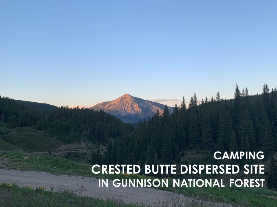
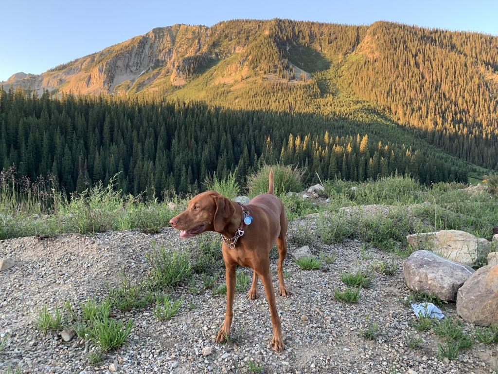
Crested Butte Dispersed Camping
Cappie’s Scoop: This was the best spot for camping because there were no bugs! I was in the car for a bit while mom kept looking for a non-buggy spot to sleep. Finally, we found this area just in time for bed. There wasn’t a lot around besides some dirt but mom said it had a nice view of the mountains. As long as I’m with mom, I can sleep anywhere! Don’t hesitate to add YOUR scoop in the comments below!
Tips: We found lots of spots to disperse camp (in the car or tent) off of Kebler Pass Rd. There are even great trees for hammocks! Head down the pass road and you can find Lake Irwin which has an established campground (for reservations visit recreation.gov), a lake to kayak or paddleboard, mountain views and trails to hike or mountain bike.
Directions: Coordinates bring you to the start of the Kebler Pass Rd (closed in winters) from the town of Crested Butte. Kebler Pass is also called Gunnison County Road 12.
| Location | 38.867897, -106.990520 |
| Time | 2 nights |
| Exposure | Sunny |
| Scenery | Mountain Views, Wildflowers, Wildlife |
| Facilities | None |
| Fees/Permits | None |
| More Info | https://www.uncovercolorado.com/scenic-drives/kebler-pass |
| Last Camped | 7/4/2021-7/6/2021 |

Engineer Mountain via Coal Bank Pass Trail

Cappie’s Scoop: You can hike this mountain from two different trails. The time I hiked this trail it was busting with lots of wildflowers. Mom kept stopping to take lots of pictures but I didn’t mind because everything smelled very good. Along the way, we found some streams for me to take a drink and lots of people had dogs so I was saying hello to everyone! We didn’t make it to the top because mom said it was very rocky and she was nervous I would like to stand on the edge which I do like to do – I need to get the best view! But we made it to “social rock” which was a perfect spot for saying hello to hoomans and other furry friends. Don’t hesitate to add YOUR scoop in the comments below!
Tips: There are a couple different trailheads to reach Engineer Mountain! See other post Engineer Mountain for a longer route. This trail is fantastic in the fall and during wildflower season!
Directions: From the town of Durango, head north on US-550 for about 33.8 miles and then turn left at an unmarked dirt road to find the trailhead parking area shortly down the road on your right. The left turn is very soon after you pass the rest area with bathrooms on your right.
| Mileage (round trip) | 7 |
| Difficulty | Strenuous |
| Gain (in feet) | 2300 |
| Trailhead | 37.699167, -107.779030 |
| Hike Time (in hours) | 5-6 |
| Exposure | Sunny and Shady |
| Scenery | Mountain Views, Forest, Wildflowers, Creek |
| Facilities | None at the trailhead but across the street are vault toilets in the parking lot. |
| Fees/Permits | None |
| More Info | https://rootsrated.com/durango-co/hiking/engineer-mountain-hiking; https://www.fs.usda.gov/recarea/sanjuan/recreation/recarea/?recid=42900 |
| Last Hiked | 7/4/2021 |


Kennedy Meadows to Relief Reservoir Backpack
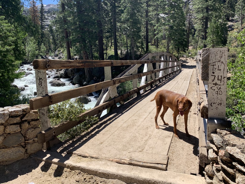
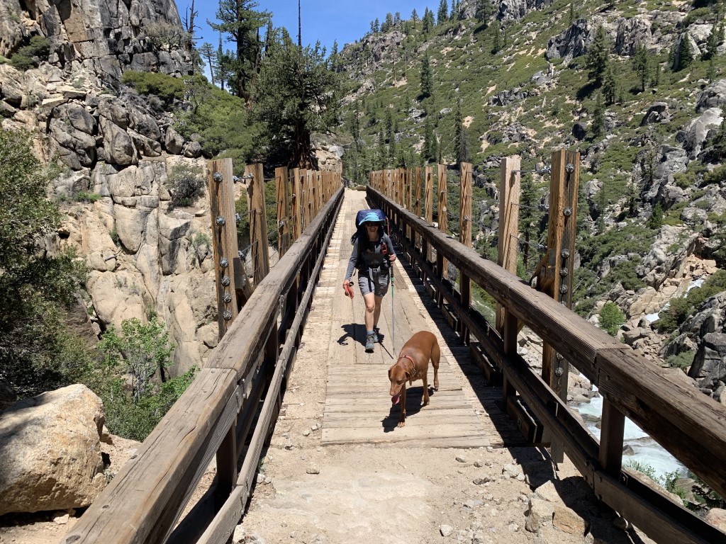
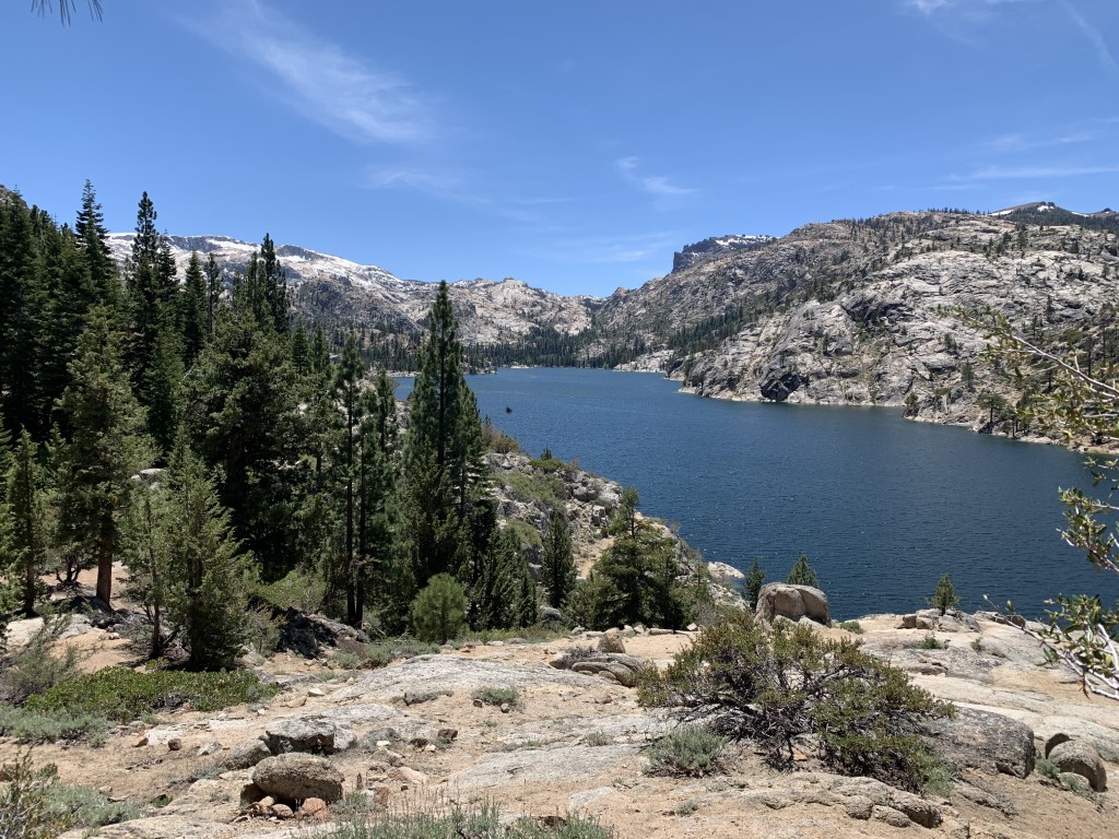
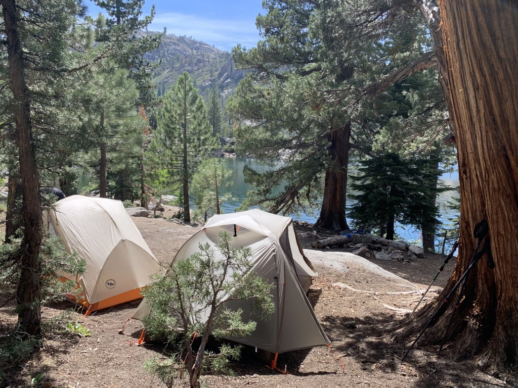
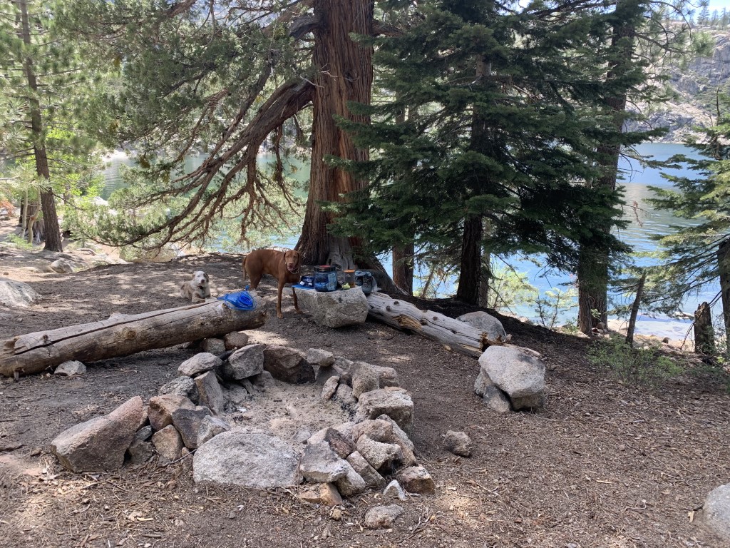
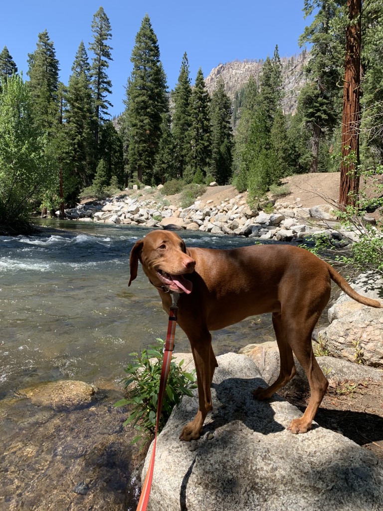
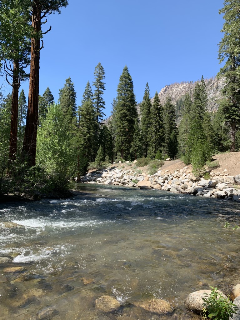
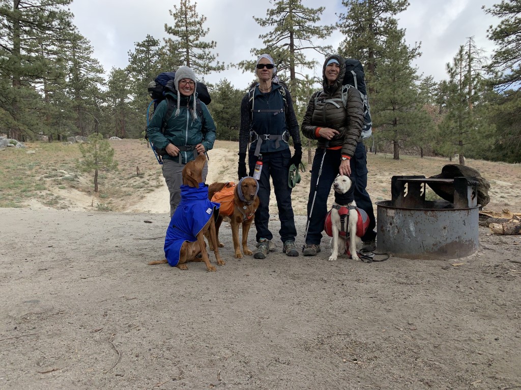
Cappie’s Scoop: This is one of my favorite areas to visit now because it had lots of spots to swim, good smelling fish in the river, fun bridges to cross, tasty sticks to chew and horse poop. Although mom would not let me eat any horse poop but I tried. I was very good around the horses and let them pass me on the trail without barking at them. I also did great walking over the bridges! Usually I get nervous but I even looked over the edge at the river underneath and was just wondering when I’d get to jump in the water. There were some rocks to climb but the trail was mostly dirt. Mom said it was warmer than usual so we spent a lot of time by the water to avoid the bugs getting us and they did get me! I need to get some more bug spray because I think it’s going to be a buggy summer. Don’t hesitate to add YOUR scoop in the comments below!
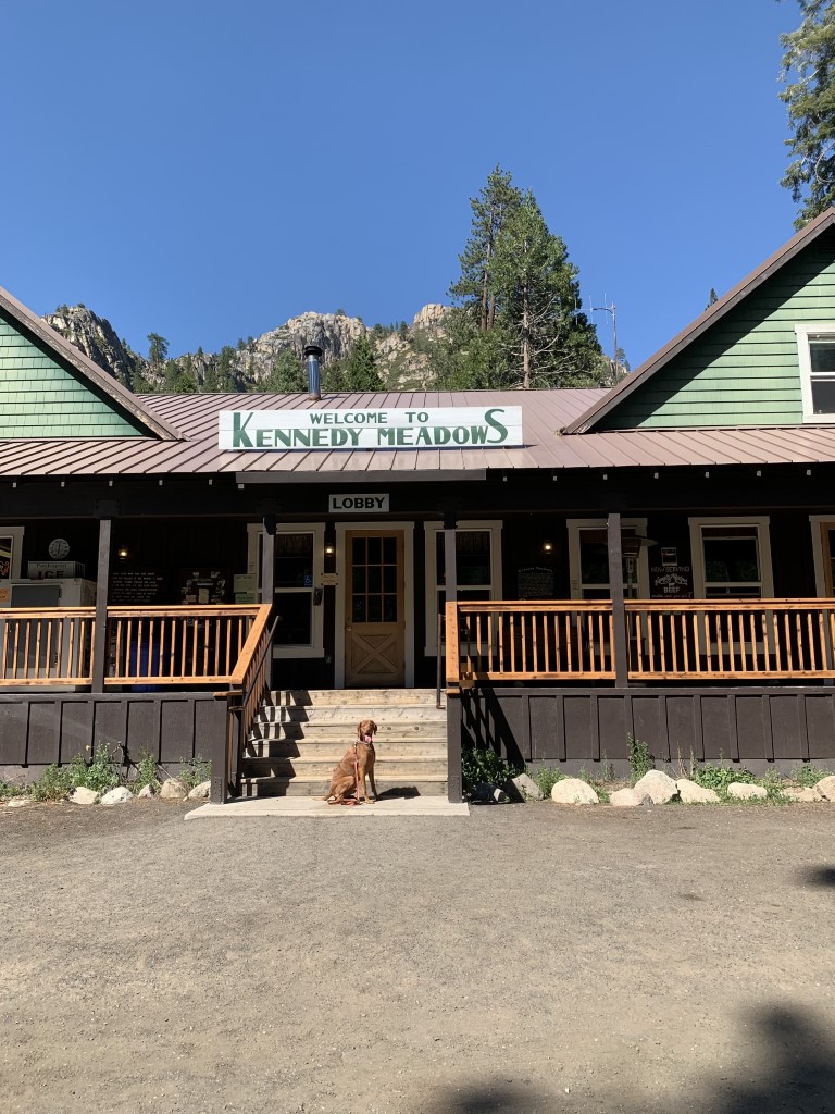
Tips: The backpacker’s parking lot also has camp sites for hikers for $15/night (2 night limit) at the time of writing this post. The lot is located down the road from the trailhead, about 0.5 miles. There are also a few parking spots at the actual trailhead and an overnight parking permit can be obtained in the lobby of the Kennedy Meadows Resort and Pack Station but we noticed the spots were all filled up every time we passed by. Also, from this trailhead, the pack station leads horseback rides for a stretch of the trail. Make sure you keep your eyes open for horses, dodge the horse poop on the trail and ensure your dog is comfortable with horses passing them on the trail. Important note: there are two Kennedy Meadows that can be reached off of highway 395. The location we visited is north of the town of Bridgeport taking 395 to highway 108 Sonora Pass. The second location is south of Lone Pine. We’d recommend visiting the northern location first if you get a chance!
Directions: From 395 (north of Bridgeport), head west on CA-108 for about 24 miles. Then turn left onto Kennedy Meadows Rd and continue down the road either to the Kennedy Meadows backpacker parking lot or to the Pack Station (trailhead start) about a mile down the road. Before you go, check https://roads.dot.ca.gov to see if Highway 108 Sonora Pass is open because snow will close the road.
Planning a Backpack – April 2021 Newsletter Special Issue
| Mileage (round trip) | 7.1 |
| Difficulty | Moderate |
| Gain (in feet) | 1371 |
| Trailhead | Backpackers parking lot: 38.316821, -119.747356 Trailhead: 38.311149, -119.745301 |
| Hike Time (in hours) | 1 night |
| Exposure | Sunny and Shady |
| Scenery | Mountain Views, Forest, Lake Views, Creek, Wildlife |
| Facilities | None |
| Fees/Permits | Overnight wilderness permit required for camping in the Emigrant Wilderness. It’s free and can be obtained in person at the Summit Ranger Station (about 30 min from Kennedy Meadows), https://www.fs.usda.gov/recarea/stanislaus/recarea/?recid=81651. |
| More Info | https://www.sonorapassvacations.com/hikes/relief_reservoir_hike.html |
| Last Hiked | 6/5/2021-6/6/2021 |


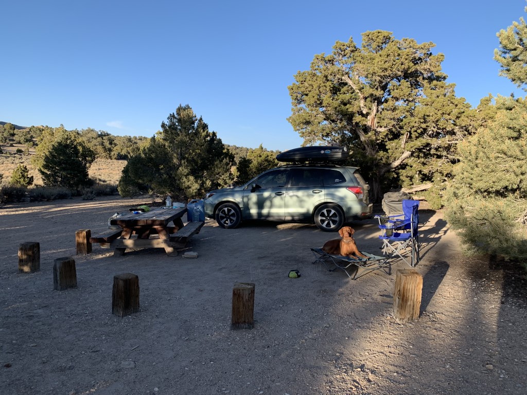
Deadman Campground
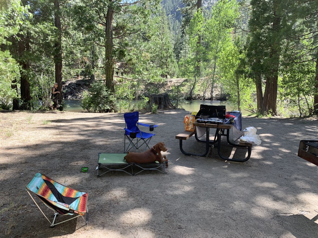
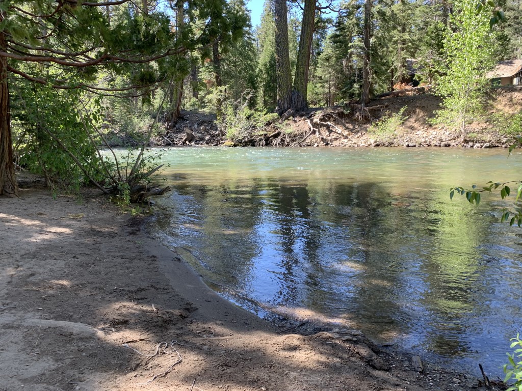
Cappie’s Scoop: Mom said we were very lucky to get a good spot at this campground because they don’t take reservations. I’m not sure what reservations are but we drove here, pulled in and started to put up our tent so I’m happy we made it! Our spot near the river with lots of fish swimming in it was a lot of fun. I like to watch the fish swim around. They are too fast and I couldn’t catch any of them! Don’t hesitate to add YOUR scoop in the comments below!
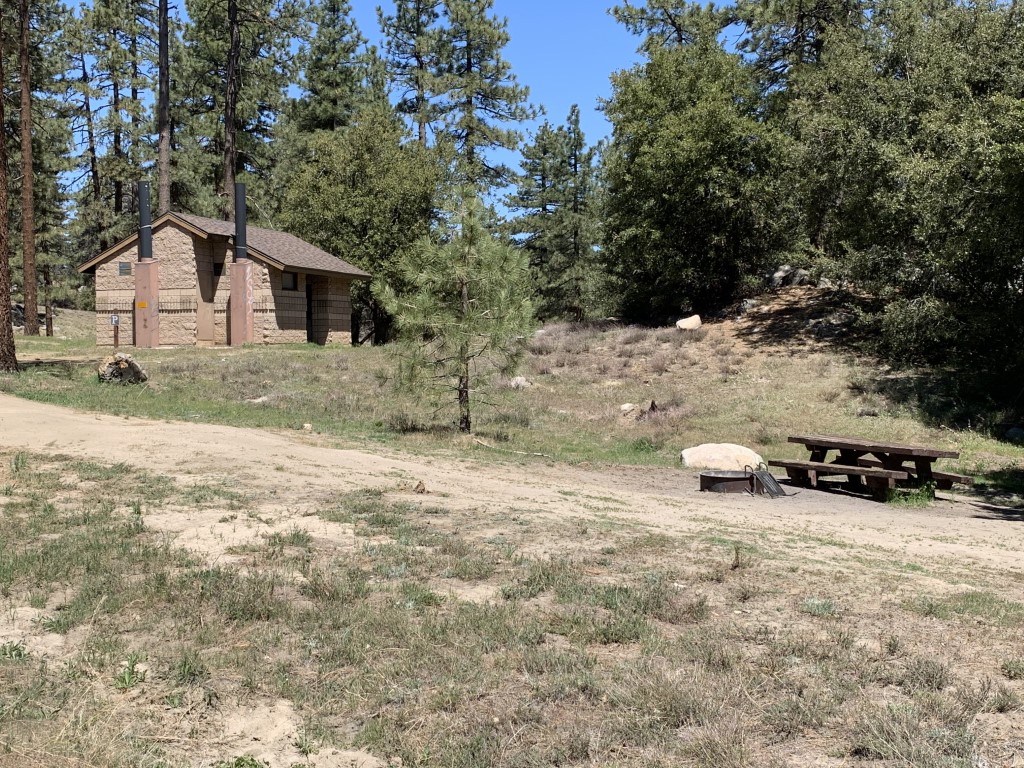
Tips: Camp sites have a picnic table, food storage box (except for site #13), and a fire ring. Firewood is available for sale, $8 per bundle. If Deadman is full, Baker Campground (on the same road) has 44 sites and is 0.7 miles away. We loved site #8, it had parking for two cars, lots of space for multiple tents, shade and it was right on the river. Site #s 1 and 2 also looked great but for those two specifically, you need to park and then carry your gear down to the site/river front to setup. This campground is close to the Kennedy Meadows to Relief Reservoir trail for a day hike or backpack. You can also reach Kennedy Lake from the same trail too.
Directions: From 395 (north of Bridgeport), head west on CA-108 for about 24 miles. Then turn left onto Kennedy Meadows Rd and continue for about 0.6 miles to the entrance for the campground on your right. Before you go, check https://roads.dot.ca.gov to see if Highway 108 Sonora Pass is open because snow will close the road.
| Location | 38.317197, -119.748783 |
| Time (in hours) | 3 nights |
| Exposure | Shady |
| Scenery | Forest, River, Wildlife |
| Facilities | Toilets, potable water and dumpsters at the campground. Water from creeks, lakes and springs should be treated and/or filtered before drinking. |
| Fees/Permits | First-come, first-served sites for $25/night at the time of writing this post. It’s recommended but not required to get a campfire permit if you wish to use a stove, grill, or have a campfire. This FREE permit can be obtained at preventwildfiresca.org or at any ranger station. |
| More Info | https://www.fs.usda.gov/recarea/stanislaus/recarea/?recid=15027 |
| Last Camped | 6/4/2021-6/7/2021 |

Ramona Trail Backpack
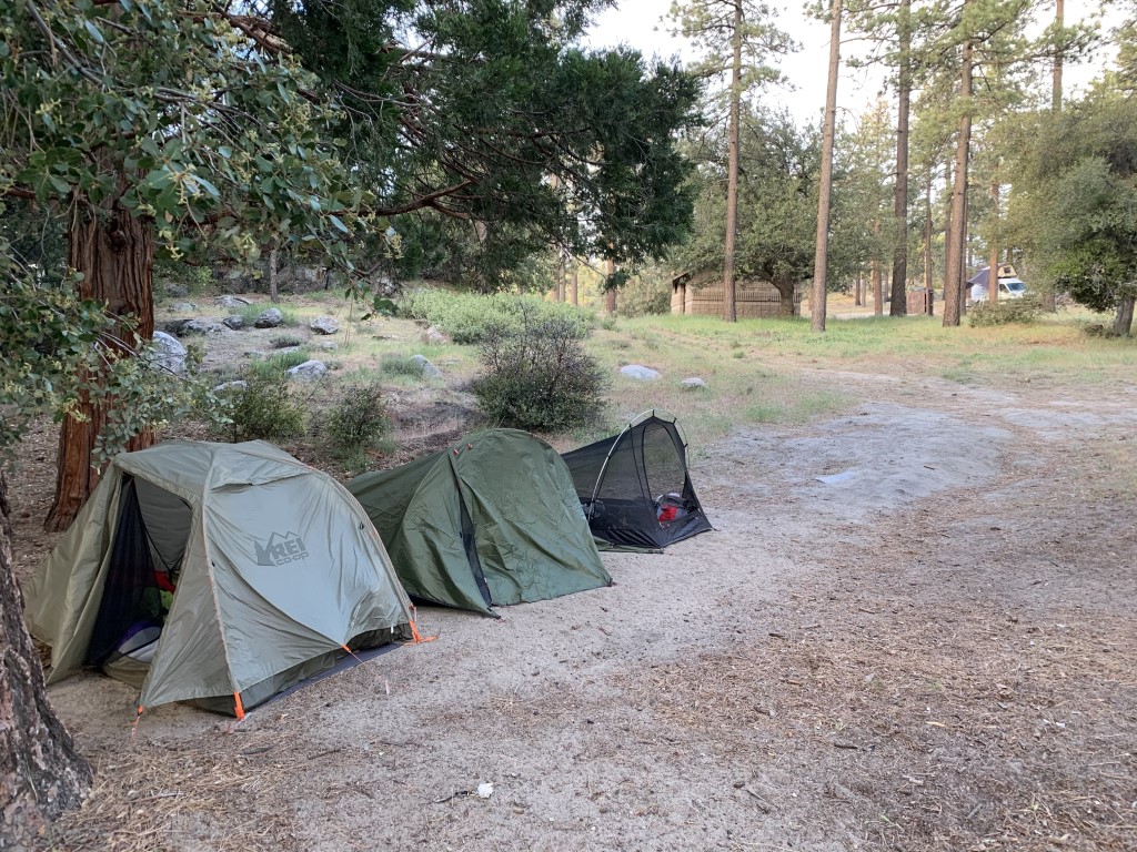
Cappie’s Scoop: Do you like sleeping in a tent? I do because it means I get to snuggle with mom and I really needed to snuggle with her on this trip. The hike to the campground started off sunny with blue skies but then the clouds rolled in. It was very windy and chilly. We got to camp and mom quickly setup our tent and after that we ate some dinner. The clouds started rolling into camp with some mist which looked cool but we thought it’s a good time to jump into the tent to stay warm. Mom packed my jacket, sleeping bag and an extra blanket. I was very warm. During the night we listened to the howling winds through the trees and couldn’t wait until the sun came up to defrost us. The low was expected to be 37 degrees. Glad it didn’t snow! In the morning we had breakfast at our campsite that had a picnic table. Then I chased my friends Copper and Bindi around camp and we hunted in the grass a bit for lizards and sticks. After that we packed up and hiked back to our cars. It was a fun trip and I didn’t want to go home yet! Don’t hesitate to add YOUR scoop in the comments below!
Tips: There are a few campsites in the area, the Toolbox Springs Yellow Post Sites and a few spots up further on Thomas Mountain. There was an unlocked bathroom with vault toilets near the yellow post sites along with fire rings and picnic tables. Remember to pack it out because there is no trash service. Also all sites are first-come, first-served. This is a great training backpack too especially if you’re planning for a multi-day trip.
Directions: From I-15 North, take the CA-79 S/Temecula Parkway exit and go 42.7 miles. Turn left onto CA-371 E and go 20.7 miles. Then turn left onto CA-74 W and about 4.4 miles up the road on your left is the turn for the trailhead. If you’re not a backpacker, about 1.5 miles from the Ramona Trail trailhead, there is a turnoff for Forest Road 6S13 that leads to Thomas Mountain (33.604049, -116.618583). It’s an 8 mile drive on a dirt road and the Tool Box Springs Campground is on the way before you reach Thomas Mountain. You can car camp instead and it’s still free!
Planning a Backpack – April 2021 Newsletter Special Issue
| Mileage (round trip) | 8 |
| Difficulty | Moderate |
| Gain (in feet) | 1624 |
| Trailhead | 33.62110, -116.63438 |
| Time (in hours) | 1 night |
| Exposure | Mostly Sunny |
| Scenery | Mountain Views, Forest, Wildflowers |
| Facilities | None at the trailhead. Vault toilets at the campground. Bring your own toilet paper. |
| Fees/Permits | None to park and none to camp. If you intend to build a fire in the provided fire rings at the campground, you will need a free CA campfire permit. You can obtain one by watching this short video online, https://www.readyforwildfire.org/permits/campfire-permit. |
| More Info | https://www.fs.usda.gov/recarea/sbnf/recarea/?recid=26495; https://www.fs.usda.gov/recarea/sbnf/recarea/?recid=74098 |
| Last Hiked | 5/20/2021-5/21/2021 |


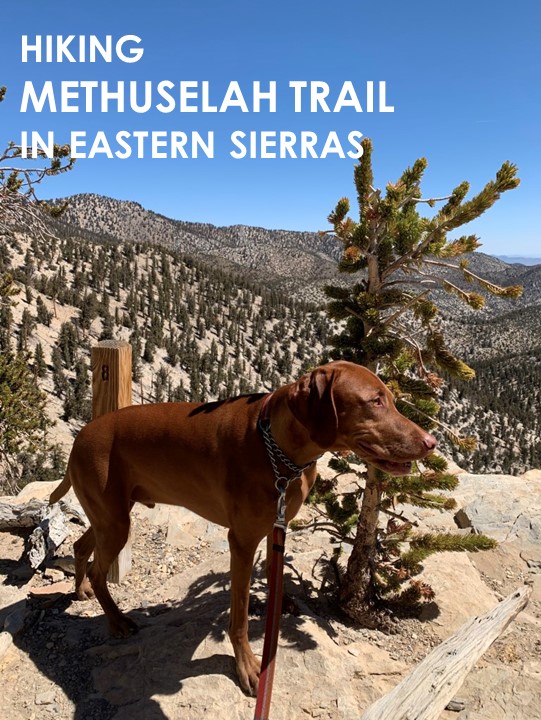
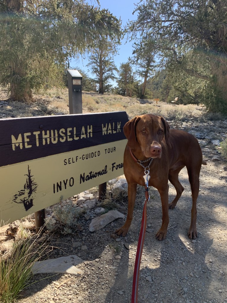
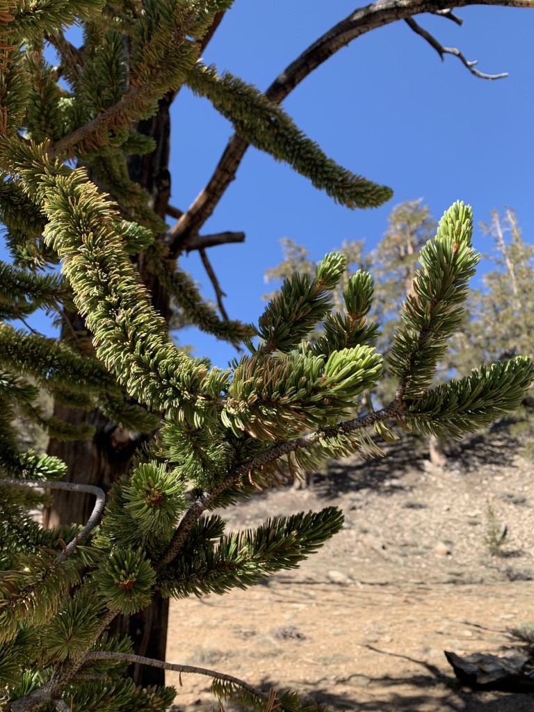
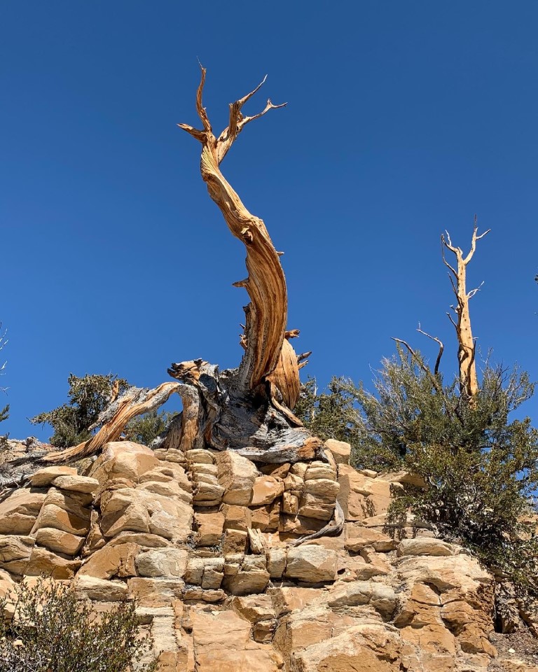
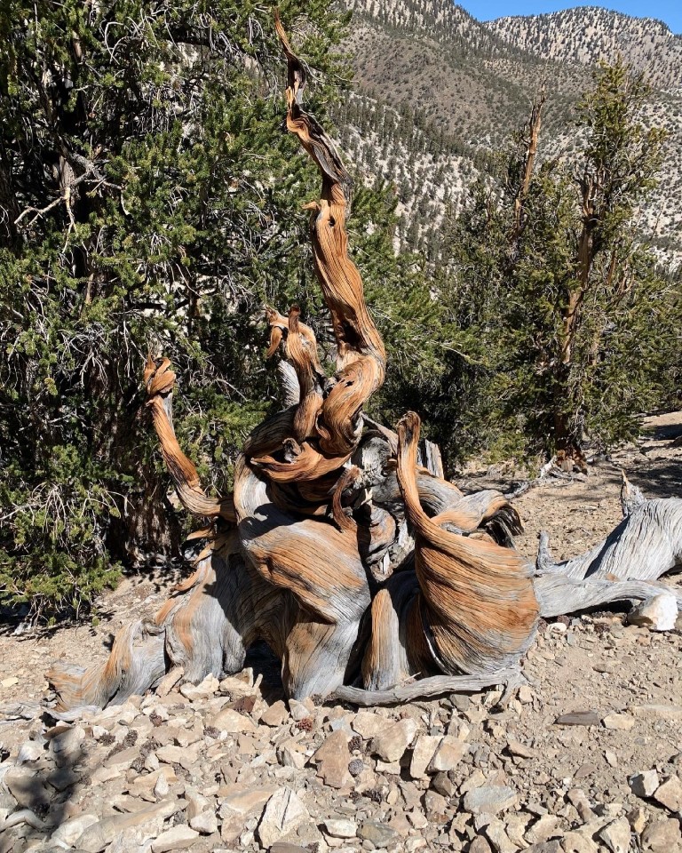
Methuselah Trail
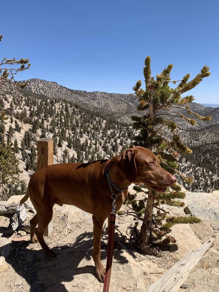
Cappie’s Scoop: Mom and I took a very long time hiking this trail because I couldn’t believe these trees! I had to stop and smell them all. They were the weirdest looking trees I’ve ever seen but I’m happy that I saw them. We camped nearby and had a great trip up on this mountain! Don’t hesitate to add YOUR scoop in the comments below!
Tips: This amazing loop trail is located in the Ancient Bristlecone Pine Forest in the White Mountains in the Inyo National Forest. The trailhead starts around 10,000 ft, can be narrow in some parts and does have a gradual incline as you wind your way through some of the most interesting trees. The oldest known living tree in the world (over 5,000 yrs old) is here but its location is kept secret to protect it. For a $1.00 donation, you can keep the brochure provided by the Forest Service at the trail start or return it when you’re finished. It provides information on each of the numbered posts/stops along the trail. Take the time to read each one and identify the feature discussed, it’s worth it! It will lengthen your time on the trail but how often will you be here! The visitor center is open 10 a.m. – 5 p.m. Thursday thru Sunday.
Directions: From 395 (south of Bishop and slightly north of Big Pine), head east on CA-168 for almost 13 miles. It’s a narrow and steep road! Then turn left onto White Mountain Rd. for 10 miles. You’ll pass a scenic overlook along the way too, it’s worth a stop (see last picture with Cappie sitting on the bench). Then continue on and turn right into the Schulman Grove Visitor Center where the trailhead starts.
| Mileage (round trip) | 4 |
| Difficulty | Moderate |
| Gain (in feet) | 800 |
| Trailhead | 37.385530, -118.178852 |
| Hike Time (in hours) | 2-3 |
| Exposure | Mostly Shady |
| Scenery | Mountain Views, Forest |
| Facilities | Toilets in the parking lot at the visitor center. |
| Fees/Permits | Parking fee that you pay in the visitor center or you can use your National Parks pass. At the time of writing this post, the fee was $3.00 per person with a maximum of $6.00 per car. Children under 18 are free. |
| More Info | https://www.bishopvisitor.com/activities/bristlecone-forest; https://www.fs.usda.gov/recarea/inyo/recarea/?recid=20272&actid=50 |
| Last Hiked | 5/11/2021, 6/18/2023 |


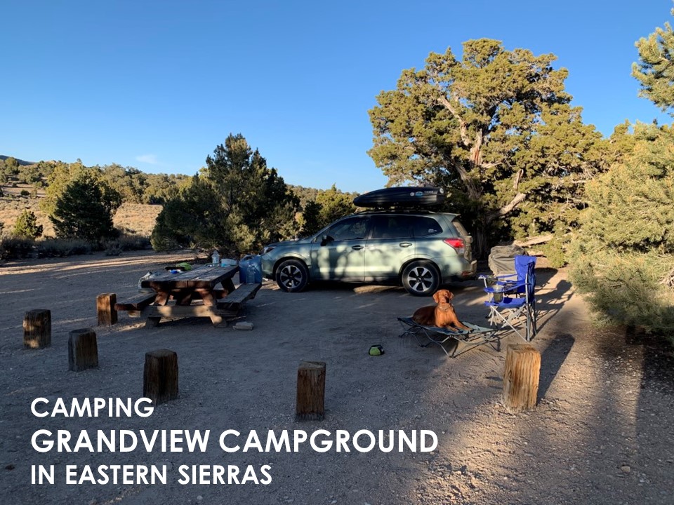
Grandview Campground
Cappie’s Scoop: Did you know that I don’t really like roads that go around and around and around. It gets me dizzy and I feel like I can’t sit still in the backseat. But after driving up this twisty road, we found a really fun campground. It was very quiet and the campsites were pretty big. Nearby I went and checked out a really cool trail. It had the craziest trees I’ve ever seen in my life! Check out my other post about this spot. Don’t hesitate to add YOUR scoop in the comments below!
Tips: Camp sites have a picnic table and a fire ring. There is no trash service at this campground so make sure you pack everything out with you. Grandview is also the closest campground to the Ancient Bristlecone Pine Forest and an amazing hike on the Methuselah Trail. Enjoy stargazing here too!
Directions: From 395 (south of Bishop and slightly north of Big Pine), head east on CA-168 for almost 13 miles. It’s a narrow and steep road! Then turn left onto White Mountain Rd. for 5.3 miles and the entrance to the campground will be on your left.
| Location | 37.333506, -118.187321 |
| Time (in hours) | 1 night |
| Exposure | Sunny |
| Scenery | Forest |
| Facilities | Toilets at the campground. No water. |
| Fees/Permits | None. First-come, first-served sites. $10/night donation requested at the time of writing this post. Donations help pay for maintenance and improvements at this campground. |
| More Info | https://www.fs.usda.gov/recarea/inyo/recarea/?recid=20268 |
| Last Camped | 5/10/2021-5/11/2021 |