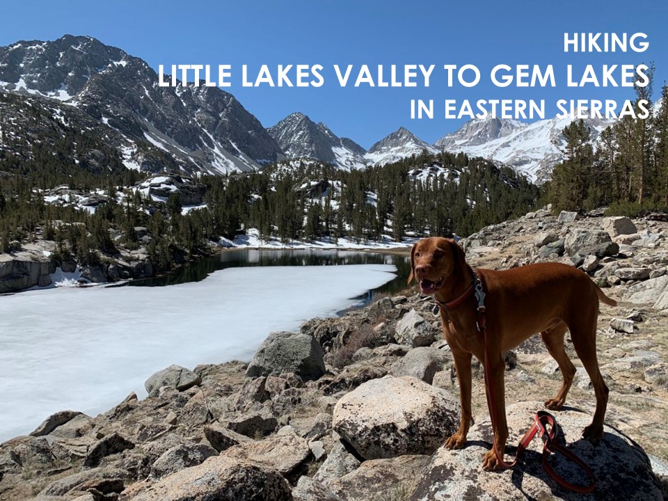
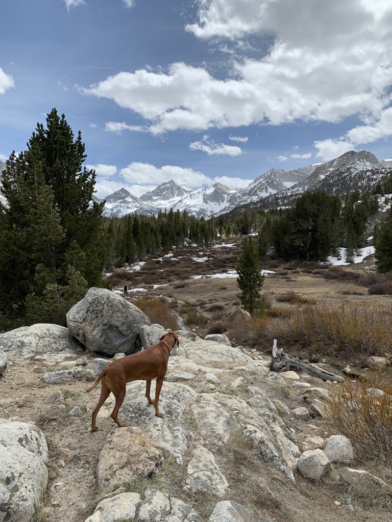
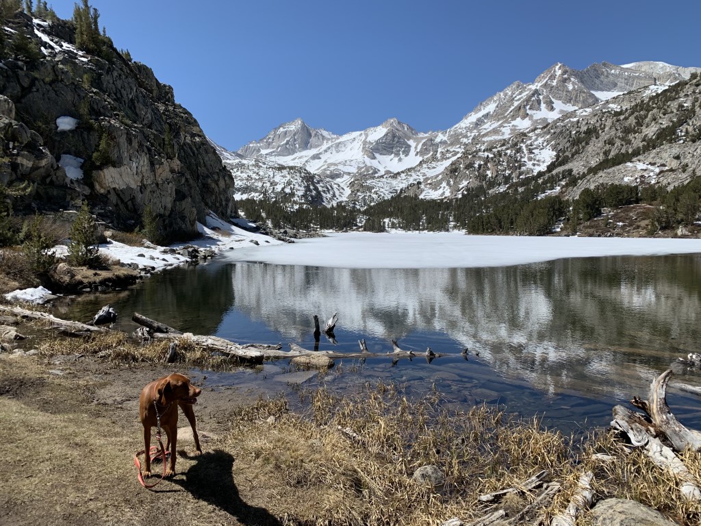
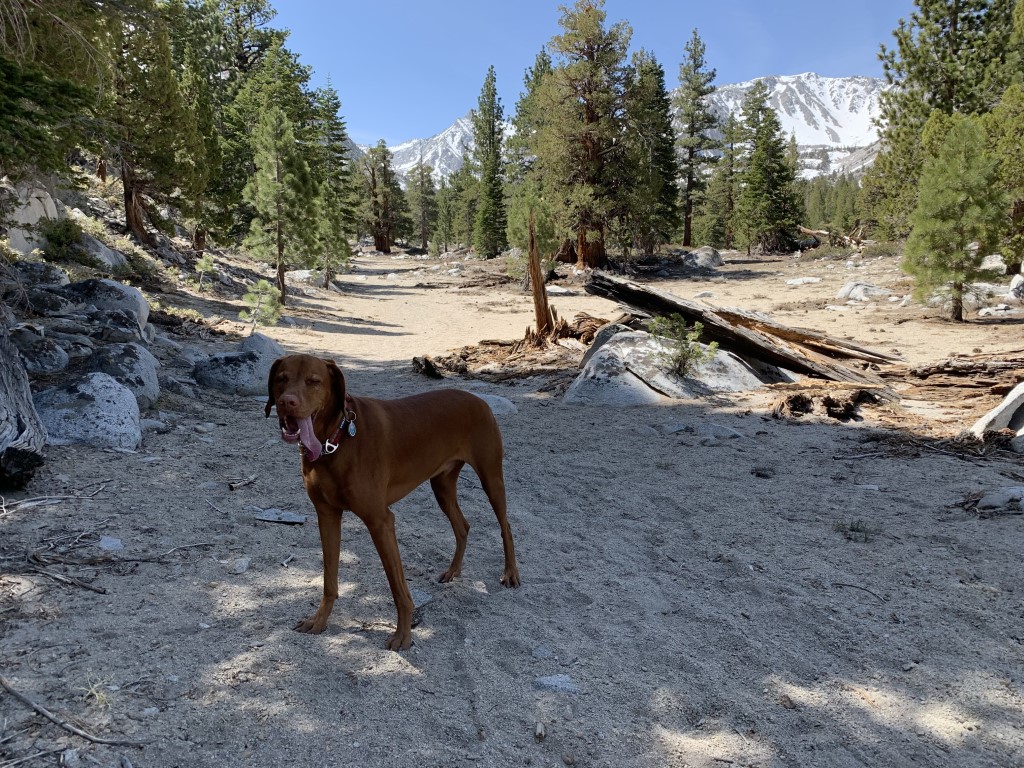
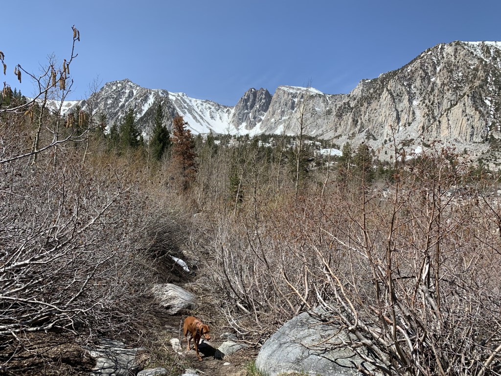
Little Lakes Valley to Gem Lakes
Cappie’s Scoop: A trail full of lakes, yes please! But there was still some snow on the ground and the lakes were ice cold so mom wouldn’t let me swim. I was bummed. At least I got to play in the snow which was a lot of fun! Don’t hesitate to add YOUR scoop in the comments below!
Tips: The Little Lakes Valley/Mosquito Flats trailhead is very popular so arrive early to get a parking spot. This would also make a great trail to backpack either to Gem Lakes or even Ruby Lake (see our other post on hiking to this lake). Overnight permits are required in the John Muir Wilderness, https://www.recreation.gov/permits/233262.
Directions: From the Toms Place exit on 395 (north of Bishop and south of Mammoth), head west on Rock Creek Road. From Toms Place (junction of Lake Crowley Road and Rock Creek Road), continue west for 10.4 miles to the Mosquito Flats Trailhead.
| Mileage (round trip) | 8.5 |
| Difficulty | Moderate |
| Gain (in feet) | 1400 |
| Trailhead | 37.435233, -118.747108 |
| Hike Time (in hours) | 5-6 |
| Exposure | Sunny |
| Scenery | Mountain Views, Forest, Alpine Lake Views |
| Facilities | Toilets and picnic tables at the trailhead. No potable water. Water from creeks, lakes and springs should be treated and/or filtered before drinking. |
| Fees/Permits | None |
| More Info | https://www.fs.usda.gov/recarea/inyo/recarea/?recid=20404&actid=50 |
| Last Hiked | 5/10/2021, 6/16/2023 |


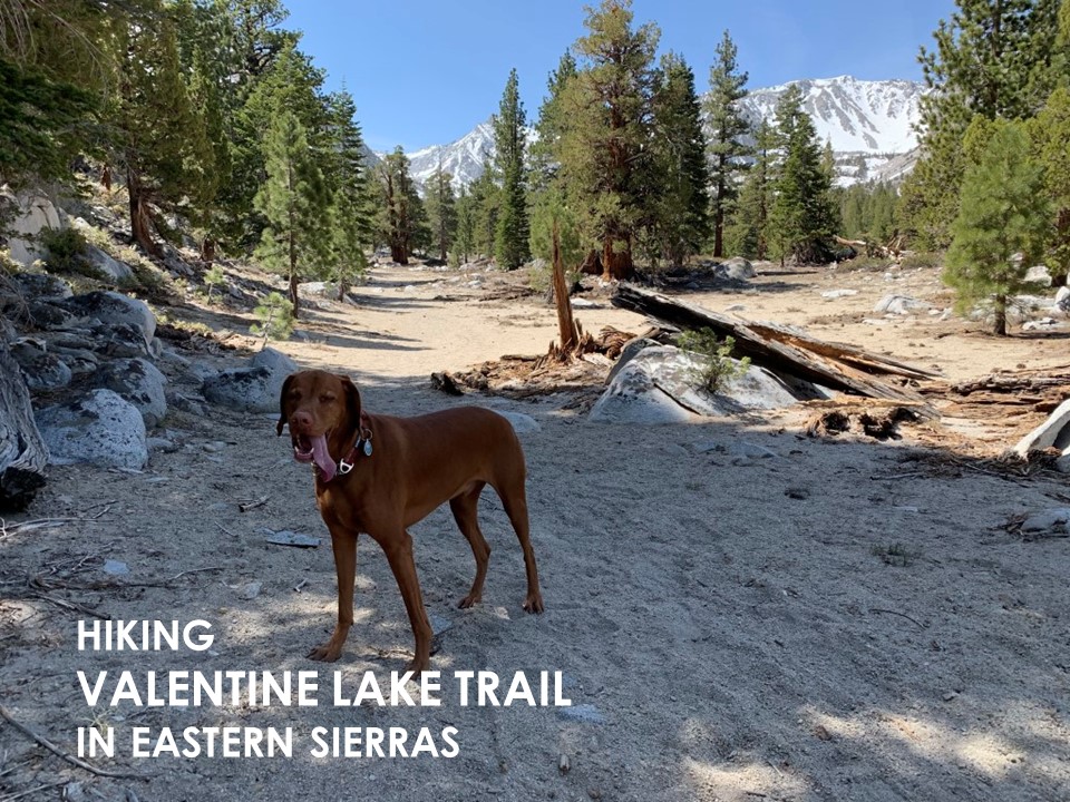
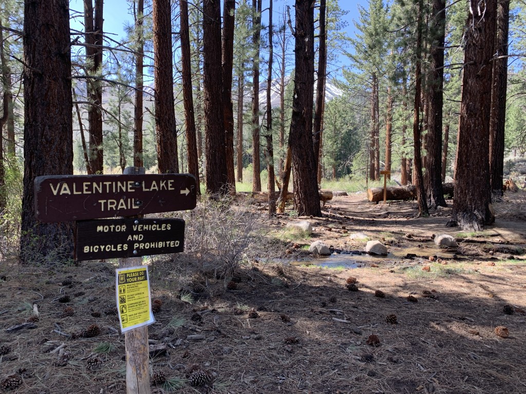
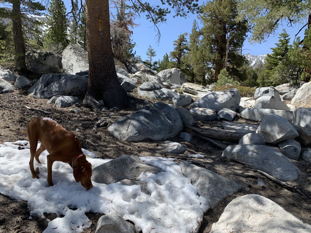
Valentine Lake Trail
Cappie’s Scoop: This trail climbed up and up until it got to a sandy area. I love sand on a trail! I feel like I’m at the beach. But then I kept hiking and we found some snow. There was a lot of snow so we didn’t get a chance to make it to the lake. It probably would’ve been frozen anyway and I wouldn’t be able to jump in so I was okay that we turned around. Next time, we make it to the lake and I’m going swimming! Don’t hesitate to add YOUR scoop in the comments below!
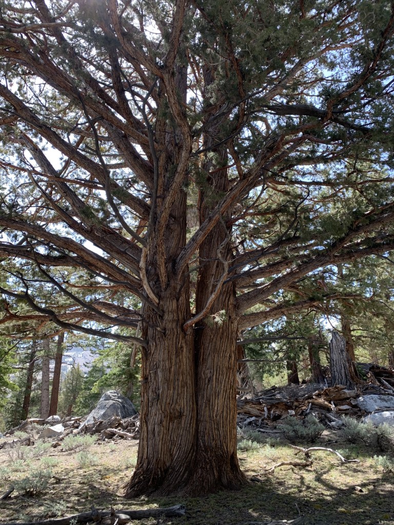
Tips: The trail is steep to start but then flattens out as you climb into the forest filled with lovely smelling Jeffrey Pines. You’ll pass a junction on the trail that leads to the Sherwin Lakes but stay straight and continue on for Valentine Lake. The last time we hiked this trail, we were about one mile short of the lake due to snow but we still wanted to share this one with you!
Directions: There are two ways to reach Valentine Lake and both start off of Sherwin Creek Rd. We started at the Valentine Lake trailhead just east of the Sherwin Creek Campground. The other trailhead is near the campground and will increase your hike by 2 miles RT.
| Mileage (round trip) | 9 |
| Difficulty | Moderate |
| Gain (in feet) | 2100 |
| Trailhead | 37.624910, -118.924670 |
| Hike Time (in hours) | 3-4 |
| Exposure | Sunny and Shady |
| Scenery | Mountain Views, Lake Views, Forest |
| Facilities | None |
| Fees/Permits | None |
| More Info | https://www.fs.usda.gov/recarea/inyo/recreation/recarea/?recid=20462 |
| Last Hiked | 5/9/2021 |
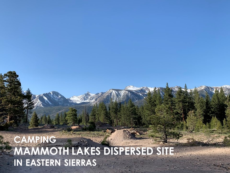
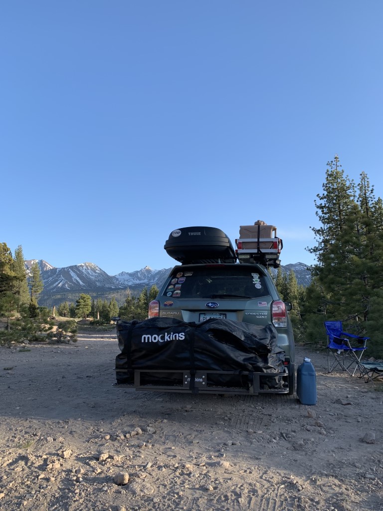
Mammoth Lakes Dispersed Camping

Cappie’s Scoop: I had a long day exploring Mammoth and lots of trails. It was time to find a spot to sleep! There were a lot of other cars and vans in this area camping so we found the right place. Plus mom said it had a nice view of the mountains. As long as I’m with mom, I can sleep anywhere! Don’t hesitate to add YOUR scoop in the comments below!
Tips: This spot not only had cell phone service but great views of the mountains! A nice area for tent camping or sleeping in your car. It was also very quiet too. We decided to sleep in our Subaru Forester. We laid down the back seats and bought an air mattress that filled up the back. Two hoomans and Cappie slept fairly comfortably together. It did get a little chilly in the morning so we turned on the car to heat up a bit while we waited for the sun to shine over the mountains on us. Then we made some breakfast using our camp stove and headed back into town to treat ourselves to coffee/tea and a vegan chocolate chip cookie at Stellar Brew. Check it out!
Directions: From Main Street in Mammoth Lakes, turn onto Sawmill Cutoff. On the corner is a forest service sign that says Inyo National Forest Campgrounds, Shady Rest. Continue down this road past the Shady Rest Campground and Park. You will reach a dirt road and there are many spots in that area for dispersed camping besides the one we provided GPS coordinates.
| Location | 37.658735, -118.945162 |
| Time (in hours) | 1 night |
| Exposure | Sunny |
| Scenery | Mountain Views, Forest |
| Facilities | None |
| Fees/Permits | None |
| More Info | We use https://www.ioverlander.com and the app to find dispersed camping sites. |
| Last Camped | 5/8/2021-5/9/2021 |

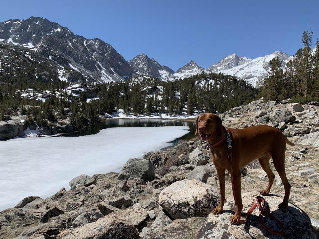
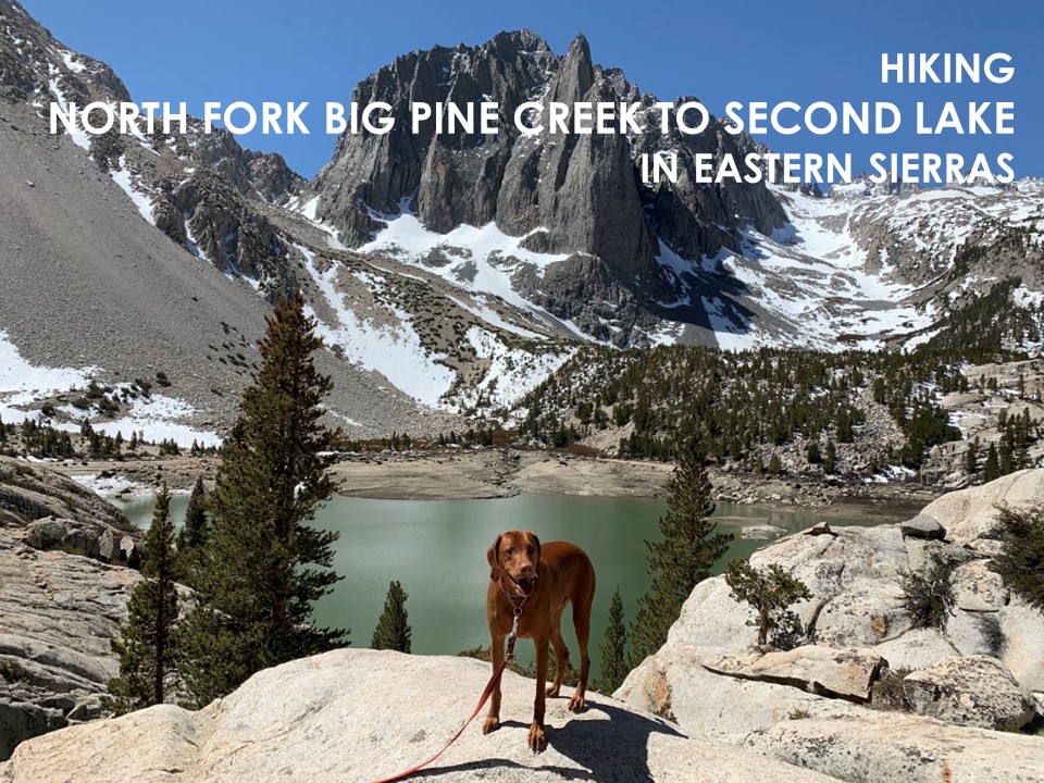
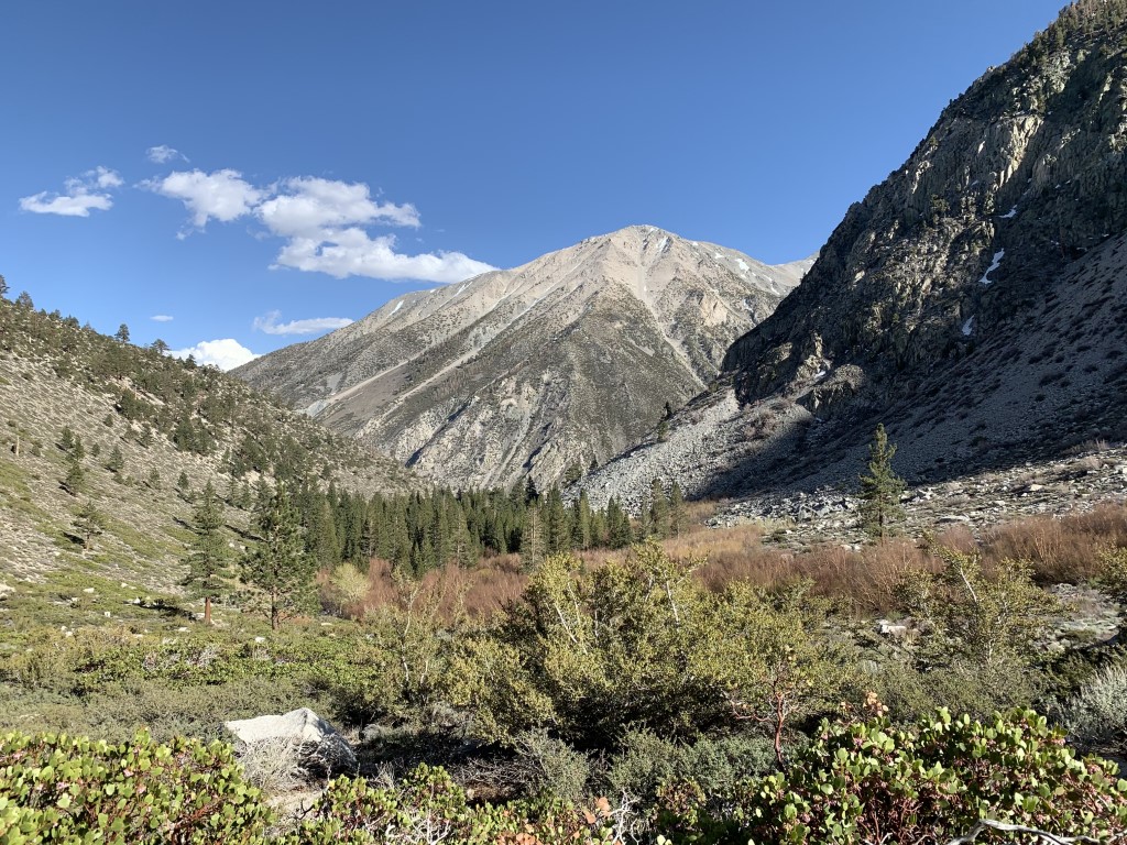
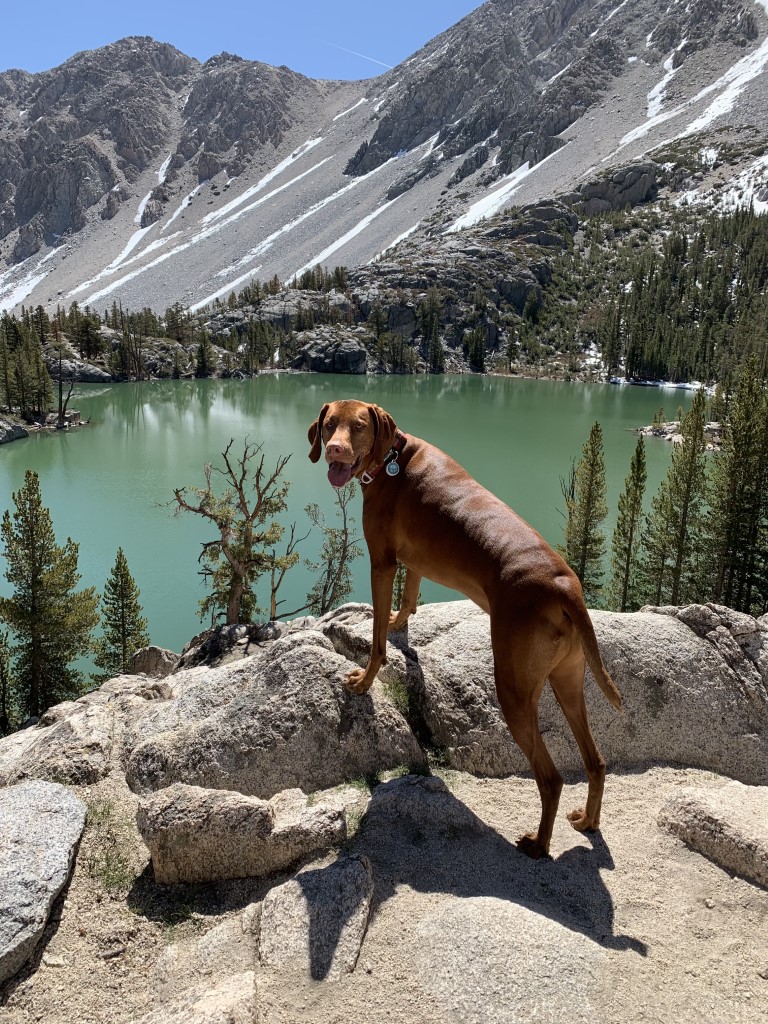
Second Lake via Big Pine Creek North Fork Trail
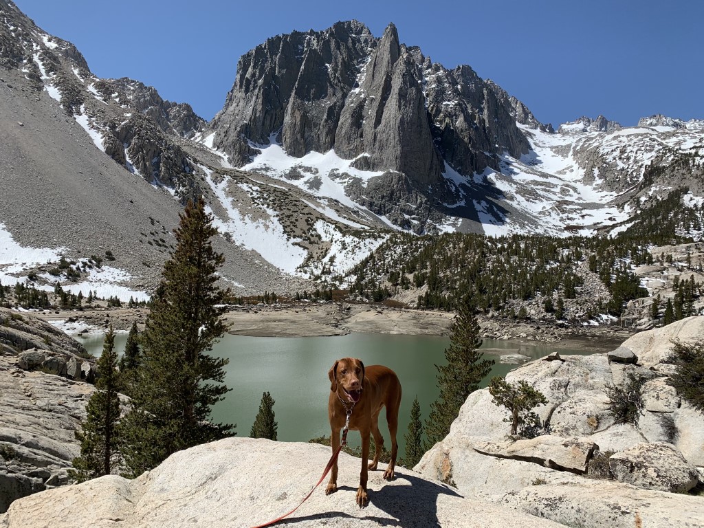
Cappie’s Scoop: Mom and I camped near this trail so all I did was wake up and walk on over to the trailhead, that was cool. The trail had lakes and waterfalls, this is my trail! I loved hiking this trail and mom said if we kept hiking, we would find even MORE lakes! But she says we will need to bring more stuff like a tent and of course more treats. So I think we should come back here again so we can see the other lakes. I’m going to swim in every one! Don’t hesitate to add YOUR scoop in the comments below!
Tips: The North Fork trail takes you to a number of alpine lakes but if you want to see the jagged spires of Temple Crag, head to the second lake and you won’t be disappointed! Bring your filter and you can fill up at the second falls or at the second lake.
Directions: From the town of Big Pine on 395 (south of Bishop and north of Independence and Lone Pine), head west on W Crocker Ave which turns into Glacier Lodge Rd. Continue for almost 10 miles and the road will dead end at the trailhead.
| Mileage (round trip) | 10 |
| Difficulty | Moderately Strenuous |
| Gain (in feet) | 2250 |
| Trailhead | 37.125285, -118.437524 |
| Hike Time (in hours) | 6-7 |
| Exposure | Sunny and Shady |
| Scenery | Mountain Views, Forest, Alpine Lake Views, Creek |
| Facilities | Toilets at the trailhead. No potable water. Water from creeks, lakes and springs should be treated and/or filtered before drinking. |
| Fees/Permits | None |
| More Info | https://www.fs.usda.gov/recarea/inyo/recarea/?recid=20328 |
| Last Hiked | 5/8/2021, 6/17/2023 |


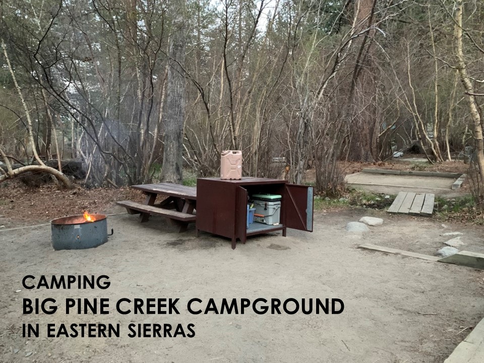
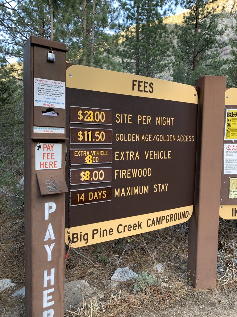
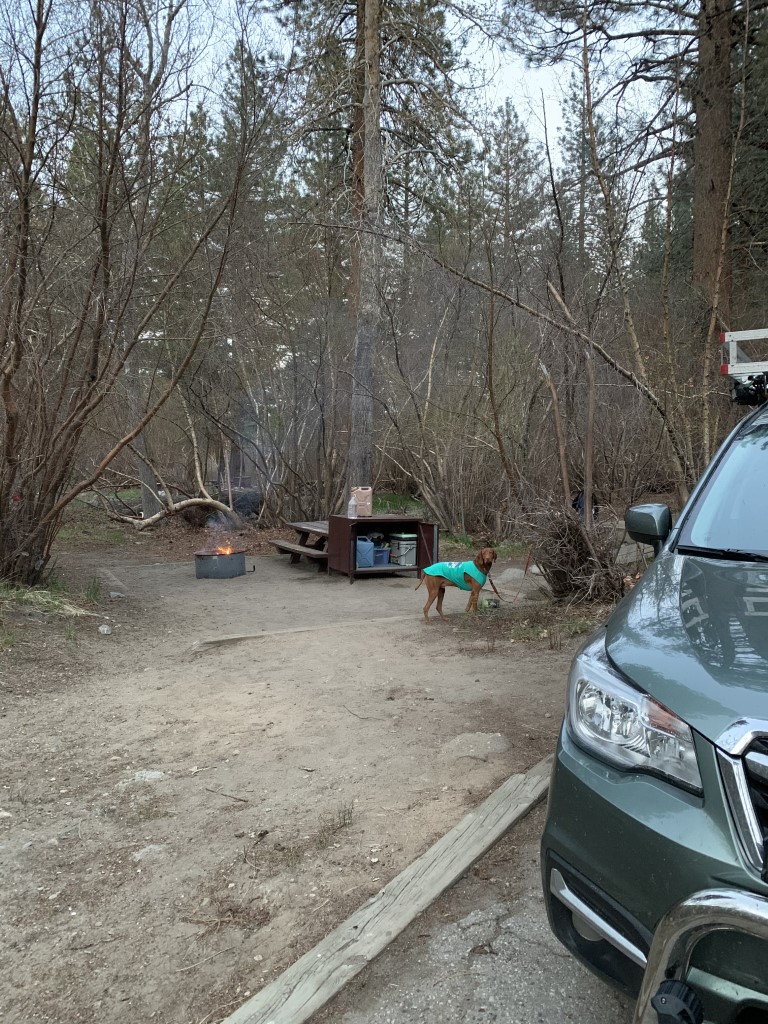
Big Pine Creek Campground

Cappie’s Scoop: I like camping especially when it’s right next to fun trails, a creek and a waterfall! The campground was very quiet and we had lots of choices on which campsite to pick. I told mom to get the one near the creek please. We got some fire wood and had a campfire which is a lot of fun and very warm. Since it was very chilly outside we slept in the car where it was very cozy and warm. Don’t hesitate to add YOUR scoop in the comments below!
Tips: Camp sites have a picnic table, food storage box, and a fire ring. Firewood is available for sale, $8 per bundle. Our favorite site is #29 because you can tent camp or sleep in the car and the driveway to park the car is “level” for sleeping. Yeah you really have to think about that! Site #9 is also really cool because it has a rock wall built around it with a rock chimney! Water is available across the way in the creek. Hiking trails to South Fork and North Fork Big Pine Creek to different alpine lakes are within walking distance. If Big Pine is full, Upper Sage Flat and Sage Flat Campgrounds are down the road.
Directions: From the town of Big Pine on 395 (south of Bishop and north of Independence and Lone Pine), head west on W Crocker Ave which turns into Glacier Lodge Rd. Continue for almost 10 miles and just before the road dead ends (at the trailhead), turn left and head towards the campground.
| Location | 37.125534, -118.433605 |
| Time (in hours) | 1 night |
| Exposure | Shady |
| Scenery | Creek, Wildlife, Forest |
| Facilities | Toilets at the campground. No potable water. Water from creeks, lakes and springs should be treated and/or filtered before drinking. |
| Fees/Permits | Sites are $23/night at the time of writing this post. |
| More Info | https://www.fs.usda.gov/recarea/inyo/recarea/?recid=20312; https://www.recreation.gov/camping/campgrounds/232305 |
| Last Camped | 5/7/2021-5/8/2021 |
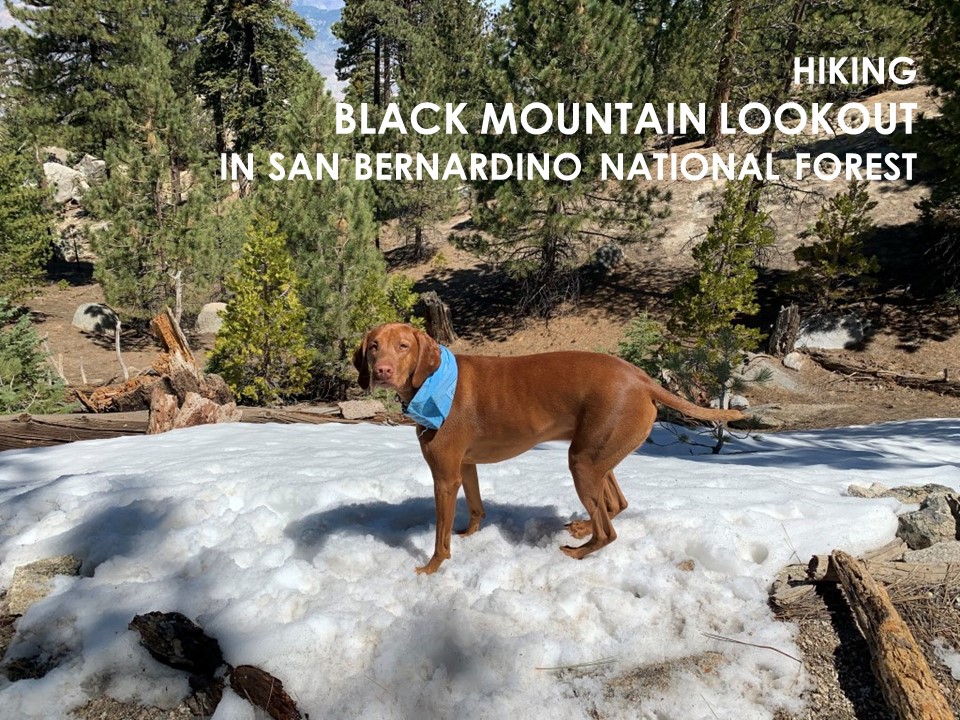
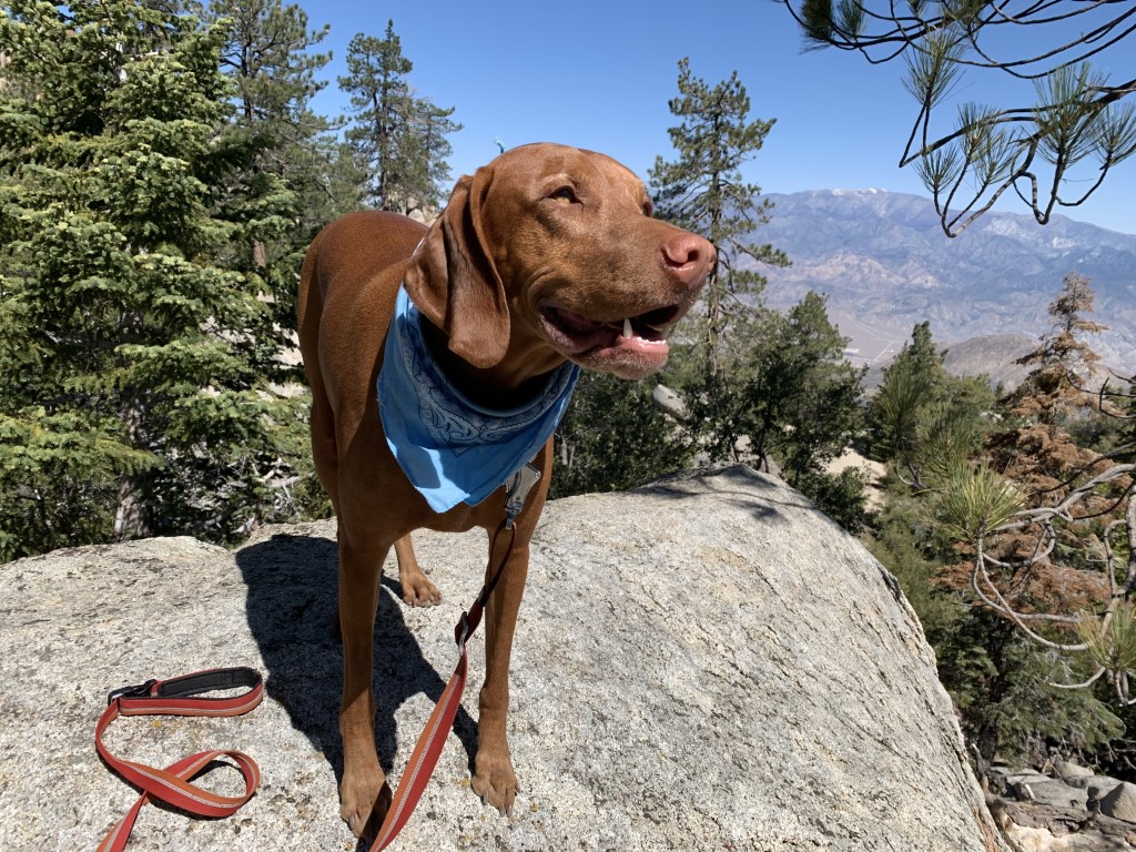
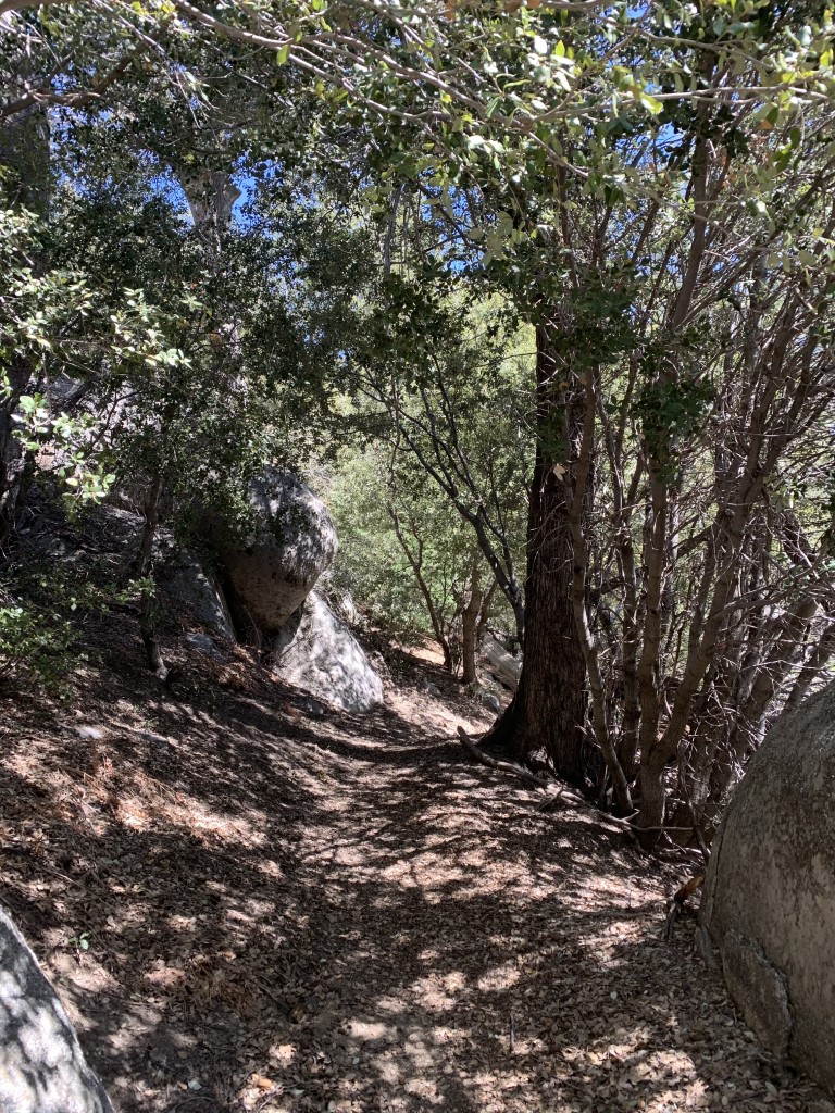
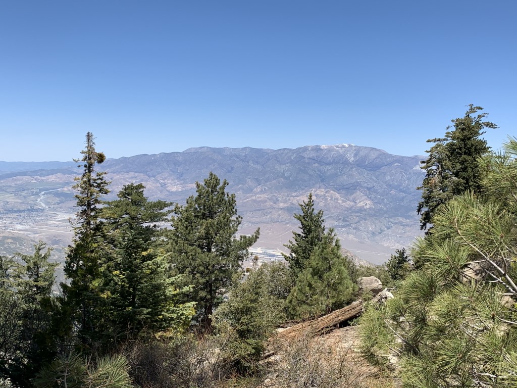
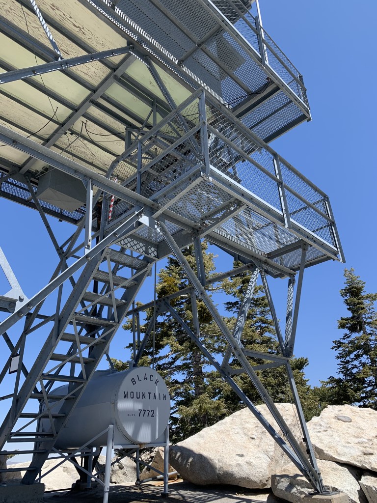
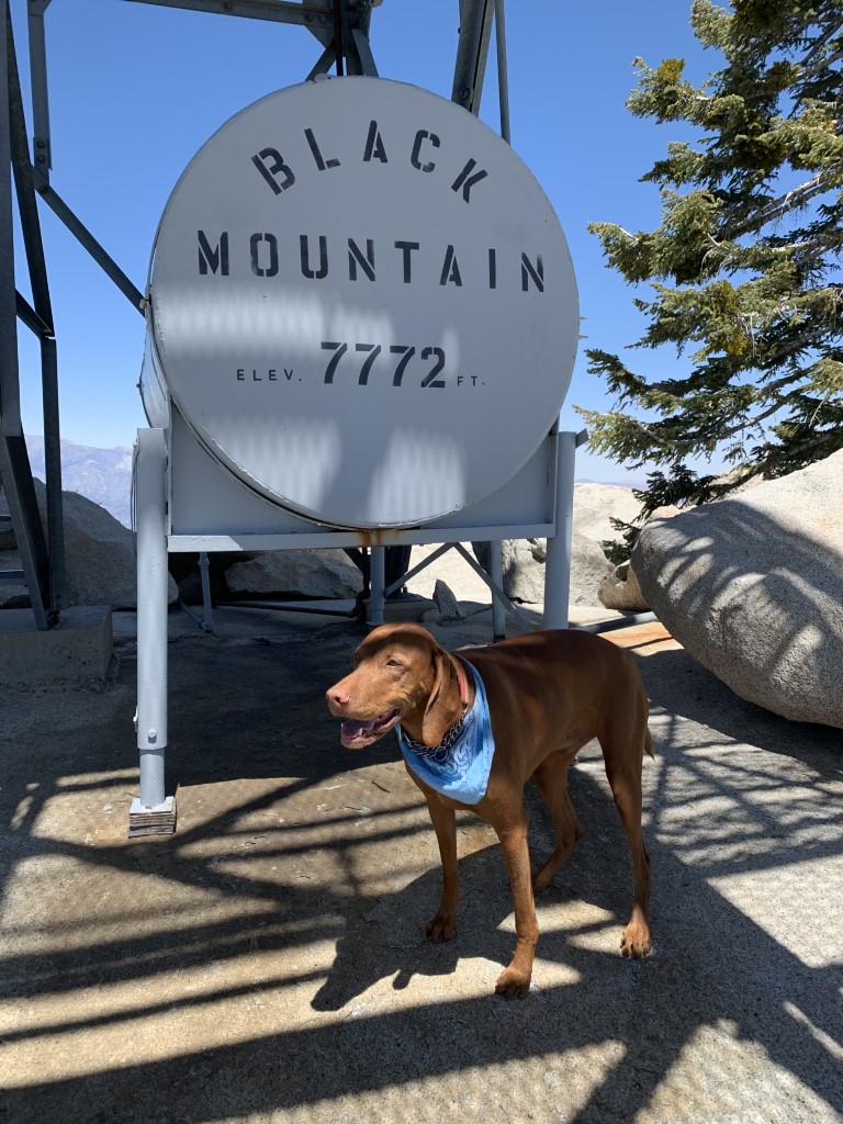
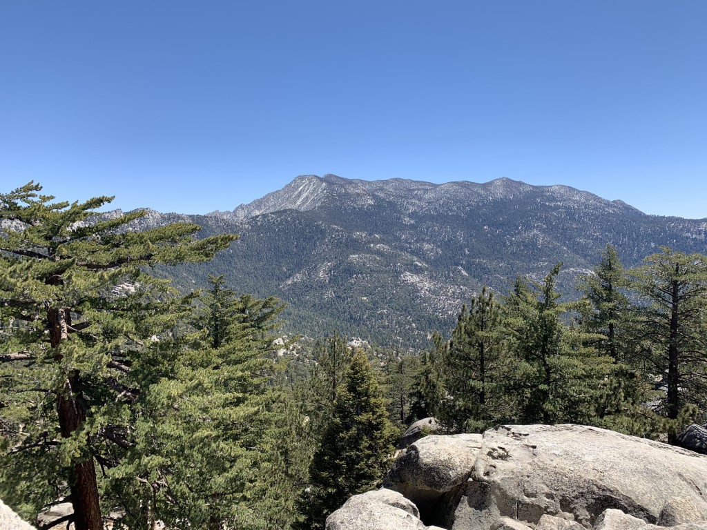
Black Mountain Lookout
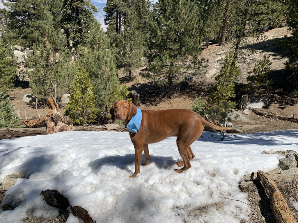
Cappie’s Scoop: The whole trail smelled like trees and pine cones! I even found a bit of snow towards the top but it wasn’t enough to zoom around in so I just hiked around it. At the top is a cool tower so I got a couple pictures and then we headed down through the trail of warm smelling pine! Don’t hesitate to add YOUR scoop in the comments below!
Tips: The trail is a bit steep most of the way up but has a few moments of leveling out at times. Like us, we noticed a different tree on the trail (almost out of place) and later confirmed it was in fact a sequoia tree planted by someone a long time ago. They are gorgeous among the other pines! Don’t forget to keep your nose open for those Jeffrey Pines. The warm sun hits the bark and it can smell like vanilla, cinnamon or for us butterscotch. Towards the end of the trail, if you’re looking at a map, there are two trails that head to the tower. We took the shorter route to the right past the concrete water tank and found the road in front of the tower. If you take the longer route, I think it only adds less than a mile since our total trip was 8 miles.
Directions: Take I-10 toward Banning and exit at Highway 243/San Gorgonio Avenue. Head south on 8th St. for 00.1 mile and then turn left onto Lincoln Street. Continue east for 0.5 mile and turn right onto S. San Gorgonio Ave./Highway 243 and drive uphill on the winding road for 16.3 miles. The turn off will be on your left and there should be a brown sign before the turn that says “Black Mountain Trail 2E35.” Turn left onto the dirt road and drive uphill a short distance until the road ends at the trailhead.
| Mileage (round trip) | 8-8.7 |
| Difficulty | Strenuous |
| Gain (in feet) | 2775 |
| Trailhead | 33.827495, -116.795400 |
| Hike Time (in hours) | 4-5 |
| Exposure | Mostly Shady |
| Scenery | Mountain Views, Forest |
| Facilities | None |
| Fees/Permits | None |
| More Info | https://hikingguy.com/hiking-trails/best-la-hikes/black-mountain-trail-to-the-fire-lookout-idyllwild-ca; https://www.fs.usda.gov/recarea/sbnf/recarea/?recid=26471 |
| Last Hiked | 4/18/2021 |

Temecula Wineries

The Parkhouse Pack’s Scoop: Pups poppin bottles! Looking for a pinkies up kind of outing with your dogs? Temecula has some great wineries that are dog friendly! We may be a little biased, but one of our favorites is Danza del Sol (we loved it so much we are now members there). They have a lovely patio usually with live music on the weekends, and during non-COVID restrictions you can bring your own food and bark-cuterie board. Their wine selection is excellent as well whether you prefer reds, whites, or bubbles, you’re sure to find one you like!
Some other great dog friendly Temecula wineries worth checking out include: Miramonte, Leoness Cellars, Vitagliano, Europa Village, and Oak Mountain. With COVID restrictions, some wineries are requiring reservations so be sure to check ahead. Also, you can sometimes find a discount for tastings on Groupon. If you love some good, fresh baked bread, Great Harvest is worth a stop on your way through town to pick some up. Otherwise, cheers and enjoy the Temecula wineries with your fur babe(s)!
| Location | 39050 De Portola Rd, Temecula, CA 92592 |
| More Info | https://www.danzadelsolwinery.com |
| Follow Us! | @sandi_n_aspen |

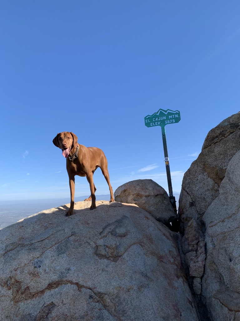
El Cajon Mountain
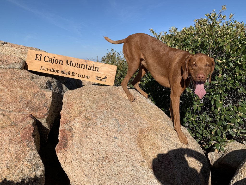
Cappie’s Scoop: Some hoomans say this is the hardest hike in San Diego. Mom says it’s a rollercoaster hike. I’ve never been on a rollercoaster so I don’t know what that means but there’s a lot of climbing up a hill and then running down it. It’s like that all the way to the top of the mountain. It’s exhausting. Start early because it sure does get hot out there too. I’m glad I did this one but it’s okay if I wait a while before going back. Don’t hesitate to add YOUR scoop in the comments below!
Tips: This trail also known as “El Cap” is a tough hike because of the roller coaster hills – up and down both ways! It can also get quite hot in this area so plan to start early, maybe even when it’s still dark with a headlamp. Surprisingly there are shady spots along the trail to take breaks under, get a snack, and some water for you and your dog. The last time we hiked this, we started at 6am and brough 4L of water for both Cappie and I. We went through it all and the temperature only reached the mid-70s so plan accordingly!
Directions: From highway 8, take Highway 67 north until the freeway portion ends and turn right on Mapleview. Turn left on Ashwood, which will turn into Wildcat Canyon Road. Go a little over 4 miles, as you get to the top of the hill turn right at the entrance to El Capitan Open Space Preserve and park in the large lot immediately to your left. Since this was posted, the parking lot is open from 8am-7pm. Outside of those times, the gate is locked. If you want to get started before 8am and/or you plan to finish after 7pm, you can park on the shoulder of Wildcat Canyon Road near the entrance. There is ample room on the shoulder to completely pull off the road.
| Mileage (round trip) | 11 |
| Difficulty | Strenuous |
| Gain (in feet) | 4000 |
| Trailhead | 32.912817, -116.884508 |
| Hike Time (in hours) | 5-7 |
| Exposure | Mostly Sunny |
| Scenery | Mountain Views, Rolling Hills, Trees |
| Facilities | Toilets 0.45 mile from the parking lot. No water. |
| Fees/Permits | None |
| More Info | http://hikingsdcounty.com/el-cajon-mountain-el-cap; https://www.sdparks.org/content/sdparks/en/park-pages/ElCapitan.html |
| Last Hiked | 4/10/2021 |


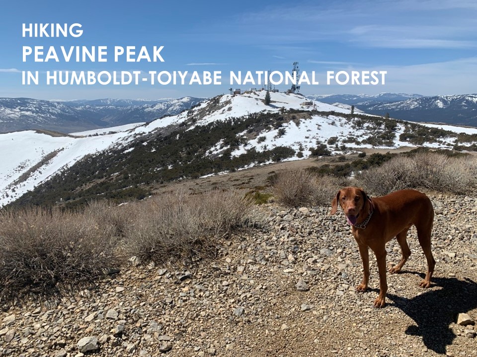
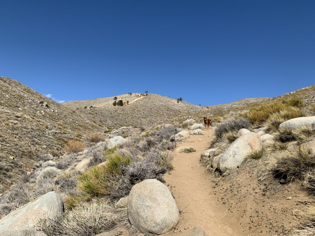
Peavine Peak
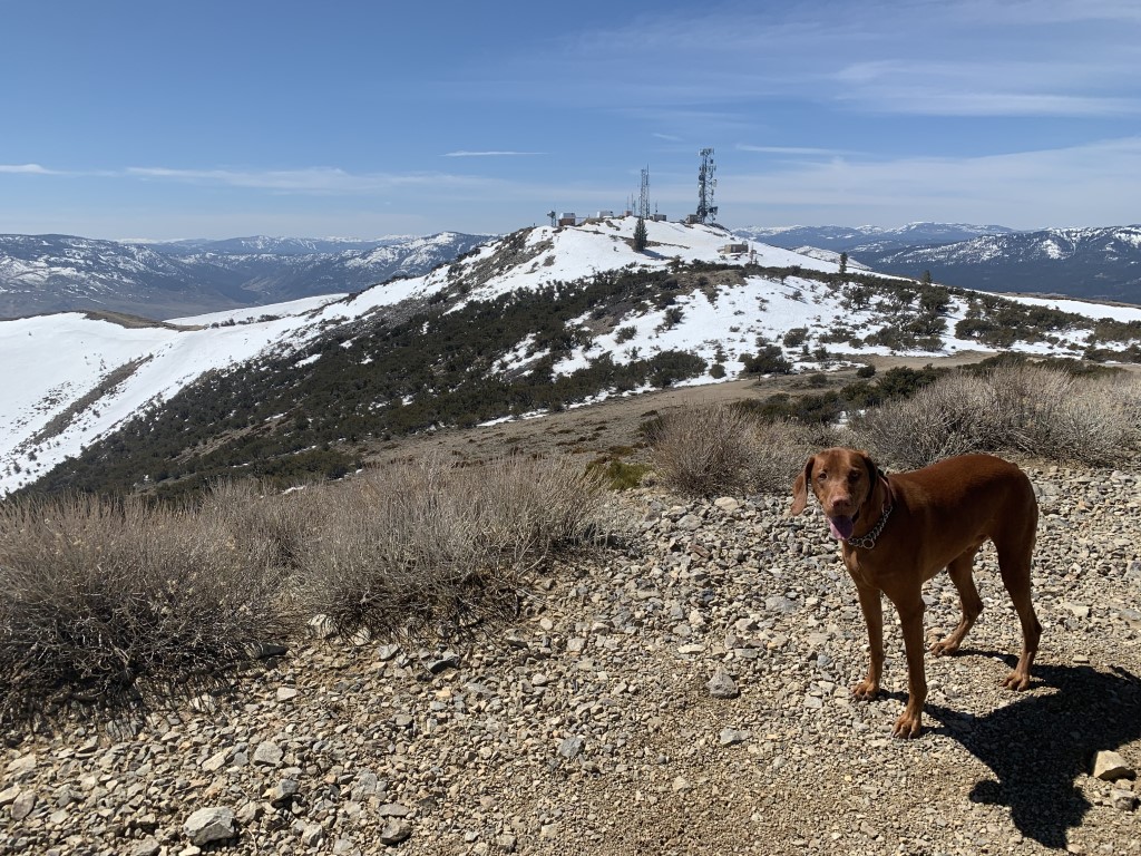
Cappie’s Scoop: If you’re visiting Tahoe and need a break from the snow, pop on over to the Reno area and climb this peak! I did find snow here too but it was much less than Tahoe. It’s better to hike this trail when it’s not too hot because there aren’t a lot of trees. I found one tree and ran under it to play hide ‘n seek with mom. She found me! Don’t hesitate to add YOUR scoop in the comments below!
Tips: The peak is 8,266 ft. We hiked this trail in April and found some lingering snow about one mile from the peak which was a lot of fun! This is also a popular OHV area so keep your eyes open for any whizzing by!
Directions: The trailhead is located in a residential area with free street parking on Peavine Hills Ave.
| Mileage (round trip) | 8.9 |
| Difficulty | Strenuous |
| Gain (in feet) | 2900 |
| Trailhead | 39.55164, -119.89628 |
| Hike Time (in hours) | 5-6 |
| Exposure | Sunny |
| Scenery | Mountain Views |
| Facilities | None |
| Fees/Permits | None |
| More Info | https://travelnevada.com/hiking/peavine-mountain; https://www.reno.gov/home/showpublisheddocument/48300/635575420081730000 |
| Last Hiked | 4/3/2021 |

Lake Sabrina via CA-168
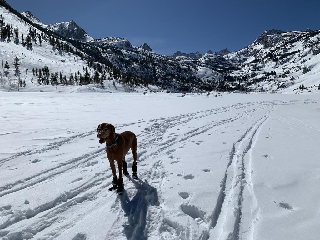
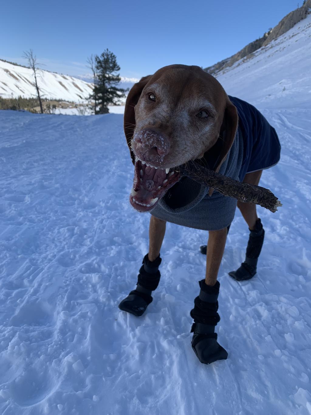
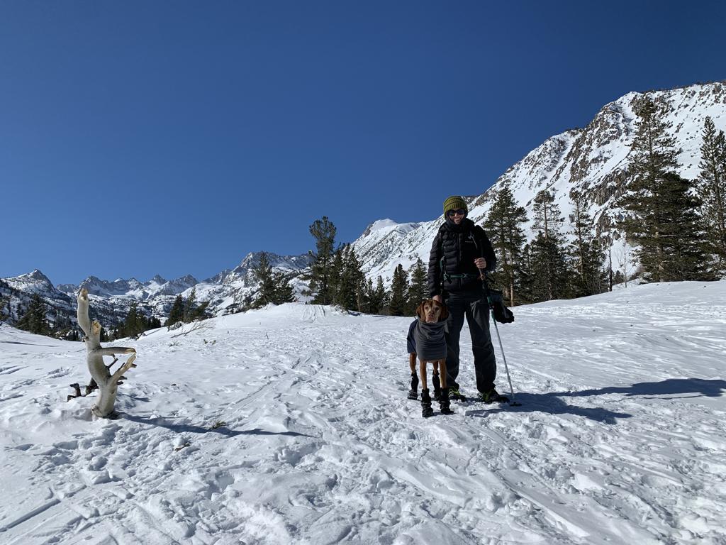
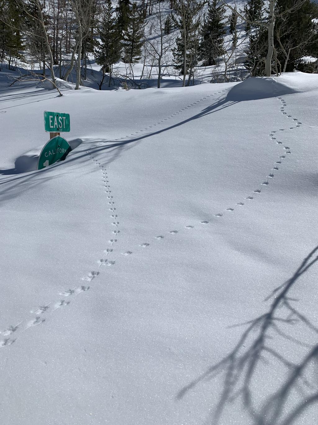
Cappie’s Scoop: This is a fun snow hike! Since this is a closed road covered in snow, it’s like a huge hiking trail! Mom can snowshoe and I can zoom around in the snow. We also saw lots of hoomans hiking up with their skis and then zooming down. It was cool! Mom thinks we should bring a sled next time. Then we got to Lake Sabrina and it was very frozen. So we hiked out onto the lake, wow, what a fun day! I was surrounded by mountains all around me while hiking on the lake. There were lots of little animals tracks in the snow too. Mom took lots of pictures. Don’t hesitate to add YOUR scoop in the comments below!
Tips: This is a snowshoe we did in the winter when CA-168 was closed from Aspendell to Lake Sabrina. We snowshoed up the road and had amazing views!
Directions: From the town of Bishop, head west on CA-168 until you reach the road closed sign during the winter and park on the side of the road.
| Mileage (round trip) | 5 |
| Difficulty | Moderate |
| Gain (in feet) | 689 |
| Trailhead | 37.235079, -118.597260 |
| Hike Time (in hours) | 3-4 |
| Exposure | Sunny |
| Scenery | Mountain Views, Alpine Lake Views, Wildlife |
| Facilities | None at the trailhead. Vault toilets at the campground. Bring your own toilet paper. |
| Fees/Permits | None to park and none to camp. If you intend to build a fire in the provided fire rings at the campground, you will need a free CA campfire permit. You can obtain one by watching this short video online, https://www.readyforwildfire.org/permits/campfire-permit. |
| More Info | https://roads.dot.ca.gov (to check road conditions) |
| Last Hiked | 4/2/2021, 2/19/2023 |