Cedar Creek Falls – Ramona
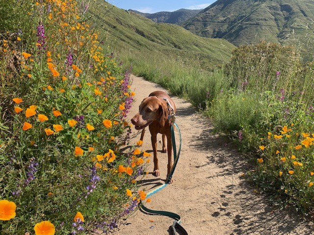
Cappie’s Scoop: The best time to do this hike is when it’s cool outside and maybe the clouds are out! If it’s hot, remember that you have to hike up the hill to get back to your car and that could be tough. Bring lots of water too and extra snacks for energy! Don’t hesitate to add YOUR scoop in the comments below!
Tips: This hike can be a challenge when it’s hot because it’s all downhill to the falls and then all uphill on the way back. Be cautious if you go while it’s raining though because the trail can get a bit muddy and slippery. You can access the trail from either Julian or Ramona (described here) trailheads. In 2023, Southern California received an unprecedented amount of rain which created 4 water crossings on this trail to reach the falls. Always proceed with caution and if crossing appears unsafe, turn around and visit another time when the water levels are low enough that it’s safe to cross.
Directions: From Main St. in Ramona, take 10th Street to San Vicente Road. Follow San Vicente Road for approximately 6.5 miles, then turn left onto Ramona Oaks Road. Turn right onto Thornbrush Road, the trailhead will be at the end of the road.
| Mileage (round trip) | 6 |
| Difficulty | Moderate |
| Gain (in feet) | 1100 |
| Trailhead | 32.995748, -116.756218 |
| Hike Time (in hours) | 3-4 |
| Exposure | Mostly Sunny |
| Scenery | Waterfall, Mountain Views, Wildflowers |
| Facilities | Vault toilets and water faucet at trailhead. |
| Fees/Permits | Permit is $6.00. Each permit allows a maximum group of 5 people and they allow a total of 75 groups to enter each day. To get your permit, visit https://www.recreation.gov/permits/234735. You must bring a printed copy of your permit; digital copies on your cell phone will not be accepted. At times, they have been checking for it at the trailhead. |
| More Info | http://hikingsdcounty.com/cedar-creek-falls-via-ramona; http://hikingsdcounty.com/cedar-creek-falls-via-julian; https://www.fs.usda.gov/recarea/cleveland/recarea/?recid=80293 |
| Last Hiked | 5/30/2016, 4/7/2023 |


