Grays Peak

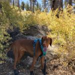
Cappie’s Scoop: Look out for mountain bikers on this trail! They really like this trail too. I hiked this trail in the fall and there were a few spots to see some colorful trees with crunchy leaves. When I reached the top, I saw Big Bear Lake and kept wondering how in the world I get down there to swim in it! Don’t hesitate to add YOUR scoop in the comments below!
Tips: This trail is located on the northside of the lake and has a good mix of sun and shade. From the peak, you can see some of the lake. You also might think you’re at the peak once you reach the yellow post saying “you are here” but take a turn to the left at the post and climb just a small bit more to get to the real peak. This trail is also popular with mountain bikers so keep your eyes open for them.
Directions: Take CA-330N/City Creek Road towards Big Bear. Follow the road for almost 15 miles and continue east as it turns into CA-18/Hilltop Blvd. After 12.3 miles, turn left onto CA-38 west. Continue driving about 2.8 miles and the trailhead will be on your left hand side across from the Grout Bay Picnic Area. If the parking lot is closed, you can find parking along side the road. Important note: This trailhead is in the center of a bald eagle wintering habitat area and is closed to all public when nesting occurs, usually from winter to spring, though it can extend into summer. Check the Forest Service page for updates.
| Mileage (round trip) | 7 |
| Difficulty | Moderate |
| Gain (in feet) | 1174 |
| Trailhead | 34.262637, -116.947796 |
| Hike Time (in hours) | 4-5 |
| Exposure | Mostly Sunny |
| Scenery | Mountain Views, Lake Views, Forest |
| Facilities | Toilets in parking area. |
| Fees/Permits | California Adventure Pass or Interagency Annual Pass/America the Beautiful Pass (National Parks Pass). |
| More Info | https://www.fs.usda.gov/recarea/sbnf/recarea/?recid=26369 |
| Last Hiked | 9/14/2018 |


