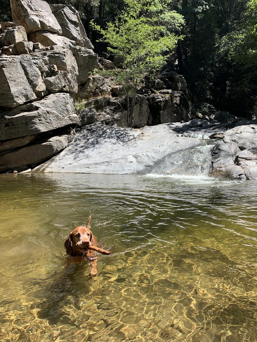
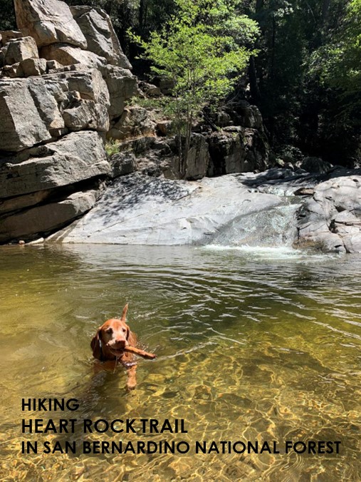
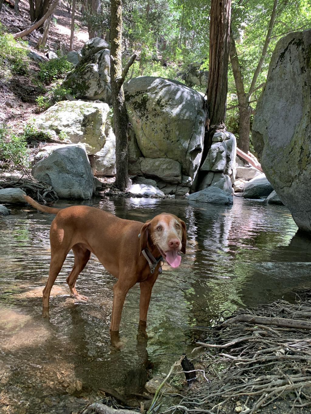
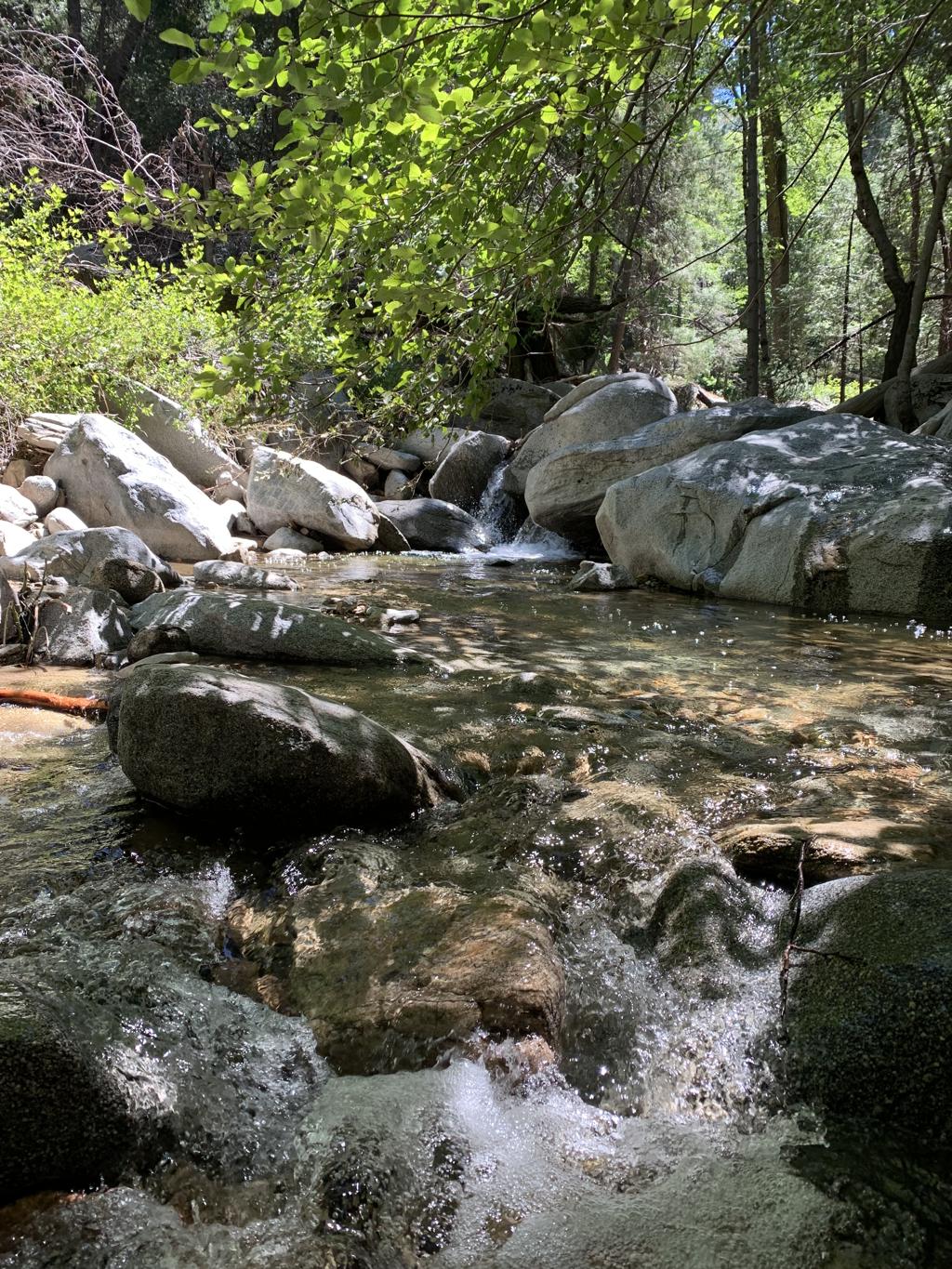
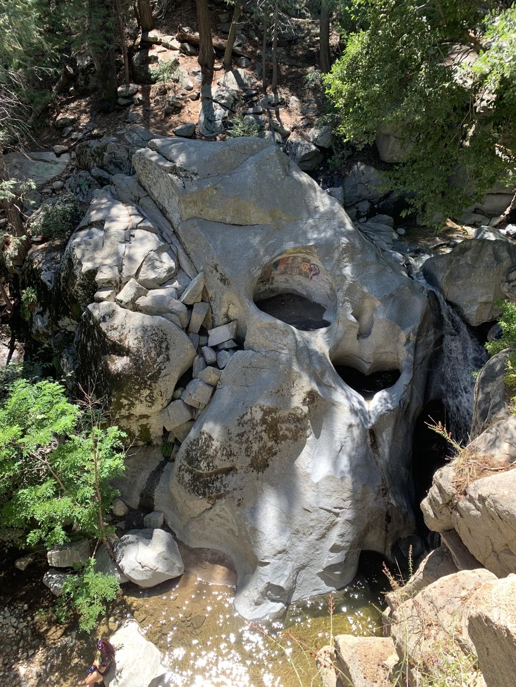
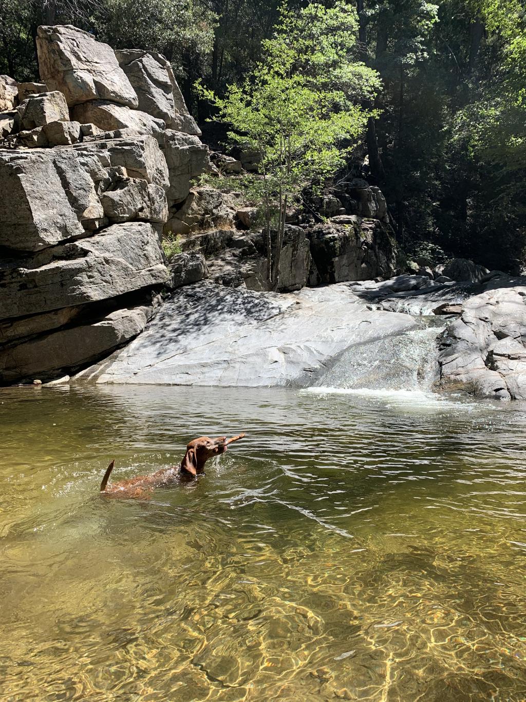
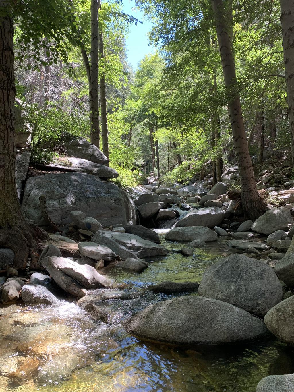
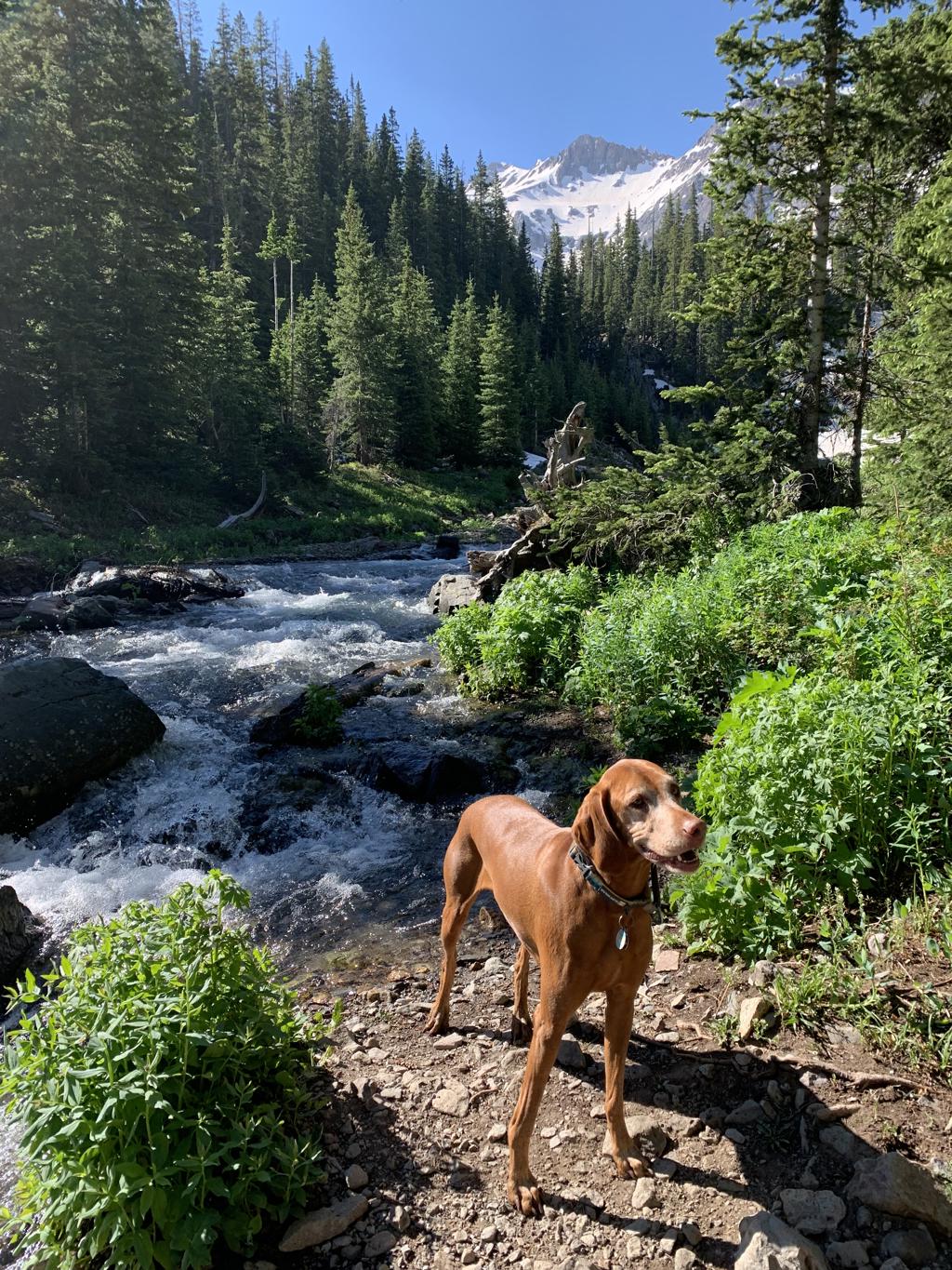
Heart Rock
Cappie’s Scoop: Coming soon! Don’t hesitate to add YOUR scoop in the comments below!
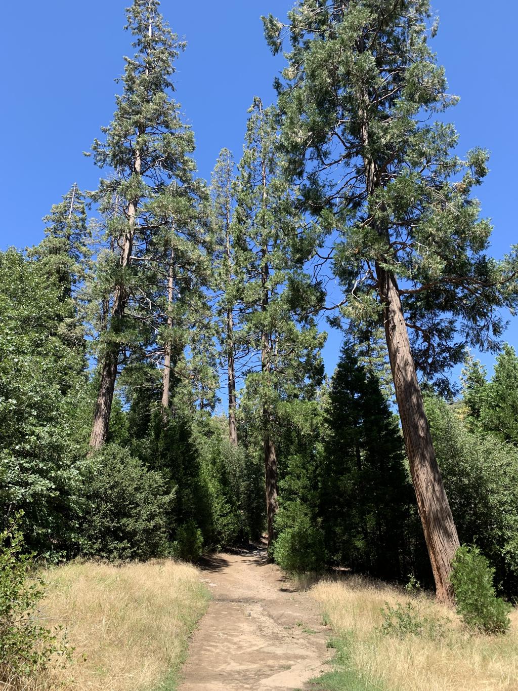
Tips: There are two ways to reach the rock but we recommend you stay on the dirt trail that hugs the creek for a more scenic hike.
Directions: Navigate to CA-18/North Waterman Avenue. Continue driving for 11.3 miles and then exit at CA-138 for Crestline. Drive 2.5 miles and then you will see a dirt parking lot on your left before the entrance to Camp Seely. Park here and then walk to the camp entrance down the paved road to the start of the dirt trail.
| Mileage (round trip) | 1.3 |
| Difficulty | Moderate |
| Gain (in feet) | 265 |
| Trailhead | 34.25271, -117.30297 |
| Hike Time (in hours) | 1 |
| Exposure | Shady |
| Scenery | Forest, Waterfall, Creek |
| Facilities | None |
| Fees/Permits | None |
| More Info | https://californiathroughmylens.com/2011/08/heart-waterfall-seeley-creek-falls-in-crestline-ca |
| Last Hiked | 8/25/2023 |
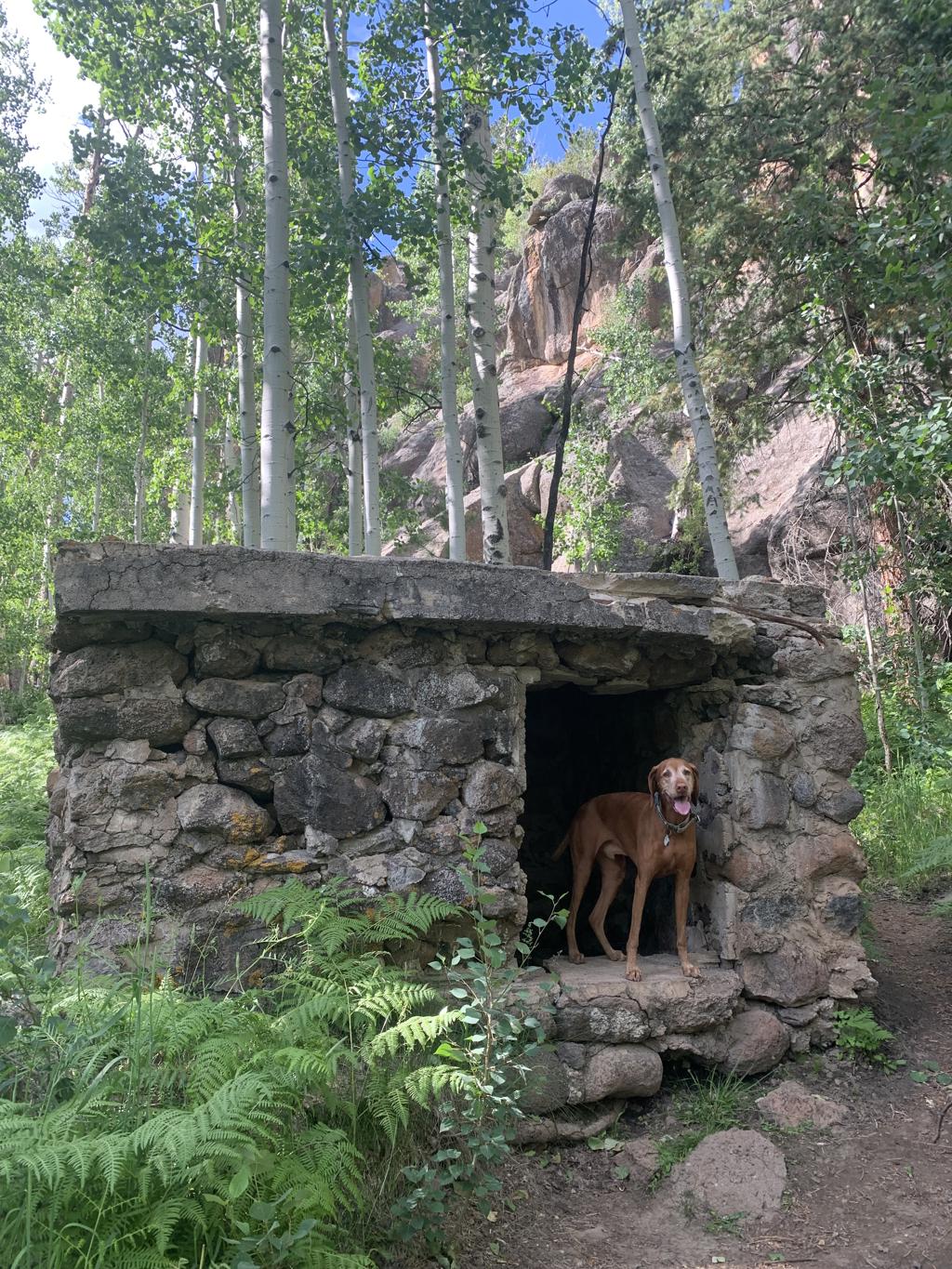
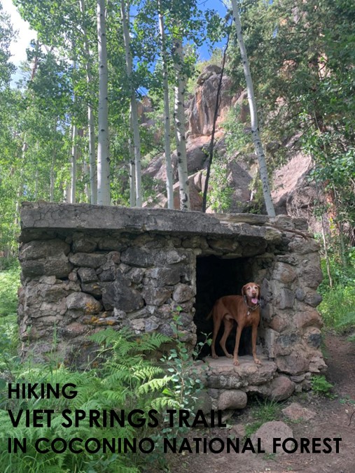
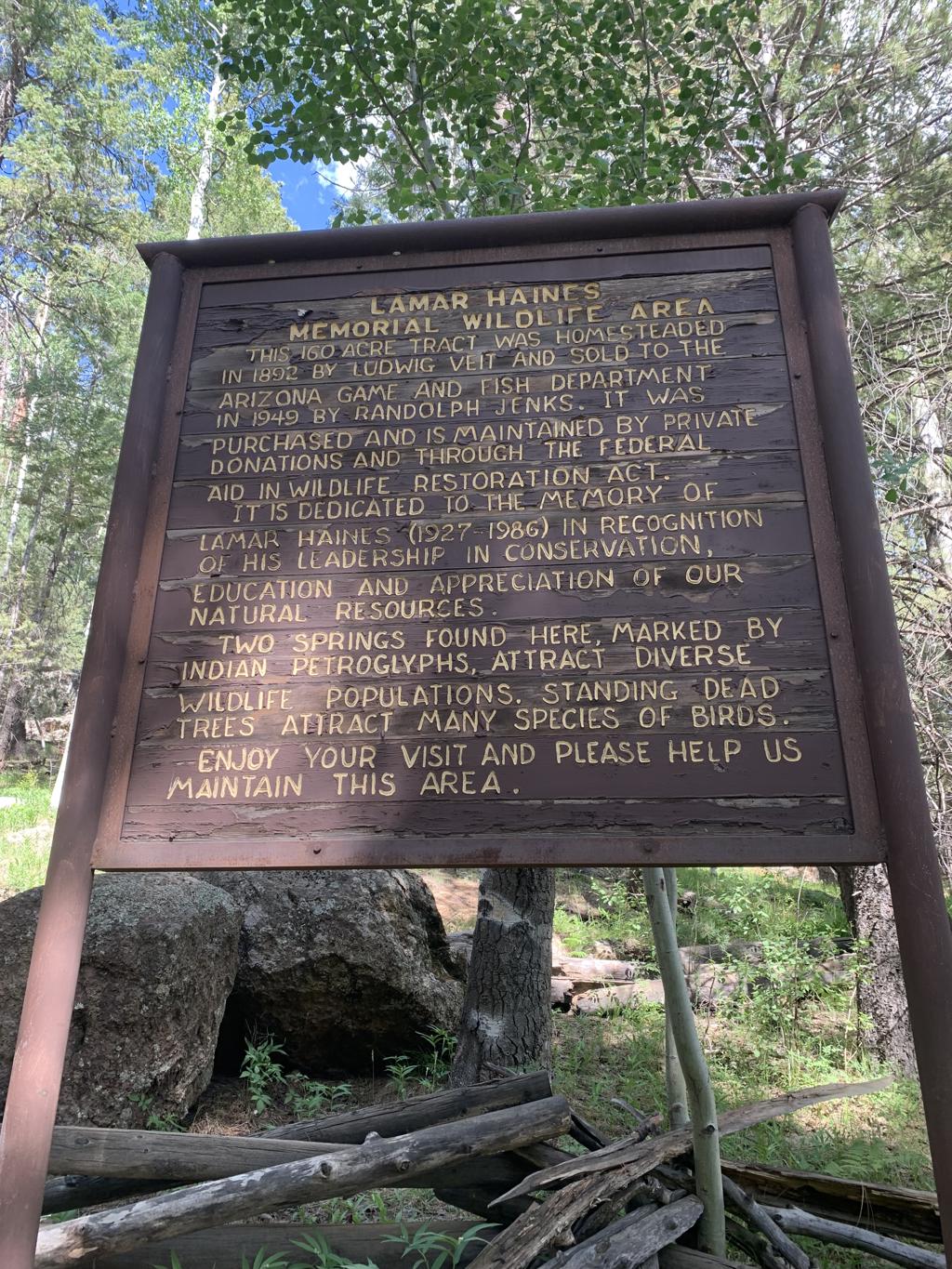
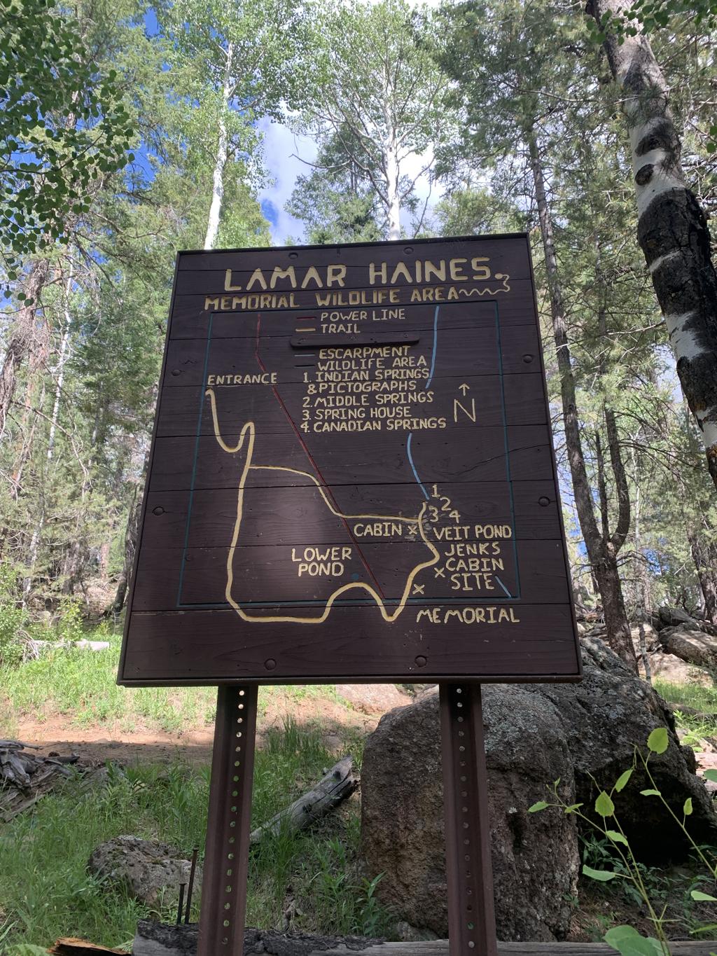
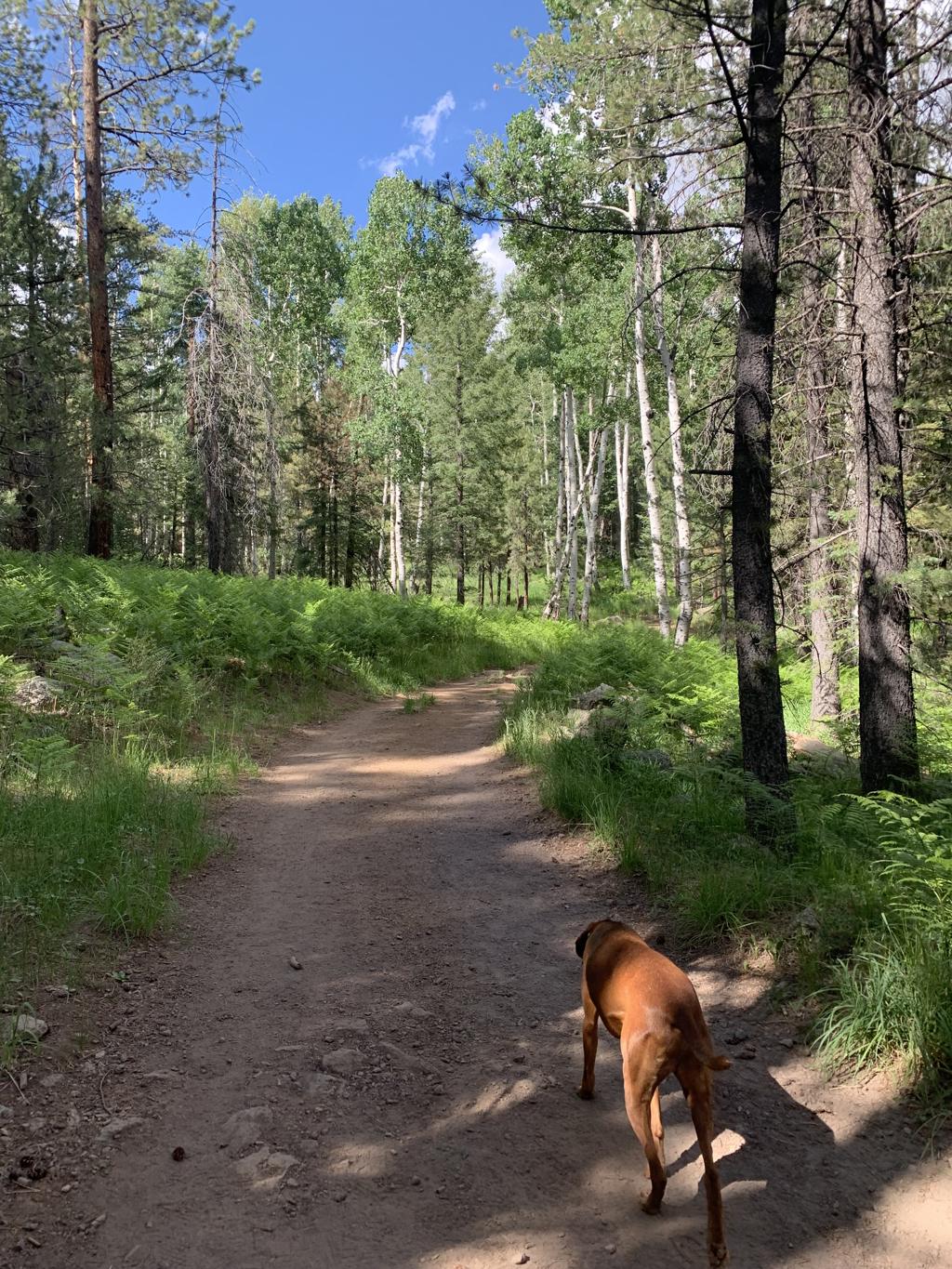
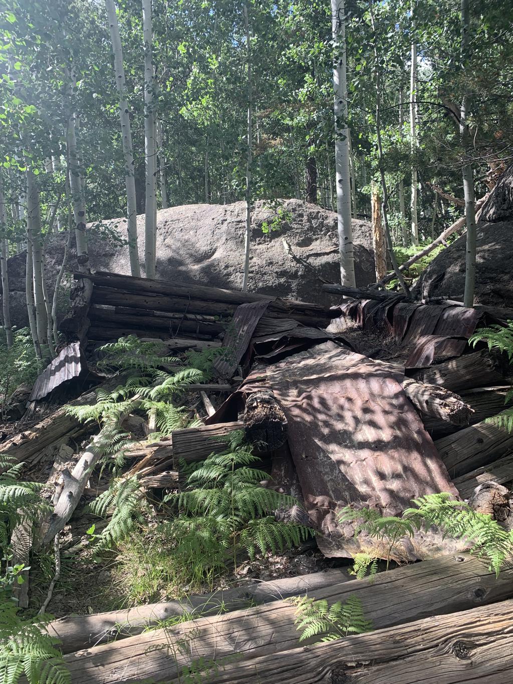
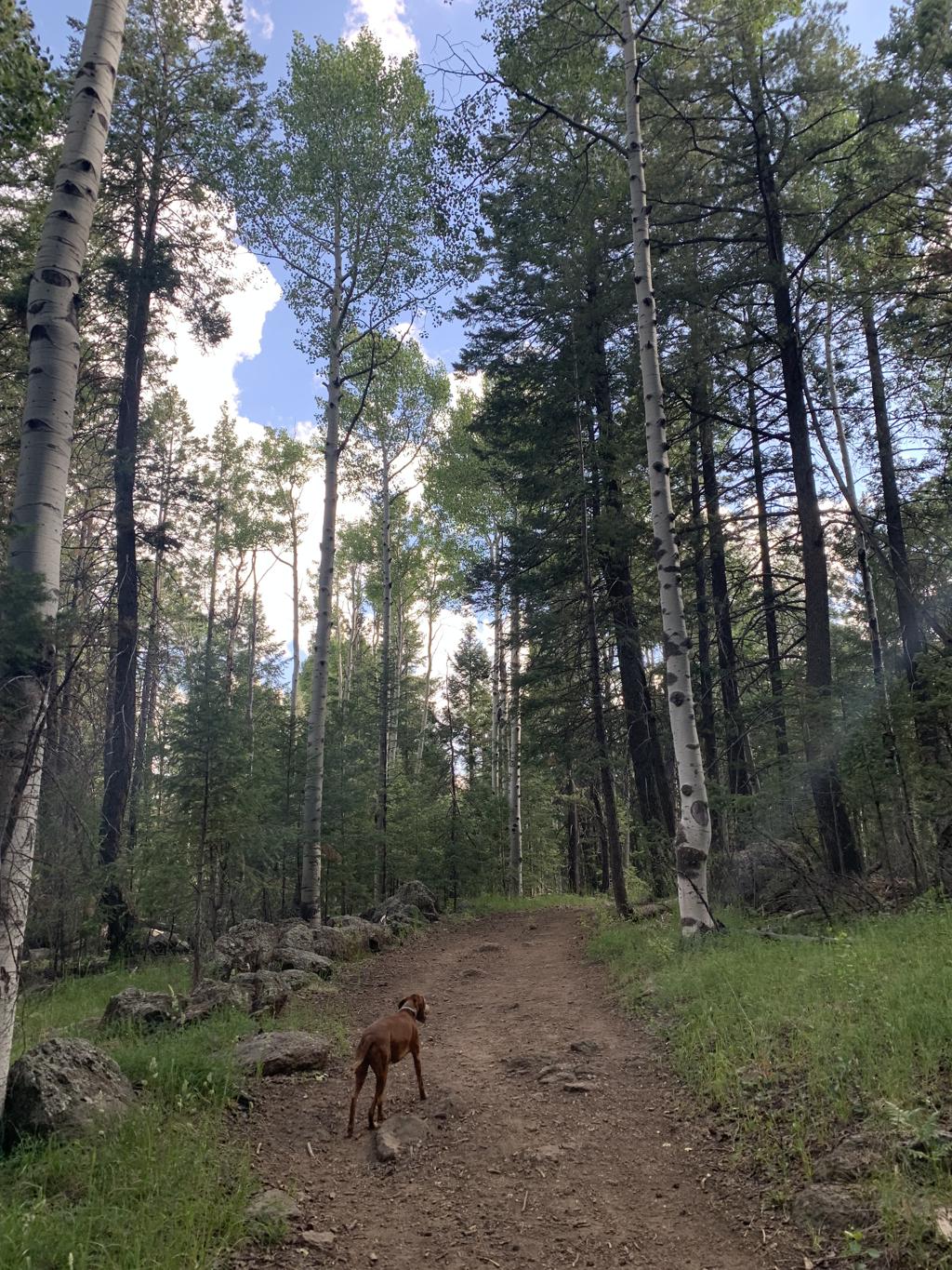
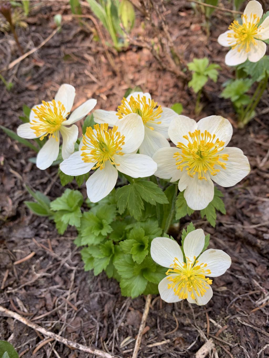
Viet Springs Trail
Cappie’s Scoop: Coming soon! Don’t hesitate to add YOUR scoop in the comments below!
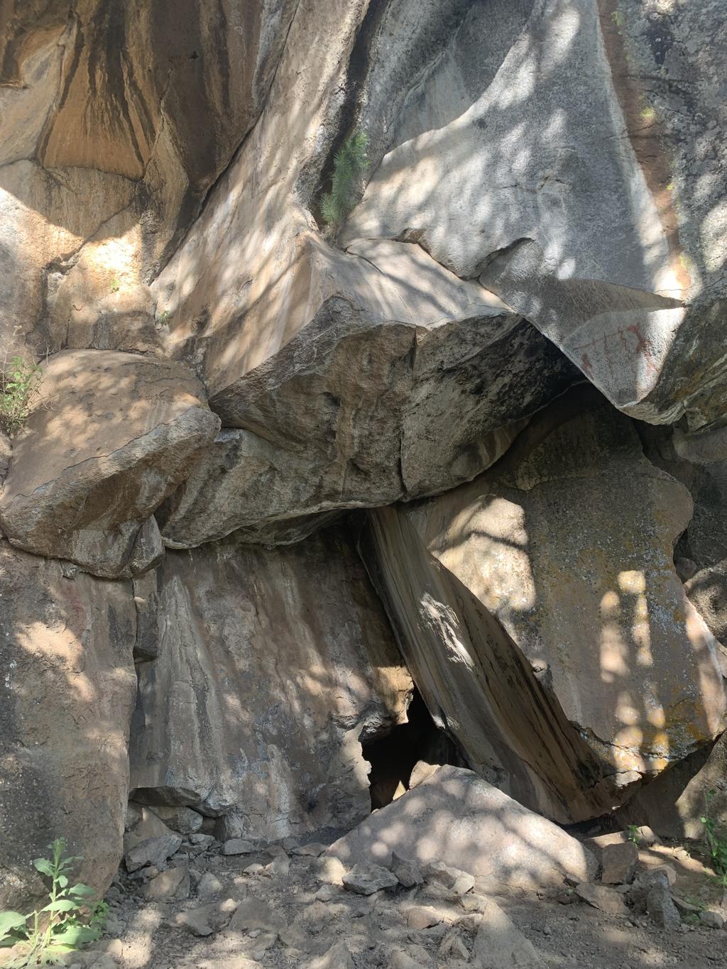
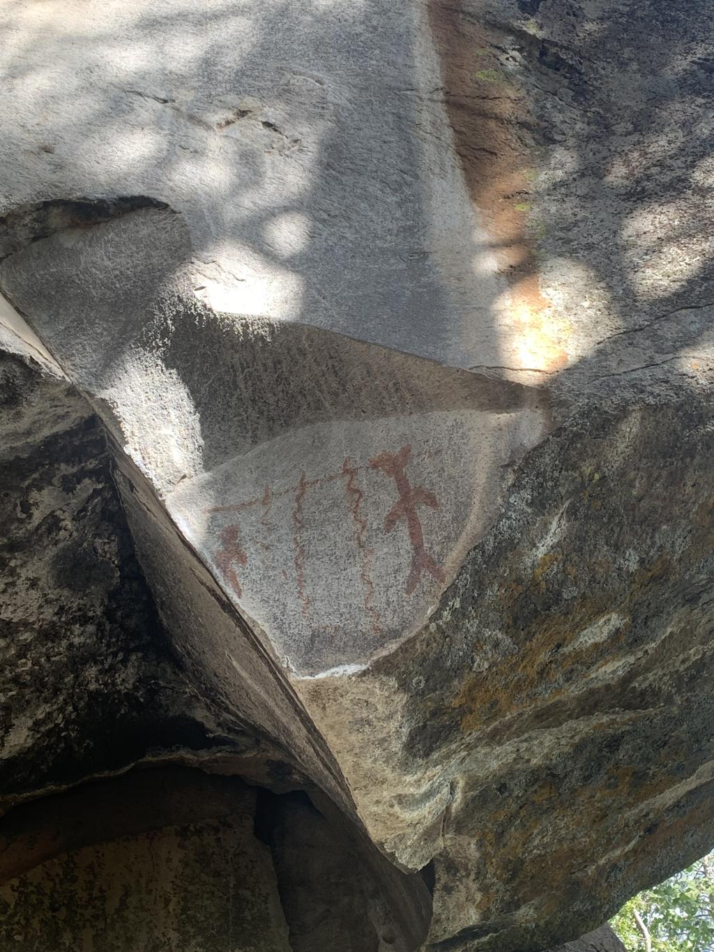
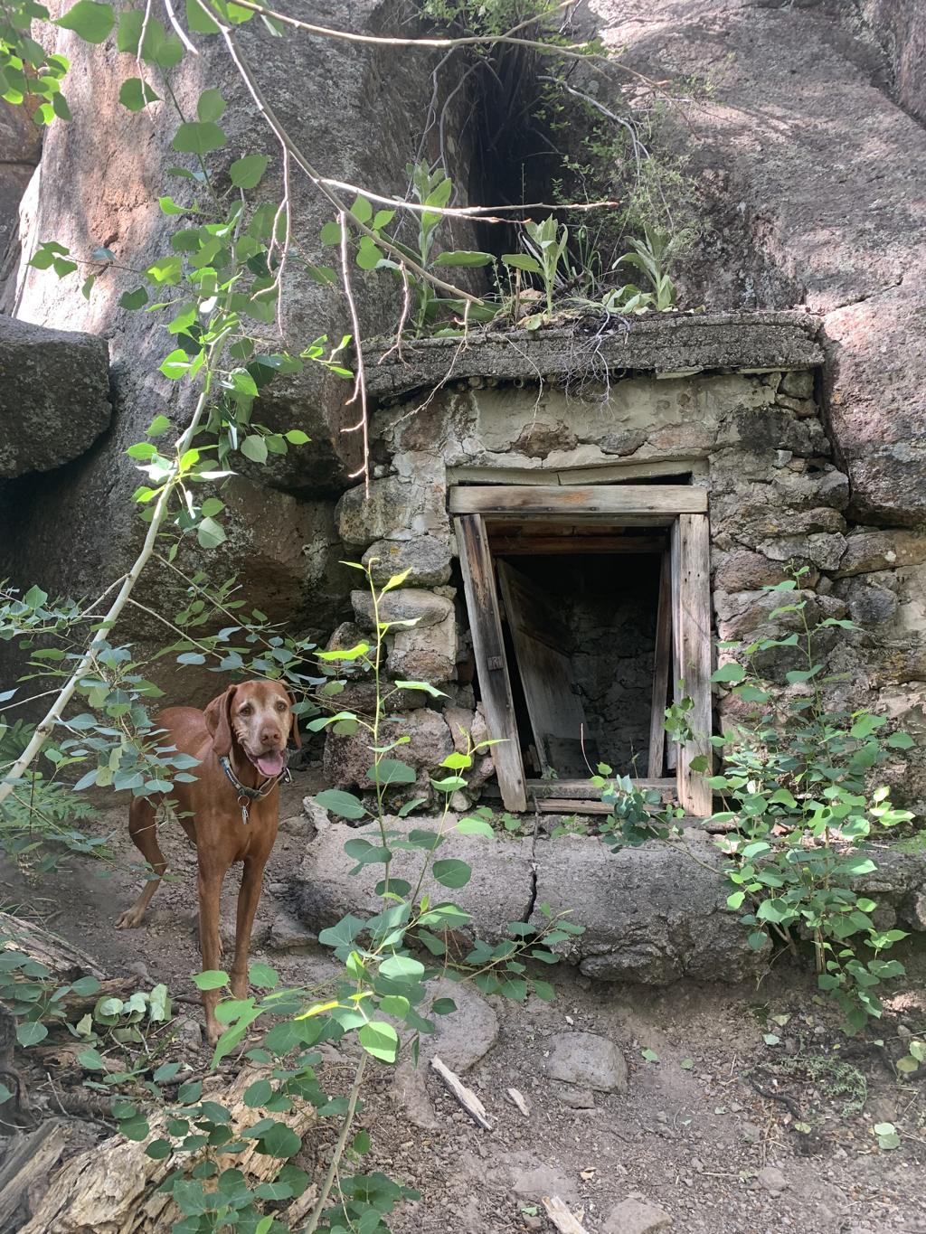
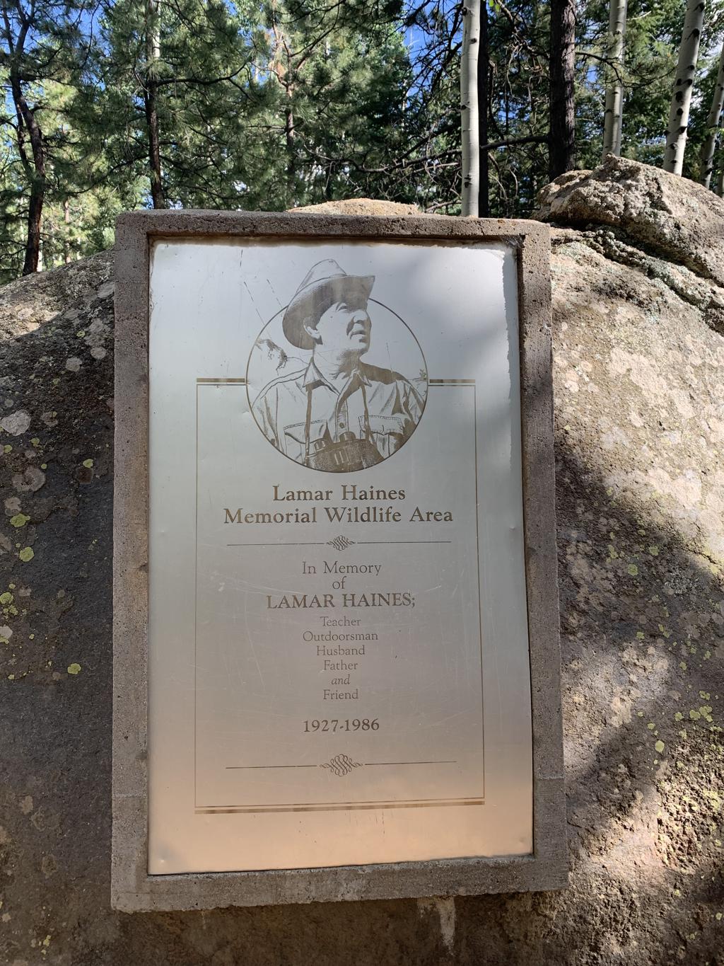
Tips: If you’re looking for the cabin and spring hut, once you get to the memorial, head to the left up the trail until you see a sign that says Jenks Cabin Site and then go left (not straight). You’ll see the broken cabin first and there’s another trail leading off to the right that takes you to the spring hut. If you continue up the trail past the hut, you’ll get to some large rocks where there’s a cave inside. There were so many flies in the cave that we didn’t go inside. If you’re standing outside the cave and look up to the right, there are some petroglyphs on the rock walls.
Directions: From the town of Flagstaff, head west on US-180 for about 7 miles or so. When you see signs for the Snow Bowl, turn right onto N Snow Bowl Rd. In 4.4 miles, there will be a turnout/small parking lot on your right side for the trailhead.
| Mileage (round trip) | 1.8 |
| Difficulty | Easy |
| Gain (in feet) | 236 |
| Trailhead | 35.3095, -111.71913 |
| Exposure | Shady |
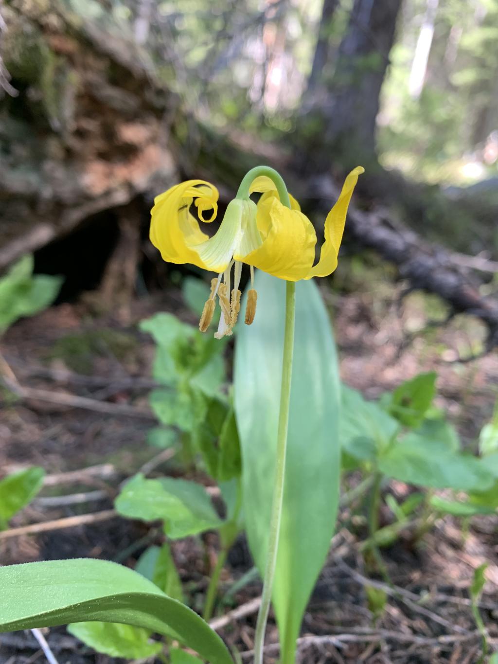
| Scenery | Mountain Views, History, Wildflowers |
| Facilities | None |
| Fees/Permits | None |
| More Info | https://www.flagstaff.com/historical-hiking-trails |
| Last Hiked | 7/10/2023 |
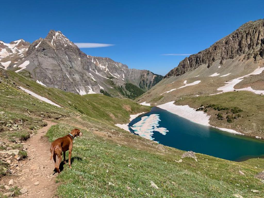
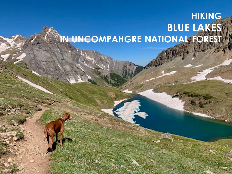
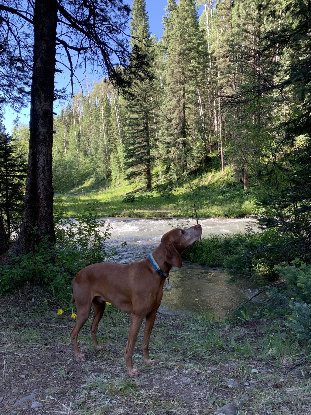
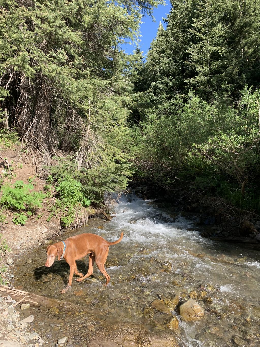
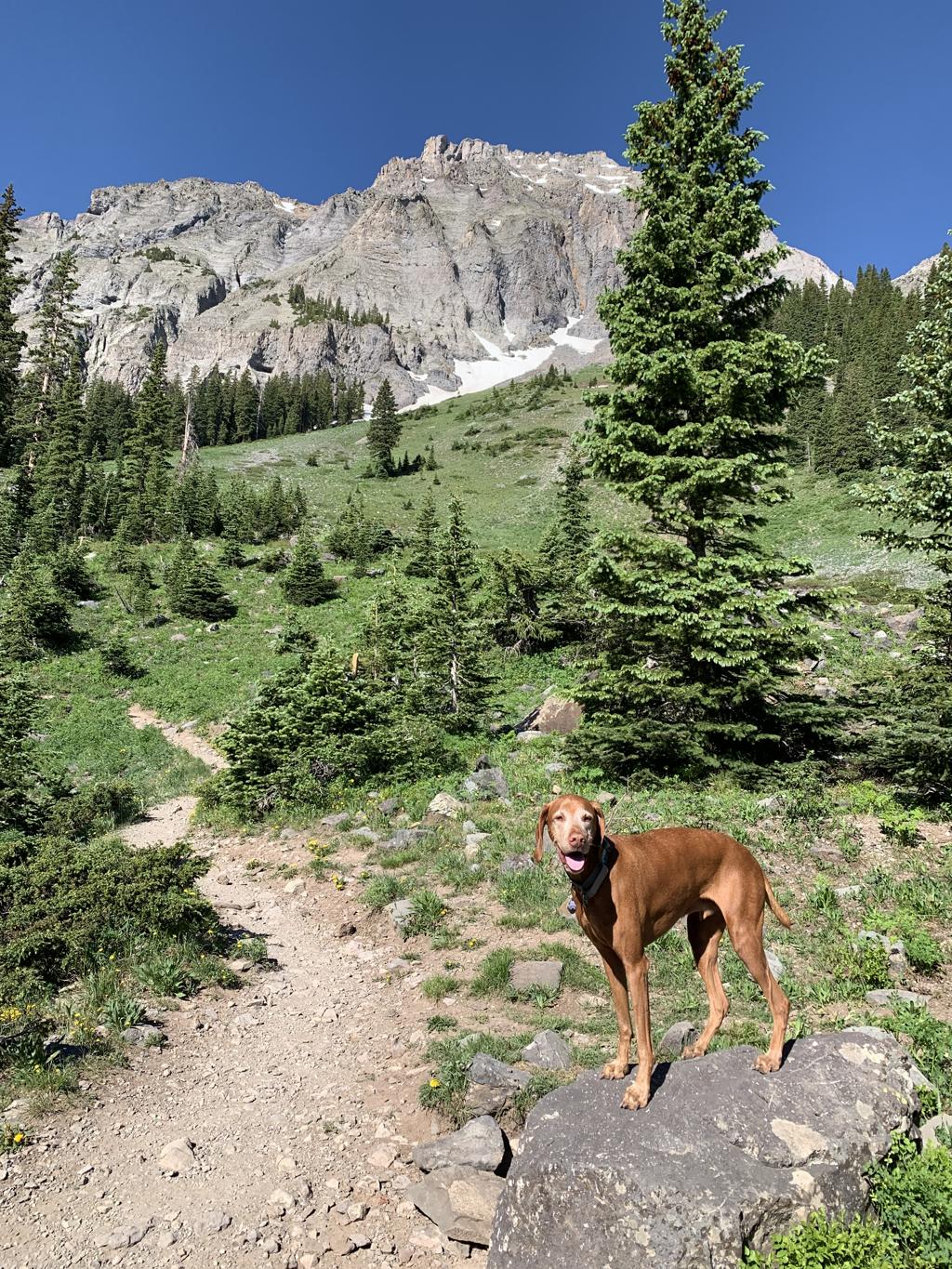
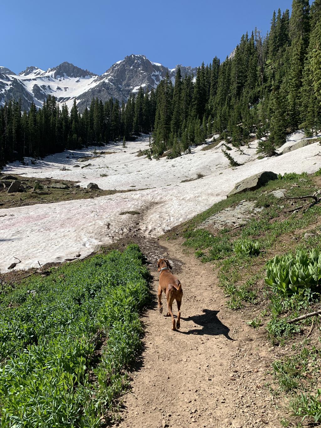
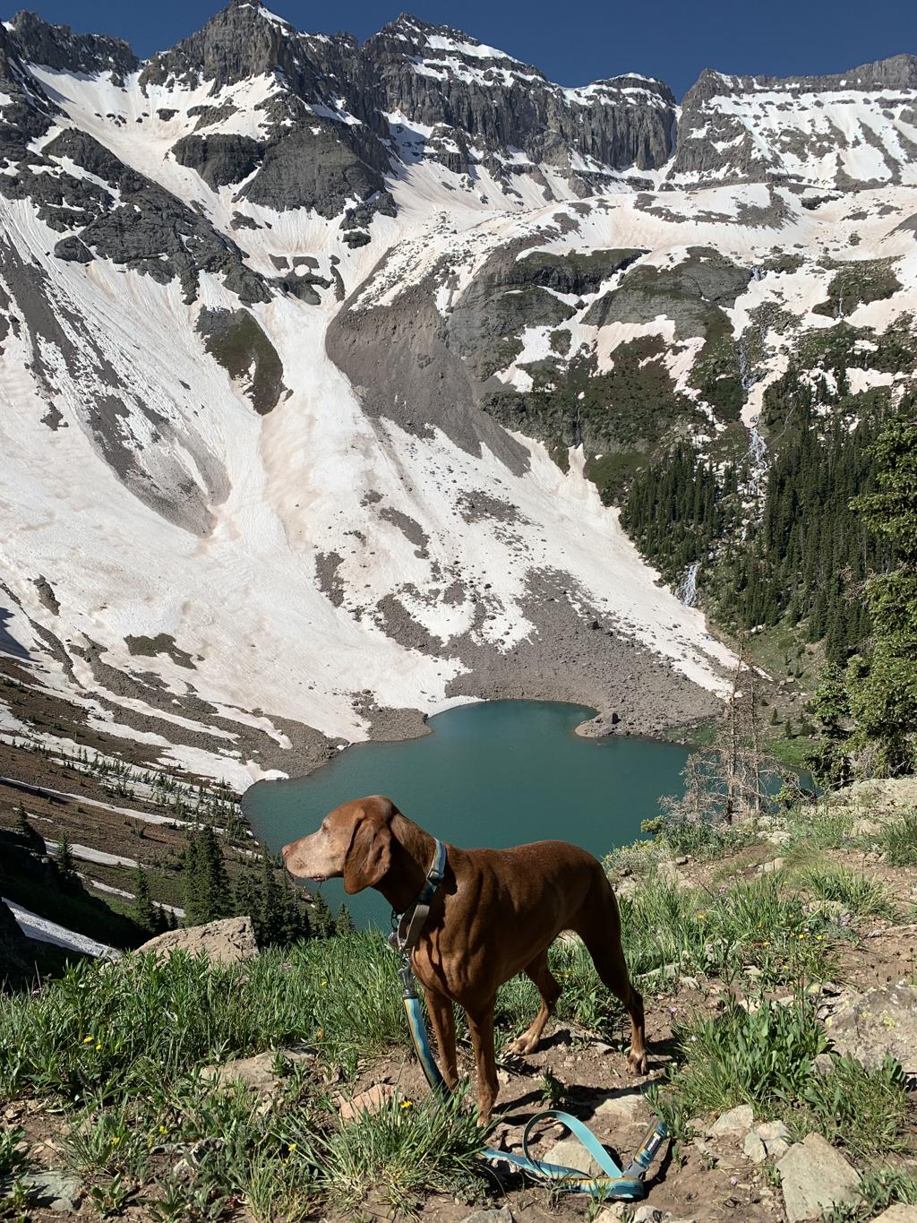
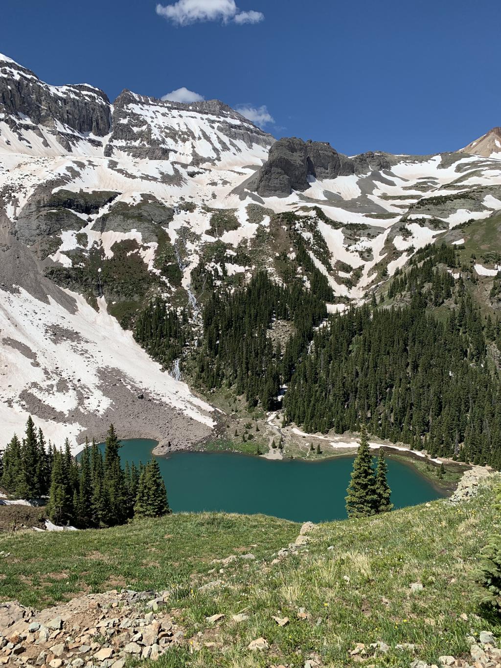
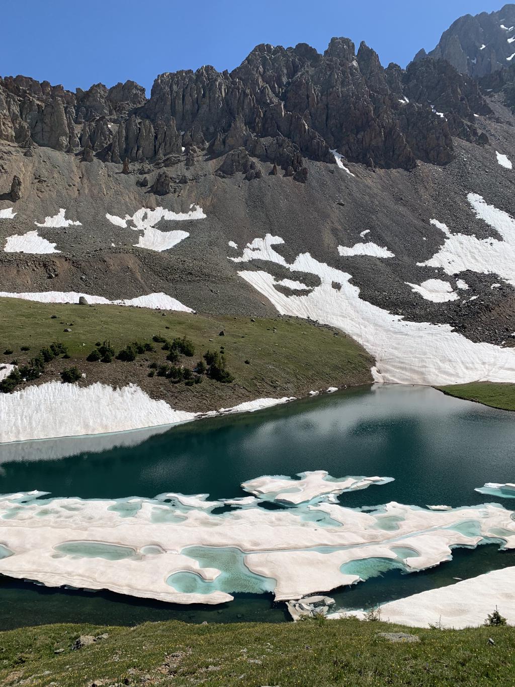
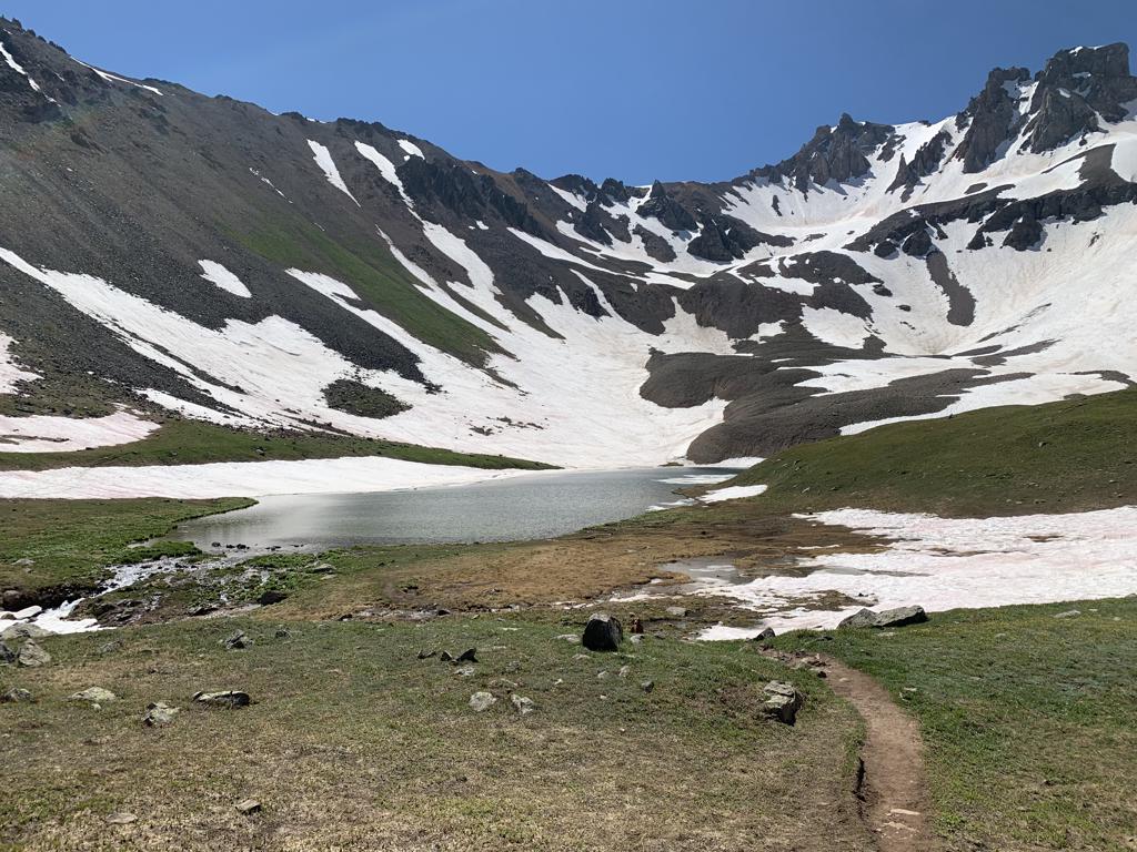
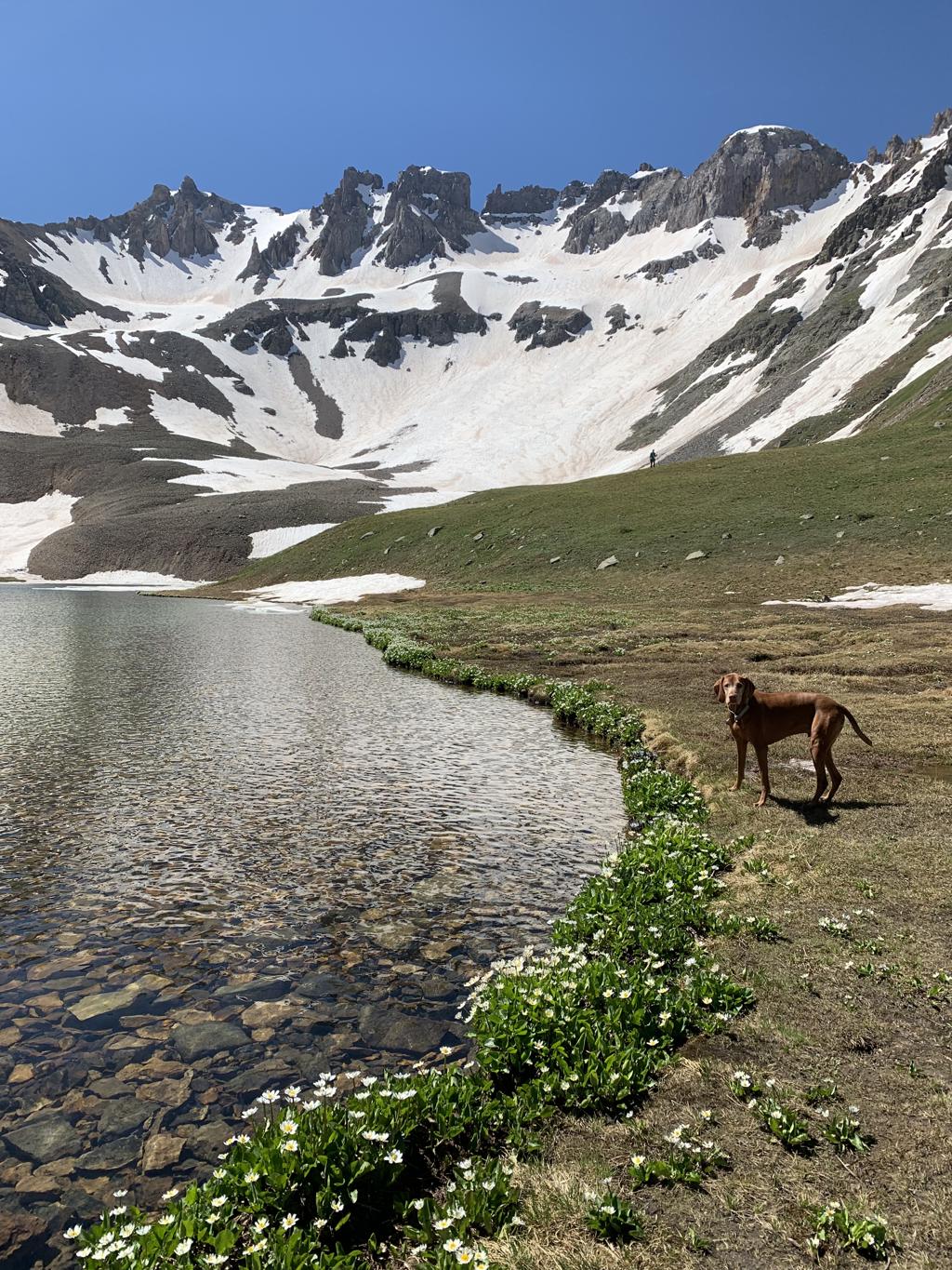
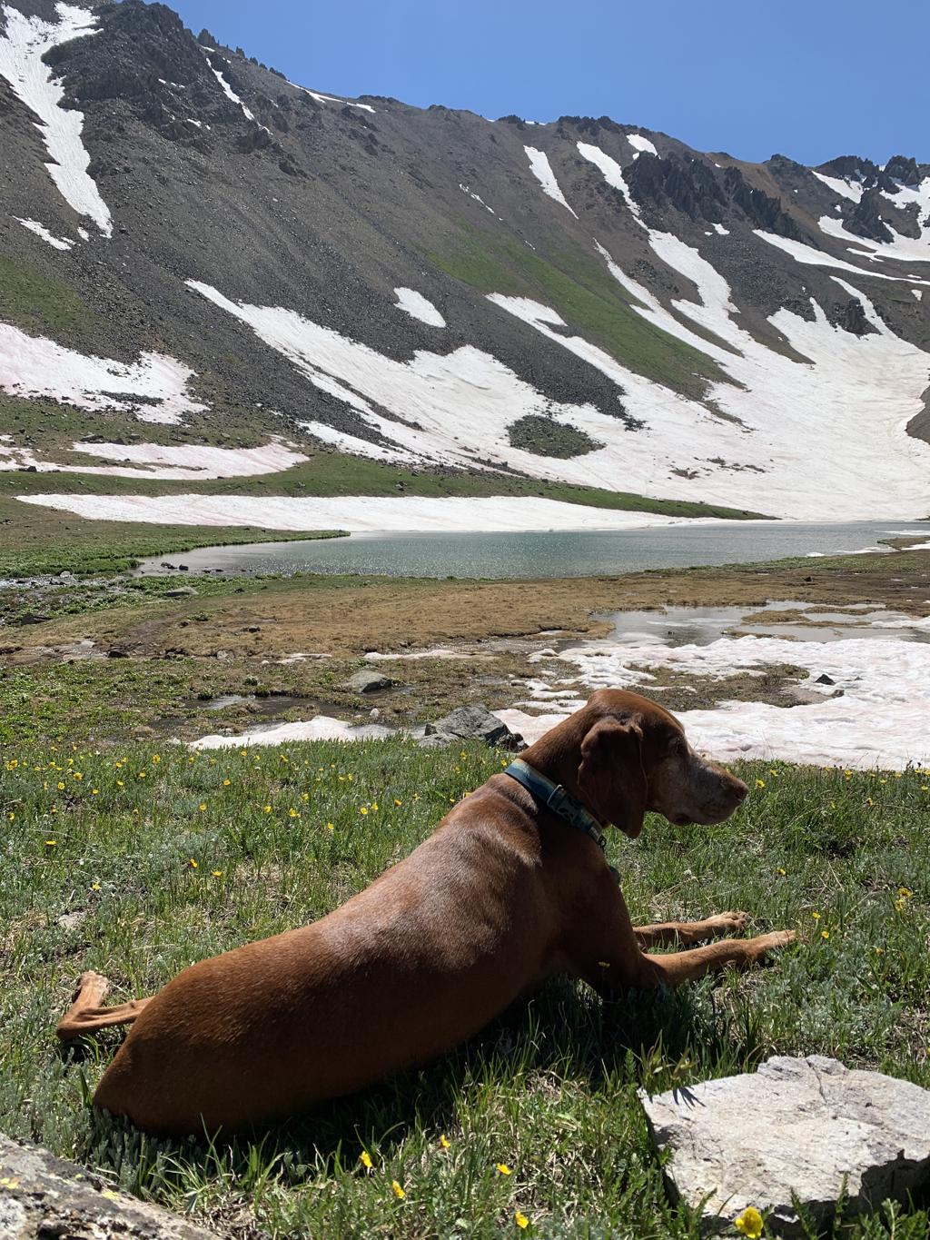
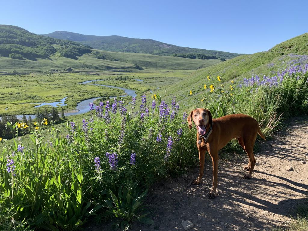
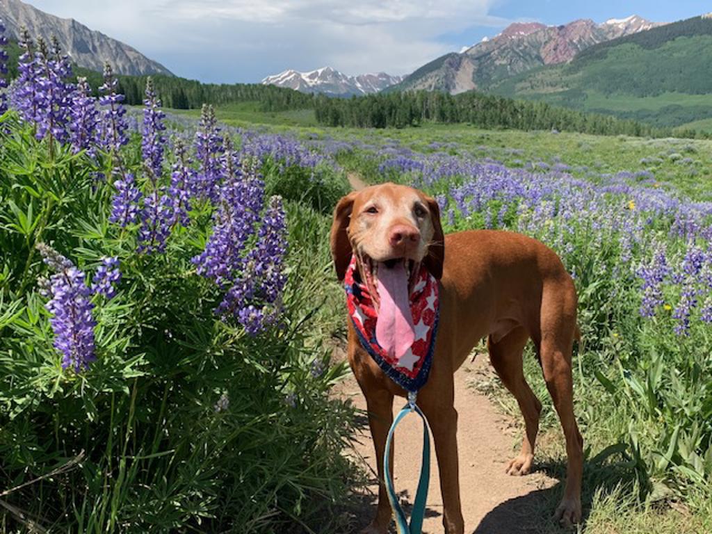
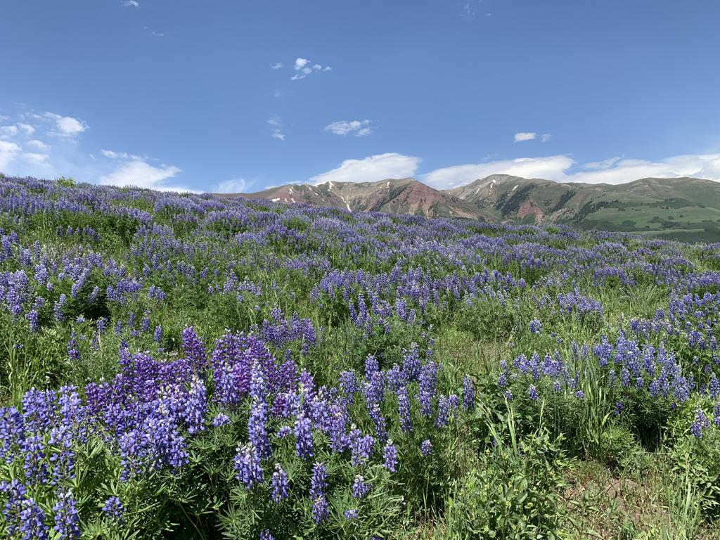
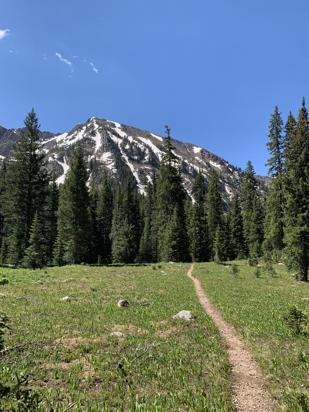
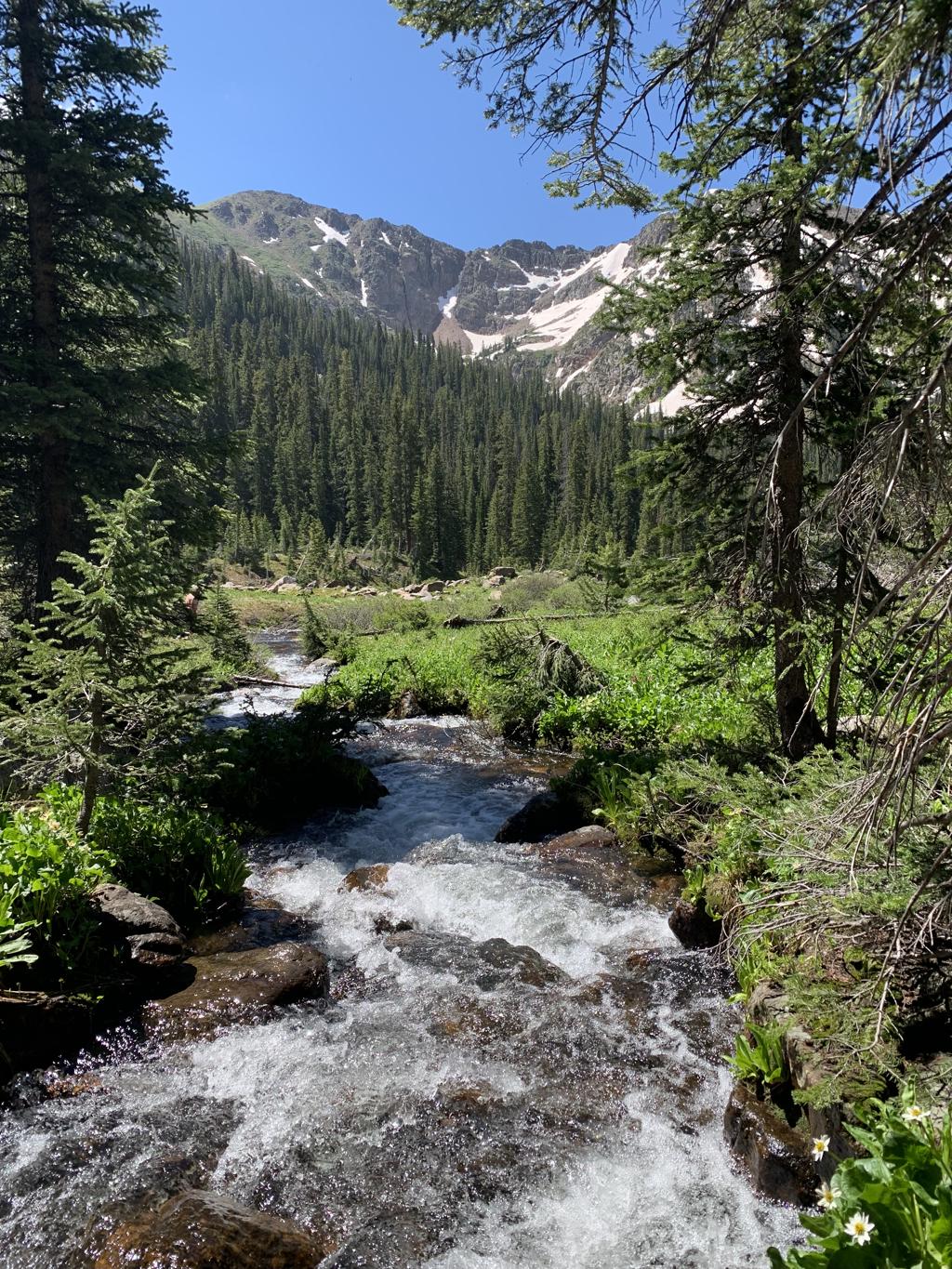
Blue Lakes
Cappie’s Scoop: Coming soon! Don’t hesitate to add YOUR scoop in the comments below!
Tips: There are two trailheads, East Dallas Trailhead (closest town is Ridgway) and Yankee Boy Basin Trailhead near Telluride. We started at East Dallas. There are three lakes – Lower, Middle and Upper Blue Lakes. If you continue past Upper Blue Lake, you can go over the pass and continue on to Mount Sneffels, a challenging 14er at 14,158 ft. It’s about 4.3 more miles (one-way) and a very steep climb. We did a day hike on this trip but have backpacked here as well and loved it! There are lots of areas to camp at Lower Blue Lake. The Lower Lake is by far the most beautiful alpine lake we’ve seen and it looks great from up above! Be sure to keep your eye on the weather because this area is known for afternoon rain.
Directions: From the town of Ridgway, head west and take CO-62 for 4.3 miles. Then turn left onto Co Rd 7 and drive 8.9 miles on a bumpy dirt road to the trailhead parking lot. This is a very popular hike so we arrived the day before and dispersed camped off of Co Rd 7. Then we got up early and had a short hike to the trailhead.
| Mileage (round trip) | 8.7 |
| Difficulty | Strenuous |
| Gain (in feet) | 2509 |
| Trailhead | 38.035273, -107.807090 |
| Exposure | Mostly Shady |
| Scenery | Mountain Views, Forest, Alpine Lake Views, Creek, Wildlife |
| Facilities | Toilets at the trailhead. |
| Fees/Permits | None |
| More Info | https://ouraytrails.org/northwest-ouray/blue-lakes |
| Last Hiked | 7/7/2023 |
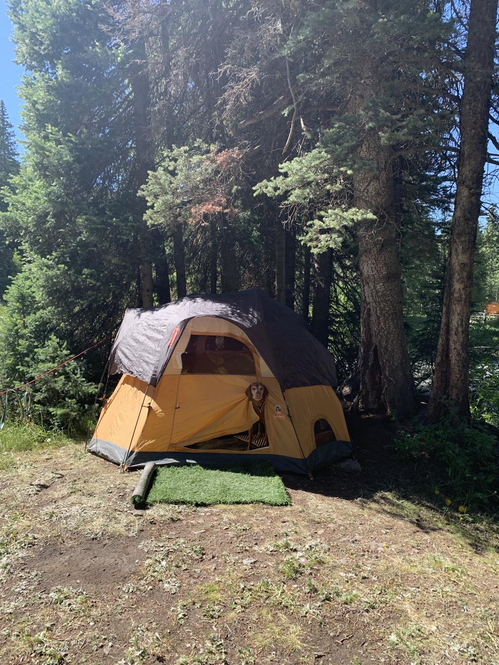

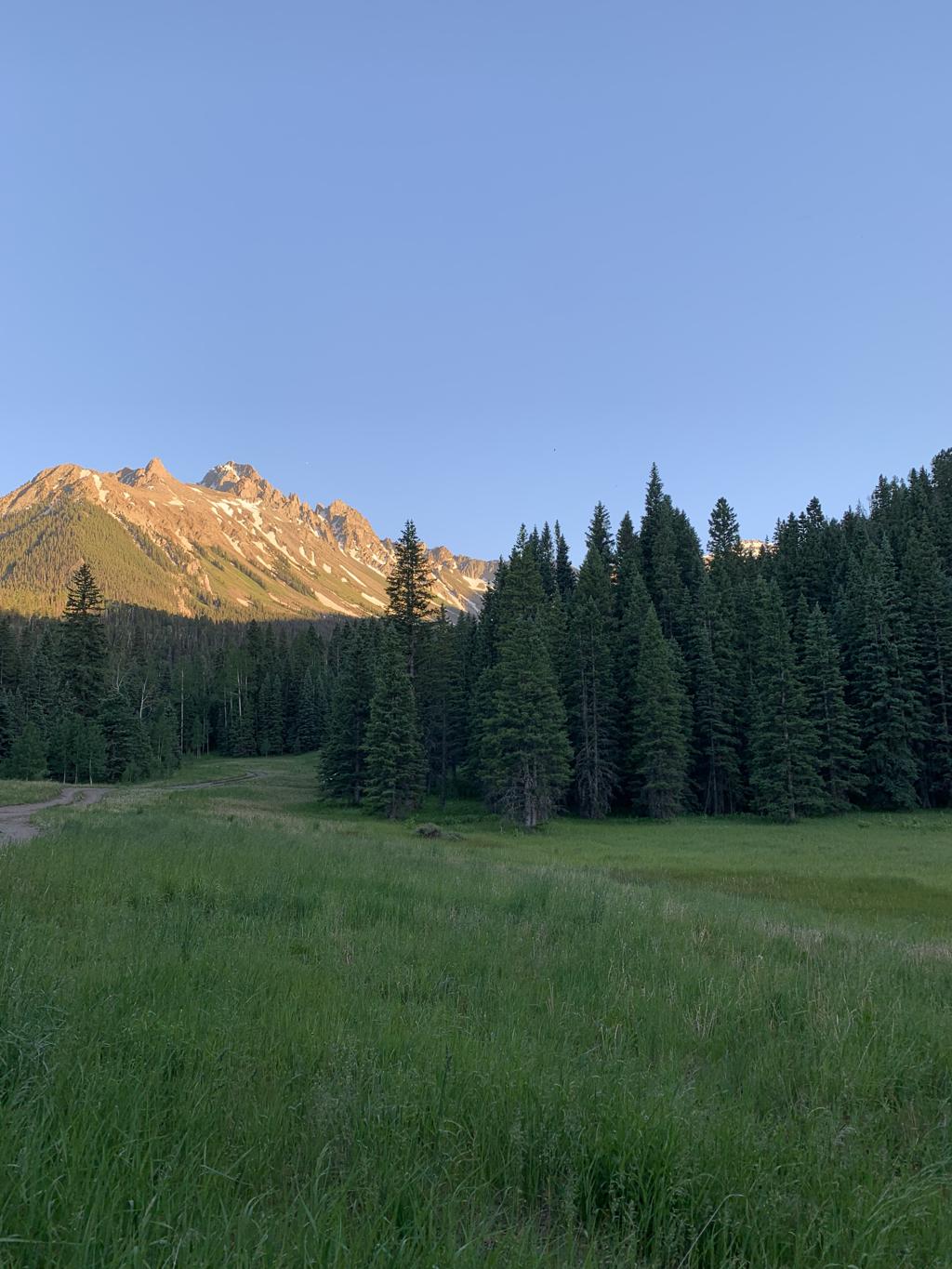

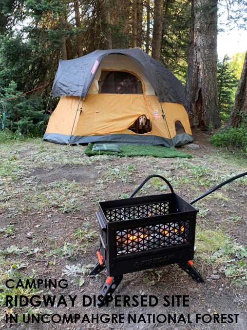
Ridgway Dispersed Camping
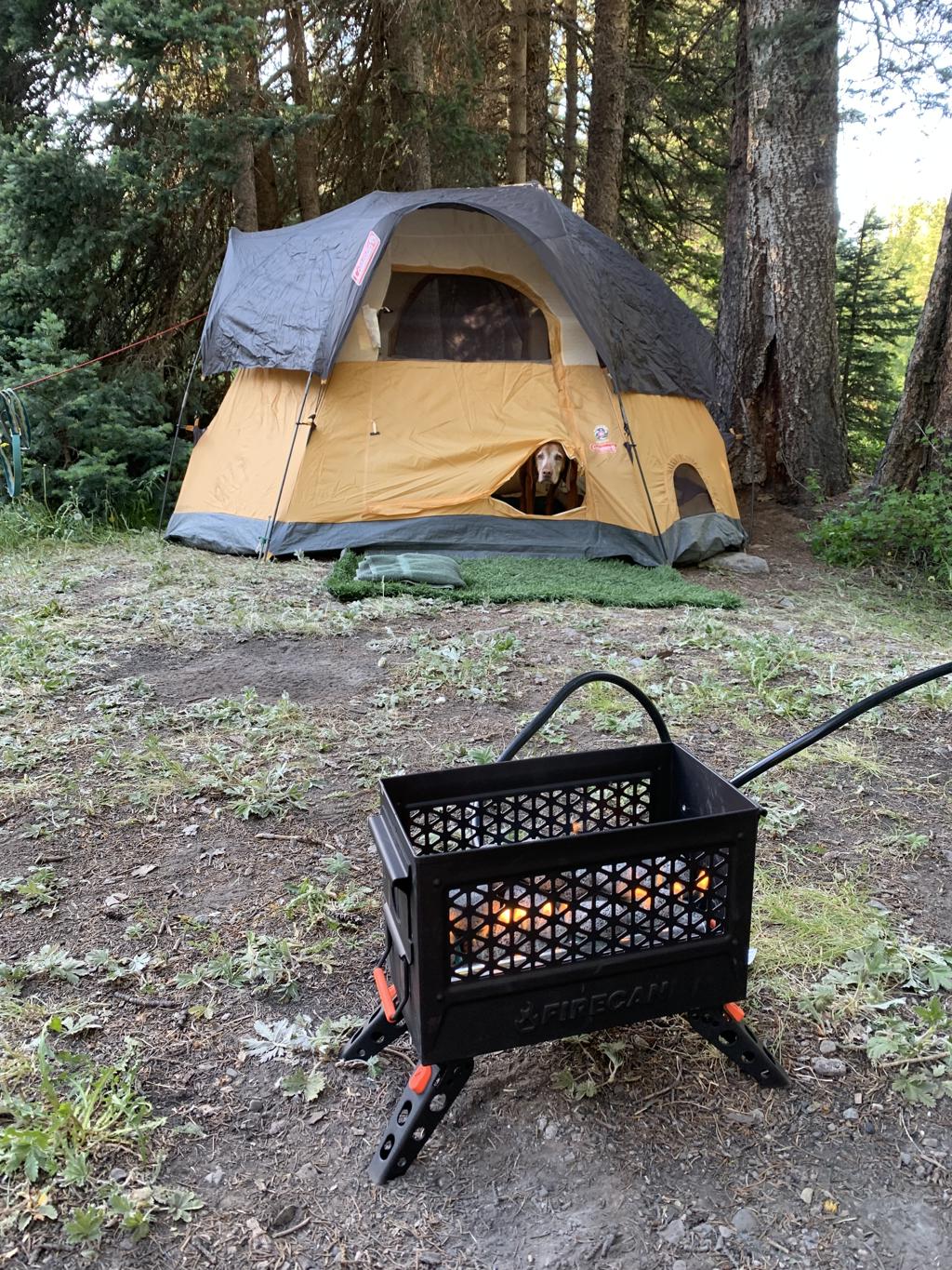
Cappie’s Scoop: This was a great spot for camping because we were near the creek and the water was nice and cold on my paws! We got there early so we could pick out a great spot. We wanted to be close to the Blue Lakes trailhead because we were going to hike there the next day. I helped mom setup the tent and a few bugs were buzzing around. Mom forgot the bug spray so we just invited them to hang out with us. Mom cooked some dinner, we listened to some music and then we got to bed. We wanted to get on the trail early and we had a long day with three alpine lakes to check out. I was so excited! Don’t hesitate to add YOUR scoop in the comments below!
Tips: We found lots of spots to disperse camp (in the car or tent) off of Co Rd 7 closer to the Blue Lakes trailhead. Get there early if you want a great spot!
Directions: From the town of Ridgway, head west and take CO-62 for 4.3 miles. Then turn left onto Co Rd 7 and drive 8.9 miles on a bumpy dirt road to the trailhead parking lot. Coordinates bring you to an area where you can camp just short of the Blue Lakes trailhead. Co Rd 7 is very bumpy with lots of craters and rocks. We did see a lot of different cars make it from vans to sedans to trucks to 4WD vehicles. If you’re not in a high clearance vehicle, my suggestion is to take it slow and let others pass you. You’ll get there but it could take a while.
| Trailhead | 38.042012, -107.807921 |
| Exposure | Mostly Shady |
| Scenery | Mountain Views, Wildflowers, Wildlife, Creek |
| Facilities | None |
| Fees/Permits | None |
| More Info | N/A |
| Last Camped | 7/6/2023-7/7/2023 |


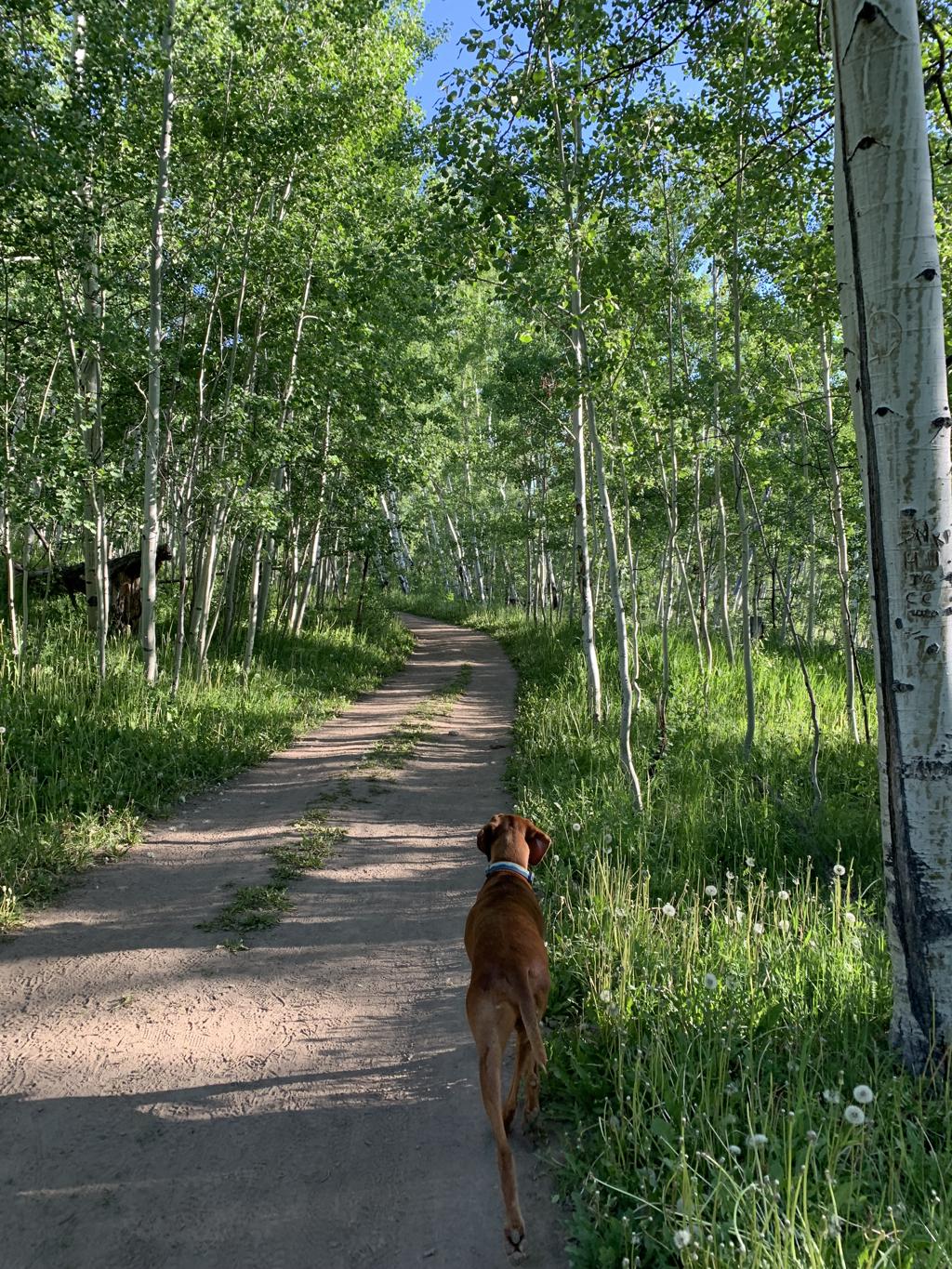
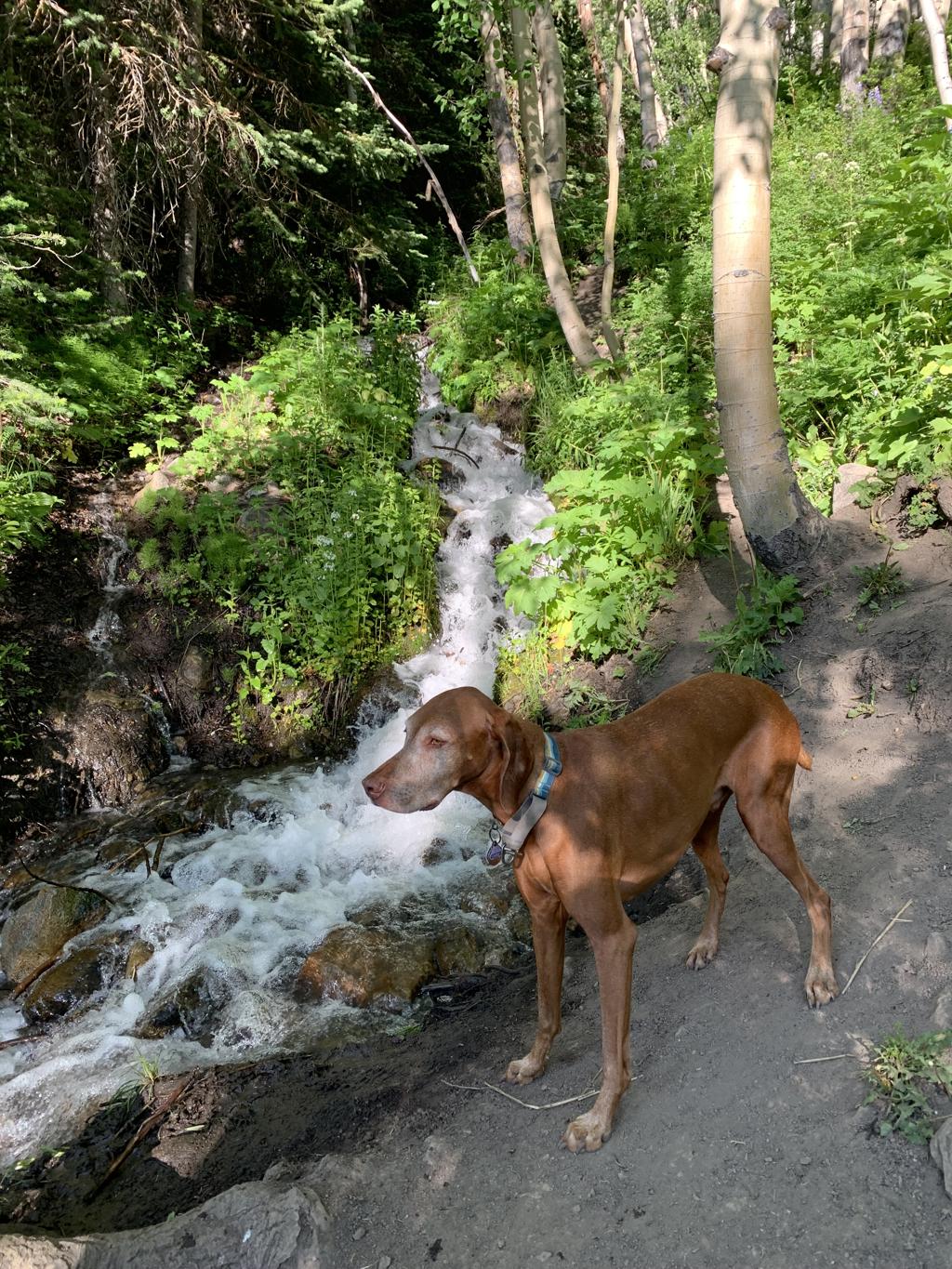
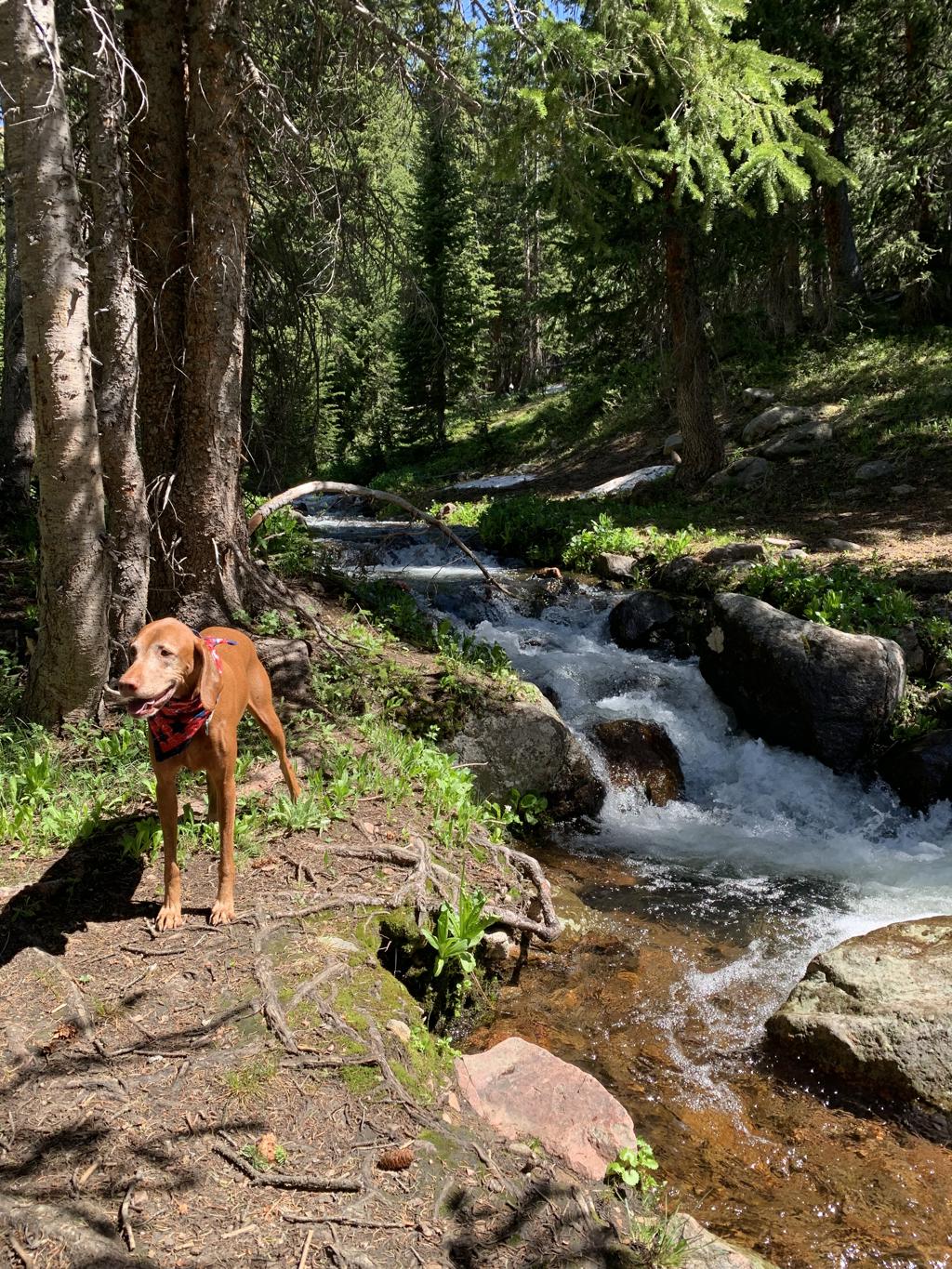
East River Trail
Cappie’s Scoop: Coming soon! Don’t hesitate to add YOUR scoop in the comments below!
Tips: The trail ends at a river crossing. Do not cross the river into private property. Turn around and hike back.
Directions: From the town of Crested Butte, turn right onto CO-135 S. In 2.1 miles, turn left onto Brush Creek Rd. In 2.5 miles, turn left into the Brush Creek Trailhead parking lot.
| Mileage (round trip) | 4.3 |
| Difficulty | Easy |
| Gain (in feet) | 324 |
| Trailhead | 38.86505, -106.91289 |
| Hike Time (in hours) | 1-2 |
| Exposure | Sunny |
| Scenery | Mountain Views, Forest, River, Wildlife, Wildflowers |
| Facilities | None |
| Fees/Permits | None |
| More Info | https://travelcrestedbutte.com/crested-butte-hikes-brush-creek |
| Last Hiked | 7/6/2023 |


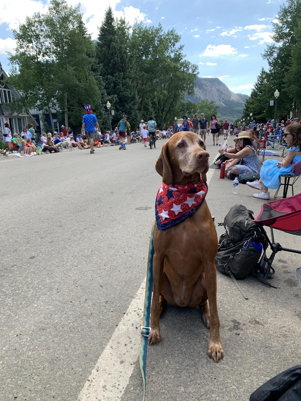
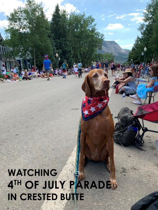
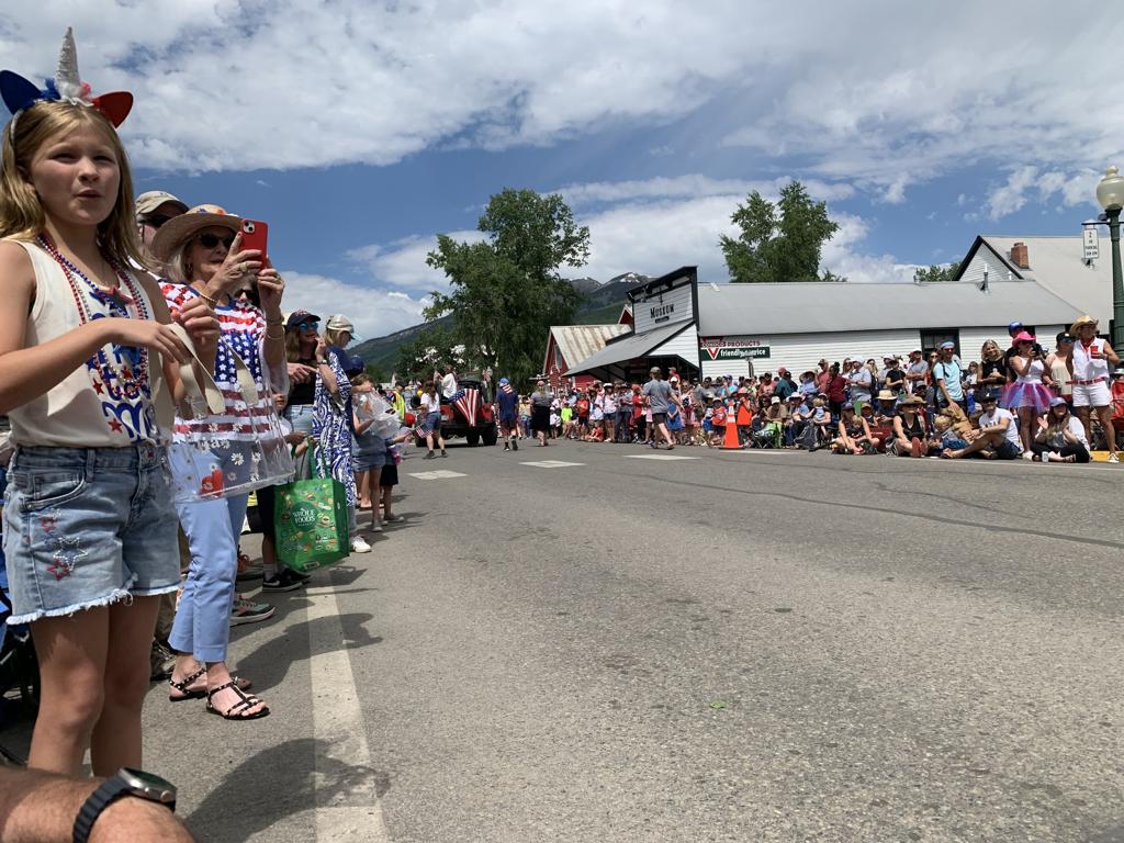
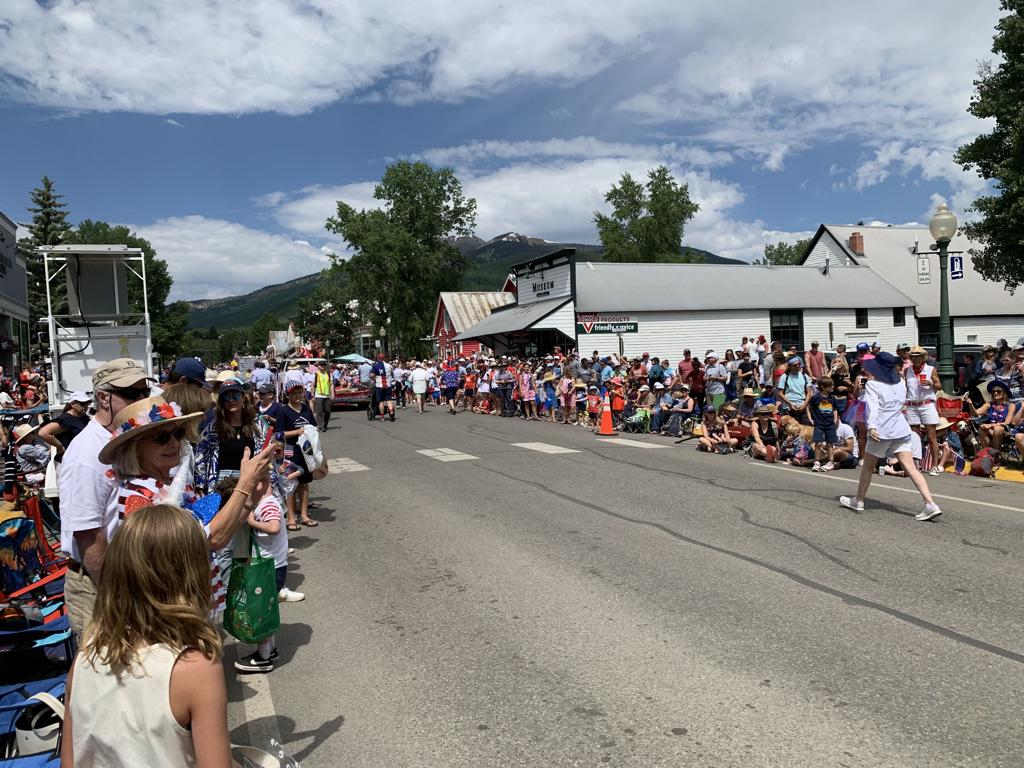
Crested Butte 4th of July Parade
Cappie’s Scoop: Coming soon! Don’t hesitate to add YOUR scoop in the comments below!
Tips: The 4th of July parade in Crested Butte is serious so you should plan to arrive early to pick your spot and setup your chair/blanket. Don’t forget water, sunscreen, treats and a blanket for your dog to lay on!
Directions: Coordinates take you to the center of town where the parade is held.
| Location | 38.869763, -106.984222 |
| Exposure | Sunny |
| Scenery | Mountain Views, Parade Floats, Patriotic Spirit |
| Facilities | Various |
| Fees/Permits | None |
| More Info | https://travelcrestedbutte.com/events-calendar/4th-of-july-celebration |
| Last Hiked | 7/4/2023 |

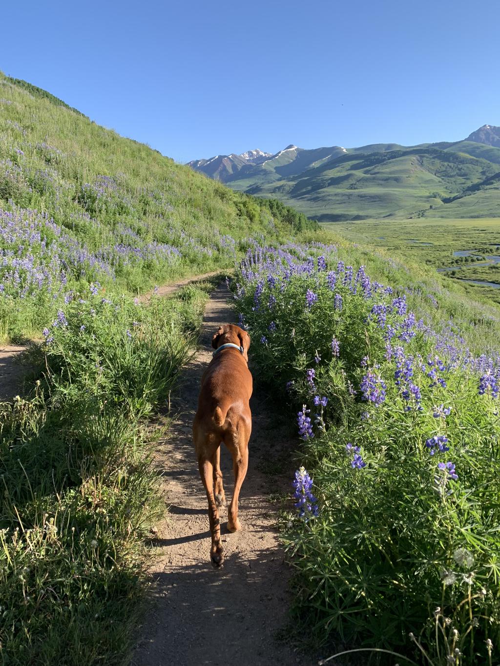
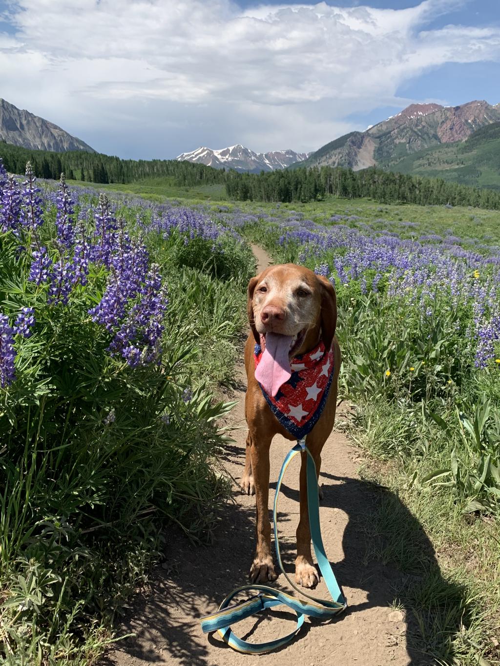
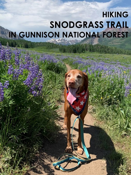
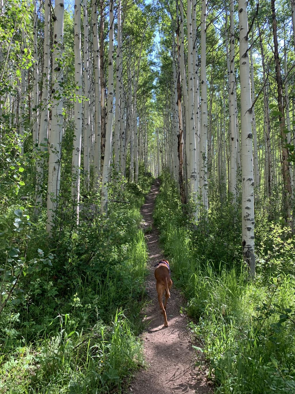
Snodgrass Trail
Cappie’s Scoop: Coming soon! Don’t hesitate to add YOUR scoop in the comments below!
Tips: If you have two cars, you can do this hike as a point-to-point or roundtrip from one of the two different trailheads. We started at the Gothic Road trailhead because it has more parking.
Directions: Coordinates are provided for two different trailheads.
| Mileage (round trip) | 7.2 |
| Difficulty | Moderate |
| Gain (in feet) | 832 |
| Trailhead | Washington Gulch Trailhead: 38.922767, -107.004626 Gothic Road Trailhead: 38.919230, -106.960320 |
| Hike Time (in hours) | 3-4 |
| Exposure | Mostly Sunny |
| Scenery | Mountain Views, Forest, Wildflowers |
| Facilities | None |
| Fees/Permits | None |
| More Info | https://travelcrestedbutte.com/crested-butte-trails-snodgrass-trail |
| Last Hiked | 7/4/2023 |


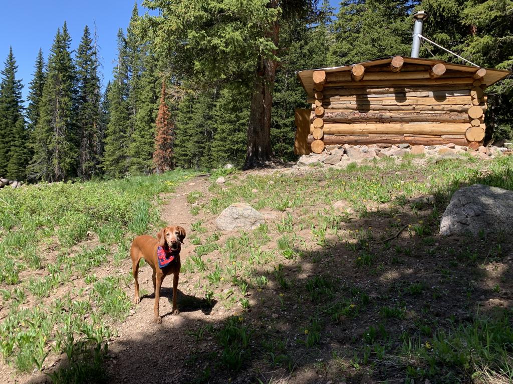
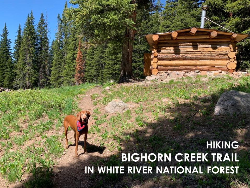
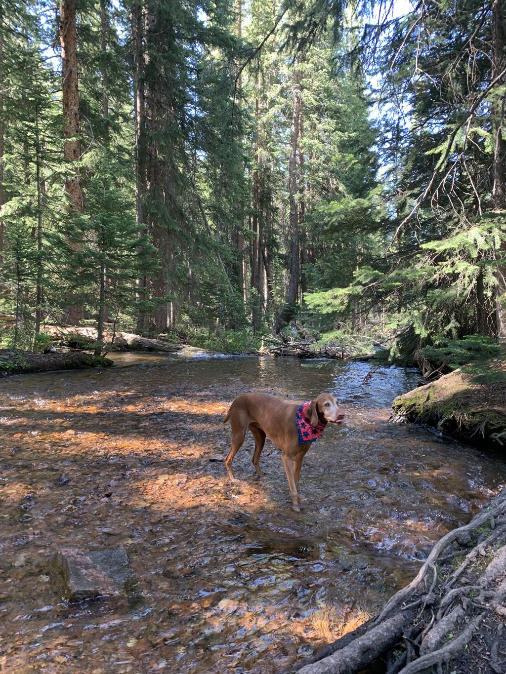
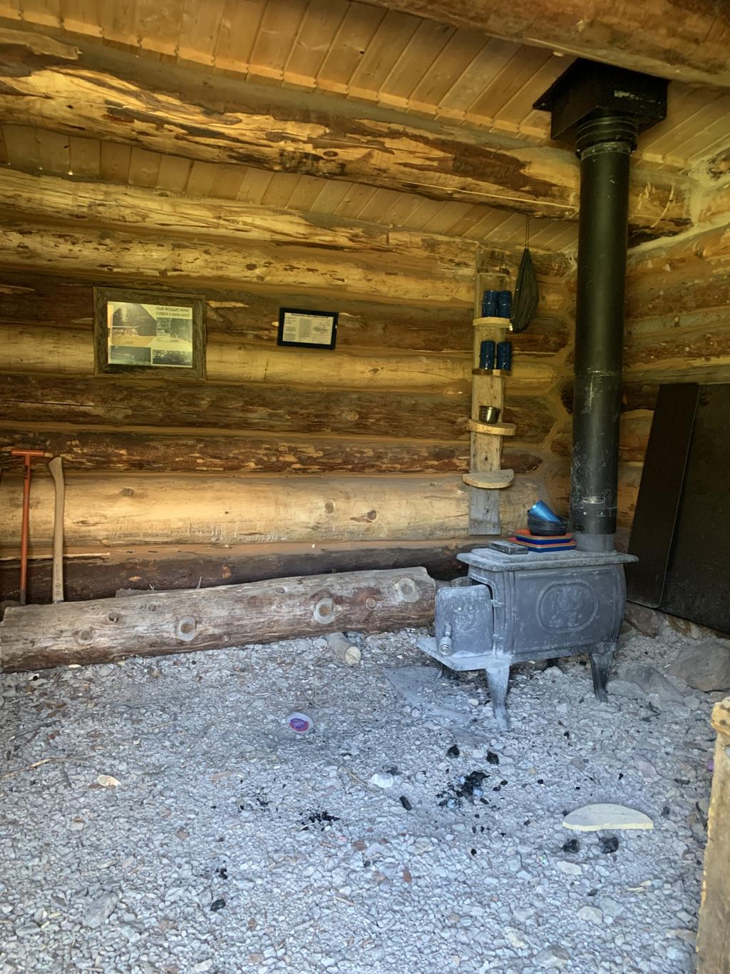
Bighorn Creek Trail
Cappie’s Scoop: Coming soon! Don’t hesitate to add YOUR scoop in the comments below!
Tips: The parking lot next to the trail is very very small. If there are no spots available, you’ll need to park down the road a bit (towards the direction you came in) and then hike up to the trail.
Directions: From Vail, head east on I-70 and take exit 180 toward E Vail. In 0.2 miles, turn right onto Big Horn Rd. Then in 0.7 miles, turn left onto Columbine Dr. You will see the small parking lot and trailhead on your left side.
| Mileage (round trip) | 7.6 |
| Difficulty | Strenuous |
| Gain (in feet) | 2250 |
| Trailhead | 39.63919, -106.29528 |
| Exposure | Sunny and Shady |
| Scenery | Mountain Views, Forest, Creek, Wildlife, Wildflowers, Log Cabin |
| Facilities | None |
| Fees/Permits | None |
| More Info | https://www.vaildaily.com/entertainment/hike-of-the-week-follow-bighorn-creek-to-an-old-prospecting-cabin |
| Last Hiked | 7/3/2023 |
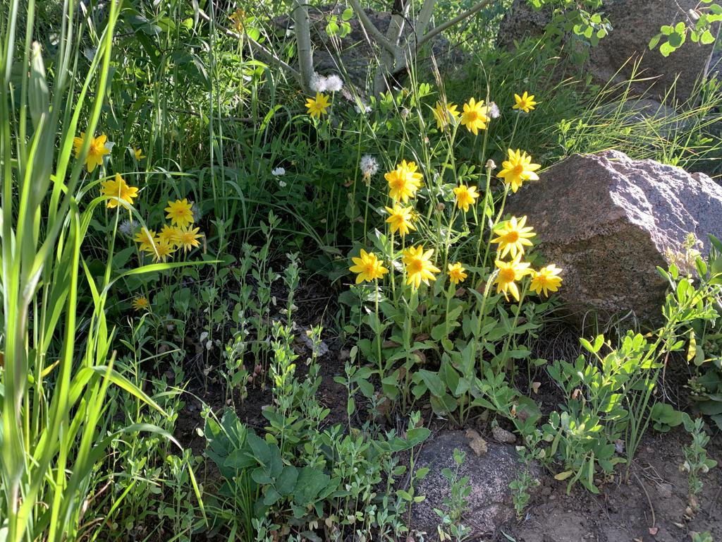


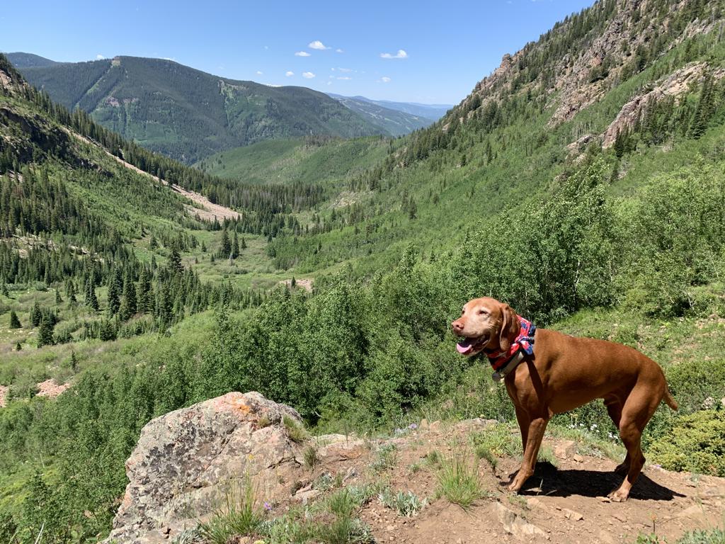
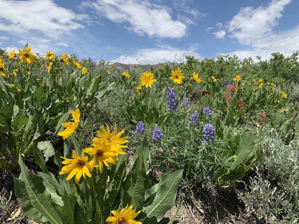
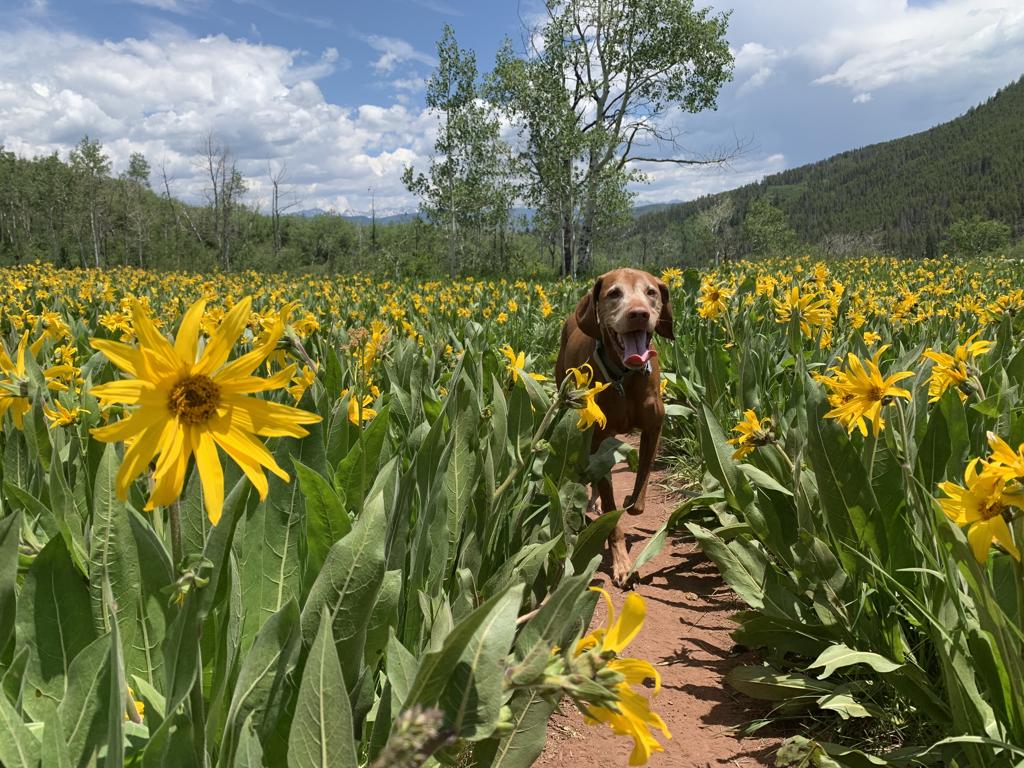
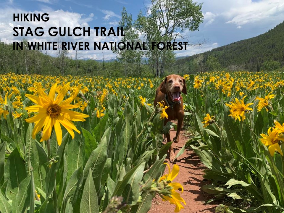
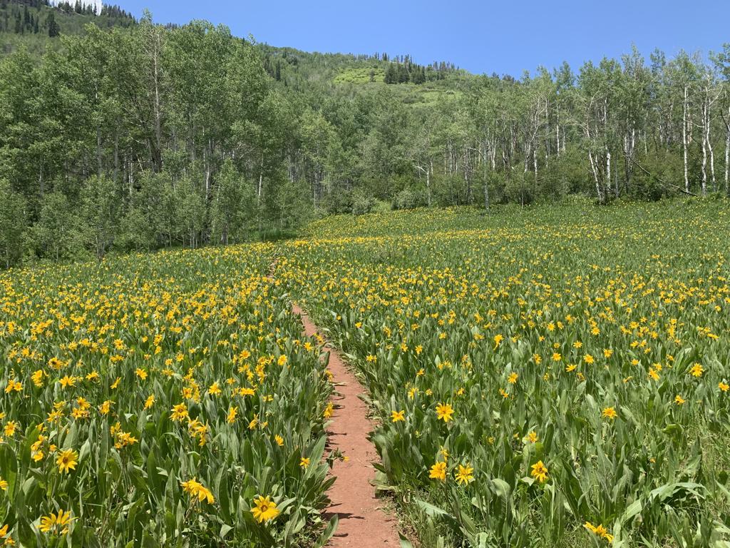
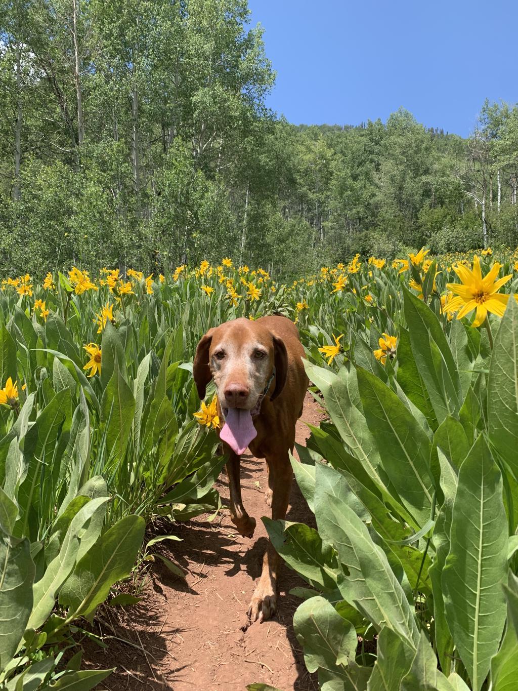
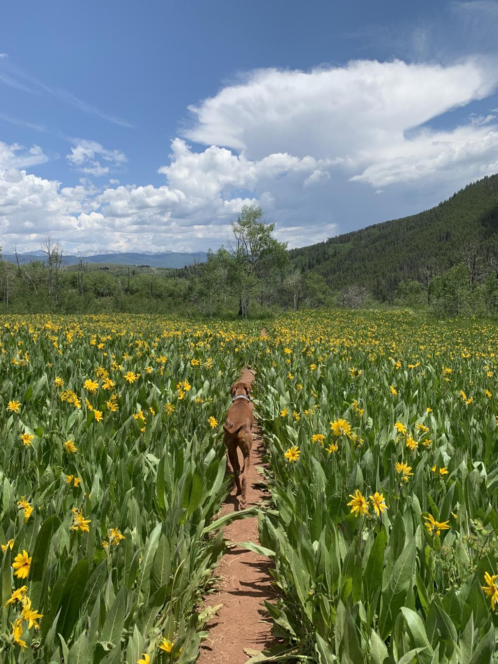
Stag Gulch Trail
Cappie’s Scoop: Coming soon! Don’t hesitate to add YOUR scoop in the comments below!
Tips: The gem of this hidden hike is the huge fields and meadows of wildflowers, mostly the mule-ears, an iconic native sunflower.
Directions: If you’re coming from Grand Junction (western Colorado), head east on I-70 and take exit 157 for CO-131 N toward Wolcott/Steamboat Spqs. Turn left onto CO-131 N and then turn right onto US-6 E. In 3.8 miles, turn right onto Squaw Creek Rd and follow this road for 4.1 miles. The turn off for the trailhead parking will be on your right. If you keep going, you’ll reach a locked gate very soon (locked at the time of this post). If you’re coming from Vail (eastern Colorado), head west on I-70 and take exit 163 toward Edwards. At the traffic circle, take the 3rd exit onto Edwards Access Rd and stay on this road through the next two traffic circles. At Edwards Roundabout, take the 1st exit onto US-6 W. In 2.6 miles, turn left onto Squaw Creek Rd and follow this road for 4.1 miles. The turn off for the trailhead parking will be on your right. If you keep going, you’ll reach a locked gate very soon (locked at the time of this post).
| Mileage (round trip) | 6.7 |
| Difficulty | Moderate |
| Gain (in feet) | 1643 |
| Trailhead | 39.60624, -106.64995 |
| Exposure | Sunny and Shady |
| Scenery | Mountain Views, Forest, Wildflowers |
| Facilities | None |
| Fees/Permits | None |
| More Info | https://www.vaildaily.com/entertainment/hike-of-the-week-stag-gulch-hike-boasts-some-of-the-valleys-best-wildflowers |
| Last Hiked | 7/2/2023 |


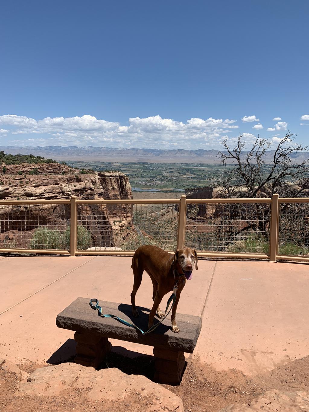
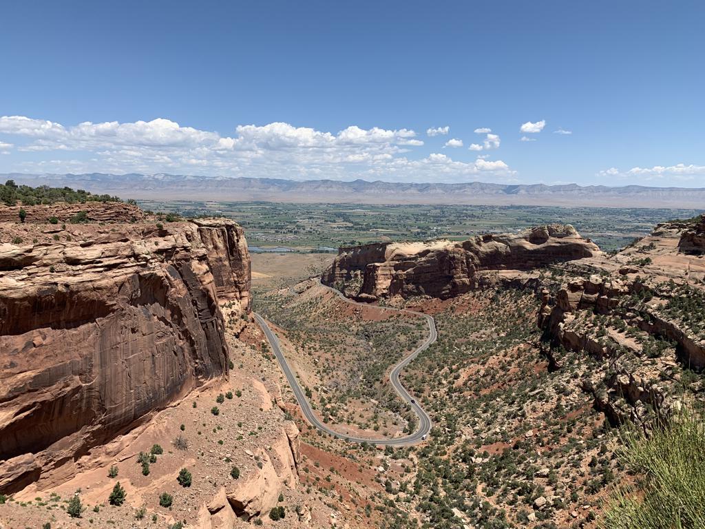
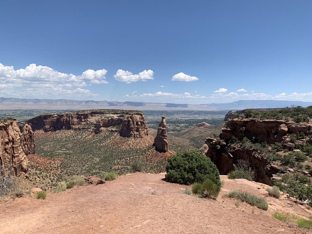
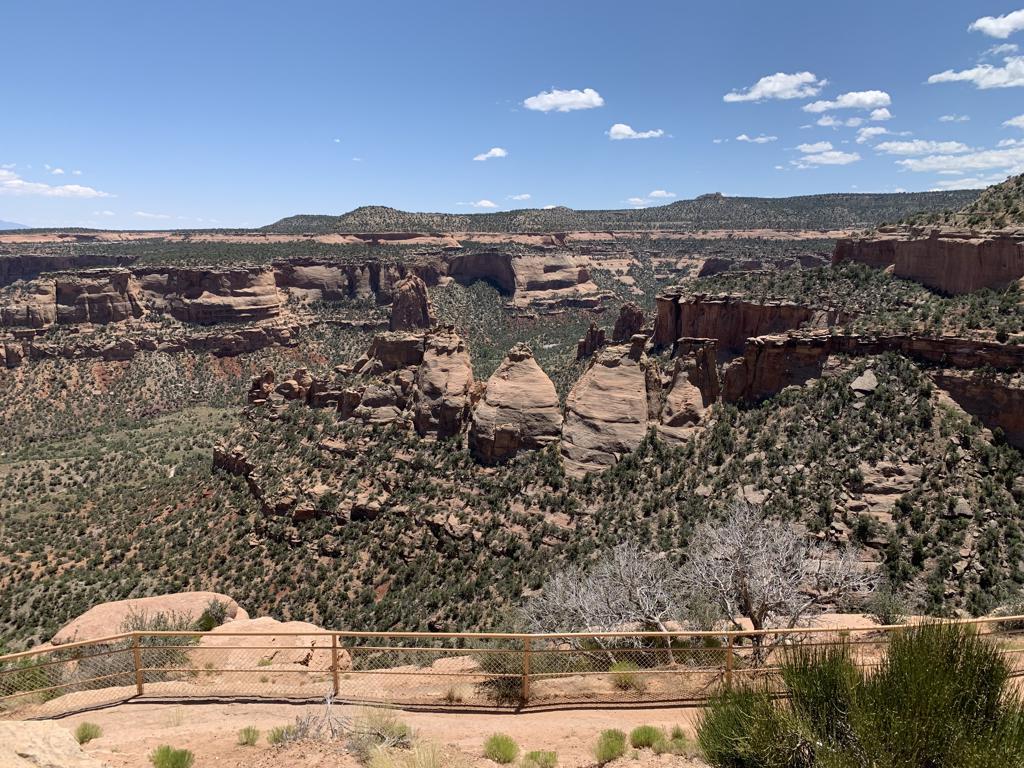
Colorado National Monument
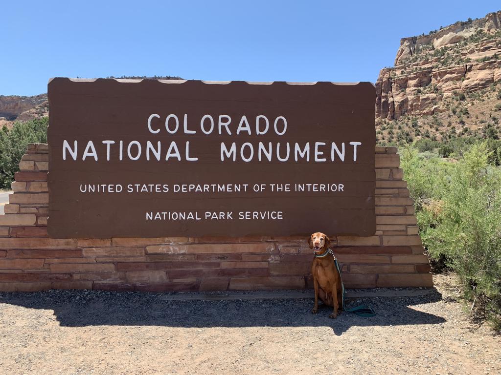
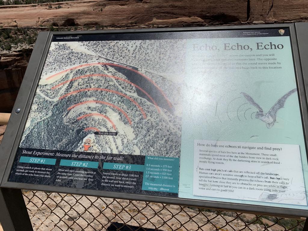
Cappie’s Scoop: Mom doesn’t take me to many National Parks because it’s just not that much fun. But this time, I was able to see a lot of things on the scenic drive when we stopped at the overlooks. My most favorite one was when we walked down to an area that had a railing to keep us safe but there were these huge rocks in front of us. All of a sudden, mom yells my name into the rocks and it yells my name back! It’s true, the rocks repeated what we said! This was the Upper Ute Canyon Overlook. Walk all the way to the end where you can see down in the canyon and there is a sign explaining the “shout experiment” and you can measure the distance sound travels. I also liked the view of Independence Monument. It’s a 5,739 ft elevation sandstone pillar and is a popular climbing destination. Every 4th of July you can watch climbers carry the flag up Independence Monument and then proudly stake it at the top. I missed seeing this by a few days so maybe another time!
Tips: The best way to experience the park with your dog is to drive the 23 mile Rim Rock Drive from one end to the other along the plateau rim. There are many pullouts and roadside overlooks to check out along the way. On average it can take about 45 minutes to 1 hour without stops but you’re going to want to stop! If you’re looking for a dog friendly spot to eat in the area, check out Base Camp Provisions in Fruita. There is a huge outdoor patio and we found a table with shade too.
Directions: There is one entrance at each end of Rim Rock Drive. Depending on the direction you’re coming, you can choose your entrance! There are also three tunnels along the drive that are fun to drive through. The road is windy and hugs the cliff in some parts so please focus on the road and keep your eyes open for bicyclists too.
| Mileage | 23 mile drive with multiple stops to hike/see sights |
| Difficulty | Easy |
| Gain (in feet) | Negligible |
| Trailhead | East Entrance (Grand Junction): 39.035251, -108.630869 West Entrance (Fruita): 39.118752, -108.731499 |
| Exposure | Sunny |
| Scenery | Canyons, Rock Formations, Tunnels, Wildlife |
| Facilities | Visitor Center Onsite |
| Fees/Permits | Private Vehicles – $25 |
| More Info | https://www.nps.gov/colm/index.htm; https://www.nps.gov/colm/planyourvisit/historic-rim-rock-drive.htm |
| Last Visited | 7/1/2023 |