Lakeside River Park

Cappie’s Scoop: Mom was really excited about this trail and kept saying, look for wildlife like jackrabbits, roadrunners, red-tailed hawks, butterflies and goldfinches. Then as we passed the water, she said, look for egrets, mallards, coots and blue heron. I told her she can look for wildlife because I’m looking for sticks and pine cones! Priorities mom! Don’t hesitate to add YOUR scoop in the comments below!
Tips: If you happen to look up information about this trail, while it’s all a part of the San Diego River Trail, it’s shared between Lakeside and Santee. The trail from Channel Rd to the Lakeside Baseball Park is Lakeside and the trail from the Lakeside Baseball Park to Magnolia Ave. is Santee. This latter section is named the Walker Preserve trail.
Directions: Starting point is different than what’s in the write-up under more info. Can use address 10354 Channel Rd, Lakeside, CA 92040 which will get you close. From I-8 E or 52 E to 67 N to Mapleview St. Turn left on Mapleview St. and then turn right onto Channel Rd. After 0.2 miles, trailhead parking lot will be on your left.
| Mileage (round trip) | 4 |
| Difficulty | Easy |
| Gain (in feet) | Negligible |
| Trailhead | 32.865507, -116.928087 |
| Hike Time (in hours) | 2-3 |
| Exposure | Mostly Shady |
| Scenery | Trees, River, Wildlife, Birds |
| Facilities | None |
| Fees/Permits | None |
| More Info | http://hikingsdcounty.com/lakeside-river-park |
| Last Hiked | 10/21/2018, 11/8/2020 |
Pumpkin Rock

Cappie’s Scoop: I like to pick pumpkins and I like to help mom carve them. She always carves bones on my pumpkin! But one time we hiked up to a huge pumpkin that sat on a hill. I gave it a smell and it’s a ROCK! I tried to get on top but it was way too high for me to jump on. It definitely puts you in the fall mood for crunchy leaves, homemade pumpkin doggie treats (hint, hint mom), and pumpkin spice lattes (for mom). I told mom to put a picture of us with our pumpkins because the pumpkin rock had a lot of yucky writing on it at the time we visited. Friends of this big pumpkin come by to paint it every so often which is very nice of them. Don’t hesitate to add YOUR scoop in the comments below!
Tips: This hike is extremely popular around Halloween so be prepared for crowds.
Directions: Can use address for George Ingalls Equestrian Event Center, 3737 Crestview Dr, Norco, CA 92860. Follow the directions to the trailhead address, which is the equestrian center. There’s plenty of parking. Just be mindful of a few “no parking” signs along some sections. The trailhead is right at the entrance to the parking lot. Note that there’s a “Pumpkin Rock Trailhead” location on Google, which is not this trailhead. You can hike there from that location but it’s steeper, only offers street parking in a residential neighborhood, and isn’t near restrooms.
| Mileage (round trip) | 1.2 |
| Difficulty | Moderate |
| Gain (in feet) | 370 |
| Trailhead | 33.936891, -117.520022 |
| Hike Time (in hours) | 1 |
| Exposure | Sunny |
| Scenery | Rock Formations |
| Facilities | Restrooms nearby at Pikes Peak Park, 111 6th St, Norco, CA 92860. |
| Fees/Permits | None |
| More Info | https://hikingguy.com/hiking-trails/best-la-hikes/hike-pumpkin-rock-trail |
| Last Hiked | 10/14/2018 |
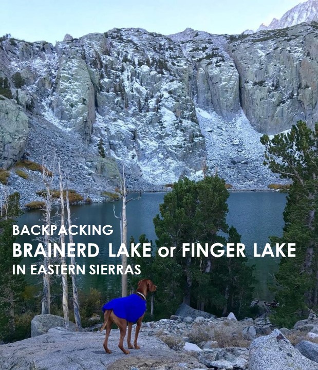
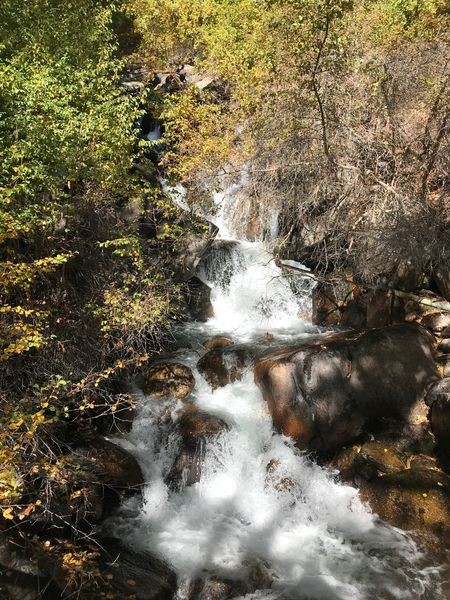
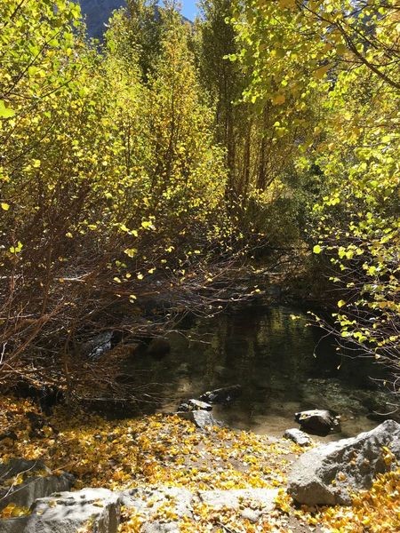
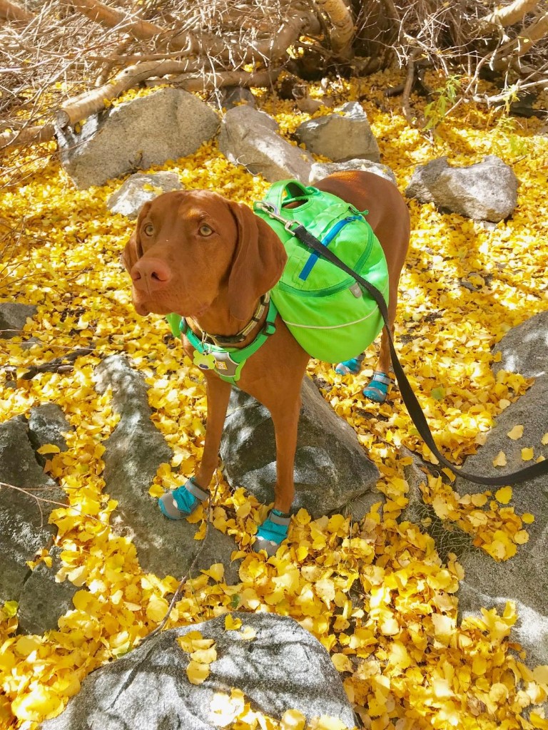
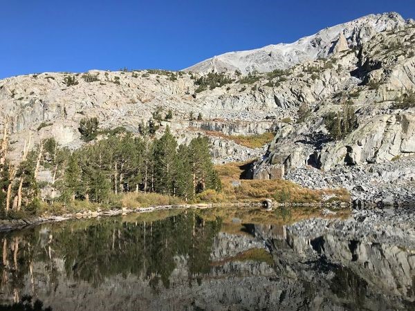
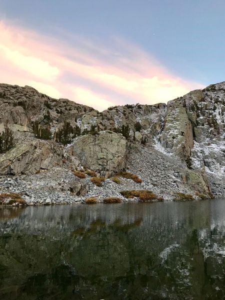
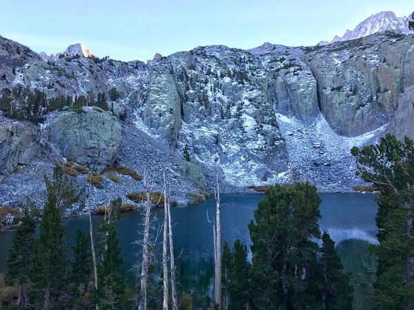
Brainerd Lake-Finger Lake via Big Pine Creek South Fork Trail
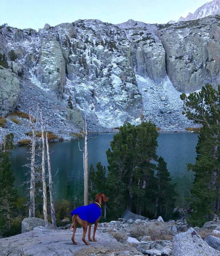
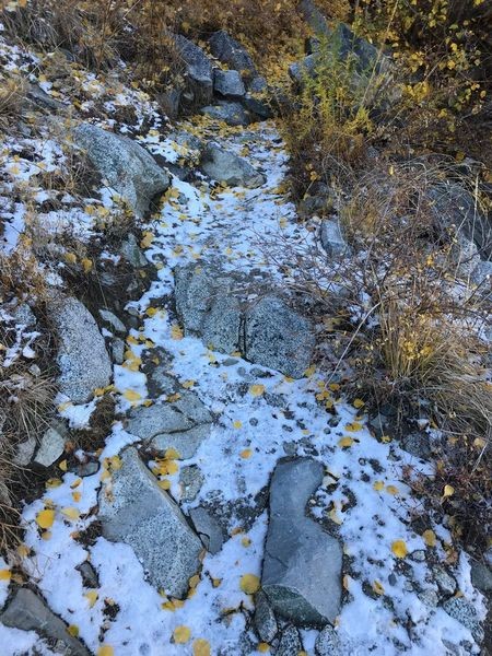
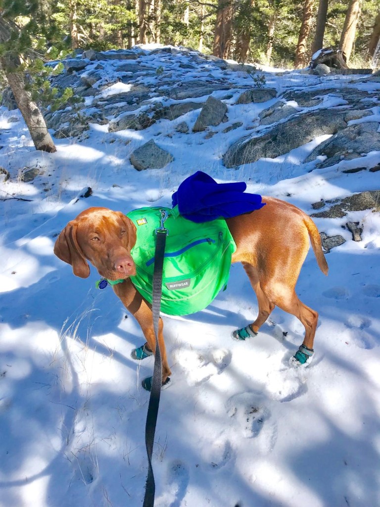
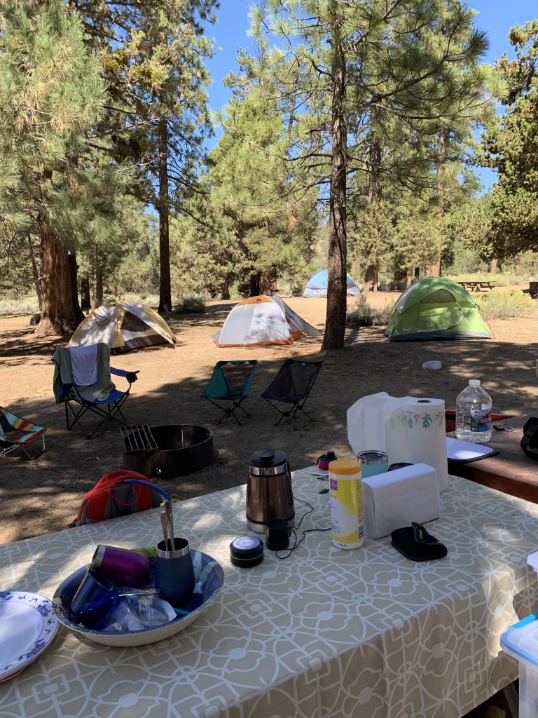
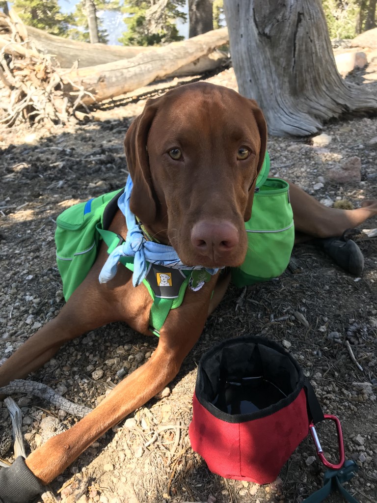
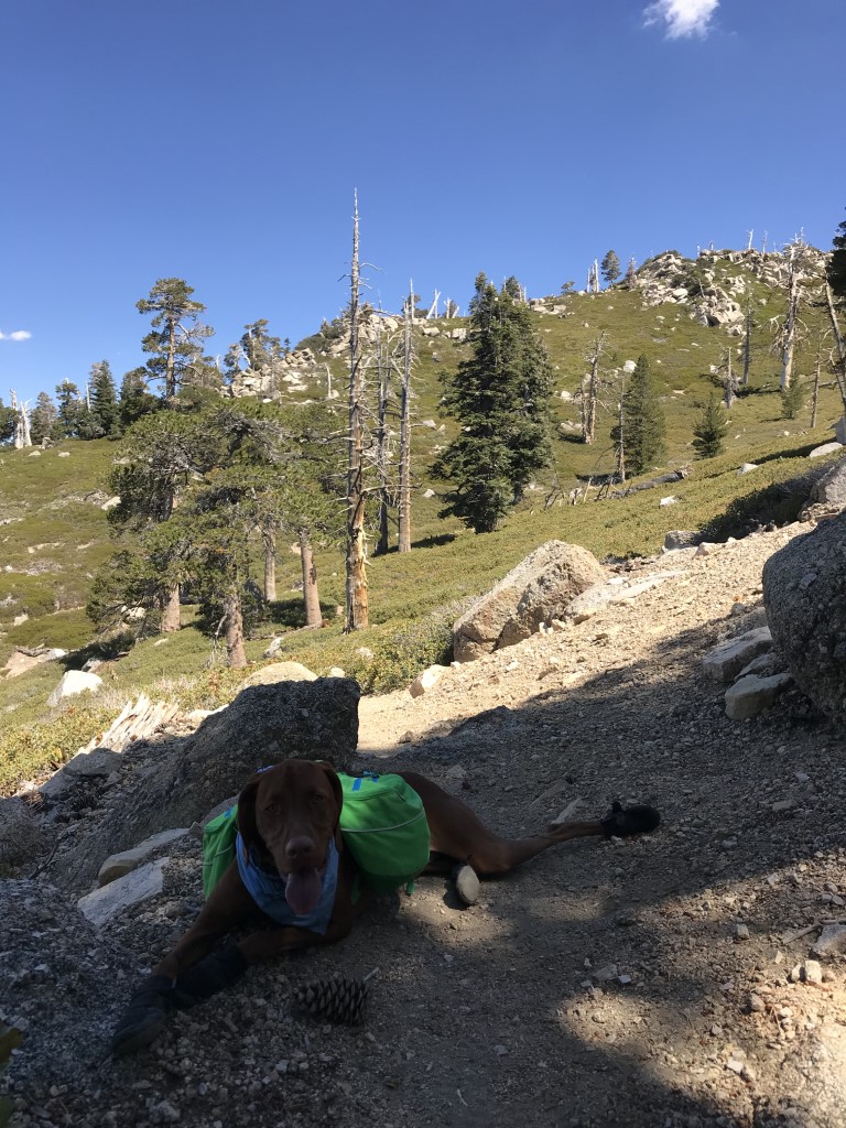
Cappie’s Scoop: What an adventure! Water crossings, fall crunchy leaves, snow, lakes, big rocks to jump on, temperature in the low 20s and an upset belly in the middle of the night. I put on my green backpack and it all begin with a hike through fall leaves! We met some other backpackers coming down the mountain and they said it snowed the night before so we knew we’d find snow at some point. The temperature started getting cooler as we climbed more and eventually we found the snow! I played for a bit but we had to keep moving. Mom likes to set up the tent when there is still light outside. Only a couple miles short of our destination Finger Lake, we decided to stop and camp at Brainerd Lake. It was perfect! Mom and I snuggled inside our tent to stay warm and drifted off to sleep. Then the unthinkable happened, I had to go to the bathroom. I sat up in the tent, giving mom the signal to let me out but she thought I had heard a noise and told me to go back to sleep. This happened a few times before mom snuggled me next to her. And then it happened, my belly got the best of me and I pooped inside our tent and worse, inside mom’s sleeping bag. Luckily we had some toilet paper with us and mom sacrificed an old hooded sweater to wipe up the mess. I gave her kisses and she forgave me knowing I tried to warn her! Sometimes an adventure happens when things go wrong and we learned a lot. When I sit up mom, let me out of the tent to go potty or it could get stinky! Don’t hesitate to add YOUR scoop in the comments below!
Tips: This trip is NOT for beginners. The Finger Lake camp (destination) is ~11,000 ft. Campfires are not allowed at this elevation. Portable gas stoves are allowed. There is a permit required to camp overnight in the Inyo National Forest. Bear-proof canisters are strongly recommended. You can rent them from your local adventure store. If you prefer to camp the night before your backpack trip starts, the Big Pine Creek Campground is near the trailhead. The camp sits at 7,600 ft elevation. Drinking water, vault toilets, picnic table, bear boxes, campfire rings and I think two parking spots are available (extra cost for additional vehicles). Firewood sold on-site. Sites first-come, first-serve. Fees $24.00 per night since last hiked. Check in with campground host upon arrival. General store nearby at Glacier Lodge.
Directions: Use the trailhead coordinates in the chart. Regardless of whether you camp the night before at Big Pine Creek Campground, you will need to park your car in the backpackers parking lot and walk down the road to the trailhead. Do NOT take the trail from the backpackers parking lot. It ascends up the northern slope of the canyon to the North Fork trail before coming back down. The walk from the parking lot down the road to the trailhead adds one extra mile of hiking. Bear boxes are located in the parking lot to store any smelly stuff so don’t leave anything in your car.
Planning a Backpack – April 2021 Newsletter Special Issue
| Mileage (round trip) | 10-12 |
| Difficulty | Strenuous |
| Gain (in feet) | 4300 |
| Trailhead | Backpackers parking lot: 37.128281, -118.427217 Big Pine Creek Campground: 37.125534, -118.433605 Big Pine Creek Trailhead: 37.125285, -118.437524 |
| Time | 2 nights |
| Exposure | Sunny and Shady |
| Scenery | Mountain Views, Forest, Creek, Alpine Lake Views |
| Facilities | Toilets at trailhead. Water from creeks, lakes and springs should be treated and/or filtered before drinking. |
| Fees/Permits | Overnight permit required (https://www.fs.usda.gov/recarea/inyo/recarea/?recid=20320), can be obtained from recreation.gov. |
| More Info | https://modernhiker.com/hike/south-fork-big-pine-creek; https://calitrails.com/2015/02/16/fall-at-finger-lake-backpacking-the-big-pine-south-fork-trail; https://www.recreation.gov/camping/big-pine-creek-campground/r/campgroundDetails.do?contractCode=NRSO&parkId=70617; http://www.glacierlodge395.com |
| Last Hiked | 10/7/2018 |


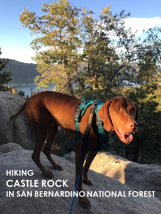
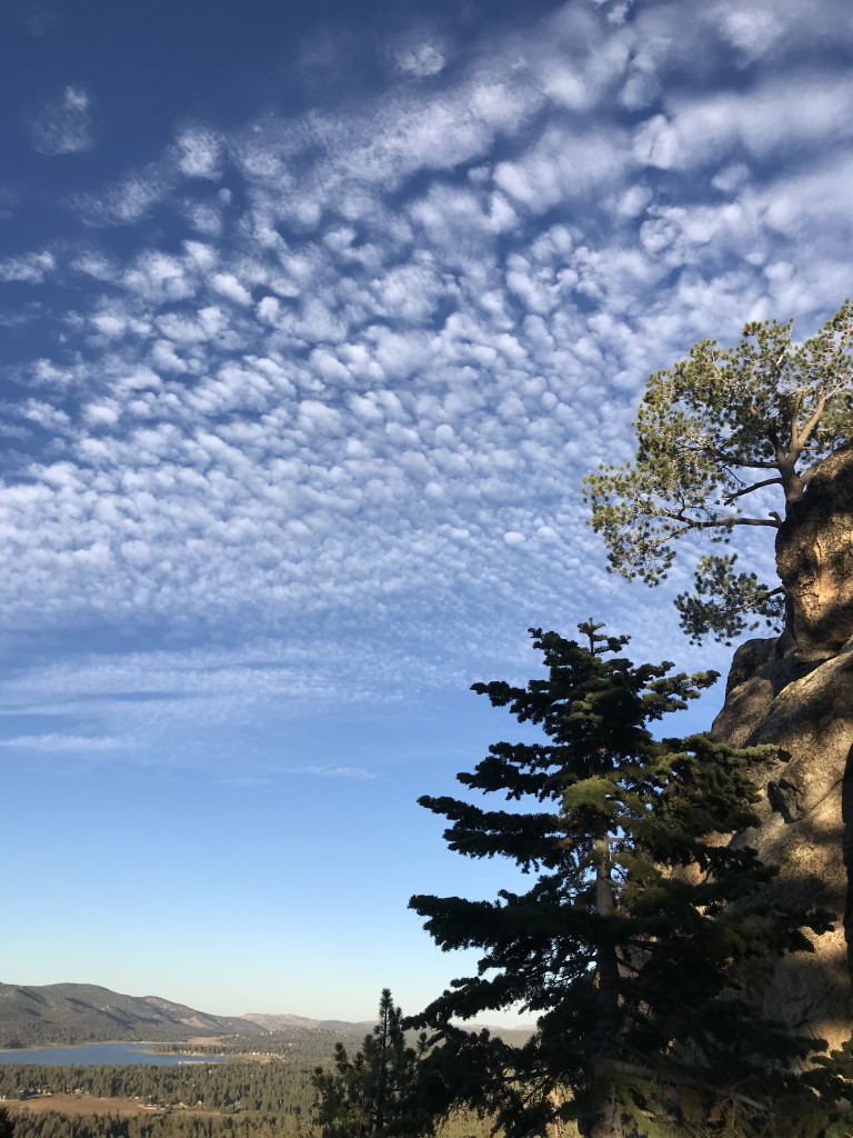
Castle Rock Trail

Cappie’s Scoop: This trail was very steep but keep climbing up for a good view! There were a lot of big rocks on this trail. Some were even too big for me to climb on. So I had to look very hard for a few good ones to jump on! Mom always gets nervous when I climb rocks but I have 4 legs and good balance unlike her! Don’t hesitate to add YOUR scoop in the comments below!
Tips: This trail is located on the southwest side of the lake. Even though it’s a short hike, it’s a bit steep. The trail also continues on if you want to do more than visit the rock.
Directions: Take CA-330N/City Creek Road towards Big Bear. Follow the road for almost 15 miles and continue east as it turns into CA-18/Hilltop Blvd. In about 13.6 miles, you will see the small parking lot on your left. The trailhead is 450 ft from the lot on the opposite side of the road – headed west, the way you drove in. If the small parking lot is full, there are some spots along side the road near the trailhead. Be careful walking next to the road with your pup as there are some curves and cars can move fast around them.
| Mileage (round trip) | 1.2 |
| Difficulty | Moderate |
| Gain (in feet) | 557 |
| Trailhead | 34.237758, -116.961407 (parking lot) 34.236628, -116.961832 (trailhead) |
| Hike Time (in hours) | 1-2 |
| Exposure | Mostly Shady |
| Scenery | Mountain Views, Lake Views, Forest |
| Facilities | None |
| Fees/Permits | None |
| More Info | https://www.fs.usda.gov/recarea/sbnf/recreation/natureviewing/recarea/?recid=26353&actid=64; http://www.bigbearlake.net/summer/castle-rock-trail |
| Last Hiked | 9/16/2018 |
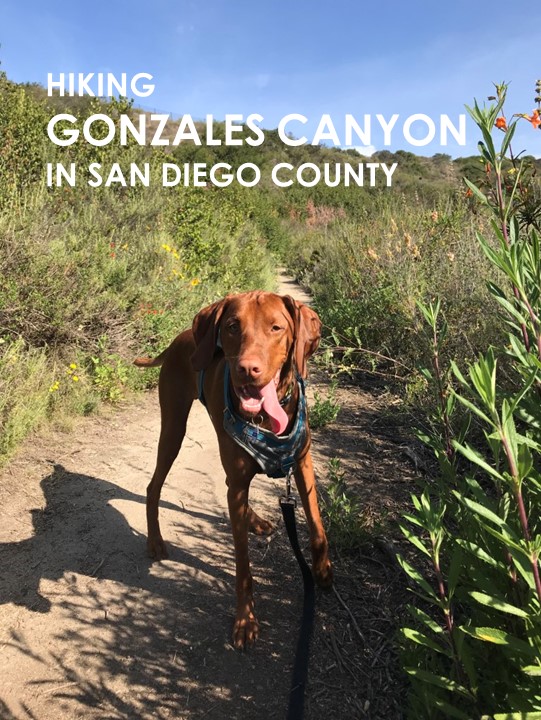
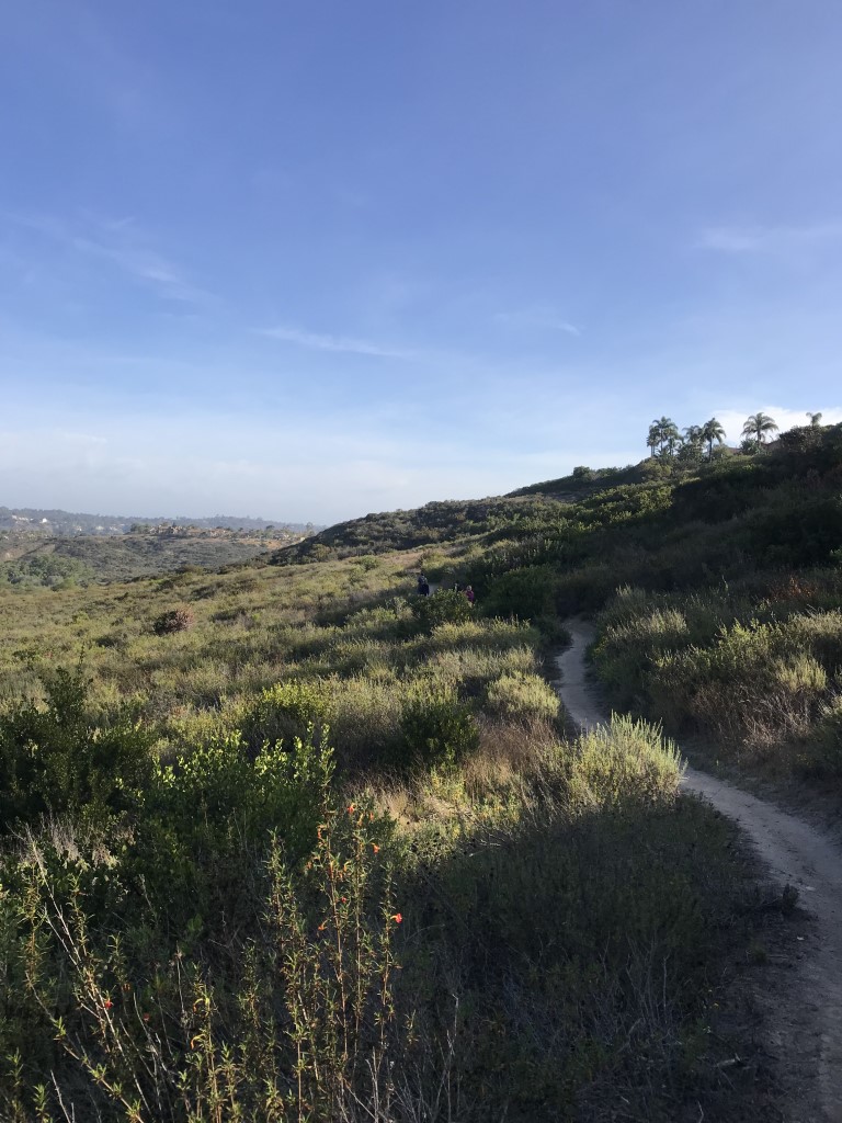
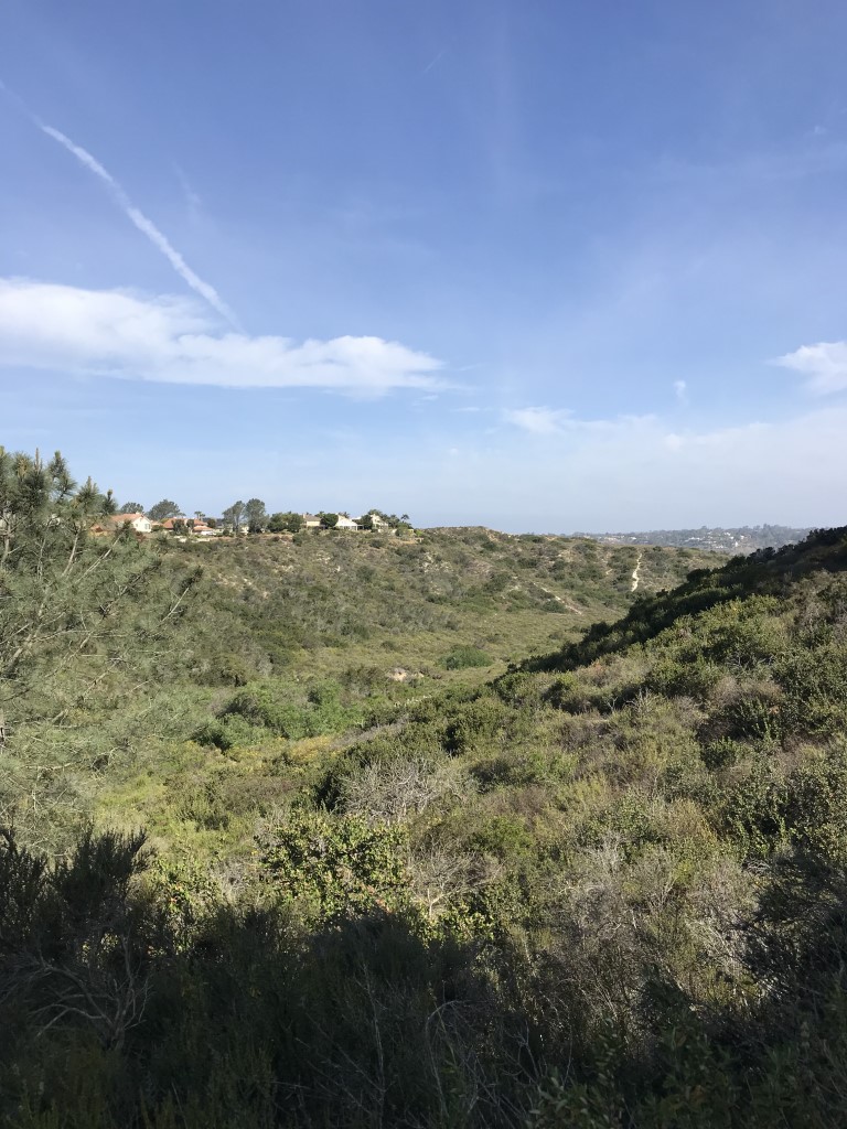
Gonzales Canyon
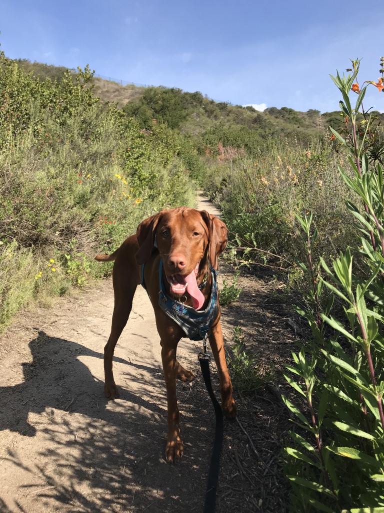
Cappie’s Scoop: One car ride and I get to hike AND play in a dog park with my furiends! Let’s go mom! We park at the dog park and pick up the trail across the street. It leads us down into the canyon which is really cool. It’s like another world down there. I couldn’t keep track of which way we were going but mom said we headed towards the Torrey Pines loop trail and did a figure 8 (whatever that is) and picked up the Lagoon trail. All those loop-di-loops made me dizzy! I’m glad I had some time to run around in the dog park after our hike to unwind from the loops. I also got to meet some new friends at the dog park too! Don’t hesitate to add YOUR scoop in the comments below!
Tips: None
Directions: Can also use address for Torrey Pines Dog Park. From I-5, take the Del Mar Heights Road exit and head east on Del Mar Heights Road. After approximately 1.3 miles, turn right onto Lansdale Drive, then after 0.1 mile turn left onto Torrey Highlands Park Road where you will find parking in front of the dog park.
| Mileage (round trip) | 2.9 |
| Difficulty | Moderate |
| Gain (in feet) | 436 |
| Trailhead | 32.960214, -117.221778 |
| Hike Time (in hours) | 2-3 |
| Exposure | Mostly Sunny |
| Scenery | Canyon Views, Trees, Wildlife, Birds, Wildflowers |
| Facilities | Restrooms and water in parking lot at dog park. |
| Fees/Permits | None |
| More Info | http://hikingsdcounty.com/gonzales-canyon |
| Last Hiked | 5/6/2018, 9/16/2018 |
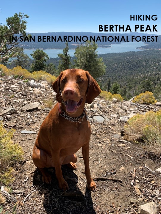
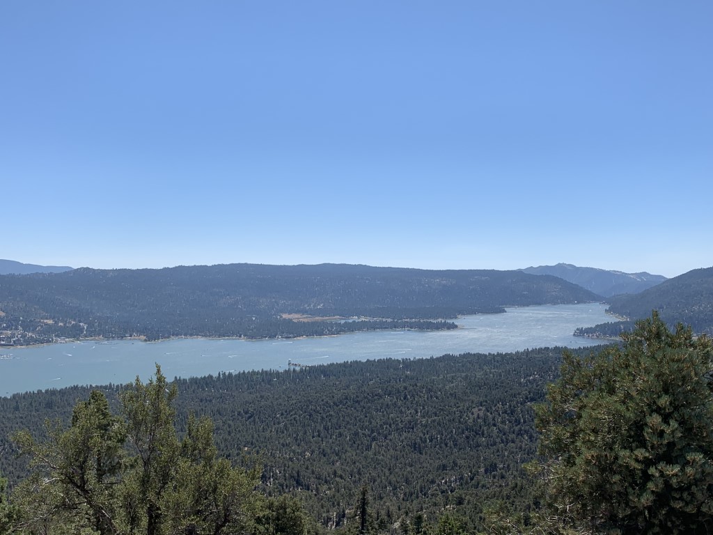
Bertha Peak

Cappie’s Scoop: This peak is across the street from a great campground! We like to camp and do this as a morning hike. I get a good view of the lake while I hike up the mountain. There are a couple benches along the way that mom can sit on or I can stand on to get a better view of the lake. The trail runs into the PCT too which is cool. One day I need to go check that trail out with mom. But for now, I head straight to the peak so I can get my reward, lots of treats! Don’t hesitate to add YOUR scoop in the comments below!
Tips: This trail is located on the northside of the lake and has a good mix of sun and shade. We started from the Cougar Crest Trailhead which was across the street from Serrano Campground. You can also start from the Big Bear Discovery Center which adds an extra mile RT.
Directions: Take CA-330N/City Creek Road towards Big Bear. Follow the road for almost 15 miles and continue east as it turns into CA-18/Hilltop Blvd. After 12.3 miles, turn left onto CA-38 west. Continue driving about 6 miles and the trailhead will be on your left hand side.
| Mileage (round trip) | 7 |
| Difficulty | Moderate |
| Gain (in feet) | 1318 |
| Trailhead | 34.263655, -116.911199 |
| Hike Time (in hours) | 4-5 |
| Exposure | Mostly Sunny |
| Scenery | Mountain Views, Lake Views, Forest |
| Facilities | Toilets in parking area. |
| Fees/Permits | California Adventure Pass or Interagency Annual Pass/America the Beautiful Pass (National Parks Pass). |
| More Info | https://modernhiker.com/hike/hiking-bertha-peak; https://mountainsfoundation.org/programs/big-bear-discovery-center |
| Last Hiked | 9/15/2018 |


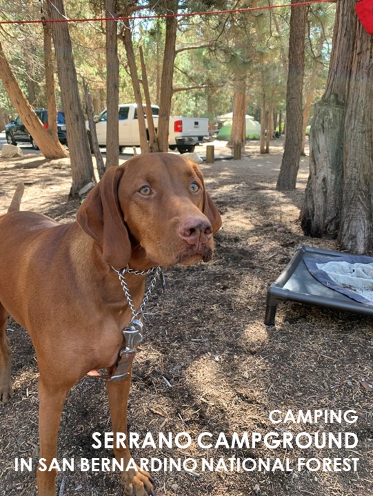
Serrano Campground

Cappie’s Scoop: Camping is a lot of fun especially when there are lizards to chase and holes to dig! Our campground was near a walking/biking trail and across the street from a trailhead. I got to hike the trail across the street all the way up to Bertha Peak. It was a lot of fun and I got a great view of Big Bear Lake. Don’t hesitate to add YOUR scoop in the comments below!
Tips: During the time we camped, the restrooms were clean and water was available throughout the campground. The camp host and security were also very responsive to any inquiries and enforced quiet hours which we enjoyed at night. Beware of coyotes running through the campground and they are incredibly loud when howling in the night! We loved site #86 in the Evening Star area because it had a lot of space in between our neighbors and some shade.
Directions: Take CA-330N/City Creek Road towards Big Bear. Follow the road for almost 15 miles and continue east as it turns into CA-18/Hilltop Blvd. After 12.3 miles, turn left onto CA-38 west. Continue driving about 6 miles and turn right onto N Shore Lane. In 0.1 miles, turn right into the campground entrance.
| Location | 34.262643, -116.911593 |
| Time | 2 nights |
| Exposure | Sunny and Shady |
| Scenery | Forest, Wildlife |
| Facilities | Restrooms and water in the campground. |
| Fees/Permits | For reservations, visit https://www.recreation.gov/camping/campgrounds/232250 |
| More Info | https://www.fs.usda.gov/recarea/sbnf/recarea/?recid=26253 |
| Last Camped | 9/14/2018-9/16/2018, 9/6/2019-9/8/2019 |


Grays Peak

Cappie’s Scoop: Look out for mountain bikers on this trail! They really like this trail too. I hiked this trail in the fall and there were a few spots to see some colorful trees with crunchy leaves. When I reached the top, I saw Big Bear Lake and kept wondering how in the world I get down there to swim in it! Don’t hesitate to add YOUR scoop in the comments below!
Tips: This trail is located on the northside of the lake and has a good mix of sun and shade. From the peak, you can see some of the lake. You also might think you’re at the peak once you reach the yellow post saying “you are here” but take a turn to the left at the post and climb just a small bit more to get to the real peak. This trail is also popular with mountain bikers so keep your eyes open for them.
Directions: Take CA-330N/City Creek Road towards Big Bear. Follow the road for almost 15 miles and continue east as it turns into CA-18/Hilltop Blvd. After 12.3 miles, turn left onto CA-38 west. Continue driving about 2.8 miles and the trailhead will be on your left hand side across from the Grout Bay Picnic Area. If the parking lot is closed, you can find parking along side the road. Important note: This trailhead is in the center of a bald eagle wintering habitat area and is closed to all public when nesting occurs, usually from winter to spring, though it can extend into summer. Check the Forest Service page for updates.
| Mileage (round trip) | 7 |
| Difficulty | Moderate |
| Gain (in feet) | 1174 |
| Trailhead | 34.262637, -116.947796 |
| Hike Time (in hours) | 4-5 |
| Exposure | Mostly Sunny |
| Scenery | Mountain Views, Lake Views, Forest |
| Facilities | Toilets in parking area. |
| Fees/Permits | California Adventure Pass or Interagency Annual Pass/America the Beautiful Pass (National Parks Pass). |
| More Info | https://www.fs.usda.gov/recarea/sbnf/recarea/?recid=26369 |
| Last Hiked | 9/14/2018 |


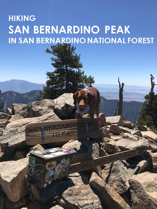
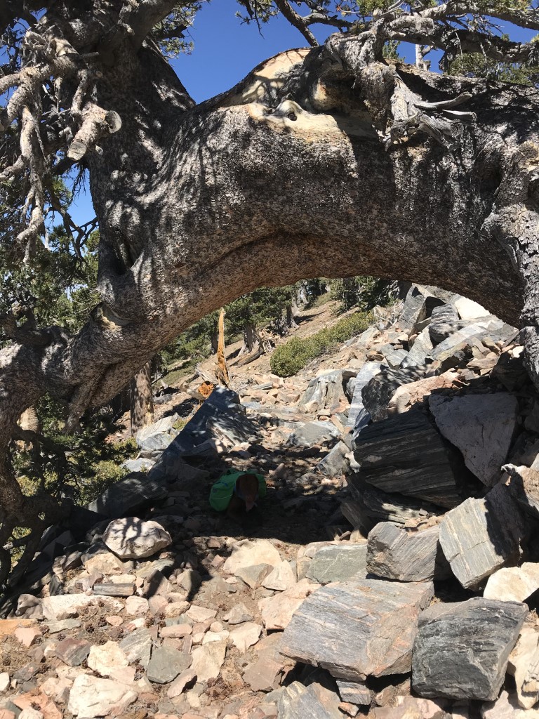
San Bernardino Peak
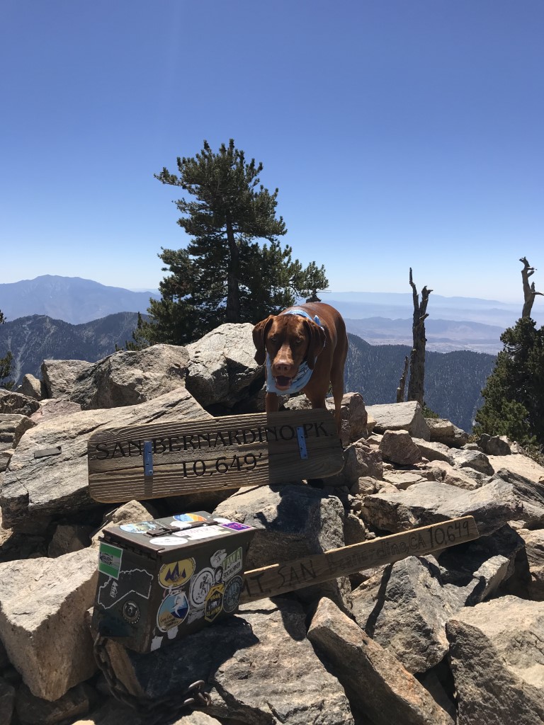
Cappie’s Scoop: This is one of the longest hikes I’ve done in a day! It was so long, the next time we did it, we backpacked. Check out our other post on San Bernardino Peak Backpack! Mom and I came on a Friday and we only saw 4 other hoomans and 1 dog the entire time. It was awesome! We reached the 10,649 ft peak and found 2 hoomans and a dog to play with. After we hung out a bit, we headed out to begin the long hike back to the car. Along the way, we passed a big pile of poop. Mom said it was bear poop but we never saw any bears. Good, good, good, whew. Don’t hesitate to add YOUR scoop in the comments below!
Tips: None
Directions: Once you’re on 38 E/Mill Creek Road, it can get tricky. You’re going to make a right at Mountain Home Creek Rd and then a left on Frontage Rd/Manzanita Ave. Once you pass the Angelus Oaks fire station on your right side, you will probably see a brown sign that says “TRAILHEAD, go to 3rd house, turn right, stay to right on dirt road to parking.” You will drive about 1/4 mile along a bumpy dirt road. Passenger cars can make it, just go slow.
Mountain Forecast (near San Bernardino Peak)
| Mileage (round trip) | 16.5 |
| Difficulty | Strenuous |
| Gain (in feet) | 4702 |
| Trailhead | 34.146122, -116.978399 |
| Hike Time (in hours) | 9 |
| Exposure | Sunny and Shady |
| Scenery | Mountain Views, Trees, Creek, Forest |
| Facilities | None |
| Fees/Permits | California Adventure Pass or Interagency Annual Pass/America the Beautiful Pass (National Parks Pass). Beginning 9/1/2020, a free day-use permit for entering San Gorgonio Wilderness areas within the San Bernardino National Forest is required and there are quotas, information at http://sgwa.org/wilderness-permits. |
| More Info | https://sixpackofpeaks.com/socal; https://socalhiker.net/a-six-pack-of-peaks |
| Last Hiked | 9/7/2018 |
Las Ramblas Loop
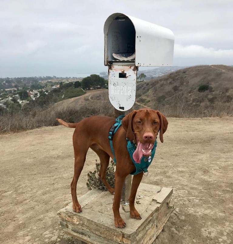
Cappie’s Scoop: You never know what you might find on a hike! When mom said we’re going to a flagpole area known as Patriot Point, I just thought we’d get a great view and my picture near a flag. However, when we got there, we saw a mailbox. Who gets mail on the top of this hill! We looked inside and there was a notebook with lots of people writing messages. Mom read a few aloud and they were funny. If you do this hike, read a few of the pages and get a good laugh. We signed the book, added our funny message and closed the mailbox. This trail has very little shade so go early, enjoy some good views of the ocean and don’t mail anything from that box! Don’t hesitate to add YOUR scoop in the comments below!
Tips: None
Directions: From I-5, take Camino Las Ramblas exit 79. Turn onto Camino Las Ramblas (heading east) and drive ~1 mile to the road’s end and park.
| Mileage (round trip) | 3.4 |
| Difficulty | Moderate |
| Gain (in feet) | 900 |
| Trailhead | 33.473849, -117.645612 |
| Hike Time (in hours) | 2 |
| Exposure | Sunny |
| Scenery | Ocean Views, Rolling Hills |
| Facilities | None |
| Fees/Permits | None |
| More Info | https://socalhiker.net/hiking-las-ramblas-to-the-flagpole |
| Last Hiked | 9/3/2018 |