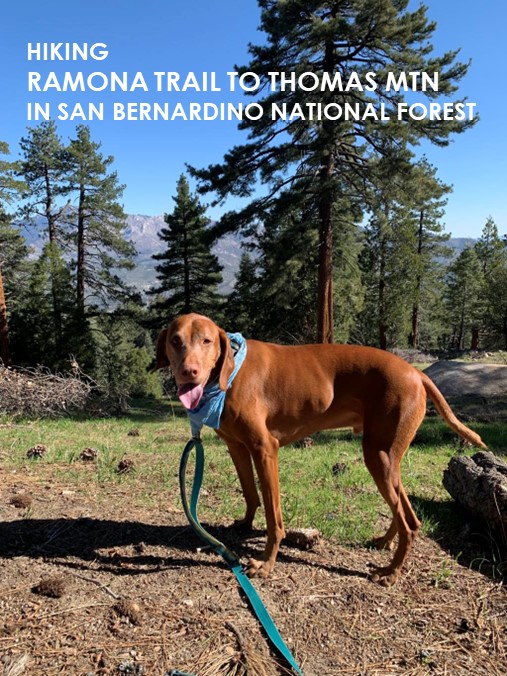
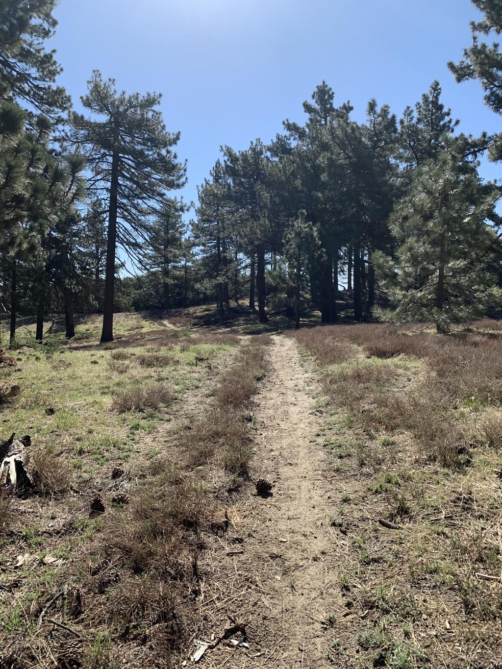
Ramona Trail to Thomas Mountain
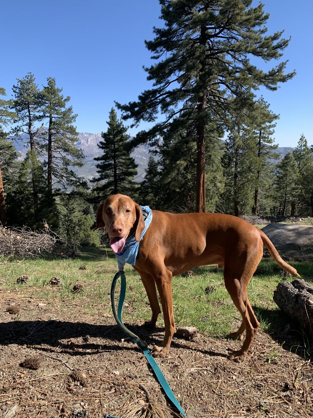
Cappie’s Scoop: I finally made it to Thomas Mountain! The last time we did this hike, we had our backpacks and tent with us and we only went to Toolbox Springs Campground. I’m glad we made it to the top of the mountain this time! It was very very windy up there but great views! Don’t hesitate to add YOUR scoop in the comments below!
Tips: On your hike up, you will reach a junction in about 3.7 miles. Take the side trail on the right to head towards Thomas Mountain Road and to start your loop counterclockwise. You can also go straight too and pick up the road after passing through Toolbox Springs Campground but you’ll return on this trail doing the loop. The peak is at 6,825 ft but is not marked from what we could find. At the top of the loop, you’ll see some towers fenced in and a concrete slab with a campsite on your right. We assumed that was the peak since it was 6,817 ft. To pick up the return loop trail, have a map handy on your phone because the start is not obvious but once you find it, you got it the rest of the way!
Directions: From I-15 North, take the CA-79 S/Temecula Parkway exit and go 42.7 miles. Turn left onto CA-371 E and go 20.7 miles. Then turn left onto CA-74 W and about 4.4 miles up the road on your left is the turn for the trailhead. If you’re not a hiker, about 1.5 miles from the Ramona Trail trailhead, there is a turnoff for Forest Road 6S13 that leads to Thomas Mountain (33.604049, -116.618583). It’s an 8 mile drive on a dirt road and the Tool Box Springs Campground is on the way before you reach Thomas Mountain. You can car camp here too and it’s free!
| Mileage (round trip) | 12.5 |
| Difficulty | Moderately Strenuous |
| Gain (in feet) | 2372 |
| Trailhead | 33.62110, -116.63438 |
| Hike Time (in hours) | 6-7 |
| Exposure | Mostly Sunny |
| Scenery | Mountain Views, Forest, Wildflowers |
| Facilities | None at the trailhead. Vault toilets at the campground. Bring your own toilet paper. |
| Fees/Permits | None to park and none to camp. If you intend to build a fire in the provided fire rings at the campground, you will need a free CA campfire permit. You can obtain one by watching this short video online, https://www.readyforwildfire.org/permits/campfire-permit. |
| More Info | https://nobodyhikesinla.com/2013/09/27/thomas-mountain-via-ramona-trail |
| Last Hiked | 4/8/2022, 5/13/2023 |


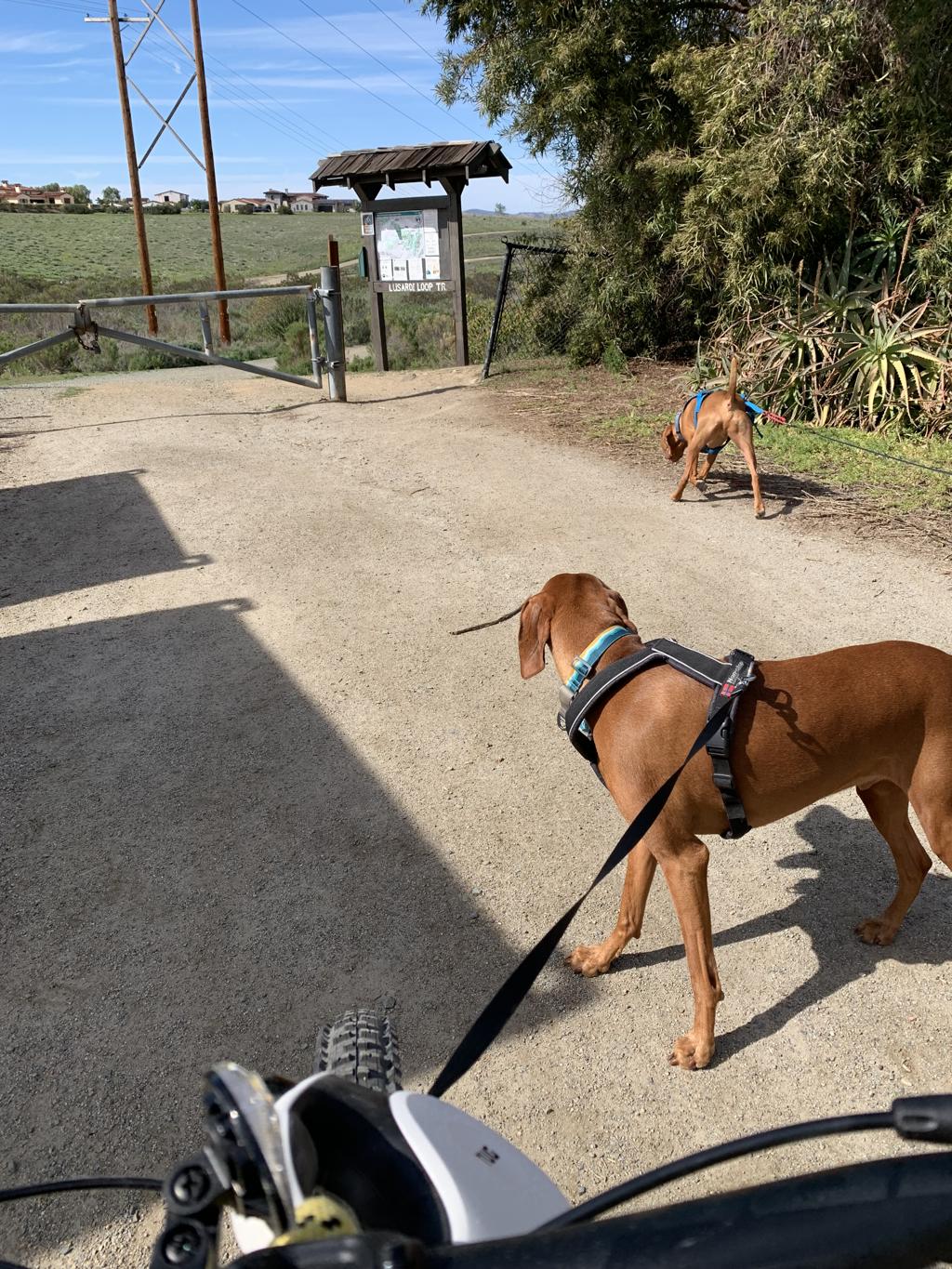
Lusardi Creek Loop Trail
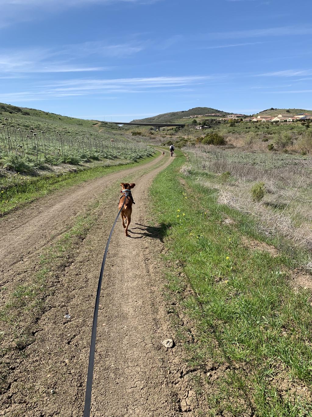
Cappie’s Scoop: Lots of hills to zoom down! Mom was trying to keep up with me but I was faster than her on the uphill. She had to get off her bike and walk. It was a lot of fun but go before it gets too hot! Don’t hesitate to add YOUR scoop in the comments below!
Tips: Bring lots of water for yourself and your dog.
Directions: Coordinates take you to Black Mountain Ranch Park where is where we picked up the loop trail. We parked in the second parking lot, the one furthest from Carmel Valley Road.
| Mileage (round trip) | 10 |
| Difficulty | Moderate |
| Gain (in feet) | 1115 |
| Trailhead | 32.989318, -117.130179 |
| Bike Time (in hours) | 3-4 |
| Exposure | Sunny |
| Scenery | Rolling Hills, Wildlife, Wildflowers |
| Facilities | None |
| Fees/Permits | None |
| More Info | https://www.mtbproject.com/trail/5736294/lusardi-creek-loop-trail |
| Last Hiked | 2/27/2022 |

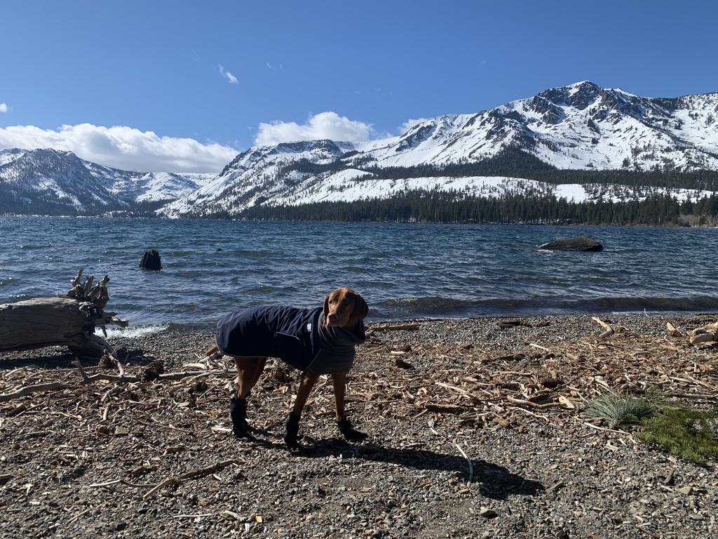
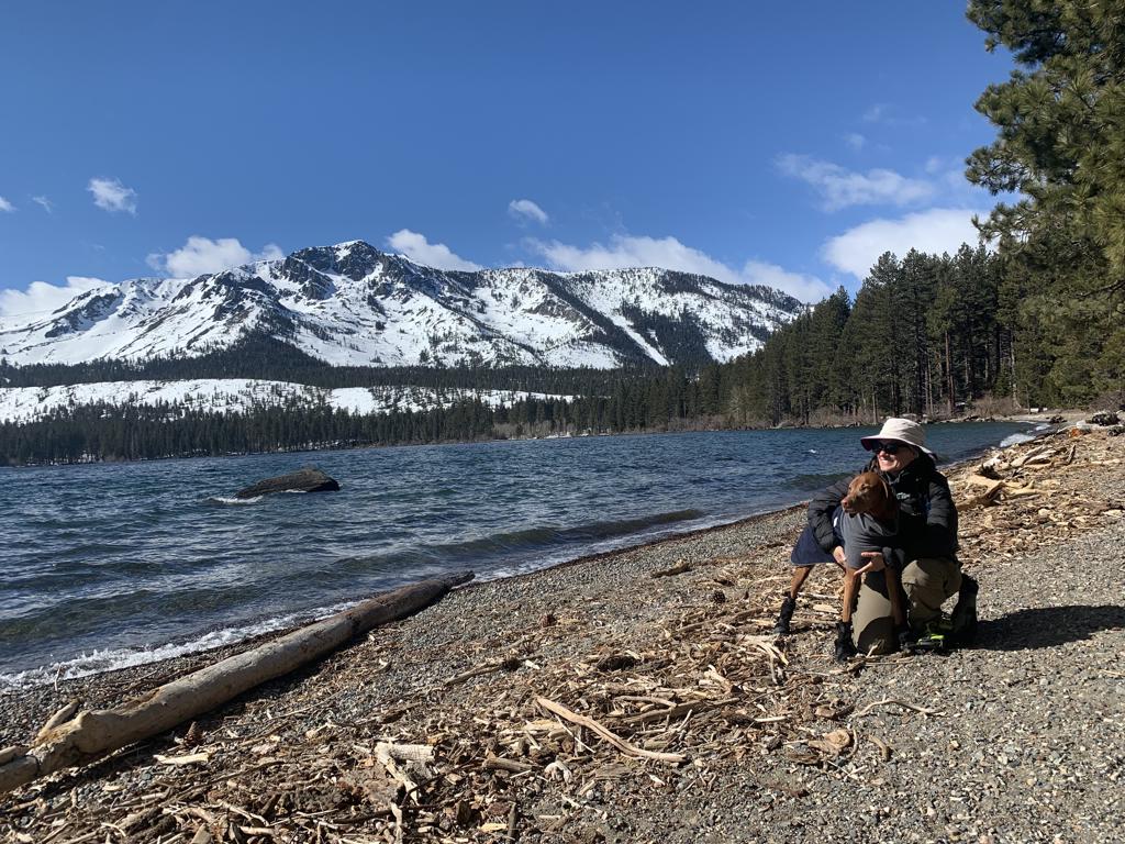
Fallen Leaf Lake
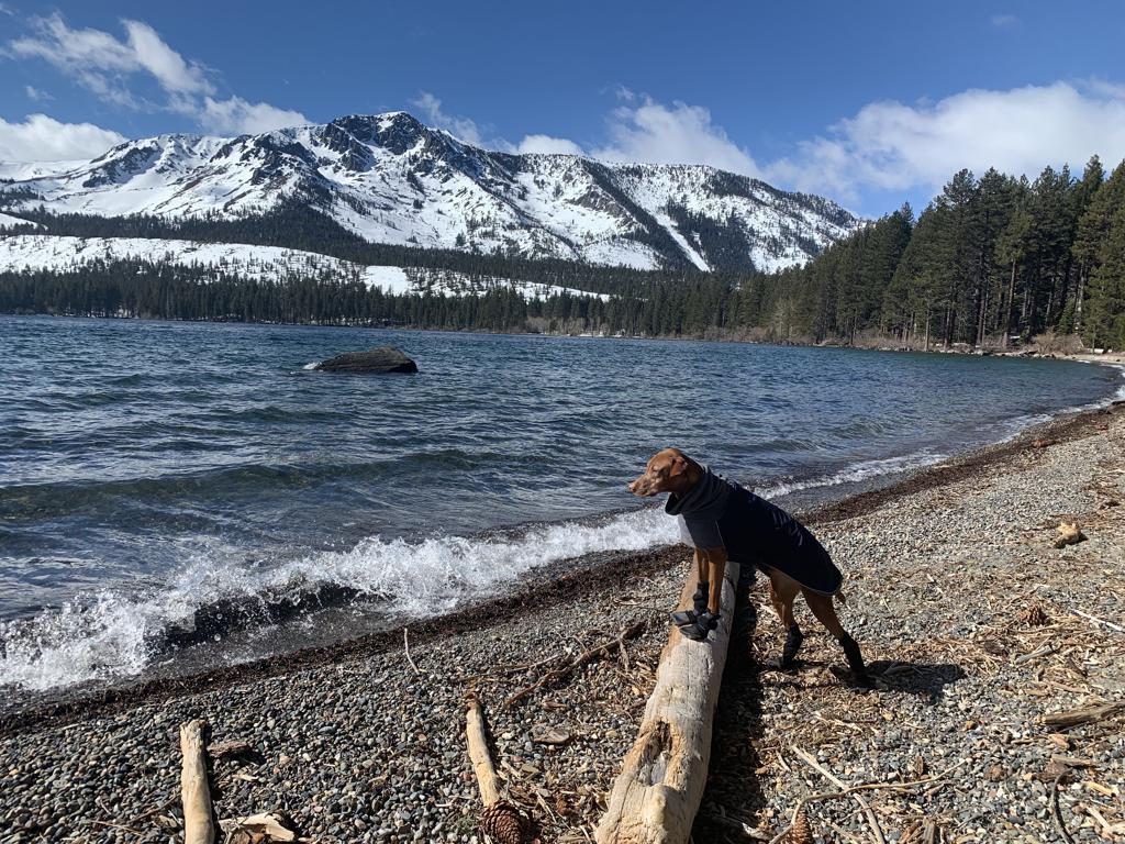
Cappie’s Scoop: This is a fun snow hike! Since this is a closed road covered in snow, it’s like a huge hiking trail! Mom can snowshoe and I can zoom around in the snow. We didn’t see many hoomans at all. I think most of them were sledding where we parked. Mom thinks we should bring a sled next time. Don’t hesitate to add YOUR scoop in the comments below!
Tips: This is a snowshoe we did in the winter when Fallen Leaf Road was closed. We snowshoed up the road a bit, through Fallen Leaf Campground and up to the lake for some amazing views! If you want to come back in the summer, you can standup paddleboard on this lake too!
Directions: From South Lake Tahoe, head south on US-50 for only a few miles and then turn right onto CA-89 N/Emerald Bay Rd. In 3.1 miles, turn left onto Fallen Leaf Rd and find a parking spot somewhere on the side of the road or in the few parking spots available. Keep in mind this is a popular spot to sled so go early to avoid crowds and a crowded parking lot.
| Mileage (round trip) | 2+ |
| Difficulty | Easy |
| Gain (in feet) | Negligible |
| Trailhead | 38.933057, -120.049637 |
| Hike Time (in hours) | 2-3 |
| Exposure | Sunny and Shady |
| Scenery | Mountain Views, Lake Views, Wildlife |
| Facilities | None at the trailhead. Vault toilets at the campground. Bring your own toilet paper. |
| Fees/Permits | None to park and none to camp. If you intend to build a fire in the provided fire rings at the campground, you will need a free CA campfire permit. You can obtain one by watching this short video online, https://www.readyforwildfire.org/permits/campfire-permit. |
| More Info | https://visitlaketahoe.com/hike/get-outside-and-get-moving-to-truly-appreciate-fallen-leaf-lake |
| Last Hiked | 2/21/2022 |

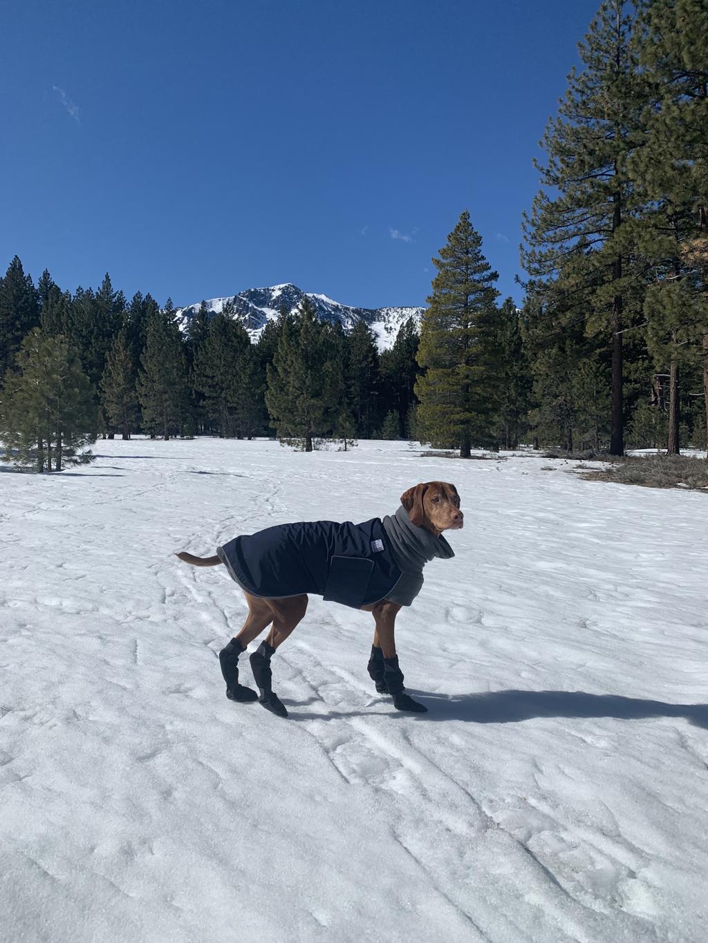
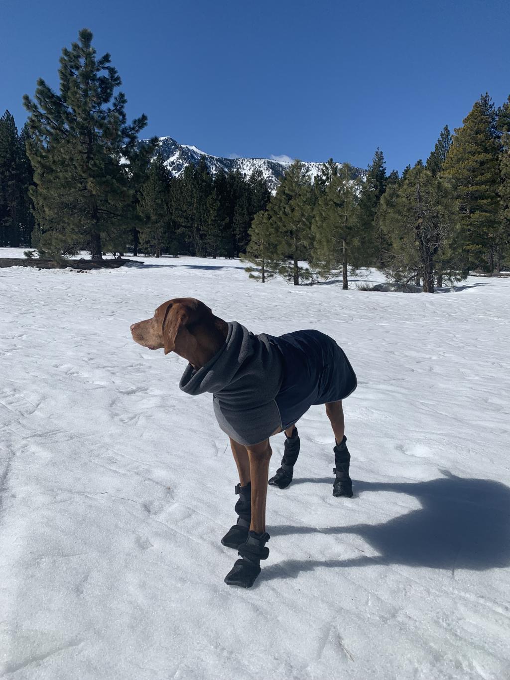
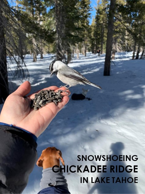
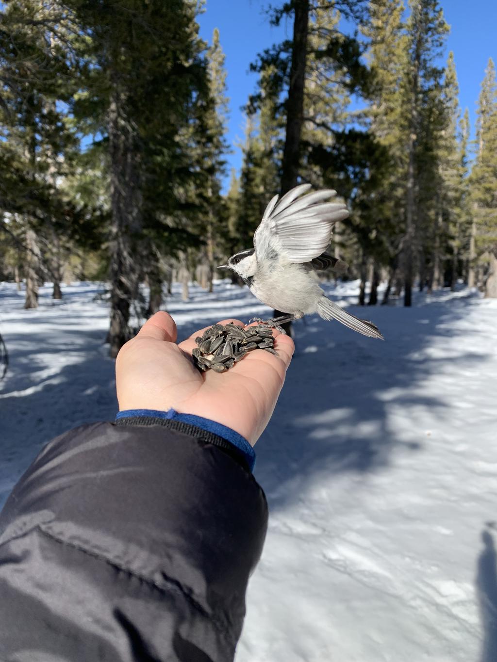
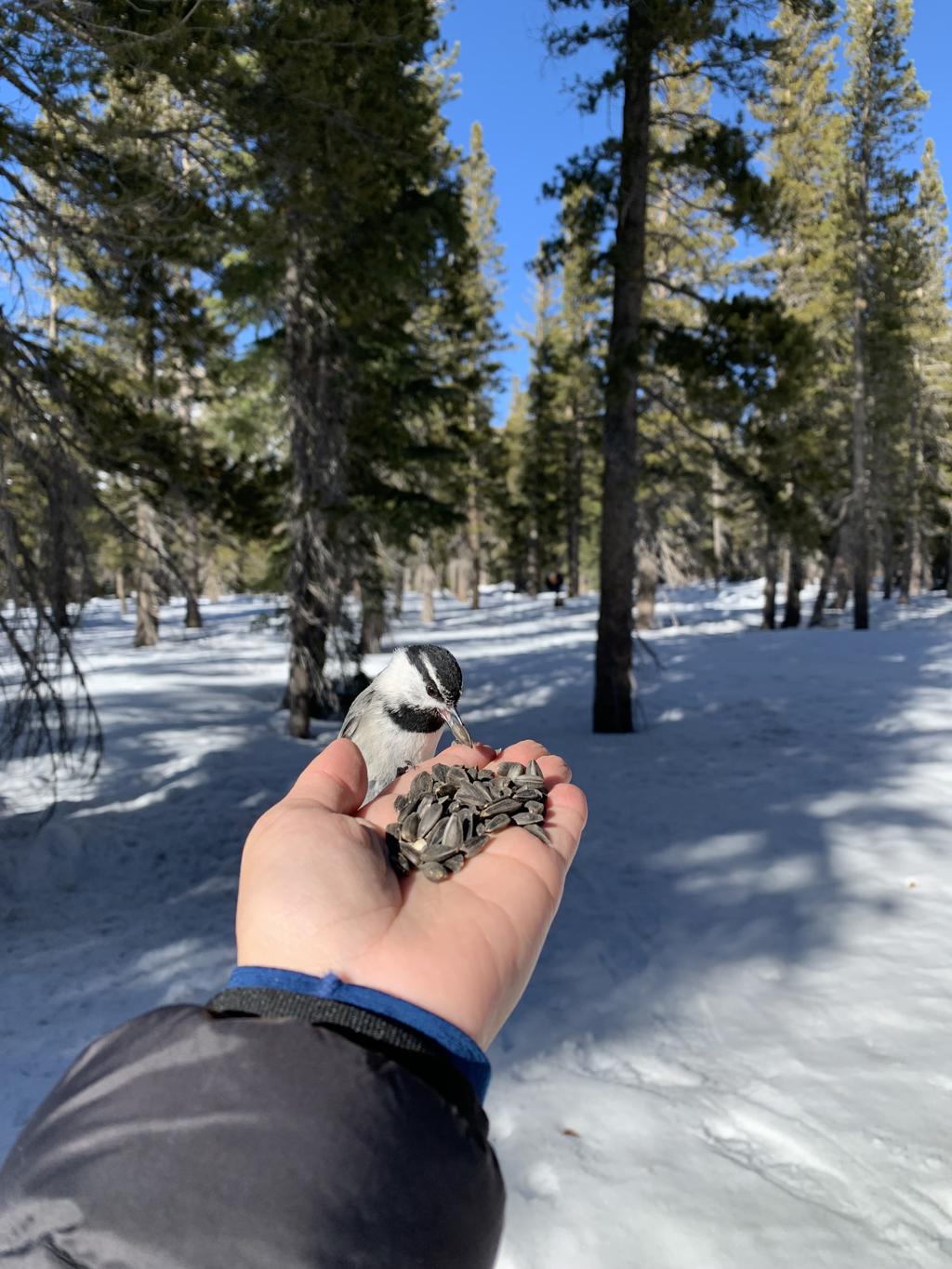
Chickadee Ridge
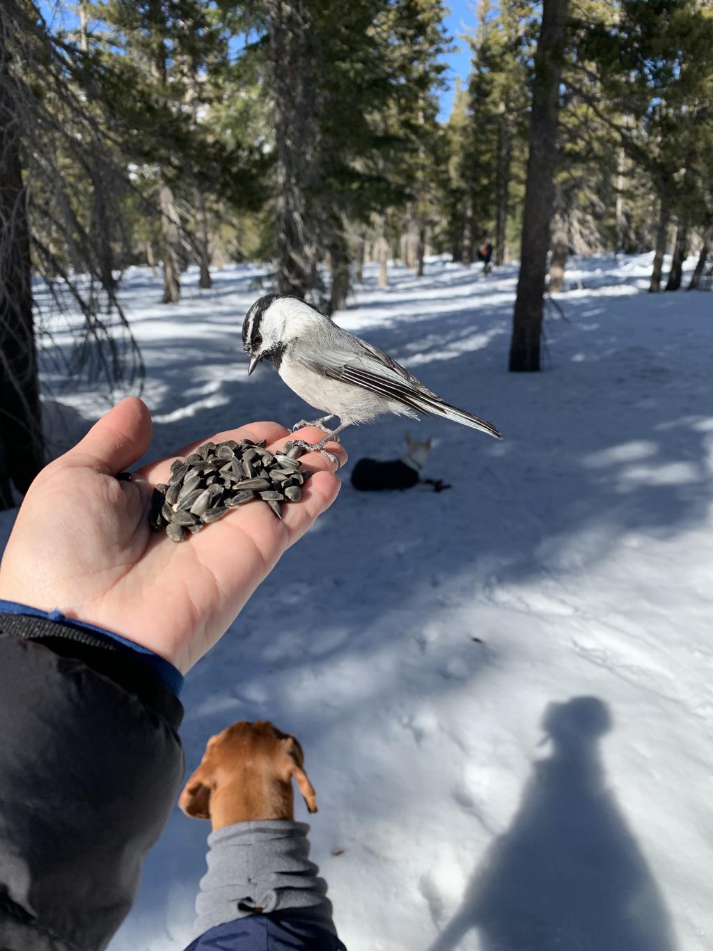
Cappie’s Scoop: The best part of this hike was watching mom feed the birds! Mom said we had to be patient and she stood there with her hand out for a long time but then the birds came! They flew on her hand and grabbed some food. It was really cool! They were not scared of me. They must have known that I’m friends with a lot of birds. Except the doves that try to build nests on my balcony at home. They are not allowed to do that and I tell them every time! Woof! Don’t hesitate to add YOUR scoop in the comments below!
Tips: This is a snowshoe we did in the winter and it’s near Lake Tahoe but on the Nevada side. Suggest you have a map handy on your phone so you can snowshoe towards the direction of the trail depending on where you park. If you’re going to feed the Chickadees, buy bird food before you go. There are a couple pet stores in South Lake Tahoe – Pet Station or Pet Supermarket. They really seemed to like the big black sunflower seeds.
Directions: From South Lake Tahoe, head north on US-50 East for about 14.8 miles. Then turn left onto NV-28 South and continue on for 11.4 miles. Then turn right onto Country Club Drive and drive 2.3 miles. Depending on the time of year you go, it might be crowded so find a safe spot to park on the side of the road. The entire area will be covered with snow in the winter and you can start your snowshoe anywhere and hike in the direction of the trail.
| Mileage (round trip) | 2.5+ |
| Difficulty | Moderate |
| Gain (in feet) | 272 |
| Trailhead | 39.30067, -119.91958 |
| Hike Time (in hours) | 3-4 |
| Exposure | Sunny and Shady |
| Scenery | Mountain Views, Lake Views, Wildlife |
| Facilities | None at the trailhead. Vault toilets at the campground. Bring your own toilet paper. |
| Fees/Permits | None to park and none to camp. If you intend to build a fire in the provided fire rings at the campground, you will need a free CA campfire permit. You can obtain one by watching this short video online, https://www.readyforwildfire.org/permits/campfire-permit. |
| More Info | https://www.martiscamp.com/chickadee-ridge-snowshoe-hike-lake-tahoes-best-hikes |
| Last Hiked | 2/19/2022 |


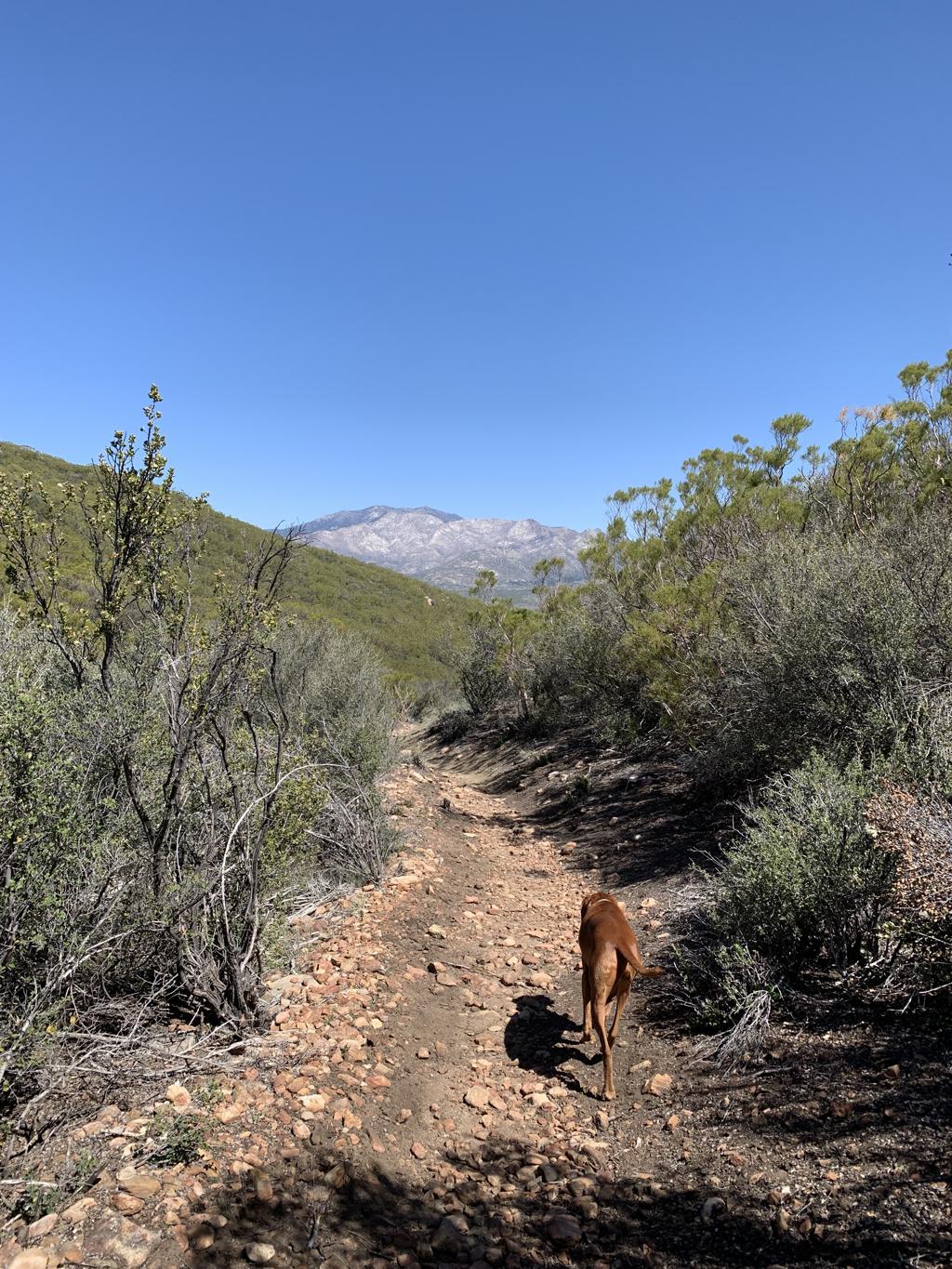
Lion Peak

Cappie’s Scoop: I don’t know if anyone knows about this trail because I never seen anyone on it! Now mom said that this trail connects with the big PCT and that in April, more people will be hiking on it. But that might be too late to hike here because it gets very hot. Winter is the time to get on this trail and you may even see patches of snow like I did! In the distance, I saw Mount San Jacinto and it had snow on it too! Don’t hesitate to add YOUR scoop in the comments below!
Tips: It’s a gradual climb in the beginning and then you reach the switchbacks which help with the elevation gain! The switchbacks end at the junction with the PCT. Continue on the PCT to reach Lion Peak. Along the way, you do pass Pyramid Peak as well if you want to bag two peaks! The turnoff for Lion Peak is not marked with a sign but there is a cairn (i.e. pile of rocks) on the right side to mark where the trail veers off to the peak. It helps to have a map handy.
Directions: From I-15 North, take the CA-79 S/Temecula Parkway exit and go 42.7 miles. Turn left onto CA-371 E and go 20.7 miles. Then turn left onto CA-74 W and go 3.8 miles. Then turn right onto Morris Ranch Road. Drive down this road for 3.6 miles (passing a couple Camps) until you see a dirt parking lot on your right. There are no facilities and no signs. The Cedar Springs Trail is a short distance down the paved road on your right. There is a sign marking the start of the trail along with a gate that is easy to open.
| Mileage (round trip) | 9.5 |
| Difficulty | Moderate |
| Gain (in feet) | 2043 |
| Trailhead | 33.652916, -116.589591 |
| Hike Time (in hours) | 4-5 |
| Exposure | Mostly Sunny |
| Scenery | Mountain Views, Forest, Desert |
| Facilities | None |
| Fees/Permits | None |
| More Info | https://www.10adventures.com/hikes/san-bernardino-national-forest/lion-peak-trail |
| Last Hiked | 2/8/2022, 2/10/2023 |


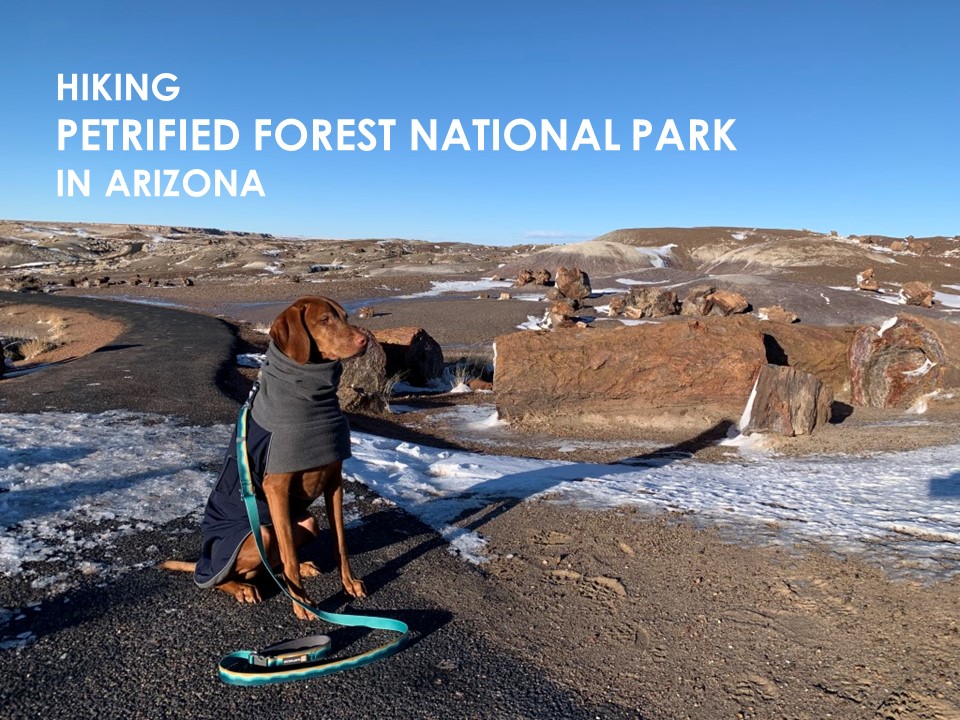
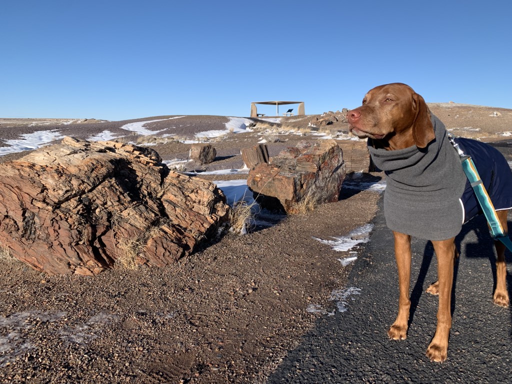
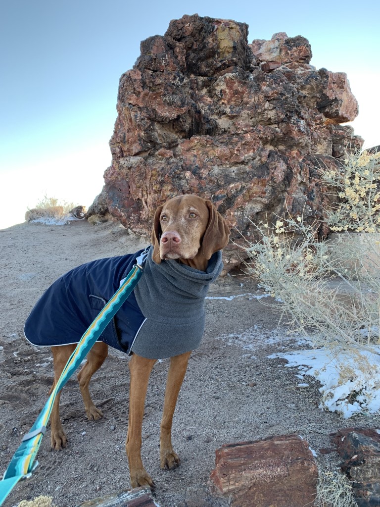
Petrified Forest National Park
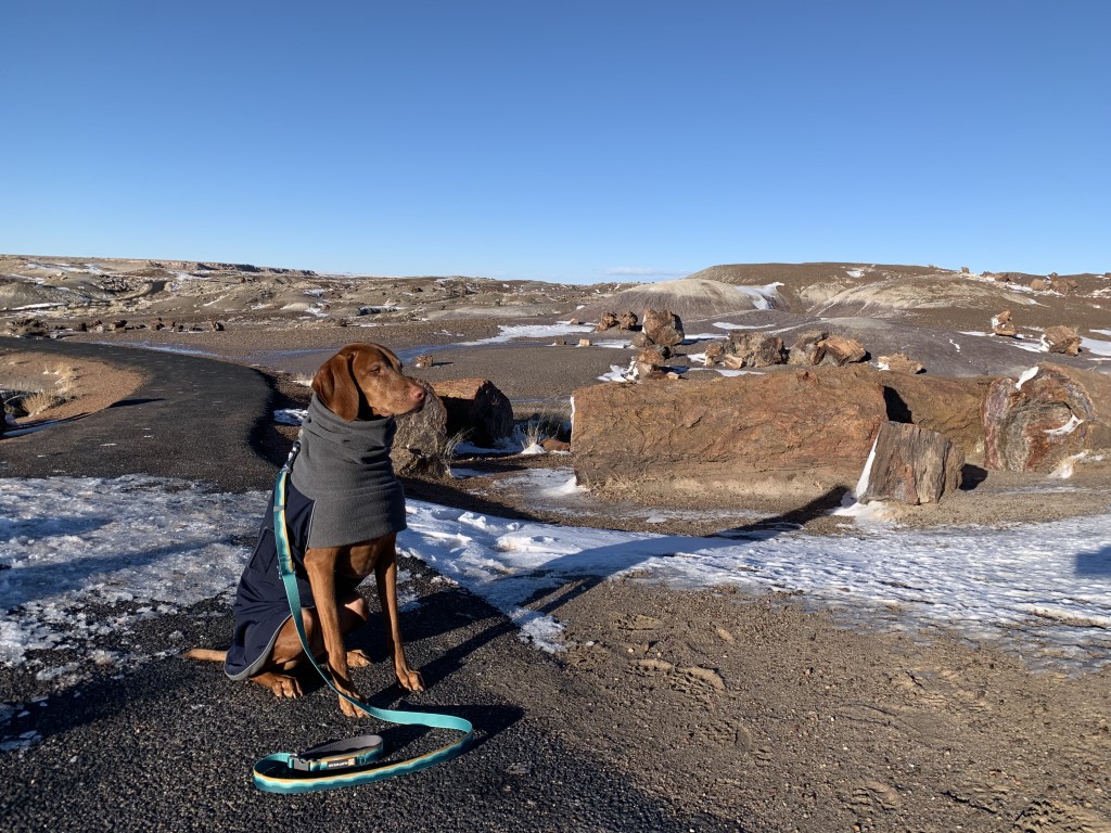
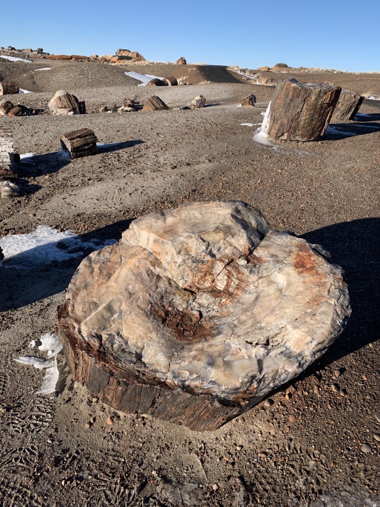
Cappie’s Scoop: Mom doesn’t take me to many National Parks because it’s just not that much fun. I can only hang in the parking lot, or on paved sidewalks or watching from the car when it’s not hot outside. But this time, pets on a leash are welcome on trails! So I was able to see most of the things on the scenic drive. I even got to SMELL the petrified wood which is what this park is most known for – they have a huge collection just laying around. I thought they looked more like rocks and not tree logs. Don’t hesitate to add YOUR scoop in the comments below!
Tips: The best way to experience the park is to drive the 28 mile long park road from one end to the other. There are many pullouts and some short trails that get you up close to interesting sights! There are 12 marked spots on the park map. What is petrified wood?
1. Painted Desert Visitor Center – Cappie waited in the car while we ran in to grab a couple souvenirs
2. Painted Desert Inn and Museum – we skipped this one
3. Painted Desert Overlooks – Cappie came with us to see the views from multiple overlooks
4. Route 66 Alignment – We skipped this one; it’s an old Studebaker rusted car
5. Puerco Pueblo – We skipped this one; it’s a 0.3 mile loop trail to old Puebloan homes and petroglyphs
6. Newspaper Rock – Cappie came with us to see the petroglyphs
7. Blue Mesa – Cappie came with us on the 1 mile paved trail to see blue, purple and gray badlands and we drove the 3.5 mile loop road
8. Agate Bridge – Cappie came with us to see the 110 ft petrified log spanning a gully
9. Jasper Forest – We skipped this one for #10; it’s a panoramic view of an area with a lot of petrified wood
10. Crystal Forest – Cappie came with us on the 0.75 mile paved loop trail where we got up close to the petrified wood
11. Rainbow Forest Museum and Giant Logs Trail – We skipped the museum but Cappie came with us on the 0.4 mile dirt loop trail
12. Long Logs & Agate House – We skipped this one; it’s a 2.6 mile trail with logs and a pueblo reconstructed of petrified wood
Directions: Coordinates take you to the Painted Desert Visitor Center and Park Headquarters. Once you enter the park, pick up a map that shows the route to drive and all of the marked stops.
| Mileage | 28 mile drive with multiple stops to hike/see sights |
| Difficulty | Easy |
| Gain (in feet) | Negligible |
| Trailhead | 35.065424, -109.782718 |
| Exposure | Sunny |
| Scenery | Desert, Badlands, Petroglyphs, Petrified Wood |
| Facilities | Visitor Center Onsite with Restrooms |
| Fees/Permits | Private Vehicles – $25. Admits one private, non-commercial vehicle (15-passenger capacity or less) and all occupants. Valid for 7 days. |
| More Info | https://www.nps.gov/pefo/index.htm |
| Last Hiked | 1/2/2022 |


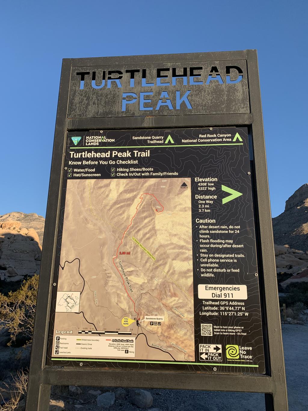
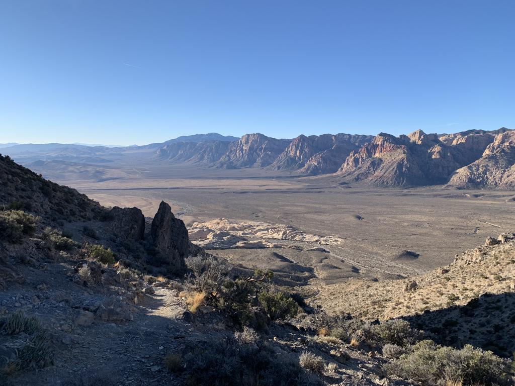
Turtlehead Peak
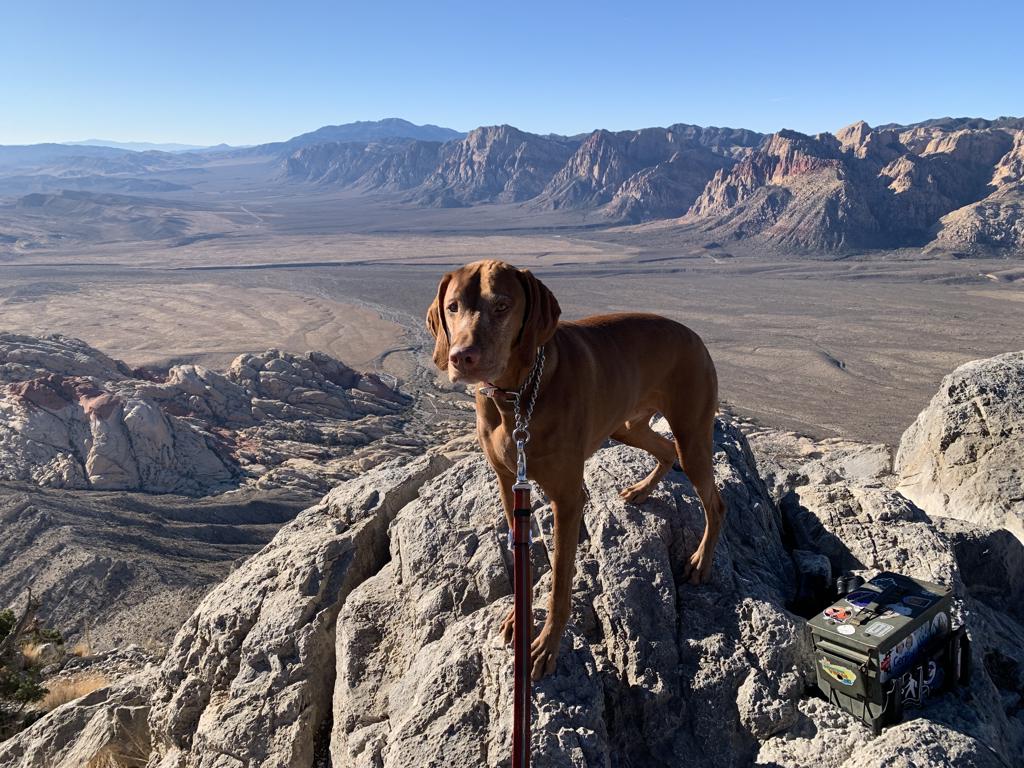
Cappie’s Scoop: Rocks, rocks, rocks. So many rocks to hike on and see on this hike! The view from the top is really cool and scary. It’s so high and you can see all the rocks in the canyon! Don’t hesitate to add YOUR scoop in the comments below!
Tips: Recommend hiking here during the winter. This area gets extremely hot in the summer so check the weather before you start your hike.
Directions: This hike is in Red Rock Canyon. Coordinates take you to the Sandstone Quarry trailhead where you can find the trail to the peak.
| Mileage (round trip) | 5 |
| Difficulty | Strenuous |
| Gain (in feet) | 2020 |
| Trailhead | 36.162312, -115.450121 |
| Hike Time (in hours) | 3-4 |
| Exposure | Sunny |
| Scenery | Mountain Views, Red Rocks |
| Facilities | Toilets in the parking lot. |
| Fees/Permits | $20 per vehicle per day – https://www.redrockcanyonlv.org/fees. In addition to the fee, timed reservations are required for vehicle entry to the Scenic Loop between 8am-5pm from October 1 through May 31 – https://www.redrockcanyonlv.org/timed-entry-reservation-info. |
| More Info | https://hikingguy.com/hiking-trails/las-vegas-hikes/hike-turtlehead-peak-trail; https://www.redrockcanyonlv.org/turtlehead-peak |
| Last Hiked | 11/28/2021 |


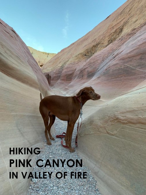
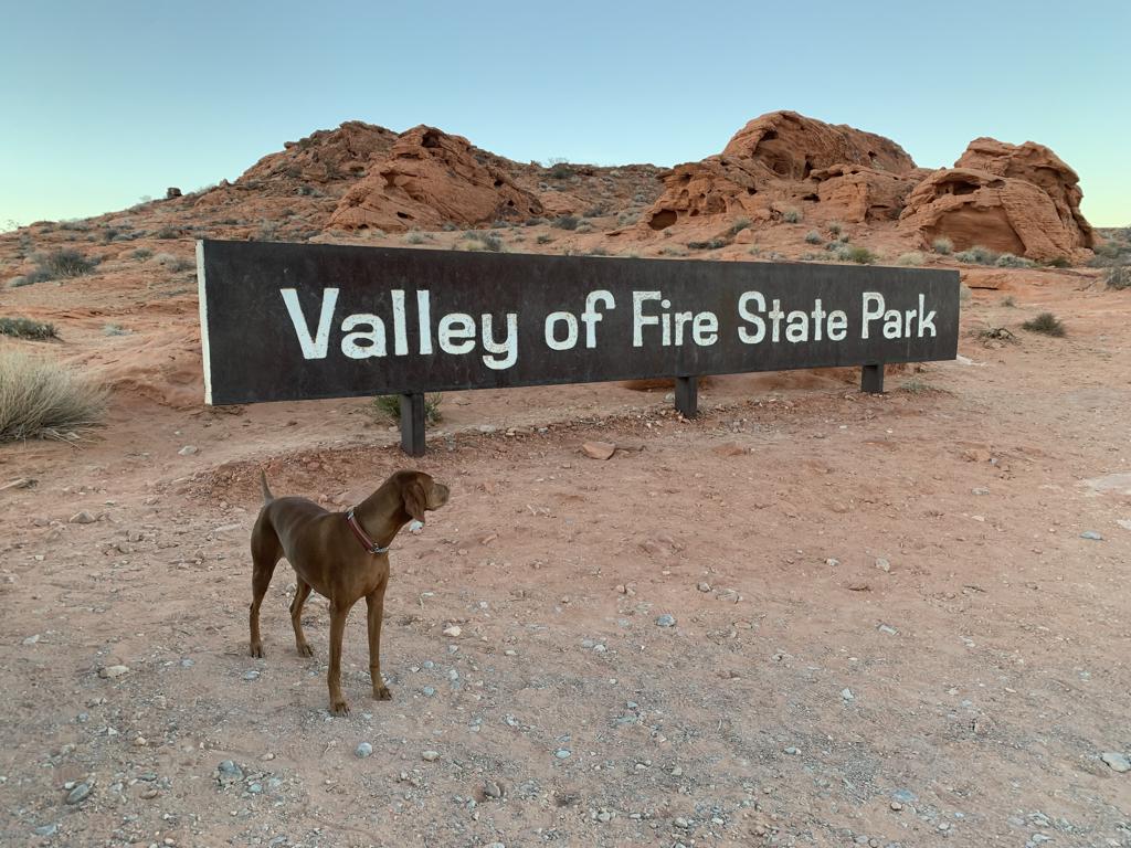
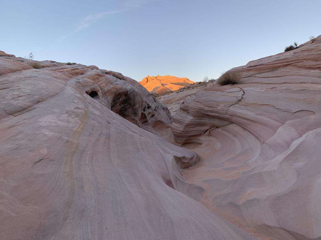
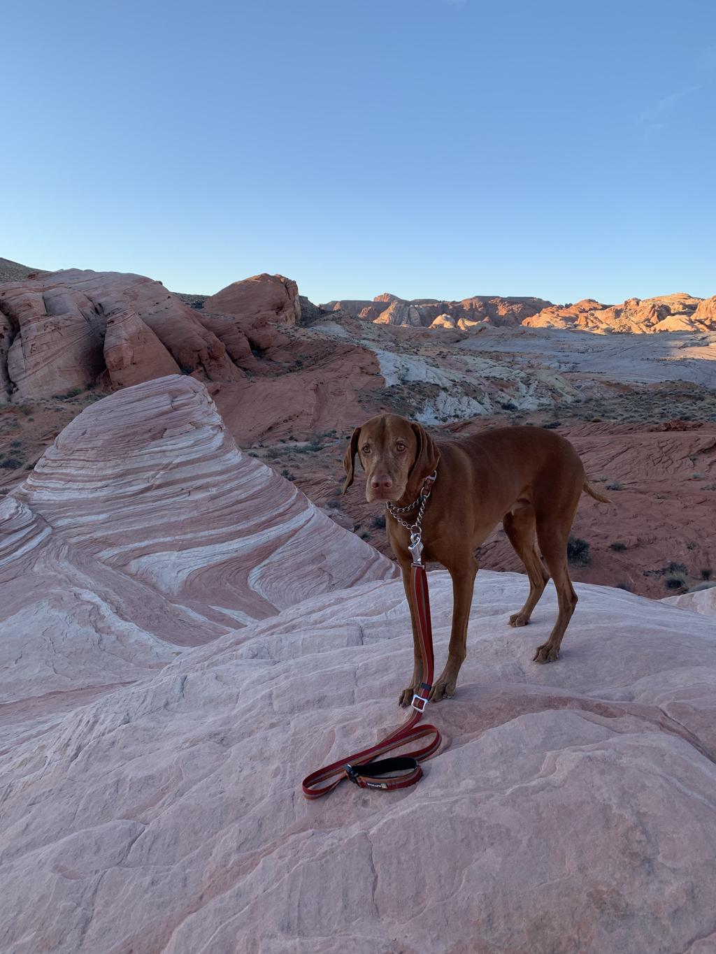
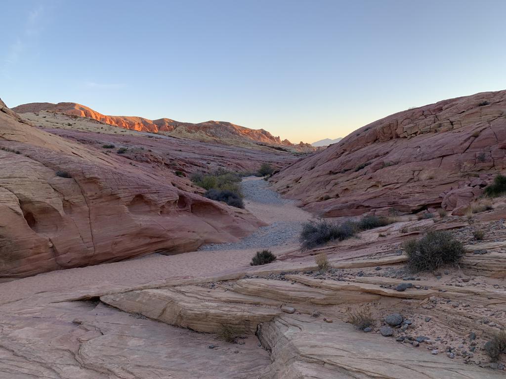
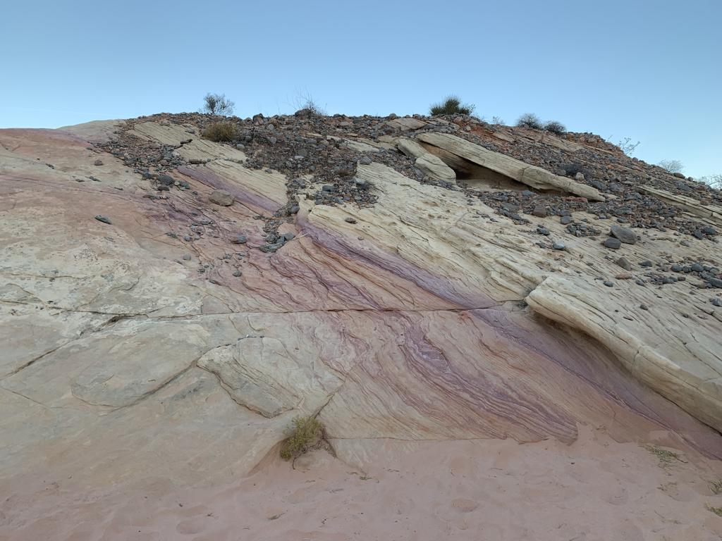
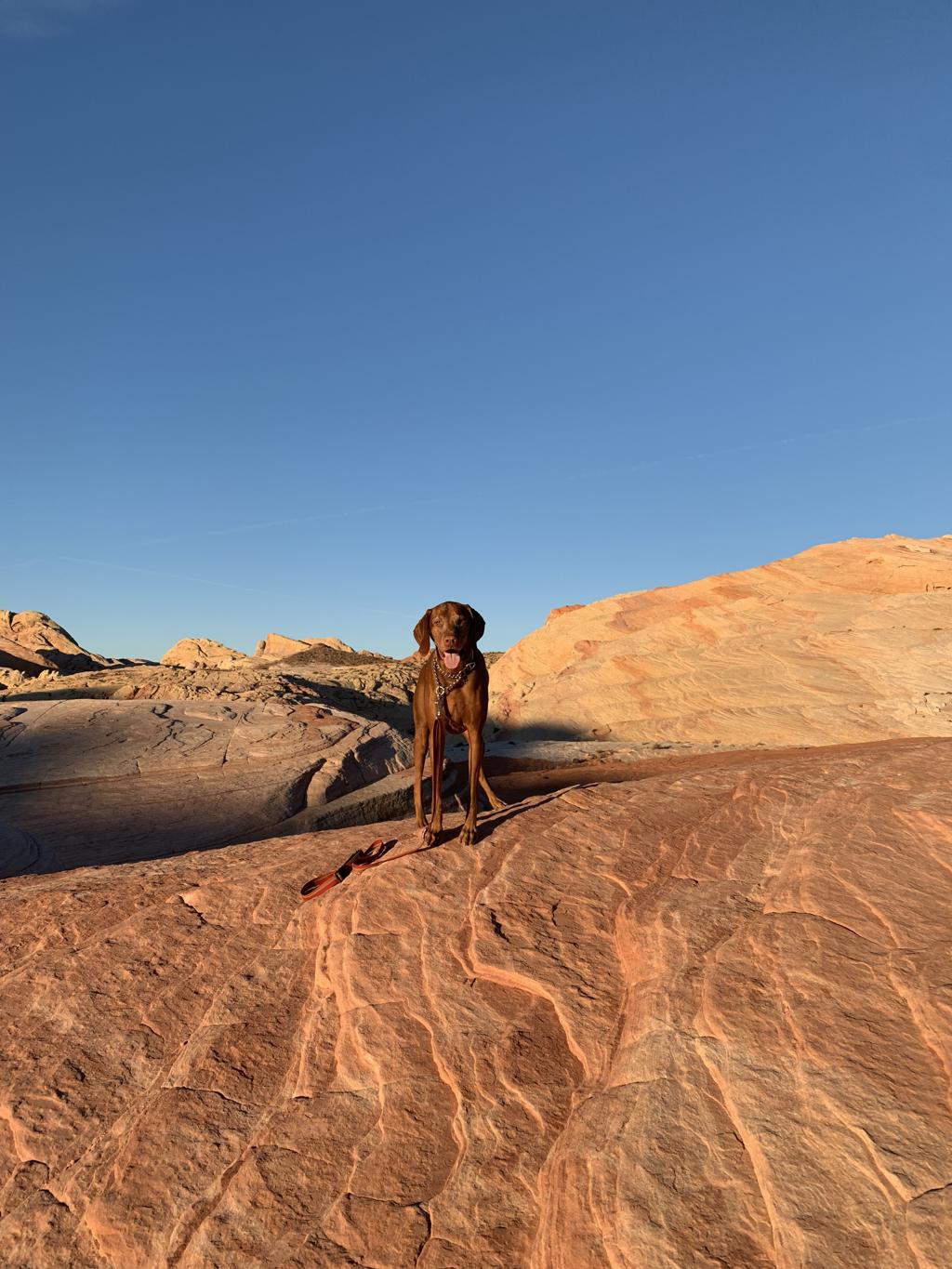
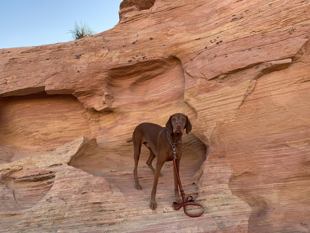
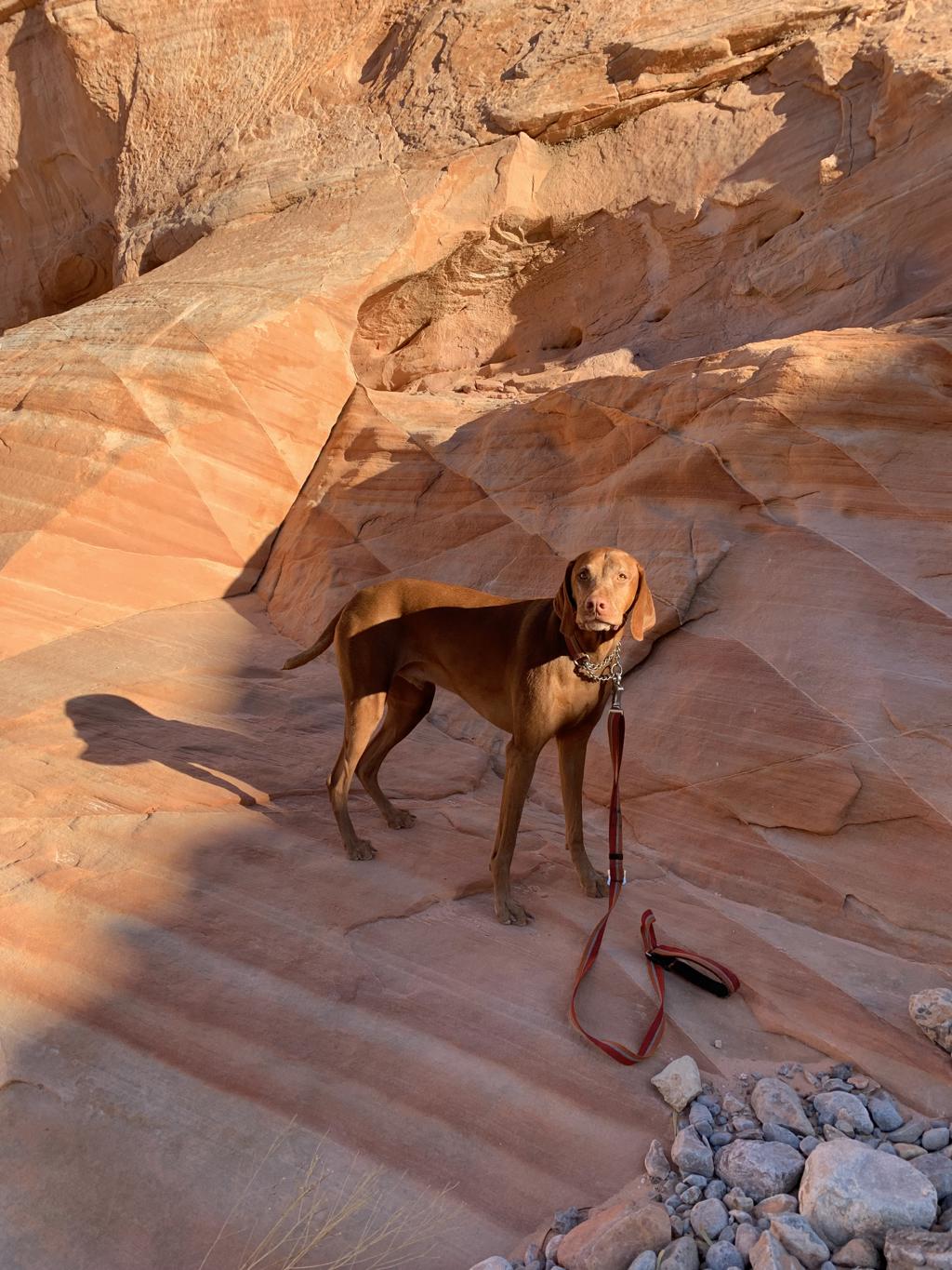
Valley of Fire State Park – Pink Canyon
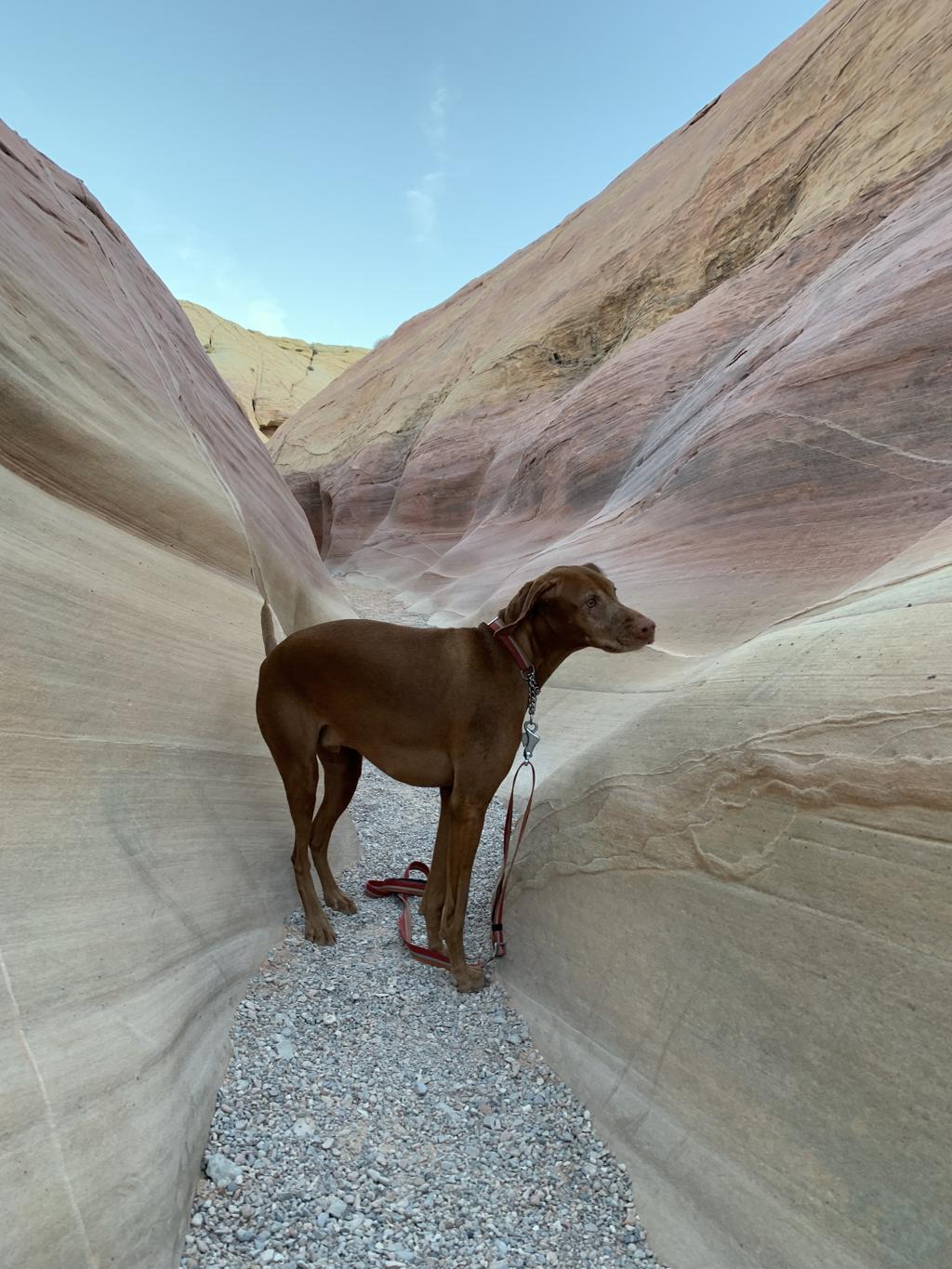
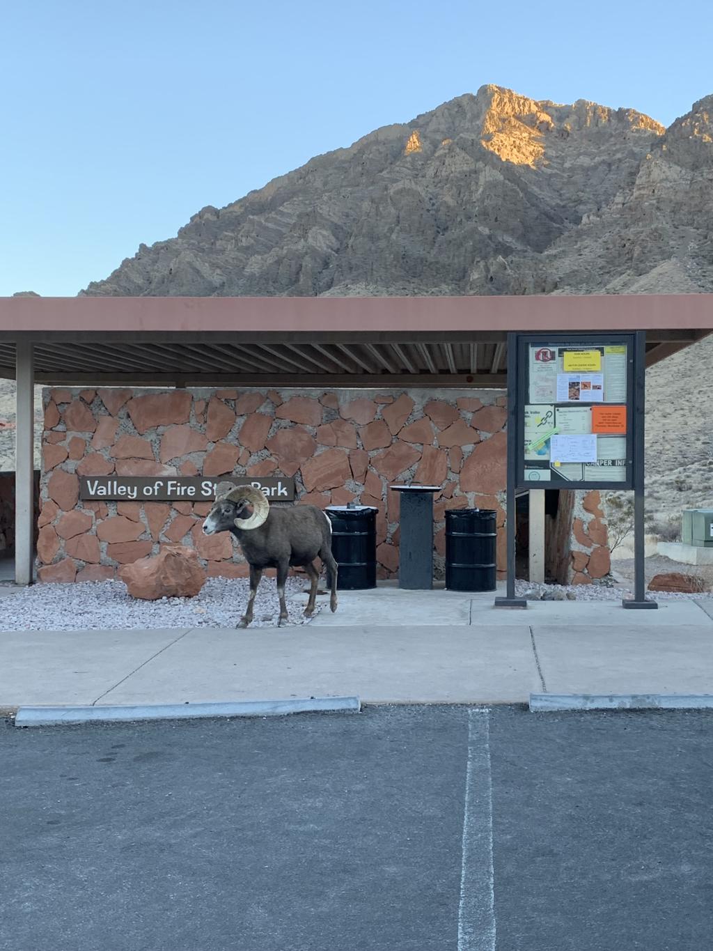
Cappie’s Scoop: The rocks are really red in this park! We drove around and stopped to see so many things – petrified logs, arches and one of my favorites was the Pink Canyon! I hiked through some really close rocks that were pink in color. Then I got to climb up on the rocks and get a great view of everything around me! We also stopped to have breakfast at the picnic tables and while driving around, we saw Bighorn Sheep too! Don’t hesitate to add YOUR scoop in the comments below!
Tips: There are a lot of things to stop and see in this park. We’ve posted some of our favorites. Also check out the Fire Cave.
Directions: There are two entrances to get into the park – coming from Las Vegas side and coming from Overton. Strongly recommend arriving early, close to sunrise to avoid long lines to get in the park. You can start your hike from the Pink Canyon trail or you can also start from the Fire Wave trailhead and reach the Pink Canyon for 2.3 miles RT.
| Mileage (round trip) | 0.5 |
| Difficulty | Easy |
| Gain (in feet) | Negligible |
| Trailhead | 36.479581, -114.526570 – this takes you next to the trail where we found a couple spots to park on the side of the road; if that’s blocked off, then you can park in the lot up Mouse’s Tank Road (36.488082, -114.528917) and walk 0.7 miles south down the road on the shoulder. Watch out for cars. |
| Hike Time (in hours) | 1 |
| Exposure | Sunny |
| Scenery | Mountain Views, Red Rocks |
| Facilities | None |
| Fees/Permits | Day use entrance fee: $10.00 per vehicle (Non-NV Vehicles: $15.00 per vehicle); Camping: $20.00 per vehicle, per night (Non-NV Vehicles: $25.00 per vehicle, per night) + $10.00 for sites with utility hook ups. |
| More Info | https://parks.nv.gov/parks/valley-of-fire; https://www.earthtrekkers.com/valley-of-fire-las-vegas-day-trip; https://uprootedtraveler.com/pink-canyon-valley-of-fire |
| Last Hiked | 11/27/2021 |


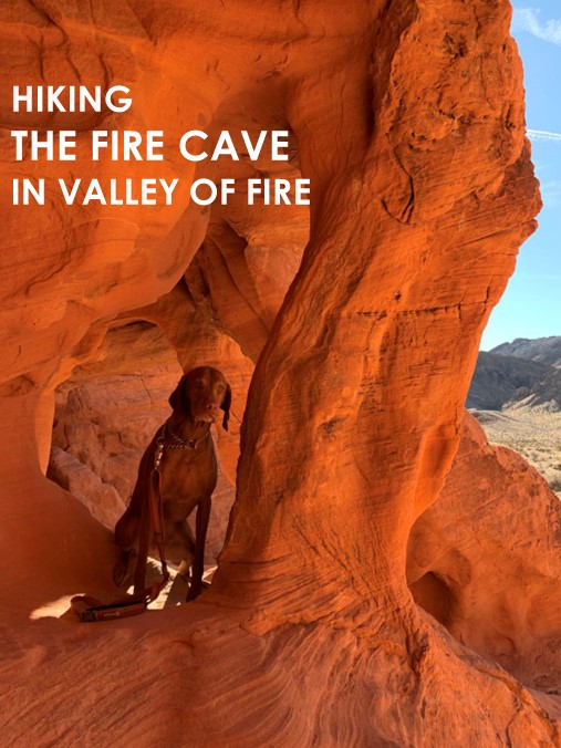
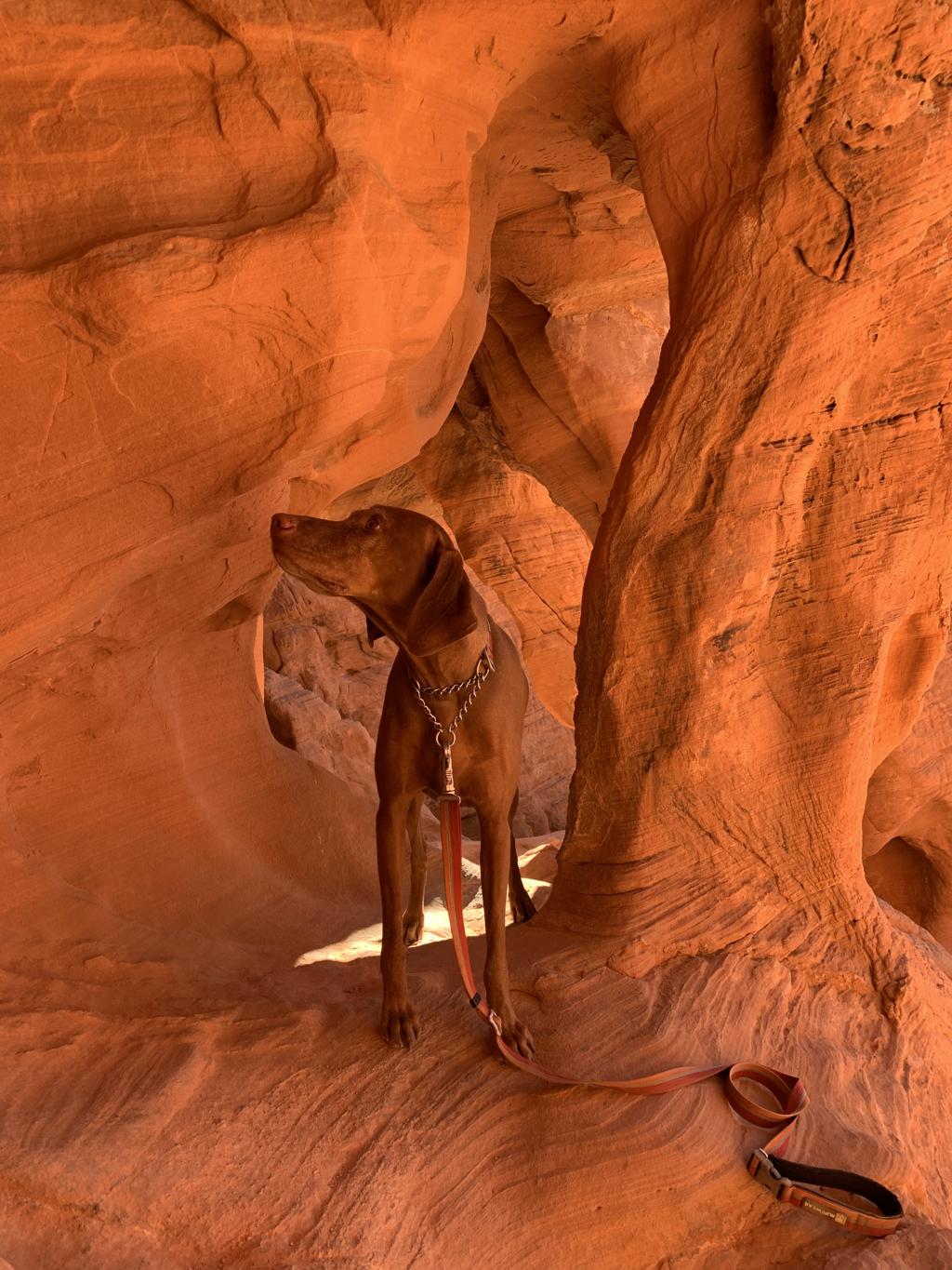
Valley of Fire State Park – Fire Cave
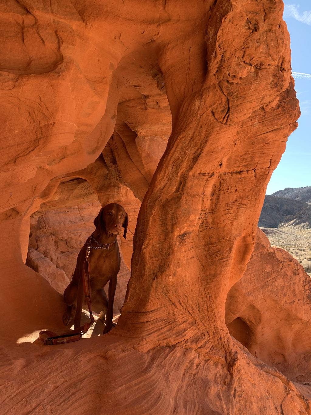
Cappie’s Scoop: The rocks are really red in this park! We drove around and stopped to see so many things – petrified logs, arches and one of my favorites was the fire cave! I got to climb inside the cave and when mom took my picture, she said I blended in. Red dog in the red rocks! We also stopped to have breakfast at the picnic tables and while driving around, we saw Bighorn Sheep too! Don’t hesitate to add YOUR scoop in the comments below!
Tips: There are a lot of things to stop and see in this park. We’ve posted some of our favorites. Also check out the Pink Canyon.
Directions: There are two entrances to get into the park – coming from Las Vegas side and coming from Overton. Strongly recommend arriving early, close to sunrise to avoid long lines to get in the park. The road to park on is unmarked. You head west on Valley of Fire Hwy from the Beehives site and turn right. Drive about 0.1 miles and park on the side of the road and hike a very short distance northeast to see this spot.
| Mileage (round trip) | 0.2 |
| Difficulty | Easy |
| Gain (in feet) | Negligible |
| Trailhead | 36.412030, -114.554261 |
| Hike Time (in hours) | N/A |
| Exposure | Sunny |
| Scenery | Mountain Views, Red Rocks |
| Facilities | None |
| Fees/Permits | Day use entrance fee: $10.00 per vehicle (Non-NV Vehicles: $15.00 per vehicle); Camping: $20.00 per vehicle, per night (Non-NV Vehicles: $25.00 per vehicle, per night) + $10.00 for sites with utility hook ups. |
| More Info | https://parks.nv.gov/parks/valley-of-fire; https://www.earthtrekkers.com/valley-of-fire-las-vegas-day-trip |
| Last Hiked | 11/26/2021 |


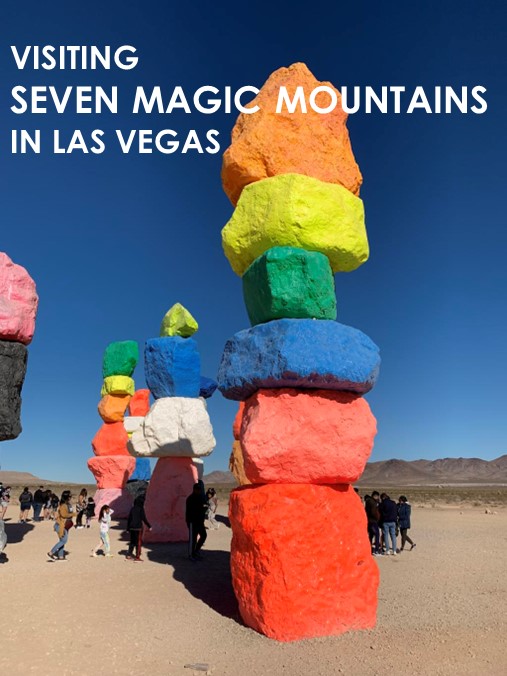
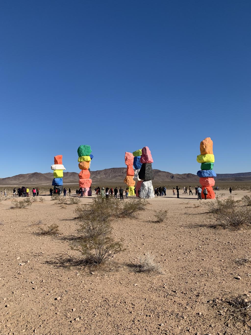
Seven Magic Mountains

Cappie’s Scoop: Mom took me to see some really tall, colorful rocks! It was a lot of fun to see them and so many people were there looking at them too. Don’t hesitate to add YOUR scoop in the comments below!
Tips: This is a very popular spot so expect crowds.
Directions: Coordinates take you to the parking lot in front of the art sculptures.
| Mileage (round trip) | N/A |
| Difficulty | Easy |
| Gain (in feet) | Negligible |
| Trailhead | 35.839869, -115.271031 |
| Hike Time (in hours) | N/A |
| Exposure | Sunny |
| Scenery | Mountain Views |
| Facilities | None |
| Fees/Permits | None |
| More Info | https://sevenmagicmountains.com |
| Last Hiked | 11/25/2021 |