Lion Peak

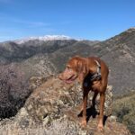
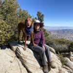
Cappie’s Scoop: I don’t know if anyone knows about this trail because I never seen anyone on it! Now mom said that this trail connects with the big PCT and that in April, more people will be hiking on it. But that might be too late to hike here because it gets very hot. Winter is the time to get on this trail and you may even see patches of snow like I did! In the distance, I saw Mount San Jacinto and it had snow on it too! Don’t hesitate to add YOUR scoop in the comments below!
Tips: It’s a gradual climb in the beginning and then you reach the switchbacks which help with the elevation gain! The switchbacks end at the junction with the PCT. Continue on the PCT to reach Lion Peak. Along the way, you do pass Pyramid Peak as well if you want to bag two peaks! The turnoff for Lion Peak is not marked with a sign but there is a cairn (i.e. pile of rocks) on the right side to mark where the trail veers off to the peak. It helps to have a map handy.
Directions: From I-15 North, take the CA-79 S/Temecula Parkway exit and go 42.7 miles. Turn left onto CA-371 E and go 20.7 miles. Then turn left onto CA-74 W and go 3.8 miles. Then turn right onto Morris Ranch Road. Drive down this road for 3.6 miles (passing a couple Camps) until you see a dirt parking lot on your right. There are no facilities and no signs. The Cedar Springs Trail is a short distance down the paved road on your right. There is a sign marking the start of the trail along with a gate that is easy to open.
| Mileage (round trip) | 9.5 |
| Difficulty | Moderate |
| Gain (in feet) | 2043 |
| Trailhead | 33.652916, -116.589591 |
| Hike Time (in hours) | 4-5 |
| Exposure | Mostly Sunny |
| Scenery | Mountain Views, Forest, Desert |
| Facilities | None |
| Fees/Permits | None |
| More Info | https://www.10adventures.com/hikes/san-bernardino-national-forest/lion-peak-trail |
| Last Hiked | 2/8/2022, 2/10/2023 |


