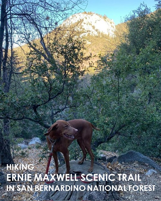
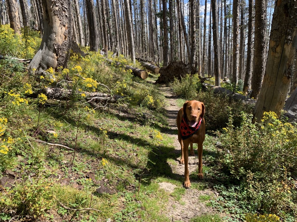
Ernie Maxwell Scenic Trail
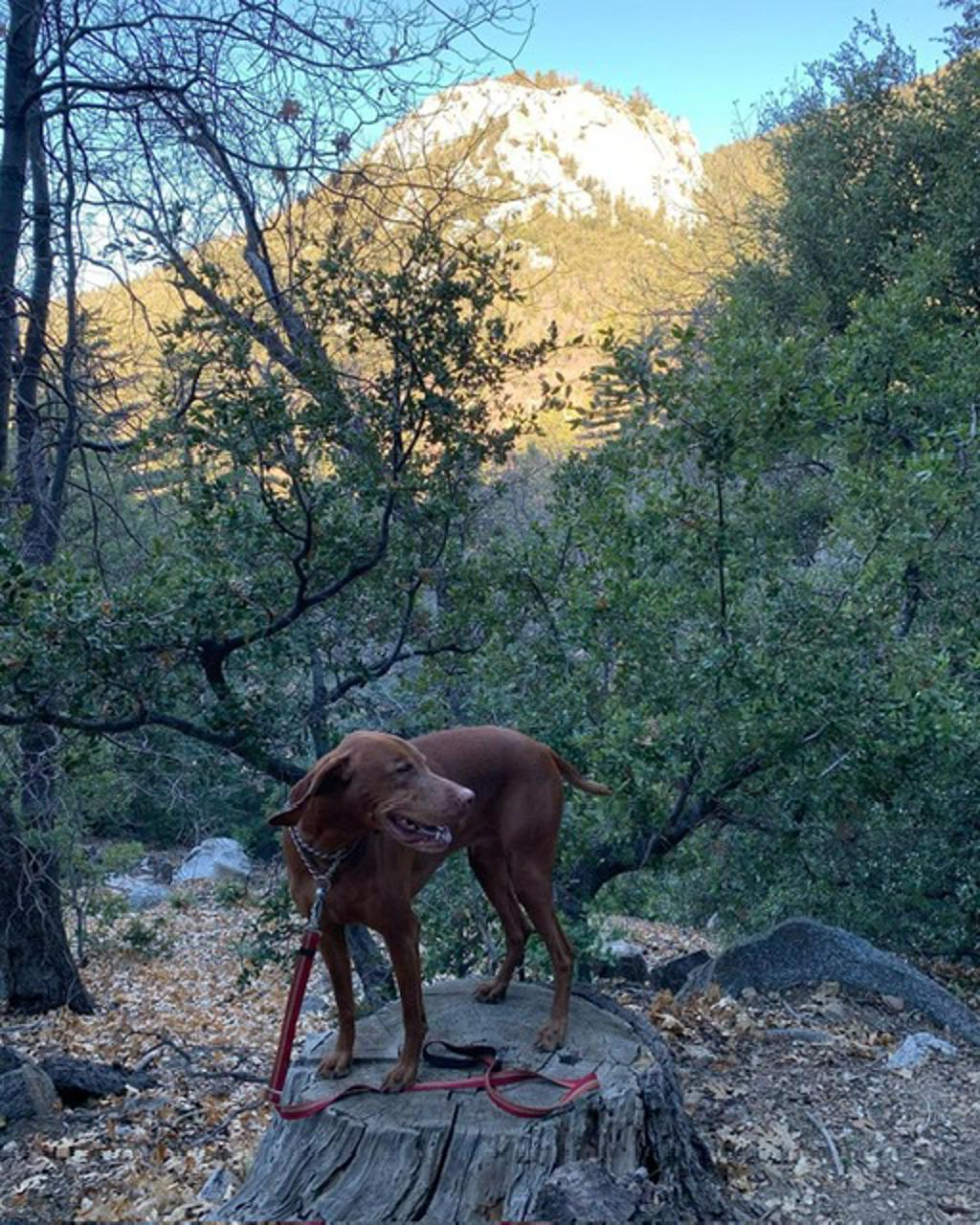
Cappie’s Scoop: A fun hike through the forest! There are some big rocks on this trail too. I couldn’t even jump on them because they were very big. I had a lot of fun and there were lots of friendly doggos on this trail too. Don’t hesitate to add YOUR scoop in the comments below!
Tips: There are two trailheads for this hike. One starts near Humber Park and requires a California Adventure Pass. The other trailhead is on Tahquitz View Drive in Idyllwild which does not require a parking pass. For this post, we started near Humber Park. If you wanted to do a long loop hike, you could park near Humber Park, take Devils Slide trail (day permit needed), take a right at the 4-way junction towards Tahquitz Peak, visit the lookout tower, then head down South Ridge trail which connects you with the fire road. Take the fire road down to Tahquitz View Road and hang a right picking up the Ernie Maxwell Trail to head back to your car. We haven’t done this yet but it’s on our list to do!
Directions: Heading towards Idyllwild-Pine Cove, if you take CA-243 S, turn left onto Pine Crest Ave which becomes S Circle Dr. Then turn left onto Fern Valley Rd and follow to the end of the road. If you’re taking CA-243 N, turn right onto Pine Crest Ave which becomes S Circle Dr. Then turn left onto Fern Valley Rd and follow 1.7 miles and turn right into the first parking lot. If you keep going, you’ll run into the Humber Park trailhead parking lot.
| Mileage (round trip) | 4.6 |
| Difficulty | Moderate |
| Gain (in feet) | 833 |
| Trailhead | 33.764638, -116.687157 |
| Hike Time (in hours) | 2-3 |
| Exposure | Mostly Shady |
| Scenery | Mountain Views, Forest |
| Facilities | Toilets in the parking lot. |
| Fees/Permits | California Adventure Pass or Interagency Annual Pass/America the Beautiful Pass (National Parks Pass). No day hike permit required for this trail. |
| More Info | https://www.fs.usda.gov/recarea/sbnf/recarea/?recid=26487; https://hikingguy.com/hiking-trails/best-la-hikes/ernie-maxwell-scenic-trail-hike |
| Last Hiked | 11/11/2021, 6/2/2023 |
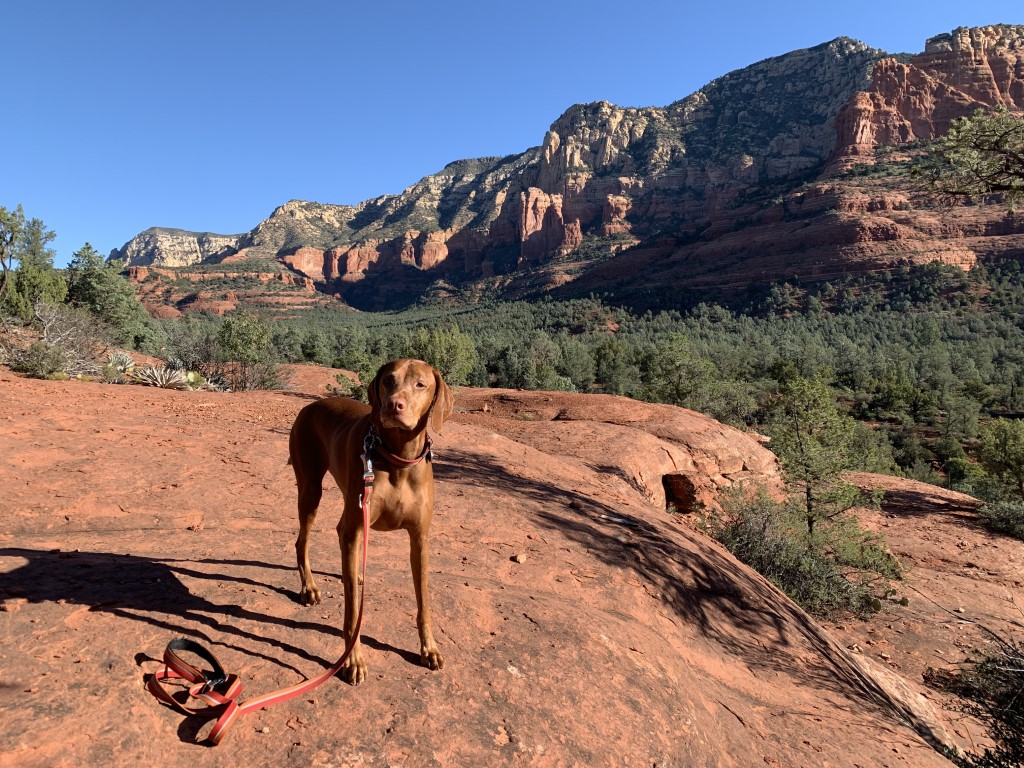
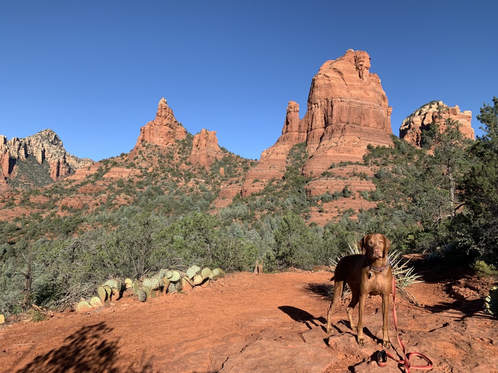
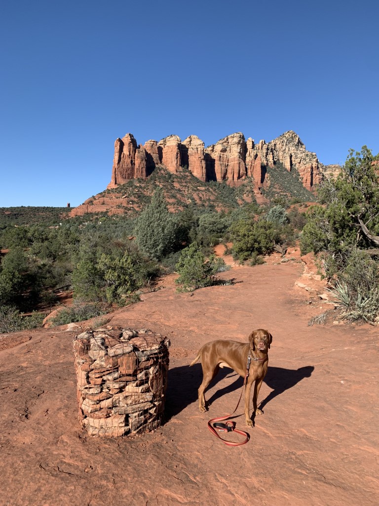
Seven Sacred Pools via Cibola Pass Trail
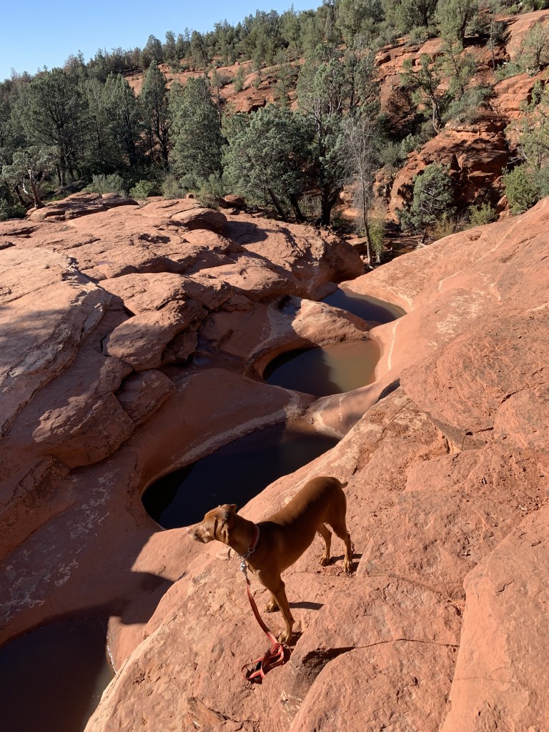
Cappie’s Scoop: I heard “pools” so I’m like, I’m in! But when we got there, it was a bunch of big holes in the ground with water inside! Not the swimming pool I was thinking about but still very cool! I love hiking on these red rocks and having rocks filled with water made it so much more fun!Don’t hesitate to add YOUR scoop in the comments below!
Tips: Keep your eyes on the temperature. Sedona is famous for those beautiful red rocks and most of the trails are a combination of dirt and hiking on the red rocks which is a lot of fun but can get very hot for your dog’s pads. Start hiking early to avoid the heat and crowds on the trail and in the parking lots!
Directions: There are lots of connecting trails but here are two trailheads where you can start this hike. Both have pros and cons. First, we’ll start off with the trailhead we recommend and where we started our hike. This post is based on parking at the Jim Thompson Trailhead (34.888050, -111.768424) off of Jordan Road (may also be called Brins Mesa Trailhead since there are a few trails starting from this lot). Pros: More parking, vault toilets and you can access other trails. Cons: Requires a Red Rock Pass which can be purchased at this parking lot and mileage is a bit further than starting from the other trailhead option. Your other option is the Soldier Pass Trailhead (34.88436, -111.78362) which is 1.1 miles RT with 108 ft elevation gain. Pros: No fee to park and closer to your hiking destination. Cons: Small parking lot, only 14 spots, no trash or restroom facilities, no street parking nearby and there are usually cars lined up waiting to park once the gated lot opens at 8am and closes at 6pm.
| Mileage (round trip) | 2.8 |
| Difficulty | Easy |
| Gain (in feet) | 403 |
| Trailhead | 34.888050, -111.768424 |
| Hike Time (in hours) | 1-2 |
| Exposure | Mostly Sunny |
| Scenery | Canyon Views, Trees, Boulders |
| Facilities | Vault toilets at trailhead. |
| Fees/Permits | Red Rock Pass or Interagency Annual Pass/America the Beautiful Pass (National Parks Pass). You can purchase daily ($5) and weekly ($15) Red Rock Passes from self-serve vending machines at this trailhead. These machines only accept credit cards for payment. For more locations plus options to buy an annual pass ($20) at the following link: https://www.fs.usda.gov/detail/coconino/recreation/?cid=stelprdb5416212#vendingmachines. |
| More Info | https://www.sedonahikingtrails.com/HikingTrails/SevenSacredPools/SevenSacredPools-1.htm |
| Last Hiked | 10/13/2021 |

Duffy Boat Cruise

The Parkhouse Pack’s Scoop: We had a great evening cruise on a Duffy boat rental in Long Beach with London Boat Rentals! First thing’s first, there is no extra fee or weight limit for the dogs to join- many other companies this is the case. We decided to go at sunset, which was beautiful as the Long Beach skyline became a silhouette and we cruised around Naples Island. You can bring your own drinks and snacks, or they partner with some local small businesses to add sweets or charcuterie to your reservation. You can also order food to go from Ballast Point and they will have it delivered for your reservation. London Boat Rentals is on the dock right in front of Ballast Point.
The staff was helpful and friendly, and ensured we had a great time. They also helped us pair our phone to the Bluetooth sound system on board the Duffy so we could really enjoy our time with some favorite tunes. There is free 3hr public parking in the marina parking lot. Be sure to check their Instagram page for giveaway opportunities! We’ll definitely go again.
| Location | London Boat Rentals, 186 N Marina Dr, Long Beach, CA 90803 |
| More Info | https://londonboatrentals.com/fleet/boats |
| Follow Us! | @sandi_n_aspen |


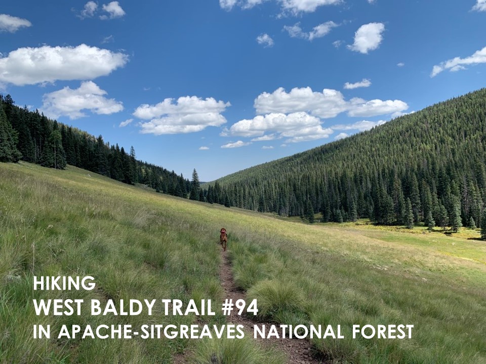
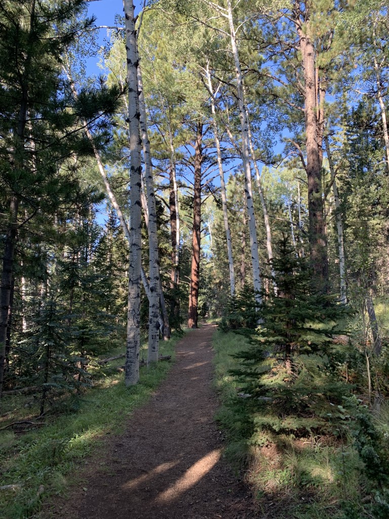
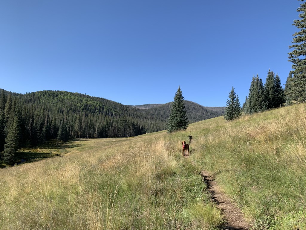
West Baldy Trail #94
Cappie’s Scoop: We drove for a while and then we arrived on a dirt road with lots of trees and grass. Mom said we’re going to car camp and then wake up to do a fun hike in the morning. It was a very cool hike! Lots of trees, grass, water and hardly any other hoomans. You can also do a loop hike too which means you get to see a lot of different things along the way. Mom says this area gets a lot of snow in the winter. That would be a lot of fun to see and zoom through! Don’t hesitate to add YOUR scoop in the comments below!
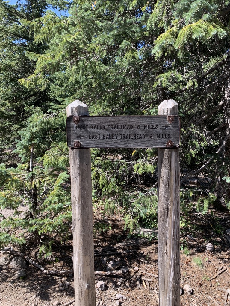
Tips: The Mount Baldy Wilderness is one of our nation’s smallest wilderness areas at 7,079 acres but one of the most beautiful too! In addition to hiking this trail, you can also backpack it and camp (limited to a maximum of 6 persons in one group per site). You can do an out and back hike (like we did) OR you can do a loop which is pretty cool. You will reach the East/West Baldy trailhead junction after 8 miles of hiking, continue towards the East Baldy Trailhead but be sure to pick up the crossover/connector trail bringing you back to the West Baldy trail where you’ve probably parked your car. It extends your hike to be about 19 miles RT. Now we haven’t even talked about Mount Baldy yet. You can take this trail all the way to the top of Mount Baldy, the second highest mountain in Arizona with some debate about the highest point – the ridge isn’t Baldy Peak (11,403 feet) but an unnamed area (11,420 feet) on Forest Service land to the north. But here’s the scoop on the peak – once you leave the trail at the East/West Baldy junction sign and starting hiking towards the peak, you’re on a reservation. Yes, Baldy Peak is located on While Mountain Apache Tribal lands and is closed to public entry UNLESS you’ve received permission. We’ve read the way to obtain permission is to write a polite letter declaring the day, the purpose, location of your intended travel, along with your name and other information. We’d recommend calling them and confirming what is needed. We added a link to their site. Until you have permission, please respect their customs and laws and do not travel to the top.
Directions: From the town of Greer, head north on Main Street/Co Rd 1120/AZ-373 and turn left onto Fs 87/Northwoods Rd. In 5.9 miles, turn left onto AZ-273 S. Go about 0.6 miles and turn right into the trailhead parking lot. Keep in mind that AZ-273 is closed in the winter.
| Mileage (round trip) | 16 |
| Difficulty | Moderate |
| Gain (in feet) | 2132 |
| Trailhead | 33.965049, -109.500654 |
| Hike Time (in hours) | 6-7 |
| Exposure | Sunny and Shady |
| Scenery | Mountain Views, Forest, Creek, Wildlife, Wildflowers |
| Facilities | Toilets at the trailhead. |
| Fees/Permits | None |
| More Info | https://www.fs.usda.gov/recarea/asnf/recreation/recarea/?recid=45133&actid=51; http://whitemountainapache.org |
| Last Hiked | 9/12/2021 |

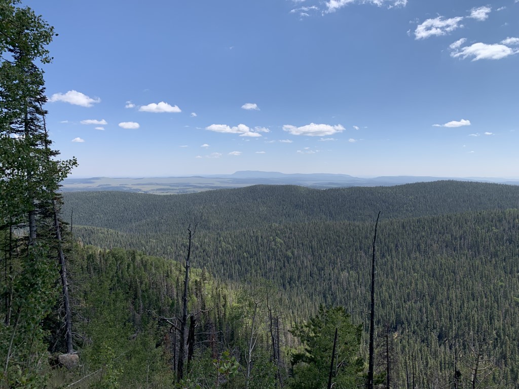

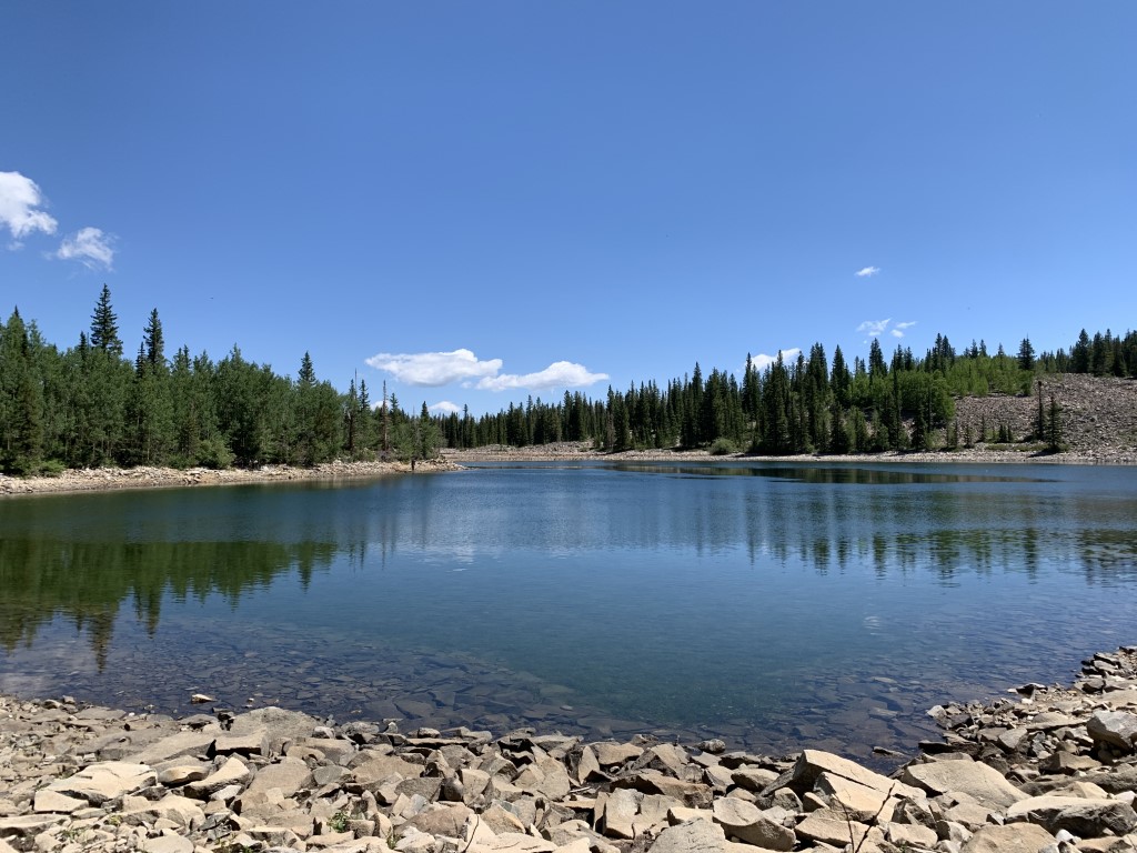
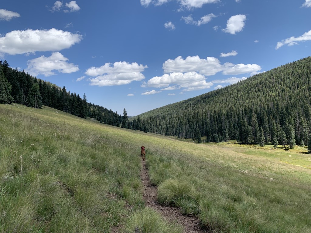
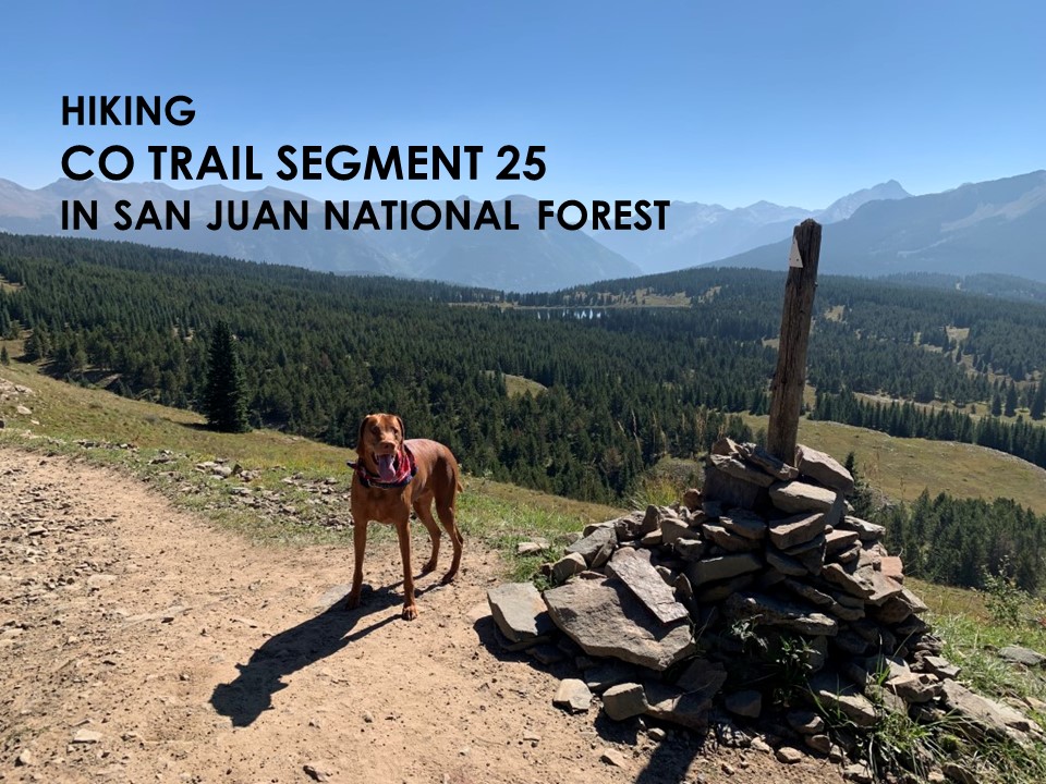
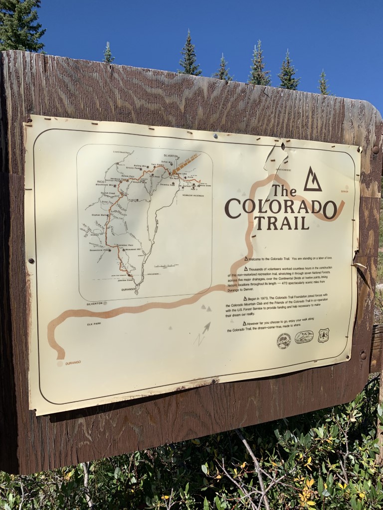
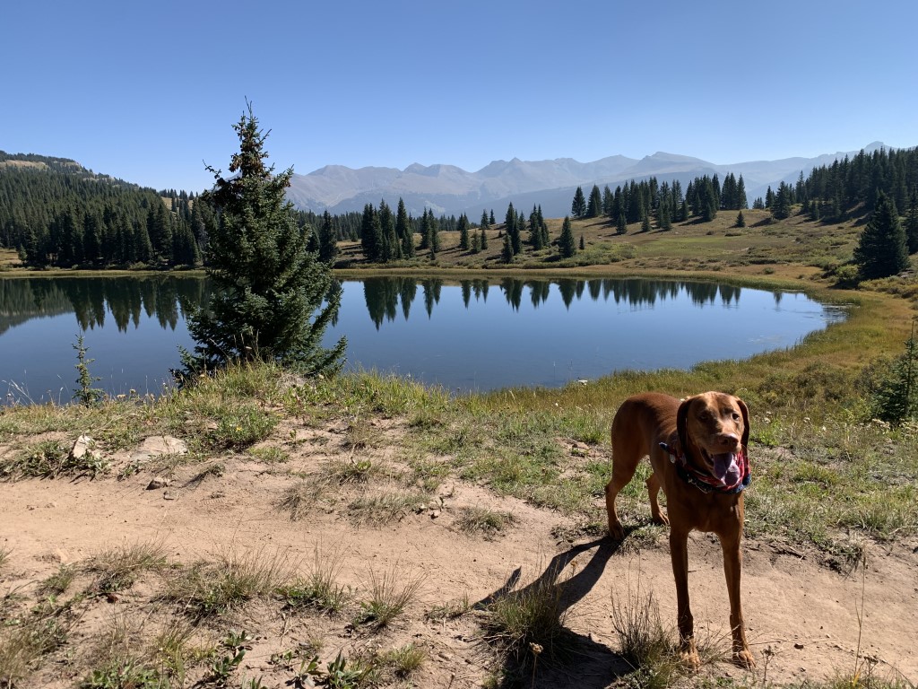
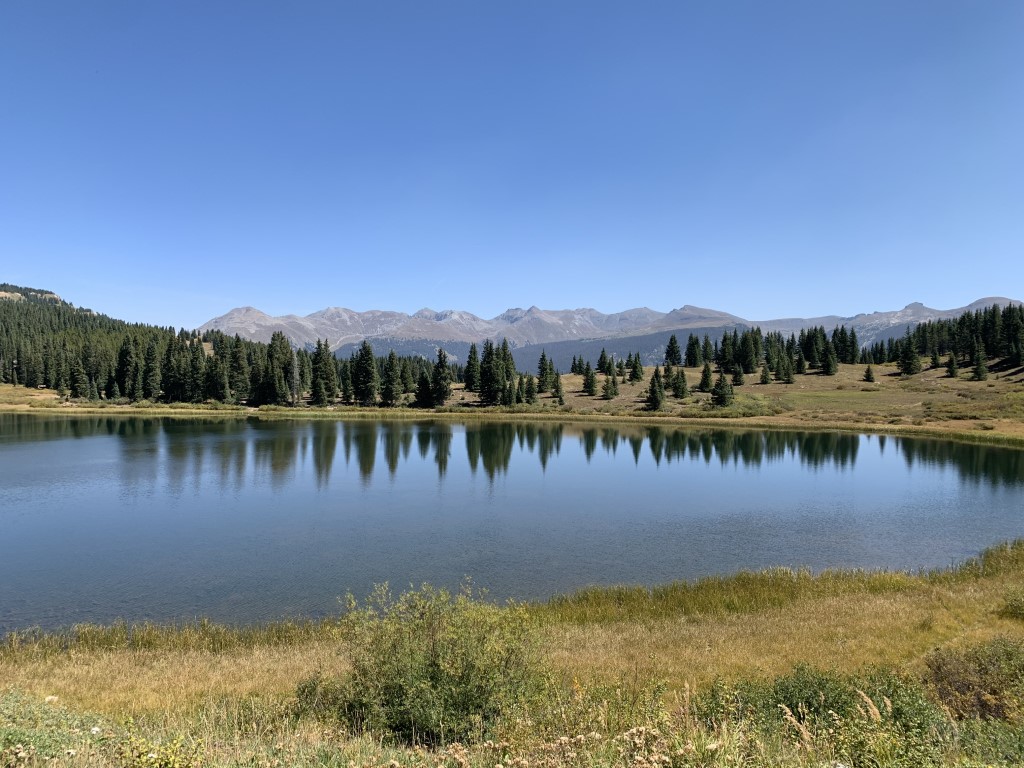
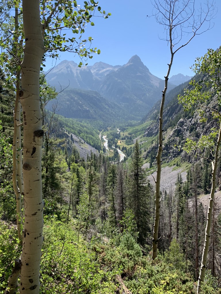
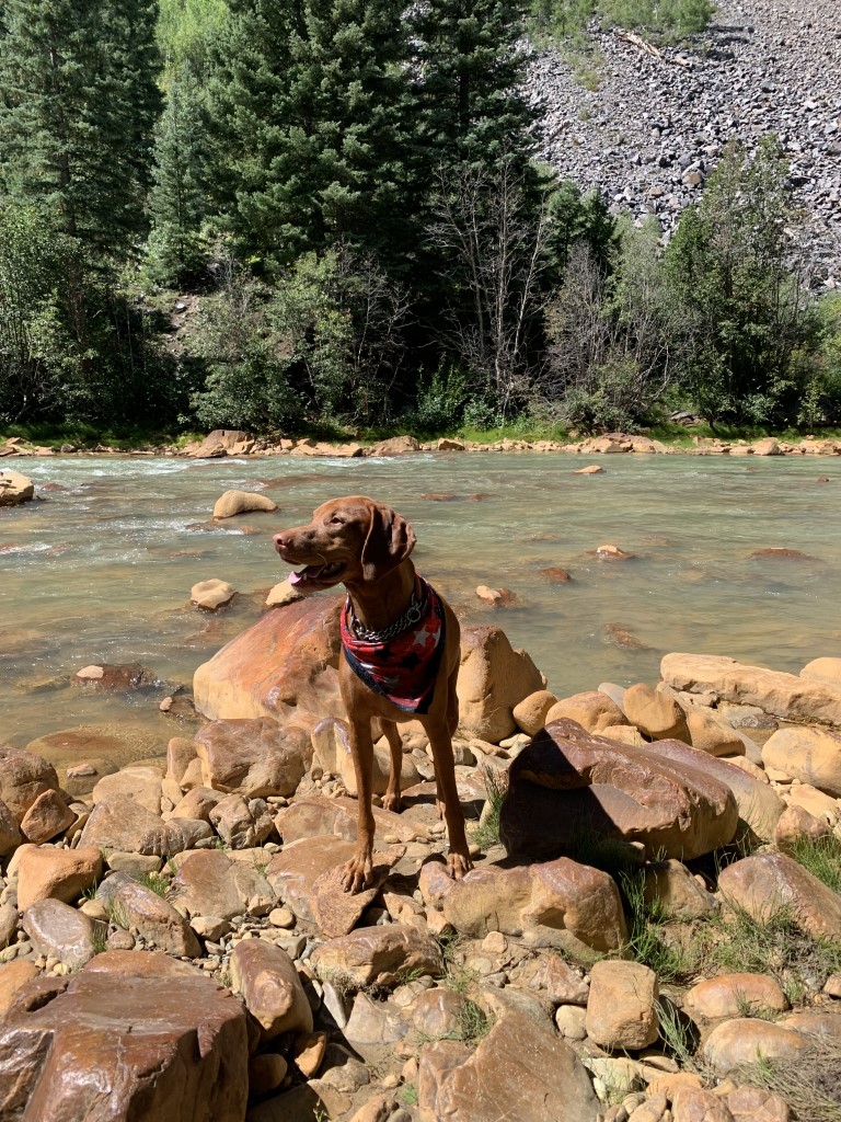
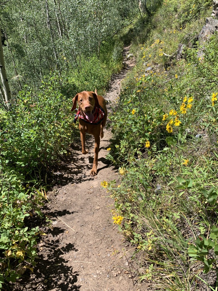
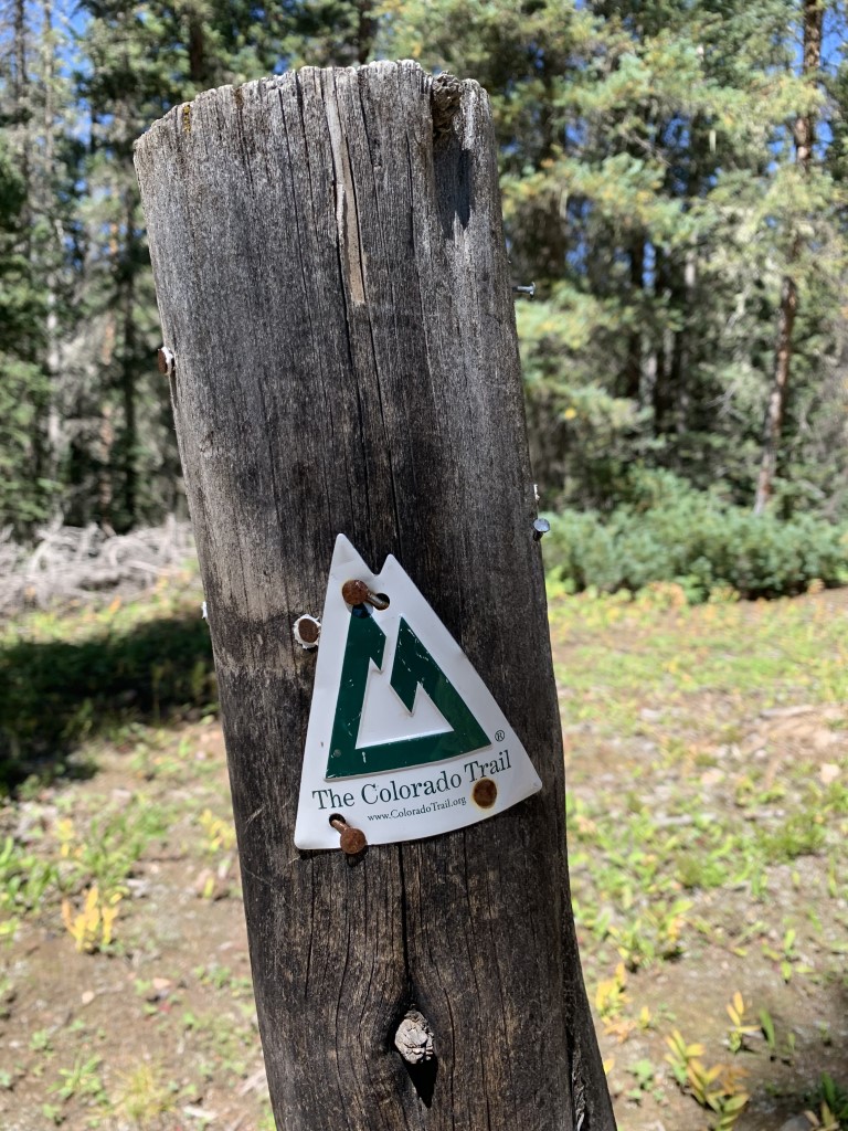
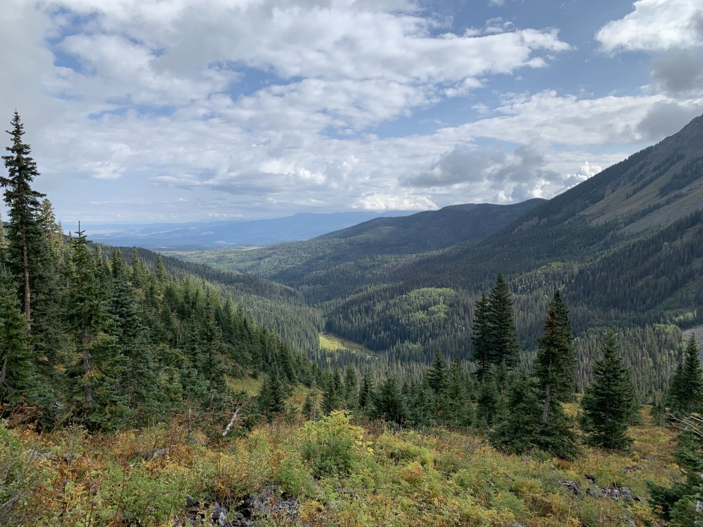
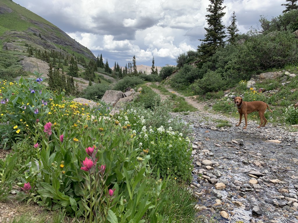
Colorado Trail Segment 25
Cappie’s Scoop: I’ve been on different parts of the Colorado Trail and this part climbed up the mountains which was really cool! There weren’t a lot of trees but the weather was good so I didn’t need the shade. I saw some hoomans on mountain bikes and they were going very slow up the hills so I had time to say hello as I ran past them. Mom and I agreed that the next time we go back, we will hike much farther on this trail to see what else is out there! Don’t hesitate to add YOUR scoop in the comments below!
Tips: We parked our car and started this hike at Molas Pass just south of Silverton. The summit parking lot is at 10,912 ft, has gorgeous views and connects to the Colorado Trail. You could also start this trail at the Little Molas Lake parking lot near the campground. The difference is less than a mile from our start and you avoid crossing highway 550. But we wanted to hike past the lake so that’s why we started at the summit lot. The incline up into the mountains is very gradual and not steep at all but we rated it moderate due to the elevation you start at. You can take this trail all the way to Durango but we decided to only hike a portion and return the way we came.
Directions: From the town of Durango head north on US-550 for about 40 miles until you see the turn off on your right for Molas Pass Overlook/Summit parking lot.
| Mileage (round trip) | 7+ |
| Difficulty | Moderate |
| Gain (in feet) | 1000 |
| Trailhead | 37.737160, -107.697485 |
| Hike Time (in hours) | 4-5 |
| Exposure | Sunny |
| Scenery | Mountain Views, Lake Views |
| Facilities | Toilets in the parking lot. |
| Fees/Permits | None |
| More Info | https://rootsrated.com/durango-co/hiking/molas-pass-colorado-trail-segment-25 |
| Last Hiked | 9/7/2021 |


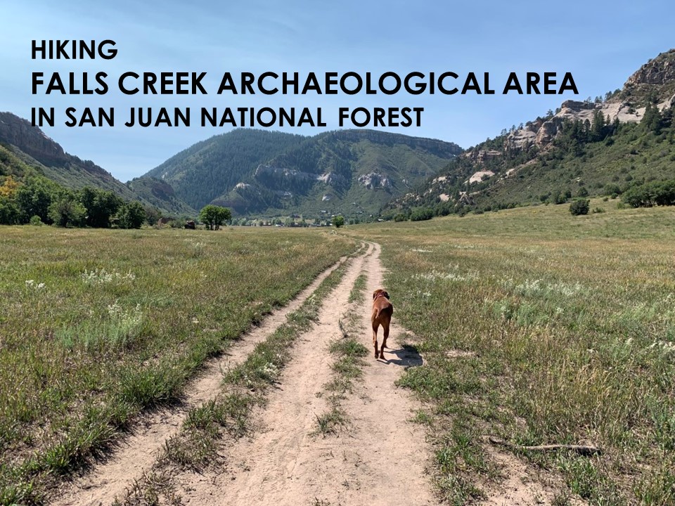
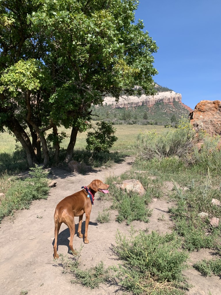
Falls Creek Archaeological Area
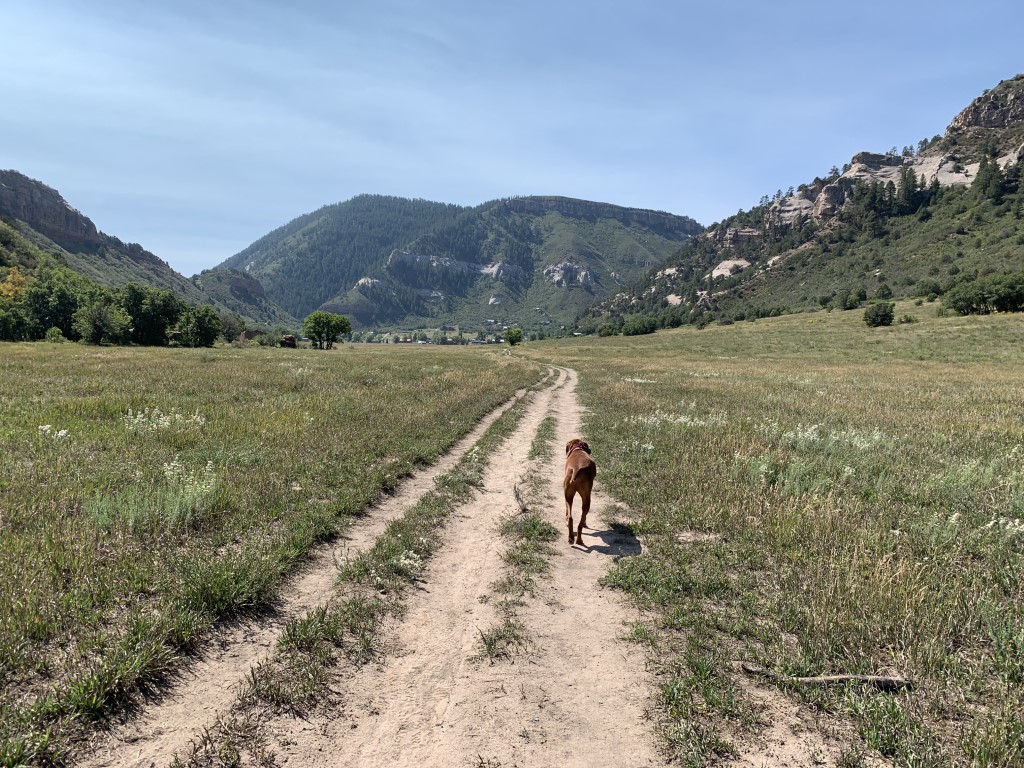
Cappie’s Scoop: So much space to zooom but mom said we had to stay on the trail and for a good reason. There were hoomans on bikes and on horses so it’s good that I stayed close to mom. It was very sunny out and I remember finding a very good tree to stand under for some shade. I think mom and I should come back here when it’s snowing because I could run very far and in big circles in this big area! Don’t hesitate to add YOUR scoop in the comments below!
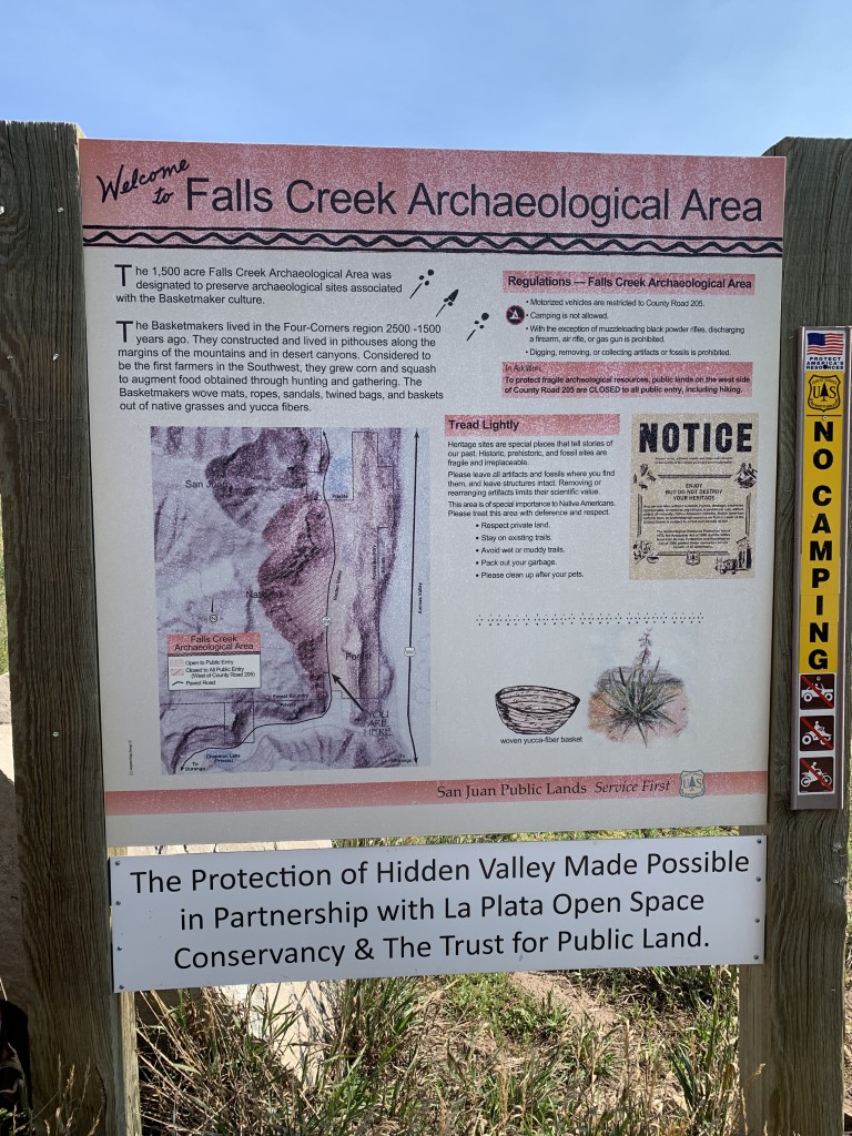
Tips: This 1,500 acre area was designated to preserve archaeological sites associated with the basketmaker culture. Please leave all artifacts and fossils where you find them, and leave structures intact. Note some of the ruins are closed to the public. There are a number of trails in this area that criss-cross and connect so you can make your own loop. Mountain bikers and horses also use these trails so keep your eyes open especially if your dog is off-leash. We agree with rootsrated.com that this would make a great area to snowshoe or cross-country ski!
Directions: From the town of Durango, head north on Main Street and turn left on W 25th Street which becomes Junction Street. Once Junction Street turns into Junction Creek Rd/CR 204, take it for almost 2 miles and then turn right onto CR 205. After another 2.5 miles, you’ll see a small dirt parking lot next to several large boulders and a sign for the Falls Creek Archaeological Area. You can park here, or continue up the road to several other small parking areas.
| Mileage (round trip) | 6+ |
| Difficulty | Easy |
| Gain (in feet) | Negligible |
| Trailhead | 37.342256, -107.867283 |
| Hike Time (in hours) | 2-3 |
| Exposure | Sunny |
| Scenery | Mountain Views, Forest, Wildflowers, Meadow |
| Facilities | None |
| Fees/Permits | None |
| More Info | https://rootsrated.com/durango-co/hiking/falls-creek-hiking; https://coloradoencyclopedia.org/article/falls-creek-rock-shelters-archaeological-site |
| Last Hiked | 9/6/2021 |

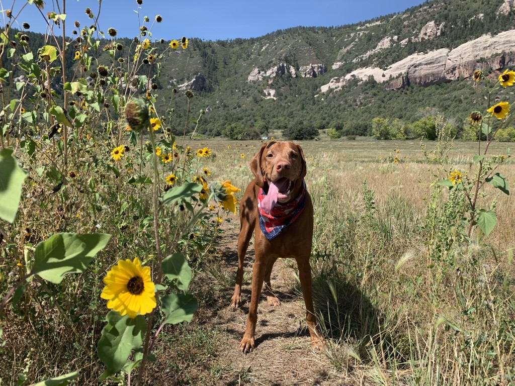
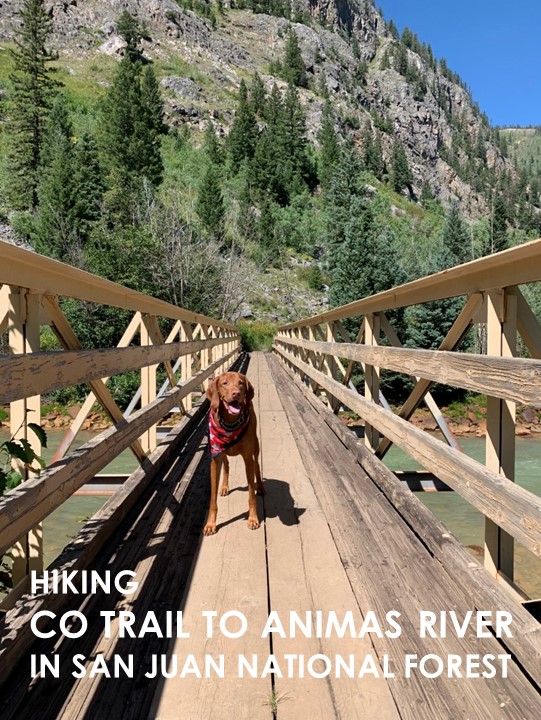
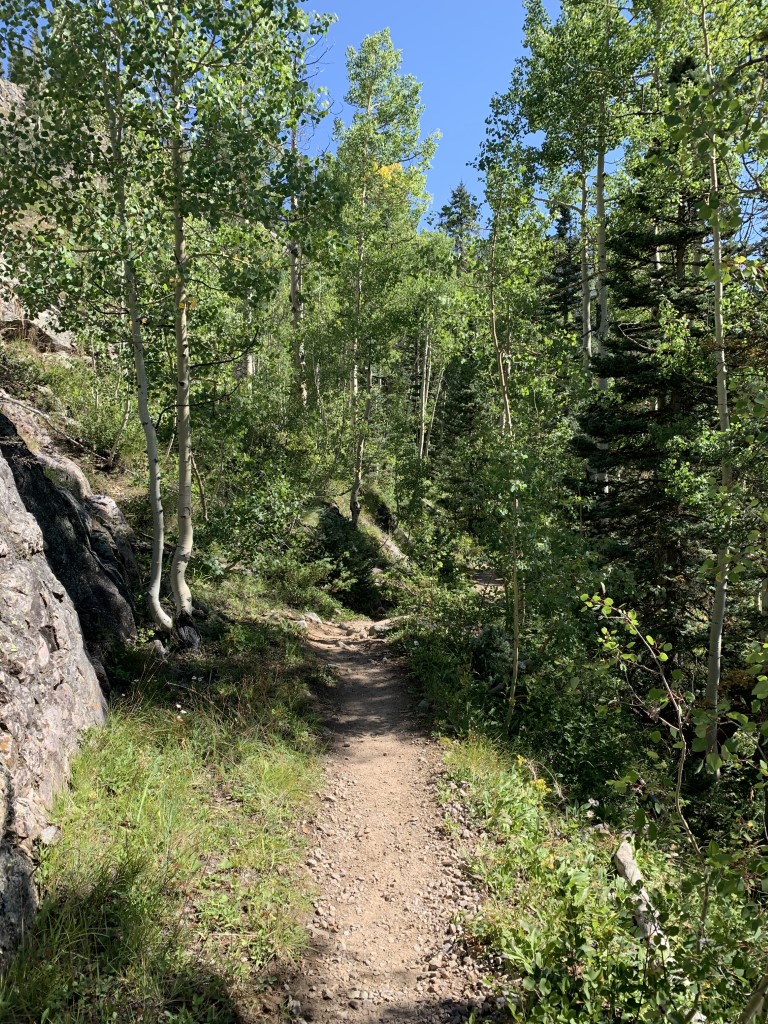
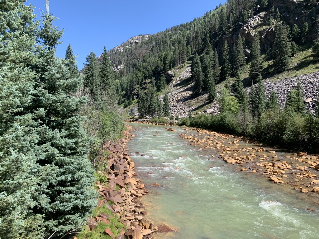
Colorado Trail to Animas River
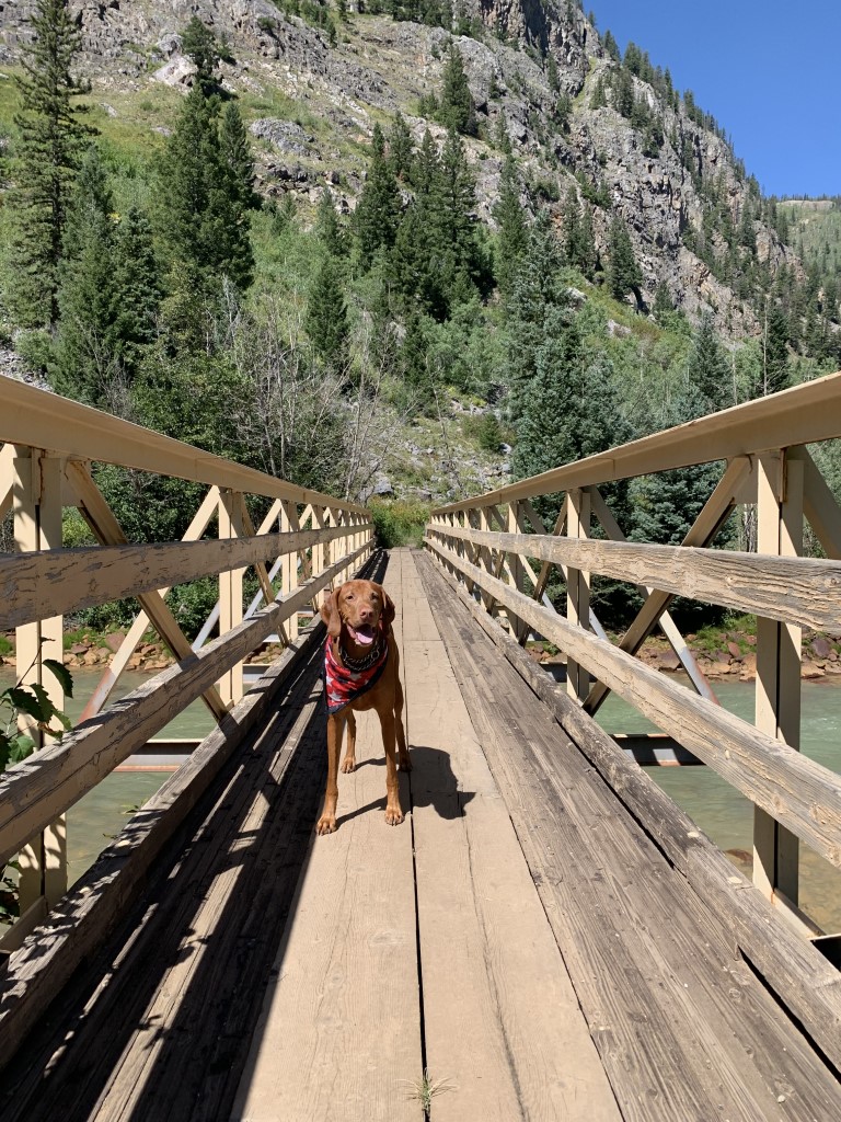
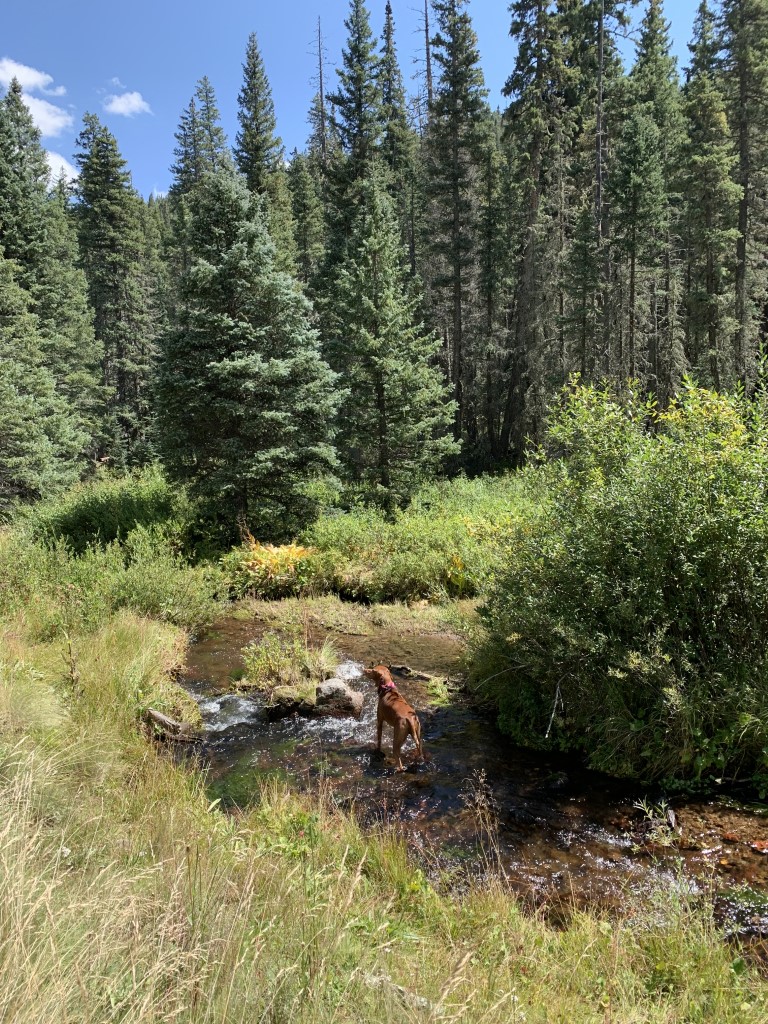
Cappie’s Scoop: This trail is very tricky. I went down the trail very quickly because it was all downhill to the cool river. You have to be very careful being next to the river because there is a train track. Mom said the train does use the track so we should not get close at all to that area. So we explored the river and I got my paws wet. Then it was very tough to go back because it’s all uphill. So take is slow furiends on this trail and save your energy for the way back! Don’t hesitate to add YOUR scoop in the comments below!
Tips: We parked our car and started this hike at Molas Pass just south of Silverton. The summit parking lot is at 10,912 ft, has gorgeous views and connects to the Colorado Trail. This was a reverse hike (so to speak) as all the elevation gain was on the way back. So we hiked down to the river for a great view and then back up the steep trail. There’s a wooden bridge to cross the river and it brings you next to the train tracks. Please stay clear of the tracks and do not cross them. There is an active train coming through multiple times per day which is really cool to see! In fact, we wish they allowed dogs on the train but if you get a chance (without your pup), take a train ride for some authentic railroad history dating back to 1882. For more info, www.durangotrain.com.
Directions: From the town of Durango head north on US-550 for about 40 miles until you see the turn off on your right for Molas Pass Overlook/Summit parking lot.
| Mileage (round trip) | 9.6 |
| Difficulty | Moderate |
| Gain (in feet) | 2200 |
| Trailhead | 37.737160, -107.697485 |
| Hike Time (in hours) | 5-6 |
| Exposure | Sunny and Shady |
| Scenery | Mountain Views, Forest, Wildflowers, Meadow, River |
| Facilities | Toilets in the parking lot. |
| Fees/Permits | None |
| More Info | https://www.fs.usda.gov/recarea/sanjuan/recarea/?recid=43070&actid=50 |
| Last Hiked | 9/5/2021 |


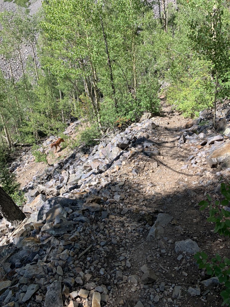

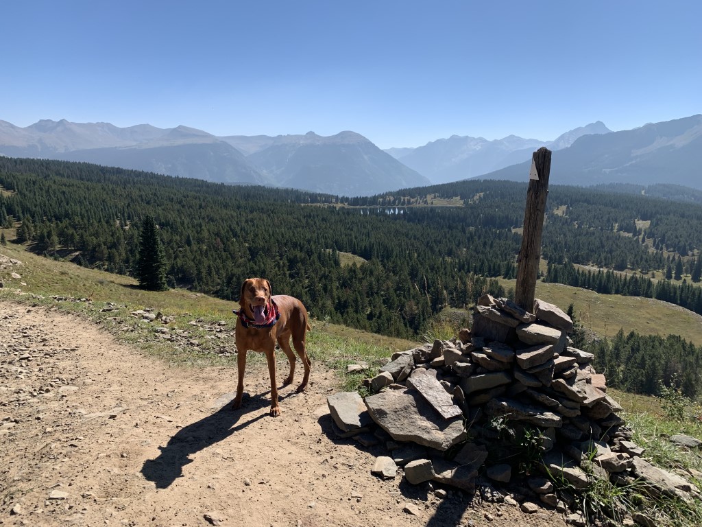
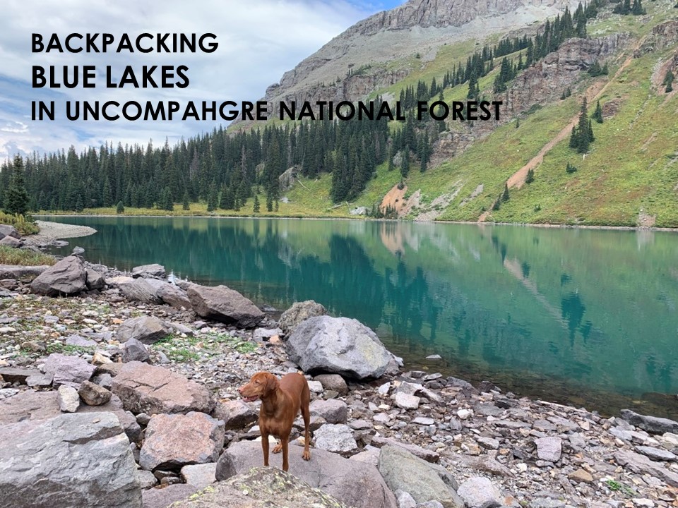
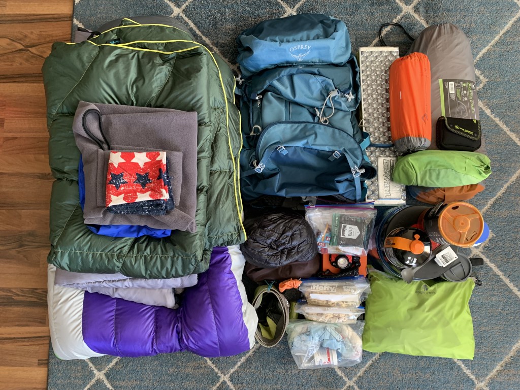
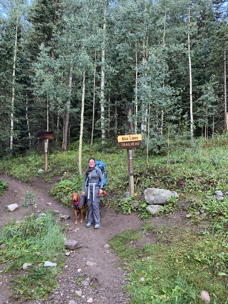
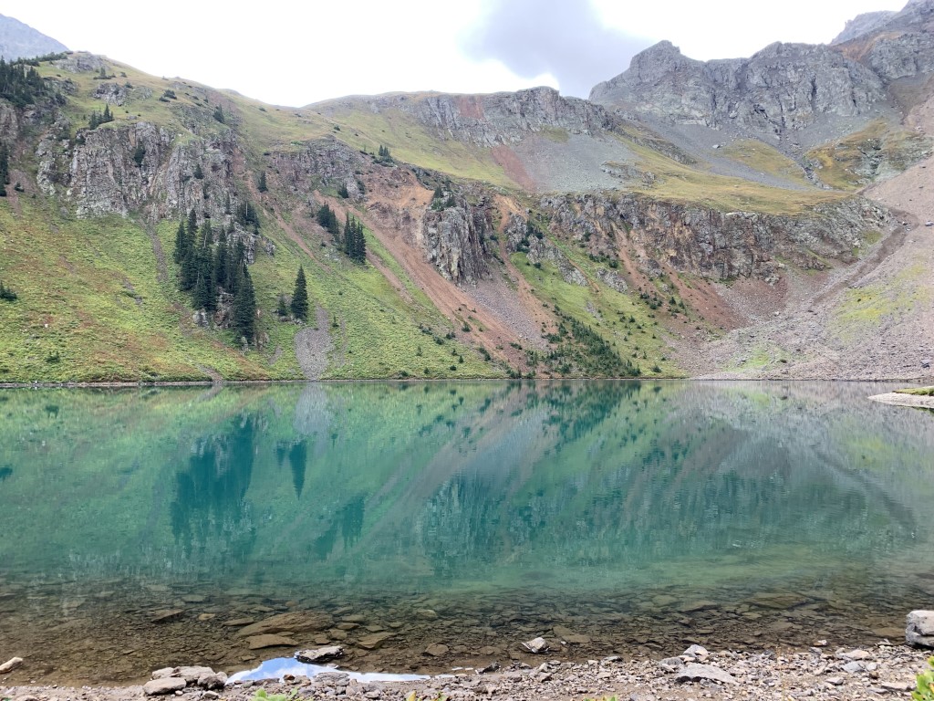
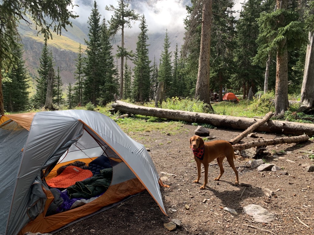
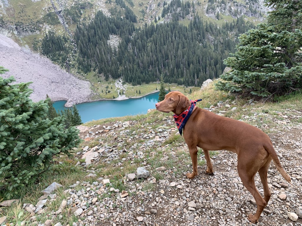
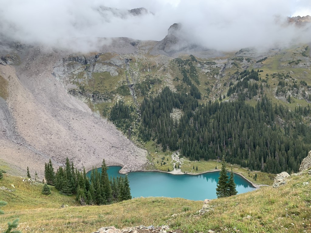
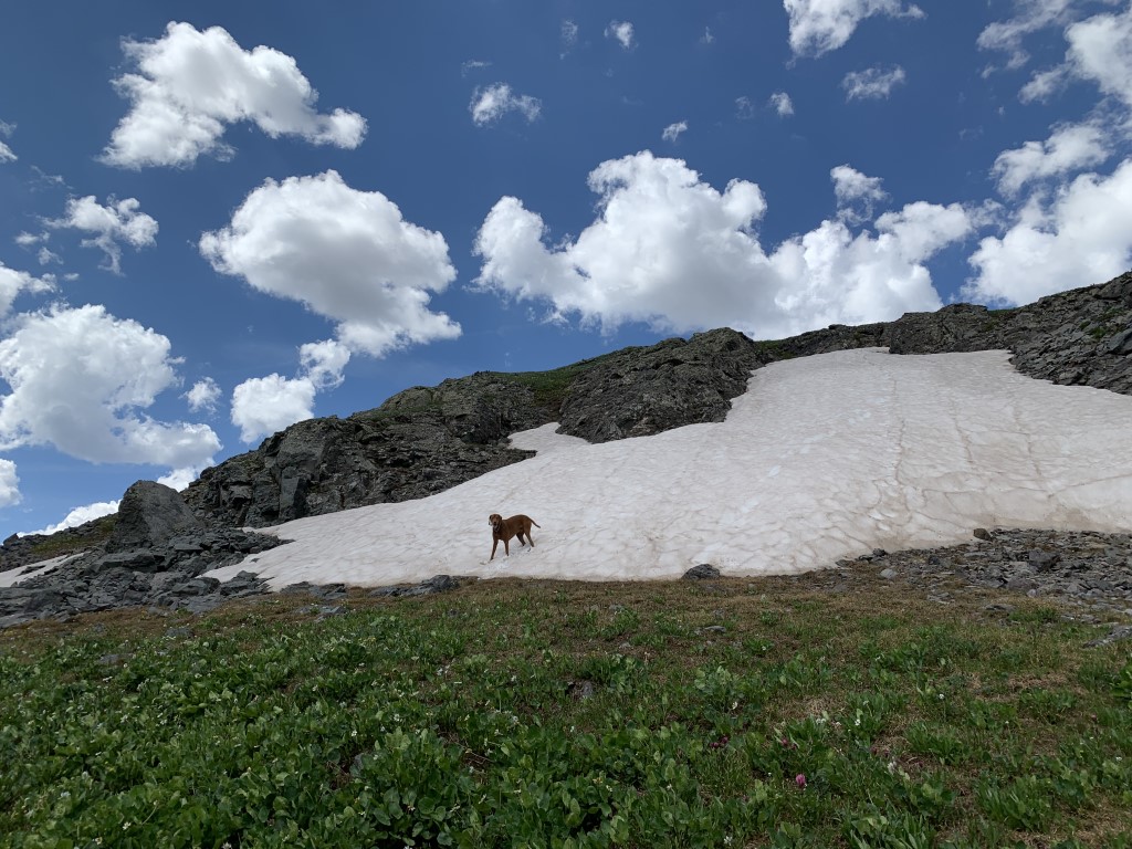
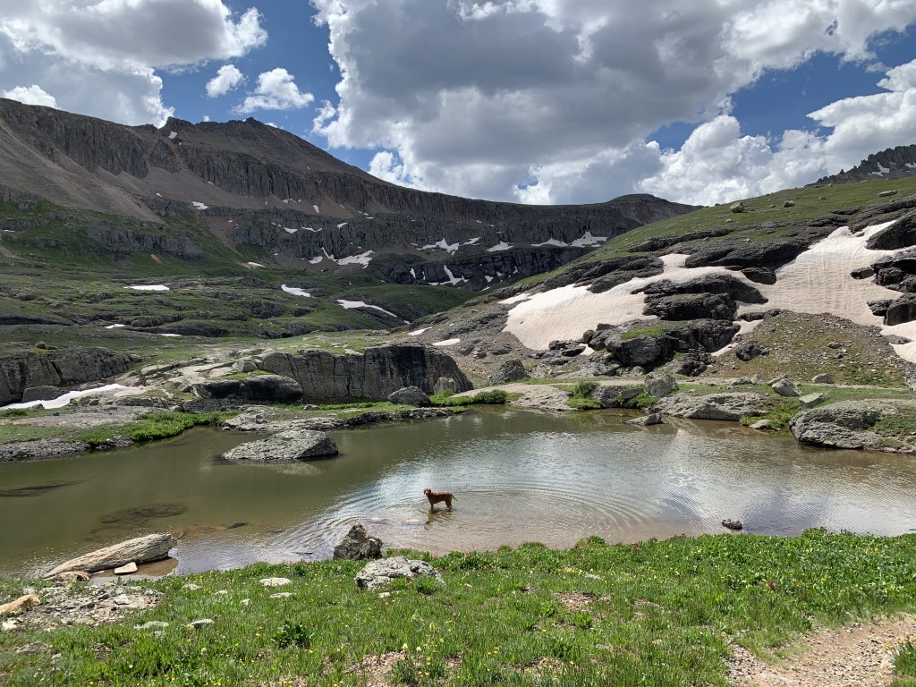
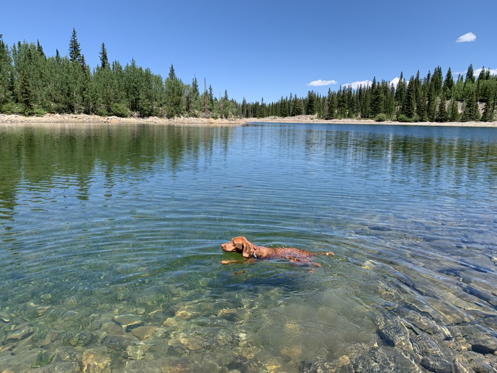
Blue Lakes Backpack
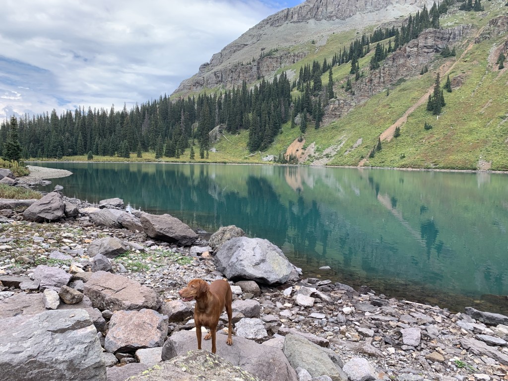
Cappie’s Scoop: The marmots were teasing me on this trail! I made it to our campsite and there was a nice big lake there! But then when I was hiking around the lake, I heard them. My ears opened up and I started looking, where are they. They were chirping at me with a very loud sound. Every time I thought I saw them, they ducked behind a rock. Those sneaky critters. After we setup our tent, Mom and I hiked up a trail to see the lake from up high. Mom was looking at the lake and I was searching for those pesky marmots. I never found them but I’ll be back! Don’t hesitate to add YOUR scoop in the comments below!
Tips: There are two trailheads, East Dallas Trailhead (closest town is Ridgway) and Yankee Boy Basin Trailhead near Telluride. We started at East Dallas. There are three lakes – Lower, Middle and Upper Blue Lakes. If you continue past Upper Blue Lake, you can go over the pass and continue on to Mount Sneffels, a challenging 14er at 14,158 ft. It’s about 4.3 more miles (one-way) and a very steep climb. We hiked in and setup camp at Lower Blue Lake. Lots of spots to pick from and near a flowing creek for filtering water. Then we continued hiking up to Middle and Upper Blue Lakes. The Lower Lake is by far the most beautiful alpine lake we’ve seen and it looks great from up above! Be sure to keep your eye on the weather because this area is known for afternoon rain which we got. Luckily we had made it to Upper Blue Lake and back before hunkering down in our tent for a couple hours. We took it as a sign to take a nap!
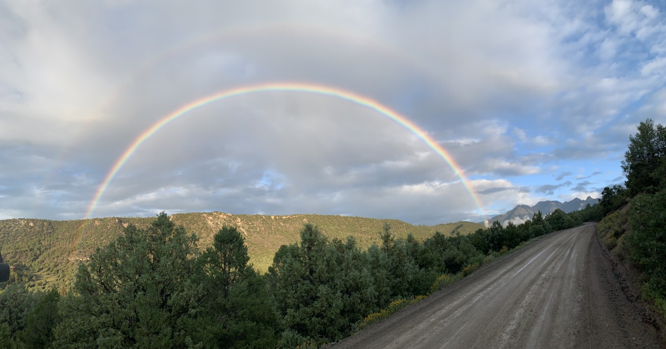
Directions: From the town of Ridgway, head west and take CO-62 for 4.3 miles. Then turn left onto Co Rd 7 and drive 8.9 miles on a bumpy dirt road to the trailhead parking lot. This is a very popular hike so we arrived the day before and found a turnout on Co Rd 7 and slept in the car. It had just rained and we caught a beautiful rainbow while driving on that road! Then we got up early and had a short drive to the trailhead.
Planning a Backpack – April 2021 Newsletter Special Issue
| Mileage (round trip) | 8.7 |
| Difficulty | Strenuous |
| Gain (in feet) | 2509 |
| Trailhead | 38.035273, -107.807090 |
| Time | 1 night |
| Exposure | Mostly Shady |
| Scenery | Mountain Views, Forest, Alpine Lake Views, Creek, Wildlife |
| Facilities | Toilets at the trailhead. |
| Fees/Permits | None |
| More Info | https://ouraytrails.org/northwest-ouray/blue-lakes |
| Last Hiked | 9/3/2021-9/4/2021 |
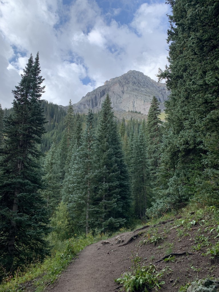
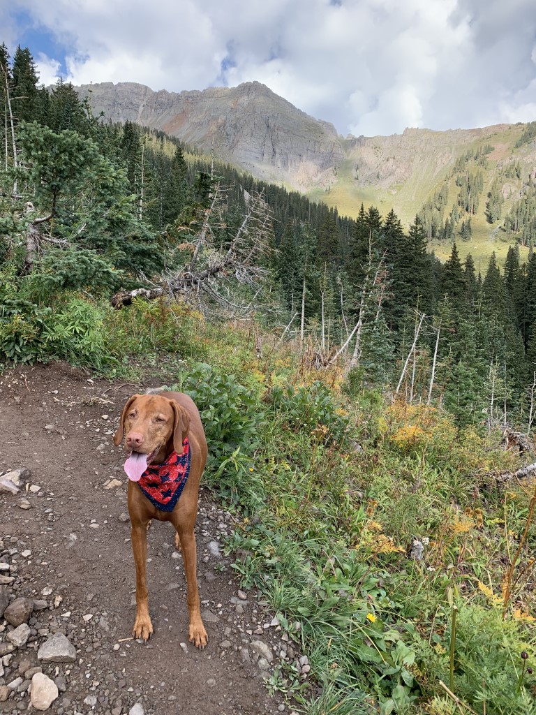
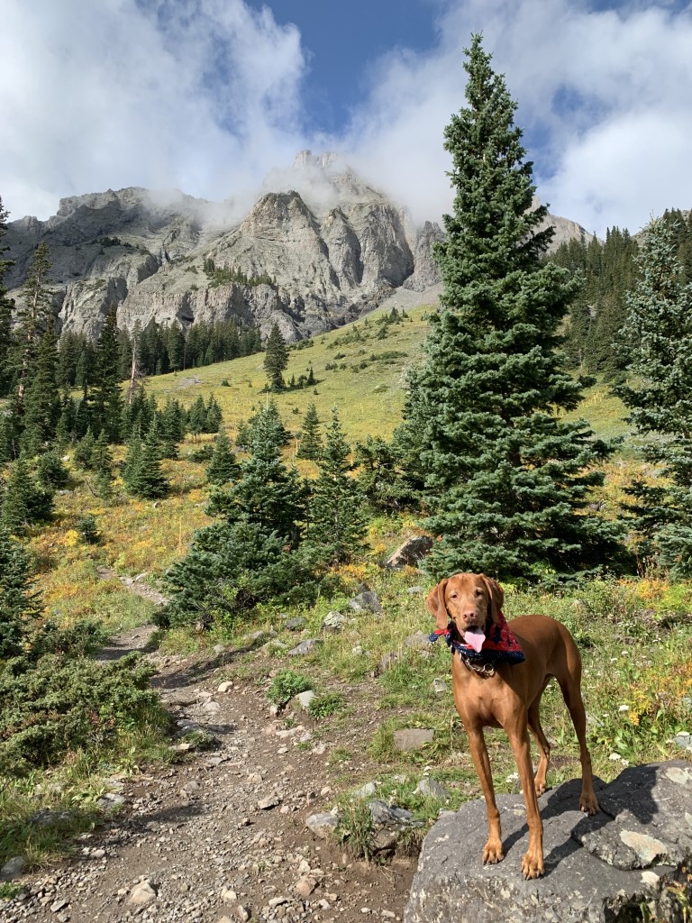

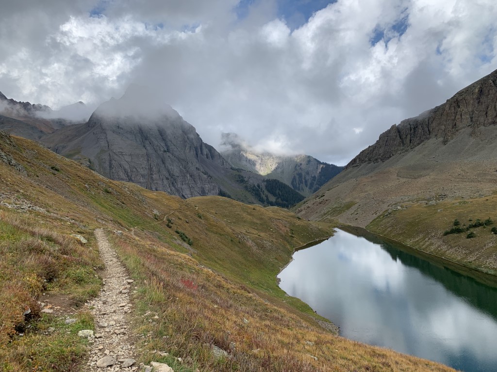
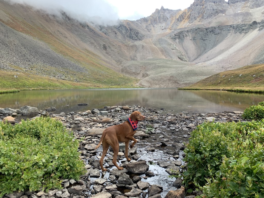


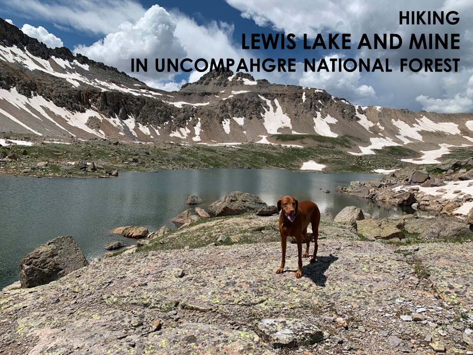
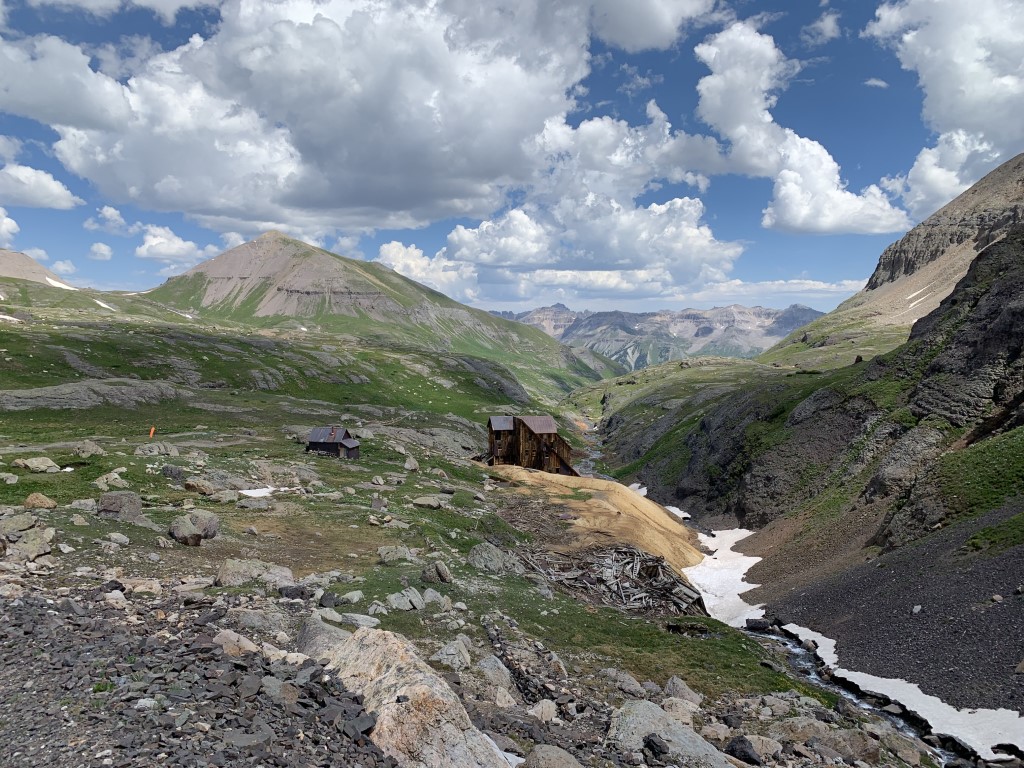
Lewis Lake and Mine
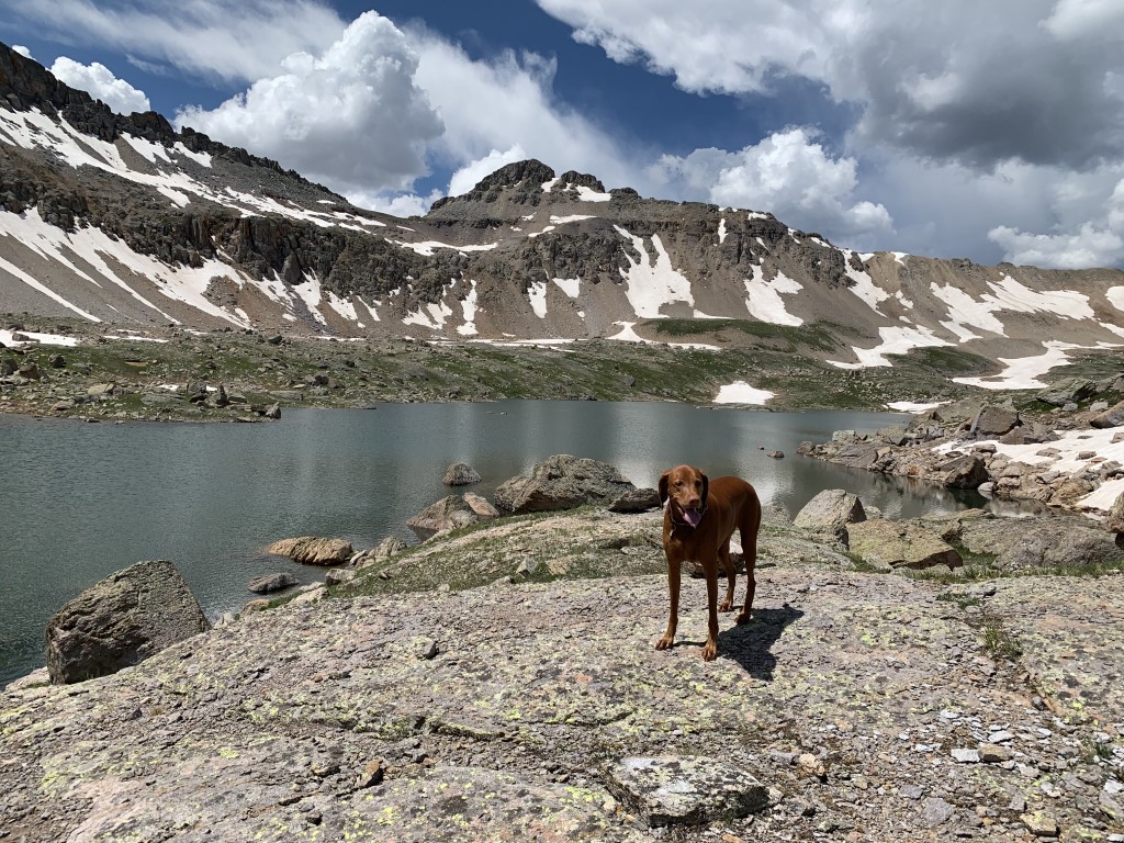
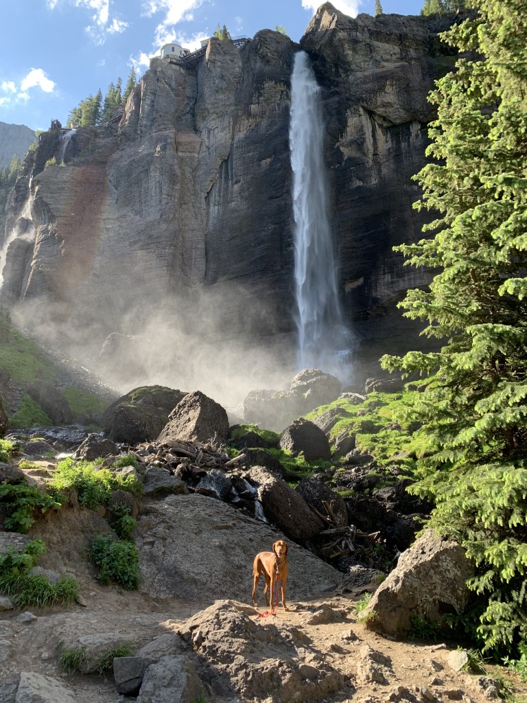
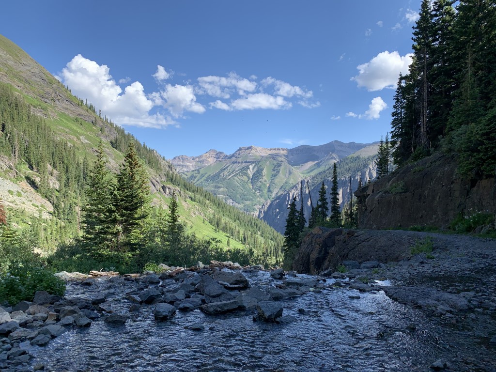
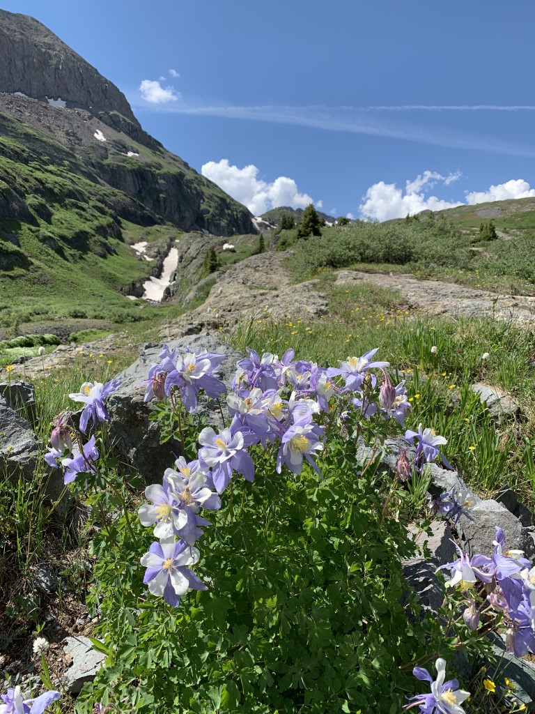
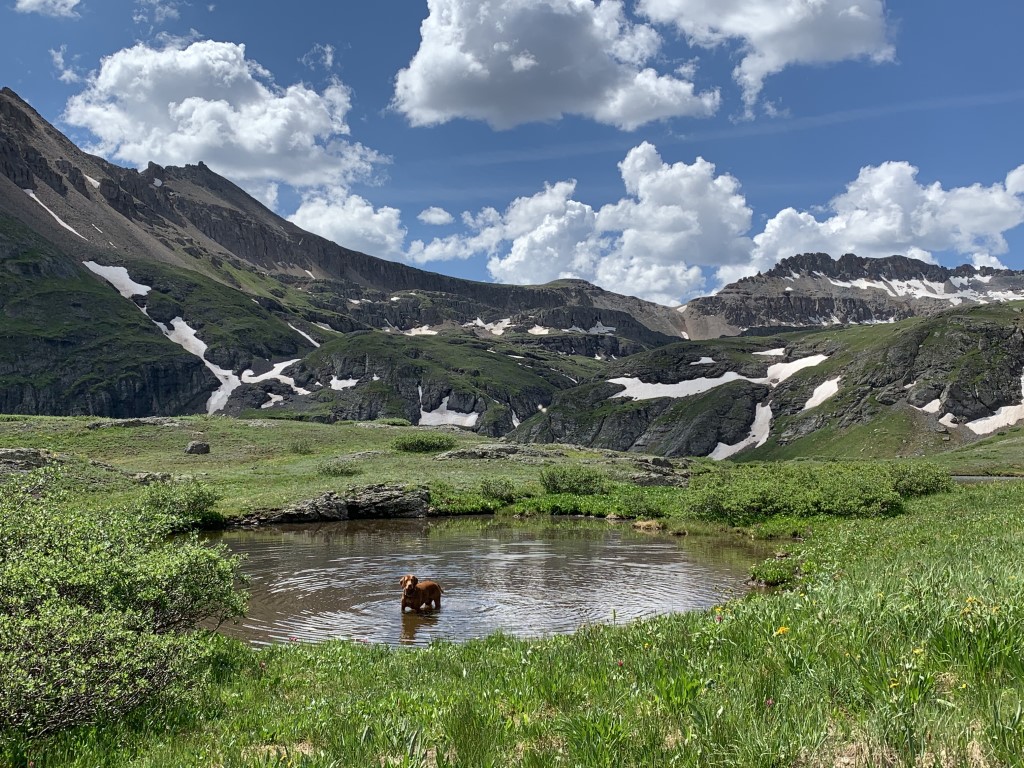
Cappie’s Scoop: Wow, all I can say is wow! I told mom we need to move here so I can hike this trail all the time. There are waterfalls, alpine lakes and big swimming holes to jump in! After I hiked for a bit up this trail, I didn’t see a lot of hoomans or dogs. There was also a lot of space for me to zoom and mom didn’t have to worry about being close to the edge of a mountain or anything. I told mom we should bring our tent next time and stay a while! If you want a shorter hike, you can hike to just Blue Lake. Don’t hesitate to add YOUR scoop in the comments below!
Tips: This is one of the most spectacular trails we’ve hiked so far! The trail up to the lake is busting with wildflowers in July, waterfalls and mountain views! You first pass the amazing largely intact 5-story historic Lewis Mill at 12,448 ft. Check it out and then keep heading up the trail to find the lake at 12,700 ft. If you still have energy and want to break the 13,000 ft mark, you can cross the damn and head up to the pass as the trail continues on!
Directions: From the town of Telluride, head east on Colorado Avenue leaving the town behind you for about 2 miles. Colorado Avenue becomes Forest Service Rd 648 and ends at a parking lot. Parking for this hike fills up fast so be sure to go early or on a weekday. Some brave vehicles may even drive up the fire road as far as the power station where the trail continues past the waterfall behind a gate. Watch out for cars if your dog is with you.
| Mileage (round trip) | 13.6 |
| Difficulty | Strenuous |
| Gain (in feet) | 3668 |
| Trailhead | 37.928665, -107.776533 |
| Hike Time (in hours) | 8-9 |
| Exposure | Mostly Sunny |
| Scenery | Mountain Views, Alpine Lake Views, Trees, Waterfalls, Wildflowers |
| Facilities | Port-a-potty at trailhead. |
| Fees/Permits | None |
| More Info | https://www.telluride.com/play/activities/lewis-mine (note the start in this write-up is only from Bridal Veil Falls and our post details are round trip from the parking lot) |
| Last Hiked | 7/10/2021 |

Thomas Lakes
Cappie’s Scoop: Mom loved the wildflowers on this trail but for me, the best part was swimming in the lake! While I was swimming in the lake, there were some hoomans trying to catch some fish. I told them I was sorry if I scared them away but I had to jump in for a swim! Don’t hesitate to add YOUR scoop in the comments below!
Tips: Check the weather before you go and start early because this area tends to heat up fast and can be prone to afternoon storms. Thomas Lakes is made up of three lakes and don’t be fooled by the first lake on your right. It’s not a part of the three! Our favorite lake was the one on the left. Easy to access and clear water for swimming. Also, you can obtain a free self-serve overnight permit at the trailhead for camping. We passed 13 camp sites near the lakes that would make an awesome backpacking trip.
Directions: From the town of Carbondale, head south on highway 133 and turn left (east) onto Prince Creek Road (Co Rd 111). Follow this road for about 5 miles or so which turns into a dirt road (closed in the winter) until you come to an intersection which may be confusing. Keep right to follow Dinkle Lake Rd to Dinkle Lake. In about 2 miles, the parking area will be on your left before you reach Dinkle Lake.
| Mileage (round trip) | 7.8 |
| Difficulty | Moderate |
| Gain (in feet) | 1627 |
| Trailhead | 39.304162, -107.124381 |
| Hike Time (in hours) | 4-5 |
| Exposure | Sunny and Shady |
| Scenery | Mountain Views, Alpine Lake Views, Forest, Wildflowers |
| Facilities | Vault toilet at trailhead. |
| Fees/Permits | None |
| More Info | https://www.fs.usda.gov/Internet/FSE_DOCUMENTS/stelprdb5186956.pdf |
| Last Hiked | 7/7/2021 |