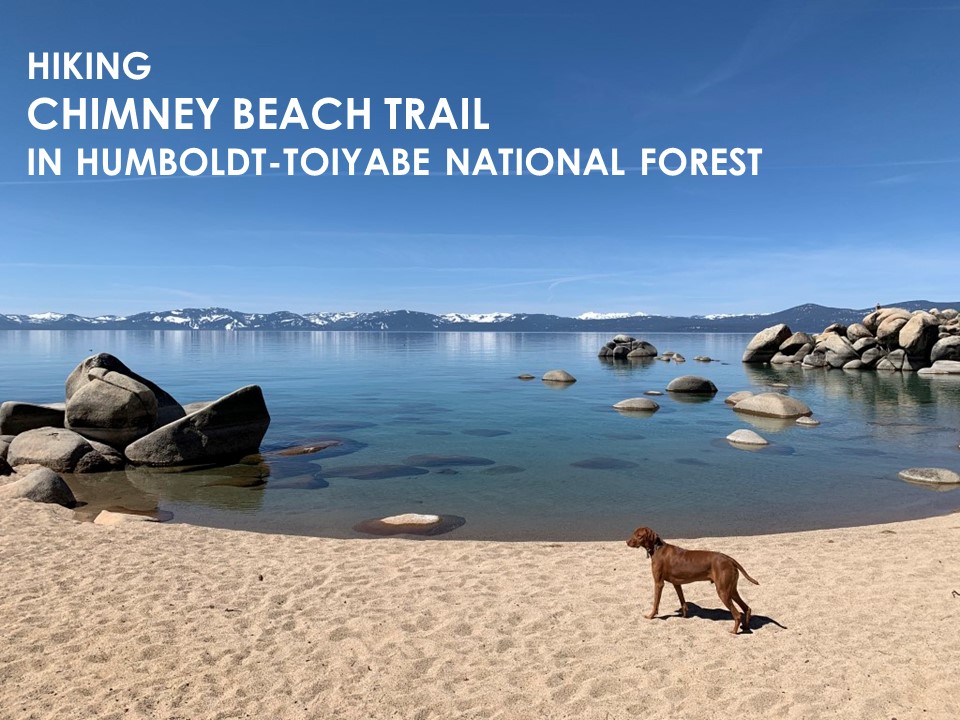
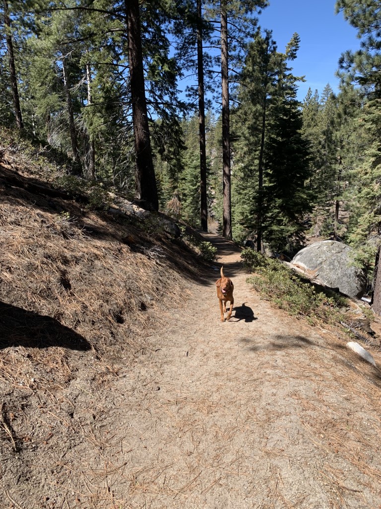
Chimney Beach Trail
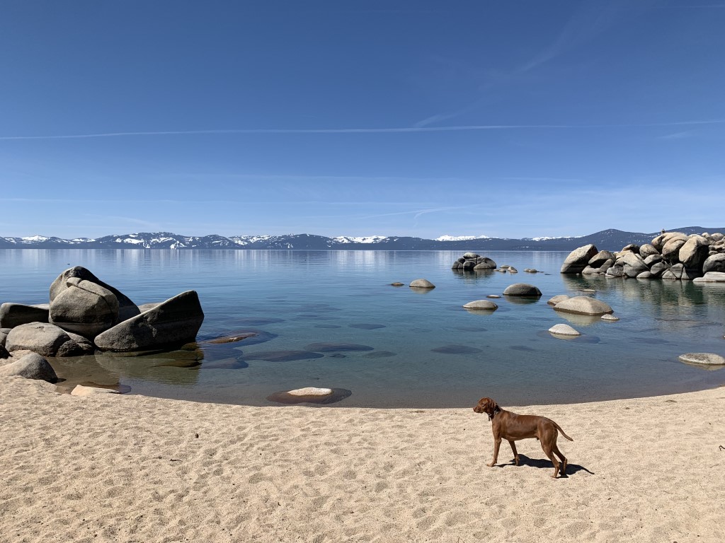
Cappie’s Scoop: Imagine just hiking along a trail, through the pine trees and then boom, you’re on the beach! You can imagine how excited I was to jump off the dirt trail and into the sand and then into the water! Mom surprised me with this hike and I wanted to stay a while just sitting on one of the cool rocks or sunbathing in the sand. I love the Lake Tahoe area! Don’t hesitate to add YOUR scoop in the comments below!
Tips: This is a gorgeous beach on the Nevada side of Lake Tahoe. Plan to go swimming or even hike down with your paddleboard!
Directions: If you’re driving south on Highway 28, the turn off is 2.6 miles past Sand Harbor State Park. Once parked, walk past the restrooms to the trailhead. The parking lot is very small so plan to arrive early especially if going on a weekend.
| Mileage (round trip) | 2.4 |
| Difficulty | Easy |
| Gain (in feet) | 249 |
| Trailhead | 39.163823, -119.930530 |
| Hike Time (in hours) | 1-2 |
| Exposure | Mostly Shady |
| Scenery | Mountain Views, Lake Views, Forest, Boulders |
| Facilities | Toilet in parking area. |
| Fees/Permits | None |
| More Info | http://www.tahoeactivities.com/chimney-beach |
| Last Hiked | 4/2/2021 |


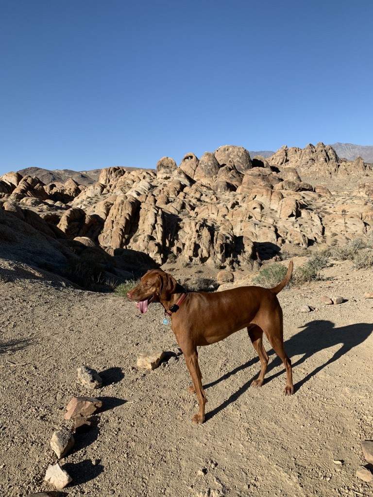
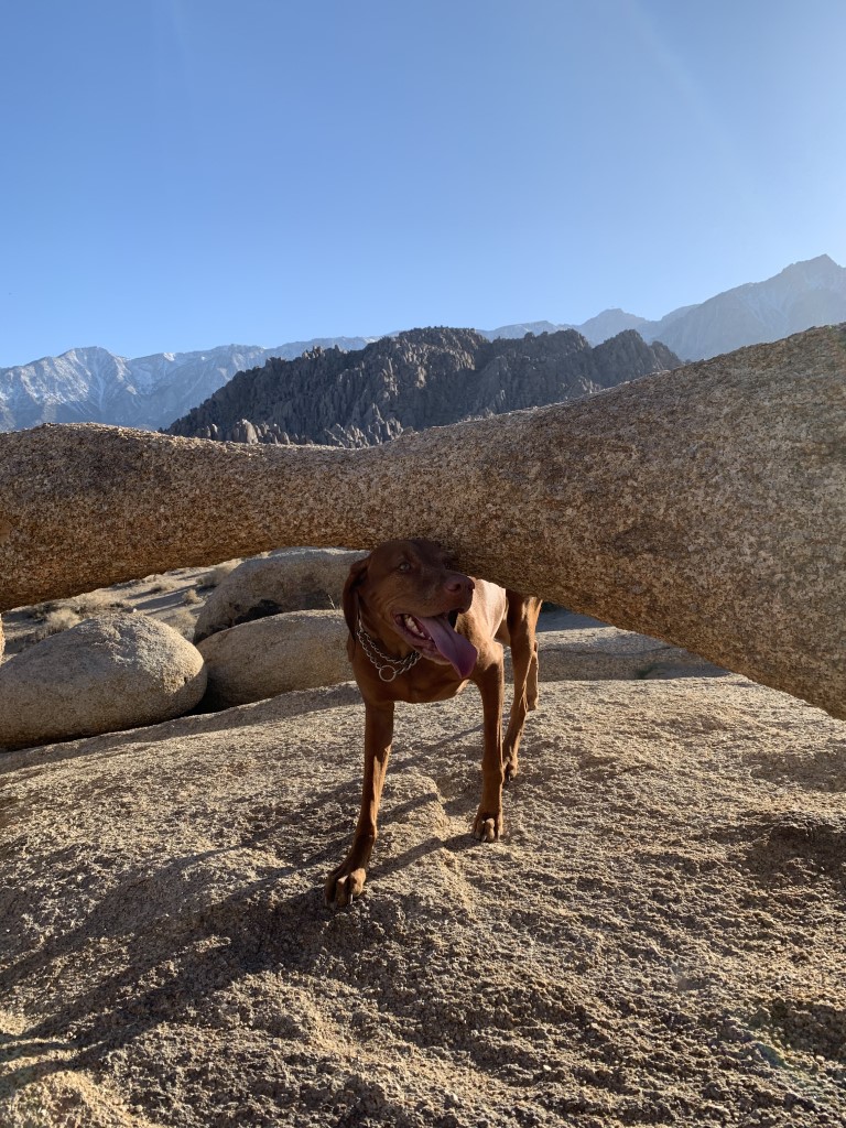
Mobius Arch Loop

Cappie’s Scoop: This is a great stop to stretch your paws. I always jump out of the car and get ready to hike the loop trail. I get so excited because I know there are lots of boulders to climb on and that’s my favorite part. There are two arches on the trail, a big hooman sized arch and a doggy sized arch. They are near each other so keep your eyes open for both of them. Don’t hesitate to add YOUR scoop in the comments below!
Tips: In addition to visiting this cool arch with a spectacular view of Mount Whitney under it (go before the sun starts to set so it doesn’t obstruct your view), this is an incredible area to visit! Alabama Hills is under the BLM and you can camp for free and there are some really cool spots to camp around all the boulders. Also Mount Whitney portal/trailhead is nearby and it’s a gorgeous area to hike. Just remember if you want to hike to the peak (highest point in the lower 48 at 14,505 ft) you will need a permit and be in great hiking condition. Alabama Hills has been a filming location for a bunch of movies, mostly westerns. It’s worth the stop!
Directions: Take Hwy 395 to Lone Pine. Turn west (at the stop light) onto Whitney Portal Road, drive 2.5 miles to Movie Road, turn right. After 1.5 miles you will come to a “Y” in the road. Go right and pull into the dirt parking area immediately on your left. You will see markers on both on the left and right sides of this parking area. You can begin your arch walk at either trail head.
| Mileage (round trip) | 0.6 |
| Difficulty | Easy |
| Gain (in feet) | 42 |
| Trailhead | 36.611318, -118.125030 |
| Hike Time (in hours) | 1 |
| Exposure | Sunny |
| Scenery | Mountain Views, Boulders |
| Facilities | Port-a-potty near the trailhead. |
| Fees/Permits | As of 10/1/21, a 3-year management plan took effect and includes making the west side of Movie Road “day use only.” Expect to see “no camping.” Eventually dispersed camping will be limited to certain areas. Visit the BLM site for a map. A permit will be required for those spots but it’s an “information permit only.” It will not be a permit that gives you a reservation. The permit will be similar to the free California Campfire Permit, watch a video with a short quiz, with the end goal being “to learn about how to ‘Leave No Trace’ and camp in Alabama Hills.” BLM is not sure when the system will start. |
| More Info | https://sierranevadageotourism.org/entries/alabama-hills-natural-arch/cb733c1a-5660-41ab-a574-4b93a55d9e37; https://www.blm.gov/visit/alabama-hills |
| Last Hiked | 4/1/2021, 5/6/2022, 2/17/2023 |

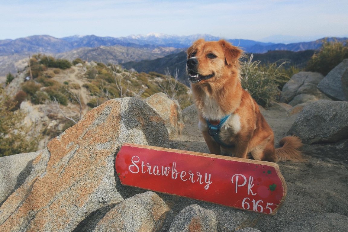
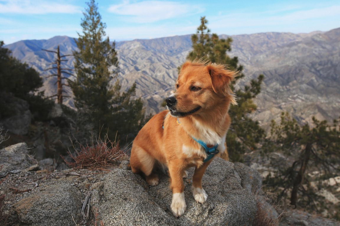
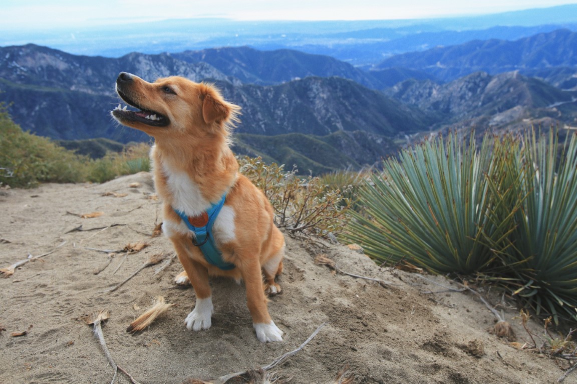
Sweet Views on Strawberry Peak
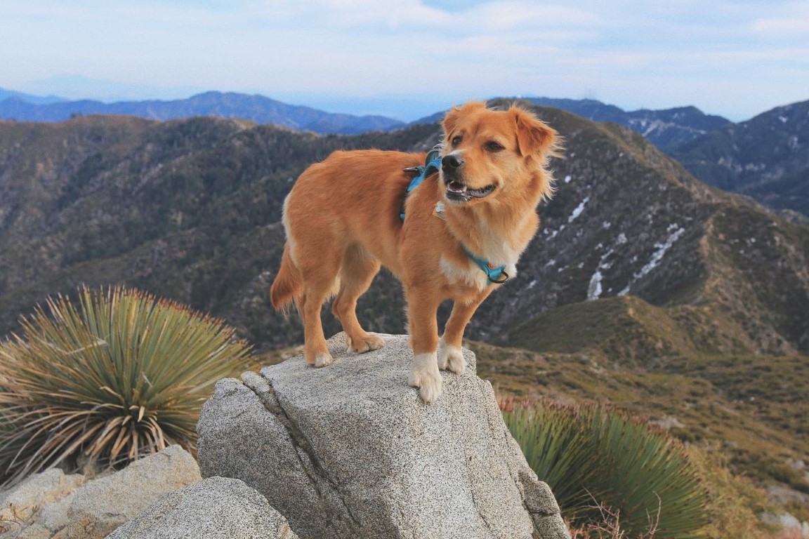
Kina’s Scoop: Last month on Valentine’s Day, I went hiking with my pawrents up Strawberry Peak via Redbox Canyon, rounding out our 10th hike of the year! This trail is a moderate-difficult out and back through the San Gabriel mountains toward a beautiful peak and overlook on a mountain that looks like a giant upside down strawberry! The first two miles are relatively painless but the incline gets pretty steep towards the end with mild rock scrambling. There are several false peaks so I recommend getting a map on AllTrails so you don’t get lost going up the wrong trail!
| Mileage (round trip) | 7.5 |
| Difficulty | Moderately Strenuous |
| Gain (in feet) | 1788 |
| Trailhead | 34.258347, -118.104768 |
| Hike Time (in hours) | 5 |
| More Info | https://socalhiker.net/hiking-to-strawberry-peak; https://hikingguy.com/hiking-trails/best-la-hikes/strawberry-peak-hike |
| Follow Us! | @kinathegoldencorg |
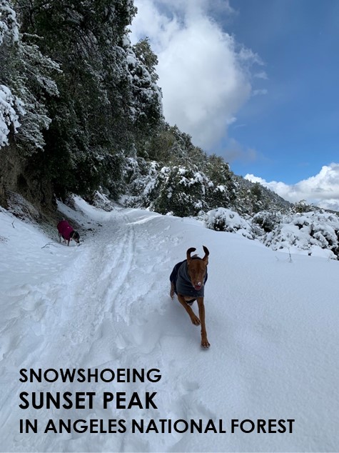
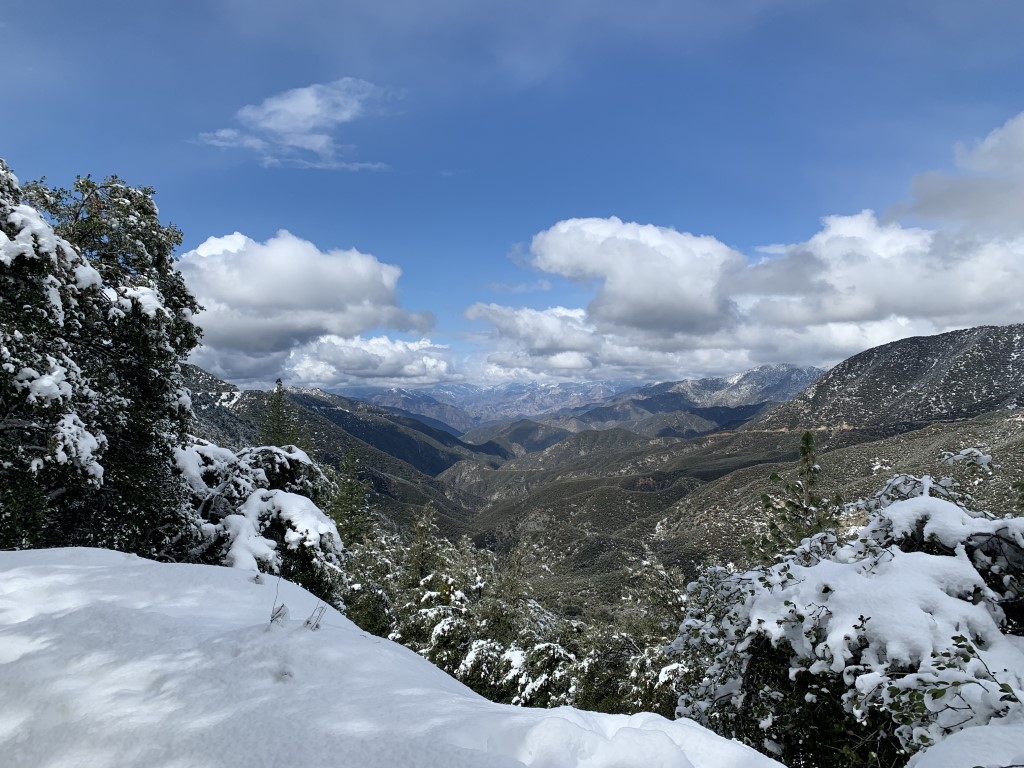
Sunset Peak – Winter
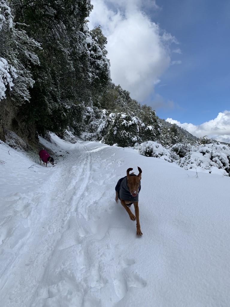
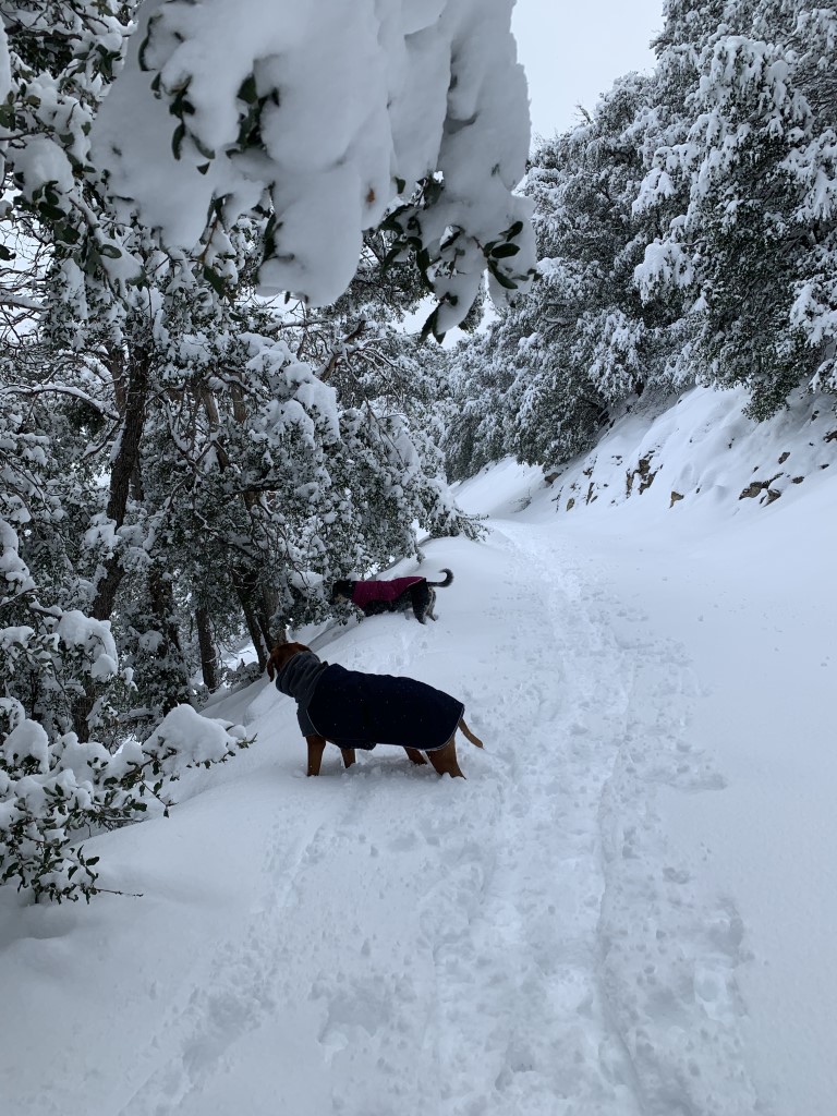
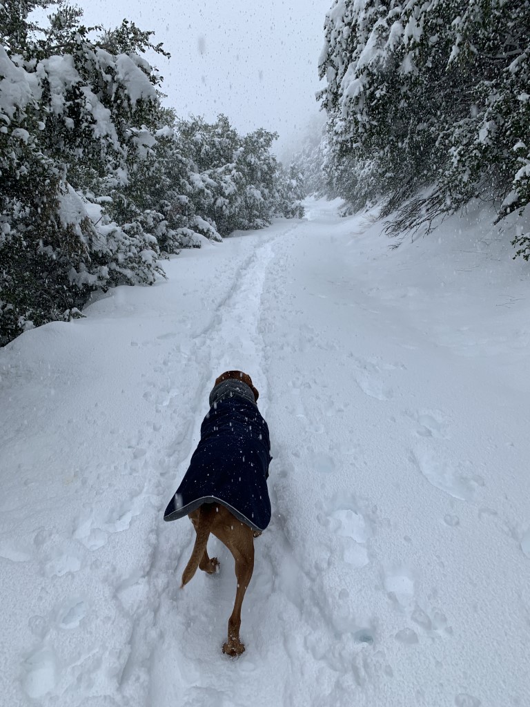
Cappie’s Scoop: Zoooming in the snow is so much fun! It’s even better when it starts snowing while I’m hiking. Mom was on her snowshoes and I was jumping like a deer through the snow. This was a really fun trail and there wasn’t many other dogs or hoomans there so we had it all to ourselves! Don’t hesitate to add YOUR scoop in the comments below!
Tips: This trail in the San Gabriel Mountains is a fantastic place to snowshoe!
Directions: The coordinates below take you to the trailhead even though we didn’t park there due the road requiring chains at the time. From Padua Avenue, turn right onto Mt. Baldy Road. In about 7.1 miles, make a sharp left onto Glendora Ridge Road. The first trailhead will be on your left in about 1 mile, parking is available on the sides of the road. The second trailhead will be on your left in 4.2 miles and has a dirt parking lot. We arrived early in the morning and about 0.5 mile before our left turn onto Glendora Ridge Rd, chains were required to go any further. We saw a parking spot on the side of the road and decided to walk the rest of the way up to the first trailhead. On our way back to the car, the chain order was lifted because the road was safe and clear.
| Mileage (round trip) | 7-8 |
| Difficulty | Moderate |
| Gain (in feet) | 1200-1400 |
| Trailhead | First trailhead (after turn onto Glendora Ridge Rd): 34.228008, -117.670338 Second trailhead: 34.219047, -117.712626 |
| Hike Time (in hours) | 3-4 |
| Exposure | Sunny and Shady |
| Scenery | Mountain Views, Forest |
| Facilities | None |
| Fees/Permits | None |
| More Info | https://modernhiker.com/hike/hiking-sunset-peak |
| Last Hiked | 3/12/2021 |


Rest Stop Fun
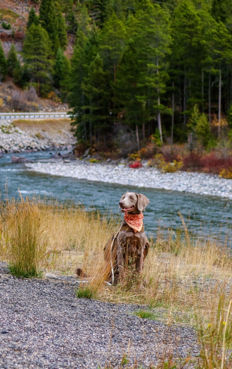
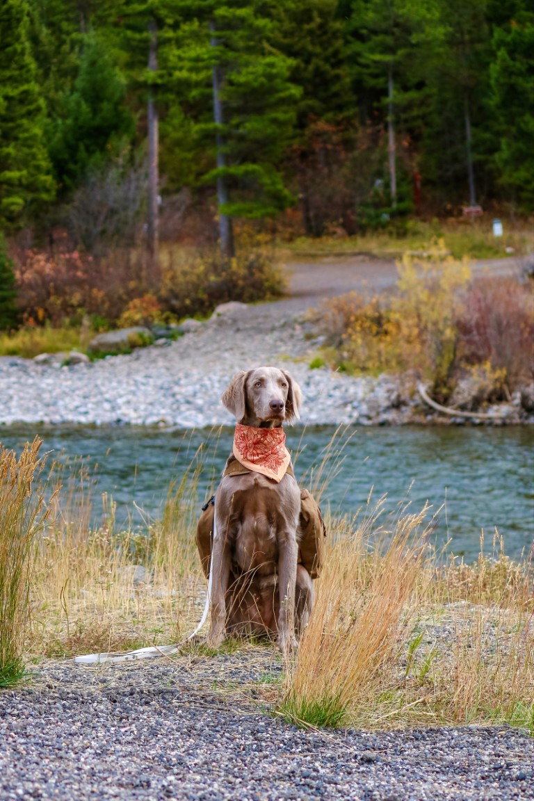
Tucker’s Scoop: Hi! I’m Tucker and I am going to tell you about my rest stop adventure! My family was on a big road trip we went to so many different places! So many new smells! We were on our way out of Montana and saw this beautiful rest stop just off the freeway, it even had trails to hike! My mom said we just had to stop for some photos! It was so much fun!! The weather was wonderful and the sights where outstanding (and that’s not just because I was there).
| Trailhead | Somewhere in Bozeman! |
| Follow Us! | @tuckexplores |
Malibu Cafe at Calamigos Ranch

The Parkhouse Pack’s Scoop: Few things capture the essence of living in SoCal like a drive on the coast along Hwy 1! We enjoyed a drive to Malibu with Sandi & Aspen for lunch at the Malibu Cafe at Calamigos Ranch. The Malibu Cafe is super dog friendly- there’s even a big sign at the entrance stating so, and for anyone not comfortable with dogs to take a seat away from any; also to note, dogs must be kept on a short leash, 3ft. The cafe sprawls over various sitting areas and terraces with tables and 3 bars, or bring a blanket and grab a seat on the grass under the beautifully mature trees. On weekends they usually have live music to enjoy while you dine and relax. During your visit, you can leave the cafe area and explore the grounds of Calamigos Ranch. There are many wedding ceremony and reception sites, so be mindful if a wedding is taking place. But otherwise there are so many beautiful areas to wander, take a seat by the pond and relax, or take advantage of the many photo op locations on the ranch grounds and at the cafe.
| Location | 327 Latigo Canyon Rd, Malibu, CA |
| More Info | https://www.themalibucafe.com |
| Follow Us! | @sandi_n_aspen |

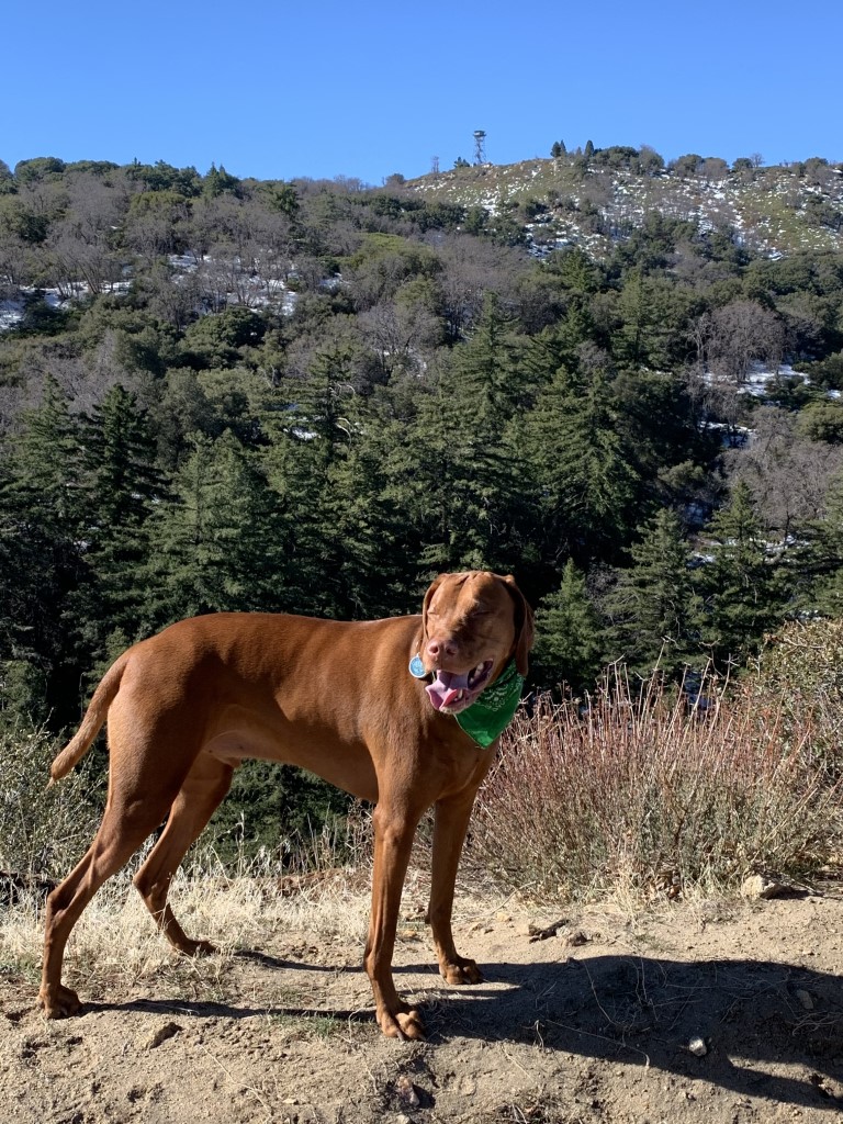
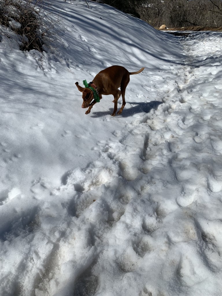
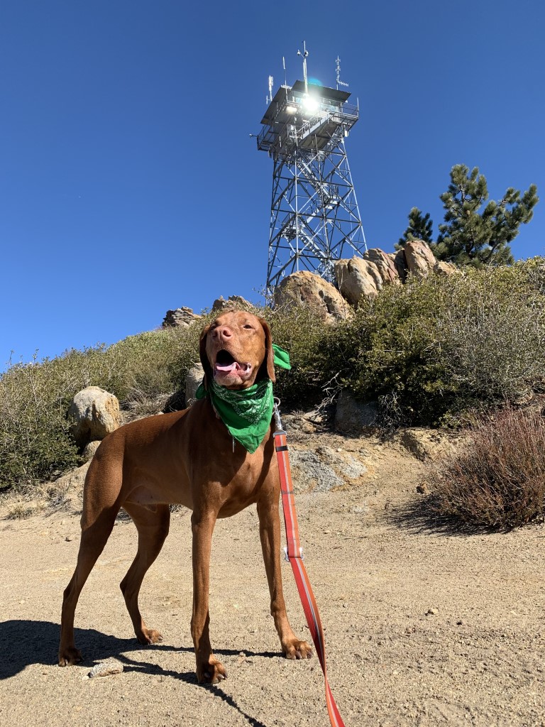
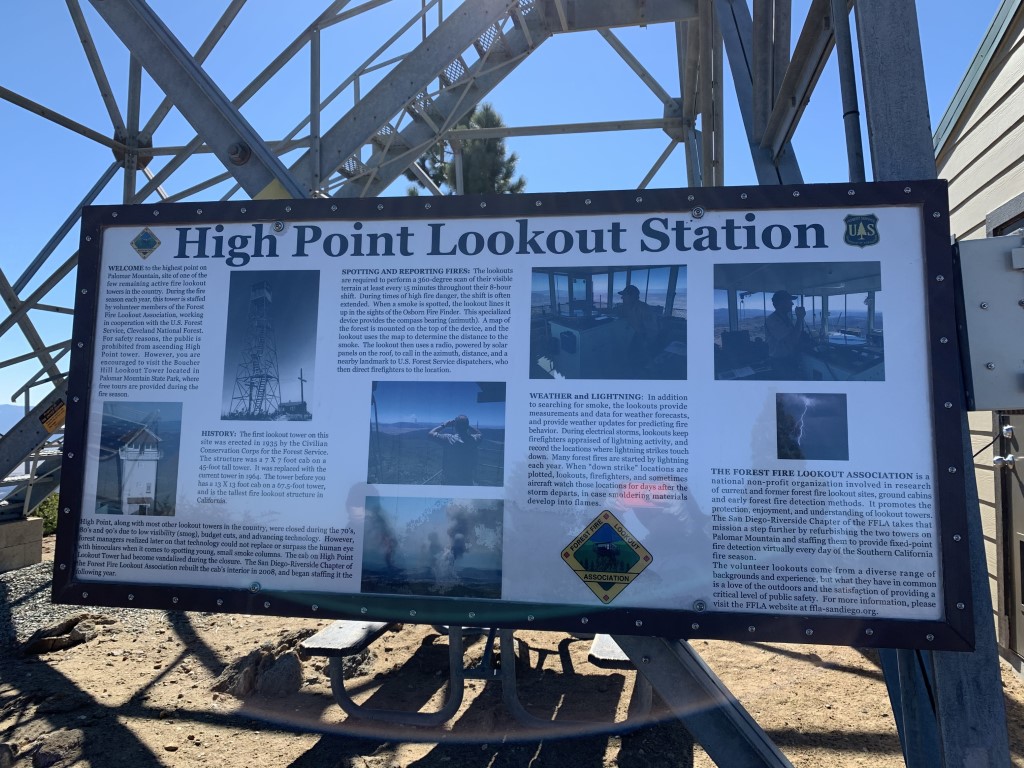
Oak Grove Trail to High Point Lookout
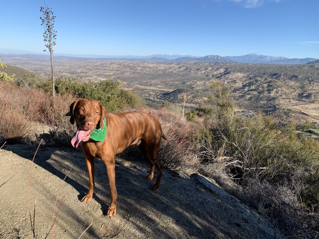
Cappie’s Scoop: Mom and I have been waiting a long time to do this hike! It’s always been too hot to go and it’s really looooong. We finally made it and there was SNOW at the top! Usually the snow melts quickly but I was so happy to see it and play in it for a bit. Of course it was another lookout tower (mom loves those) and I couldn’t get inside. But the Tower Lead Leif was there and he showed me all the cool tools on the picnic table in front of the station. I was very lucky because he was packing up for the season and had some things already in his car that he pulled out for me to see! It was a fun day and we had the trail practically all to ourselves. Don’t hesitate to add YOUR scoop in the comments below!
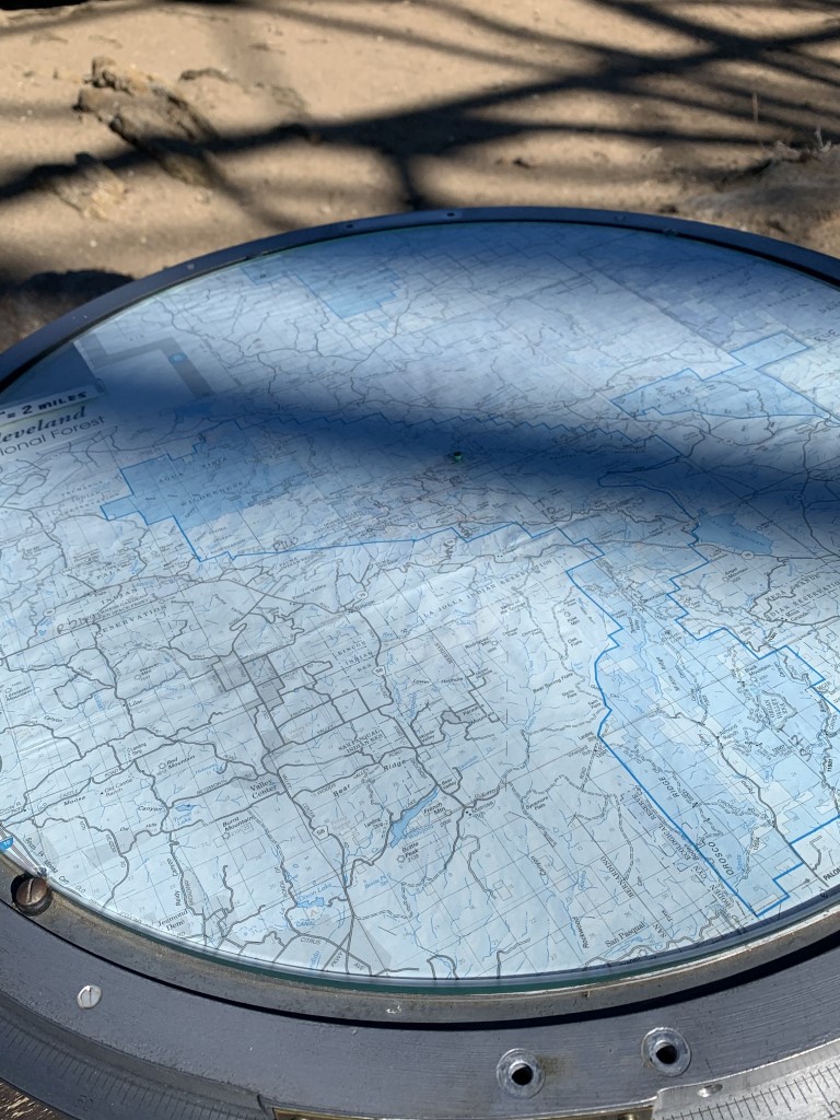
Tips: Start early, this is a very long hike and the parking lot can fill up fast. The first mile or so is a bit steep but once you hit the fire road, the climb becomes gradual and levels out from time to time. When we last visited, there was snow at the top so we carried our microspikes but luckily didn’t have to use them. There are some nice stretches of shade while the sun is still rising. The lookout station is one of the few remaining active fire lookout towers in the country. We met the Tower Lead Leif as he was closing it for the season and didn’t expect to open it again until May 1st. He showed us the Osborne Fire Finder (looks like a big compass) and other cool instruments to measure wind, air temperature and ground moisture (fuel stick). He mentioned that they usually close the tower at the end of Nov 2020 (at time of writing) but it was very dry so they kept it open longer. You may want to have a map handy as there are a few junctions on the fire road. At the first gate, pass through and stay left. Around 5.5 miles, we stayed right at the fork but we saw there was a trail leading to the tower to the left but we didn’t explore that route. Lastly there was another fork at about 6.3 miles, stay left and pass through the white gate.
Directions: From I-15 North, take the CA-79 S/Temecula Parkway exit. Turn right onto Temecula Parkway/79-s and continue for approximately 24 miles to the Oak Grove Fire Station. Turn right into the Oak Grove Trailhead parking lot (it’s marked with a sign) before you pass the fire station. The trailhead parking is across the street from the Oak Grove Campground. There are very few parking spots.
High Point Tower Weather Station
| Mileage (round trip) | 13.5 |
| Difficulty | Strenuous |
| Gain (in feet) | 3600 |
| Trailhead | 33.386475, -116.791996 |
| Hike Time (in hours) | 6-7 |
| Exposure | Mostly Sunny |
| Scenery | Mountain Views, Forest |
| Facilities | None |
| Fees/Permits | California Adventure Pass or Interagency Annual Pass/America the Beautiful Pass (National Parks Pass). |
| More Info | https://hikingguy.com/hiking-trails/hiking-san-diego/oak-grove-trail-to-high-point-hike; https://socalhiker.net/hiking-to-high-point-on-palomar-mountain-in-the-cleveland-national-forest; http://hikingsdcounty.com/oak-grove-high-point-palomar |
| Last Hiked | 2/7/2021 |


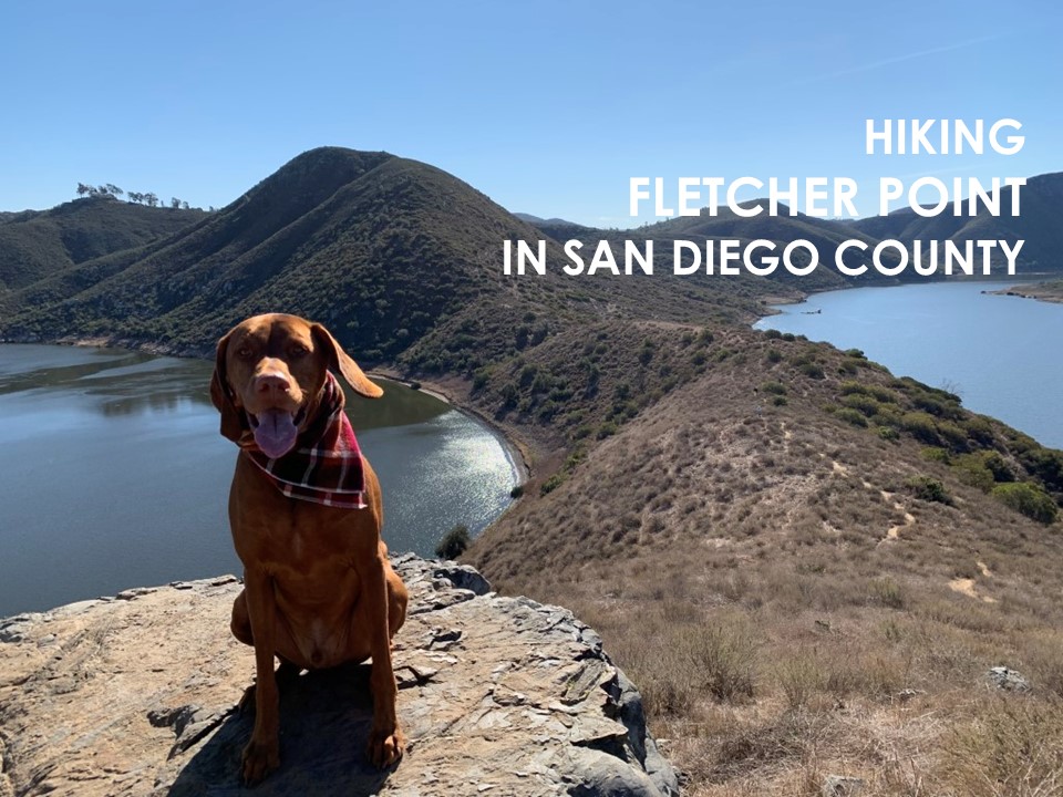
Fletcher Point
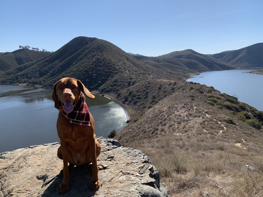
Cappie’s Scoop: I’ve hiked the trails in this area a lot but this time we went a different way and it was really cool! We hiked along the water and up to a point with a great view! This trail didn’t have a lot of hoomans or dogs on it when we hiked it in the morning. On the way back to the car, there were mountain bikers on the trail so keep your eyes out for them. They go really fast! Don’t hesitate to add YOUR scoop in the comments below!
Tips: We started this hike from the parking lot on W Bernardo Drive where you can access multiple trails. There are a few trail junctions along the way so recommend you have a map handy on your phone so you don’t miss a turn! The David Kreitzer Lake Hodges Bicycle Pedestrian Bridge is nearby and worth walking over. It’s the world’s longest stress ribbon bridge.
Directions: Can use address 19140 W Bernardo Drive. From I-15, take the W Bernardo Dr/Pomerado Rd exit and head west on West Bernardo Drive. Follow West Bernardo Drive for approximately .5 miles. The parking lot will be on your right.
| Mileage (round trip) | 7.8 |
| Difficulty | Moderate |
| Gain (in feet) | 780 |
| Trailhead | 33.052025, -117.076414 |
| Hike Time (in hours) | 4-5 |
| Exposure | Mostly Sunny |
| Scenery | Lake Views, Bay Views, Wildlife, Birds, Wildflowers |
| Facilities | Toilet in parking area. |
| Fees/Permits | None |
| More Info | https://hiddensandiego.net/things-to-do/places/fletcher-point |
| Last Hiked | 1/2/2021 |

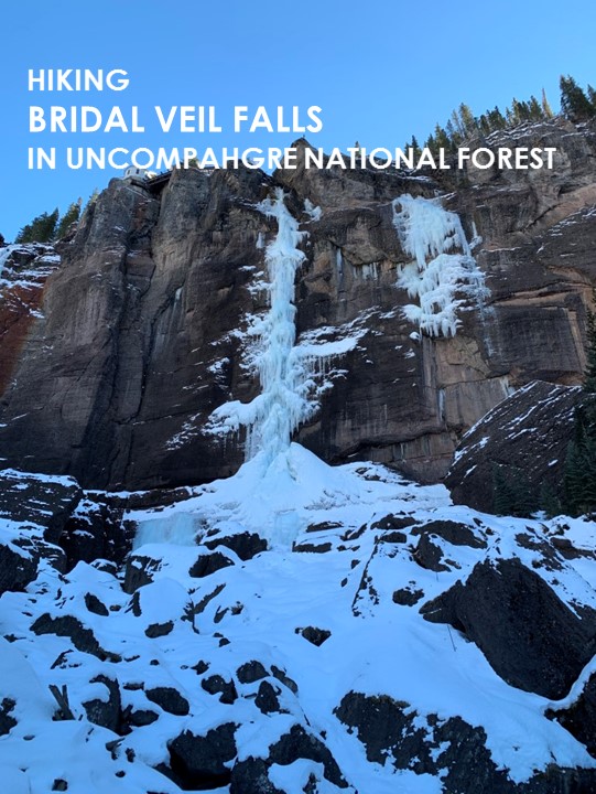
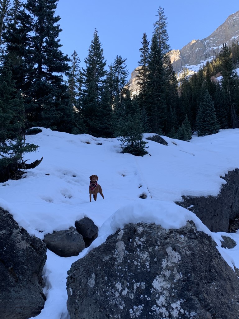
Bridal Veil Falls – Winter
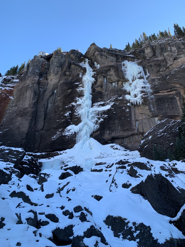
Cappie’s Scoop: I’ve hiked here in the summer and winter. If you want to see pictures of the summer hike, check out Bridal Veil Falls – Summer. I’m a water dog so any trail with water, I’m there! Don’t hesitate to add YOUR scoop in the comments below!
Tips: Located just outside of Telluride, this multi-use trail is great in the summer and winter! We had a chance to do both seeing the waterfall running strong in the summer and frozen in the winter. See other post for summer pictures. Total roundtrip mileage is to the power station (top of the falls). There is also a new trail from the parking lot to the base of the falls and avoids the fire road. We checked this out but the trail is a little rough and uneven so be prepared for it if you take this detour. The trail does connect back to the fire road so you can continue up to the best viewpoint of the waterfall – so close that you feel the mist of the falls on your face! Want a longer hike, see our posts for Blue Lake and Lewis Lake which are on the same trail.
Directions: From the town of Telluride, head east on Colorado Avenue leaving the town behind you for about 2 miles. Colorado Avenue becomes Forest Service Rd 648 and ends at a parking lot. Parking for this hike fills up fast so be sure to go early or on a weekday. Some brave vehicles may even drive up the fire road as far as the power station where the trail continues past the waterfall behind a gate. Watch out for cars if your dog is with you.
| Mileage (round trip) | 4.8 |
| Difficulty | Moderate |
| Gain (in feet) | 1368 |
| Trailhead | 37.928665, -107.776533 |
| Hike Time (in hours) | 3-4 |
| Exposure | Mostly Sunny |
| Scenery | Mountain Views, Trees, Waterfalls |
| Facilities | Port-a-potty at trailhead. |
| Fees/Permits | None |
| More Info | https://www.telluride.com/play/activities/bridal-veil-falls |
| Last Hiked | 12/8/2020 |


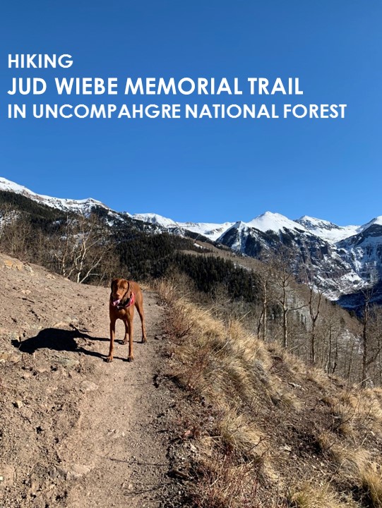
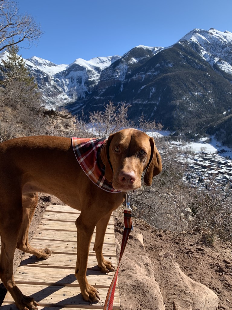
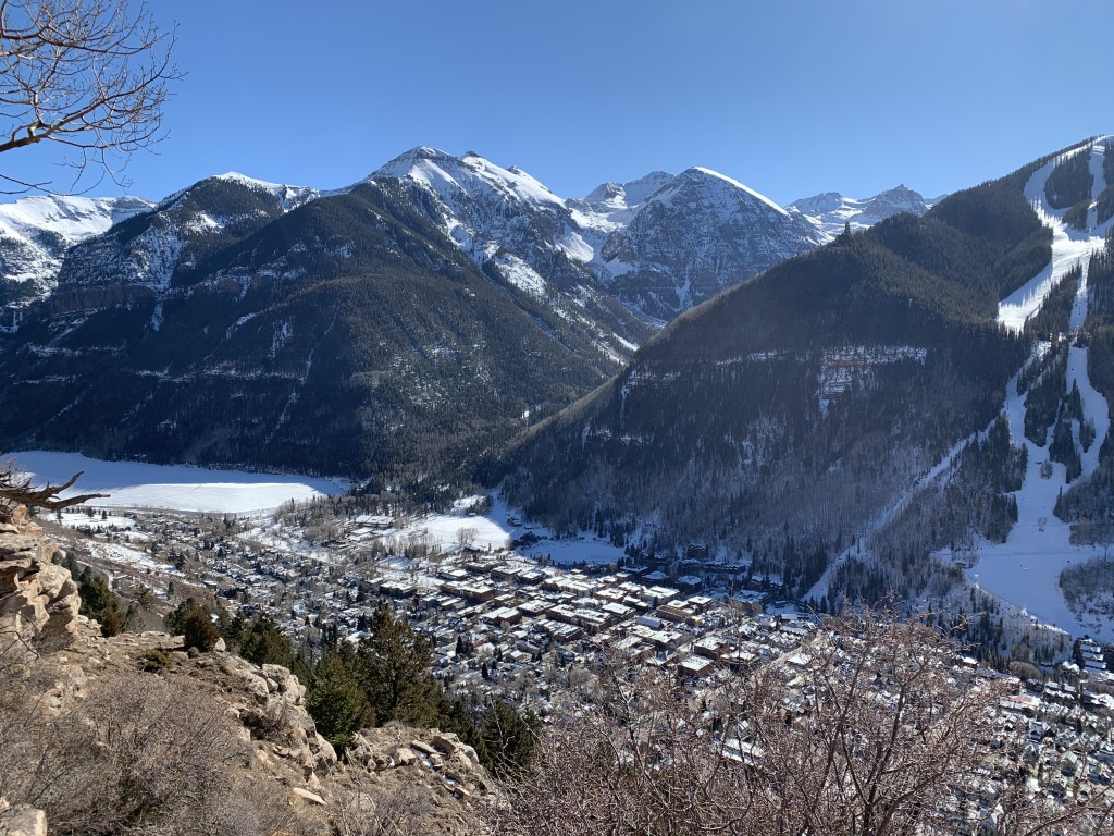
Jud Wiebe Memorial Trail

Cappie’s Scoop: This is the side of the mountain that gets the most sun so if the snow is melting, you’ll probably get some mud. I had fun squishing through the mud but mom was not happy. She kept getting her boots stuck in the mud. Yuck! Don’t hesitate to add YOUR scoop in the comments below!
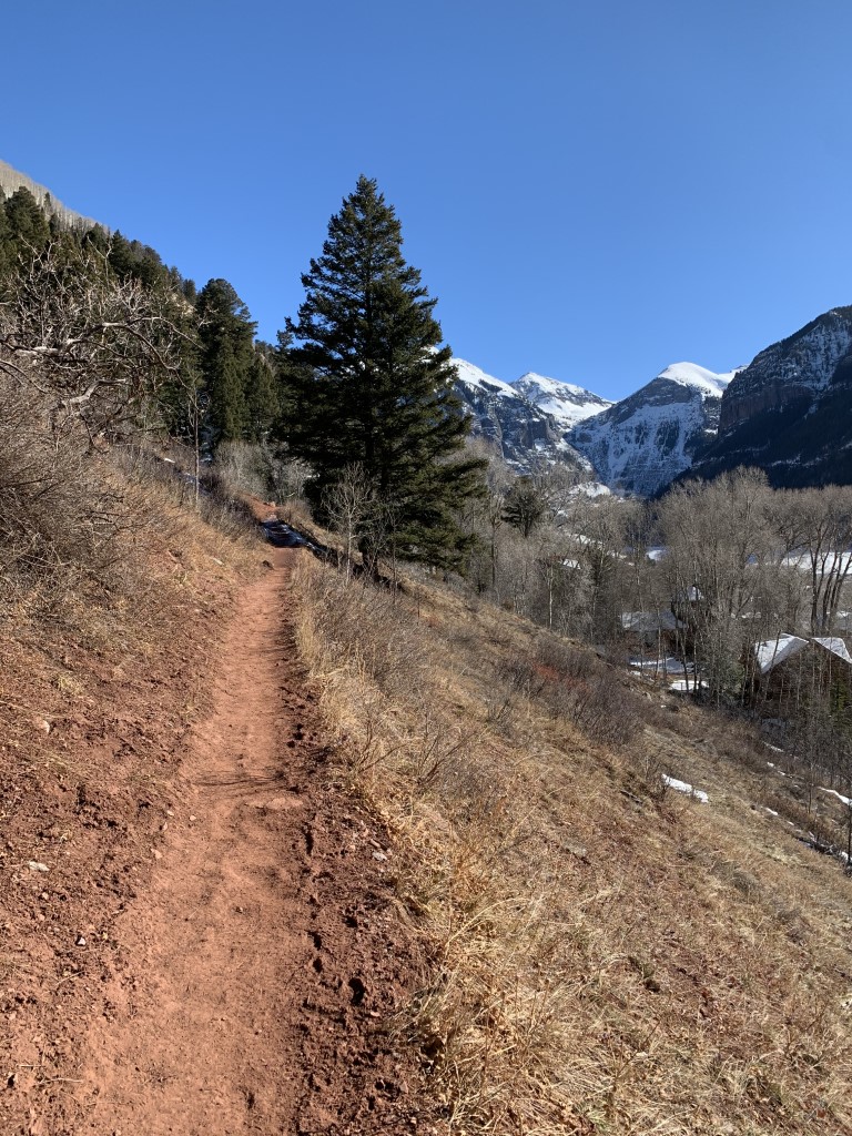
Tips: We hiked the loop starting at Aspen Street and ending at Tomboy Road. You can also do this hike in reverse too! The sun shines on this side of the mountain so this trail is one of the first to clear of snow but it would also be a great snowshoe hike too. The views are truly unbeatable and there’s even a bench at its highest point to enjoy the panoramic views. The trail was named in memory of Jud Wiebe, a Forest Service recreation manager who planned the trail but passed away of cancer in 1986 before the trail was completed.
Directions: Trail starts at the north end of Aspen Street in downtown Telluride and the coordinates are for the trailhead. Parking is available nearby on the street but not at the trailhead.
| Mileage (round trip) | 3 |
| Difficulty | Moderate |
| Gain (in feet) | 1213 |
| Trailhead | 37.941016, -107.812444 |
| Hike Time (in hours) | 2-3 |
| Exposure | Mostly Shady |
| Scenery | Mountain Views, Forest, Creek |
| Facilities | None |
| Fees/Permits | None |
| More Info | https://rootsrated.com/telluride-co/hiking/jud-wiebe-trail |
| Last Hiked | 12/7/2020 |