Sweetwater River Trail
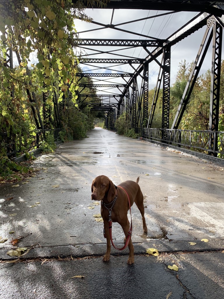
Cappie’s Scoop: This hike starts on a really cool bridge! The bridge is so wide that I’m not scared of this one and it doesn’t wiggle. We’ve seen lots of birds, bunnies and coyotes here. Mom says there are also road runners which are birds that run really fast on the ground, I want to see one of those one day! Maybe challenge them to a race to see who’s faster! Don’t hesitate to add YOUR scoop in the comments below!
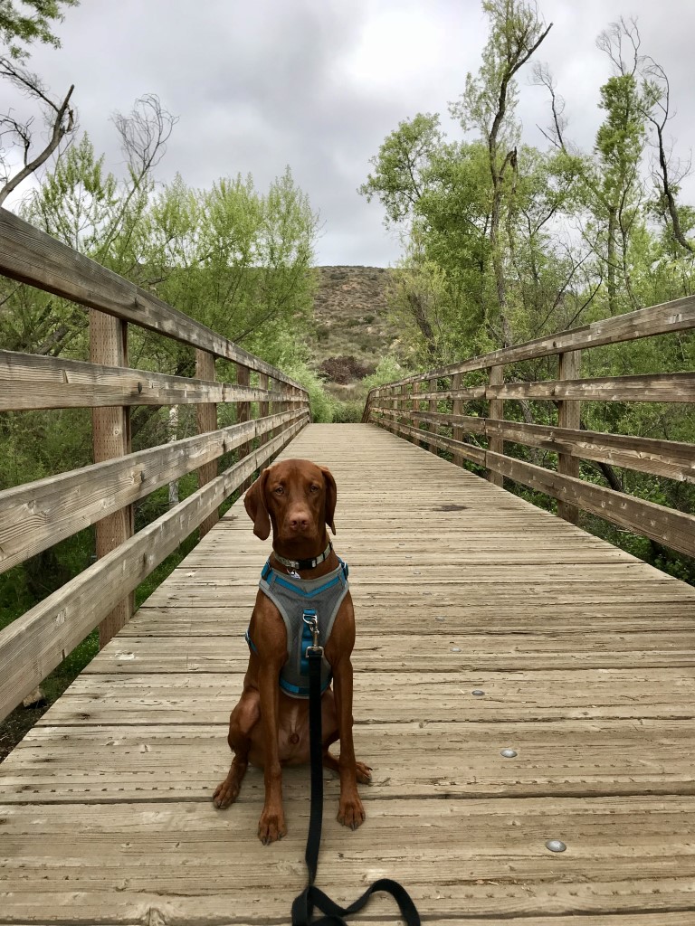
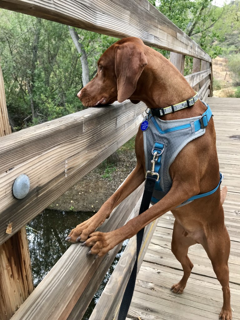
Tips: This hike is in the San Diego National Wildlife Refuge. It starts at the historic Sweetwater River Bridge also known as Steele Canyon Bridge built in 1929. Once you cross the bridge, look for a pair of large boulders and the trail starts by walking through them. There are a few intersections along the way. For all of them we went straight or took the fork to the right. At about 1.1 miles, we took a right to find the wooden bridge and Cappie looked for ducks! Then we decided to return the way we came and took one of the paths we passed earlier to check it out but still arrived back at the same starting point.
Directions: Take 94 east until it turns into Campo Road. Turn right onto CA-94 E/Campo Road. Turn right onto Singer Lane. The parking area is immediately on your left.
| Mileage (round trip) | 2.3 |
| Difficulty | Easy |
| Gain (in feet) | Negligible |
| Trailhead | 32.734118, -116.941074 |
| Hike Time (in hours) | 1-2 |
| Exposure | Sunny and Shady |
| Scenery | Trees, Wildlife, Wildflowers, Birds, River |
| Facilities | None |
| Fees/Permits | None |
| More Info | http://hikingsdcounty.com/san-diego-national-wildlife-refuge-sweetwater-river-traill |
| Last Hiked | 11/8/2020 |


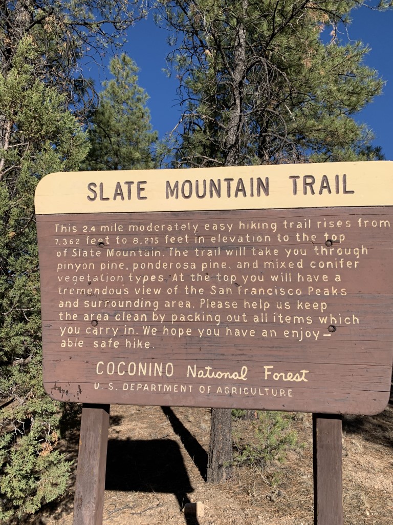
Slate Mountain
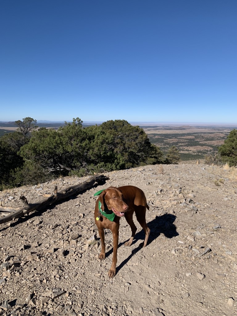
Cappie’s Scoop: This trail was closed for a while due to some wildfires but when it opened back up, I wanted to check it out! It was a very quiet trail with hardly anyone there. There are informational signs along the trail that describe the trees and bushes. Mom had to stop and read them all. One tree was really cool, the Alligator tree! No, it didn’t bite me but it had some cool bark on it. Haha! Once we got to the top, I had a lot to check out. You can see all the mountains around us. I told mom all we needed was a couple chairs or a hammock to stay a while! Don’t hesitate to add YOUR scoop in the comments below!
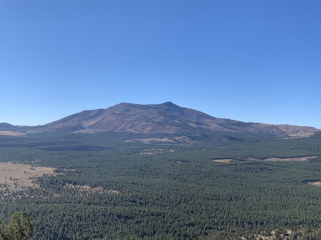
Tips: A great hidden hike that provides views of the San Francisco Peaks, Kendrick Mountain, Red Mountain, the Grand Canyon, and the Painted Desert from the top of Slate Mountain. Also along the trail, there are markers with information about the trees in the area which was fun to read. Look for the Alligator Juniper, pretty cool tree!
Directions: To reach the trailhead from Flagstaff, go North on US 180 for about thirty miles then turn left on FR 191. Follow 191 for two miles and you will come to the trailhead parking on your right. We attempted to drive this road after it had rained and it was very slippery. The dirt road is also mud that sticks to your tires and your shoes (we shouldn’t have gotten out of the car!) and you may want to visit another day.
| Mileage (round trip) | 4 |
| Difficulty | Easy |
| Gain (in feet) | 810 |
| Trailhead | 35.485768, -111.836128 |
| Hike Time (in hours) | 2-3 |
| Exposure | Sunny |
| Scenery | Mountain Views |
| Facilities | None |
| Fees/Permits | None |
| More Info | https://www.fs.usda.gov/recarea/coconino/recarea/?recid=55180 |
| Last Hiked | 10/16/2020 |


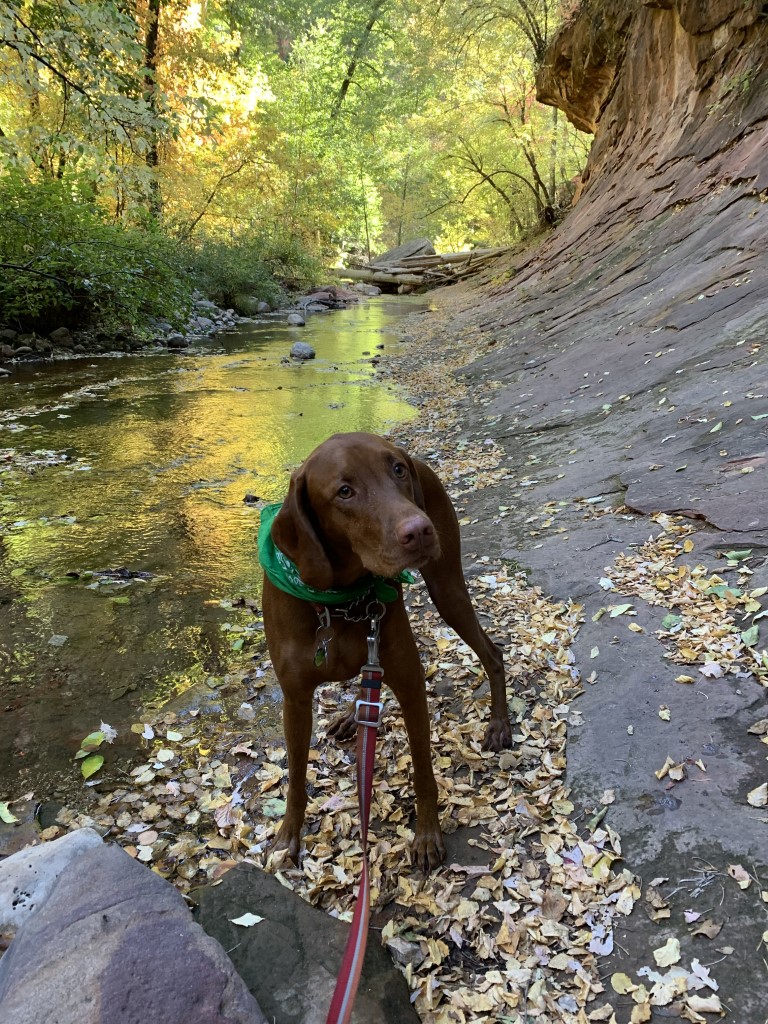
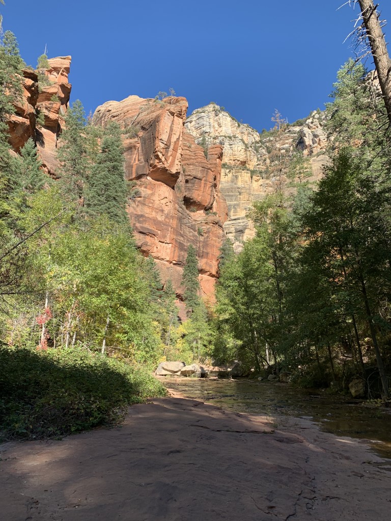
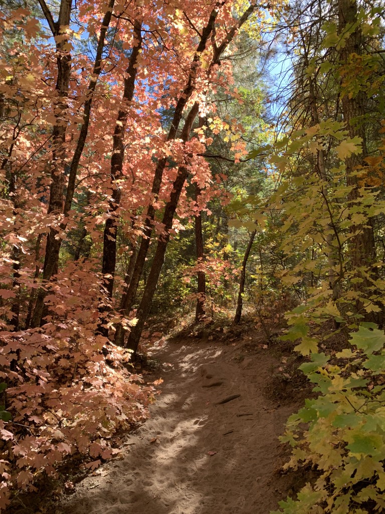
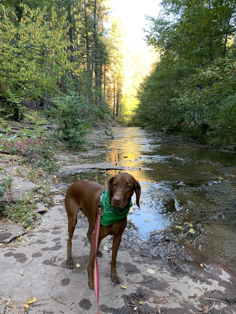
West Fork of Oak Creek
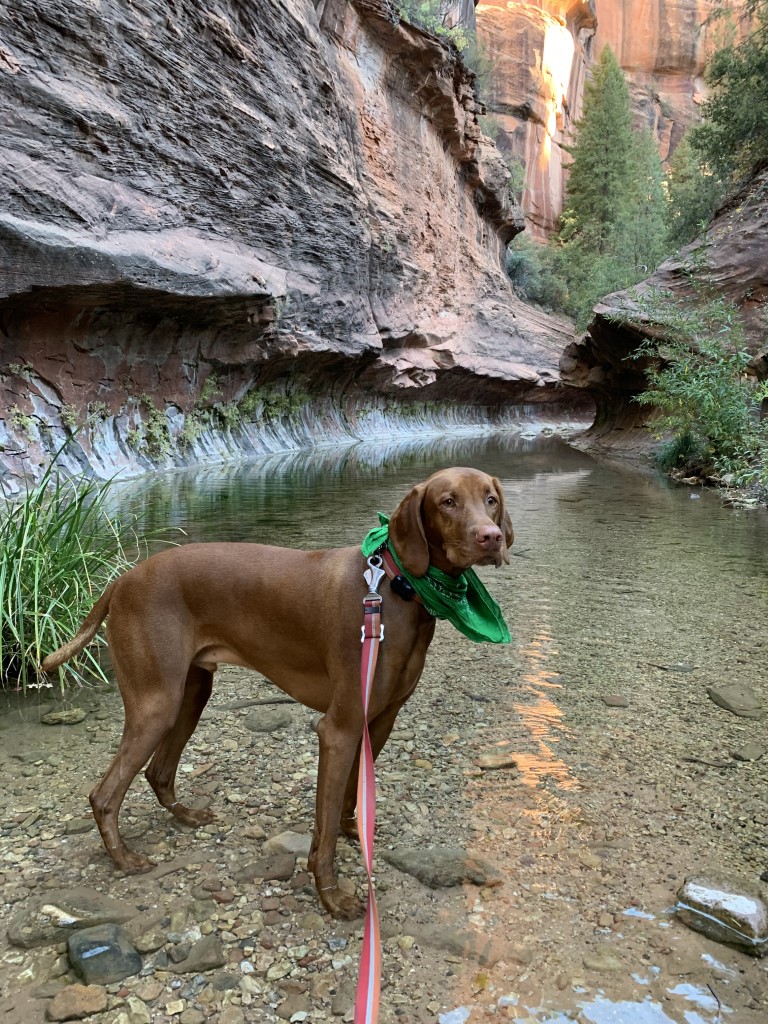
Cappie’s Scoop: Water and sand, this was so much fun! I felt like I was at the beach. The trail is very sandy and we crossed the stream like 13 times so I got my paws wet a lot which cooled them off. At the end of the maintained trail is a narrow canyon that had a lot of water. Mom said if she had some water shoes and neoprene socks, we would’ve kept going another 2 miles through the canyon pool! I hope we can do that one day – what a fun adventure that would be! Don’t hesitate to add YOUR scoop in the comments below!
Tips: This canyon is a great spot to visit any time of the year! I’d recommend checking the weather before you go because the canyon can get hot even though there is a lot of shade on the trail. We hiked this spot at the start of fall and the canyon colors were really amazing – red, yellow, orange, and pink! There are some gorgeous red maple trees that were just so vibrant! If you go in the winter, there are icicles that hang from the red rocks.
Directions: The turn to the parking lot is off of 89A. If you’re coming from Sedona, it will be a left turn and if you’re coming from Flagstaff, it will be a right turn. The parking lot is very small so arrive early. If the lot is full, you will be waiting in line until someone leaves.
| Mileage (round trip) | 8 |
| Difficulty | Easy |
| Gain (in feet) | 365 |
| Trailhead | 34.990200, -111.741658 |
| Hike Time (in hours) | 3-4 |
| Exposure | Mostly Shady |
| Scenery | Creek, Wildlife, Wildflowers, Trees |
| Facilities | Toilets in parking area. |
| Fees/Permits | Day use is $11 per vehicle (up to 5 people), $2 per person if you walk-in or bicycle. The Grand Annual Red Rock Pass is also accepted here. |
| More Info | https://www.fs.usda.gov/recarea/coconino/recarea/?recid=55432 |
| Last Hiked | 11/21/2018, 10/15/2020 |


Frosty’s Forest & Pumpkin Patch

The Parkhouse Pack’s Scoop: Frosty’s in Chino is a great dog friendly pumpkin patch in the fall, complete with a sunflower field and corn maze which the dogs are also allowed in. They had a wide assortment of pumpkins for a fair price. During the winter it turns into a Christmas tree farm, bring the dogs to help you pick the perfect tree….but no marking it lol.
| Location | 14861 Ramona Ave, Chino, CA 91710 |
| More Info | https://www.frostysforest.com |
| Follow Us! | @sandi_n_aspen |


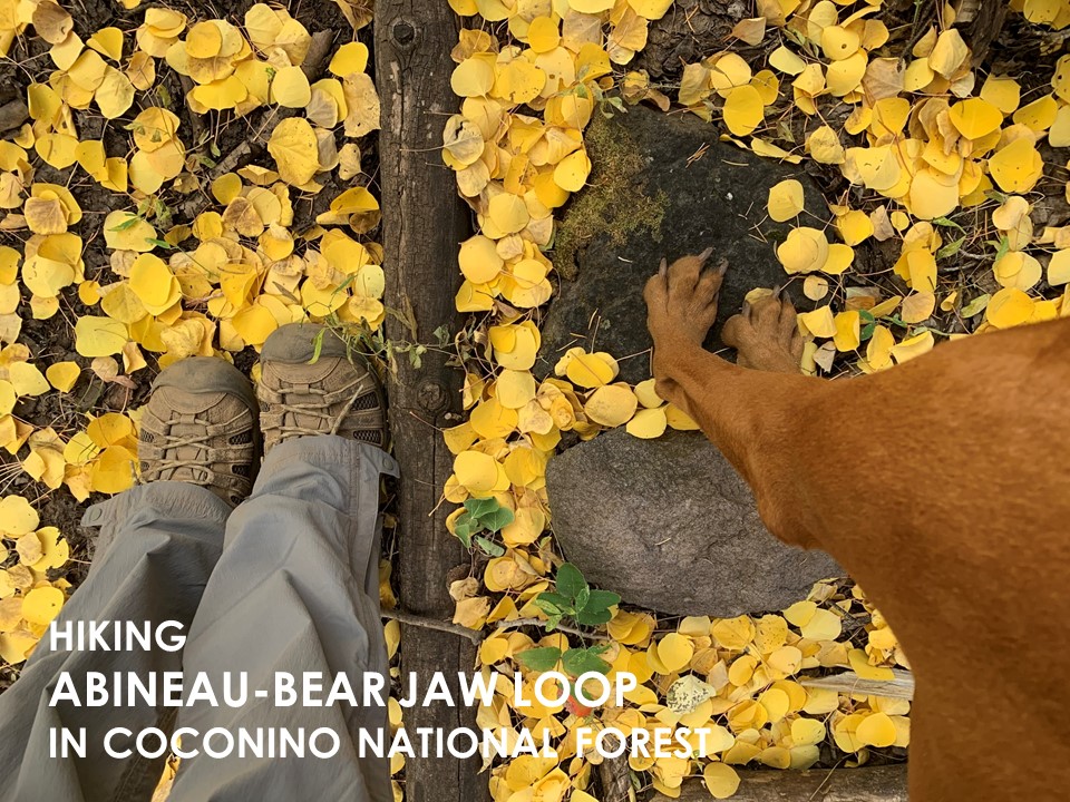
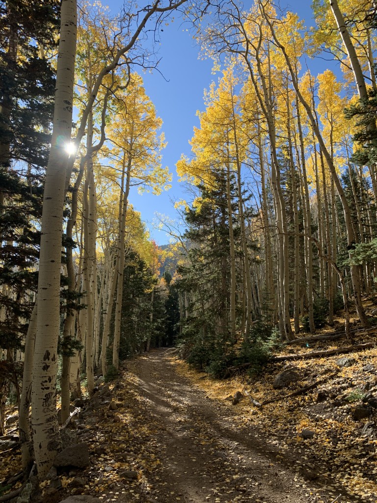
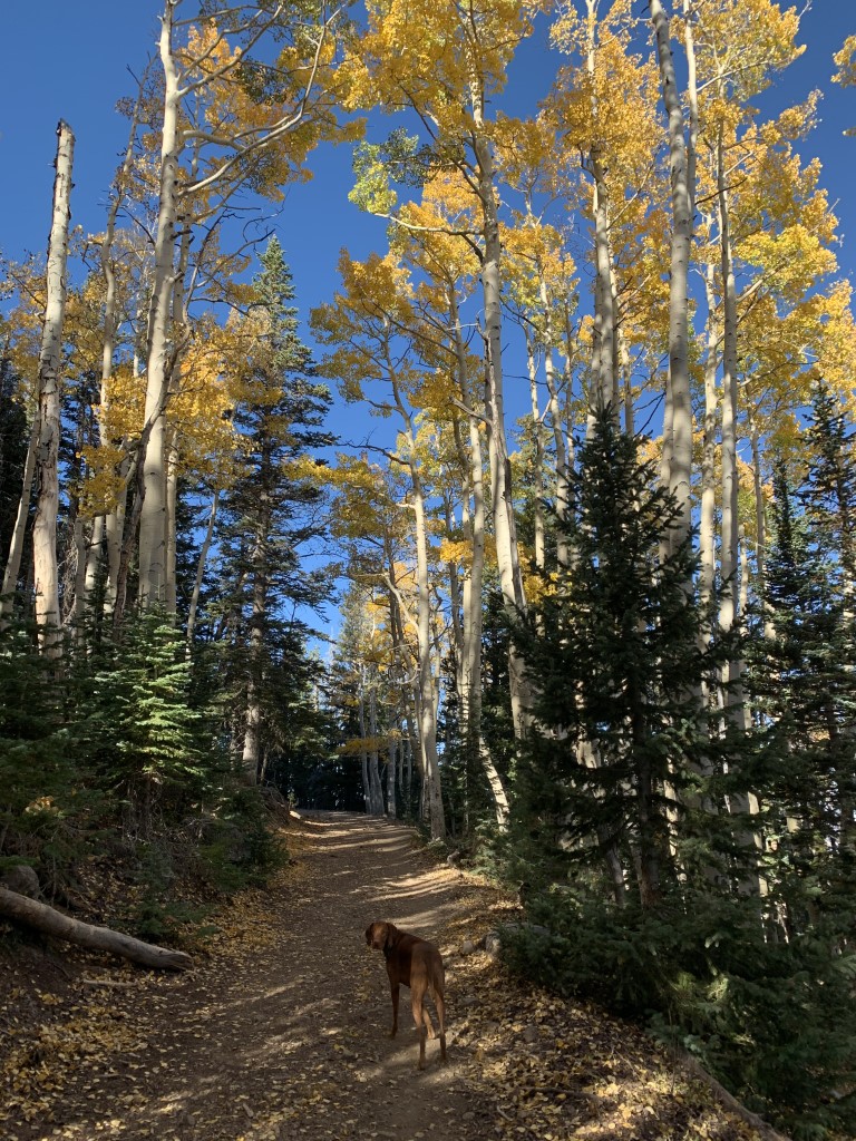
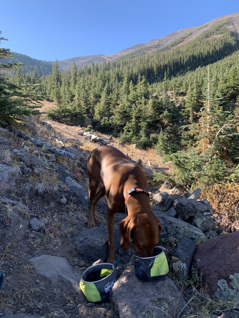
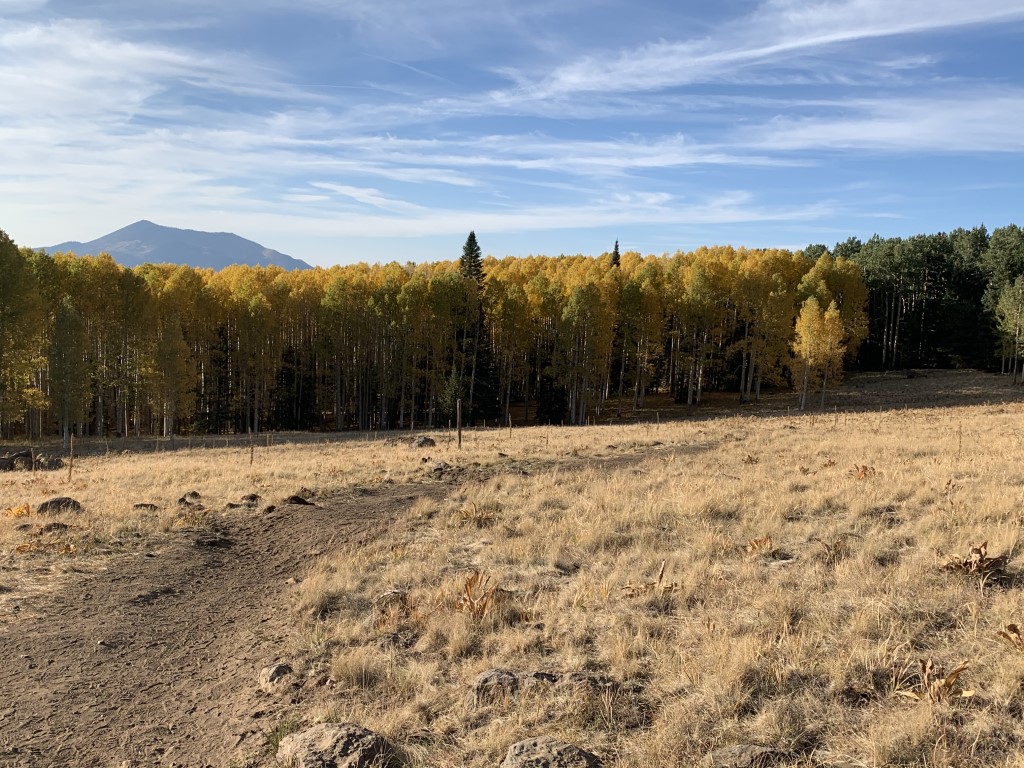
Abineau – Bear Jaw Loop – Fall
Cappie’s Scoop: This is the most amazing trail in Flagstaff! I’ll hike it any season unless the road is covered in snow and mom can’t make it to the trailhead. The trail is the most fun in the fall when the leaves are falling and crunchy! There are lots of sticks and shade too. Mom has also found a lot of cool looking funghi on the trail but they smell weird to me. I’ll stick with sticks! We always do a loop but you can also hike all the way down the Waterline Road and get to more trails including the Inner Basin! If you can make it here, come in the fall, it’s the best! Don’t hesitate to add YOUR scoop in the comments below!
Tips: Normally I would recommend going counterclockwise to get the steep part out of the way first and get to the snowy area faster during winter (check out our winter post here) but if you want to see the spot for fall colors quickly, go clockwise because it will take you right to the best area!
Directions: From Flagstaff, you can reach this trail from two different highways – either 180N or US-89N. Either way, you’ll be driving on a fire road to get to the trailhead. We didn’t need 4WD or high clearance although high clearance is nice. 1) We chose to take 180N because we wanted the least amount of driving time on the fire road. Take 180N for about 18.7 miles. Turn right onto FR 151. After 1.2 miles, continue straight onto FR 418. In about 3 miles, turn right to take the road to the trailhead. There is a sign for the trail. 2) Or take US-89N for 15.7 miles to Forest Road 420, which is directly across from the turnoff to Sunset Crater Volcano National Monument. Turn left onto FR 420 and continue about a half-mile to Forest Road 552. Turn right onto FR 552 and continue 1 mile to Forest Road 418. Turn right onto FR 418 and continue 8.1 miles to Forest Road 9123J. Turn left onto FR 9123J and continue 0.5 miles to the trailhead.
| Mileage (round trip) | 7 |
| Difficulty | Moderately Strenuous |
| Gain (in feet) | 2100 |
| Trailhead | 35.386737, -111.677171 |
| Hike Time (in hours) | 3-4 |
| Exposure | Mostly Shady |
| Scenery | Mountain Views, Forest |
| Facilities | None |
| Fees/Permits | None |
| More Info | https://www.fs.usda.gov/recarea/coconino/recarea/?recid=55058; https://www.arizonahighways.com/explore/hiking/abineau-bear-jaw-loop; https://www.azutopia.com/moderate-hikes/bear-jaw-abineau-trail-loop |
| Last Hiked | 10/12/2020, 10/10/2021 |


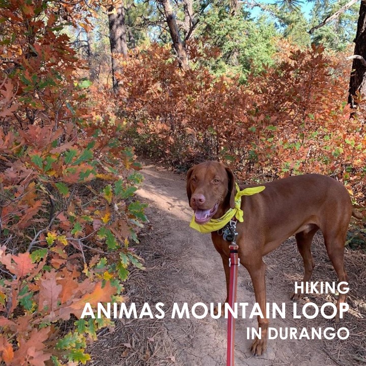
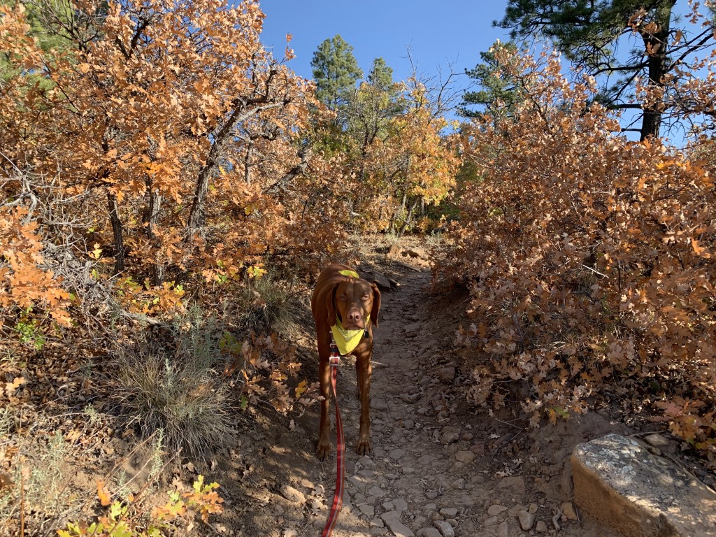
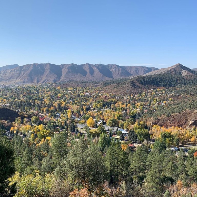
Animas Mountain Loop
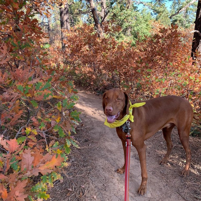
Cappie’s Scoop: I visited Durango and they have a trail in the town! I walked there with mom from our hotel and we started hiking up the mountain. There are really good views of the whole town and the Animas River. I was hoping to see the train but didn’t. If you go early, you will probably see some deer who like hanging out there too. Don’t hesitate to add YOUR scoop in the comments below!
Tips: We started at the east trailhead and hiked a 6 mile loop but there are a few trails (inner and outer loop trails) that you could also hike. Our loop hike brought us through the forest and up the mountain for a great view of the valley. This is also a popular climbing and bouldering area, so you even might see a few people scaling the rocks. We did this during the fall and we had a gorgeous view of Durango! The parking lot fills up on weekends so arrive early. Some of the higher trails may also close in the winter due to snow (seasonal closure, December 15 to April 15).
Directions: From the town of Durango, head north on Main Street and turn left on W 32nd Street and then a right on W 4th Ave. The parking lot/trailhead is about 300 ft up the road on your left.
| Mileage (round trip) | 6 |
| Difficulty | Moderate |
| Gain (in feet) | 1519 |
| Trailhead | 37.302807, -107.872669 |
| Hike Time (in hours) | 3-4 |
| Exposure | Mostly Shady |
| Scenery | Mountain Views, Trees, City Views |
| Facilities | None |
| Fees/Permits | None |
| More Info | https://www.durangotrails.org/?s=animas |
| Last Hiked | 10/11/2020 |
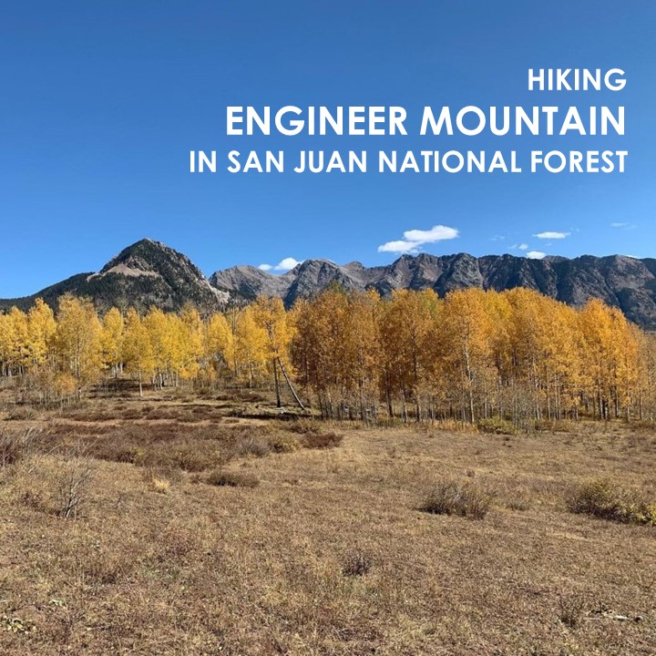
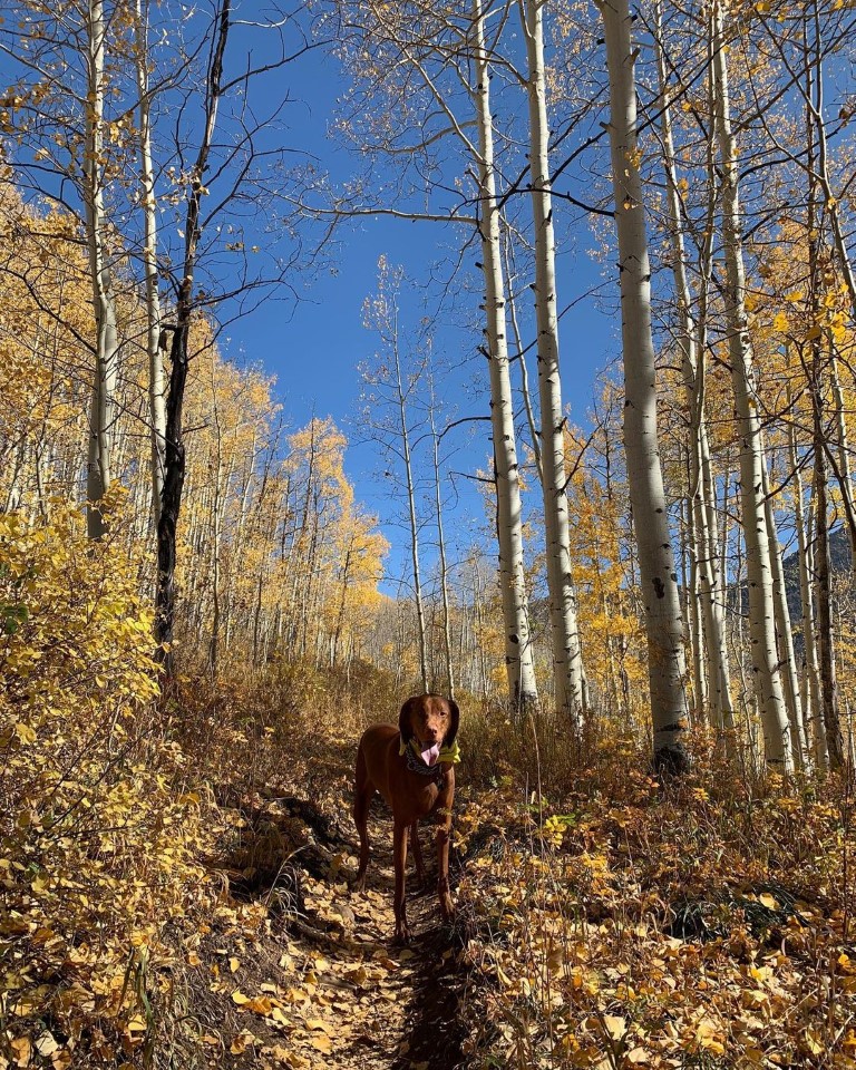
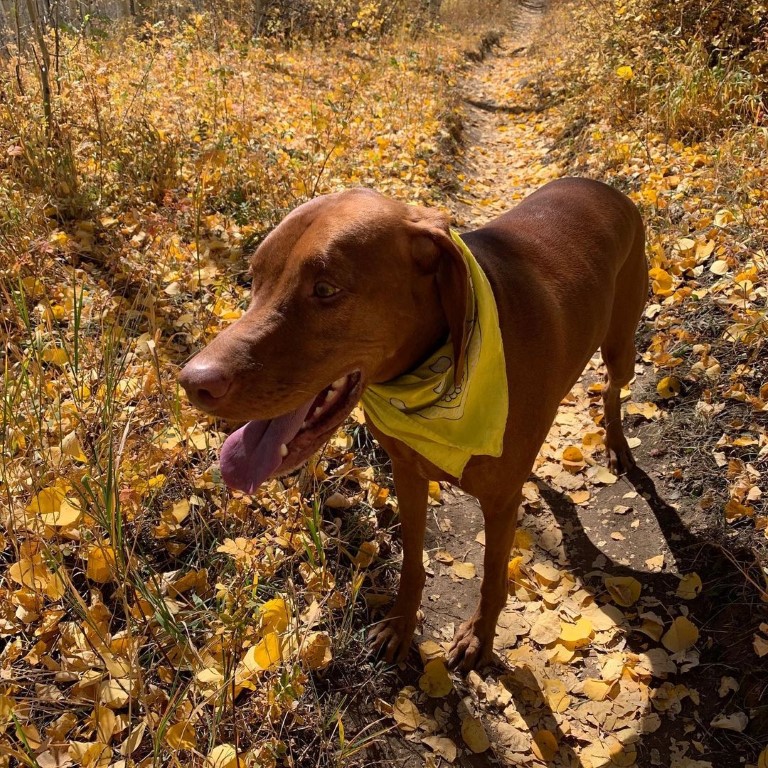
Engineer Mountain
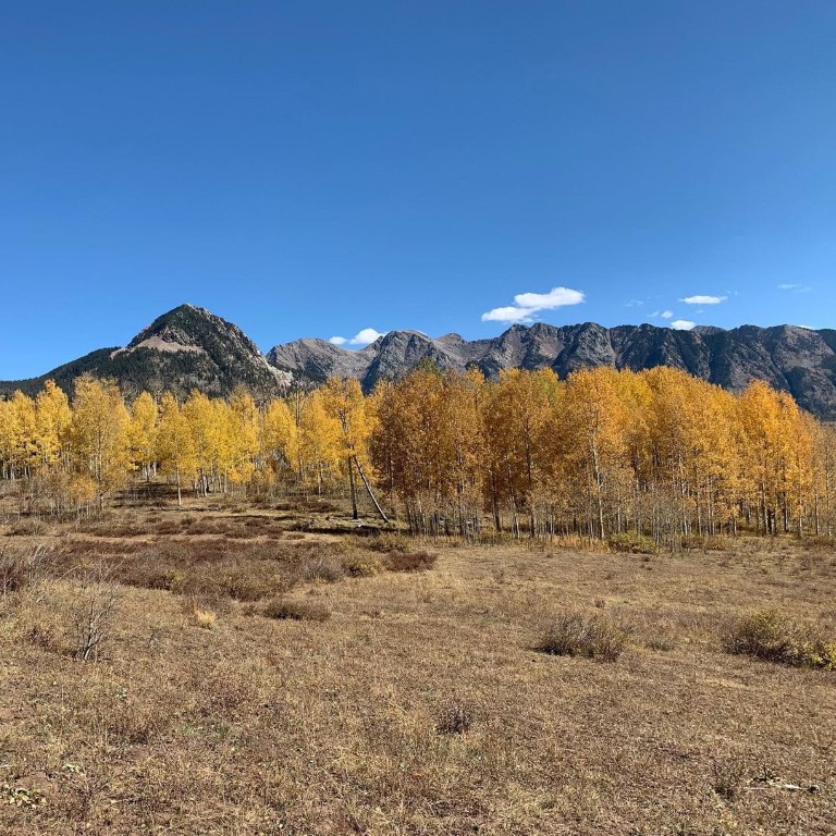
Cappie’s Scoop: This trail had lots of crunchy leaves because mom said it was fall! It smelled so good and I tried to crunch a few (ok a bunch) as we hiked up the mountain. We didn’t make it to the top because mom said it was very rocky and she was nervous I would like to stand on the edge which I do like to do – I need to get the best view! But we made it to “social rock” which was a perfect spot for saying hello to hoomans and other furry friends. Don’t hesitate to add YOUR scoop in the comments below!
Tips: There are a couple different trailheads to reach Engineer Mountain! See other post Engineer Mountain via Coal Bank Pass Trail for a shorter route. This trail is fantastic in the fall and during wildflower season!
Directions: From the town of Durango, head north on US-550 for about 29.3 miles and then turn left at an unmarked dirt road to find the trailhead parking area shortly down the road on your right.
| Mileage (round trip) | 12 |
| Difficulty | Strenuous |
| Gain (in feet) | 3100 |
| Trailhead | 37.660148, -107.800317 |
| Hike Time (in hours) | 6-8 |
| Exposure | Sunny and Shady |
| Scenery | Mountain Views, Forest, Wildflowers, Creek |
| Facilities | None |
| Fees/Permits | None |
| More Info | https://www.fs.usda.gov/recarea/sanjuan/recreation/recarea/?recid=42900 |
| Last Hiked | 10/10/2020 |
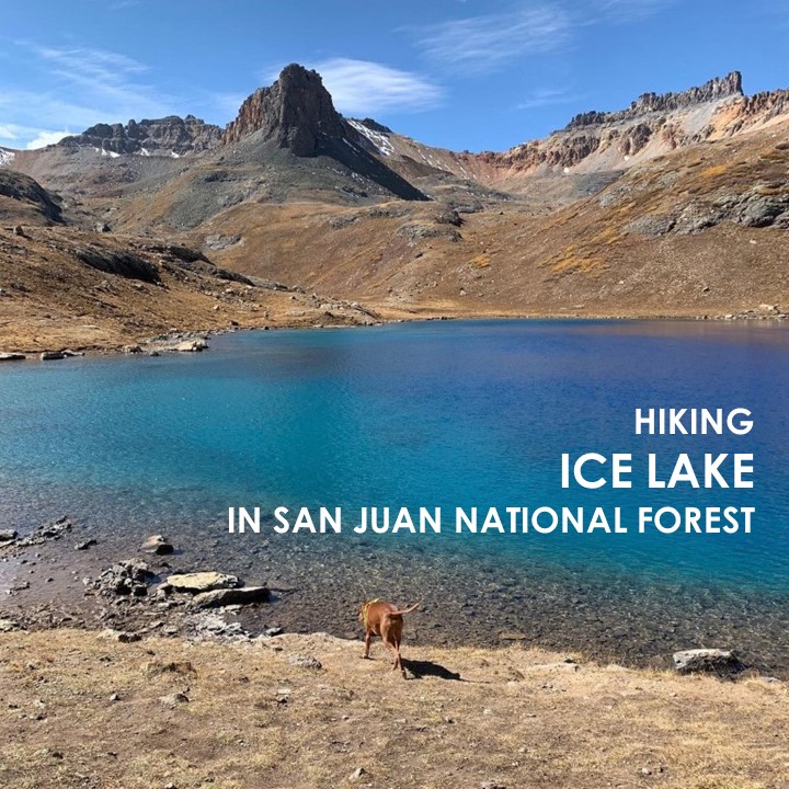
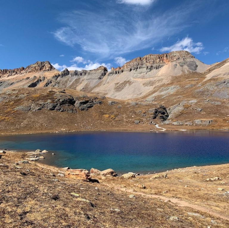
Ice Lake

Cappie’s Scoop: This trail was really cool! I hiked over a creek, past a waterfall, through the forest and then it opened up with some big meadows! Right before I started the tough climb up the mountain, I hopped over another creek. It was a tough hike but wow, when we saw that lake, it was the coolest color I’ve ever seen! It was very windy so Mom took a few photos and then we headed down. Don’t hesitate to add YOUR scoop in the comments below!
Tips: There are a number of amazing lakes in the Ice Lake Basin that you can hike to from this trailhead! There is even an option to do a bit of a loop to some of the lakes to include Island Lake, Ice Lake, and Fuller Lake. That route is about 8.6 miles with 3,070 ft elevation gain. You can also shorten this loop to hike just to Island Lake and Ice Lake which is about 7 miles with 2,650 ft elevation gain going clockwise. On this hike, we hiked to Ice Lake at 12,270 ft and back which is reflected in this post. Plus, dogs can be on leash or off-leash under voice control.
Directions: From the town of Silverton, head towards and turn slight right onto US-550 North. In about 2 miles, turn left onto Co Rd 7/Forest Rd 585. Continue down this dirt road passing dispersed camping sites and an established campground. The trailhead parking lot will be on your right in about 4.4 miles.
| Mileage (round trip) | 7 |
| Difficulty | Strenuous |
| Gain (in feet) | 2430 |
| Trailhead | 37.806673, -107.773987 |
| Hike Time (in hours) | 4-5 |
| Exposure | Sunny and Shady |
| Scenery | Mountain Views, Alpine Lake Views, Forest |
| Facilities | None |
| Fees/Permits | None |
| More Info | https://www.fs.usda.gov/recarea/sanjuan/recarea/?recid=42984&actid=50 |
| Last Hiked | 10/9/2020 |
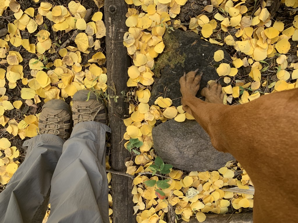
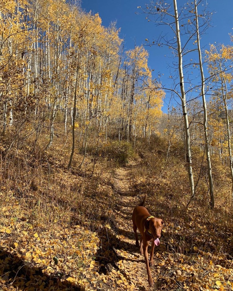
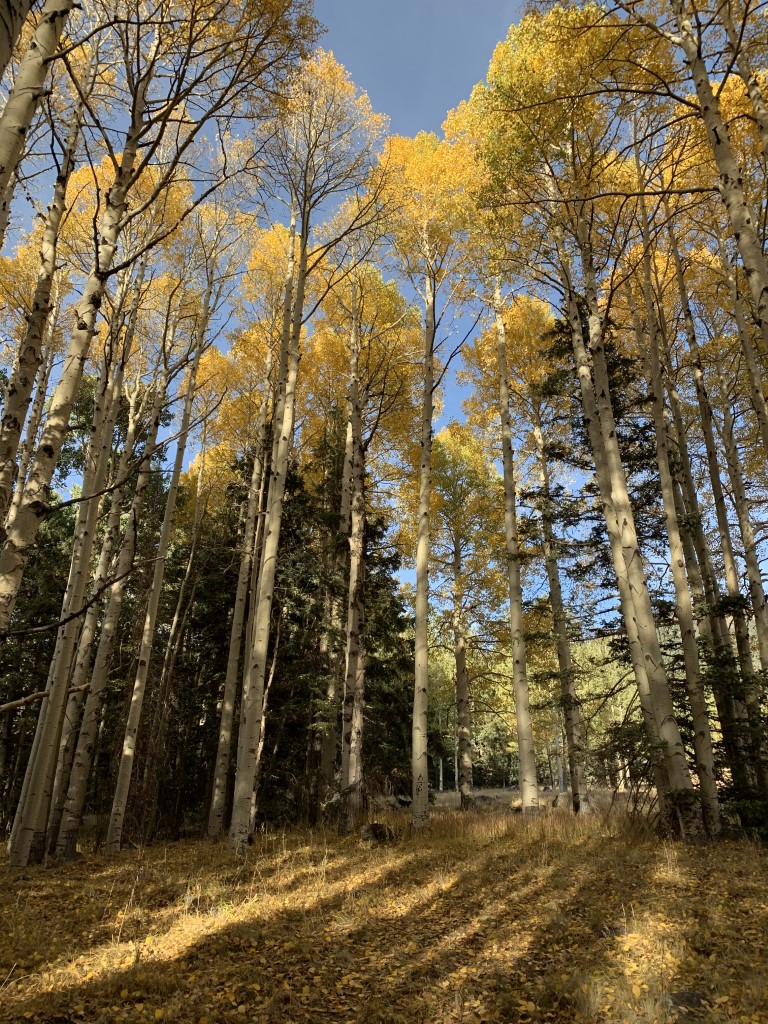
Aspen Nature Loop
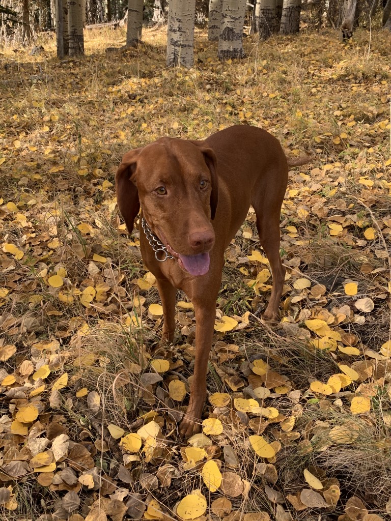
Cappie’s Scoop: You want the best place to see fall colors and get lost in yellow and gold aspen trees, this is one of the best trails in Flagstaff for it! Mom and I try to visit every year and hike this loop because it’s so pretty. Oh and the smells are really good too. There are a lot of leaves and grass in this aspen grove and I just want to roll around in it. It makes it really hard for mom to keep hiking because we stop a lot for good smells and of course photos. Mom takes my fall photo here every year! The parking lot for this hike is the same for Humphrey’s Peak. Don’t hesitate to add YOUR scoop in the comments below!
Tips: Need a quick fall fix, this 1.5 mile trail takes you through beautiful aspen groves where you can soak in all the fall colors and have a view of the mountains! Plus, the trail is often less crowded than other fall color hikes around Flagstaff.
Directions: From Flagstaff, head north out of town on Hwy 180. After mile marker 222, turn right onto N Snow Bowl Rd. following the sign for the Arizona Snowbowl. Continue up the windy road for 6.5 miles. You will come to a sign pointing left that says “LOT 1 Base Area Parking Humphrey Trail”. Turn left into that parking area for the trailhead.
| Mileage (round trip) | 2.5 |
| Difficulty | Easy |
| Gain (in feet) | 360 |
| Trailhead | 35.331063, -111.711646 |
| Hike Time (in hours) | 3 |
| Exposure | Shady |
| Scenery | Mountain Views, Forest, Wildflowers |
| Facilities | None |
| Fees/Permits | None |
| More Info | https://www.fs.usda.gov/recarea/coconino/recarea/?recid=55064 |
| Last Hiked | 10/5/2020, 10/11/2021, 10/8/2022 |


Pincushion Mountain
King & Sam’s Scoop: This is a short and sweet hike at around 4 miles out and and back. It’s a good uphill push to the peak without much shade. There are sometimes cows near the trail. The view from the peak provides stunning 360 degree views of the Table Mountains, Millerton Lake, and the San Joaquin River. It’s a popular hiking trail so expect there to be some others out on the trail.
| Mileage (round trip) | 4 |
| Difficulty | Moderate |
| Trailhead | 37.03731, -119.64977 |
| Follow Us! | @kingandsamexplore |