Yosemite National Park – Glacier Point
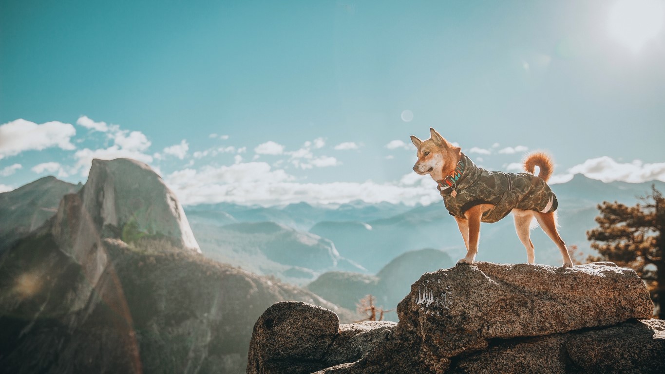
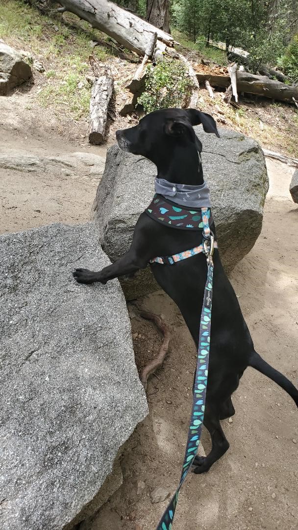
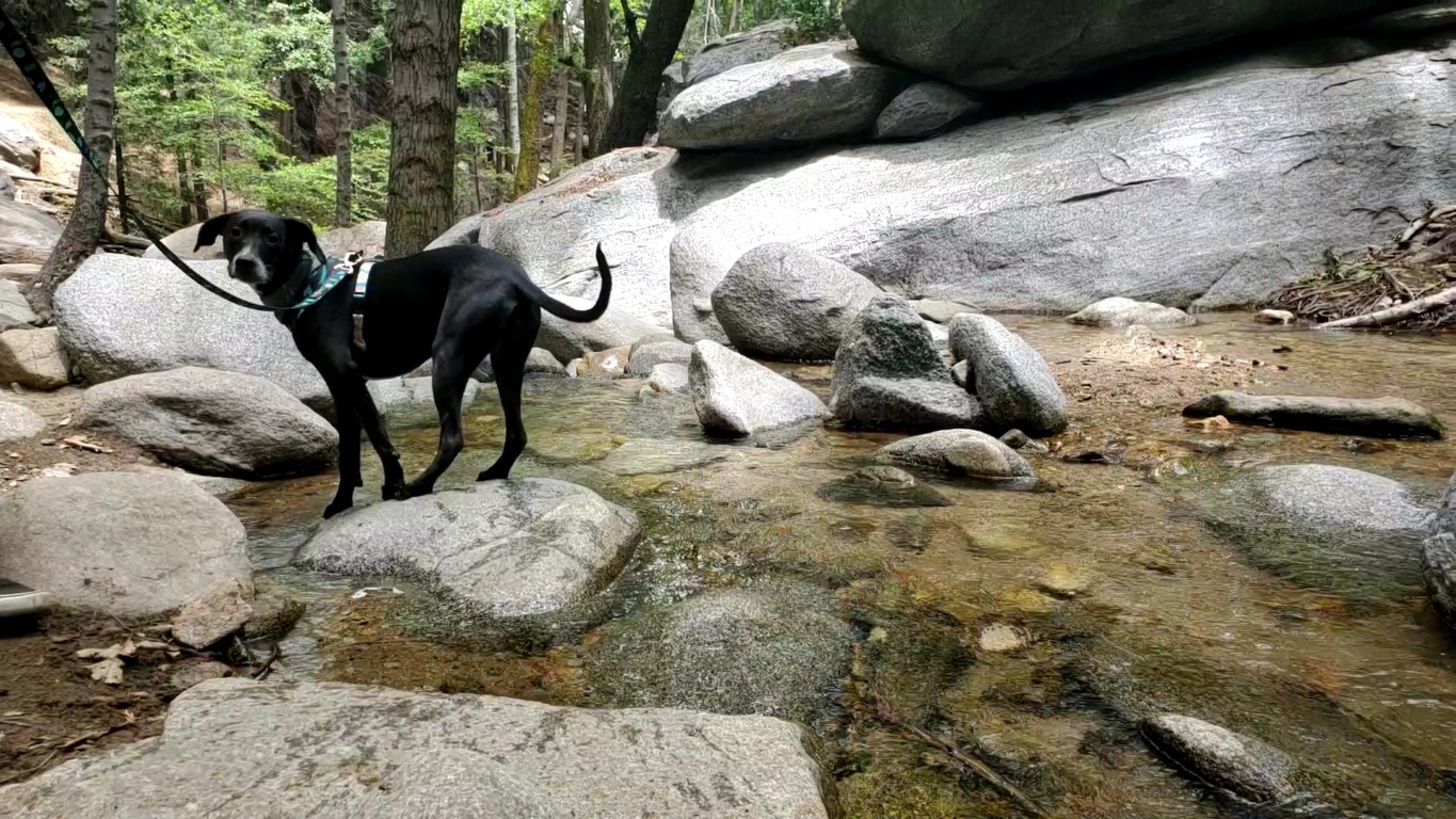
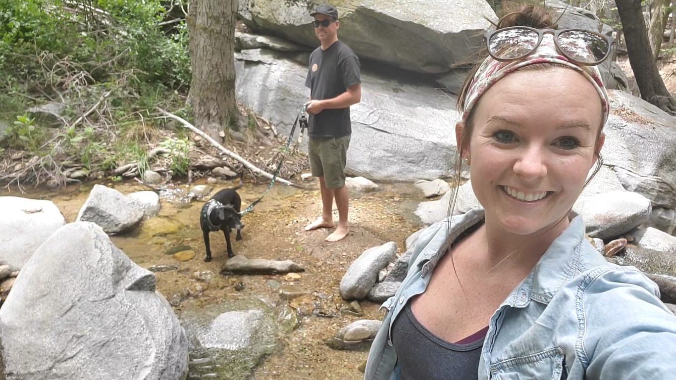
Amanda & Ippo’s Scoop: In October 2019 we decided to celebrate Ippo’s Barkday in style! So we packed up the car and took a road trip from SoCal to visit Yosemite. It was a trip to remember – the views were gorgeous and we found a few pet-friendly trails to hike. One of our favorite views was the Half Dome! It was a tad cold when we went but I feel the best season to visit Yosemite would be Fall through Spring. We definitely look forward to going back!
| Trailhead | 37.727630, -119.574435 (Glacier Point Trailhead/Parking Lot) |
| More Info | https://www.nps.gov/yose/planyourvisit/pets.htm |
| Follow Us! | @ippo_shiba_gram |
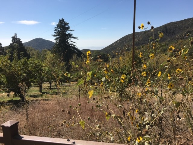
Oak Glen – Apple Country!

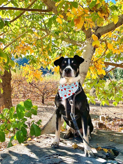
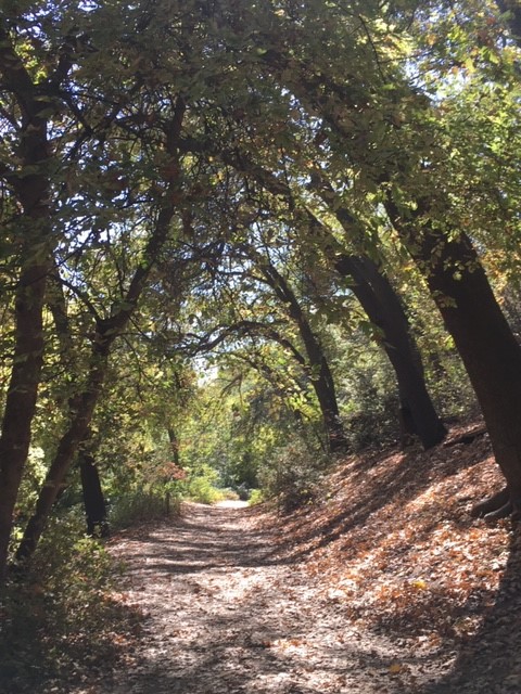
Catherine, Axel, & Rosie’s Scoop: Oak Glen is one of our absolute favorite places to go! It’s located off the 10 freeway just north of Yucaipa and Beaumont. Oak Glen is known for its apples, but it is fun to visit even if it isn’t apple season. The orchards are dog friendly and many of them have tasty treats including, barbecue, pies, roasted corn, mini donuts, and of course apples. There are some hiking trails and nature walks nearby. We recommend the Oak Glen Preserve and Southern California Montane Botanic Garden. It is gorgeous year round and dogs are always welcome. Snowline Orchard is a popular one and has allowed us to walk our dogs through the apple trees. We enjoy spending the afternoon there because they have a small winery and do tastings and the scenery is great. Oak Glen even has a few wedding venues ( my husband and I got married there!) and we know from experience that The Homestead at Wilshire Ranch is dog friendly! The best season to go to Oak Glen is fall; it is apple season and there are many fun activities. But the town is still open in the winter and there is snow.
| Location | 34.040244, -116.940956 (Oak Glen Preserve) 34.044495, -116.948029 (Snow-Line Orchard) |
| Follow Us! | @axelrosemary |


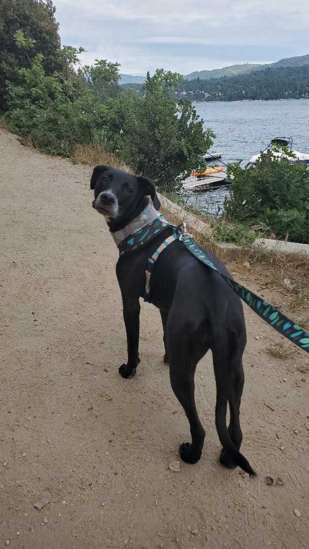
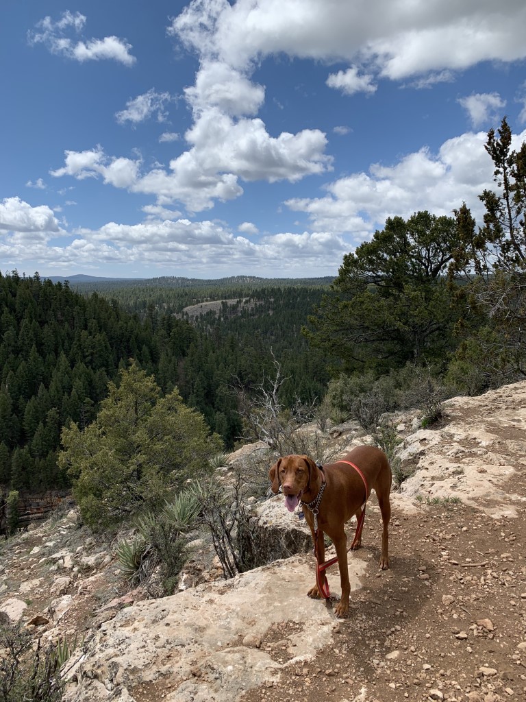
Lake Arrowhead Adventures
Rachael’s Scoop: This was my pups second camping trip and we decided it was time to take her to the mountains! We stayed at North Shore Campground and it was a great stay. I highly recommend the campground as it was less than a 5 minutes ride to see lake views. The lake is private but there are areas to get up close to the lake. We went late May and the weather was absolutely amazing! Cool at night and warm during the day. After our night of camping, we looked into hikes and found the Heart Rock Trail which was also dog-friendly. It was pretty crowded, but people were maintaining their distance which was nice. That was my pups first time in fresh water and boy was it chilly, but she loved it! The hike was a 1.7 mile loop trail and was a perfect way to end our weekend camping.
| Mileage (round trip) | 1.7 |
| Difficulty | Easy |
| Gain (in feet) | 285 |
| Trailhead | 34.267163, -117.165167 (North Shore Campground) 34.255686, -117.305856 (Heart Rock Trailhead) |
| Hike Time | 2 days |
| More Info | https://www.fs.usda.gov/recarea/sbnf/recarea/?recid=26247 |
| Follow Us! | @raqueel09; @dina_babe20 |


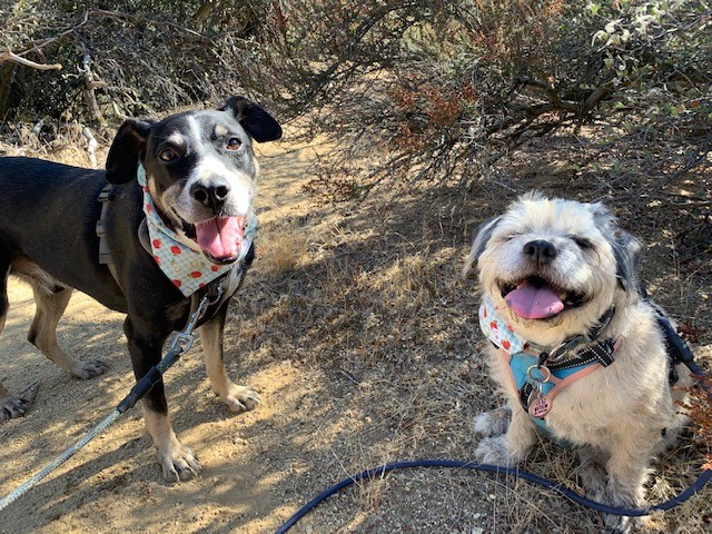
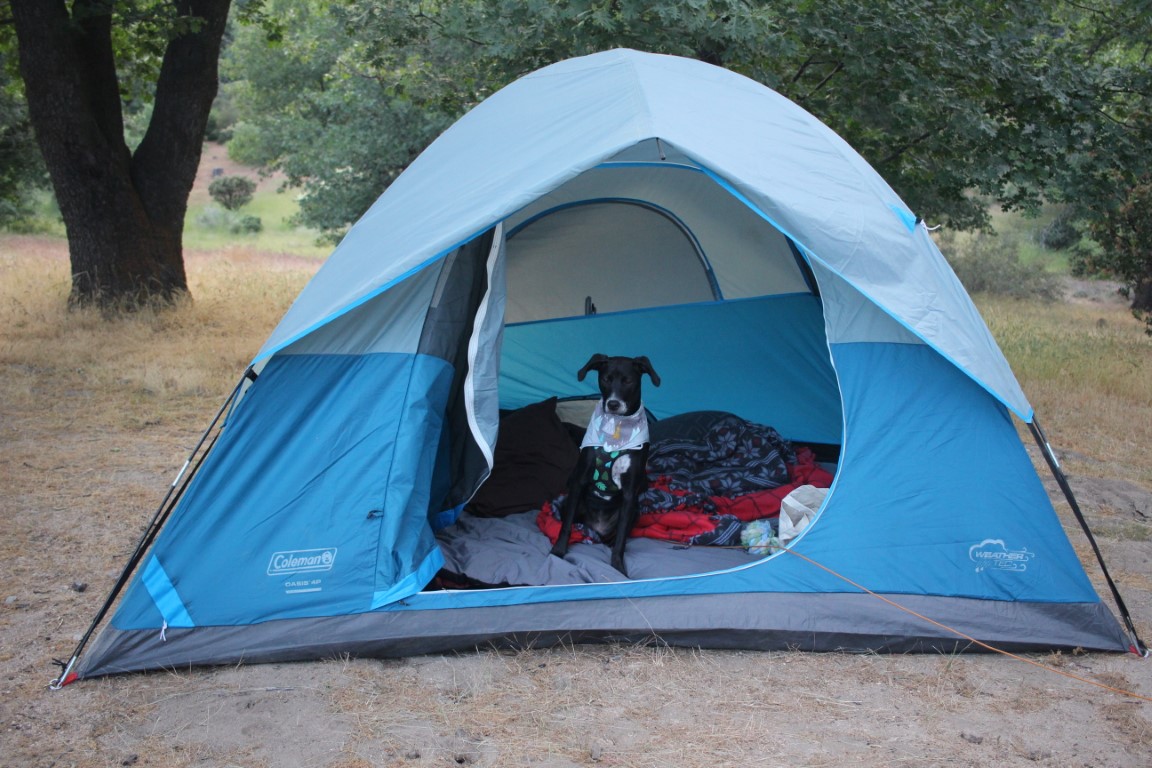
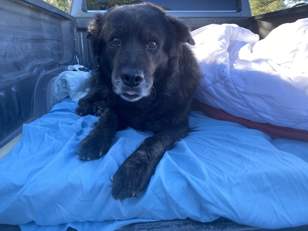
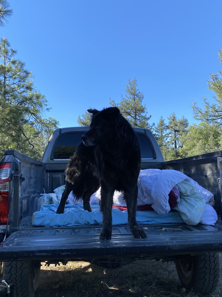
Kitchen Creek Camping
Doggo’s Scoop: Well a few weeks ago, my human and his human took me to the mountains. They’ve been taking me out a lot more often lately and I like that, a lot! They took me up, and we spiraled and spiraled in the truck for a good long time before we finally stopped and they let me out. It was nice and there were lots of trees and lots of flies and birds I got to chase. We spent the night next to a small fire, which was warm, and I got to claim my territory in lots of spots around the campsite! Then we went to sleep under the stars and in the morning we walked down the Kitchen Creek trail until the flies started swarming, which was gross, I can’t swat them off seeing as I have four legs, so we left! And we spun round and round the mountain again until we got back home! Yay!
| Mileage (round trip) | 3.6 |
| Difficulty | Moderate |
| Gain (in feet) | 620 |
| Trailhead | 32.747847, -116.451212 |
| Hike Time | 2 days |
| More Info | https://www.fs.usda.gov/recarea/cleveland/recarea/?recid=47570 |
| Follow Us! | @horchatabubbletea |
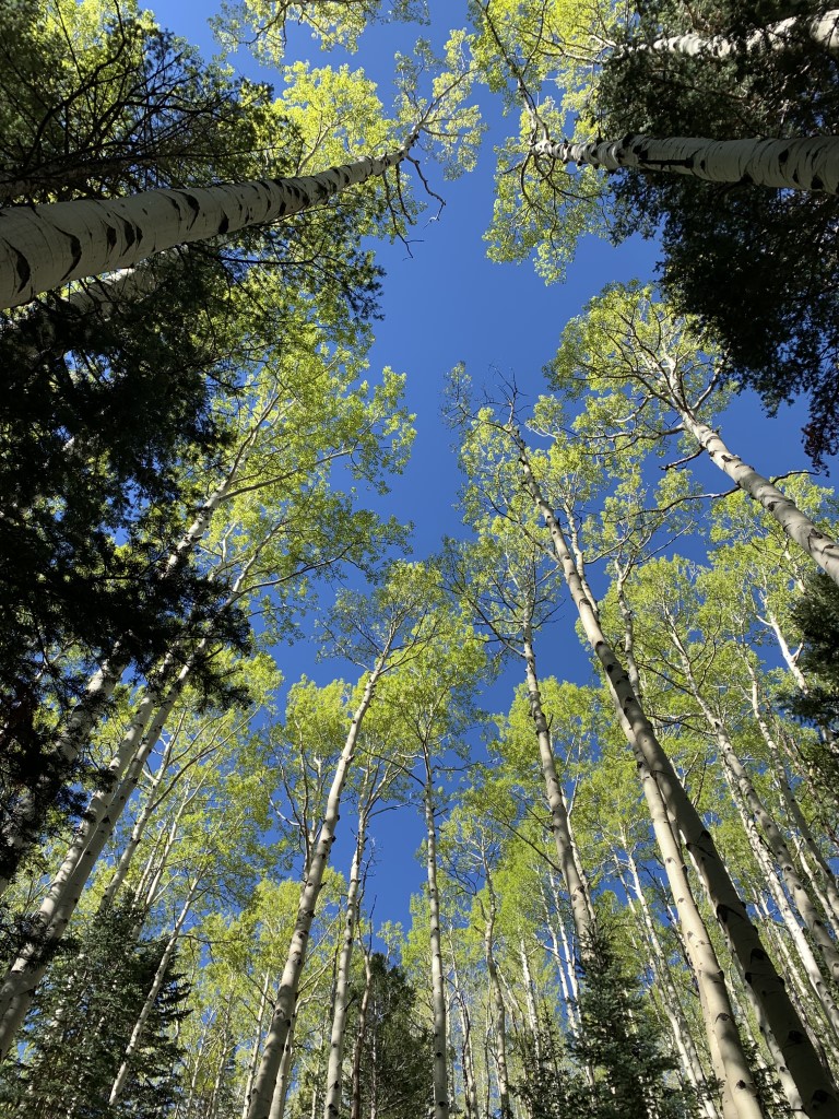
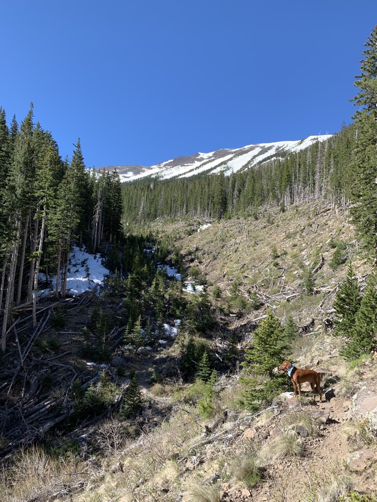
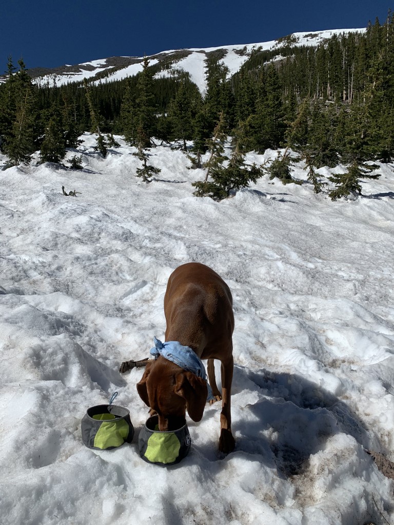
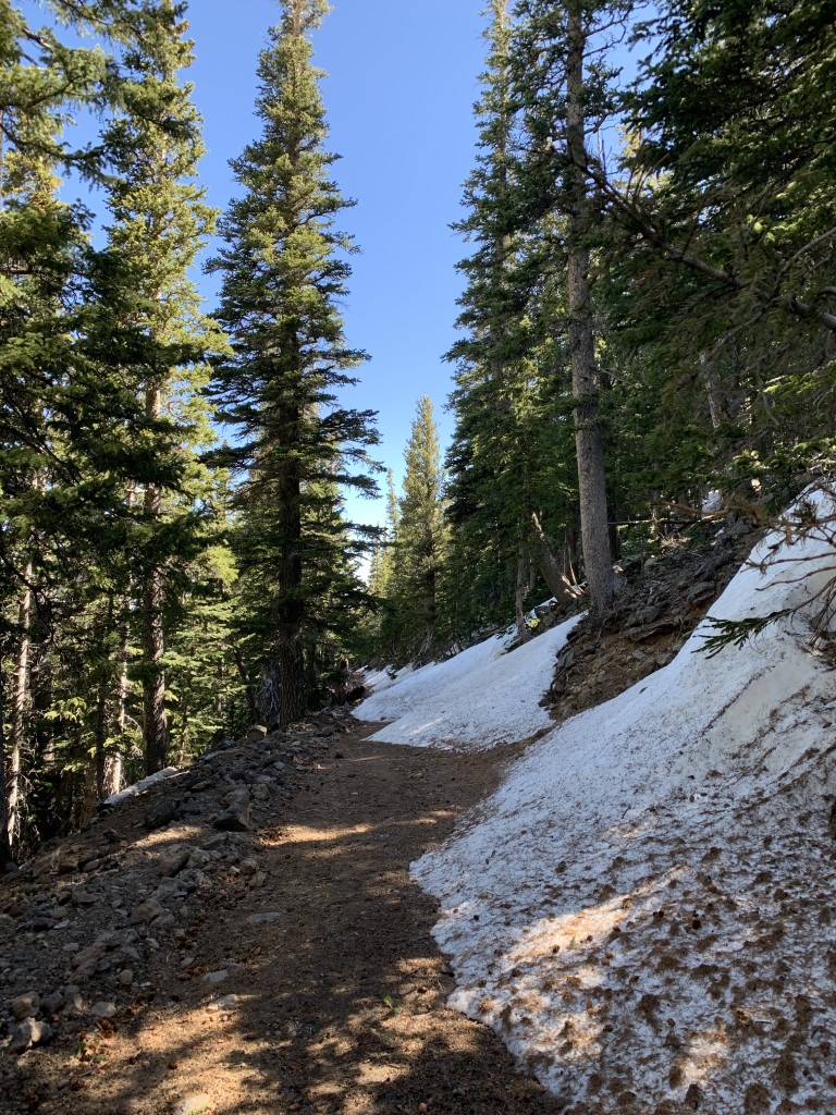
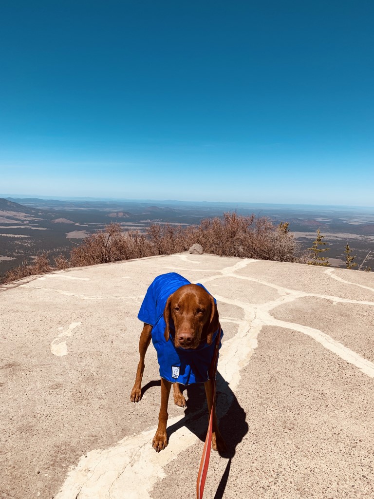
Abineau – Bear Jaw Loop – Winter
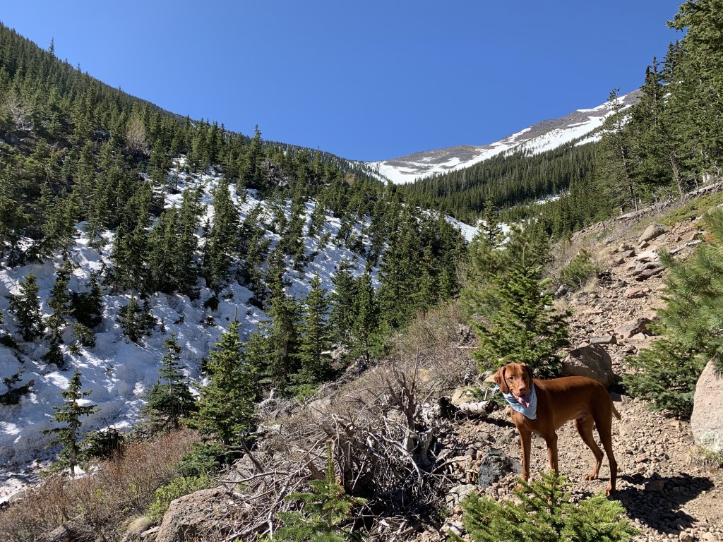
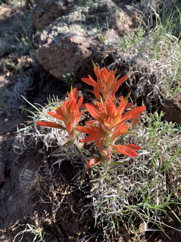
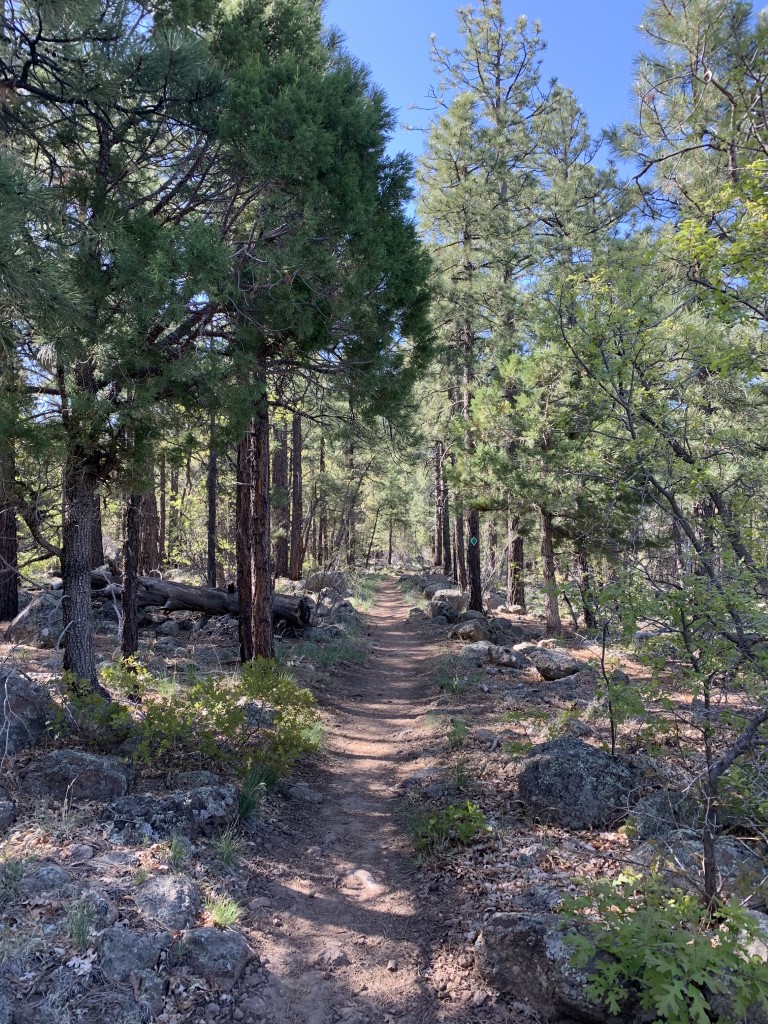
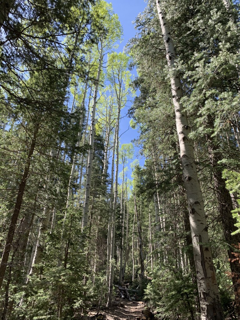
Cappie’s Scoop: Mom read that once we do this hike, it will be our favorite in the area. She was right! I can’t wait to come back again in the fall to see what it looks like. But for now, I had so much fun playing in the snow at 10,300 ft high! There was also no one else on the trail when we hiked it so we had the whole trail to ourselves. Mom and I decided to hike counter-clockwise (Abineau Trail first) and get to the snow quicker. Clockwise takes you on Bear Jaw Trail. It was only a little more than 2 miles and we saw it, the view of the highest peak in Arizona, Humphrey’s! We crossed over towards Bear Jaw Trail and headed down on Waterline Road first before turning left to continue on Bear Jaw. The aspen trees were everywhere! Mom kept stopping to take pictures but they all looked the same to me, big white sticks with green leaves! I’m sure it looks amazing in the fall and we’ll probably be back to see it … if mom has her way! Don’t hesitate to add YOUR scoop in the comments below!
Tips: Since this loop trail reaches an elevation of over 10,000, you may have to wait until the snow clears to be able to safely complete the loop. This is a great hike after the snow clears (or maybe still a little bit of snow to play in) and also a great fall hike too with the tons of aspen trees on the trail.
Directions: From Flagstaff, you can reach this trail from two different highways – either 180N or US-89N. Either way, you’ll be driving on a fire road to get to the trailhead. We didn’t need 4WD or high clearance although high clearance is nice. 1) We chose to take 180N because we wanted the least amount of driving time on the fire road. Take 180N for about 18.7 miles. Turn right onto FR 151. After 1.2 miles, continue straight onto FR 418. In about 3 miles, turn right to take the road to the trailhead. There is a sign for the trail. 2) Or take US-89N for 15.7 miles to Forest Road 420, which is directly across from the turnoff to Sunset Crater Volcano National Monument. Turn left onto FR 420 and continue about a half-mile to Forest Road 552. Turn right onto FR 552 and continue 1 mile to Forest Road 418. Turn right onto FR 418 and continue 8.1 miles to Forest Road 9123J. Turn left onto FR 9123J and continue 0.5 miles to the trailhead.
| Mileage (round trip) | 7 |
| Difficulty | Moderately Strenuous |
| Gain (in feet) | 2100 |
| Trailhead | 35.386737, -111.677171 |
| Hike Time (in hours) | 3-4 |
| Exposure | Mostly Shady |
| Scenery | Mountain Views, Forest, Wildflowers |
| Facilities | None |
| Fees/Permits | None |
| More Info | https://www.fs.usda.gov/recarea/coconino/recarea/?recid=55058; https://www.arizonahighways.com/explore/hiking/abineau-bear-jaw-loop; https://www.azutopia.com/moderate-hikes/bear-jaw-abineau-trail-loop |
| Last Hiked | 5/25/2020 |


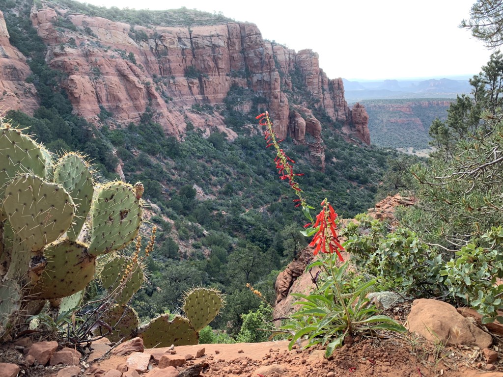
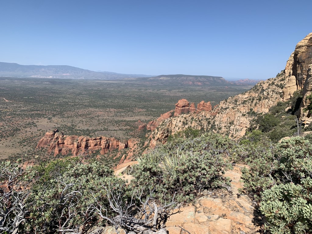
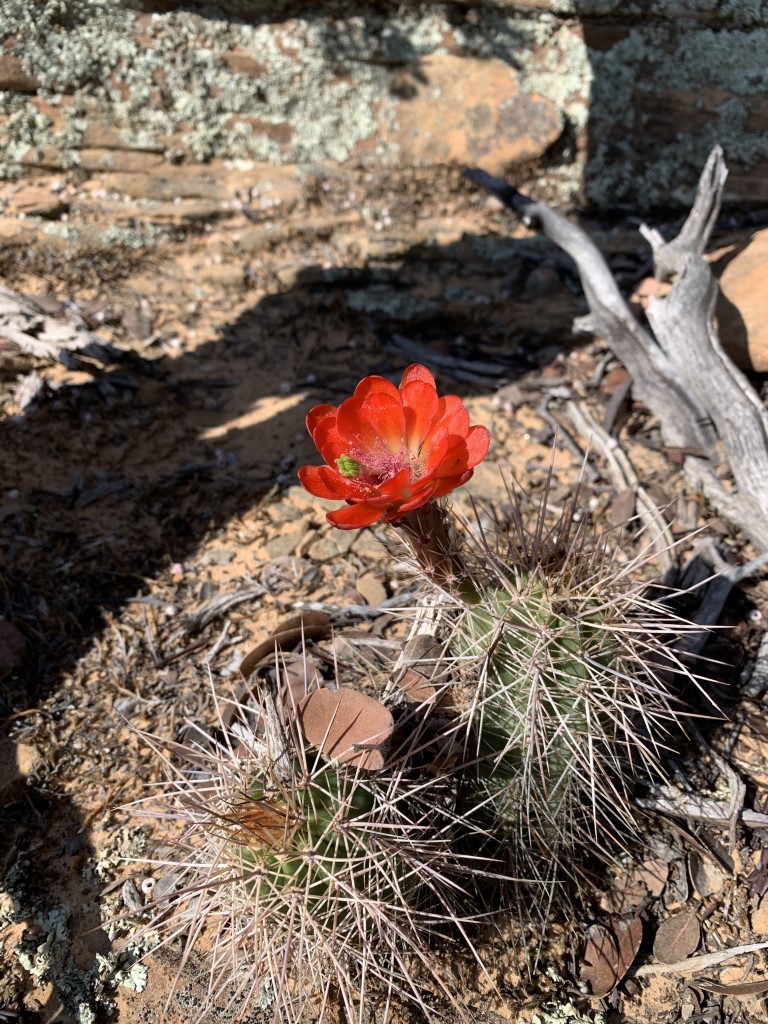
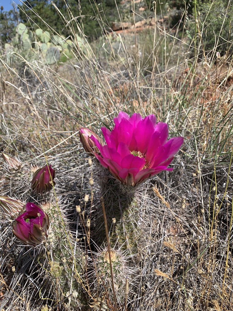
Bear Mountain
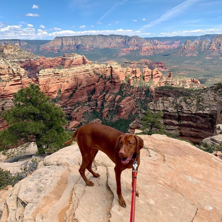
Cappie’s Scoop: This is one of my favorite hikes not only because the views are amazing but the rocks are RED just like me! And I get to climb a lot of rocks. The trail climbs and climbs with a few trees to hide under for some shade. Here’s the good news, you know when you’ve reached the end because it says “End of Trail.” Every time mom and I are close to Sedona, we will try and squeeze in this hike. Also, in case you were wondering, there are no bears on this trail except for one, me, Cappie Bear! Don’t hesitate to add YOUR scoop in the comments below!
Tips: This trail is a lot of climbing. You gain a good amount of elevation in only a couple miles. Be sure to start early because there is little to no shade. The sun may be behind the rocks early in the morning but it may come out in full force as the day goes on. We hiked this trail in May and we encountered a rattlesnake. There are a lot of rocks so keep your eyes open and have a plan in place if someone were to get bit. Since this is not a traditional dirt trail, the white painted blazes on the red rock help you navigate the route.
Directions: From Sedona, head south on 89A. Turn right onto Dry Creek Road. After 4.5 miles you’ll reach a stop sign. Turn left and follow the sign for Enchantment Resort. Continue 1.2 miles and the parking area is on the left. If it’s full, there are a few spots on the side of the road where you can pull off safely. The trail begins across the street from the parking lot.
| Mileage (round trip) | 4.6 |
| Difficulty | Moderately Strenuous |
| Gain (in feet) | 2109 |
| Trailhead | 34.893439, -111.865172 |
| Hike Time (in hours) | 3-4 |
| Exposure | Sunny |
| Scenery | Mountain Views, Wildflowers, Wildlife, Boulders |
| Facilities | Toilets in parking area. |
| Fees/Permits | Red Rock Pass or Interagency Annual Pass/America the Beautiful Pass (National Parks Pass). You can purchase daily ($5) and weekly ($15) Red Rock Passes from self-serve vending machines at this trailhead. These machines only accept credit cards for payment. For more locations plus options to buy an annual pass ($20) at the following link: https://www.fs.usda.gov/detail/coconino/recreation/?cid=stelprdb5416212#vendingmachines. |
| More Info | https://socalhiker.net/hiking-bear-mountain-in-sedona; https://www.arizonahighways.com/explore/hiking/bear-mountain-trail |
| Last Hiked | 11/20/2018, 5/10/2020 |


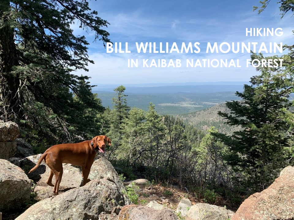
Bill Williams Mountain
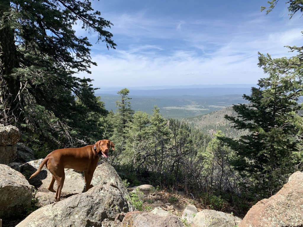
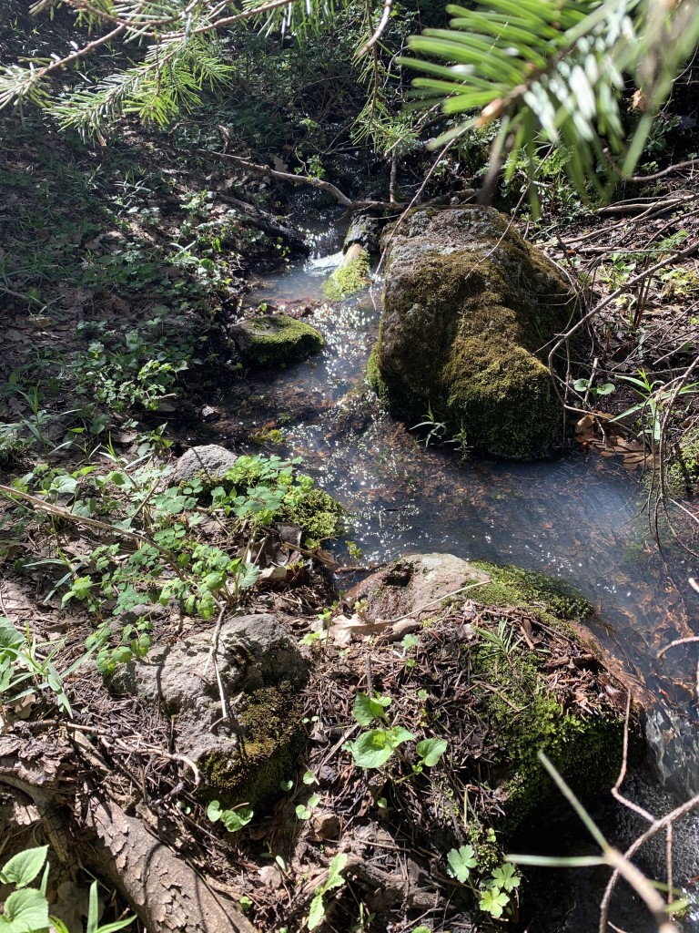
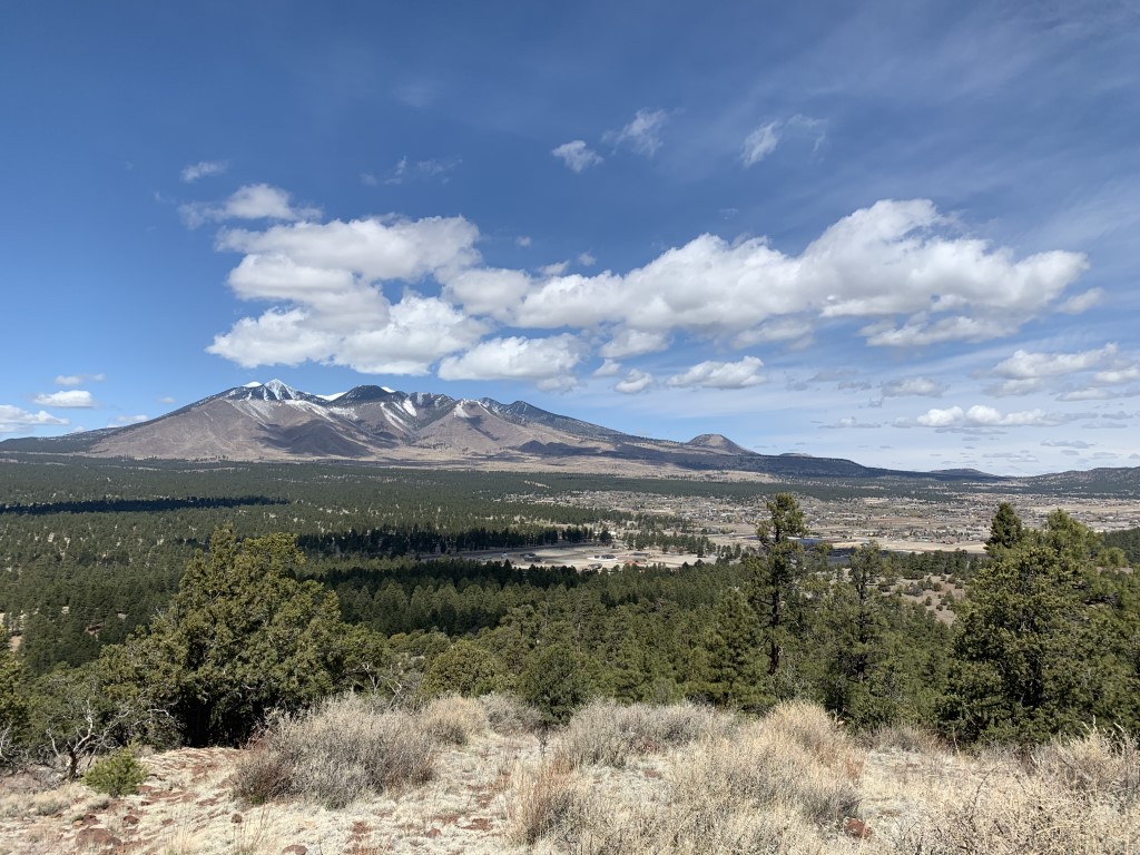
Cappie’s Scoop: Wow, mom finally found a trail with LOTS of shade! I got to do a lot of tree hopping because there were a few trees down blocking the trail. We passed a small creek on the way to the top and I stopped to soak my paws. Ahhh, it felt good! Once we found the top, I let out a huge sigh, another lookout tower that I can’t climb up inside. Mom sure does have a knack for finding lookout towers! Mom read some history on it and then she said that we’re standing on the oldest of the extinct volcanoes in Flagstaff, six million years old. Now she tells me. Well it gave us a great view of the area, thank you hot lava! Don’t hesitate to add YOUR scoop in the comments below!
Tips: None
Directions: From Flagstaff, head west on Rte 66 and take 40 West. Go about 29 miles and take exit 161 for Golf Course Dr., last exit for the town of Williams. At the end of the offramp take a left onto Rte 66, then take your next possible right onto Frontage Road. Go half a mile then make a left onto S Clover Rd. just after the sign with a ranger station icon. Go a quarter mile down this road and as it curves left, the trailhead parking will be on your right side.
| Mileage (round trip) | 7.3 |
| Difficulty | Moderately Strenuous |
| Gain (in feet) | 2250 |
| Trailhead | 35.237591, -112.214848 |
| Hike Time (in hours) | 3-4 |
| Exposure | Mostly Shady |
| Scenery | Mountain Views, Forest, Wildflowers |
| Facilities | Toilets in parking area. |
| Fees/Permits | None |
| More Info | https://socalhiker.net/hiking-bill-williams-mountain; https://www.arizonahighways.com/explore/hiking/bill-williams-trail |
| Last Hiked | 5/9/2020 |


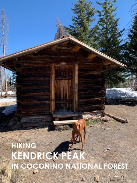
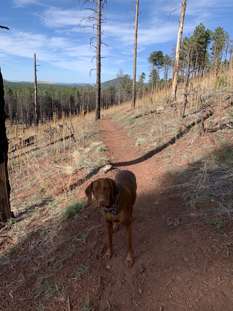
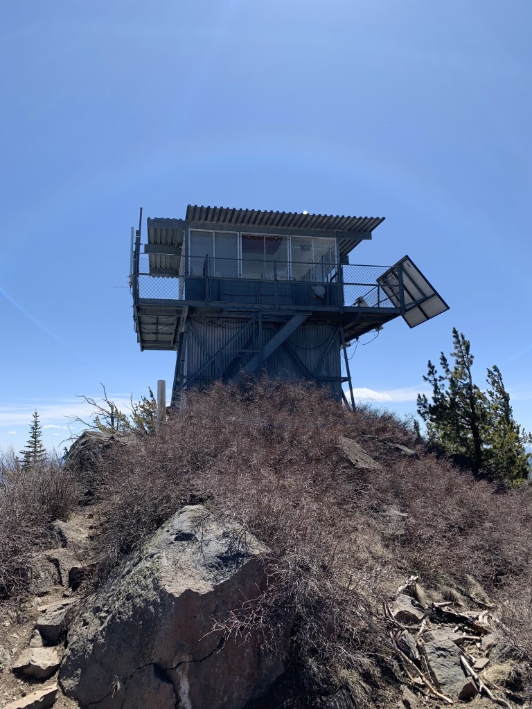
Kendrick Peak
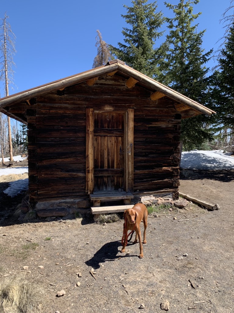
Cappie’s Scoop: I tried to hike this peak in 2019 but mom saw a bunch of animal tracks on the trail, got nervous and said we better turn around. She didn’t tell me what she saw but mom knows best right! We returned to conquer this trail again and it turned out to be a fun hike! There is a lot of hiking up and up and up. Eventually we reached a small cabin and I was hoping to go inside but it was locked. Bummer! Then we saw the sign for the lookout tower and mom said, let’s go! But I knew it was going to be another tower with no dogs allowed. Still, mom loves her towers so we went to the top and sat behind the tower on a big concrete platform and had snacks. There was still some snow around the tower so we sat in the warm sun. It was very nice! Don’t hesitate to add YOUR scoop in the comments below!
Tips: The area was damaged by the 2000 Pumpkin Fire so you may see a lot of trees still burned. This is a great calf burner hike with lots of steep uphills eventually reaching a small cabin, saved from the fire. Go 0.5 miles more and you reach the lookout tower. There is a flat platform on the other side of the operational fire lookout tower which makes a nice spot to sit and relax.
Directions: From Flagstaff, head north on Hwy 180. Continue on 180 for ten miles beyond the turn for Arizona Snowbowl. After mile marker 232, and just before mile marker 233, turn left onto FS 193 – a dirt road with a cattle guard at the start. Go about 3.2 miles until it ends at a T intersection with FS 171. Go right on FS 171, and continue about 2 miles. Turn right onto FS 190, go up about half a mile and you’ll see the trailhead parking area on the right side.
| Mileage (round trip) | 9.4 |
| Difficulty | Strenuous |
| Gain (in feet) | 2851 |
| Trailhead | 35.386737, -111.867770 |
| Hike Time (in hours) | 5-6 |
| Exposure | Mostly Shady |
| Scenery | Mountain Views, Forest |
| Facilities | Toilets in parking area. |
| Fees/Permits | None |
| More Info | https://socalhiker.net/hiking-to-kendrick-peak-in-the-kaibab-national-forest; https://www.arizonahighways.com/explore/hiking/kendrick-trail |
| Last Hiked | 5/2/2020, 9/2/2022 |


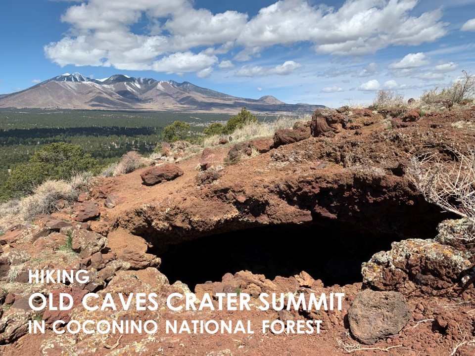
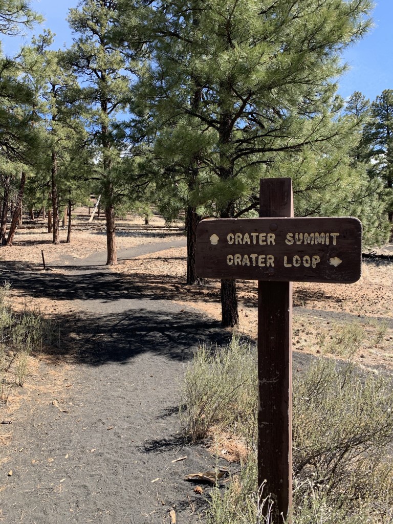
Old Caves Crater Summit
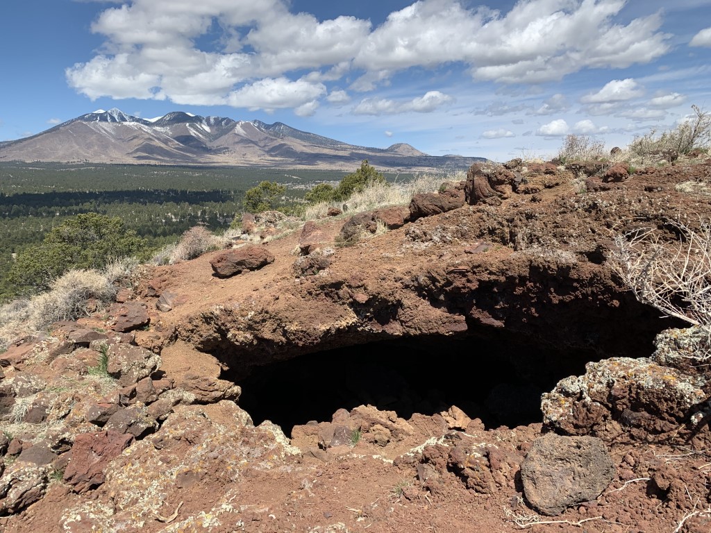
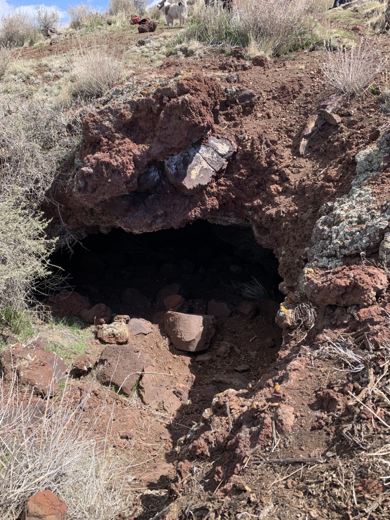
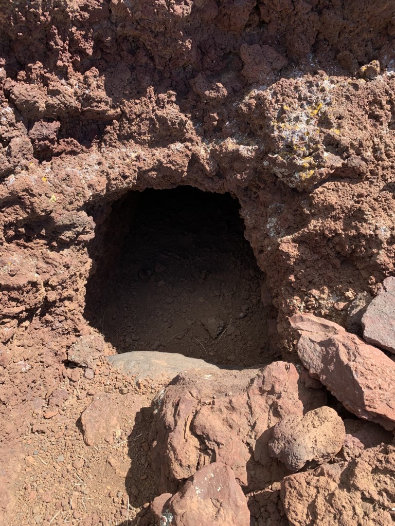
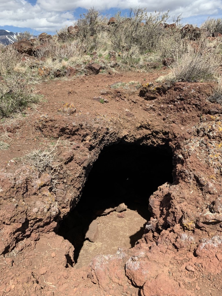
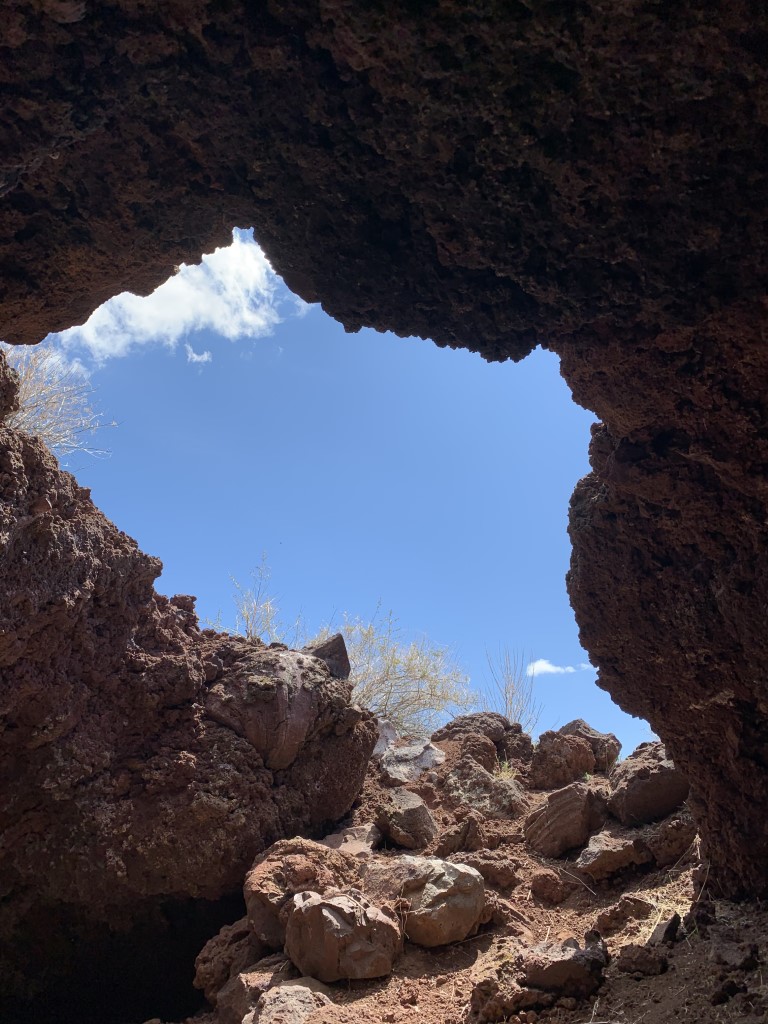
Cappie’s Scoop: When mom said we were going to see some caves, I was nervous. Were they going to be dark, scary, dusty, smelly, or maybe full of sticks? Who knows! So we decided to go check them out. When we got to the top, I almost forgot about the caves because we had a great view of the mountains in front of us and I thought “let’s sit down and have some treats right now!” A perfect spot for a picnic and even to watch the sunset. Surrounding us were a dozen of caves so mom said we should check out a few. They were really cool and not too big so I didn’t get lost in the dark. But furiends, be careful if you go because the lava rock can be quite sharp, watch your paws! Don’t hesitate to add YOUR scoop in the comments below!
Tips: This is one of many cinder cones in the area and has an interesting history. This volcano had upside-down eruptions causing a series of tunnels and grottoes that we now can explore! You can do an out and back to the caves (right turn at the top) and summit (left turn at the top) OR you can do a loop which continues from the summit around the crater.
Directions: From Flagstaff, head north on US-89. Turn right onto Silver Saddle Rd. The trailhead is 0.6 miles on your left.
| Mileage (round trip) | 4.2 |
| Difficulty | Moderate |
| Gain (in feet) | 656 |
| Trailhead | 35.269961, -111.535501 |
| Hike Time (in hours) | 3-4 |
| Exposure | Sunny and Shady |
| Scenery | Mountain Views, Trees |
| Facilities | None |
| Fees/Permits | None |
| More Info | https://www.azcentral.com/story/travel/2015/11/04/arizona-hike-old-caves-crater-flagstaff/74764038 |
| Last Hiked | 4/19/2020 |

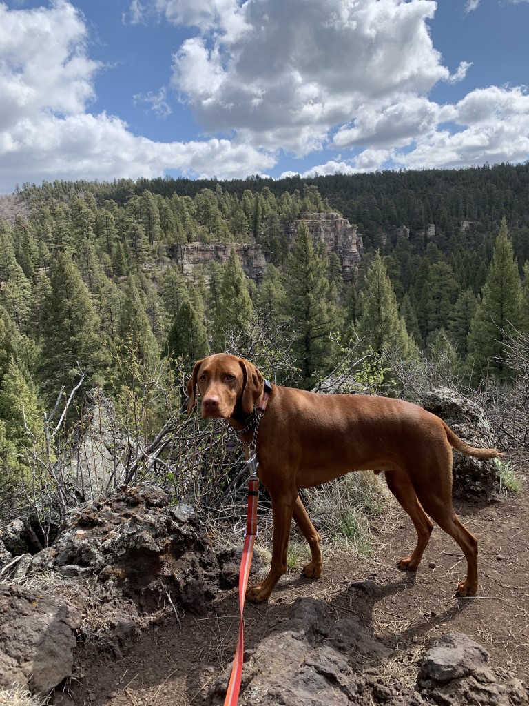
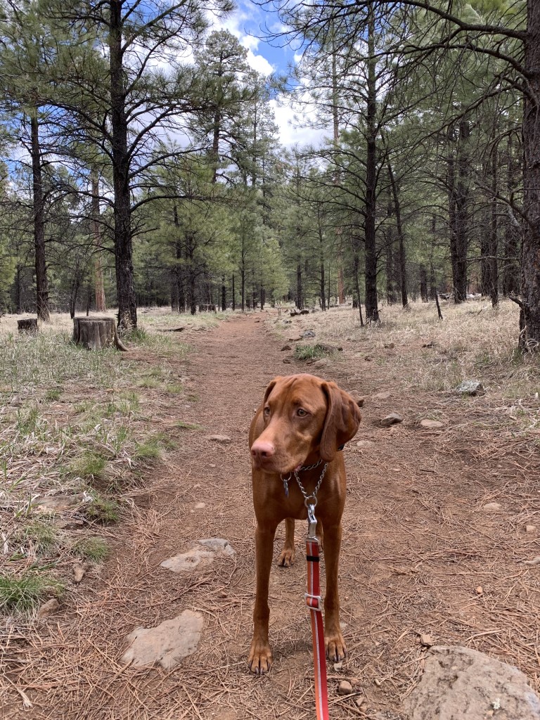
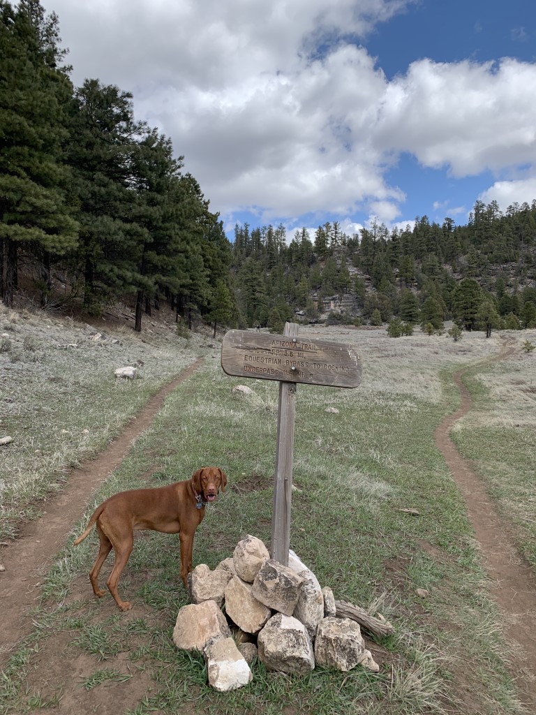
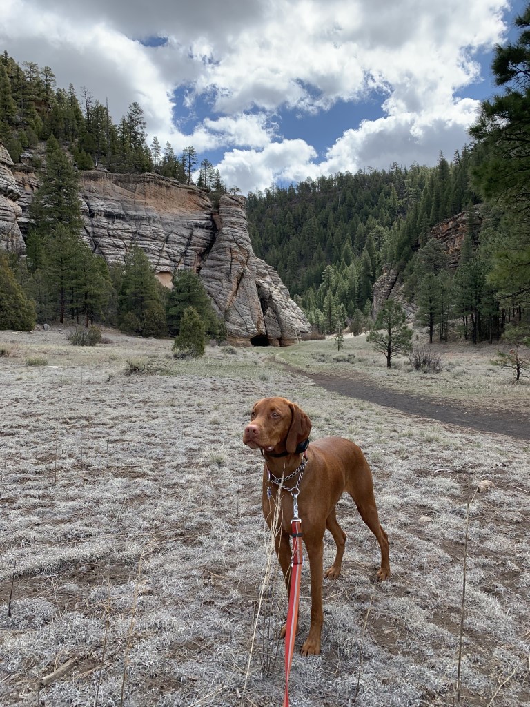
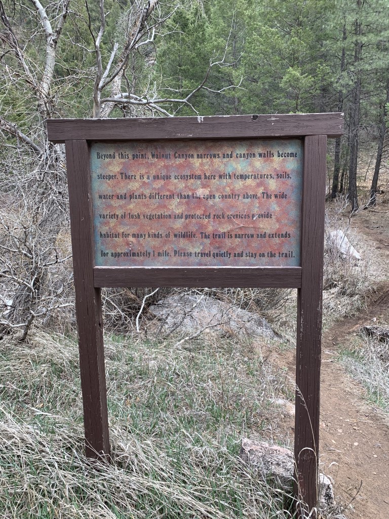
Sandy’s Canyon to Fisher Point
Cappie’s Scoop: The good news, this trail starts out going downhill into the canyon. The not-so-good news, you have to finish your hike climbing uphill out of the canyon! So furiends, save some energy for the end of your hike. Once you get to the canyon, it’s a nice walk through meadow-like areas and eventually Sandy’s Canyon trail ends at the junction for the Arizona Trail (AZT) but continue on the AZT going north. Off in the distance, I saw the San Francisco Peaks and as you get closer for the turnoff to Fisher Point, you see to the right some cool sandstone cliffs and the beginning of Walnut Canyon. I went over to check them out and saw a sign that if we wanted to walk through the canyon, it was one mile each way. I hiked for a bit inside and then I wanted to climb up to Fisher Point to see the view from there. It was very cool but furiends, be careful and don’t get too close to the edge, it’s a bit scary! Don’t hesitate to add YOUR scoop in the comments below!
Tips: There are a number of trails you can access from hiking into Sandy’s Canyon. This route takes you from the canyon up to Fisher Point and returning the same way. It may be helpful to have a map handy. You can extend your trip by taking a detour through Walnut Canyon (add 2 miles RT to your hike) to explore the sandstone walls.
Directions: From Flagstaff, head south on Lake Mary Rd for about 4.5 miles. Turn left to access Sandy’s Canyon trailhead (there is a sign for this trailhead on Lake Mary Rd). Then make your immediate first right and drive down the dirt road about 0.2 miles till it ends at a parking lot.
| Mileage (round trip) | 7-10 |
| Difficulty | Moderate |
| Gain (in feet) | 730 |
| Trailhead | 35.128374, -111.602638 |
| Hike Time (in hours) | 4-5 |
| Exposure | Sunny and Shady |
| Scenery | Canyon Views, Forest, Wildlife, Wildflowers |
| Facilities | None |
| Fees/Permits | None |
| More Info | https://www.azutopia.com/easy-hikes/sandys-canyon-hiking-trail; https://www.fs.usda.gov/recarea/coconino/recarea/?recid=55034 |
| Last Hiked | 4/18/2020 |